Chicago Lakes Trail #52, Arapahoe National Forest – Idaho Springs CO 8/10/13

Upper Chicago Lake
Upper Chicago Lake

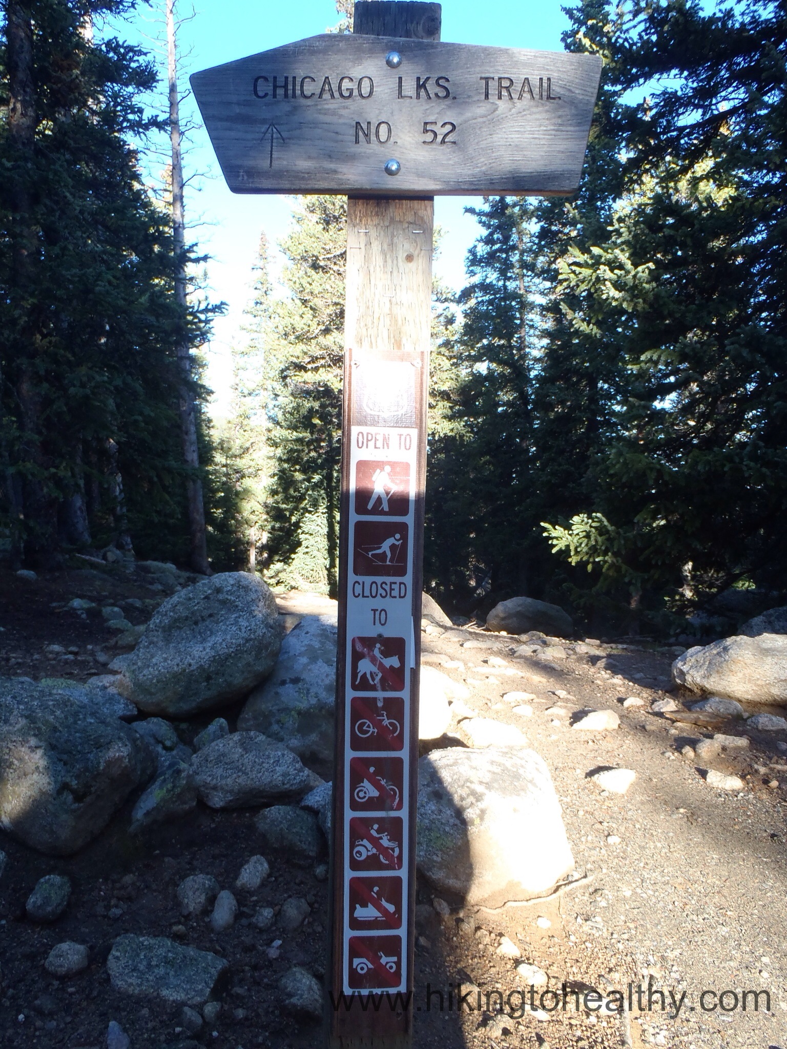
The Chicago Lakes Trail #52

Starting Elevation: 10,650 ( Lowest point of the hike 10,320)

Highest Elevation: 11,740 ( Lower lake at 11,420ft.  Total elevation gain approximately 2000ft)

Trail Length:  Officially I saw everything from 9-10 miles, my fitbit said we went 11 miles but we did walk around the upper lake a lot.

Trail Uses:  hiker in all places and then horses in some….NO BIKES

Degree of difficulty:  Moderate to difficult mostly due to length and one scramble to Upper Chicago Lake.

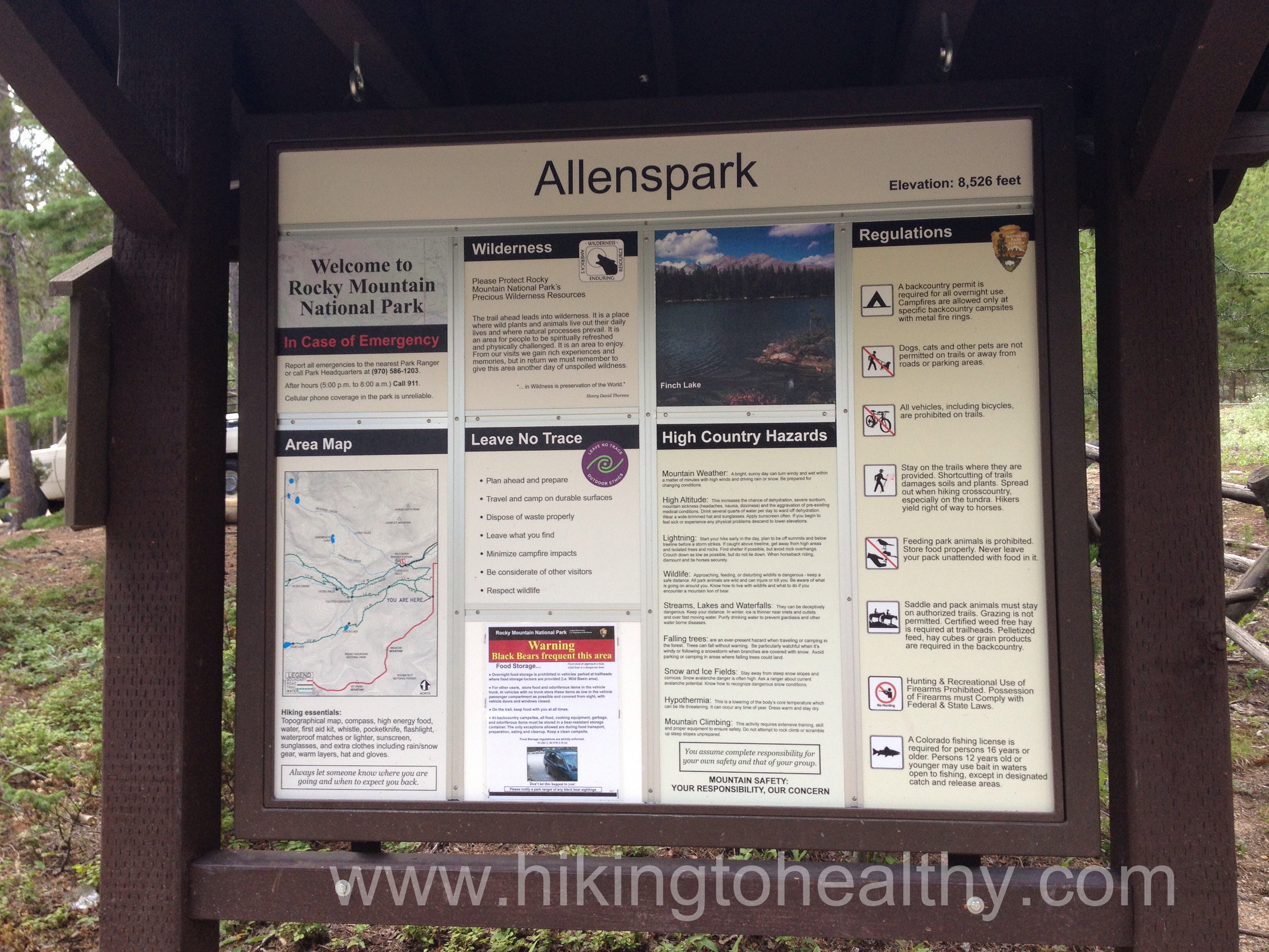
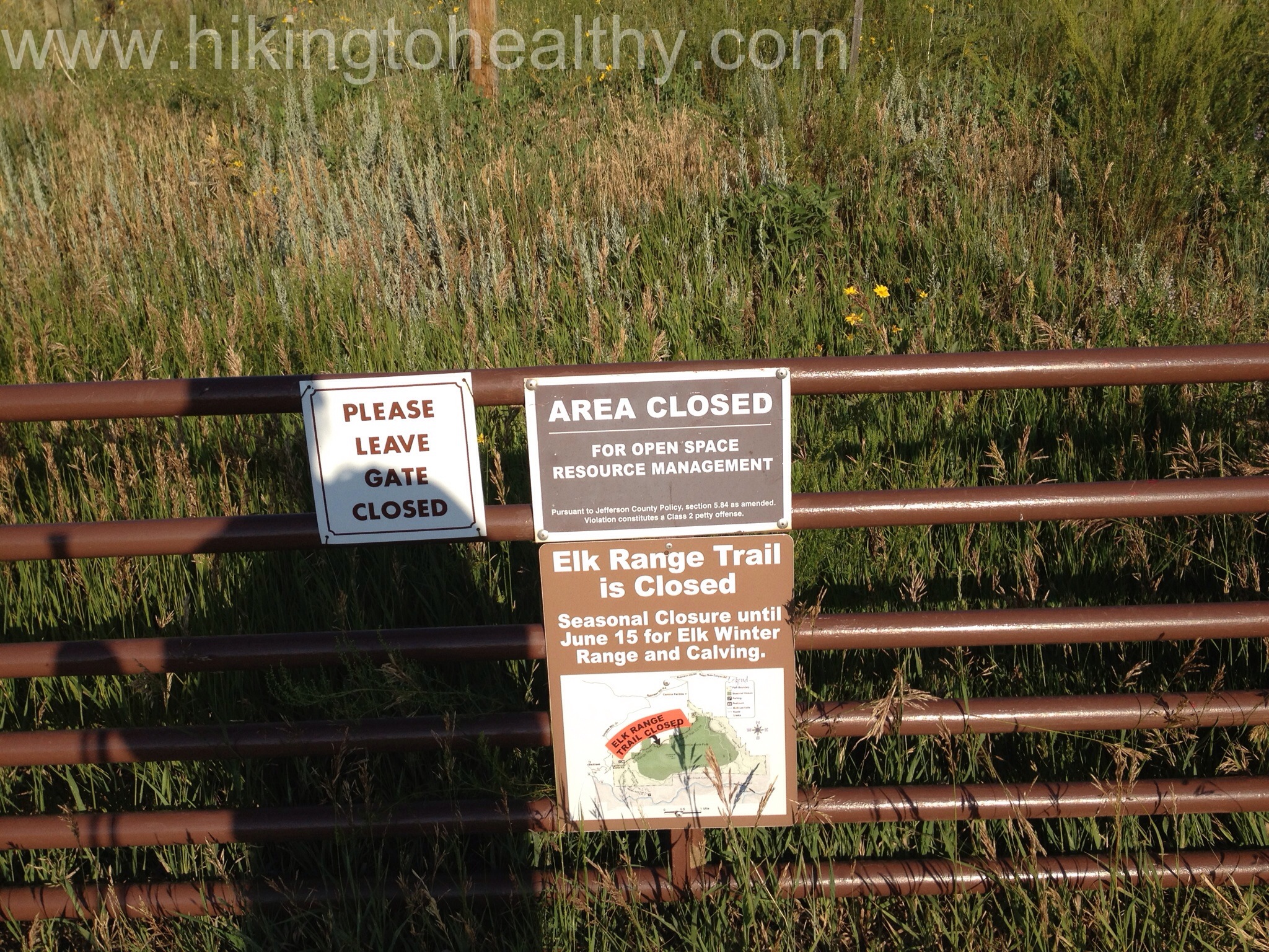
Bathrooms:  1 Creepy one at the Echo Lake Picnic parking lot ( For some reason Denver County Mountain Park use the S shaped ones with no doors…..)

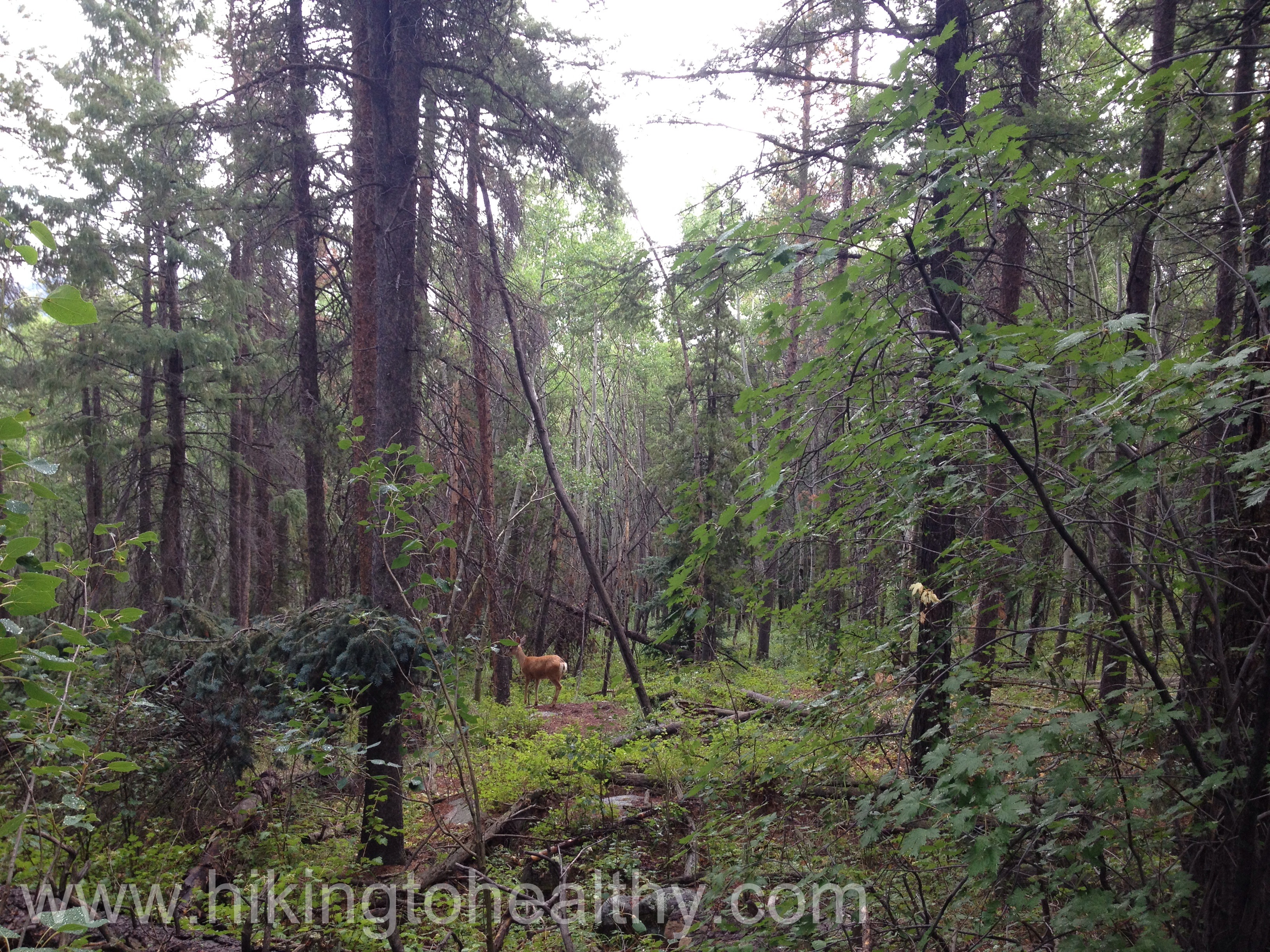
Pets:  Yes for dogs, I am not sure if a leash was required but we saw dog owners with dogs on leash and off.

Fees:  None

Lower lake trail on right

I have been wanting to try this hike since April.  I had targeted as one of our conditioning hikes to get ready for our first 14er, but then we got those crazy snow storms throughout April and May which meant the trail was under many feet of snow when I originally wanted to attempt it.  When it was finally possible to hike it, it was mountain goat and sheep mating season and Park Rangers ask that you do not hike here in order to let the goats and sheep do their thing.   Which of course I respected since the poor animals deserve some peace while they mate.  We weren’t expecting to do these re-acclimating hikes, but since I was forced to get used to it all again I figured now was the perfect time to check them out.

I got to the trail head at 7AM and it was COLD, I guess fall is coming more quickly then I want.  I got bundled up and was even glad I had gloves on hand, as I think it was like 35 degrees at the start of our hike.

Starting from the parking lot

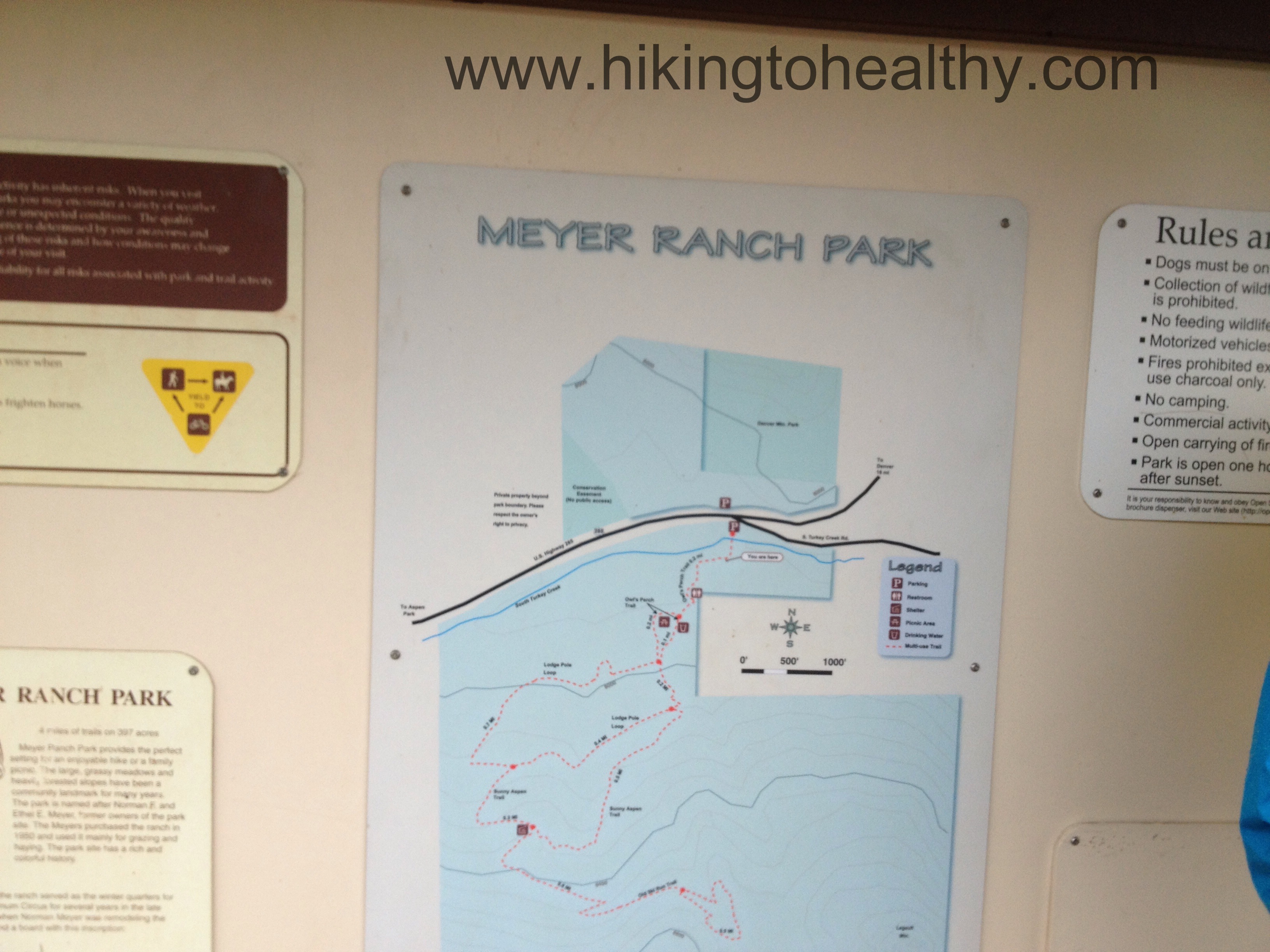
My suggestion is to park at the Echo Lake Picnic Area, as that is really close to the Chicago Lakes Trail which is the hardest part of the hike to actually find.  Since I followed the book suggestion and we got there insanely early, parking here was no problem( not a lot of parking spots here) but you can park all around the Lake and at the Echo Lake Lodge.  The trail head is a little off the Lake Path on the Southwest side of the Echo Lake.

Echo Lake
Echo Lake
The trail entrance on the southwest of the Lake
Chicago Lakes Trail #52 Official start

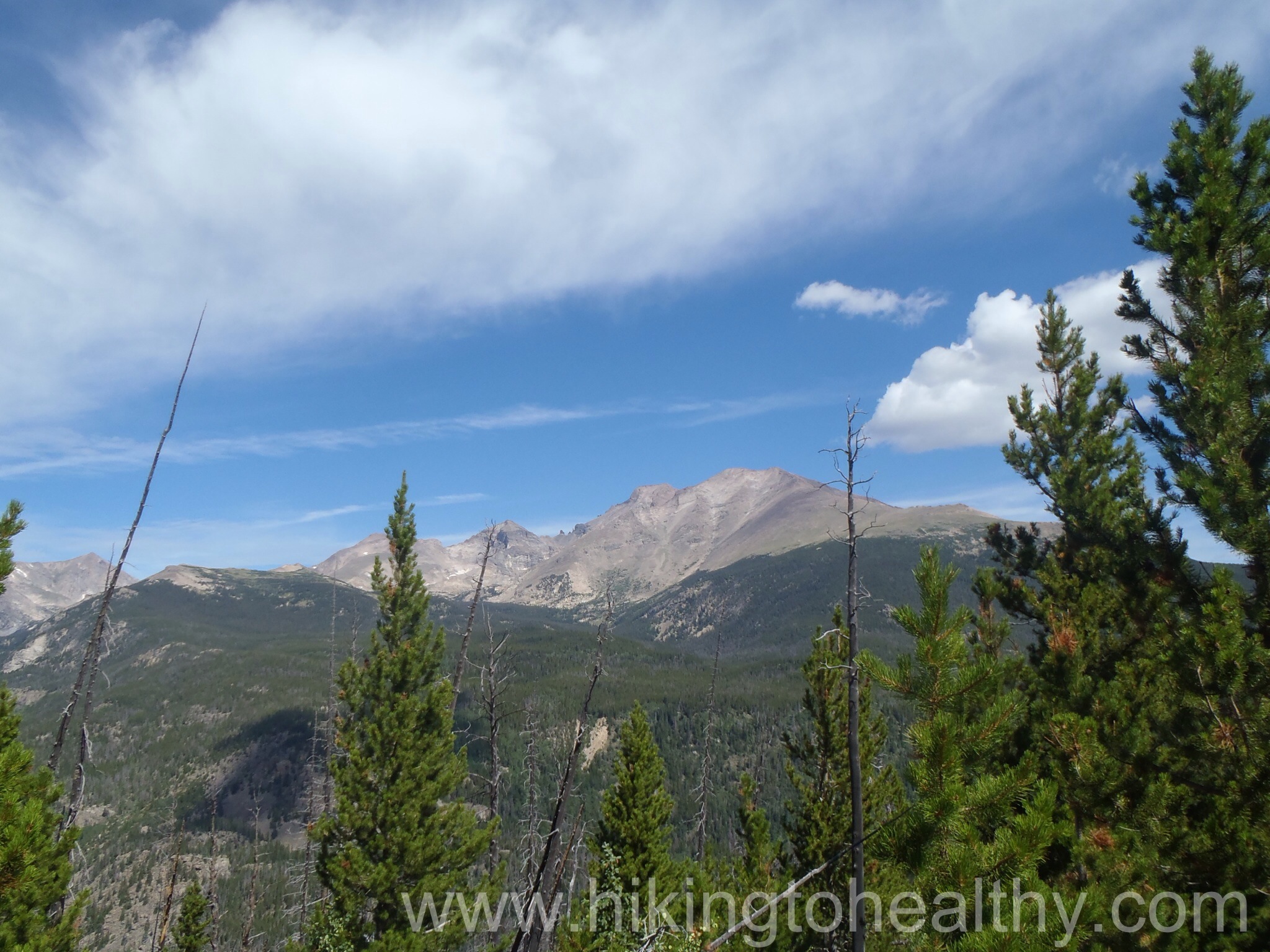
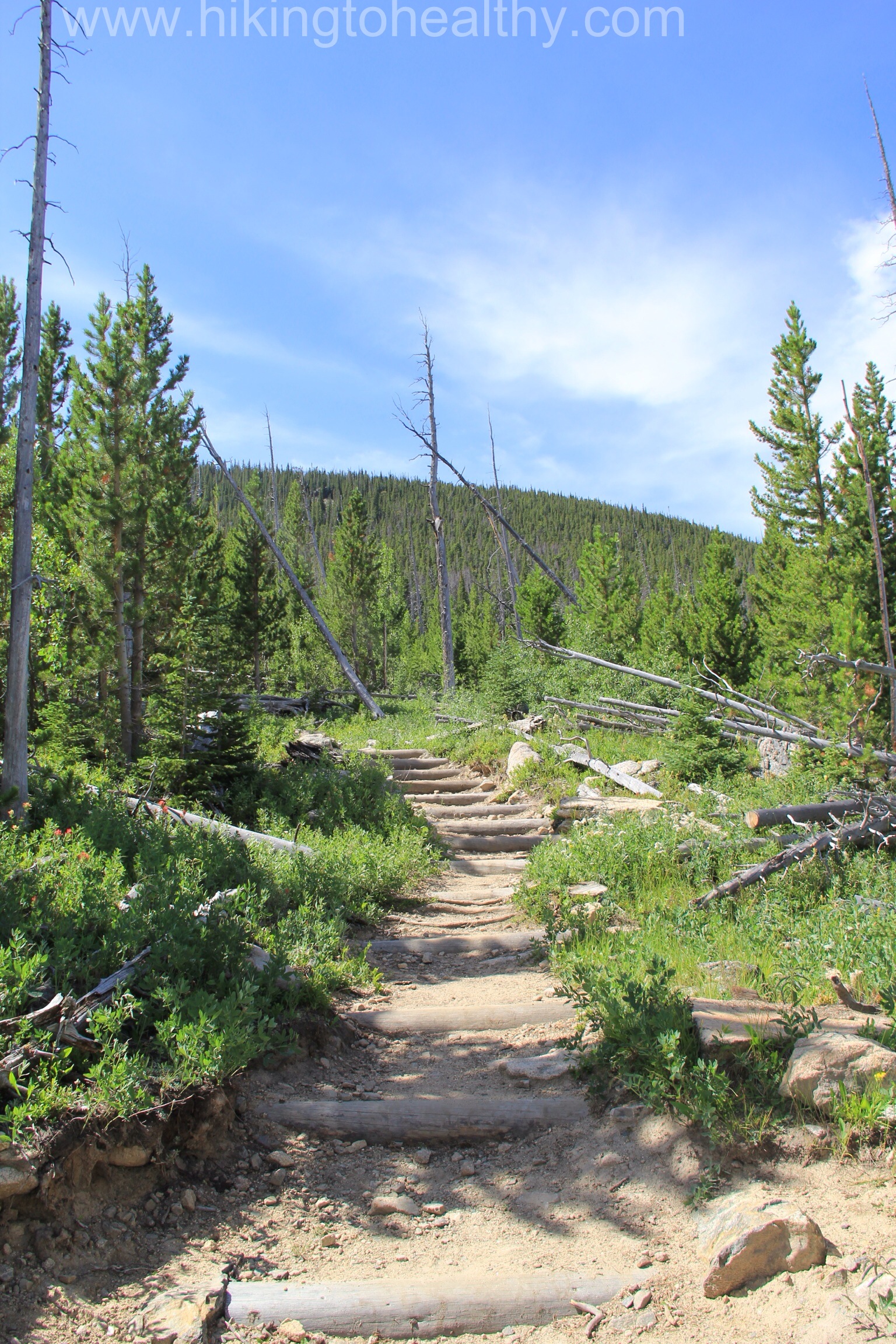
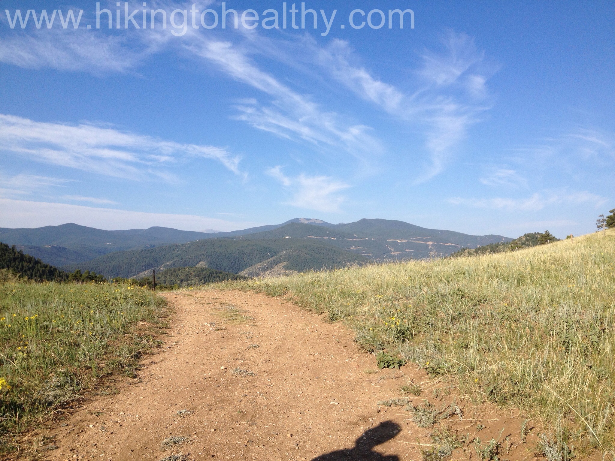
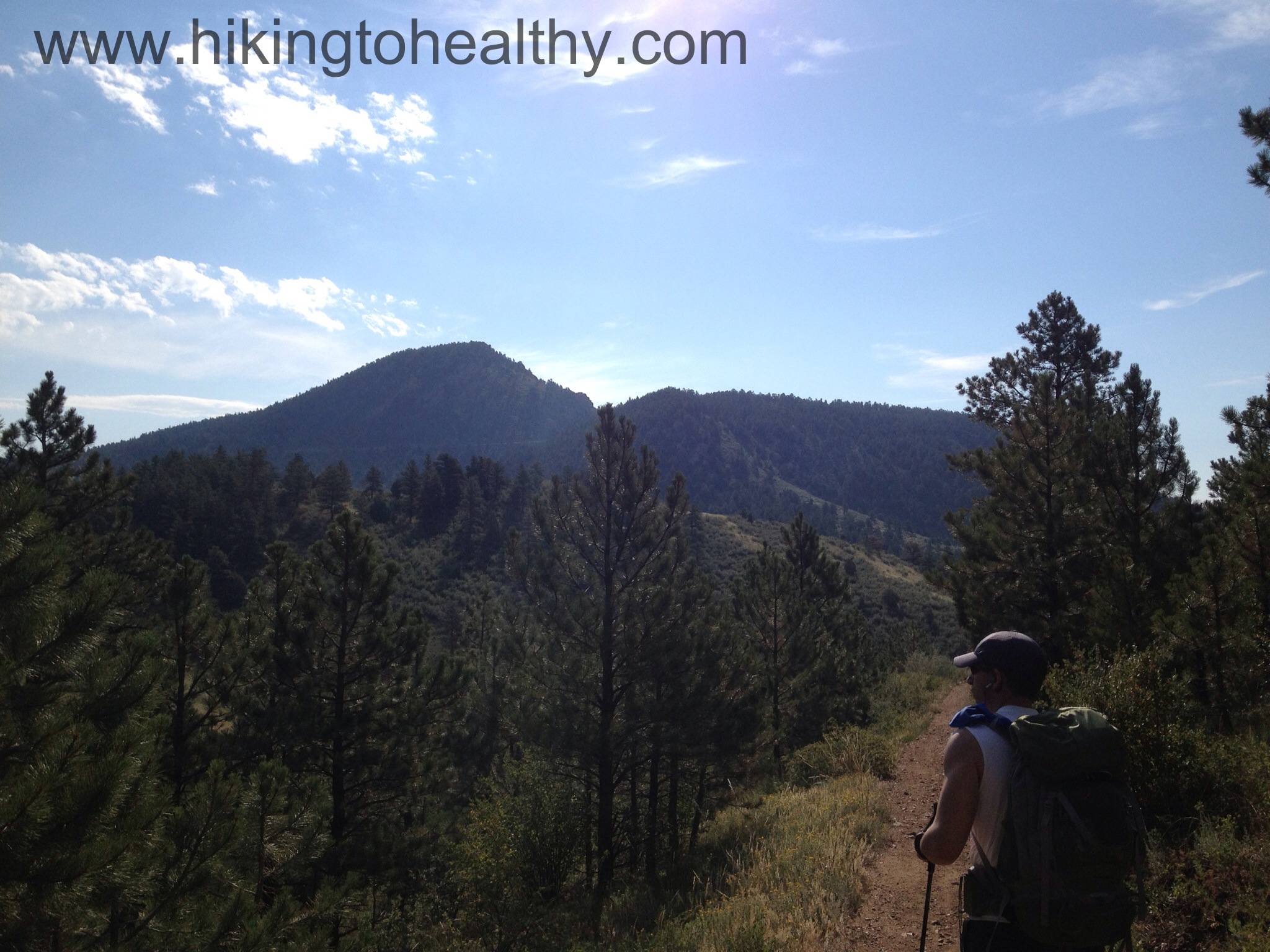
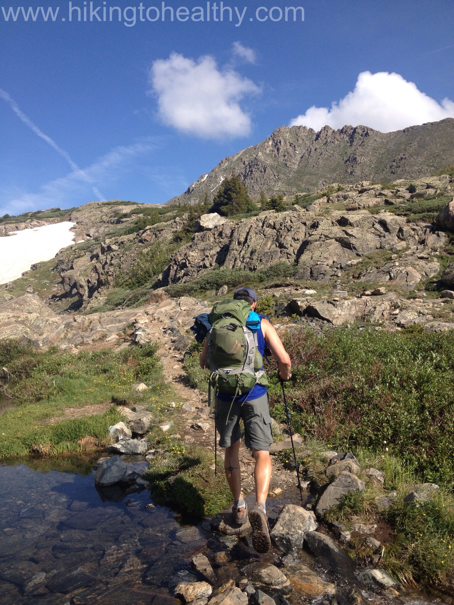
Not long after you get on the official trail, you immediately descend about 3-400 feet and cross over the Chicago Creek.  Portions of this descent will challenge those who may  have “issues” with heights as the Switchback initially is very close to the a nice steep drop off.  It also gives great views of your final destination and Mt. Evans.  It was a beautiful view to have while heading down.

Trail conditions going down OLYMPUS DIGITAL CAMERA

Crossing the Chicago Creek at the bottom of the initial descent.

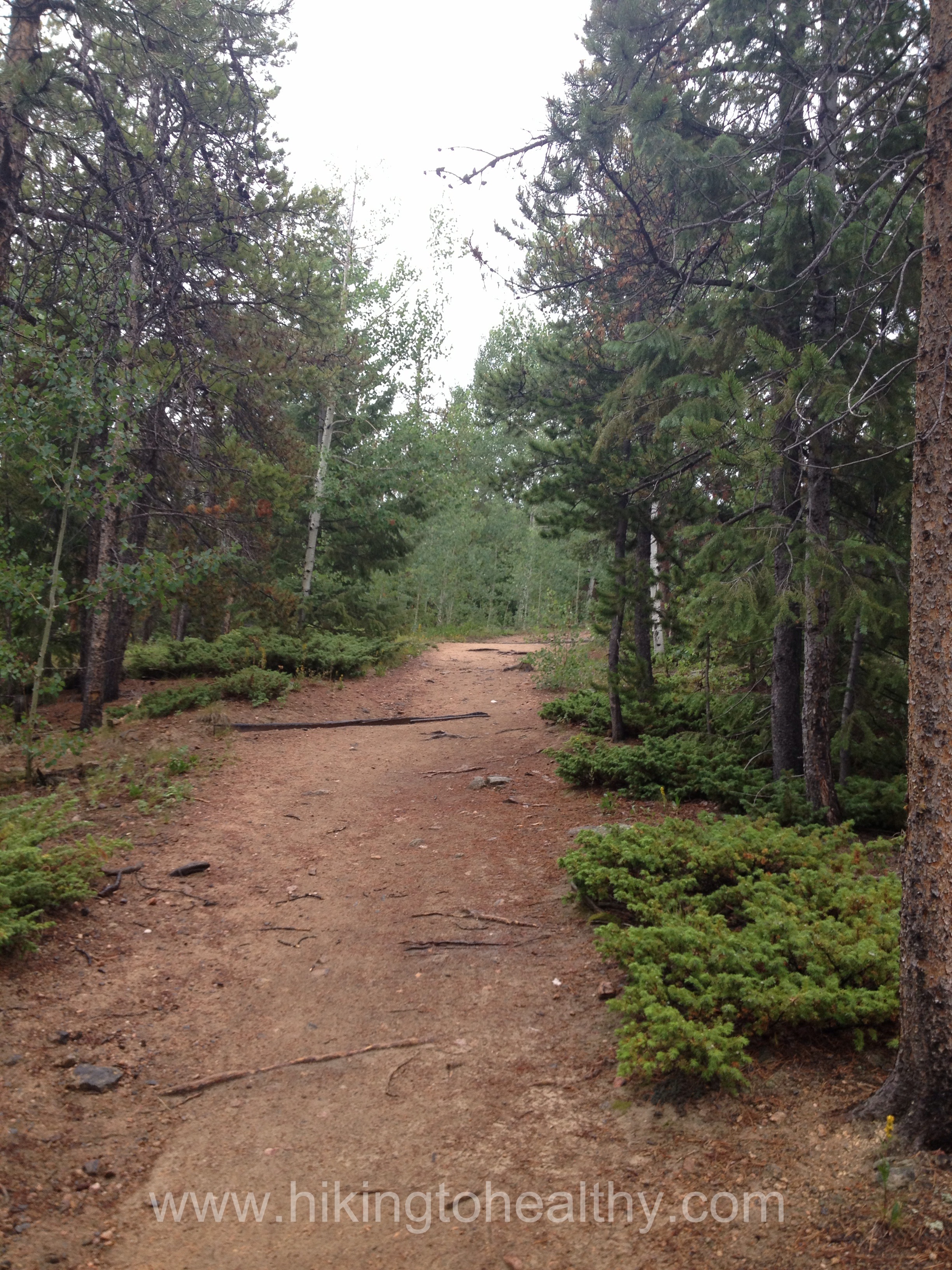
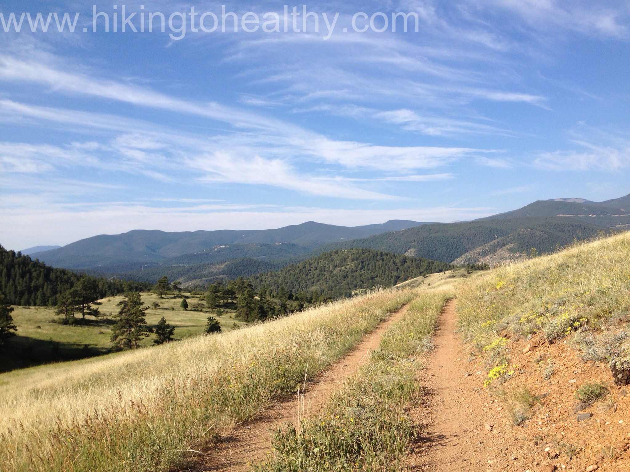
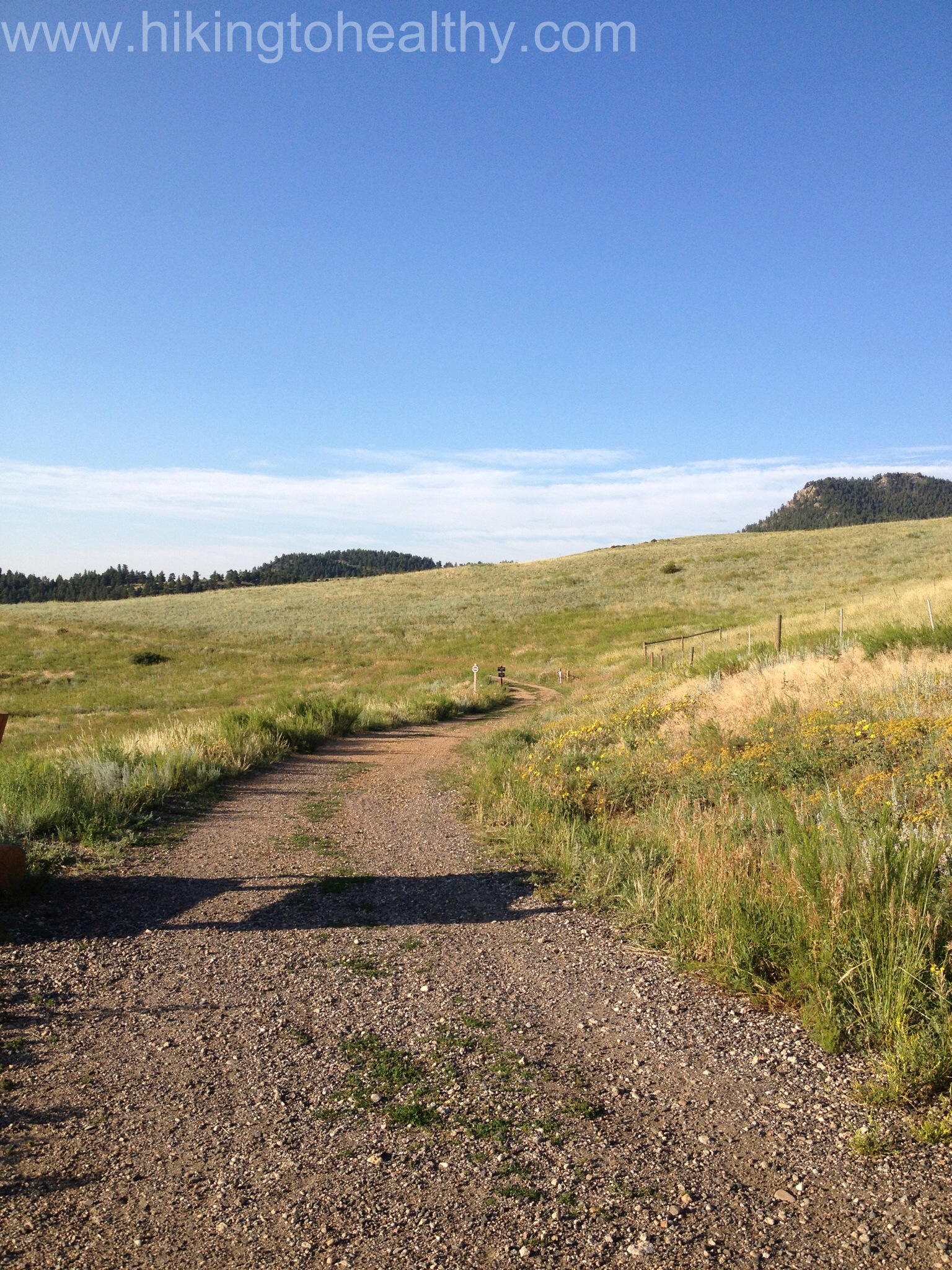
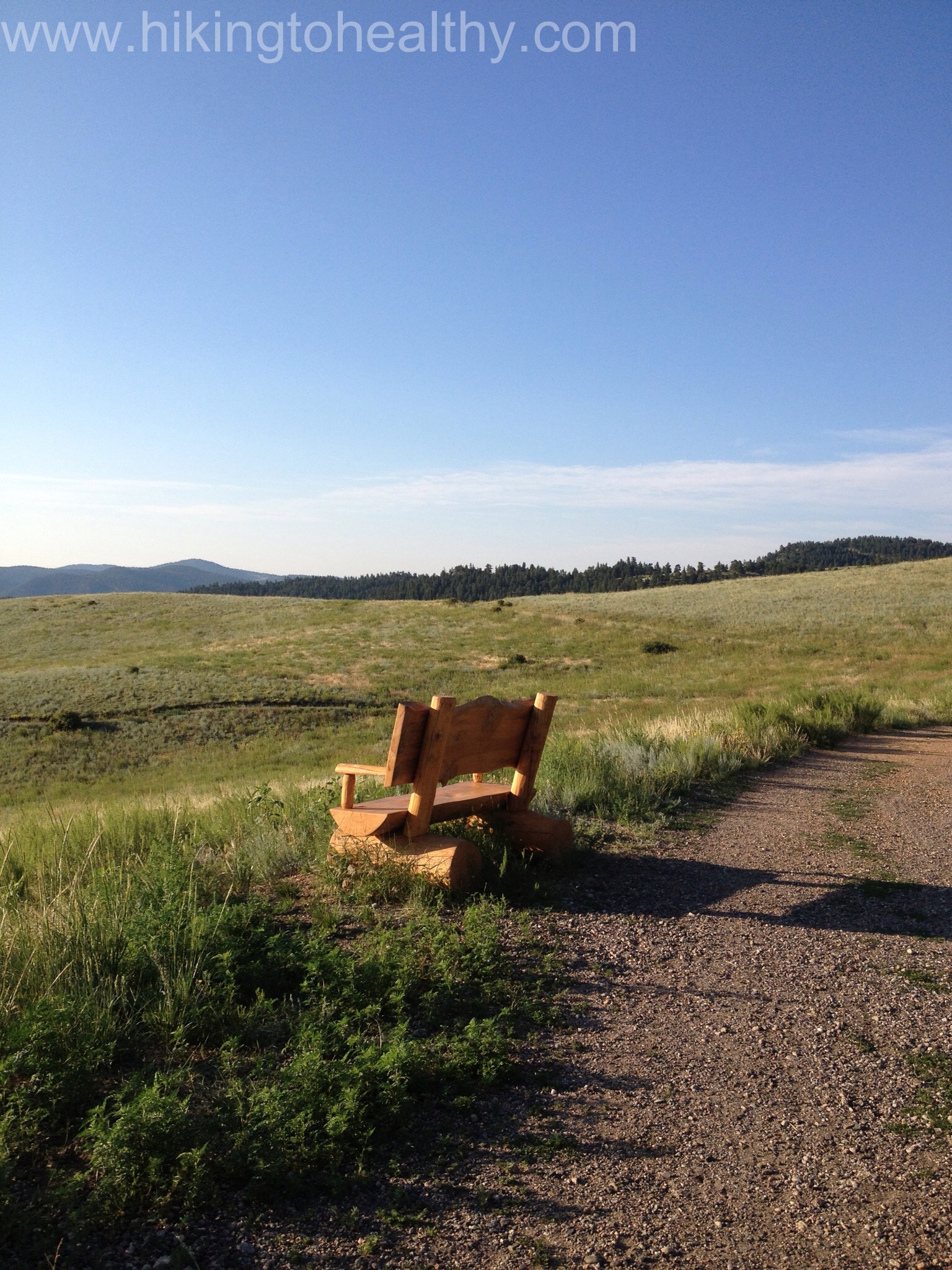
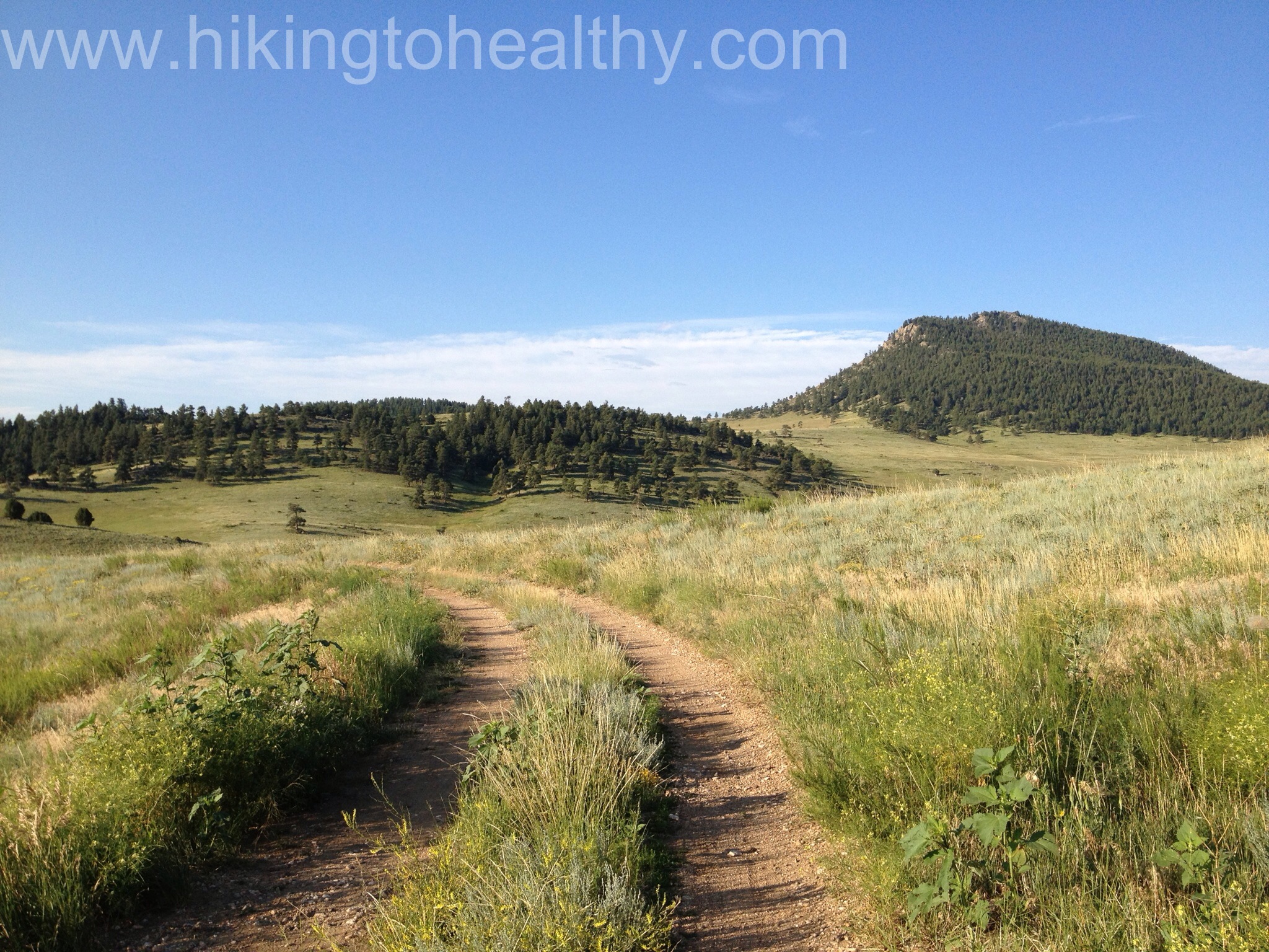
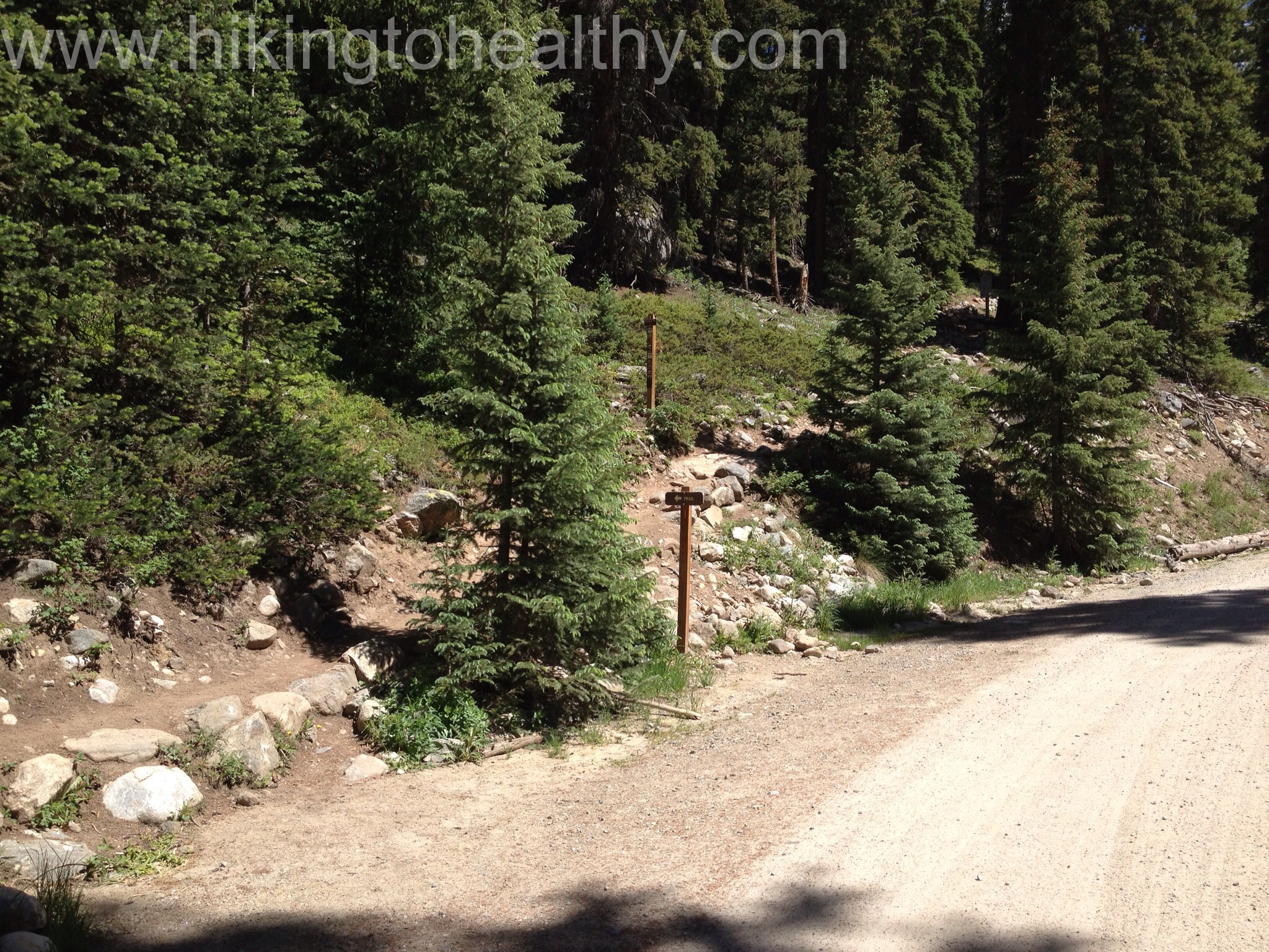
From this point forward the trail is very well-marked, you take an access road up for about a mile, past the Idaho Springs Reservoir.  I have to admit during my research for the hike, I was worried about this road section but actually it’s fine and looks more like a wide path then road.  They are doing some type of maintenance by the Reservoir but on a weekend there was nothing to see but the equipment.

Entering the Road portion
You want to look for this sign on the way back so you don't miss the way back to your car
You want to look for this sign on the way back to your car it is across the road from the sign above
The road part of the trail
Cabins as you pass Idaho Springs Reservoir

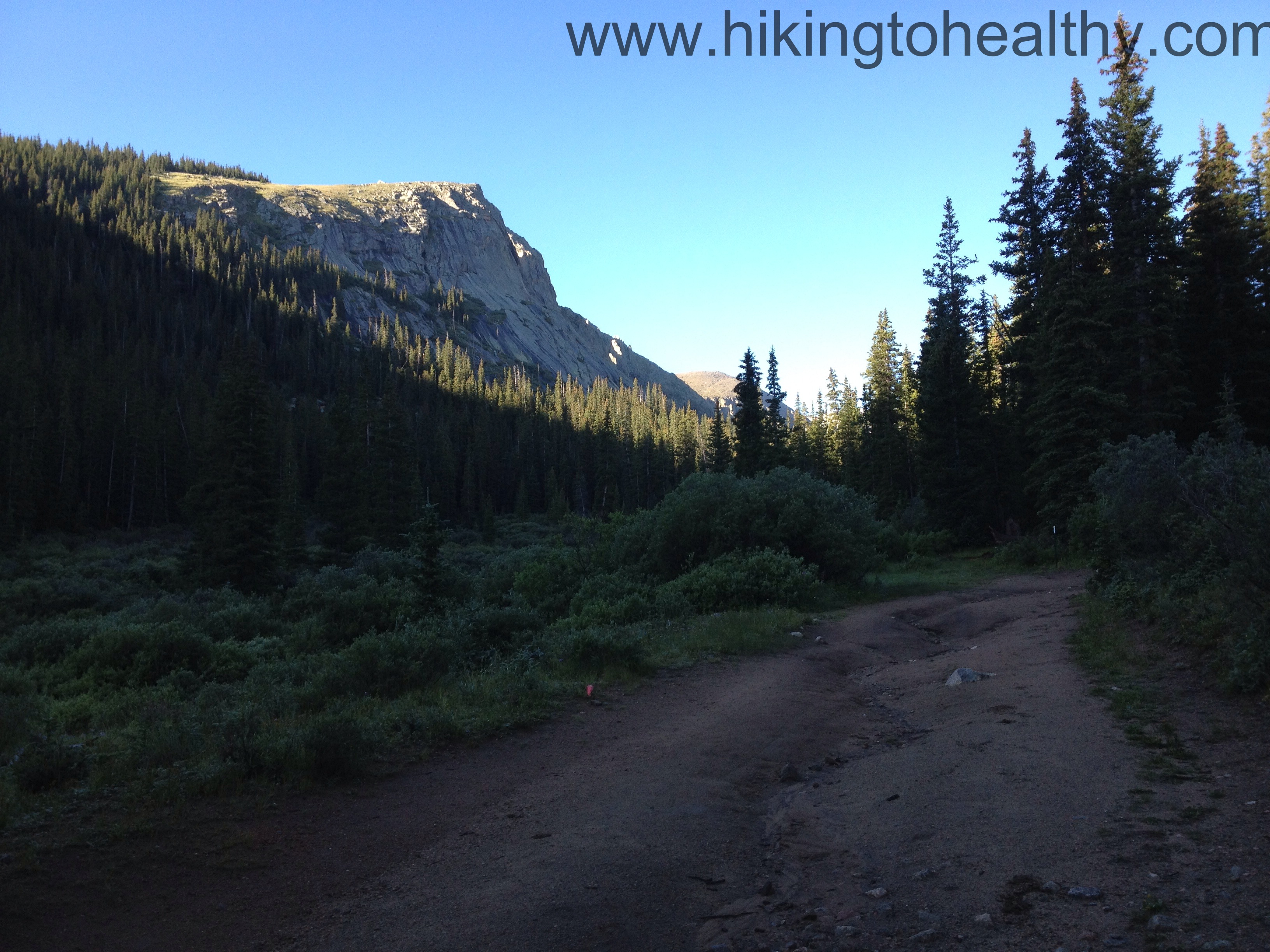
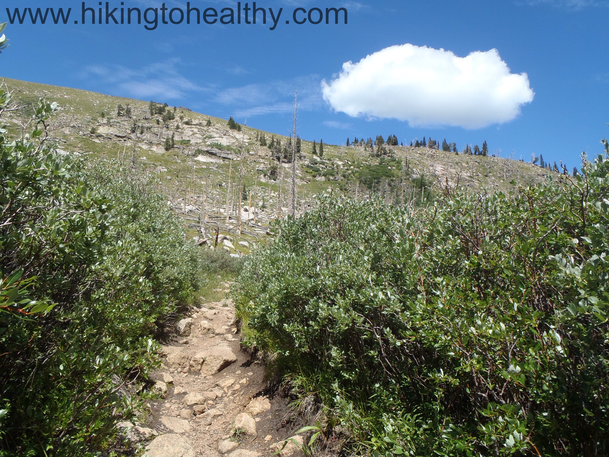
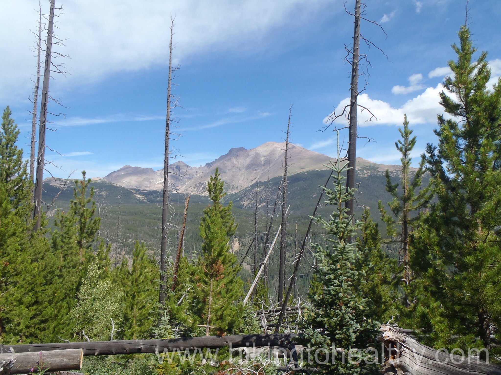
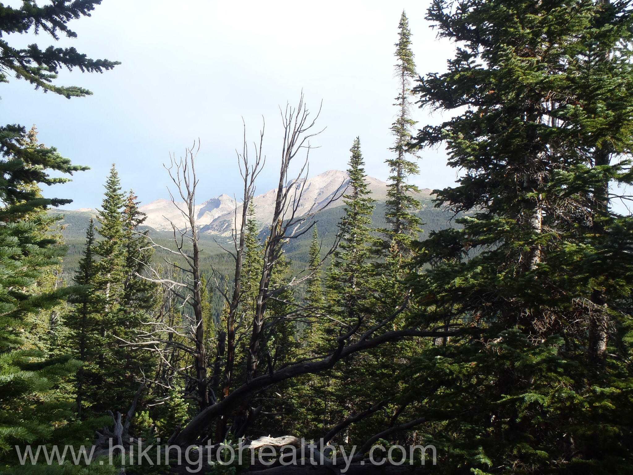
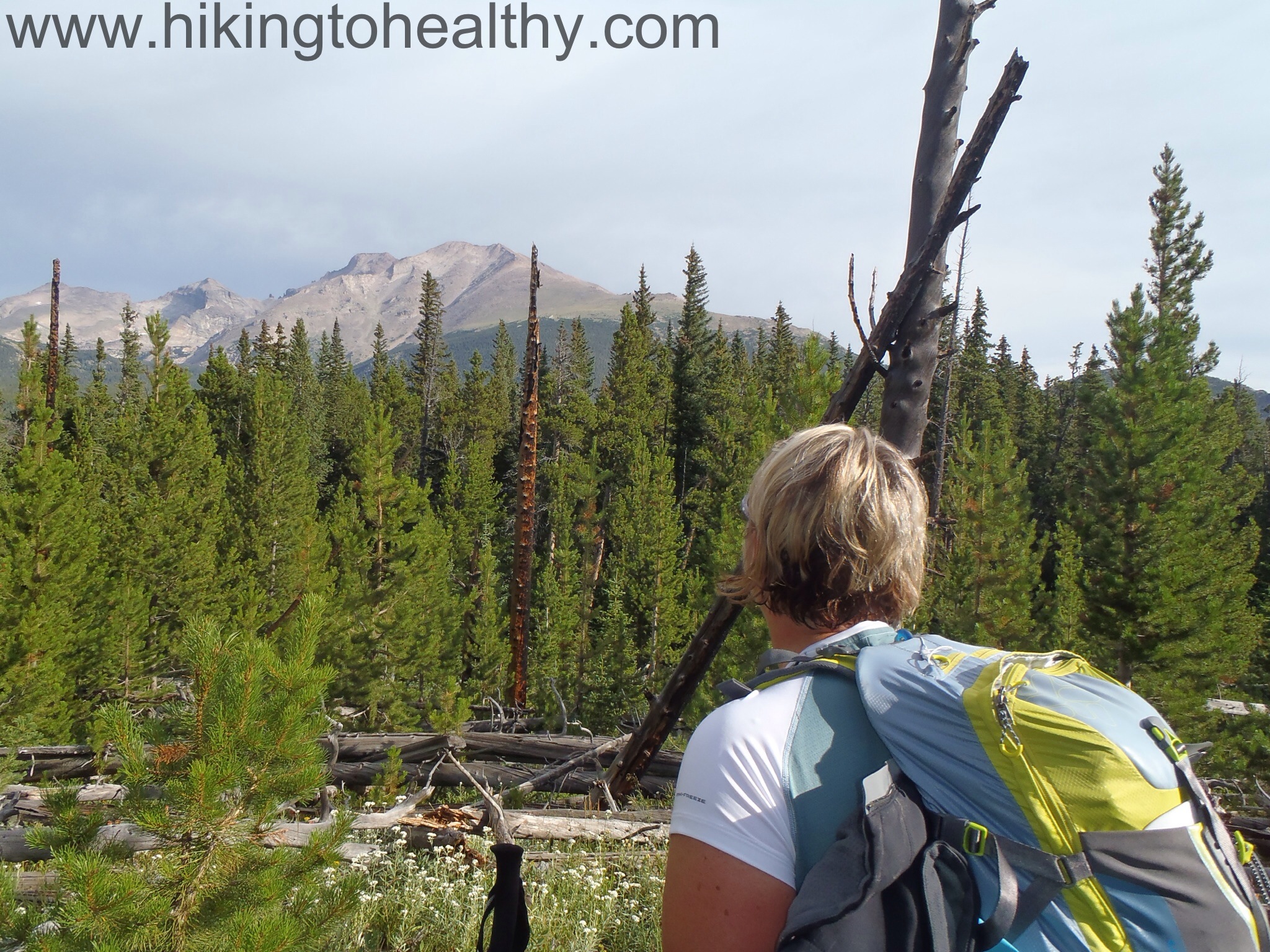
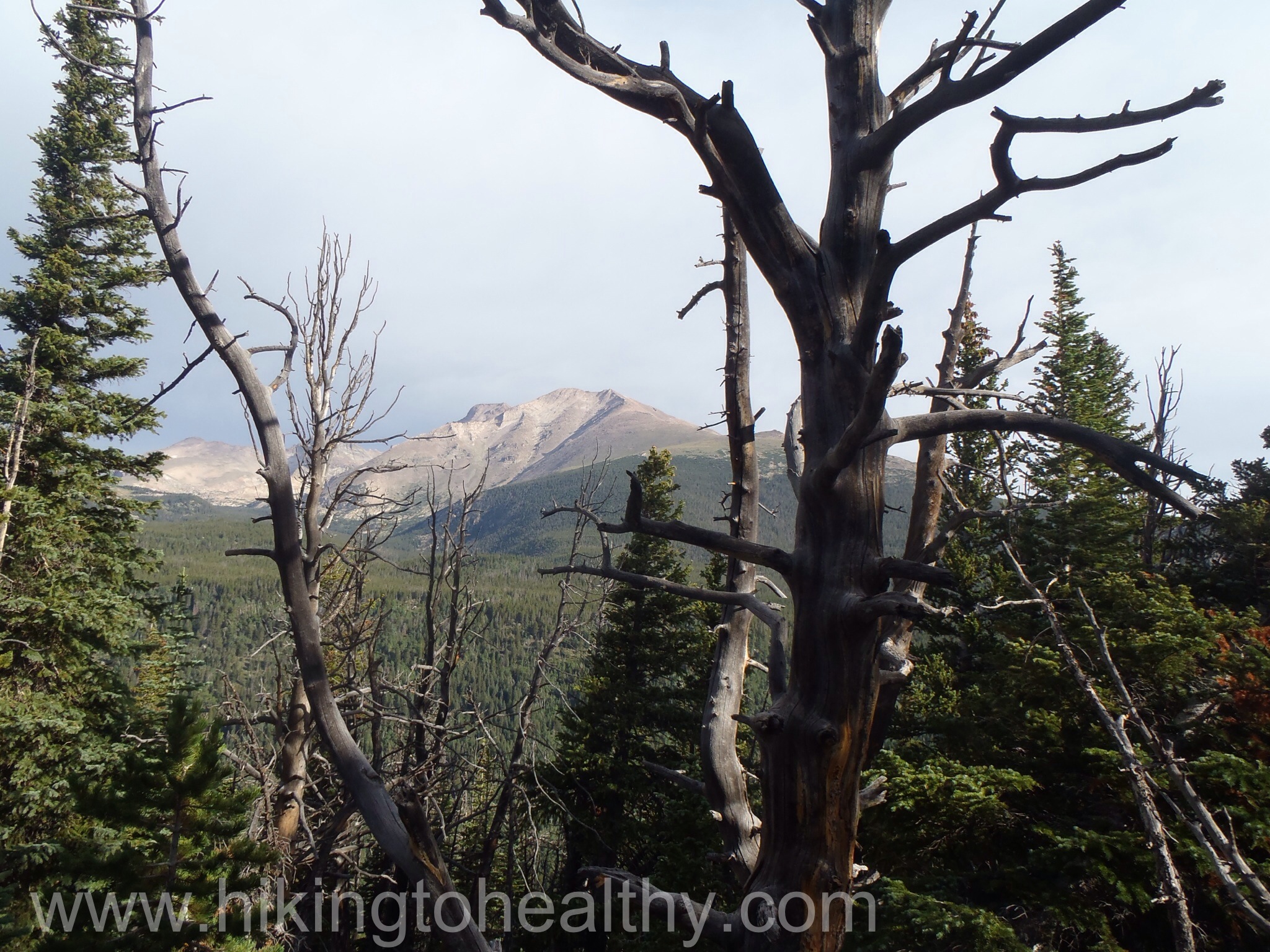
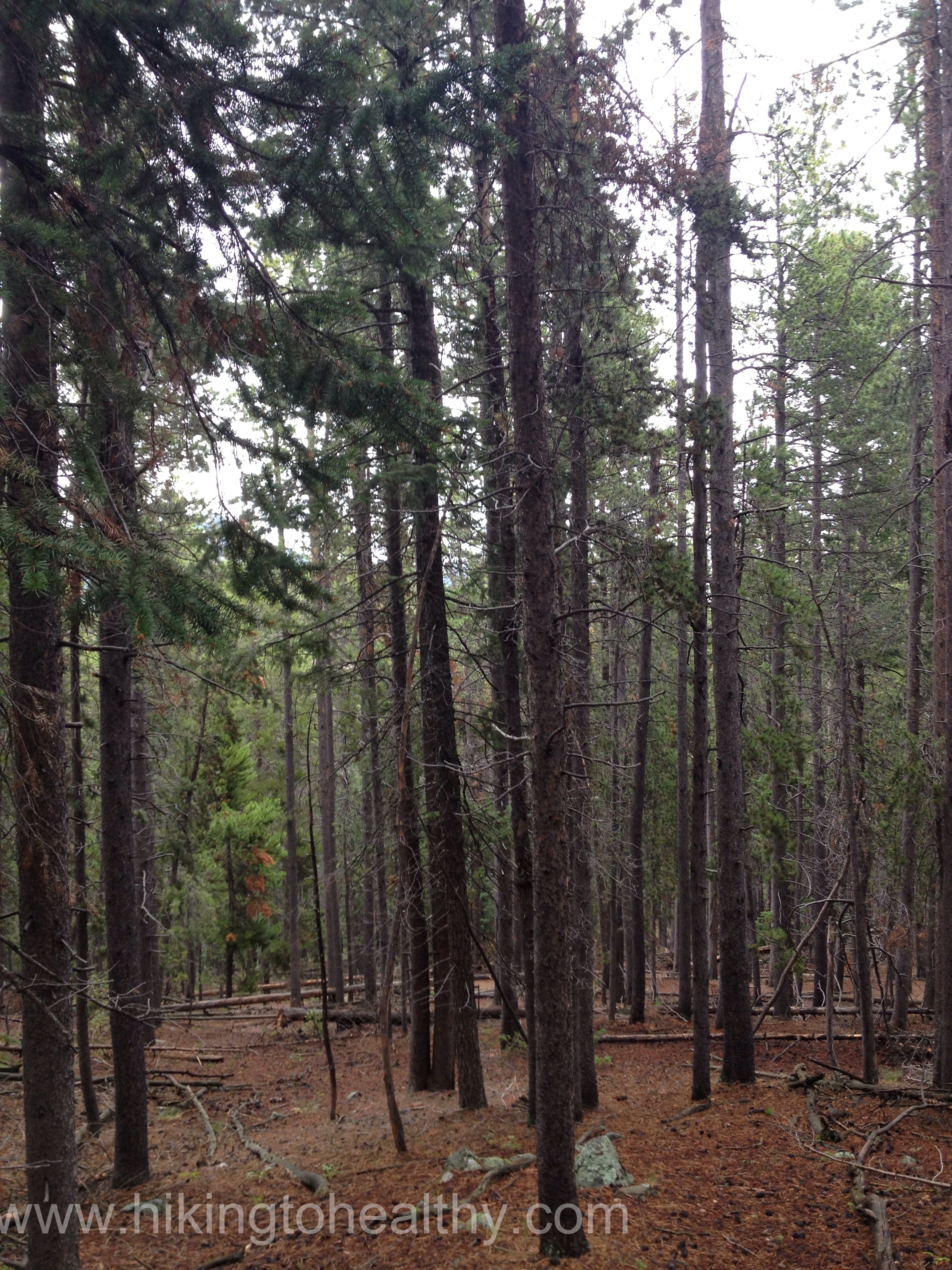
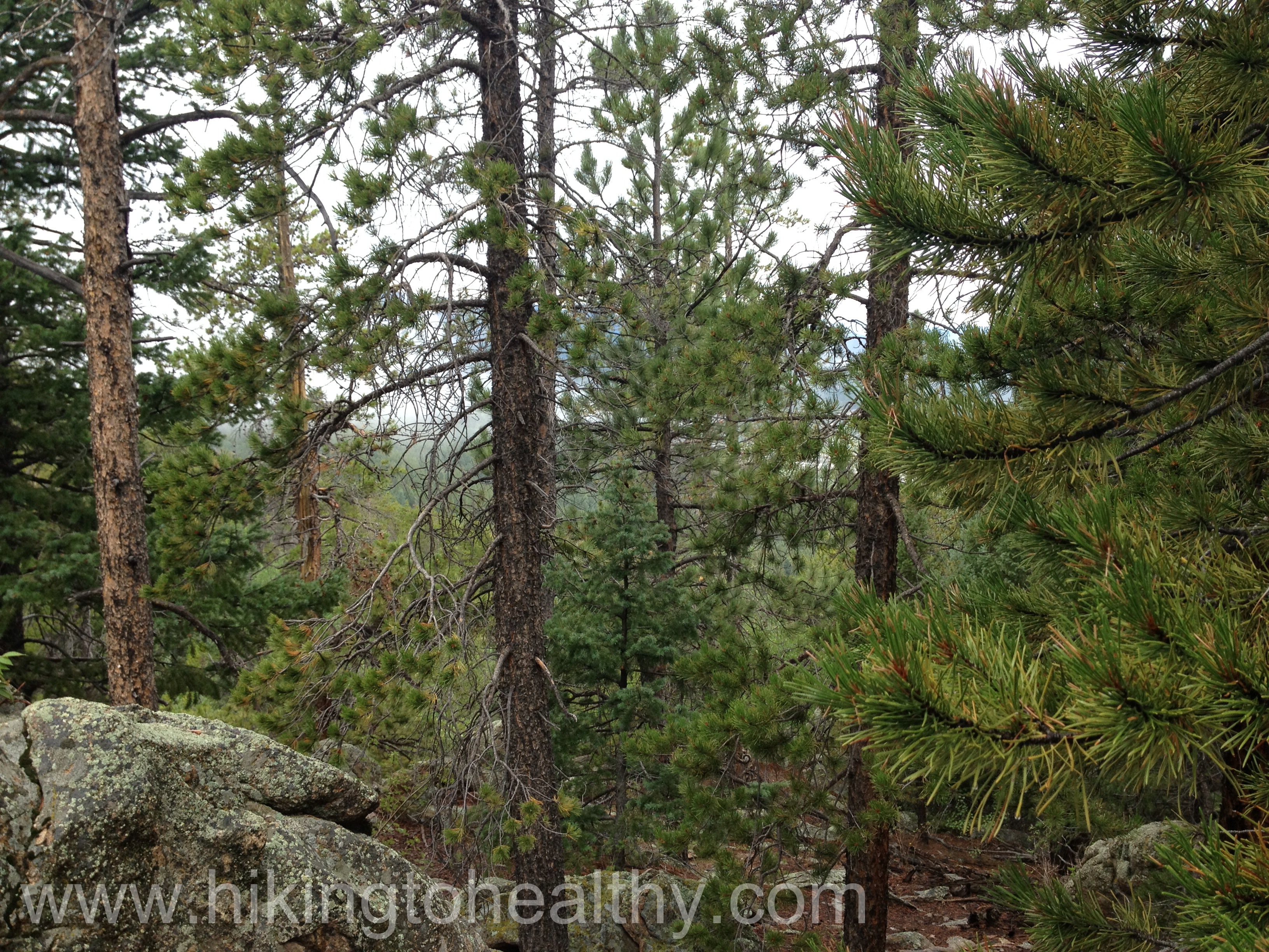
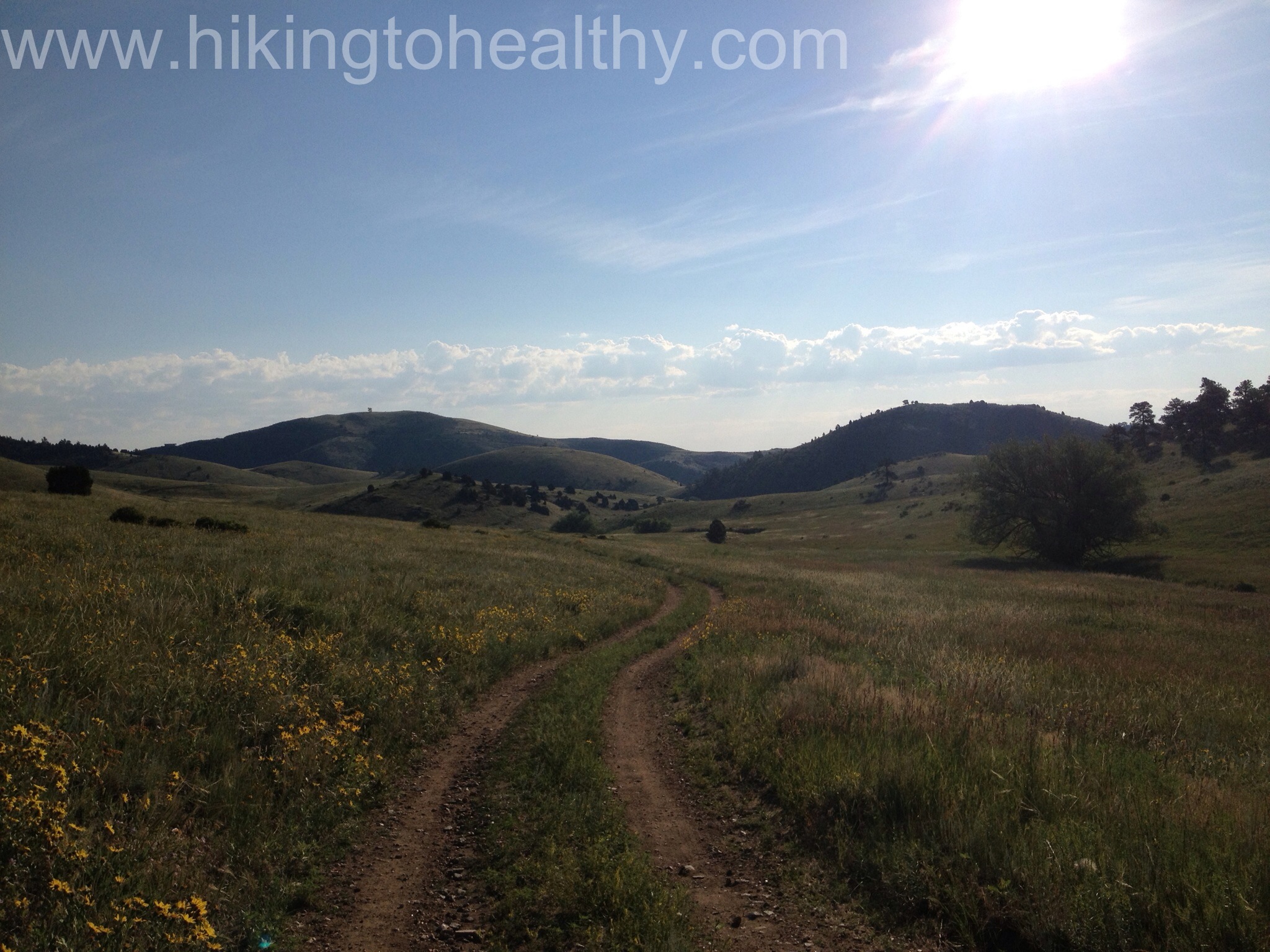
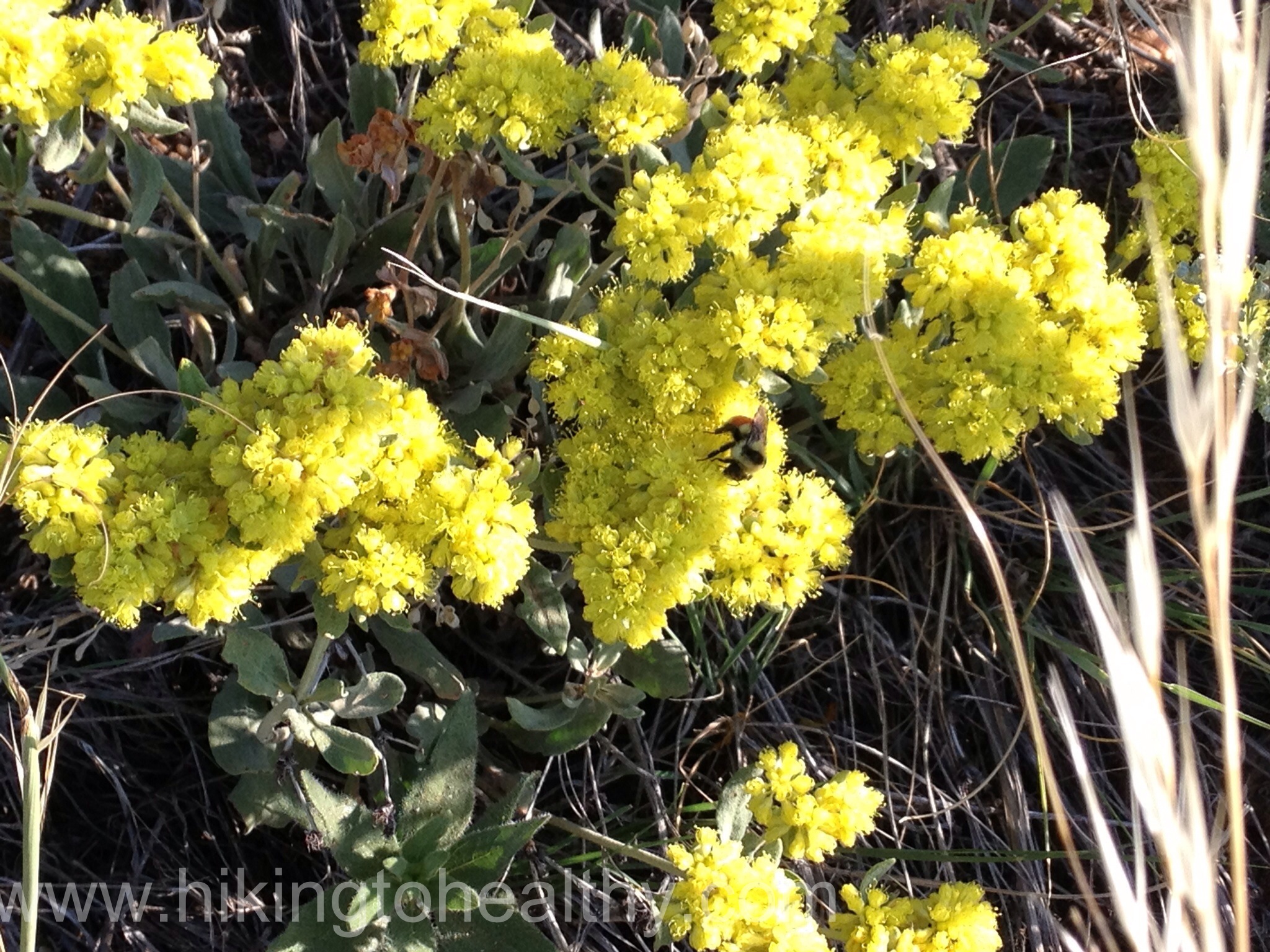
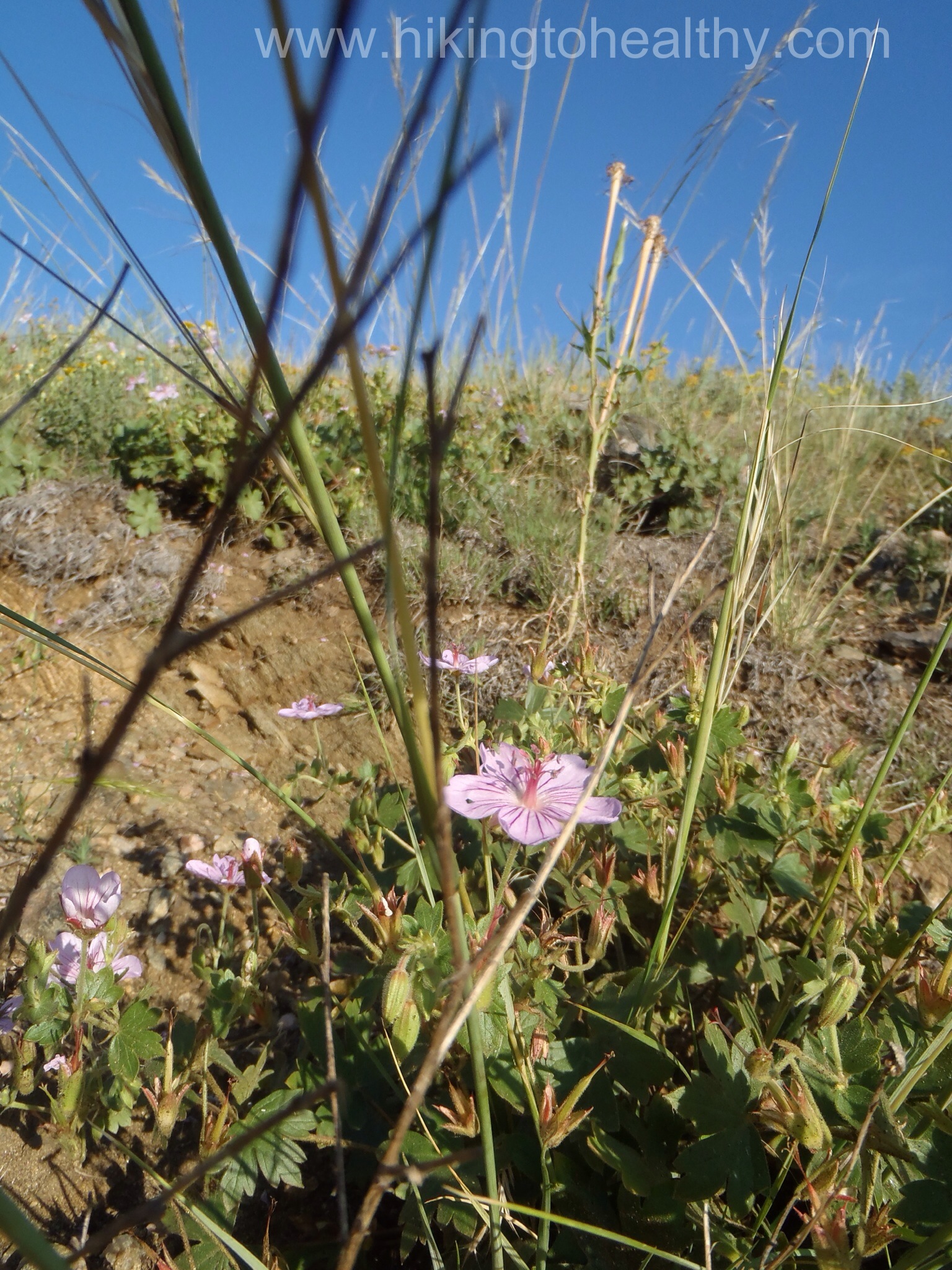
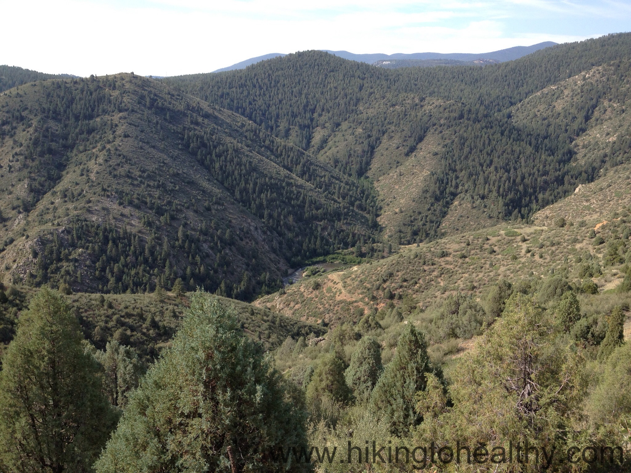
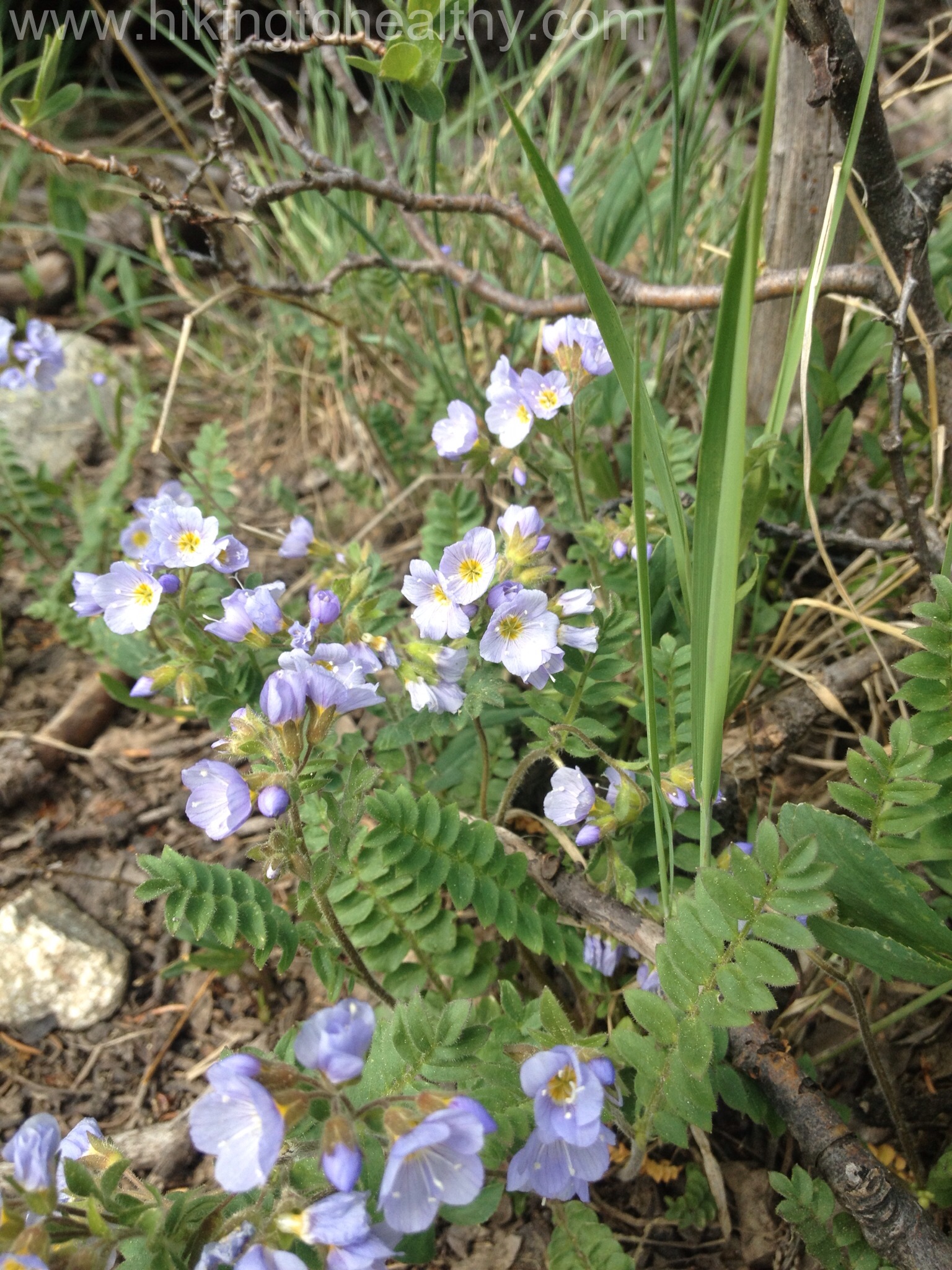
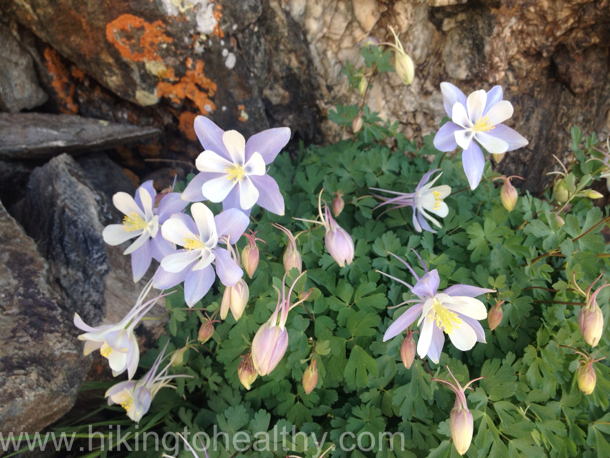
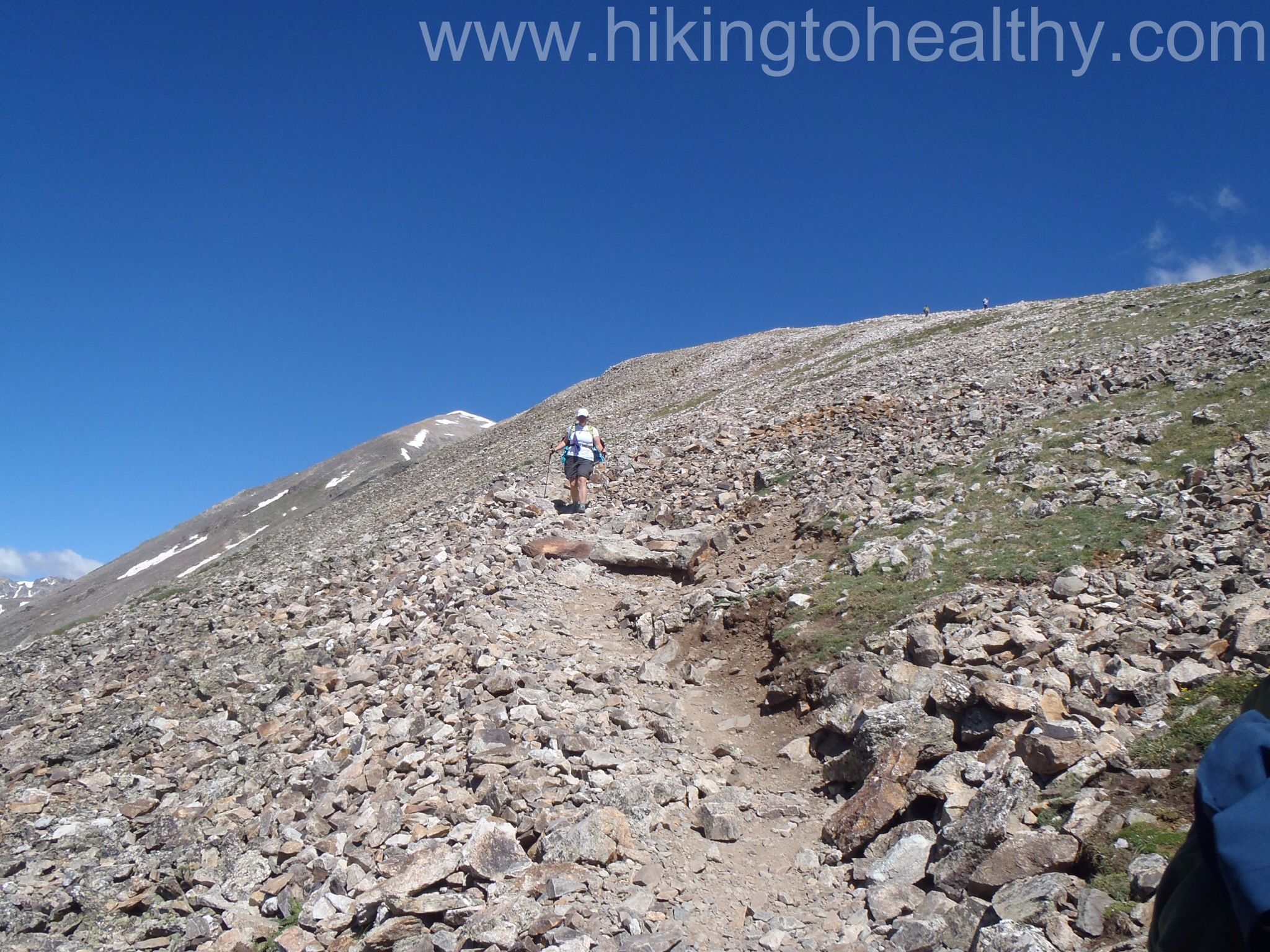
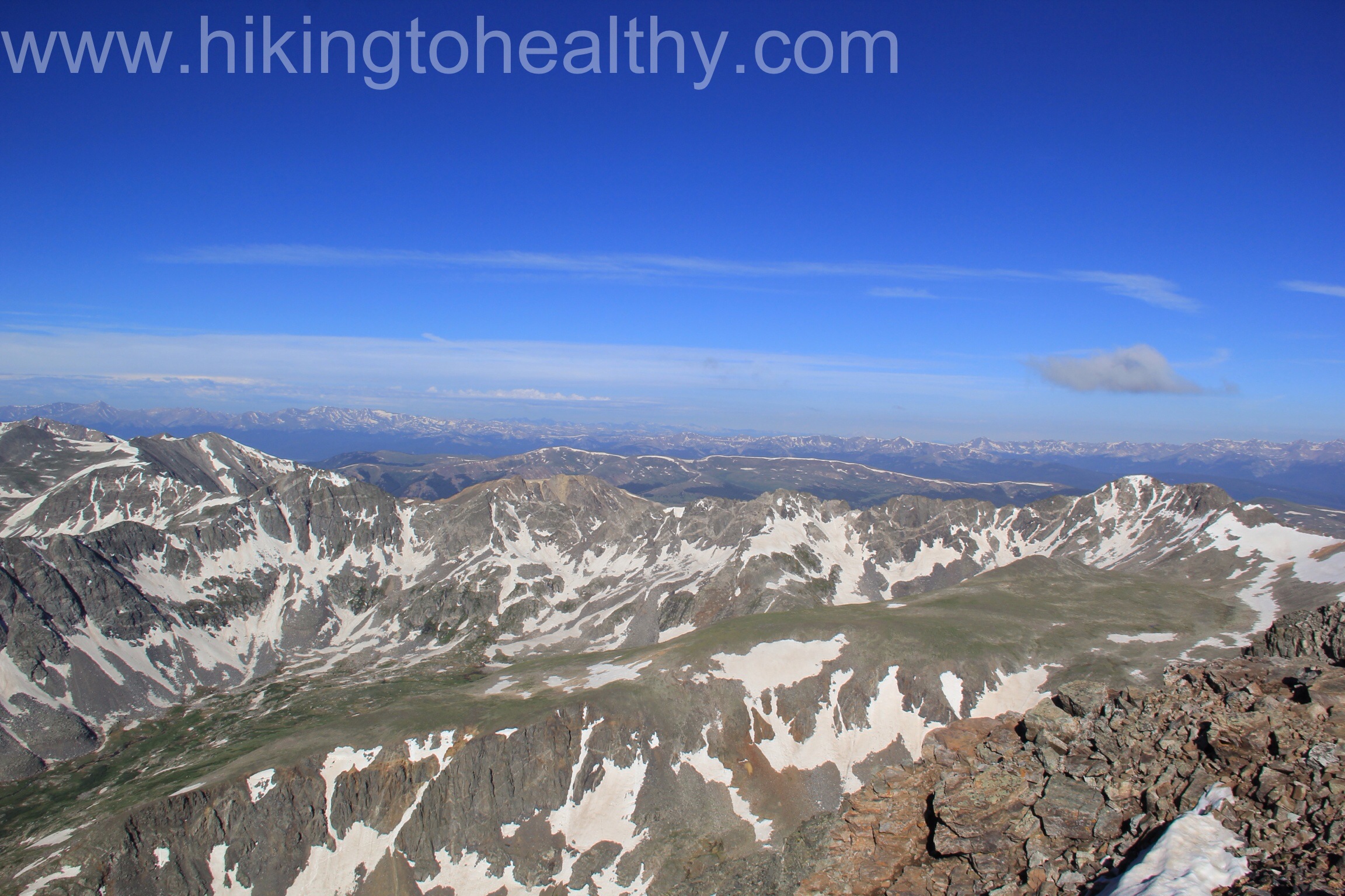
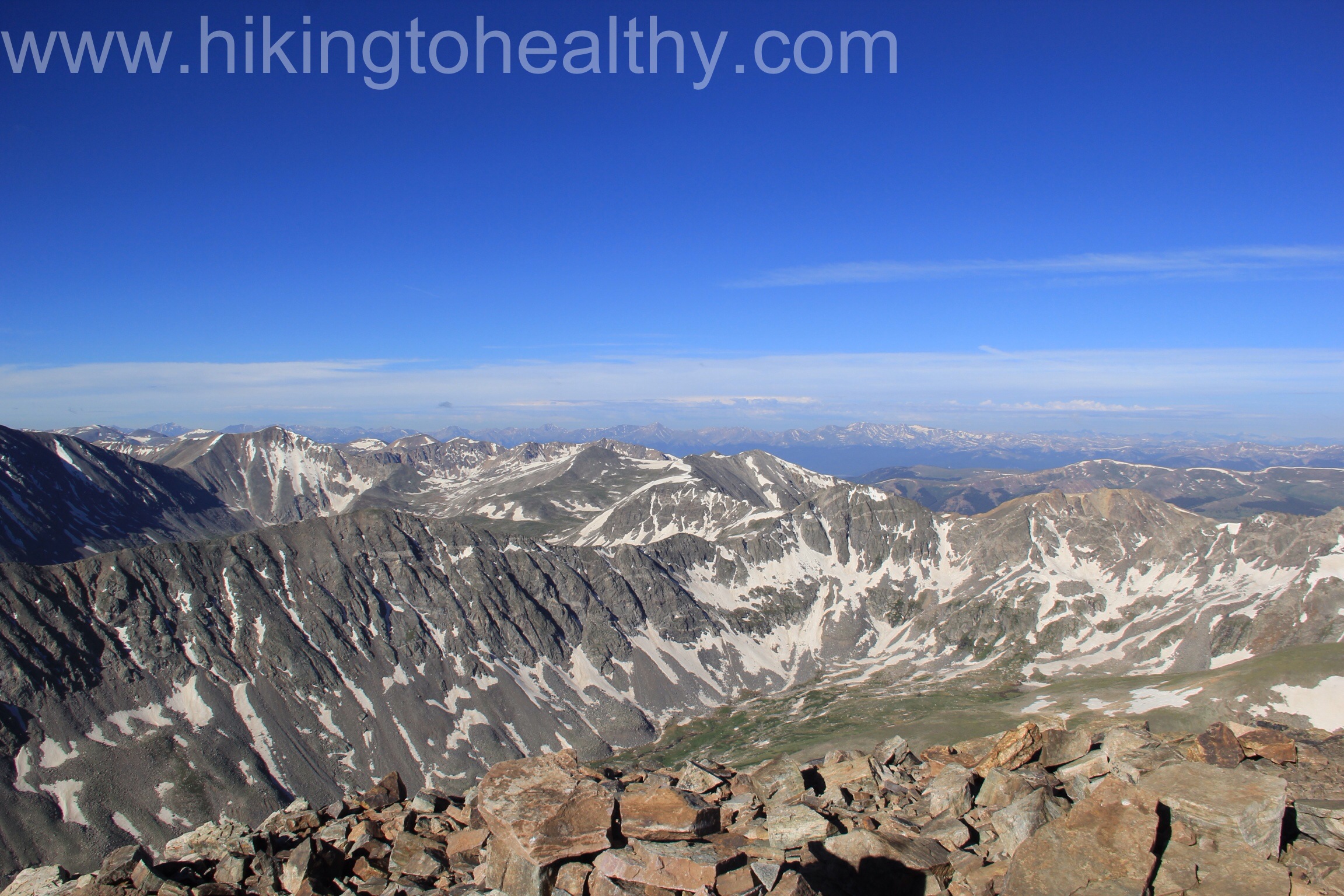
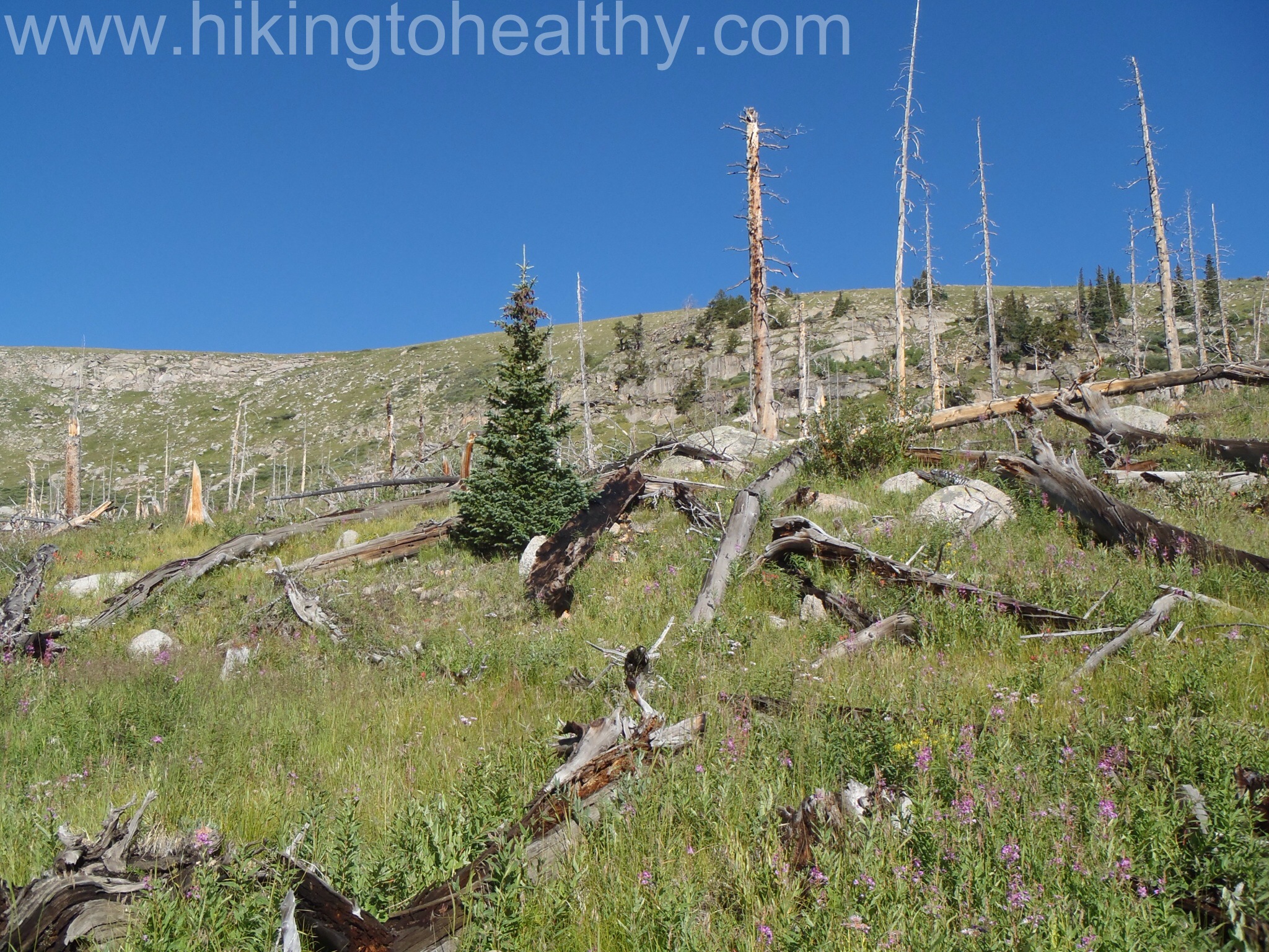
As we crossed over to the Mt. Evans Wilderness, the trail went back to single track and starts climbing more aggressively through an old burn scar from a fire in the 70’s. As it flattened out for a short stretch, the wild flowers were everywhere and the views of mountains on either side of us was pretty amazing.

Mt. Evans WildernessPermit Box for Mt. Evans wilderness

Trail goes back to single track and gets steeper.

I am always surprised at how beautiful a burn scar is as it ages.  All the below are from that burn scar.

OLYMPUS DIGITAL CAMERA OLYMPUS DIGITAL CAMERA OLYMPUS DIGITAL CAMERA OLYMPUS DIGITAL CAMERA

Water Crossing in the Burn Scar
Trail levels out before we descend to the lower Lake

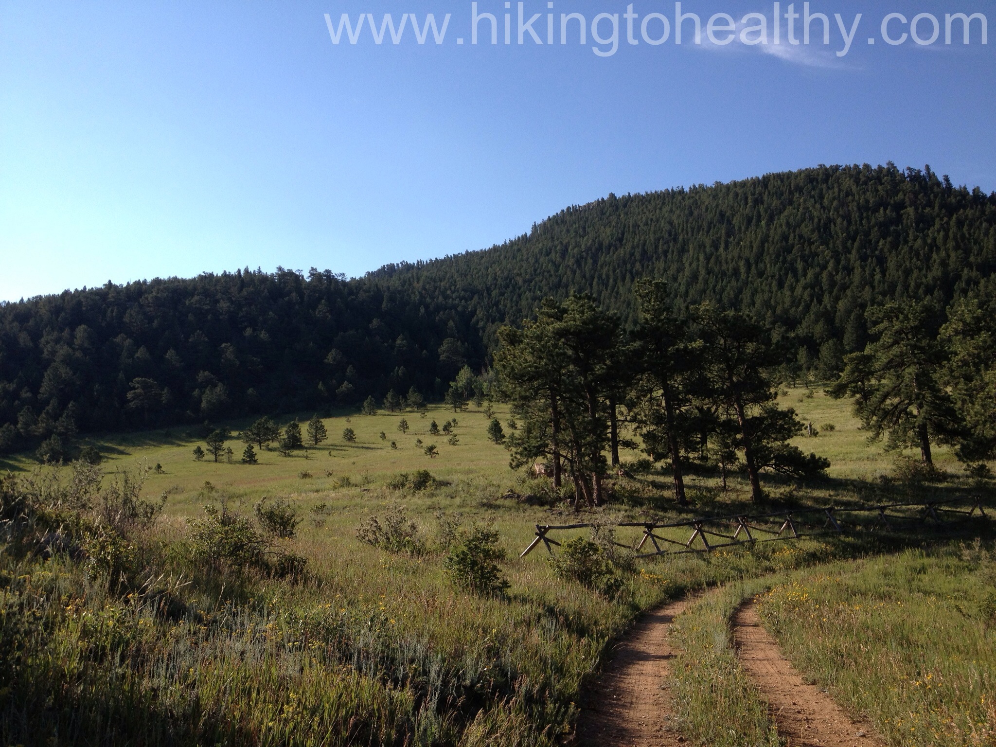
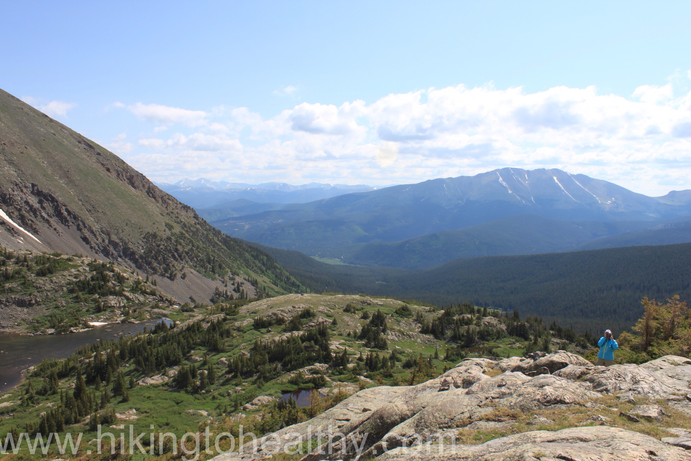
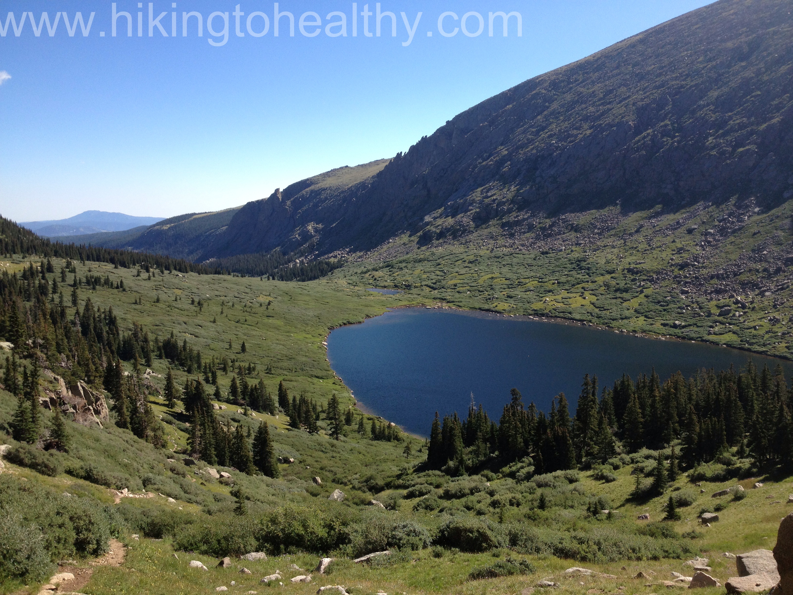
As we came up to the lower Chicago lake, outside of the obvious beauty, we were enchanted by how dense the brush was on either side of the trail and how moist everything was.  We also started descending again and there was more and more mud with standing water on the trail.

Entering the Dense coverage

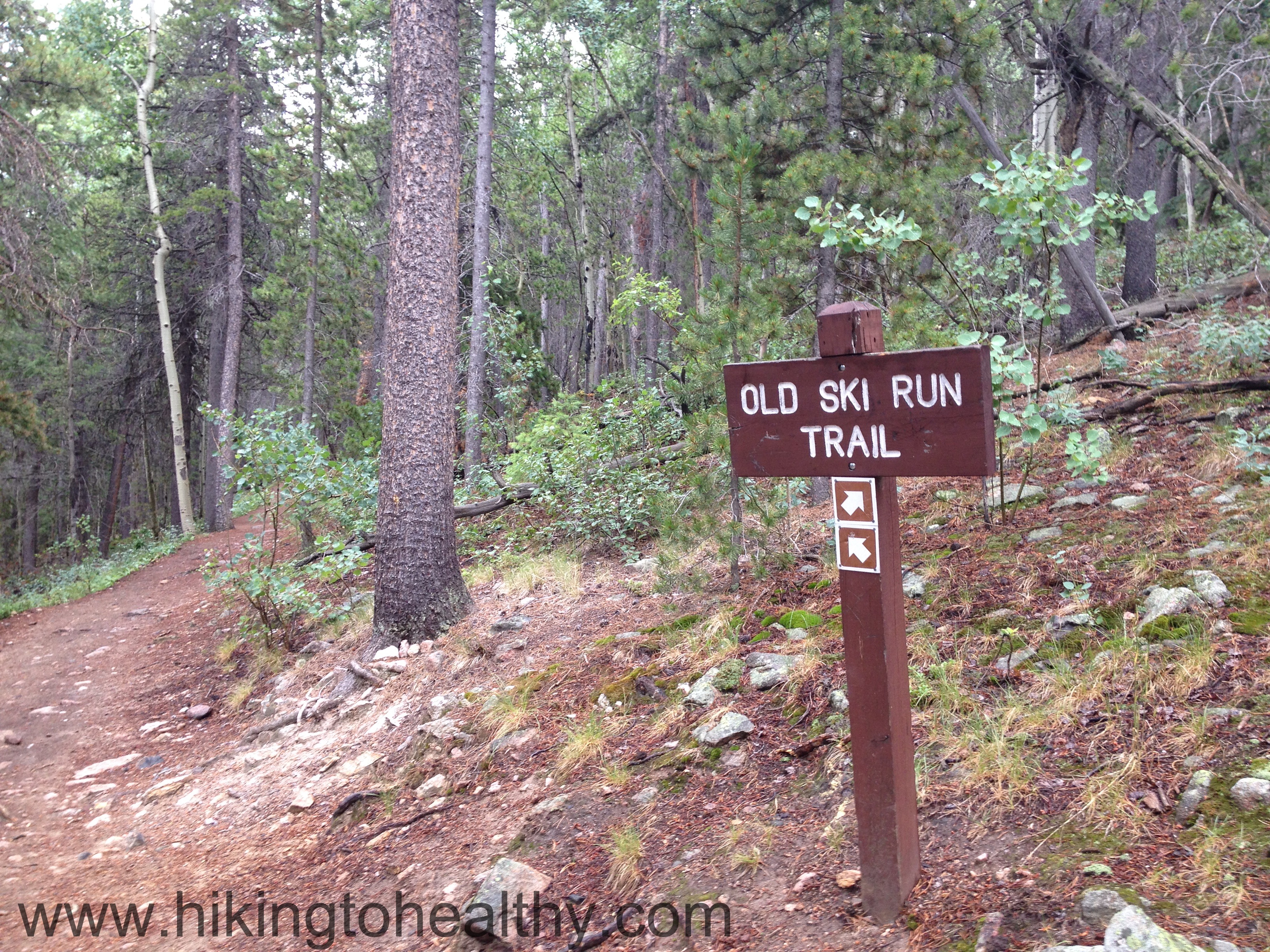
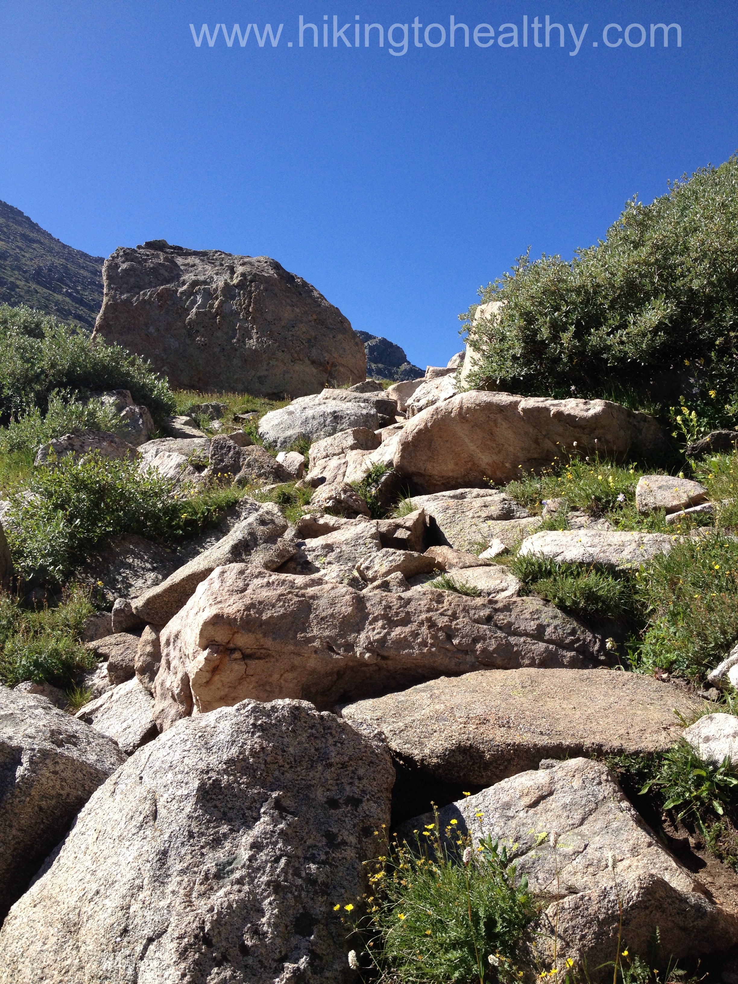
This was also a little tricky through here as I knew we had to stay right on the trail to get to the upper Chicago Lake and since we were heading down through such dense coverage, I was certain we missed the turn off.  We came to this huge boulder and thought maybe this is where we go right but it wasn’t.

When you come to this huge boulder go left
Coming out of the dense coverage

In fact, it isn’t really until we started climbing out of the dense tree/bush coverage,  that we came to the trail going off left to lower Chicago Lake and we stayed right to climb to upper Chicago Lake.

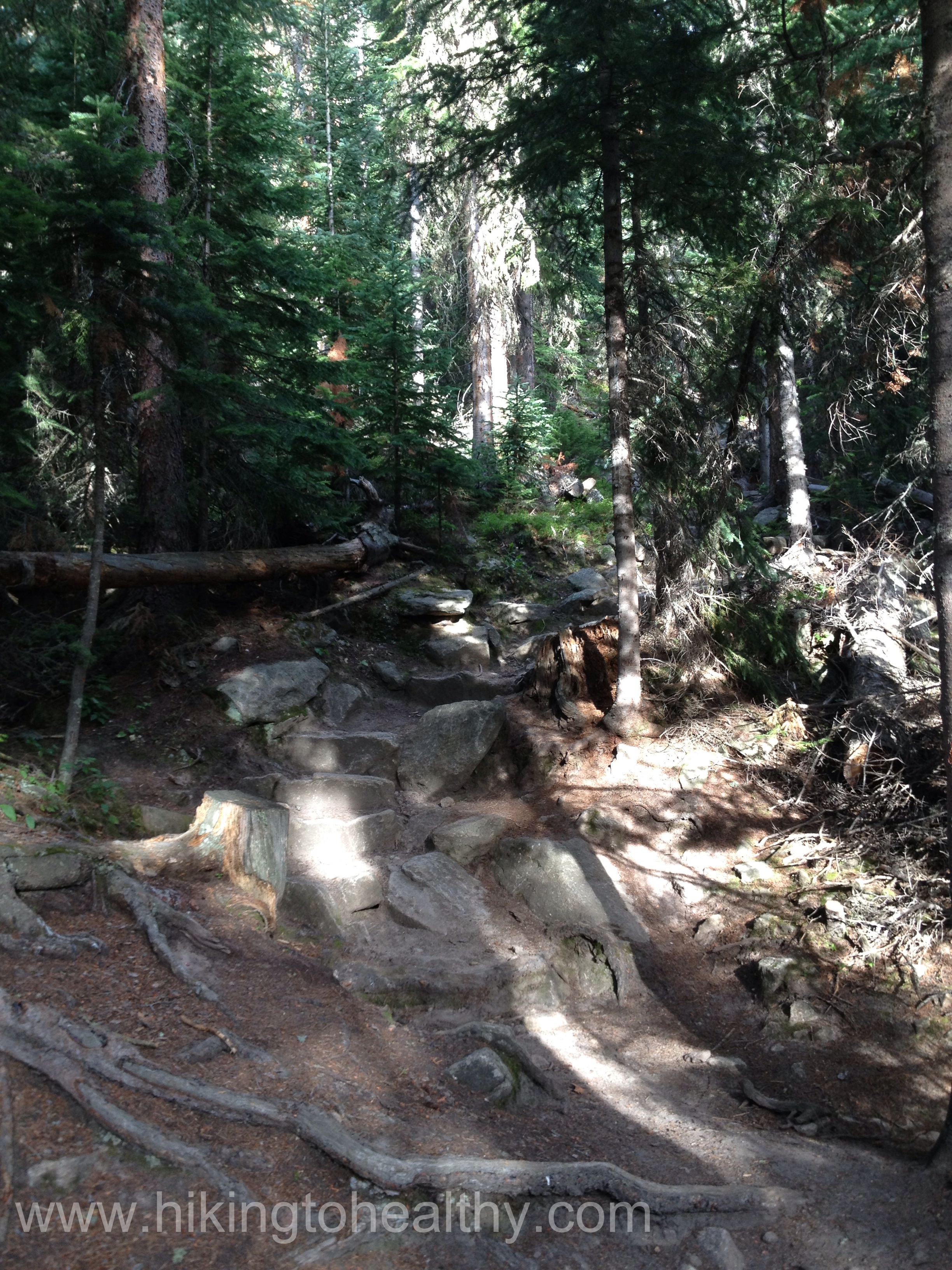
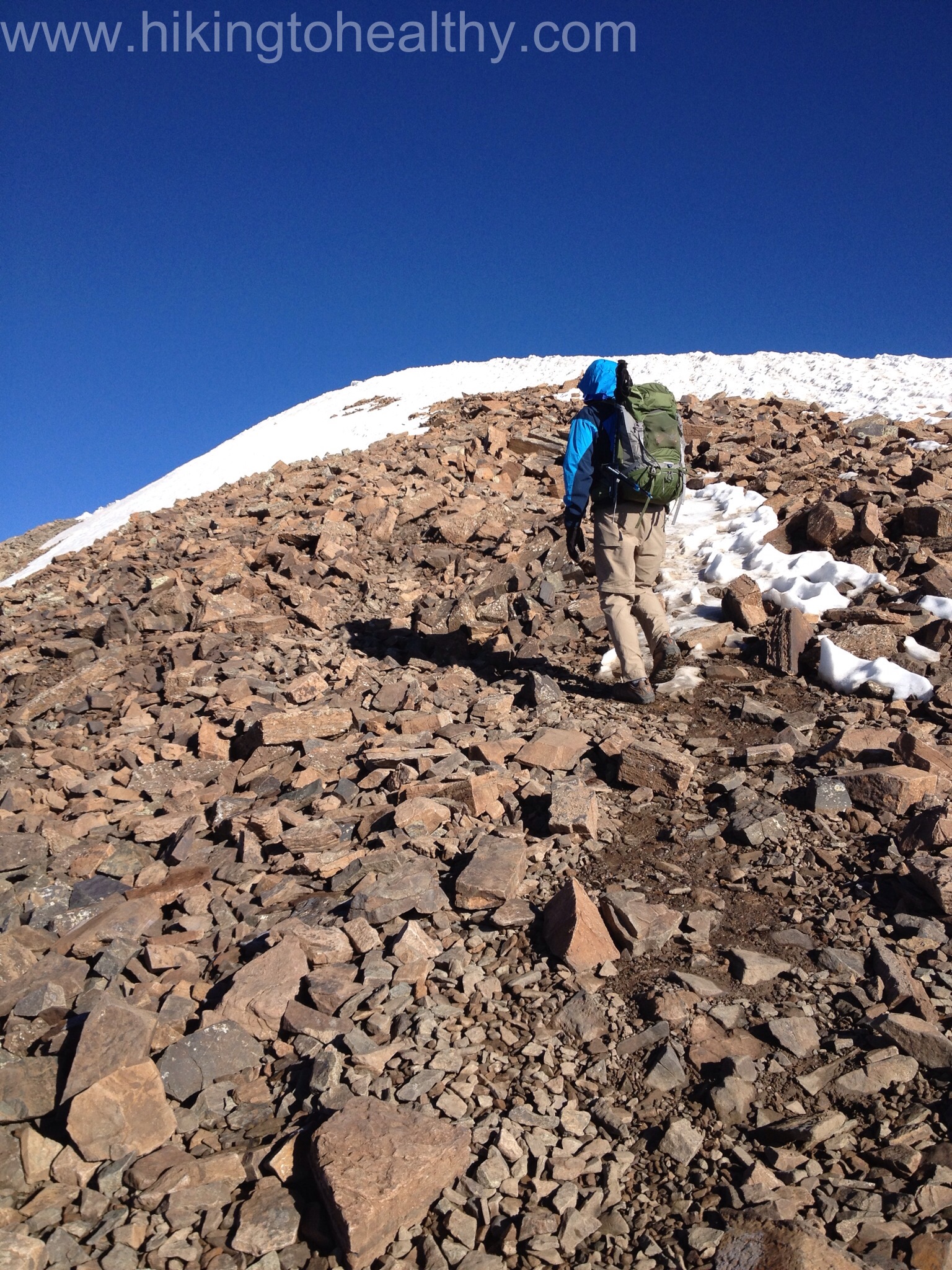
This last climb does require some scrambling but nothing too bad, we did put away our poles so that we could use our hands freely.

Trail conditions up the scramble Scramble

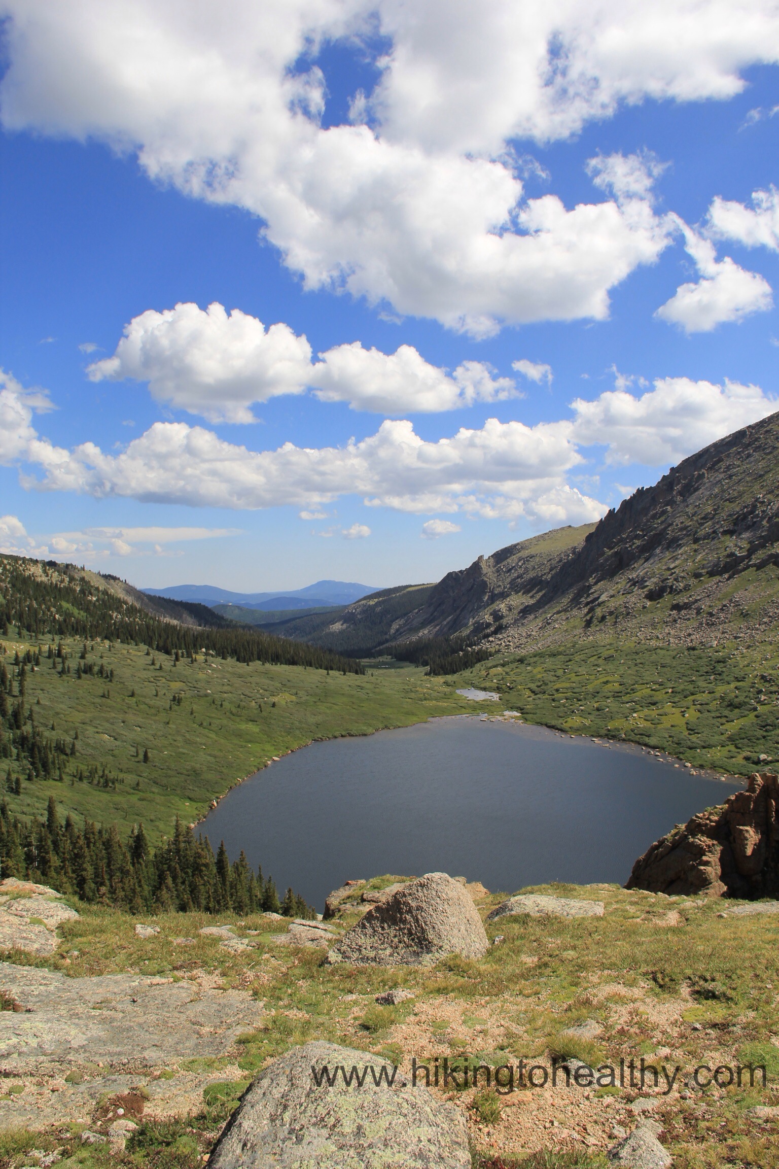
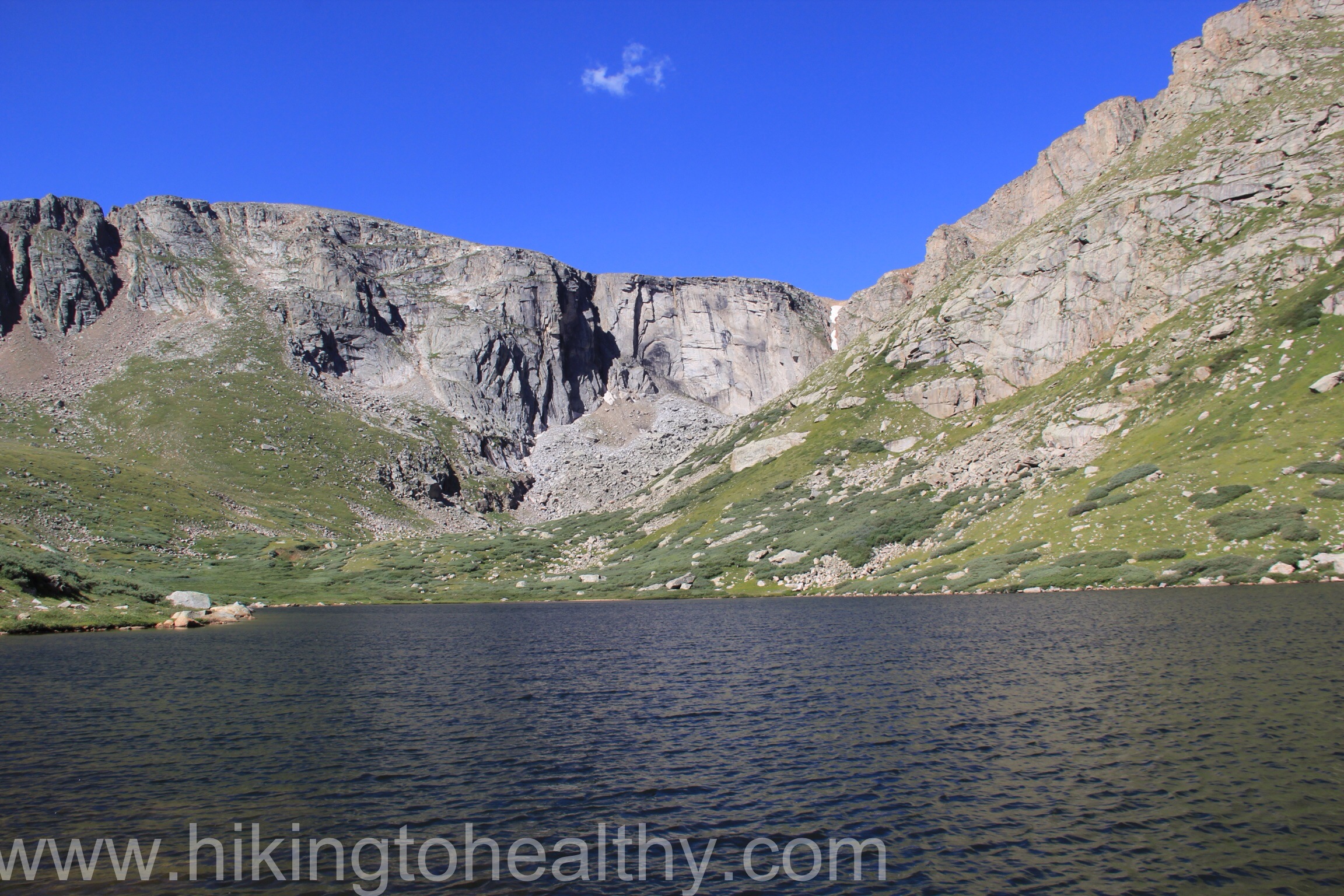
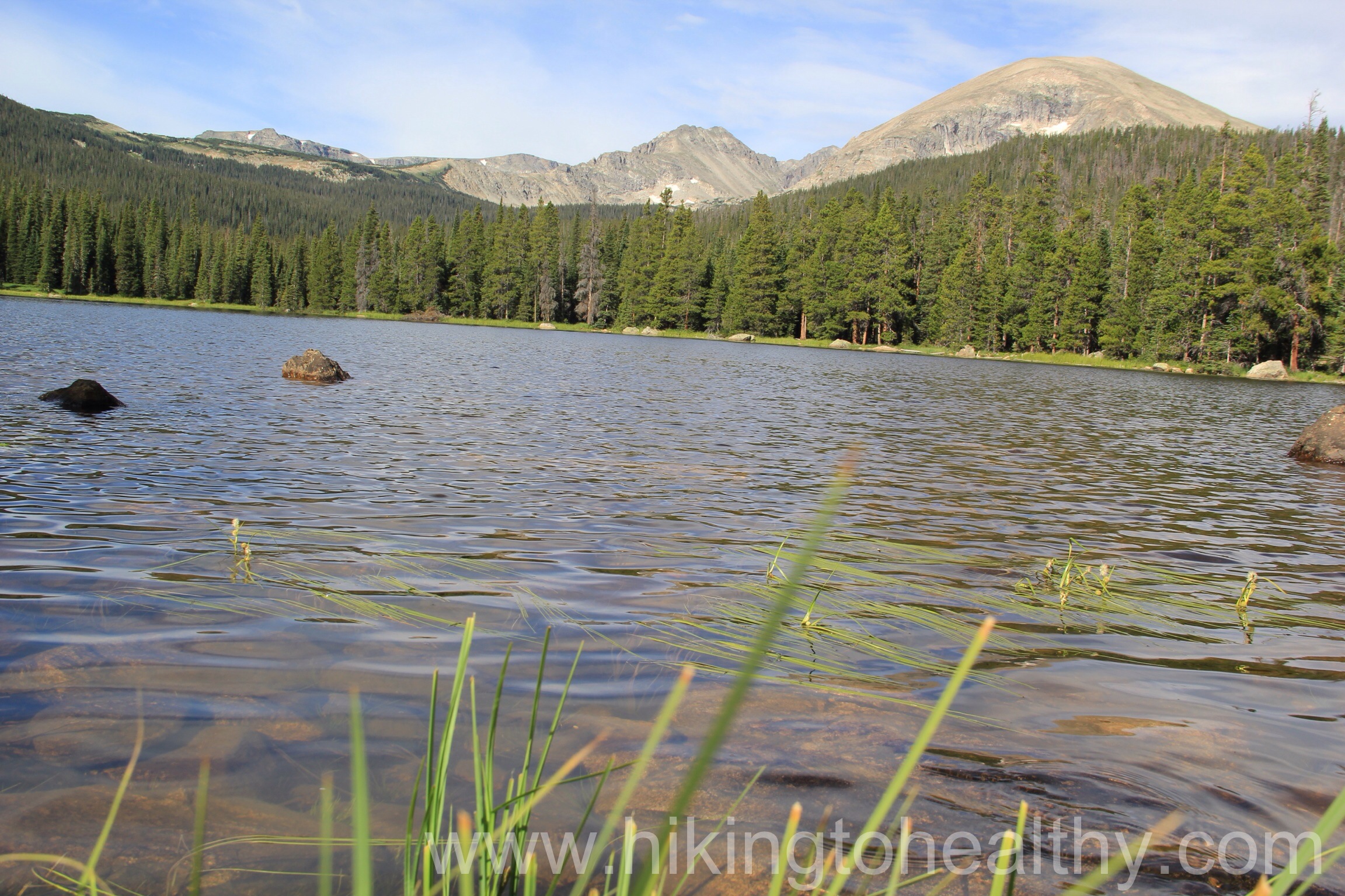
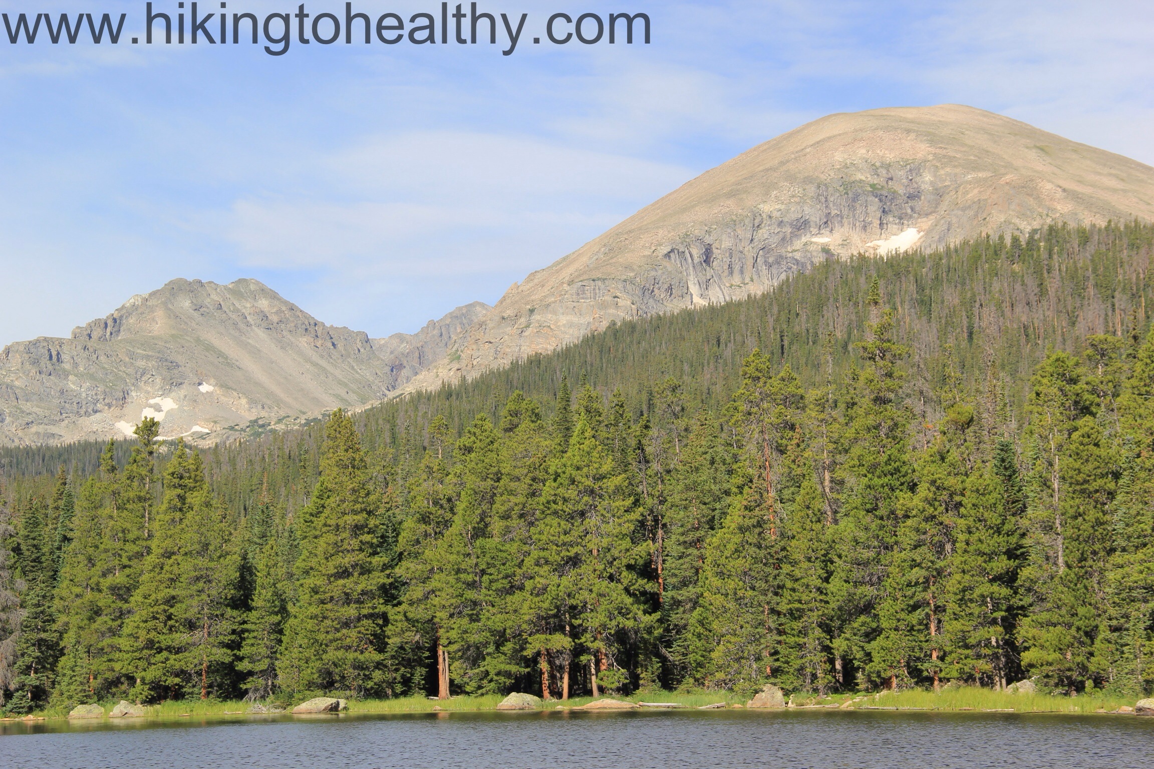
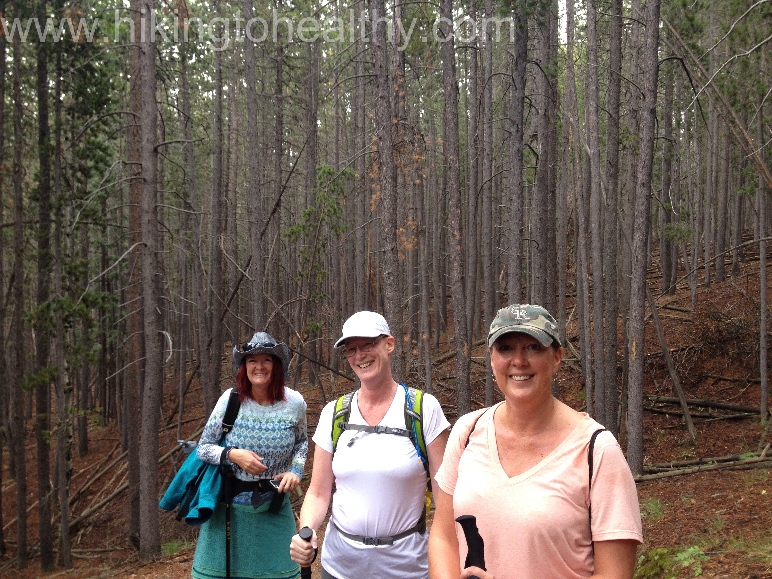
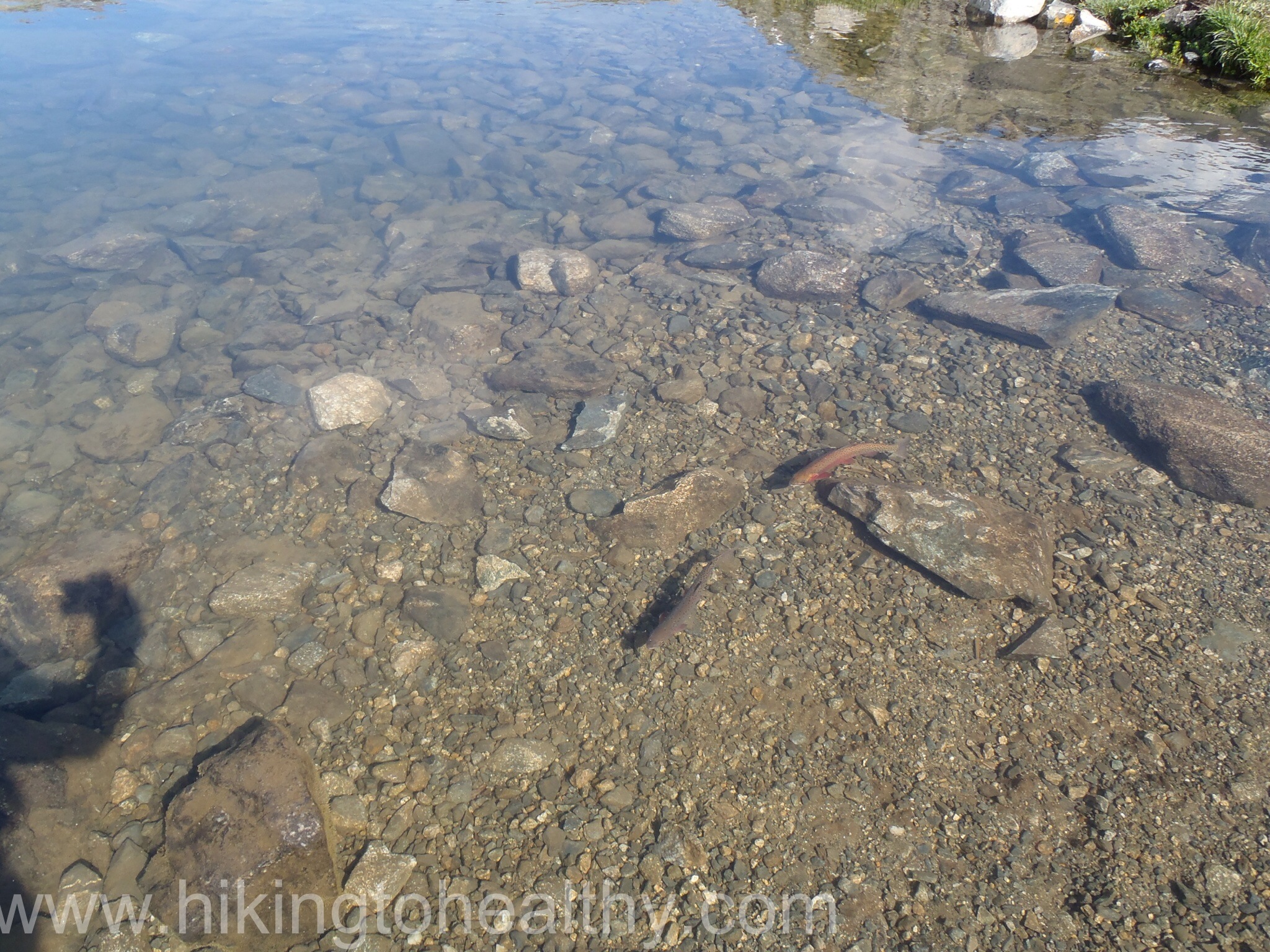
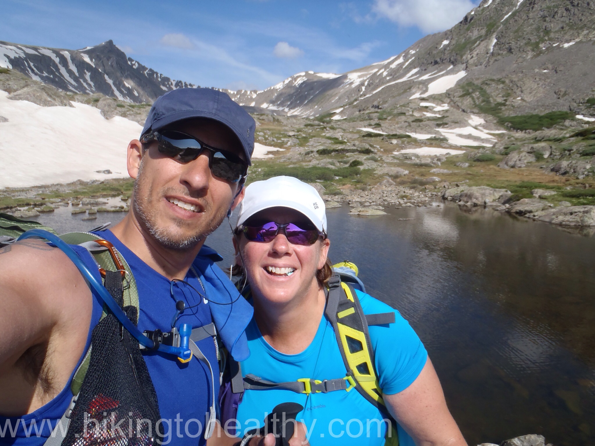
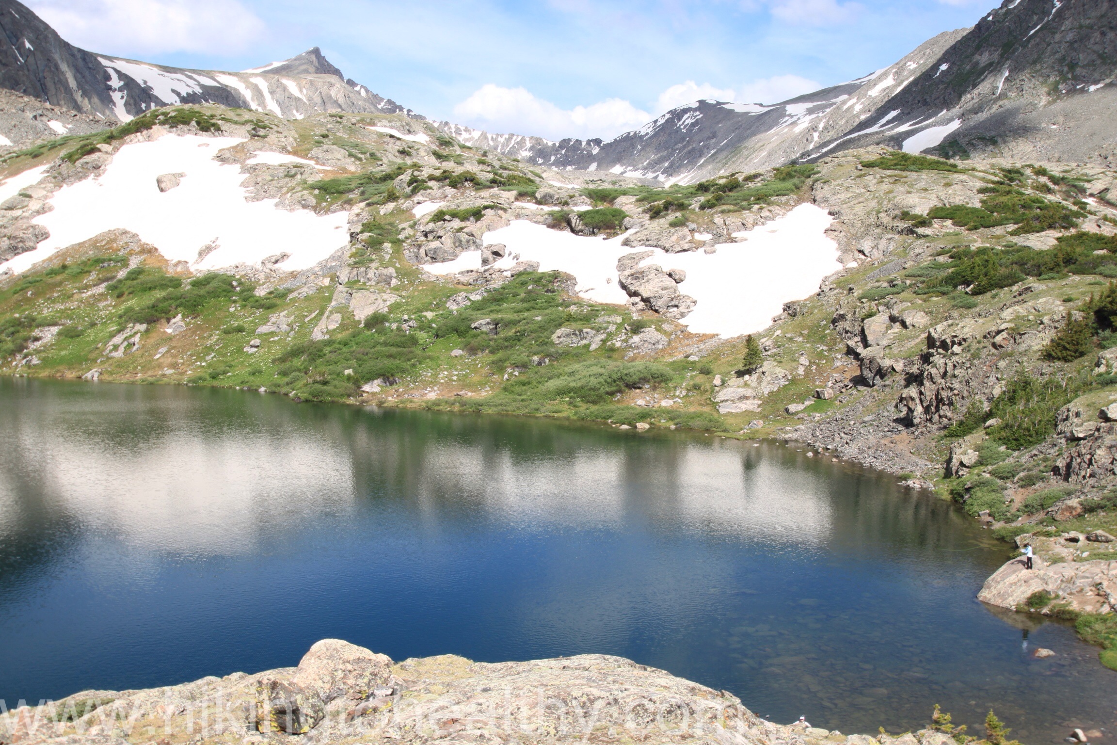
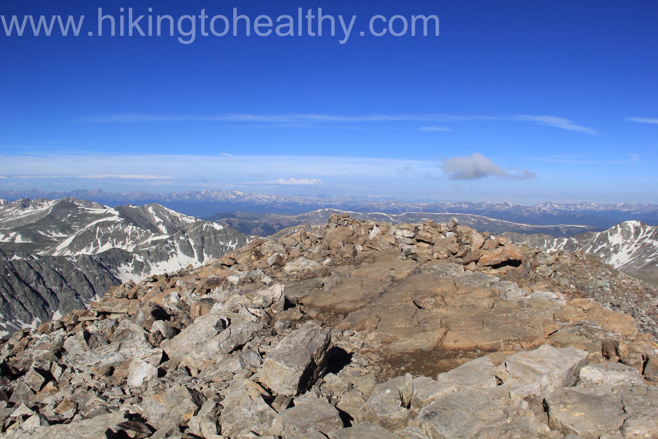
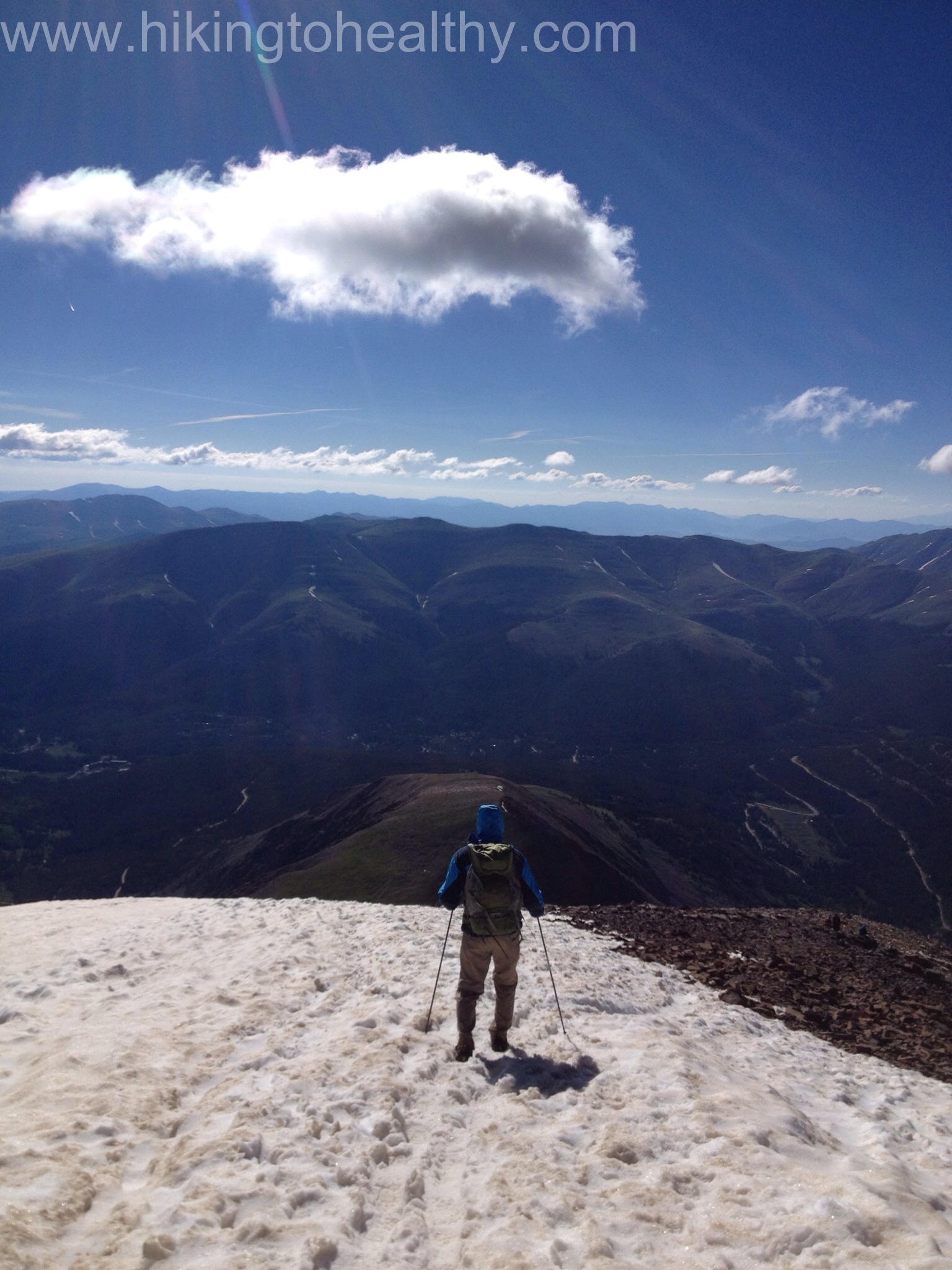
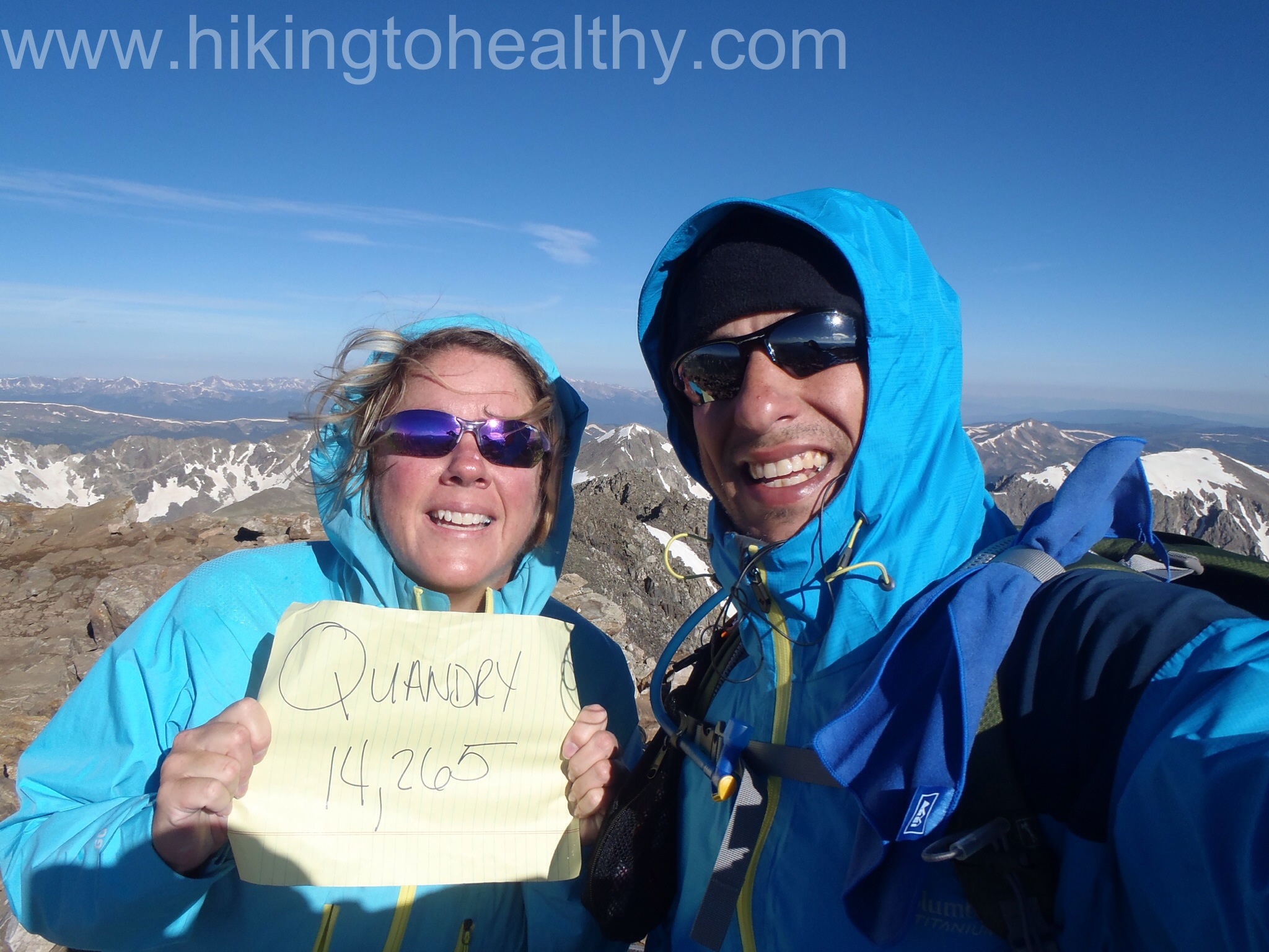
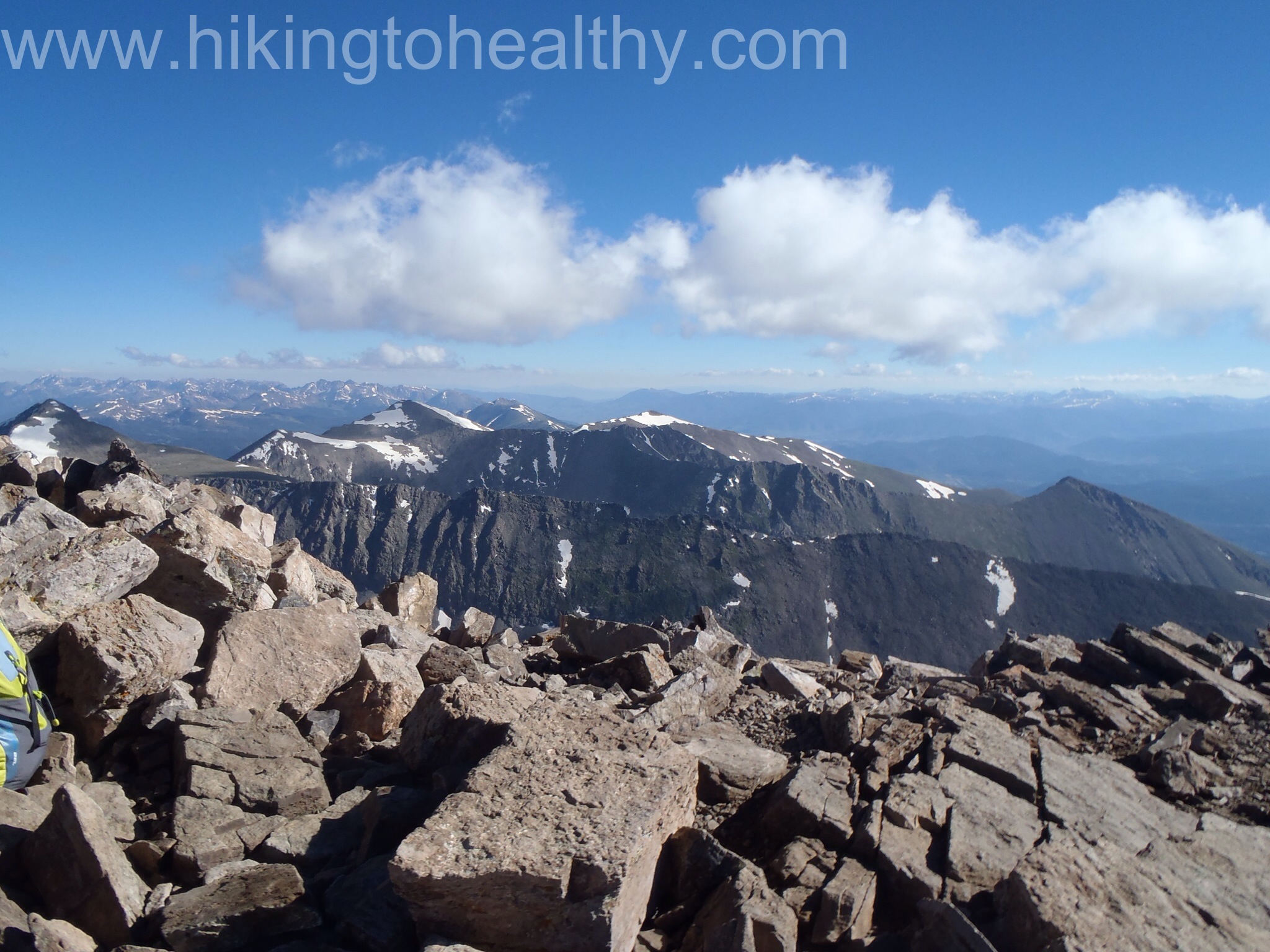
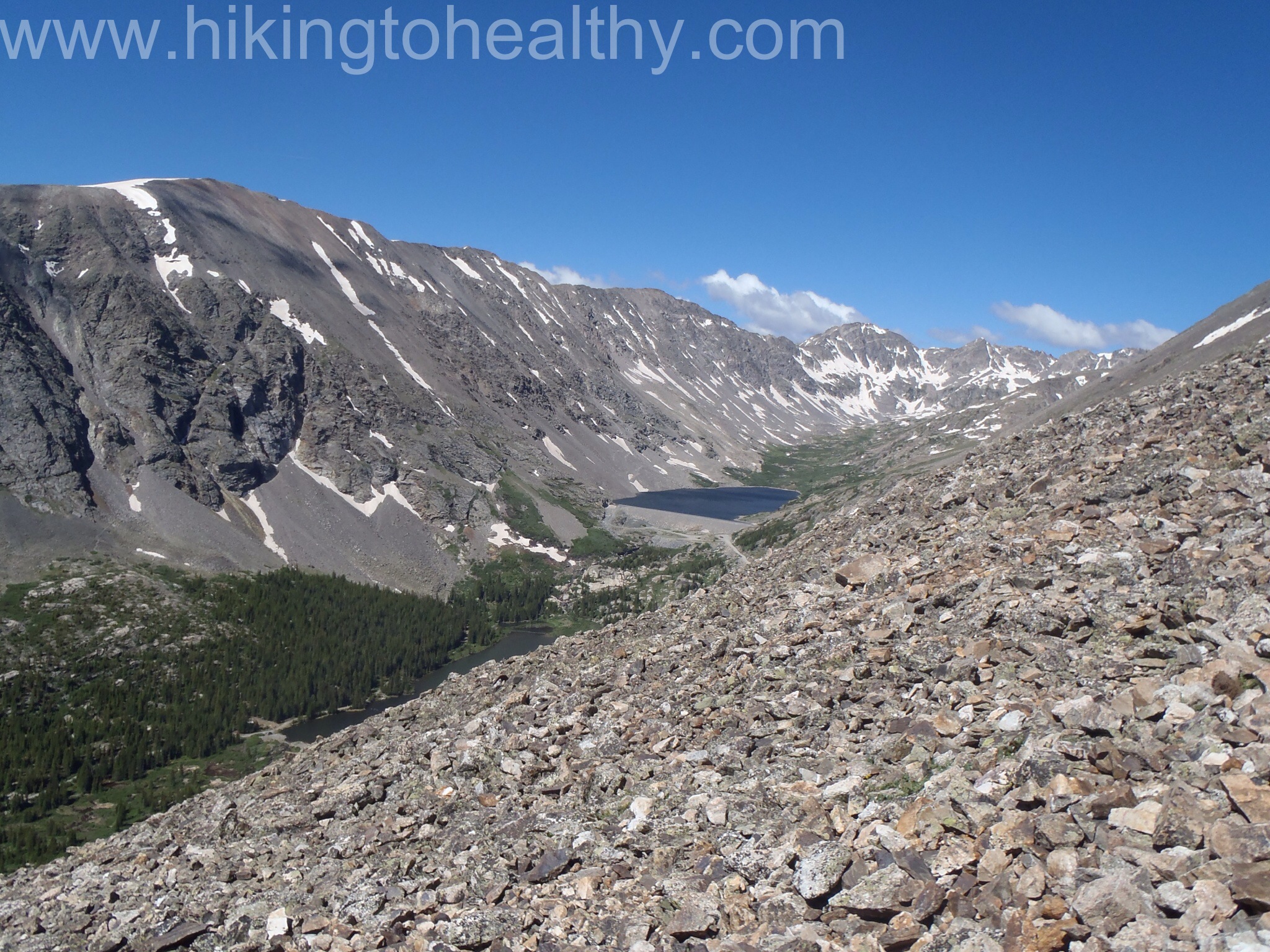
Upon cresting the final lip of the scramble, the upper Chicago lake was spread out below us.  It was spectacular!  It took us about 2.5 hours to get there and we ended up sitting around taking pictures while snacking for almost an hour.  Plus we were fascinated with the people climbing up to Summit Lake and possibly Mt. Evans (14er) as this is also the crazy long route ( 14-16 miles round trip) to summit Mt. Evans, on the south side of the lake.  It looked really steep and as the wind picked up we saw the little group slow down quite a bit.

Upper Chicago Lake
Upper Chicago Lake
This is the trail going up to Summit Lake I tried to zoom up as there as people ascending

This is an in and back hike, the first one where my books said it would take longer on the trip back then it does on the trip there.   There were a couple of reasons we took longer on our way back, that scramble to the upper lake is actually pretty steep and we took our time getting down it, then the last .8 miles is straight up 3-400 vertical feet up a single track trail that is heavily used. It did take us almost 3 hours to get back.

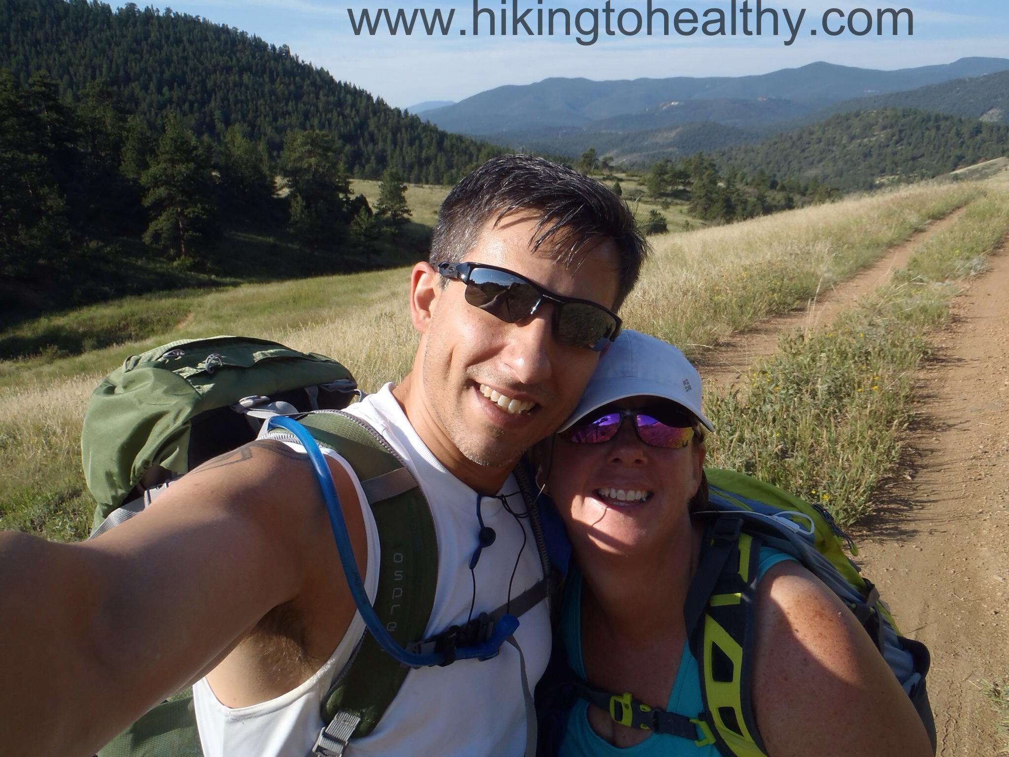
Also the trail started getting pretty busy on the way back with like 50 back packers coming in to camp by the lakes for the night, among a bunch of regular hikers.  It made us very jealous as camping up there must be so lovely!  It was even more busy between the Mt. Evans Wilderness boundary and the start of the hike with people picnicking by Echo Lake looking for some pre- Picnic exercise.  Overall it was a beautiful hike and again renewed my love of hiking and Colorado!  If you ever have the chance, please check this one out, it is worth the effort!  After the directions to the trail head will my favorite pictures

Directions: 

The Chicago Lakes Trail begins at Echo Lake (west side), 13.25 miles south of I-70 on HWY 103.

From I-70, exit #240 and head south on HWY 103 (toward Mt Evans) for 13 miles to Echo Lake. Turn right at the Echo Lake Picnic Area, down the first dirt road on your right and continue .25 miles to the parking area.

Flying Pig Cloud
Flying Pig Cloud

Fav 1 Fav5 Fav3 fav 8 Fav2 Fav4 OLYMPUS DIGITAL CAMERA Fav 6

To confess or not to confess…. The stress of the weigh in….UGH

I have been decidedly not talking about my weight loss journey and as you can probably guess, for all the bad reasons no one ever wants to talk about it. ….It is not going well.

I want to say that I have been hard-core, and kinda I have been but at the same time I know I am not doing my best.  Life happens, and this where I always end up failing.  I have spent the last month and half doing a million things outside of hiking, exercising and while my eating hasn’t been perfect, it doesn’t explain why I have gained so much weight back….  The truth is, I have gained back weight and then lost some of what I gained back.

For the past 2 weeks I have been focusing on not quitting, which I would normally do at this stage in pursuit of my goal weight.  And OMG, I am great at quitting when it comes to weight loss but I don’t want to quit, I really want to get healthy and I want to do and see more of Colorado while hiking like a crazy person!

The hardest part of being me is, I am truly addicted to food( really bad for you food) and unlike those addicted to substances, I can’t give up food since I need it to live  so I am just trying to manage.

I am in a managing stage.

It is not ideal but it is where I am at.

In the end, I had gained back 2.8 LBS and this week I lost .8 LBS which makes me only +2lbs. I am sort of ok with this.

While I fight my desire to quit, I have managed to plan a months worth of hikes to keep me motivated.

SInce I am not on a diet but a life change, I figure that this will always be my challenge in life and if I can’t figure out how to get through today, then how can I possibly hope to get through tomorrow?

This is my confession and my hope, I am 17 months into this journey and I am so much happier for everything I have seen and done in that time.  I am holding on to all those summits and spectacular views as motivation to Keep moving forward.

Our hike today was a great motivator and the hike I have planned for next week has butterflies in my stomach because I can’t wait to see it.

I am sorry and I am back on track…I swear!


Finch Lake – Rocky Mountain National Park – Allenspark trailhead, Allenspark CO 8/3/13

OLYMPUS DIGITAL CAMERA

The Finch Lake trail

Starting Elevation: 8526Ft

Highest Elevation: 10,165 ( Total Elevation gain around 1900Ft)

Trail Length:  Officially 8.2 miles but we wandered around the lake a lot so we ended up with 9 miles total, it took us approx. 4 hours total

Trail Uses:  Hiker only

Degree of difficulty: Moderate

Bathrooms: None

Pets:  Not allowed, as this is all in Rocky Mountain National Park

Fees: None at this trail head location(one of the reasons I chose it)

OLYMPUS DIGITAL CAMERA

When I was looking for a hike to hit this weekend, I needed something with some views, around 10K at its highest point and 8-9 miles in length.  I had not yet really dug into my Lakes Hiking book from Colorado Mountain Club and this was a great opportunity to see what it had to offer.   Finch Lake did not disappoint and surprisingly, for none of the reason I initially chose it.

Allenspark Trailhead Parking lot

I was honestly surprised at how hard my hikes had been the week before, I mean I knew it always takes me a minute to re-acclimate when I travel back to sea level but I thought with all I had accomplished so far I would bounce back more quickly.  The blister situation had improved over the course of the week prior but were still a significant issue.  I was pretty depressed about the fact that we were once again starting low to work our way back up to another 14er after finally climbing our fist one just a month earlier.  I manged to get over myself pretty quickly because the fact is, these mountains will be around much longer then I will, but if I don’t take care of me now I won’t get to see as much of them as they invitingly offer up to me each week.

OLYMPUS DIGITAL CAMERA

I got up insanely early Saturday, 4AM, because the weather forecast said that rain chances would increase even earlier then usual, around 11AM, and I wanted to make sure we got to the lake and were well on our return before any hit.  We started hiking at 7AM and while there were a few cars already in the parking lot, we only crossed paths with a few other hikers almost the whole way to the lake.

First Trail Marker
First Trail Marker
Trail Conditions for the 1st .8 miles

The first mile is pretty much through dense forest, in fact maybe the most dense forest I have seen since I started hiking in Colorado.  It was like hiking through a Grimm fairytale.  We met our first trail break at a little under a mile in and stayed left, the trail is really well marked so we had no problems following it correctly to our final destination. As we climbed a little out of the heavy denseness, the views started to show themselves, it was all Mt. Meeker & Long’s Peak on our right just getting better and better as we continued on.

Next trailhead

Trail Conditions for the next mile probably the steepest part of the hike
The views are starting out awesome

At the next trail break, we took advantage of a little outcropping to get some good pictures of the view, we were 2.2 miles away from the lake.  While we were snapping away, another hiker moved on down the trail we had been on.  At the time we didn’t think much about it, but I have to tell you when we passed him, I got the most creeped out I have ever been on a hike.  There was not really anything outwardly odd about him but what he was putting off just wasn’t right.  I used to be a victim advocate for victims of violent crime and I always listen to my gift of fear, the next 1.5 miles were a blur for me as we huffed and puffed to get as far away from him, as quickly as we could.  At one point I was considering what my options for protection were if attacked.  What changed at mile 1.5 you may wonder….. trail maintenance, there were 3 National Park workers improving the trail.  It was an immediate relief and we never saw the hiker again.

Last Trail break before Finch lake
Trail Conditions through the burn scar
Cool Water crossing before we started down to the lake
Yay Trail Maintenance
Already fixed trail
Already fixed trail

As we got closer to the lake, we saw the option to carry on to Pear lake another 2.2 miles ahead.

At Finch Lake

Trail conditions by Finch Lake

Since this wasn’t an option for us today, we explored the area around the lake.  It as incredibly marshy and at first the bugs were not really aware of us but then I got one quick bite and that little monster must have rang a dinner bell because I was swarmed and attacked mercilessly. I actually squealed as I ran away from my marshy perch, barely grabbing my pack en route.

fav 4 fav 5

We started seeing more people around the lake coming and going up to either the camp sites or Pear Lake but from what I have read, this is a hidden gem in RMNP and so gets much less traffic then all the other lakes in the park.  It’s true, while we did see an increase in traffic after 9AM, it was one of the lighter trafficked hikes we have done lately.  Plus the no fee entrance was a huge bonus!

We turned around and headed back the way we came.  It was like a brand new trail now that there were more people out an about and we were not trying to get away from  someone.  The surrounding mountains  looked even more beautiful ( if that is possible) on the way back and something had shifted in the atmosphere so that Long’s Peak, Mt. Meeker and their neighbors looked extra close, like we could reach out and touch them close.  I LOVE when that happens.

Fav 11 fav 10

We ended up taking almost as long to get back because we stopped a lot to take pictures of all we missed on our rush through mile 1.8-3.5.  We finished up the last little bit as it started to thunder, our timing was almost perfect as the rain started up on our way to Oskar Blues Grill & Brew for our little victory dance.

OLYMPUS DIGITAL CAMERA

This is a beautiful hike and one I know we will likely do again soon so we can see Pear lake.  I also think we are going to start dipping our toes into backpacking and this looks like a perfect trail to test our resolve on.   One of the best things was that we were in Rocky Mountain National Park the whole time without all the RMNP crowds or the fee to get to a trail head and it was breathtakingly beautiful!  As always, my favorite pictures after the directions.

Directions:  From Hwy 66 west into Lyons, At the Y intersection in Lyons, turn left on Highway 7 toward Allenspark. About 18.5 miles turn left on Business Route 7/Allenspark. (Don’t take the first Business Route 7 into Ferncliffe.) 0.1 of a mile, turn right on County Road 90 (just before the post office). Travel 1.5 miles to a fork in the road. (There are several, but stay on the main road) At 1.5 miles, take the right fork, travel 0.1 of a mile to the trailhead on your right. There is a sign that says “Allenspark Trailhead.”

Copeland from teh scarOLYMPUS DIGITAL CAMERA OLYMPUS DIGITAL CAMERA OLYMPUS DIGITAL CAMERA OLYMPUS DIGITAL CAMERA fav9 OLYMPUS DIGITAL CAMERA fav 3

Meyer Ranch Park- Jefferson County Open Space 2nd Official Girls Hike , Conifer CO Hiked 7/28/13

Deer

Owls Perch > Lodgepole Loop > Sunny Aspen Trail > Old Ski Run Loop > Sunny Aspen Trail > Lodgepole Loop > Owls Perch

Starting Elevation: 7900 ft

Highest Elevation:  8770 ft ( total gain was around 900 feet in elevation gain)

Trail Length: 5 Miles

Trail Uses:  Hiker, Biker & Horses

Degree of Difficulty: Easy

Bathrooms:  Yes a vault toilet about half a mile up Owls Perch trail from the parking lot

Pets:  Yes – On leash only

Fees:  None

park Map

I was lucky enough  to hike 2 times this past weekend and the second time was with my favorite Colorado girlfriends.  I am so honored that they trust me enough to take them hiking and I was super impressed that they were such troopers!  We met at 6:30AM on Sunday and it seemed like the minute we got in the car to go to the trailhead, it started raining.  Not too bad, but it still hadn’t stopped when we got to the park which is kinda of an odd occurrence in Colorado, usually it is a quick downpour and then done.

We started up the trail and actually liked the way the rain and clouds enhanced all the colors of this trail.  It was a very easy grade up and the trail was nice and wide most of the way.

Starting out
Starting out the Owls Perch Trail after the Bathroom

The signage is really great on this trail and since our goal was to go through the whole park it was easy to keep moving forward through each trail break.   I had read a lot about this trail before I picked it, what stood out most was that it is all in the pines and there is never really any great “View” to climb too, but I also knew that a couple of my companions were  a little nervous about how much they would be able to handle and some needed a little extra shade to hike comfortably.

Rainy Break
Karin, Lisa & Carrie getting hot in the rain…to peel off layers or not?

I think this is a great starter hike in terms of getting comfortable with a steady climb over very easy terrain.  It is one of those trails that even in the rain there wasn’t any mud, just wet sand with a few rocks and very easy to get through during yucky conditions, although I have read that because of all the shade it takes a while for the snow to melt.  Something to consider if you want to do this in late fall, winter or Early Spring.

Ldgepole to Sunny Aspen
We took Owl’s Perch to Lodgepole to Sunny Aspen – It is very easy to follow

I was surprised my wonderful friends were game to keep hiking in the rain, even as we all started getting pretty hot from exertion but had to stay covered because of the wetness.

Trail COndtions 2
trail conditions as we made our way to Old Ski Run Trail – Beautifully wide with a nice gentle incline

We got to the top Old Ski Hill loop pretty quickly and just as the rain started to let up, so we all stripped a layer because we were crazy hot in our rain gear.

Old ski run loop
Old Ski Run Trail and the halfway point of the hike.

There were a few switchbacks to climb with a very gentle grade and before we knew it we were at the highest part. It was at this point I realized I left all my good cameras at home so I did just a few quick pictures of the trail itself and my beautiful companions with my iPhone.

At the highest point
Carrie, Karin & Lisa at the top part of the loop and our highest point for the day.
Trail on the ki loop
The Old Ski Run Loop leveled off pretty quickly after just a few easy switchbacks
The view
Looking around at the top
Fog coming in
You can’t really tell but we could see all the clouds in between the mountains around us. I still like this picture despite its lack of “view”

We found a rock outcropping to climb to in hopes of seeing more of a view, but there just isn’t one on this trail and while we were checking out what we could see more people heading up joining us so we headed back down after spending just 10 minutes exploring.

Sunny Aspen Trail  to the Lodgepole loop
We went left at the trail break to experience the other side of the park on journey back to the car.

The journey down was much busier then the one up, in fact we had almost the whole hike up to ourselves.  Coming down we crossed paths with lots of other hikers enjoying the short break in the weather we would end up having on Sunday.  It always makes me happy I started early when the trail starts to get crowded.

Owls perch trail break
The last trail break to the Bathroom and then the parking lot

Although I didn’t know it when I picked this hike, it was absolutely the best hike for a rainy day like we had on Sunday.  Now is it the best hike to get your Colorado beauty on, I am not too sure about that.  I wanted to make sure my friends had fun while getting a nice workout in and again this trail is perfect for that.  I am pretty excited to say that all 3 ladies are already asking about our next girls hike so I think they liked it enough to get the hiking bug.

I would like to see this one again maybe in the fall to see how changing environment changes the views and maybe it would make me love it a little more.  It is a beautiful hike, don’t get me wrong I may be getting addicted to all those summit views I had the pleasure of enjoying, so I did leave the trail thinking I never need to do this one again but now a few days later I am not so sure.

The best part of the day was really Carrie, Karin & Lisa ( Poor Julie got sick just that morning and had to cancel at the last-minute).  There is something about having such good friends along and showing them what has been gobbling up all my weekends, then them totally getting it.

Directions:  Take US Highway 285 South from C-470 towards Aspen Park.  Exit the highway at mile marker 239, onto South Turkey Creek Road.  The overflow parking area is on the north side of highway 285; go underneath Highway 285 to access the main parking lot.

Elk Range Trail, Centennial Cone Park- Golden CO Hiked 7/27/13

My Favorite view
My Favorite view

Elk Range Trail> Travois Trail>Juniper Trail>Mayhem Gulch Trail> Travois> Elk Range Trail

Starting Elevation: 7750 ft

Highest Elevation:  7900- ish ft ( Lots of ups and downs gave us a total of 1100 feet in elevation gain)

Trail Length:  The whole park can get you around 12-15 miles of hiking but we hit up 9 miles today with the initial intention of only getting in 7miles.  For the first time ever my fitbit matched the trail map information.

Trail Uses:  Hiker, Biker, Horses share on weekdays  – On the weekends it is hiker only on odd days & Biker only on Even days.

Degree of Difficulty:  Easy to Moderate, mostly because of potential trail length

Bathrooms:  Yes at all 3 parking lots

Pets:  Yes but dogs must be on leash and for the first time ever they all were on leash!

Fees:  None

OLYMPUS DIGITAL CAMERA OLYMPUS DIGITAL CAMERA 1st trail marker

We are finally healed enough from our tattoos that we can get back to the exercise we love most, HIKING.   3 weeks of not hiking has taken its toll on both Aaron and I, I mean yeah I got out last weekend but it wasn’t a super challenging hike and I didn’t have my favorite hiking partner with me.   Surprisingly 3 weeks of inaction really effected our stamina and strength,  we both were a little nervous about what might be challenging so when I was looking for a trail this weekend I went with a low one and maybe a little easier than what we normally do.   I have wanted to check out the Centennial Cone Park for almost a year but at first it seemed too hard and then it seemed too easy so I kept passing it over.  It was perfect after a 3 week unexpected break.  We decided we would try out the newly reopened Elk Range Trail and go a little further depending on how we felt physically.

Start of the trail
Start of the trail

The trail itself starts out pretty easy and since we parked at the north parking lot we initially started out going slowly down on a road like path.  Look at the cool bench they have the beginning so you can just enjoy the rolling hills all around:

Cool Bench

The park itself consists of one big loop with 2 side loops near different entrances of the trail(s).  One trail is open most of the year except during December & January, the Travois Trail and it is almost 8 miles one way to the west parking lot.  The other is the Elk Range Trail that closes periodically, during May and June for Elk calving and again December & January for hunting those same elk…weird.  The other thing is that the park alternates on the weekends between biker only(even Days) and hiker only(Odd Days), which I have to say I really love.

The Gate and notices for when the trail is closed

The trail moves across a couple of hills and in just a 1.4 miles we were upon the private property cross over.  It is before the private property, that if you want to try to make your way to the summit of the Centennial Cone, do it here because the opposite side of it looks much harder to navigate.  It will have to be a path you, find as there is no trail up to the top.  We chose to just play it easy today and went onward to the West Parking lot.

Before coming to Private Property
Looking back at the way we came

We made really good time to the private property and actually to the west parking lot 3 miles into the hike, it took us just an hour.  Remember this is private property so stay on the trail, it is nice that they let everyone go through so lets all make sure they don’t stop that kindness.

Gates to cross over to private property
View of the Cone after we crossed over the Private Property

We made such good time to the West Parking lot, we decided to go ahead and try to do the extra 2.5 miles by doing quick loop on this end of the park.  We were also feeling deceptively good.

The view as we got closer to the west parking lot

We went down the Travois Trail to pick up the Juniper Trail to the Mayhem Trail and back around to the Travois returning to the Elk Range trail.  The Travois to Juniper to Mayhem was all single track through a little bit of tree coverage so our first, and only,  bit of relief from the sun today.

Take the Travois Trail down to Juniper
Go right on to the Juniper Trail
Trail conditions on this small loop

Coming up to the Mayhem Gulch Trail, offers another small option to lengthen you hike to hit the Mayhem Gulch parking lot.  At this point we started to realize we may have over committed ourselves and so we just took the left and headed back to the Travois trail.

Go left and up to get back

last trail switch Fav 1

Strangely, the trail turned into quite the struggle for me at this point.  My feet apparently aren’t allowed to take any breaks, I am awash with blisters…again!  In the end this trail was perfect to help us gauge what we can do next week and how much our break hurt us.  It changed my plans for the next month which means longer until we climb our next 14er, we are both a little bummed but determined to get back up there as soon as we can.

A couple of things to note, this trail is almost entirely exposed so in the summer go early or late and slather on the sun block.   We were thrilled at how many flowers were out on the trail, this time last year it was so dry and hot, all the flowers had burned out this low.  We were again walking through a parade of flowers the whole time and they were everywhere!!!  I am not sure how long this will last so if you think you want to check out this trail go soon to enjoy all the flowers even the Rangers were surprised at the abundance of flowers.  Finally our choice of starting at the North parking lot meant that we went mostly downhill in the beginning and so the return trip was all up hill.

After the directions will some our favorite pictures from the hike.

Directions:

North Access: 4306 Camino Perdido, Golden External Link Icon. Horse trailer parking permitted.

West Access: 2234 Douglas Mountain Road, Golden External Link Icon. No horse trailers allowed.

Mayhem Gulch Trailhead, Clear Creek Canyon Road: From Golden, the trailhead is between mile marker 262.5 and 262, 9.5 miles from the intersection of US 6 and State Highway 93, on the north side of the road.

Flowers 1 OLYMPUS DIGITAL CAMERA OLYMPUS DIGITAL CAMERA OLYMPUS DIGITAL CAMERA OLYMPUS DIGITAL CAMERA Flower 3 Flower 4 Fav 2 Fav 4 Fav 3


Weigh in day 7/26/13 +.6, 56.8lbs down 33.2 left to go

This small gain is not a surprise to me and I am not overly concerned about it.  With my inability to exercise for almost two weeks and break from counting calories last week, I am surprised it wasn’t more.  I will take this little gift and turn it into a challenge for my weigh in next week.

I do have to say I am pretty excited about my hikes this weekend, neither is very long and there isn’t a ton of elevation gain but they are both brand new hikes with some of my favorite people in the world!  I get Aaron back tomorrow and on Sunday all my favorite Colorado girlfriends!  It will be a perfect weekend!

The other thing I am getting really excited about is I am just 13 lbs away from my wedding weight!!!  Below is one of my favorite pictures from that day….we eloped…in Vegas…no one knew until we got back….And yes I did get a full-fledged wedding dress and made Aaron wear a tux even though we eloped totally in secret.  I mean look how handsome he is in a tux I was not passing up that opportunity!

July 2004
July 2004


Healing Hike – Deer Creek Canyon, my home away from home 7/20/13

Best view of the day

I have learned so many big lessons these past 2 weeks, most I don’t ever want to talk about.  The big word I want to focus on is I LEARNED a lot last week…. outside of those things I never want to talk about here, I did learn that while Aaron and I can sit through 3-5 hours of tattooing that doesn’t mean we should.  Healing has been difficult to say the least, and I think this is the first time we have experienced the challenge of healing for a type 1 diabetic.

I had hoped I could start exercising sooner, but so slowly my leg felt better and I could finally start doing walks again last Wednesday almost 2 full weeks after getting my tattoo.  It was strange feeling stuck and not liking it.  I couldn’t sleep well, I stopped tracking calories and then I had a lot of “OTHER” issues to contemplate.  It was a super tough-struggle-to-deal-with-it week….in the end I decided I needed a week break from my new lifestyle.  I get that I shouldn’t ever do this nor should I ever find reasons to make a break OK but last week I needed it and I am washing away my guilt right or wrong.

As I started walking and stretching for the first time in almost 2 weeks it felt sooooo GOOD.  Aaron was not at the same healing place I was but I needed to move forward to get out of my head and house.  We talked about what I could do and decided that Deer Creek Canyon(Hike Details Here) was my best option for a quick centering hike to get me back on track but not too tough for my almost healed tattoo.

I was resigned to hiking alone which is not ideal, but I needed centering so I was ready to find my purpose stick in my head phones and sweat it out.

Strangely  coincidental, I have a good solid group of people I walk with at work every week day and each week I talk about what our hiking plans are then how the hike went.  My walking buddy and friend Lisa asked about my plans and when I said what I was doing she asked if she could join me.  It was perfect!  There is nothing like converting someone  to love hiking to help me get back on track.

Lisa was a super trooper, she is incredibly active but not hiking a couple of mountains active.  Nothing like jumping in and taking on 6+miles with 1300 feet of elevation for her first hike with me.  I was so impressed, she kept a great attitude kept moving and celebrated a little when we started heading down.

The hike and Lisa were exactly what I needed to get me focused on where I want to go.  She loved the hike and helped me remember all that I had accomplished over the past 17 months.  It was great and motivating and lifted me back up to where I needed to be.

This Monday I was back on the plan, exercising counting calories and picking our next hikes. We will be doing an easier hike this weekend because of our unplanned break and Aaron’s still healing tattoo but  its a new one that I have wanted to do for a while.  I will also be doing my monthly girls hike, which is another new one and I got Lisa to sign up for another hike with me…pretty excited about that!


Upper Mohawk Lakes, Partial Repeater-Hiked 7/4/13

Upper Mohawk Lake
Upper Mohawk Lake

When we started our vacation week in the mountains, the original goal was James Peak on Saturday(done), Mohawk Lakes on Sunday ( done Thursday), Quandary Peak on Tuesday ( Done), Upper Crystal Lakes on Wednesday (Skipped) and Thursday a drunken celebration (delayed), Friday up in the air since we knew the tattoos would be intense.  But that Saturday night was unexpected, Aaron had 3 bad blood sugar lows in the night, that 3rd one was especially bad at just 40 and I made the decision then we would change our hiking plans.   We slept in and headed back to town so I could work on Monday ( I didn’t have enough vacation for the whole week).

Tuesday and summiting Quandary Peak was a huge success, then we celebrated way too hard but had a great time!  When we got up at 5AM to attempt Upper Crystal Lake on Wednesday we couldn’t even eat and if we couldn’t eat we can’t hike.  It was a well deserved rest day and while Thursday was quickly upon us, Aaron graciously agreed to do this repeater because I was desperate to make it to that 3rd lake we missed out on the first time we did the hike.  We got up at 5AM and were on the trail to Upper Mohawk Lakes (hike details here) at a respectable 6:30AM.

It was a surprisingly slow start, not because we weren’t rearing to go, hung over or because we were struggling with the altitude, but because Aaron’s diabetes was just not cooperating.  He dropped fast and had to aggressively feed the insulin he had on board, since exercise helps lower blood sugar we had to just move slow.  Honestly it wasn’t a big deal to me because this trail is just crazy beautiful and since we started early, we had it all to ourselves.  Taking our time just helped me love it more and notice the changes from our first attempt last September.

Continental Falls from Spruce Creek Trail

Last year it had been a deep drought intense year and while we are still in drought conditions, they have let up some with our late snowy April and May, Breckenridge got like 8 feet of snow in those amazing 6 weeks.  The fact we could see the falls from way below and so far away is an example of our improved situation, last September they were nowhere to be seen until we climbed over to them.  This was a pretty joyous discovery, one we wouldn’t have necessarily noticed if we were trucking through like we planned, so yay forced slow approach!

I had to capture this reflection again on our 2nd attempt

The first time we came upon this pond I was amazed at the reflection, this time I still loved the reflection and was amazed at the additional ponds all around the main one.  There was lots of ohhhing and ahhing on my part, mostly Aaron was sick of eating to keep his blood sugar up but was handling it all like a champ.  I am so crazy proud of him and his fighting attitude!

This hike the second time around was a revelation, we were easily moving forward I am 20+lbs lighter than the first time and had a tremendous gain in stamina as well as strength.

As we came up to the scramble to the first lake, it was hardly the harrowing obstacle I remembered it to be, but simply lovely in its approach to the Lower lake and the flowers!  I mean ….WOW, they lined the trail like a parade and we were the floats.

FLowers

I cannot begin to explain how different I felt from that first time we hiked this trail but I can tell I was in a very happy place.  We made quick work to the 2nd lake and the snow there only made everything prettier, we took a couple of pictures and then got so excited about a huge Columbine bush along the lake, that we missed the correct trail to the upper lake but managed to make our own way up there.

As we got to the 2nd Lake
Seriously....just breath-taking
Seriously….just breath-taking
The fish were jumping out of the water for attention
Aaron quickly made his way to the Columbine bush we were spying, completely missing the trail on the far right
Nature still does it best so worth missing the trail
Nature still does it best, so worth missing the trail

We just kept moving forward not realizing we missed the trail and made our way up over the ridge.  I guess all of new-found bouldering skills have made us blind, as we got to a hard part Aaron saw the actual trail to our right and we just laughed at our ignorance. Climbing to this 3rd lake, what I think is Upper Mohawk Lake, was so easy but the bugs were really intense. This was the view as we crested the ridge

OLYMPUS DIGITAL CAMERA

Us at Upper Mohawk Lake

I have read there are 3-6 more lakes past this one and that they require serious climbing skills, but standing at this 3rd lake and seeing the trail over the next ridge made us seriously contemplate an attempt to go further.  What stopped us was a lack of real knowledge of what lay ahead and the fact that we could see 2 groups approaching this 3rd lake.   Oh and the mosquitos were a little too thrilled to have fresh meat….I know we are in short sleeves but it is maybe 55 degrees in the above picture so you know they were hearty mosquitos!  We stayed for a mere 5 minutes and then practically ran down to Mohawk lake and killed an hour taking pictures and eating some snacks.

It was an amazing day for so many reasons but mostly because you can’t beat scenery like this.  We got to actually hit every waterfall, got great pictures and this time I actually jogged down the part of the trail I fell down last time.  The only question I walked away with was is the 3rd lake upper Mohawk Lake or is the second….many passed hikers seemed to think the 2nd lake is in fact Upper Mohawk and most were only trying to get to that first lake.  Either way I am completely in love with this hike, there isn’t one bad part and the views from all over are just amazing.  It has made me realize the best thing I ever did was move to Colorado, the hiking here has opened up a huge new world to me.  I will post our favorite pictures, it should be no surprise that we took well over a thousand pictures between the 2 of us.  If you ever find yourself in Breckenridge DO THIS HIKE!

Mohawk -2 Us and east over lower mawhawk fav 2

Looking out East Over Lower Mohawk Lake
Facing North from Mohawk Lake

Us at Mohawk Fav 4 Fav1

These Goats scampered up and the Fisher woman scared them up above her
These Goats scampered up and the fisher woman scared them up above her
They quickly climbed way above her and then stood in Judgement of her skills...she was pretty good
They quickly climbed way above her and then stood in Judgement of her skills…she was pretty good
Continental Falls up close
Looking down and east fro the falls
Looking down and east from the falls
Some of the flowers by the falls
Same Pond and the PM Reflections on the way down
Aaron checking out the view east from half way down

Views East From COntinentail fallsPacfici Peak and Mohawk GOod ROute picture

Weigh in day 7/12/13 -.4, 56.4 down 32.6 left to go

I am going to be honest, I am suspicious of this loss. Not because we over indulged on vacation last week, we absolutely did, but I kept true to our aggressively active vacation attitude so I wasn’t too worried about a huge gain and I would have been happy with a maintain.

We did 3 of the 5 hikes I wanted to get done mostly because we over celebrated our 14er accomplishment (got good and drunk). We worked out on days we didn’t hike and we always walked the 2.5 miles to town from our hotel and then back up the mountain at least once. I am so proud of myself for sticking with it.

After completing our first 14er and celebrating 15 years together, we decided the best way to commemorate the 2 events was new tattoos on our legs.  The we both got complicated ones that took a long time to complete, mine 4.5 hrs and Aaron’s 3.5 hrs. I was ok with the 48-72 hours they suggest you just sit around to help it heal well, but as it turned out with bigger more complicated tattoos you need to give them more time. When I got on the elliptical Monday morning before work, I did just 30 minutes when the throbbing tattoo won out, then watched as it got worse and worse in its appearance, barely being able to walk because my right leg was swollen and sore.  After 8 hours of over moisturizing it I finally got a chance to do some research and learned you aren’t supposed to work out for like a week or two after really big and/or intense pieces of work(and I over moisturized). Honestly I couldn’t have even taken a nice walk if I wanted too, all week just getting around for the basics has been challenging so this is why I am suspicious of any loss.

But I will take it for sure!  I am feeling so much better today and if I didn’t have to travel this weekend, I would likely have started working out again tomorrow even though a hike is out of the question.  Since I am traveling to sea level for a few days our hike next weekend will be an easier one, then I think a 13er the next week and the week after I would like to try another 14er!  I am completely addicted to summits now!

I do owe one more write-up on our third hike and I should get that out next week when I get back into town.

Below is my new tattoo right after it was done, the best it has looked all week, I can’t wait until it is done healing.   It is a Hamsa, supposed to keep the evil eye or evil off of you, in case you were wondering.

20130712-104418.jpg

Quandary Peak 14,265 Ft (our first 14er!!!!!), Breckenridge CO 7/2/13

Views at the summit
Views at the summit

Quandary Peak Trail, East Approach

Starting Elevation: 10,995Ft

Summit Elevation:  14,295 Ft ( 3300ft total elevation gain)

Trail Length: 6.5- 7 miles miles officially ( my fitbit said 8 miles at the end)  It took us 6.5 hrs; 3:45 hrs going up  2:45hrs coming down

Trail Uses: Hiker, Biker, Horses

Degree of Difficulty:  Strenuous

Bathrooms: There are at least 2 parking lots and the first one does have port-o-potties, the one we parked at did not

Pets: On leash

Fees:  None

Summit Marker
Summit Marker

Quandary is really close to Breckenridge where we were staying and one of the easier 14ers you can do in Colorado.  I can’t lie in that I wanted to try a really easy one for our first 14er.  After our reluctant turnaround so close to the summit of James Peak a few days before, we made sure to not chance weather coming in at the wrong time when we tried Quandary, so we got up at 2:30AM and to the trail head at 4AM.  We have also heard that the trail is crazy crowded the later in the day you go and we kinda wanted it to ourselves so we could go at our own pace, breathing as heavily as we needed.   Plus we could barely sleep anyway because we were so excited for our first attempt  at a 14er!!!!

As we pulled up there were already 3 cars in the parking lot, we got ready in record time and right before we started , there were people in one of the cars and one came over to talk to us.  He said that he was a camp counselor that had brought a group of kids to hike Quandary to catch the sunrise and one of their kids got altitude sickness so he was sitting with him.  apparently this was a surprise since he had done Mt. Elbert and Mt. Massive earlier in the week, just a reinforcement that you never know when altitude sickness is going to hit.

Here are the pictures I took of the parking lot and trail head when we got back down around 11:30AM

Parking LotTrailhead signs

Walk across the road to the trailhead

Trailhead signage

There is something weird about hiking with your headlamp on, it feels strangely exposing in that we don’t know who or what is watching us.  At the same time, it forces you to only to pay attention to the trail lit up in front of you and not dread what you see up ahead which kinda makes the incline seem much easier, for me at least.  Plus it means coming back down will be like doing a loop hike because it will be brand new for us.

Proof we started while it's still dark
Proof we started while it was still dark

We actually made surprisingly good time to get for the first 2-2.5 miles and as the sun started rising we were just at the tree line.

OLYMPUS DIGITAL CAMERA

What it looked during the day

The colors as the sun rises always take my breath away, as we were approaching the gravel we could see the top of Quandary lit up in a beautiful pink gold.

Getting close to the traverse. Quandary looks beautiful
Getting close to the traverse. Quandary looks beautiful.

The trail at this point was a nice steady climb with some rocks mostly dirt, it did get steep on occasion but not too bad.

As we moved to the next part of climb, it is through a ton of rocks all sizes and gravel, to me it seemed like the steepest part of the trail.  Which coincidentally, is also the hardest part of the trail both going up and coming down.  The ground is pretty unstable and then the steep grade, well it makes the trip down more challenging.

Coming down the gravel part
Going up it around 7AM
Going up it around 6:30AM

After the gravel climb it levels out for a nice comfy traverse which lets you catch your breath and feel more comfortable with the altitude, in fact I felt so good that as we approached the summit climb I figured it would be cake.  We hit the summit climb a little before 7AM.

The traverse in the distance as we were climbing down from the summit

The path up the ridge to the summit is totally hidden until you are on top of it and I was kinda worried we would be bouldering up the 1000+ feet in elevation left to go, but as you follow what you are on, you see it clearly and it is very well planned out.  It is steep and you can find yourself bouldering a little on accident, but then spot the trail just ahead.  The hardest part was just plain old breathing, we found ourselves stopping every 20-30 feet just to catch our breath.

Super close to the summit

The last little bit was over a small snow field, it was well used and already slick.   Aaron’s issue with heights kicked in here so we did take the time put our yaktrax on but I don’t think they are necessary.  It did help us get to the summit, and put Aaron more at peace although once we took a few pictures together on the summit, he sat in a wind shelter and didn’t move until we went back down, asking me like 10 times to watch out….not so close… Trust me the summit is plenty big no fear of falling off.

Snow field Before summit

View East from the Summit

OLYMPUS DIGITAL CAMERA

It was pretty emotional for me when we got to the top, I felt so incredibly accomplished after losing almost 2/3s of the weight and training for a year and a half, we did it!  I totally cried happy tears!  Then I cried tears of amazement because of the views.  I am already planning for our next 14er!  We got to the summit right at 8AM, because we were so early we had it to ourselves almost the whole time, there was just one other person who came and went.  On the way down, the trail was super crowded, like I am guessing we passed over a 100-200 other hikers.  Going early was the best decision we made.  After the directions will be our favorite pictures!

Directions: From I-70, take Exit #203 for Breckenridge – Highway 9 and travel south through the towns of Breckenridge and Blue River. Travel 18.3 miles from Exit #203 to State Road 850( Blue Lakes Road) and turn right (west). Make an immediate right on McCullough Gulch Road (State Road 851 north) and travel .3 miles up the maintained dirt road to the trailhead. Spaces are limited, but roadside parking is permitted.  There is also a parking lot immediately after turning onto Blue Lakes Road with the port-o-potty but we opted to go to the Official trail head parking.

Views southwest OLYMPUS DIGITAL CAMERA

Summit
Summit
VIews Northwest
Views Northwest
Views South
Views South

OLYMPUS DIGITAL CAMERA Fav 1

A Momma goat posing so we ignore her kids
Goat family
Goat family
Blue Lakes just south of Quandary at sunrise
Blue Lakes on the way down