
South Rim Trail
Permitted uses: Foot
Miles paved: 0
Miles non-paved: 3.0
Total distance: 3.0
Usage: Medium
Degree of difficulty: Easy to Moderate
Elevation: 6,100
ADA accessible: No
Pets: No
We love this state park, it is what actually finally got us back on track to following our Colorado dream back in March. There is a daily $7 fee to use the park or an annual $70 fee for unlimited use of all Colorado State parks. The 2 trails we did today were the easier of the trails the park has to offer. I was nursing an injured knee but wanted to at least get some mileage in for the weekend. One thing about the trails on this side is if it just rained, they are mud pits so don’t go the same day it rains or if it has been a rainy week before you go…..that said all the trails are pretty exposed to the sun so in the summer this is an early morning hike or a later in the afternoon hike. And wear sun block the sun is strong here, especially in the summer!
We started out at the visitor center and did the South Rim first, from the park map follow the path on the left.
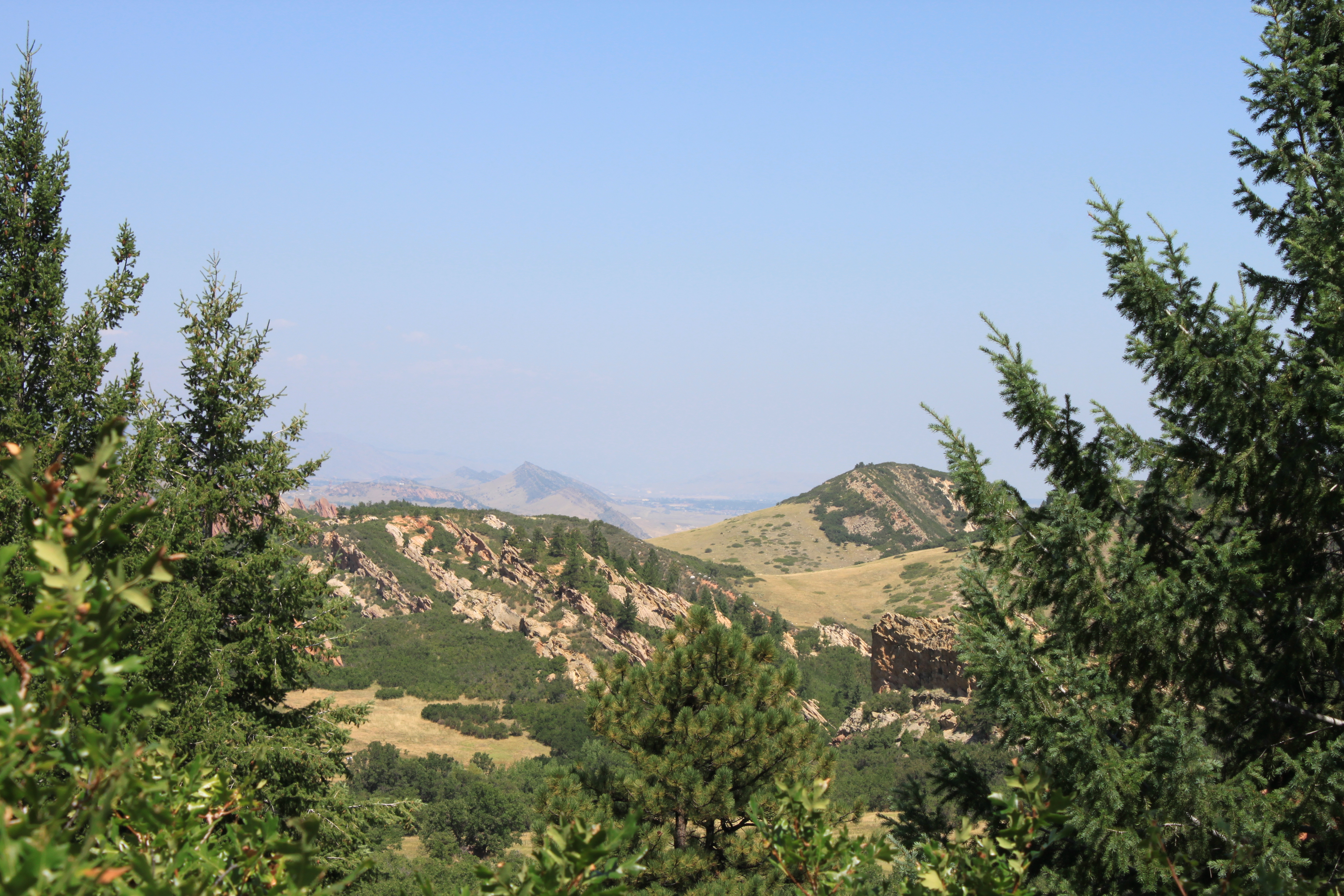
it is a pretty minor climb and the trail is a nice width with beautiful tree coverage on the sides, but not so much overhead, which does allow for beautiful views of this side of the park


And this is me and Aaron


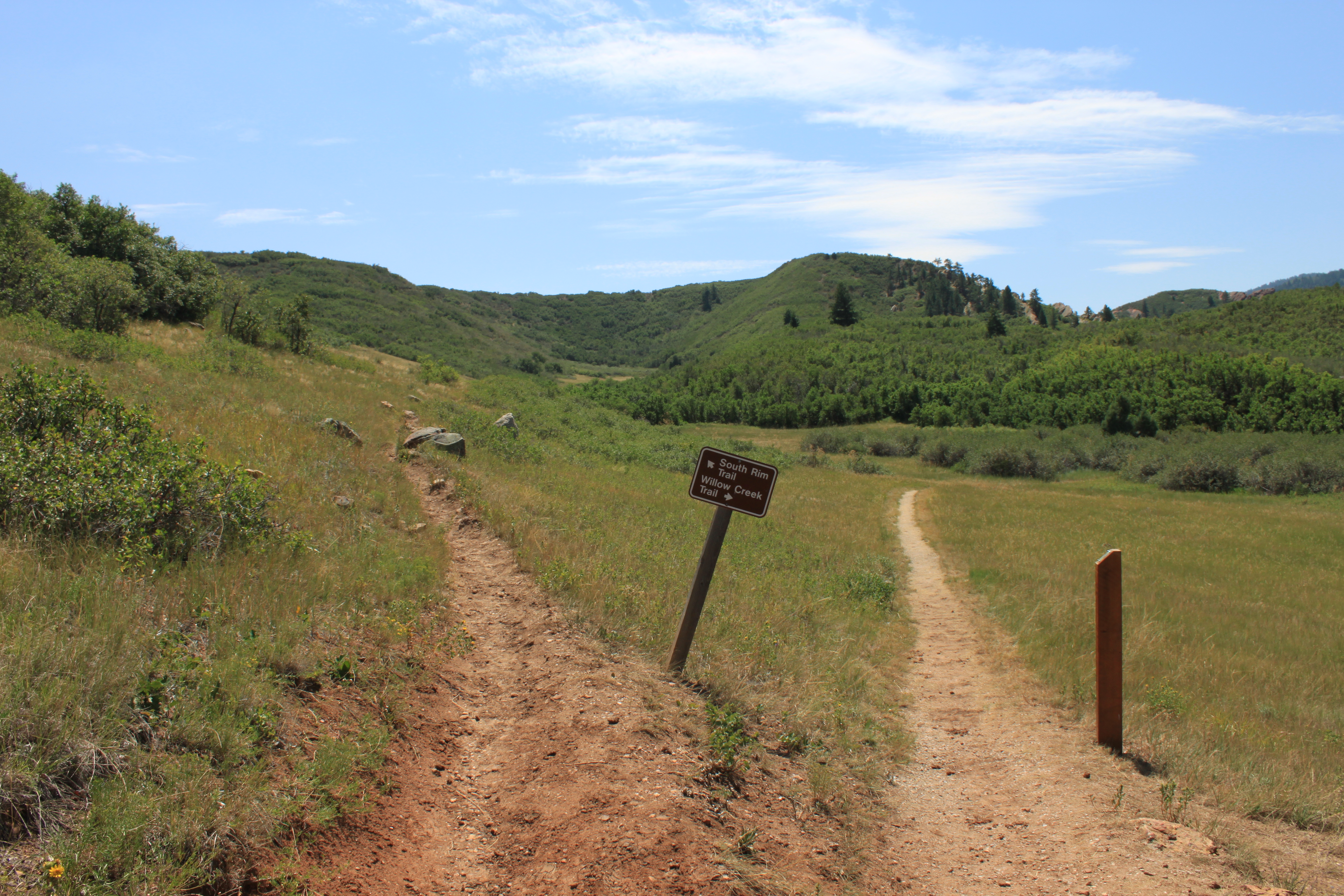
It is not too far in before the first trail turn off comes up, follow the sign to the South Rim Trail

The park is really well marked, a lot of people do this shorter hike of willow creek, but a lot drop off by the time you turn onto South Rim and even Fewer go up Carpenters peak which is a very beautiful hike that has decent elevation gain but that is for another post.
So on we go to the South Rim trail

From here on out it is just the South RIm trail and it goes up and along the Dakota hogback, giving you gorgeous views of the whole state park.
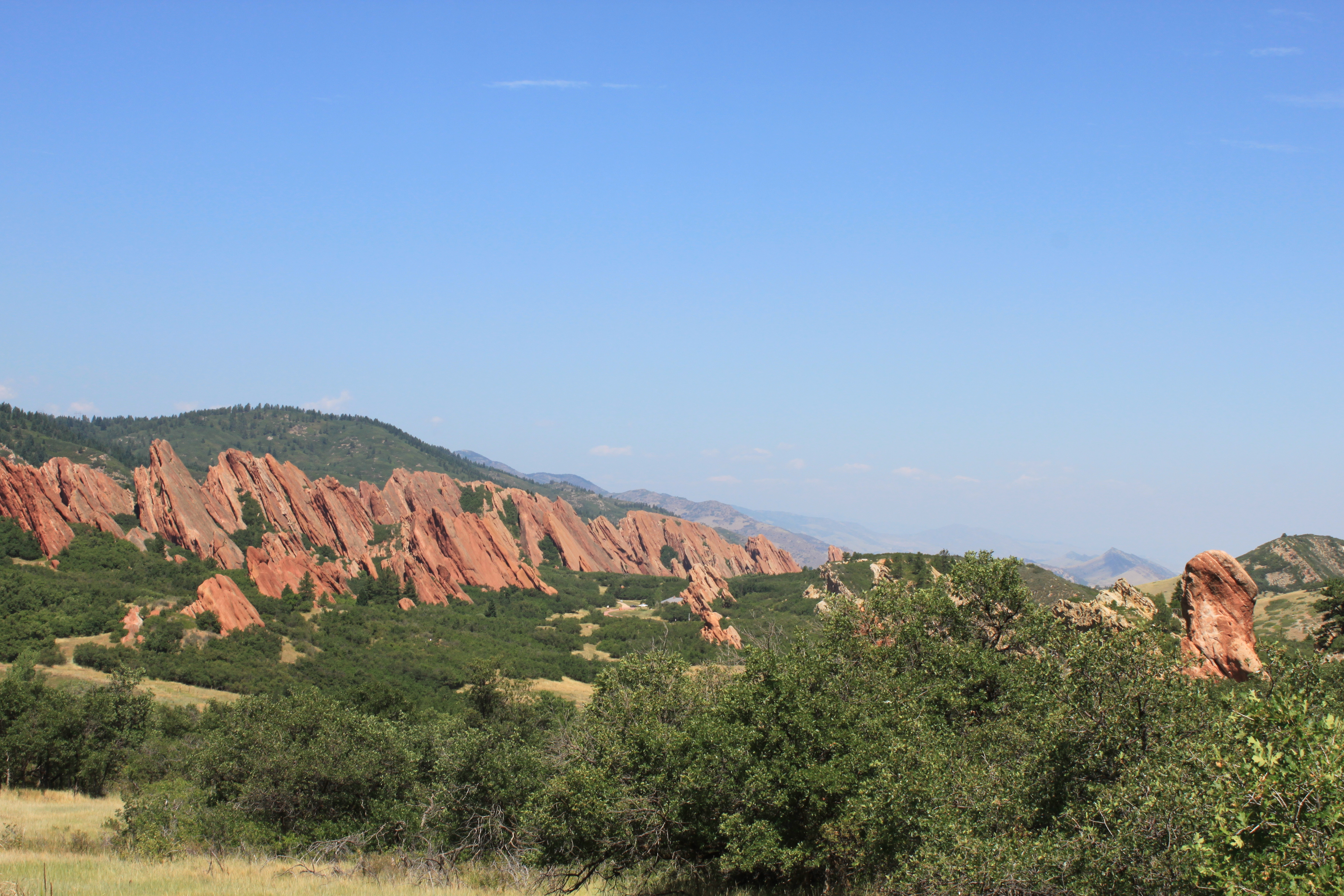
When you reach the top of the hogback there is a scenic walk out to other side, we have done this trail 3 or 4 times now and we always take the loop thinking it is the trail. So scenic overlook on the right….trail continuation on the left.

Coming down is just as beautiful as going up, as you get closer to the bottom, the willow creek trail shows back up again
This is looking back at the merging or the 2 trails, just in case you decide you want to start on this side, which is easy to do. As this does come around to one of the parking lots, the furthest east of the 3 and the first one you pass coming into the park.

So we parked in the middle lot, since we got in later than we planned. The trail works it way along all 3 parking lots to the main, paved path going to the visitors center.
This is how you get to Roxborough from 470:
| From Wadsworth |
| Take Wadsworth south past Chatfield State Park. Turn left on Waterton Road (just before the entrance to Lockheed Martin.) Continue on Waterton Road—crossing the South Platte River, until it ends at North Rampart Range Road (1.6 miles) Turn right (south) on North Rampart Range Road. Continue south past Roxborough Village and the Foothills Water Treatment Plant. (2.3 miles) At the intersection of North Rampart Range Road and Roxborough Park Road (just before the entrance to Arrowhead golf course), turn left onto Roxborough Park Road. Take the next right on East Roxborough Drive(about 50 yards away) to enter the park. |
| From Santa Fe |
| Head south on Santa Fe (Highway 85) to Titan Road. (4.2 miles south of C-470 intersection) Turn right (west) on Titan Road. Continue heading west on Titan Road. It will curve and begin to head south—becoming North Rampart Range Road (3 miles). Continue south on North Rampart Range Road past Roxborough Village and the Foothills Water Treatment Plant (3.5 miles). At the intersection of North Rampart Range Road and Roxborough Park Road, turn left onto Roxborough Park Road. Take the next right on East Roxborough Drive(about 50 yards away) to enter the park. |
