

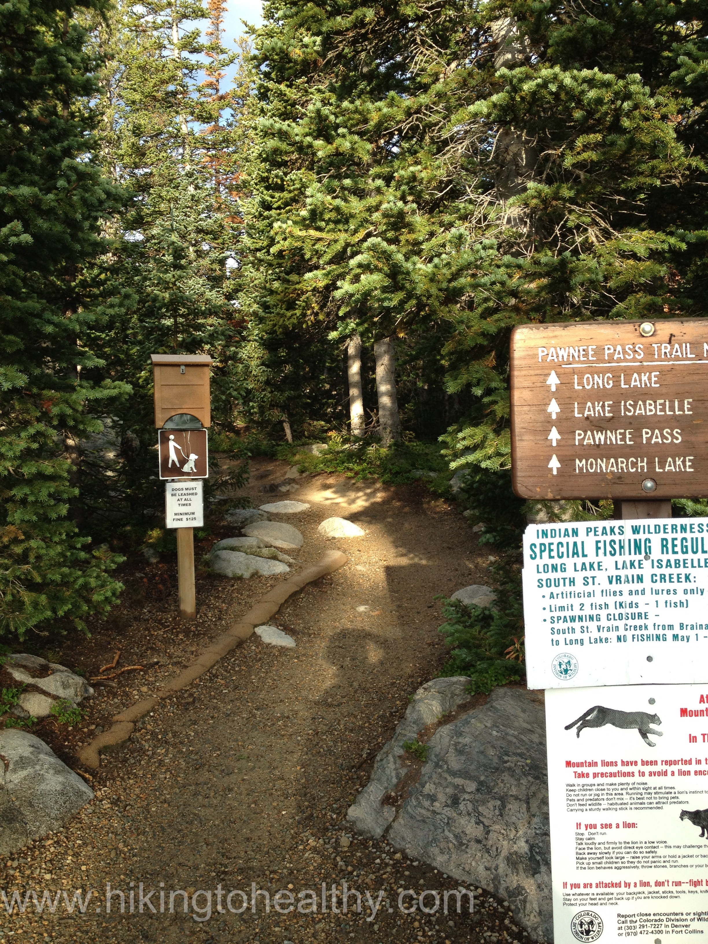
Pawnee Pass Trail
Starting Elevation: 10,500 Feet
Highest Elevation: 12,550 Feet ( total elevation gain approx. 2200 feet)
Trail Length: 9.2 miles, my pedometer said we got around 10.5 miles but we did venture around quite a bit, It took us about 5.5 hours total
Trail Uses: Hiker only
Degree of DIfficulty: Moderate difficult given distance & altitude
Bathrooms: At every parking lot in the Brainard Lake Recreation Area and beautifully taken care of…. Best Vault toilets we have used to date
Pets: Yes, dogs on leash only, there is a well posted $125 fine if your dog is not on a leash and lots of rangers around to enforce it. The first trail ever where all the dogs were actually leashed.
Fees: Yes – $10 for 3 days in a car, $1 for a person walking or biking in and $55 for Season pass ( May- Nov).

I have had this hike on my wish list for some time, its elevation is ideal for getting back up to 14K but with our snowy spring it was taken off my getting ready list in April. Since I have found myself in this readjusting phase in hopes of getting in one more 14er before the season is done, I figured it was the perfect weekend to check it out. I can tell you it did not disappoint.
We got to The Brainard Lake Recreation area right at 7AM and honestly it was almost too late to secure a parking spot, we got one of the last 2 in the parking lot at the trailhead. This park is unique in that you can only park in designated parking and so lots of people were hiking to the trailhead from other parking lots in the recreation area. Make sure when you go, you go early, as we were driving out at 1PM almost every parking lot was full except the last one by the entrance. There is so much more to the park then these set of trails and it made me want to plan a May- November where I get the annual pass and just explore every hike in the park.
Plus I saw my first moose! It was huge, I mean like gianormous, and like every other idiot that sees something for the first time I stopped right next to it so we could get a picture and then later realized how lucky I was that the moose was not too put off about it.

Getting on the path was easy, it was really well-marked throughout and we started moving through pretty quickly. I had read that it is worth it to take the .2 mile detour and see the views from Long Lake right at the beginning, great advice! It was stunning even with our overcast skies. If you find yourself on this hike, go over and see the view from Long Lake.


From here we got back on Pawnee Pass trail and enjoyed the lovely surroundings, which was thick with Pine, fir and Englemann Spruce it was so beautiful and serene. Some the of trees were so huge around, well the ones that were downed seemed like the largest ones I have seen outside the Redwood forest. I am also falling in love with old tree stumps, this part of the trail was like a gallery of tree stumps in their beautiful stages of decay or deterioration.


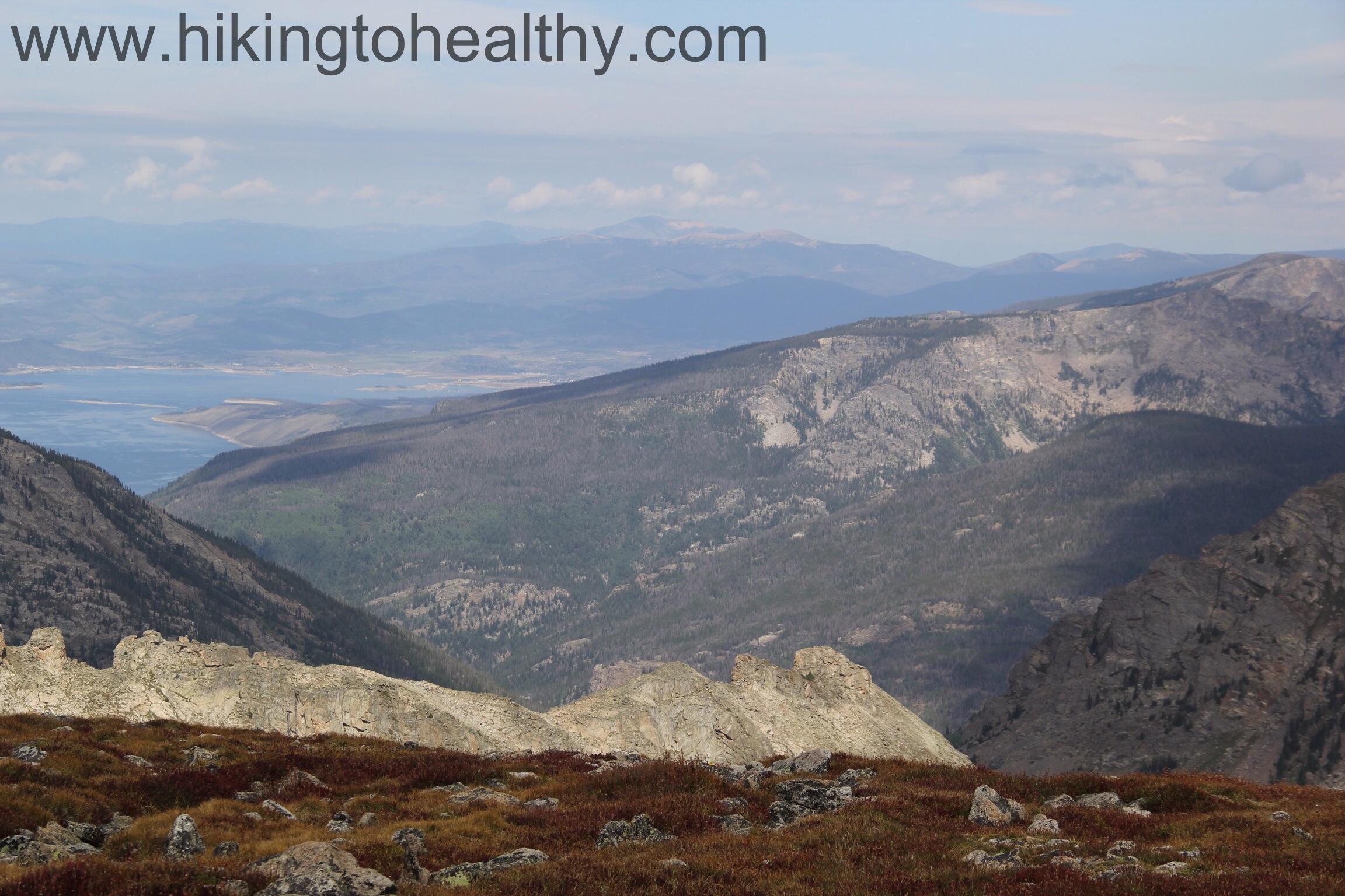
At 2 miles in we came up to Lake Isabelle and the Isabelle Glacier Trail. The views from the trailhead of the Indian Peaks surrounding Lake Isabelle were, no surprise here, amazing! but the lake itself was disappointing. I didn’t find out the details, it did look like they were certainly doing some work on the lake and I don’t know if that meant they had to drain it or what so it was a little sad-looking when all the other lakes we passed looked pretty good.


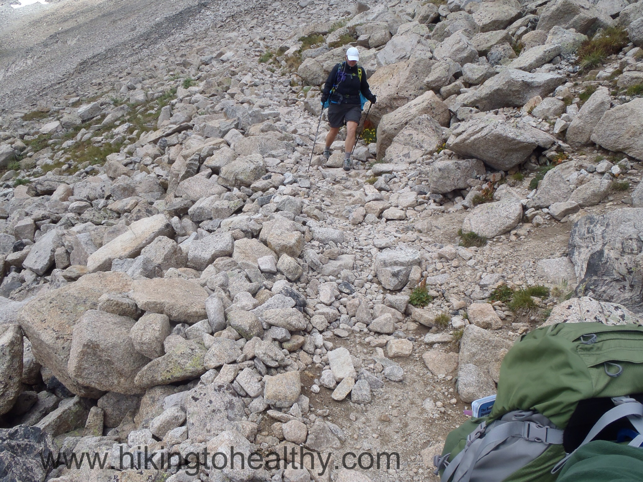
We took the trail break up to the Pawnee Pass and the next 1.1 miles is probably the hardest of the whole hike as we climbed up a series of switchbacks to a natural Bench above Lake Isabelle. It was perfect… and windy. As we got to the last little climb the trail does get close to the rocky cliffs above Lake Isabelle so note to those who are uncomfortable heights, this is a tight spot.


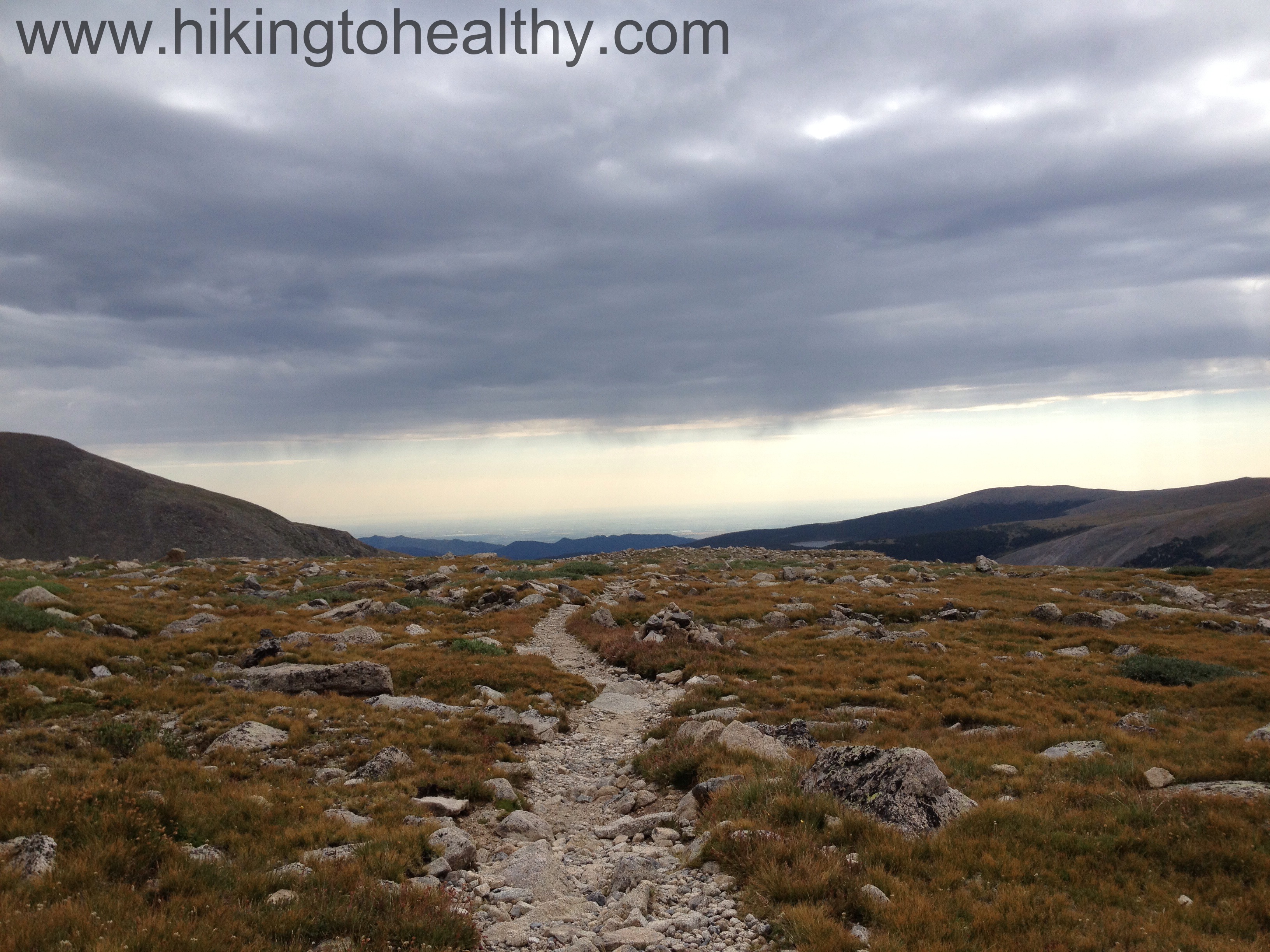
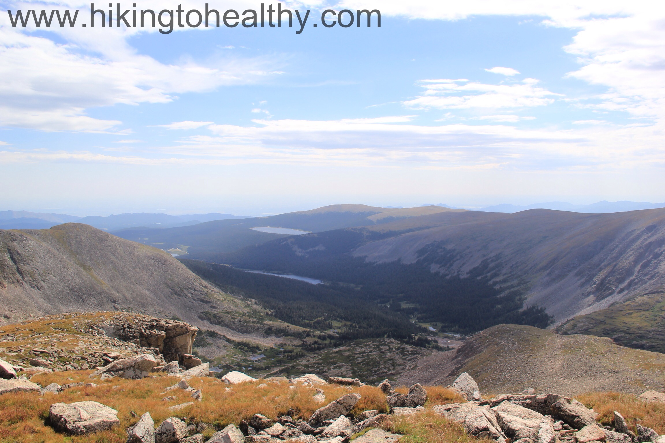
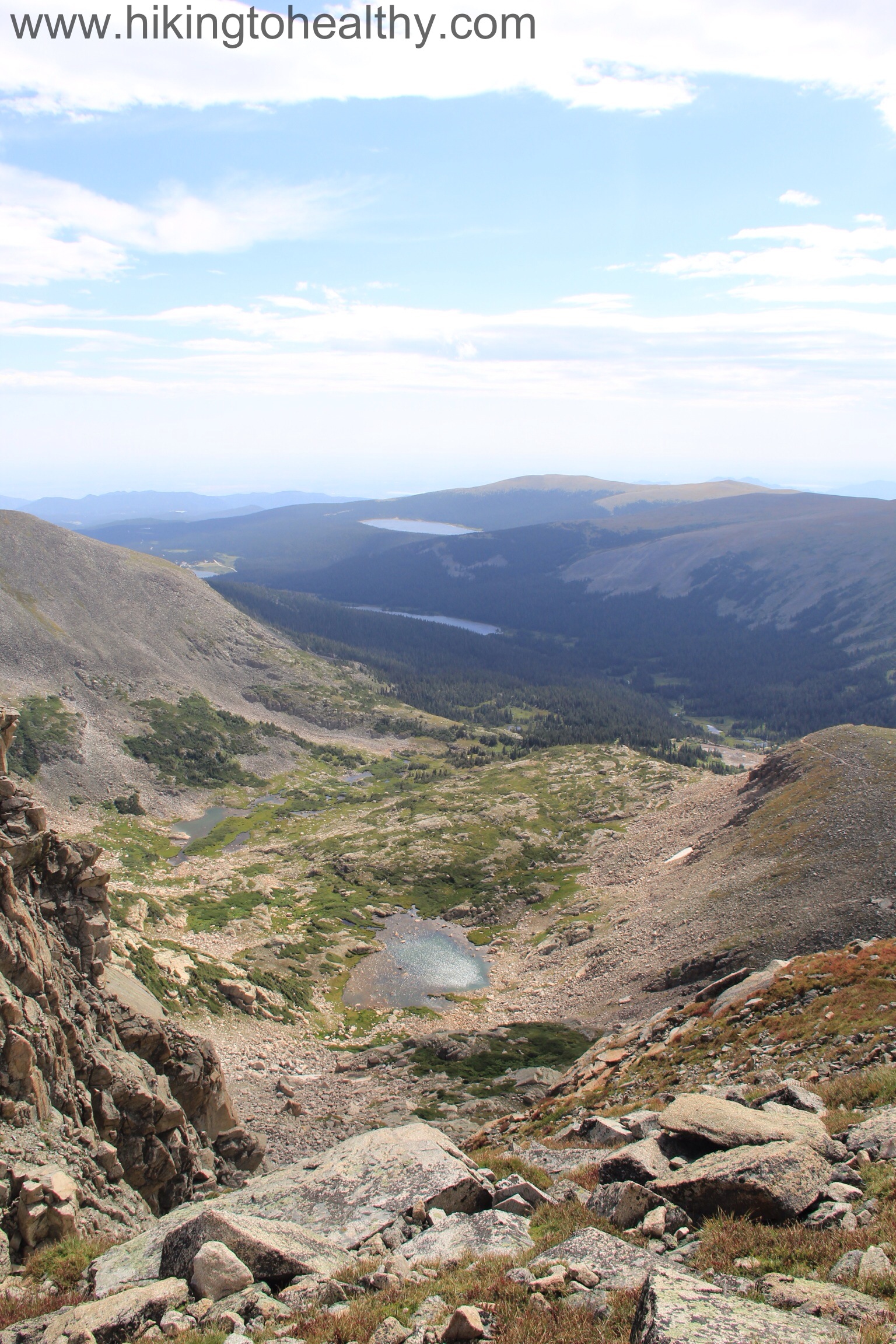
Next, is a little respite as we walked across the bench to the final climb up to the pass. It looked really tough but as we started the next series of switchbacks up, it was surprisingly easy and the actual grade was not that bad, the trail was beautifully planned out. Before we knew it we had made it to the pass….. and then our teeth started chattering. Even though it was in the 90’s in Denver, it felt like a very brisk and windy 40 at 12,550ft, we were freezing and were so glad we over prepare for every single hike with winter gear in our packs. I guess the mountains are moving to Fall even though we are still nice an toasty at 5600ft.


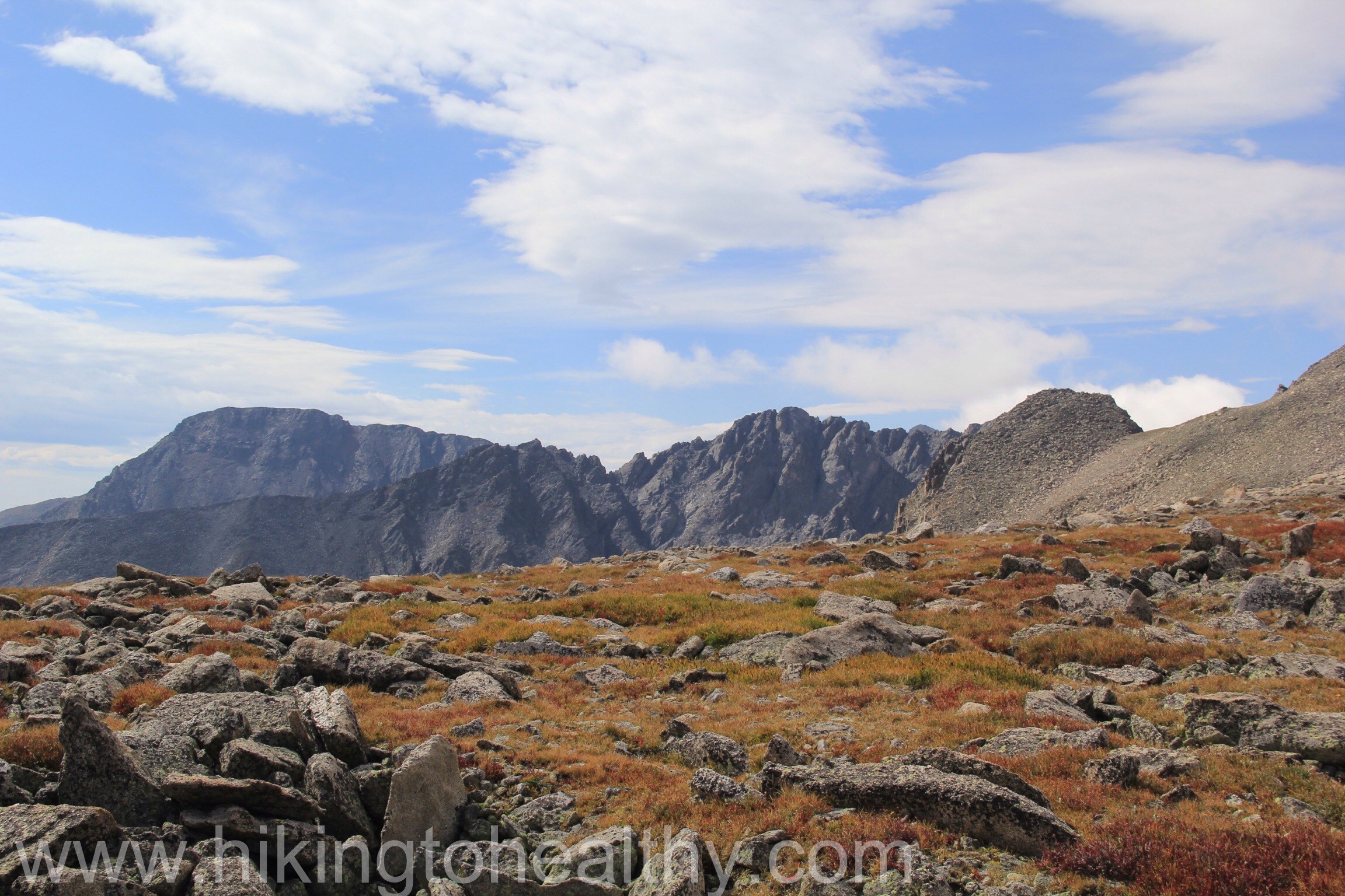
At the pass you can easily take the trail and summit Pawnee Peak ( 12,943Ft) but we didn’t. We were worried about the clouds coming up and the wind was REALLY strong, but walking North-Northwest from the pass sign gave us amazing views of everything on the side of the pass. It was hard to head back down after just 30 minutes but we did, I know that we will do this hike again and next time summit Pawnee peak.


I am starting to look at trails differently because there is so much more we walk away from each time we head back. I can tell that the next logical step for me is backpacking to get days of views and see the total picture. Each hike ends too quickly and even though I know I can’t go further, I want too.
It was cool to see where we were going at Long Lake and then to be totally surprised when we got there at how different the top looked. I mean I know we do it all the time but this hike was different because it was so laid out in a series of steps that led to a beautiful surprise finish. I hope one day you check this hike out, like so many hikes in Colorado, it is pretty amazing! After the directions to the hike are my favorite pictures.
Directions: Take 36 through Boulder and from Broadway( north-end of Boulder) continue 4.8 miles to Left Hand Canyon Rd( 94) turn Left. At 5.2 miles you will need to turn left to stay on Left Hand Canyon Rd. Stay on this for 11.6 miles through the town of Ward to the Peak to Peak Highway ( Colorado 72). Turn right onto 72 and then Immediately left into the Brainard Lake Recreation Area.


This looks awesome! Funny thing ….we considered going there on Sunday but slept in instead and just went to the Rainbow lakes near nederland. We’ve both been sick the last few weeks and out of the swing of things! We have a trip planned to Durango this weekend and will hopefully get back into it.
Ha! We must be reading the same hiking books! One of these days we are going to accidentally meet up! I hope you are feeling better and that Durango gets you back to hiking!
Great pictures! I hiked up Pawnee Pass years ago – it’s been on my list to do again. Cool that you saw the moose too!
Thanks! It was a great hike and the moose was awesome!
How awesome that you saw a moose!! I have spent some time in Maine but have never seen a wild moose. All your hikes are so breathtakingly gorgeous.
I was pretty excited all weekend about it! I never knew how big they were!!! Colorado is just so beautiful, I am lucky this is my backyard now!!! Thank you!
Beautiful! I love all our hikes here in Colorado! We’re so lucky.
I love all the hikes here too! Moving here is the best thing I ever did! Thanks for checking out my blog!
I love your pictures; great photography! Hiking over Pawnee Pass to Pawnee Lake is one of my favorite out-and-back one night backpacking trips (you should try it sometime)!
Oh we would love to do that one day! I thought this was just a beautiful area and can’t wait to get back!!! Thanks for checking out my blog!
Once again some stunning scenery! I think you guys will enjoy backpacking once you start it. Since I started I haven’t done any day walks – backpacking is that addictive! 🙂
Congratulations on seeing your first moose. I know it is a big deal, as they are kind of tough to find. I saw my first moose at Park City Ski Resort in February 2009, and the ski patrol would not let me stop and take a picture. I did not see one again until last month- 4.5 years later, so there is really no reason to feel dumb for stopping to get a picture.