

Starting Elevation: 12,000 Ft
Highest Elevation: 13,234 FT at the Summit – total elevation gain was around 1600 ft.
Trail Length: Approximately 4 miles
Trail Uses: Hiking only (I think I couldn’t find any guidelines)
Degree Of Difficulty: Difficult mostly because of altitude
Bathroom: None
Pets: I didn’t see any and I didn’t see any signs saying one way or another.
Fees: None

The best part of Colorado is all the hiking opportunities. Even with all the traffic along I70, you can still find a gem that you might get all to yourself, Mt. Sniktau is occasionally one of those. On this particular day I went with my hiking superhero Wendy, who was my hiking host for the day. She is amazing! We left before sunrise and got on the trail just as the sun was coming up which made for a beautiful hike,

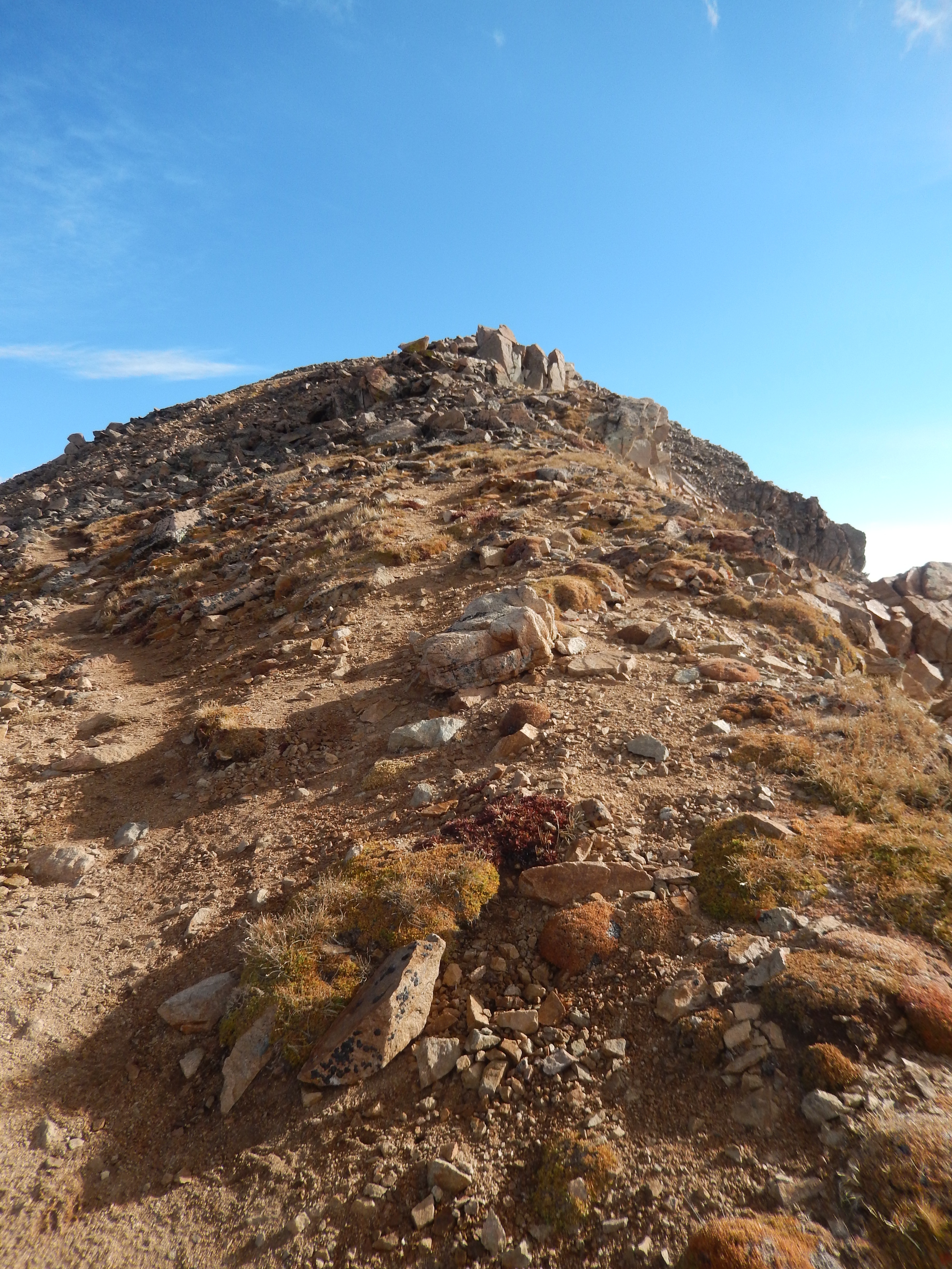
The hike is steep at first as you climb up to Cupid. At Cupid you can either go right to Grizzly Peak or left to Sniktau.

You climb about 900 ft in the first mile. It is a slow mile….


I understand if you are so inclined you can even get to Torrey’s from this route but that is a killer way to climb that particular 14er. The total elevation gain is something insane. We went left. It is a nice gentle climb to the first false summit of Sniktau.

From here you hit the false summit and then the summit climb, both of which are a little tricky but not terribly so, just follow them to the left.
We saw 2 other hikers the whole morning on the trail, now the parking lot was full when we got down but it didn’t seem like they were hikers. Really the view is pretty awesome just from the parking lot and a lot of people do just that.
This mountain is right on I 70 and you can see everything from it, the Eisenhower Tunnel, Grays & Torreys (twin 14ers that are very popular) and the continental divide is stretched out all around you.
A couple of things to know about Sniktau – It is insanely windy all the time no matter what weather is doing elsewhere. Like all mountains, you want to start early to miss the daily noonish storm and this whole hike is above treeline. The parking lot can get really busy and turn you off BUT most people didn’t climb very far up the path the day we were there. I would say get there as early as you can. We did this last September but it is a year round hike/snowshoe apparently, but I would be nervous in winter. I cannot wait to get back here, hopefully in the next few weeks!
After the directions will be some of my favorite pictures, I would note I didn’t do my usual descriptive set of pictures mostly because I wasn’t sure I would make my way back to blogging. Hopefully there is still enough for you to get an idea if this is one you want to try.
Directions: From I-70 take the Loveland Pass exit, passing the Loveland Ski Area on Highway 6 and go to the top of Loveland Pass. You can also take Highway 6 from Dillon through Keystone resort to the top of Loveland Pass.


Spectacular views! The elevation would have tested me (especially if it was very windy.) Those false peaks are a tease too. These are gorgeous pics.
Did this hike last summer and really enjoyed it. I’ll probably hit Cupid and Grizzly when I’m up that way again this summer. Nice job!
I definitely going to head Grizzly from here as well. The weather we are having right now means I will be putting off hitting sniktau again this weekend. I really loved this hike!
The views are just stunning 🙂
Oh Man Rob, the views were way more amazing in person, a completely beautiful hike!