

The Braille Trail > Beaver Brook Trail > Windy Saddle and Look out Mountain
Starting Elevation: 7400 ft
Highest Elevation: 7800 Ft ( we did approximately 2000 ft total elevation gain)
Trail Length: 8.8 miles one way 17.6 round trip. on this trip we did 9 miles round trip.
Trail uses: Hiker only
Degree of Difficulty: Difficult due to length and Elevation gains and losses
Bathrooms: There was supposed to be one somewhere after the Braille Trail but we couldn’t find it so maybe
Pets: Dogs on Leash only
Fees: None
I know I know ….. I am a terrible blogger I have been away forever. Things have been super crazy in my life but the one thing I haven’t stopped doing is hiking every weekend. I haven’t done a ton of new hikes but I want to make sure I get them out here, because the new hikes I did hit were all amazing and I want to keep track of them.
I will try and get back on track with the healthy part. I haven’t lost new weight, but I haven’t gained any either so I still need to lose about 50 pounds.
Let’s focus on this particular new hike – I found this hike in a book, but dismissed it because round trip it is LONG and then a friend told me about it. Well the first couple miles of it any way and her description way out did the book. It was easy to get to and had potential great pay out so away we went.
The road to the trailhead does turn to dirt but is drivable with a low clearance vehicle (aka a civic like low clearance type of vehicle).
There are 2 parking lots, one on the left a little higher and one on the right > right on the trailhead. Both are small and this trail gets good use = cars eventually park all the way up the road on the side.


The first quarter mile of this trail is a braille trail for the blind. There is a guide rope and knowledge boards in both written and braille. I mean how incredibly cool is that!?!?!

It was not long until we came to the sign for the trail and then trail is marked with a B B trail marker periodically. 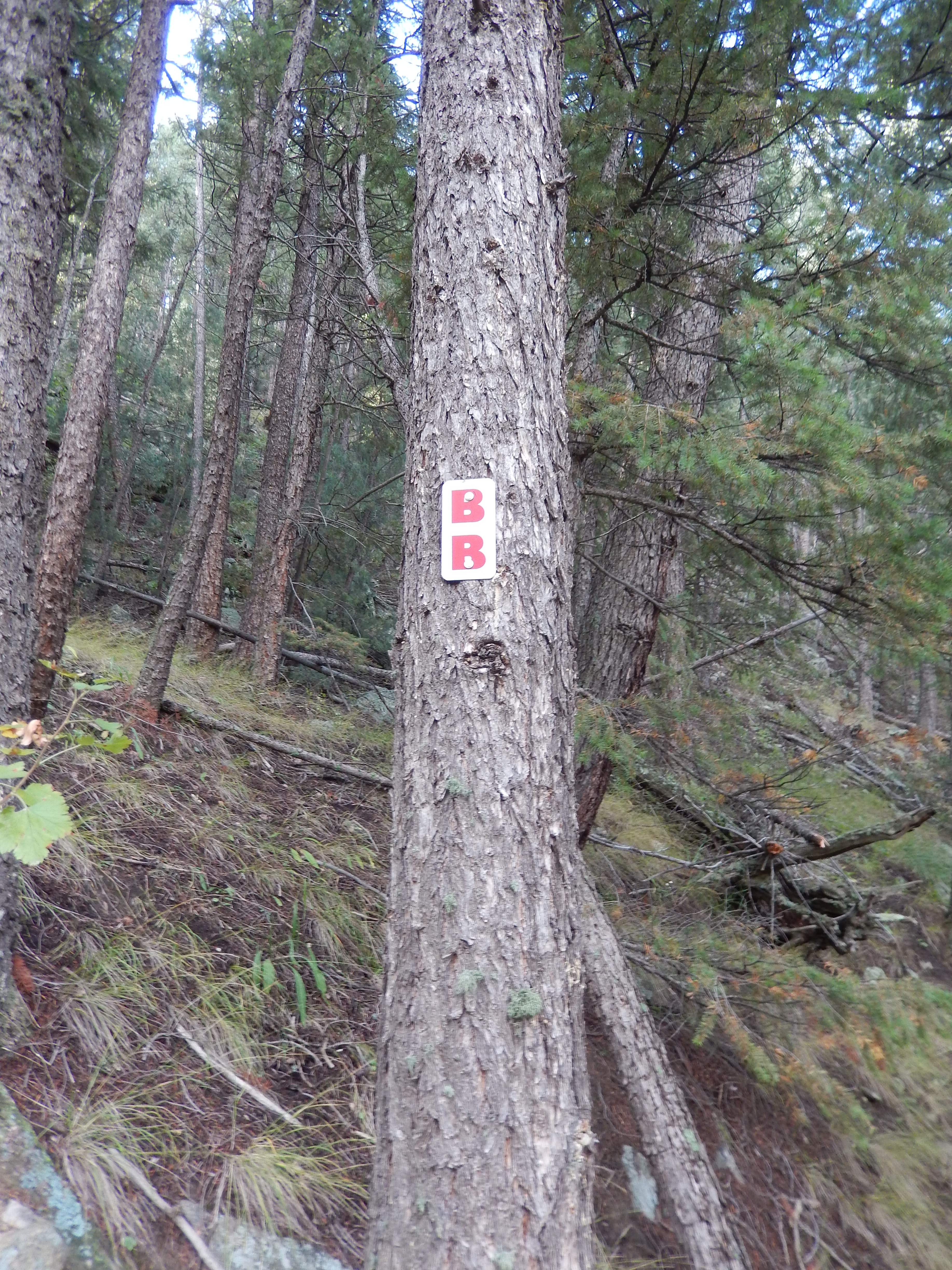

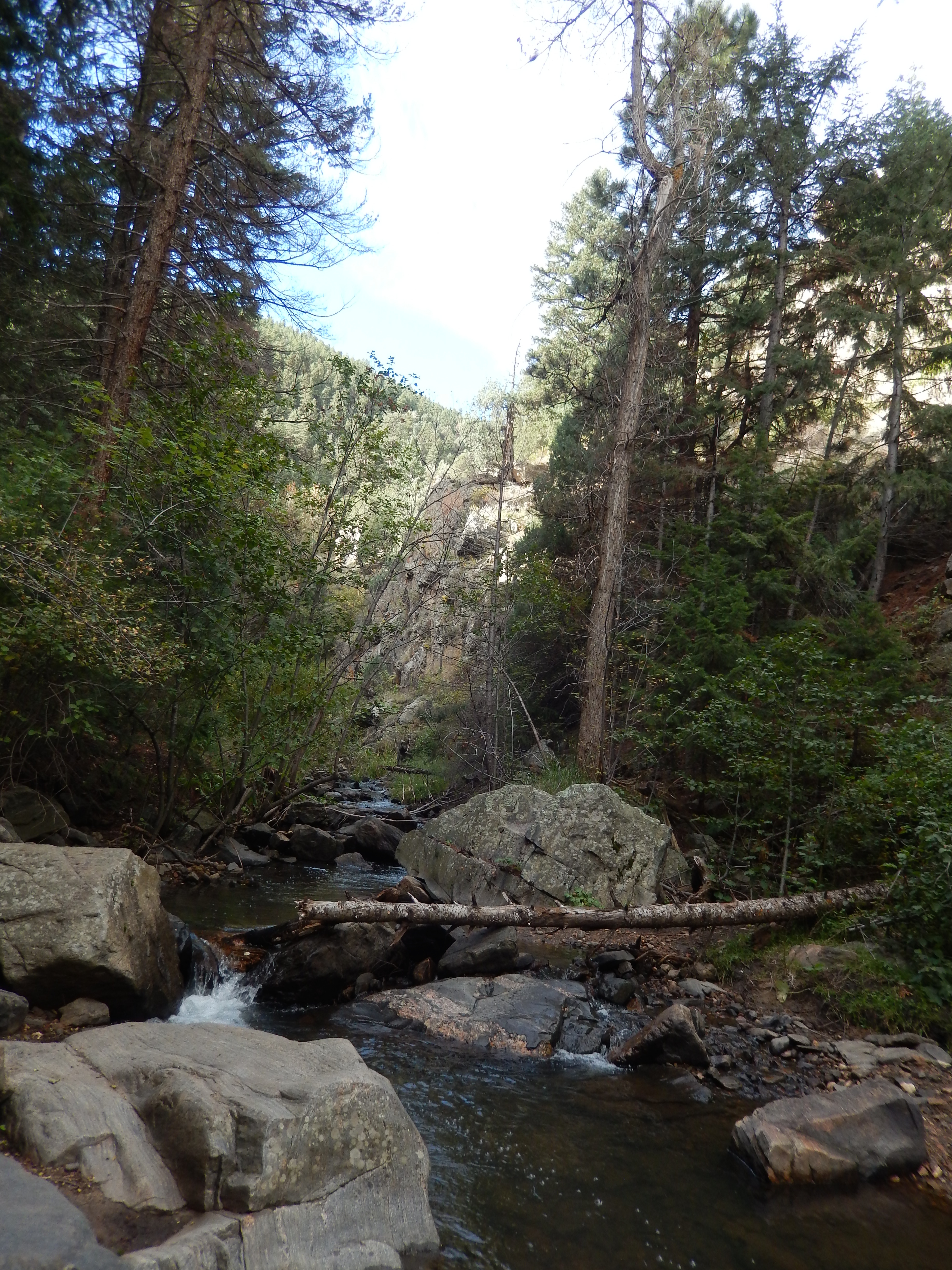
The trail descends about 840 feet to the Beaver Brook over the course of a mile and a half and it really is quite lovely the whole way down.


We got to the brook pretty quickly and just enjoyed the view

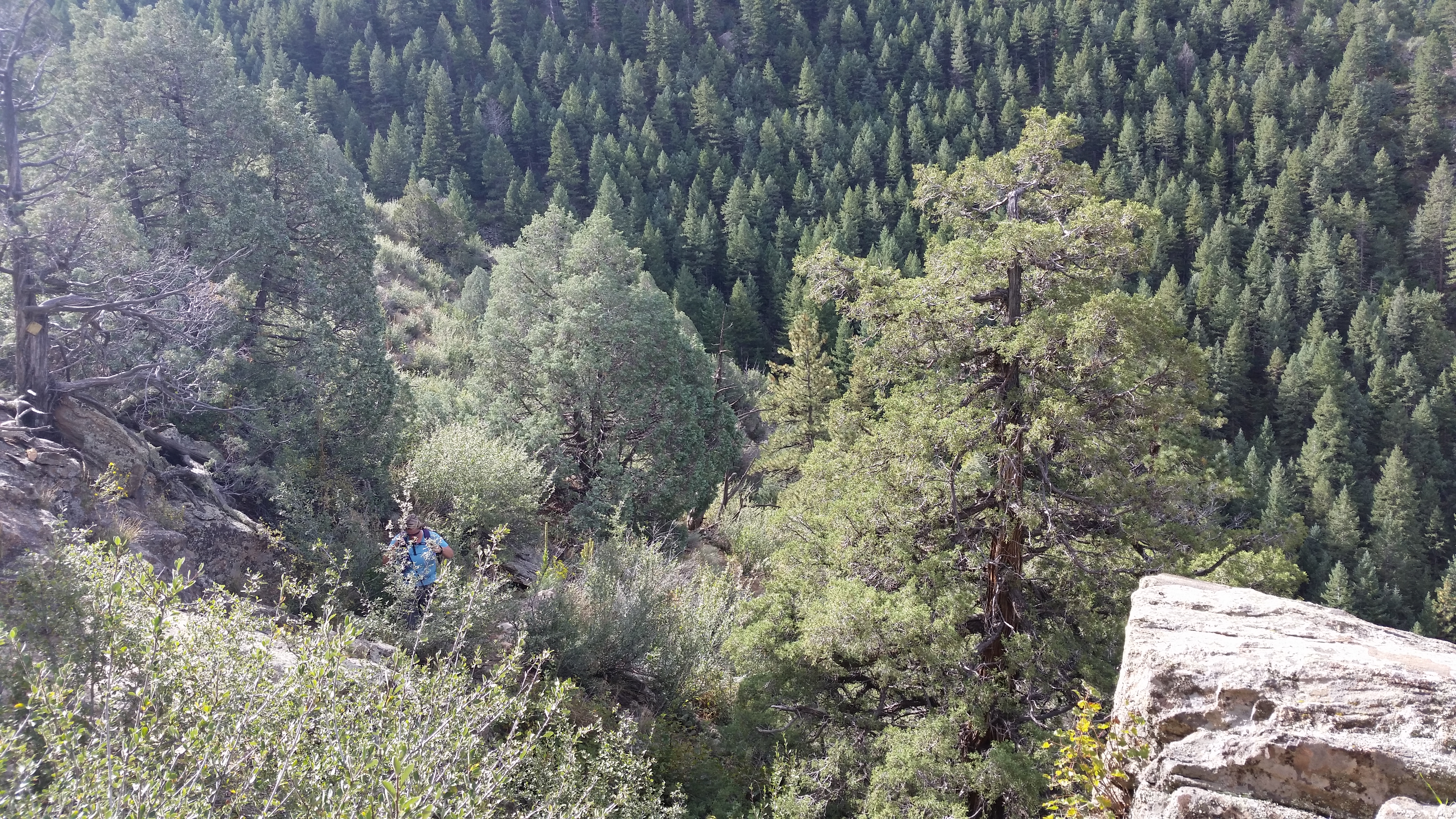
From here it got kinda tricky finding and keeping the trail. It winds through and over a drainage stream with a lot of scrambling and trying to get over big rocks. Look for the trails markers, either the BB or a yellow diamond to keep track of the trail. I had planned on taking pictures on the way back but life happens.
Then it is a steep climb up about 1200 feet and over some big boulders in places for about 1.7 miles. It was pretty steep through this sections with some nice sized boulders to get past while climbing up over the gulch the brook is in.

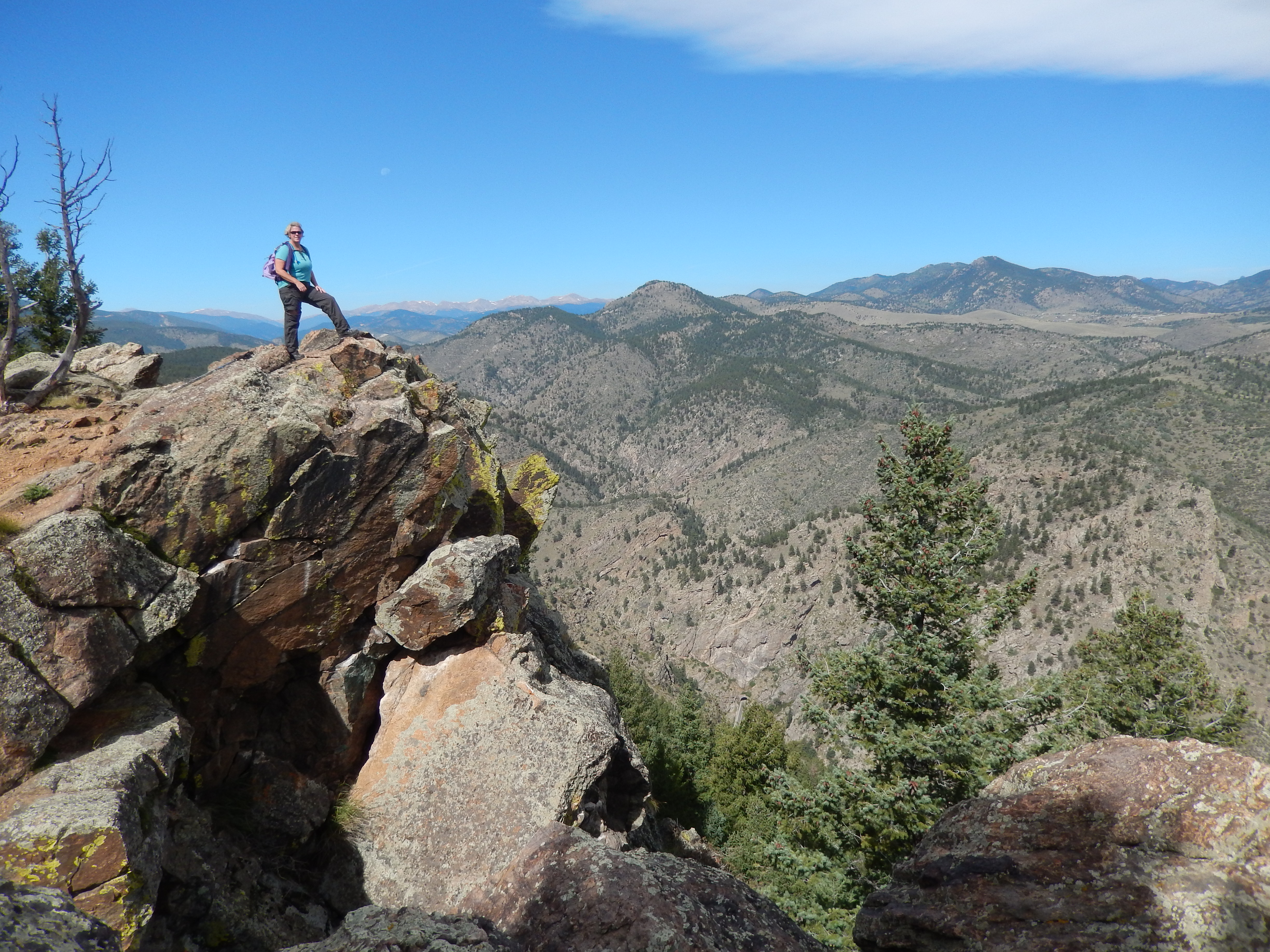
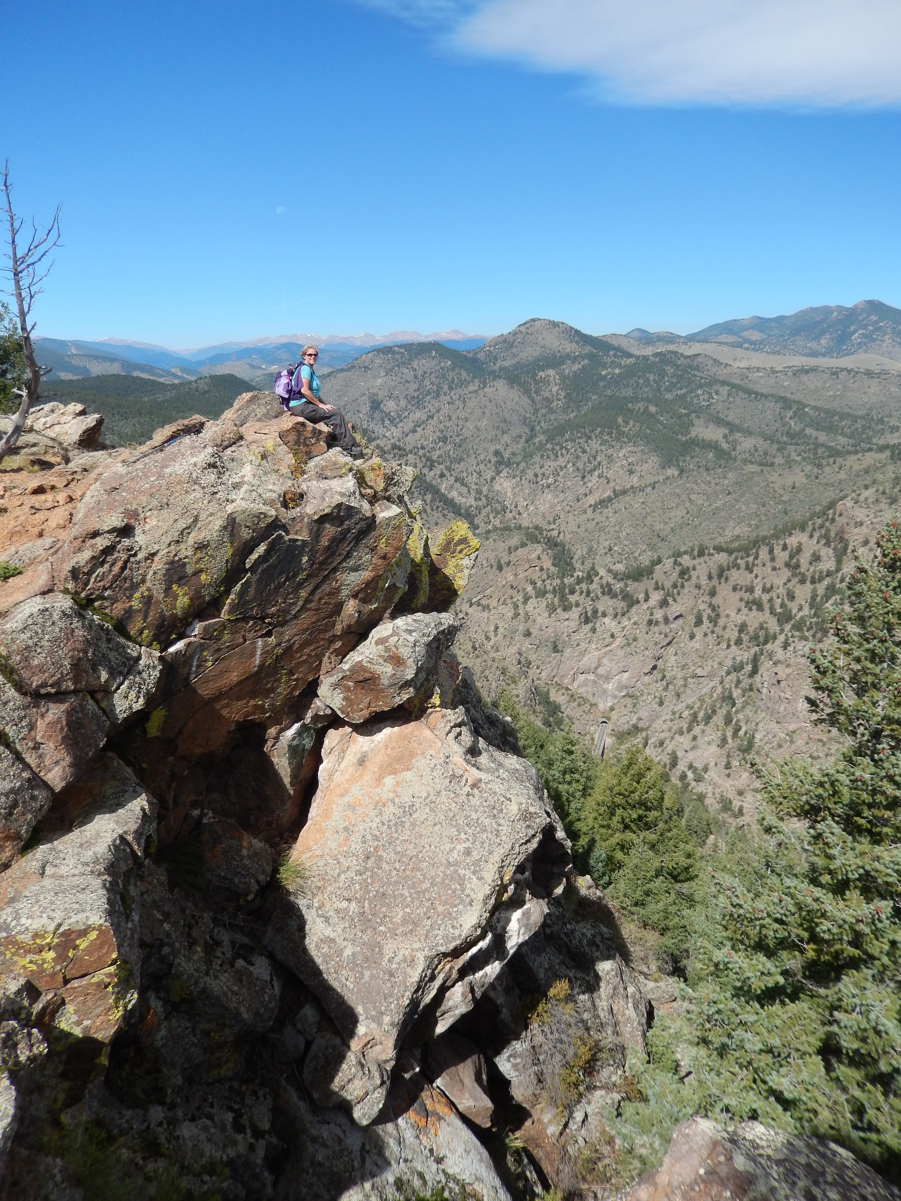
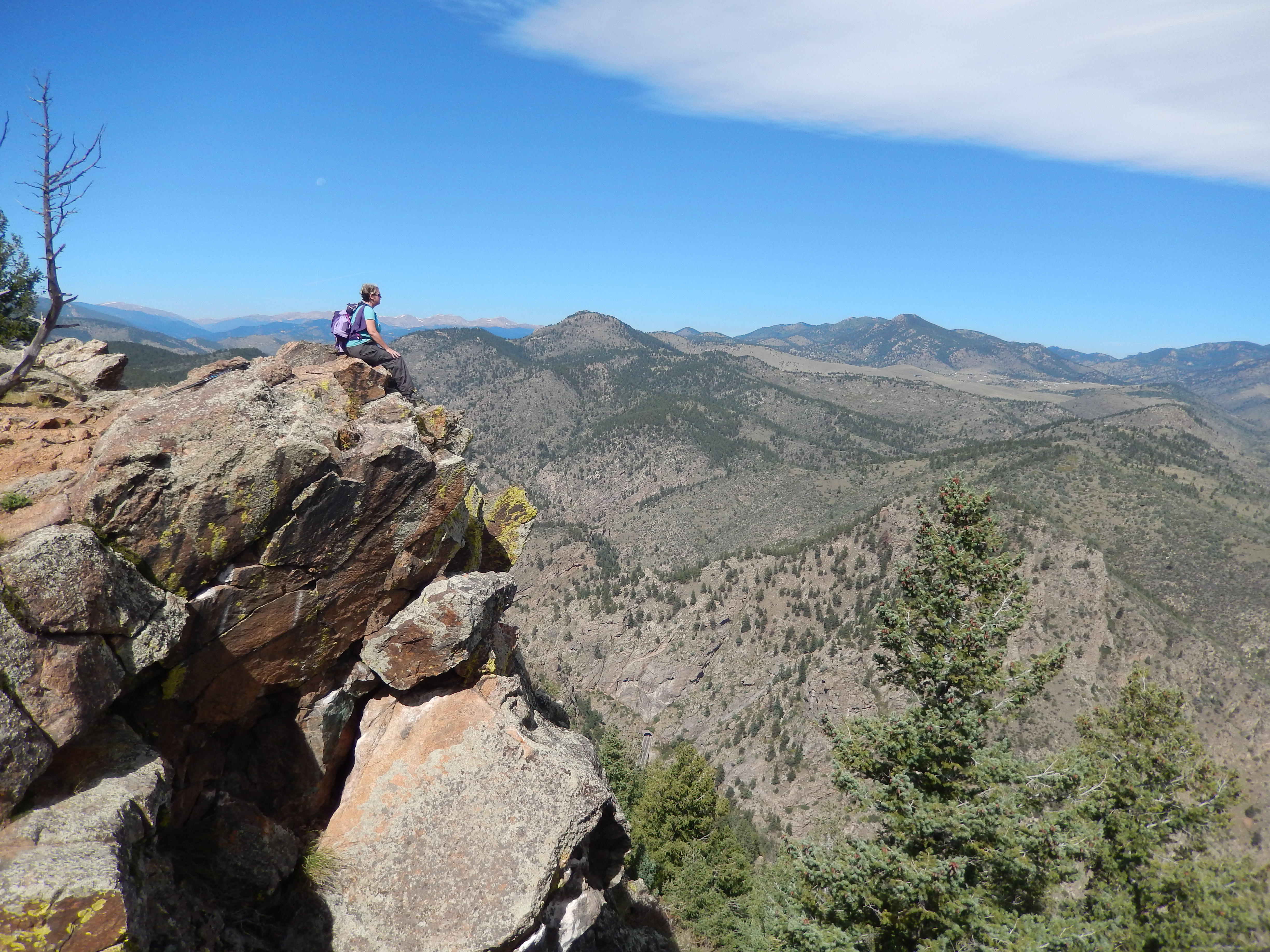
We got to the highest part and it was so pretty looking around and down at the Clear Creek below!

Our goal this day was to get to the Gudy Gaskill Loop and then head back to the car looking for 9-10 miles total. But where we expected the trail break to be it never showed up. We hunted around for 30 minutes and finally gave up, heading back.
I remember thinking on the way up as we crossed a certain set of boulders how tricky it may be on the way back and man I was right! On the way down, my leg slid and got trapped between those boulders while I fell hard on my butt right on a cactus, I popped up but my leg was still stuck so I had to fall back on the cactus, get my leg out and then I called to Aaron for help.
The cactus was young and the prickles were abundant > fortunate or not, they weren’t very long or hard. Aaron was trying to get out as many as could so I could walk again but then he pushed a bunch through both my pants and then underwear…. you can probably guess where this is going. Eventually this random cat call hit us. It was then that I realized that I was standing on cliff of the canyon with my butt facing out while Aaron diligently tried to get out enough prickles so I could walk out the last 2.5 miles.
So that happened….. Did I mention that the hike to Beaver Brook and back, insanely popular?
Anyway, no surprise here, all those pictures I planned on taking on the way back to show the trail never happened. Oh and all the prickles were not out. So in case you are wondering walking up a mountain with cactus prickles in your bottom… not fun. Seeing like a million people hanging out at the Beaver Brook on the way down wondering how many saw your butt…. well eye averting.
Needless to say it was an interesting hike with few pictures but huge memories…. interesting memories.
Overall the hike was pretty amazing for a million reasons except the one that may make me avoid it for a while. It is an incredible workout with great views.
There are no favorite picture to share after the directions but I do hope you check it out and have better luck then I did!
Directions: Take I 70 west from Denver to the Chief Hosa exit and turn right immediately and follow the road down to the trailhead.

Happy to see your post! Hadn’t seen any for a long time and was hoping everything was OK. Glad to hear you have been getting out and hiking on most weekends.
Thank you! Things are ok I just was busy with work that just getting in the hiking has been my priority. I haven’t been able to research too much new stuff or write. I am hoping that I can back at it now that I have had some changes at work. I have so much reading to catch up on!
Ouch. I can’t imagine having to hike with cactus in my rear. Glad you’re posting again…good to hear from you.
It was an interesting 2.5 miles and drive home to where we could get some tweezers! Thanks for the welcome back!
Having had cacti experiences myself I was cringing as I read about your predicament! However, I did have to smile when you realised you had an audience! Loved the pics at the top of the rocks/cliff. Great walk and write up. 🙂
Thank you Jane!
Kathy,
So glad you are back and in fine style! I’ve been enjoying reading about your successes and with sincere empathy at your setbacks. We’ve all been there. Ouch, are all the cacti spines gone??? Hoping so!
I’m originally from Chicago (Rogers Park), but have been on the west coast for many years, the last 20 in Oregon. I too am a hiking fool and coming to visit my daughter (at DU) next week. I plan to hike daily and will be staying near Winter Park for part of the time. Have you a favorite couple of hikes to recommend this time of year? 8-10 miles and up to 3000 ft elev would be ok, less ok too. Want to join me for a hike or two?
Hi Pam
I lived in Rogers Park for 5 years myself! Unfortunately I am going out of town this weekend so I won’t be able to join you but thank you for the invite! I think it might be tricky up around Winter park as they got a a lot of snow over the past week. The kind of snow that snow shoes don’t help with so I am cautious to recommend much that won’t be miserable post holing all over the place.
You can find links to these hikes on my hikes page and check out the details. But look at Hell’s Hole, probably not the amount of elevation gain you want but definitely the mileage. If you want to be up high and see a gorgeous view I would recommend Mount Flora which is really close to Winter Park neither the mileage nor elevation gain but worth every step. It is just over 13000 ft and the trail west facing so typically a year round hike/snowshoe but I would be cautious next week with all new wet snow.
Closer to the front range I would say Mt. Falcon is excellent Start at the east end and climb up all the way to the tower it is near Red rocks.
Deer Creek Canyon is an excellent work out and you can easily string together good mileage.
I really like Hall ranch too but that may be out of your way in Lyons. Hopefully these give you some ideas. Good luck and have fun!
Small world! I grew up just off of Morse and Lake Mich. I’ll be in Colorado May 3-12. Let me know if any of those days work. I’ll also be in Denver part of the time.
Thanks for all the great hike ideas.
Greenleaf and sheridan/Lakeshore just off the lake myself – VERY small world! Ugh! You are here like the worst time ever for me to meet up! I am so sorry I would have loved it, but I am both out of town during that time and then booked solid ansi can’t get any time off work. But don’t hesitate to reach out if you need more suggestions.
Welcome back! I’m really glad we don’t have native cactus growing in this country 🙂
Thank you Rob! I see I have a lot to catch up with on where you have been going!
So glad you are blogging again. I have missed you! Life does interrupt, doesn’t it?
Thank you! It really does… silly life!