

Eldorado Canyon Trail and a little bit of Walker Ranch Loop
Starting Elevation: 6000 Ft
HIghest Elevation: Approximately 7400 Ft
Trip Length: 7.2 miles according to the map( 3.6 in and 3.6 out), my fitbit said 8.5, took us about 3.5 hours
Trail uses: Hiking & Horses
Fees: $8 per day or get an annual state park pass for unlimited access ( $70)
Degree of difficulty: Moderate/Difficult
Bathrooms: The Visitor center, at the trail head and the parking lots at the entrance by the rock climbers
ADA accessible: No
Pets: Yes, and on six-foot leash under control at all times
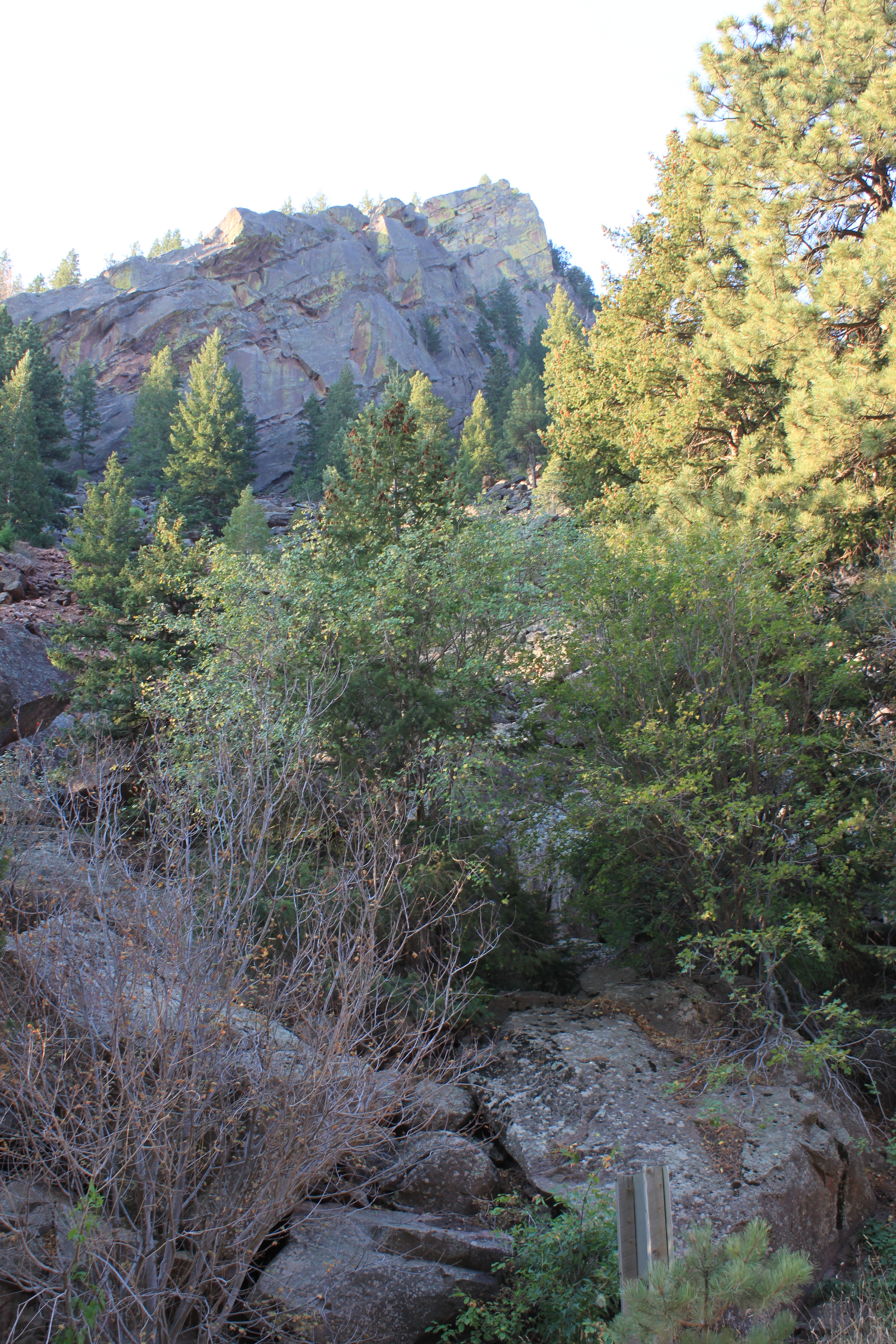
View of where we are going, well at least part

When we first bought our Annual State park pass, we made the deal that we would need to visit a State park at least 12 times in the course of the year to ensure it paid for itself. So after doing Roxborough, I was checking out the all the state parks to see what I wanted to do next. Eldorado Canyon State Park was it but the trail rating made it seem unreachable, that and the trail descriptions I found. This hike is not a straight up straight down and at the time I was just trying to get in shape to go straight up and straight down, but I decided after doing Bergen peak last week that it was time to check out Eldorado Canyon State Park.
We slept terrible Friday night and so got up extra early to head out for the hike, which is good because yesterday was the Pro Cycling Race and it would cross over the one road into and out of Eldorado State Park. I am used to using an address to find a location, but I couldn’t find one anywhere for here and now I know why. To get to the park we drove through the town of Eldorado Springs, which surprisingly has no paved roads and hand written signs saying slow down, speed limit is 10MPH. And just when I thought it must be the wrong way, there on someone’s fence was a sign for the state park pointing us ahead. Which is good, because I was certain the road would lead right to someone’s house.
This state park is also a huge rock climbing destination and there was a bunch of rock climbers gearing up at 7:15AM. The drive back to the trail head is spectacular, in fact we had to stop a lot and capture the amazing views and so our early start went down the drain in the 45 minutes we spent ohhhhing and ahhhhing.


Ok let’s talk trail, It is right off the parking lot very close to the visitors center and it is steep:

The state park people have put in a lot of stairs to help get up this climb, both made of rock and some with wood starts. Some of these steps are a big step up and my chubby legs were working hard to get up them. So be prepared to do some hard core lunges. As we climbed up this first ascent, it was hard to keep our eyes on the trail because the views were so amazing! There are train tracks on the other side of the canyon and we actually saw a train going by on the way back. You also can see the Continental Divide peaking over the closer mountains at this point. I did get pictures but the haze from fires in surrounding states makes it hard to see:


There are some rocks or rock piles that you have navigate through and then find the path on the other side, something I had read about before we came and was concerned. But they are not as bad as I had imagined, it just required taking a little extra time and finding good footing.
After the first ascent, the trail does go down a little and then up again. All along the path are these amazing huge boulders covered in lichen and the views of the canyon are just wonderful…..Then it goes down some more and back up again, this is a bigger decline and ascent then the second one but not too bad. This is what I decided must be the second summit and it is the last one before the longest decent to the end of the trail and the beginning of the Walker Ranch trail loop. It is confusing spot, it looks there are 3 trails, one on the left that clearly is about the scenic views, one straight ahead that looks like it goes down gently, and one on the right that has a greater decline. To get to the end, it’s the one on the right. Although many people turnaround here and head back instead of facing the final decline and the subsequent ascent back, if you can go down do it because it is so worth it.

When we reached the Walker Ranch trail loop, we took a suggested extra .10 miles on the left part of the loop from the trail head and this was the best part of the whole hike. It was the South Boulder Creek, and there were rapids and small falls everywhere. It was a great victory lap or us.


Before I go crazy with all the amazing creek shots, I am just want to sum this up. After spending 45 minutes taking pictures and climbing over rocks to get the best shots, we turned around and headed back to the visitors center.
You can do the full Walker Ranch trail loop, it is 7 miles which would give a total trip of 14 miles but we just aren’t there yet. The total trip took us 4 hrs 15 minutes, but if I take out the 45 minutes of picture-taking it was 3.5 hours roundtrip. On the way there we came across only 2 runners, on the way back it was much more crowded but not as crowded as other hikes have been. ( directions are below the pictures)


Here is how you get there:
Directions
|

One thought on “Eldorado Canyon Trail – Eldorado State Park 8/25/12”