
Walter Orr Robert Trail> Mesa> Fern Canyon> Bear Peak Trail> Bear Canyon Trail> Mesa Trail> Walter Orr Robert Trail @NCAR
Starting Elevation: 6104
Highest Elevation: 8461 ( with some up s and downs we had a total Elevation gain of a little more than 2600 feet)
Trip Length: Officially it is anywhere from 7.5 to 9 miles depending on what trip information you can find, we were pretty close to 9 mile
Trail Uses: Hiker and Joggers- no bikes
Pets: Dogs are allowed but from Fern Canyon to Bear Canyon Leash only. For the Mesa Trail as long as they have the Boulder green tag for voice command, they can be off leash.
Fees: None
Degree of Difficulty: Difficult
Bathrooms: None that I could find….although it looked like during regular business hours the lobby of NCAR could be used. We didn’t check to see if regular business hours included Saturday and Sunday. Sadly we discovered not many people practice leave no trace on this trail…

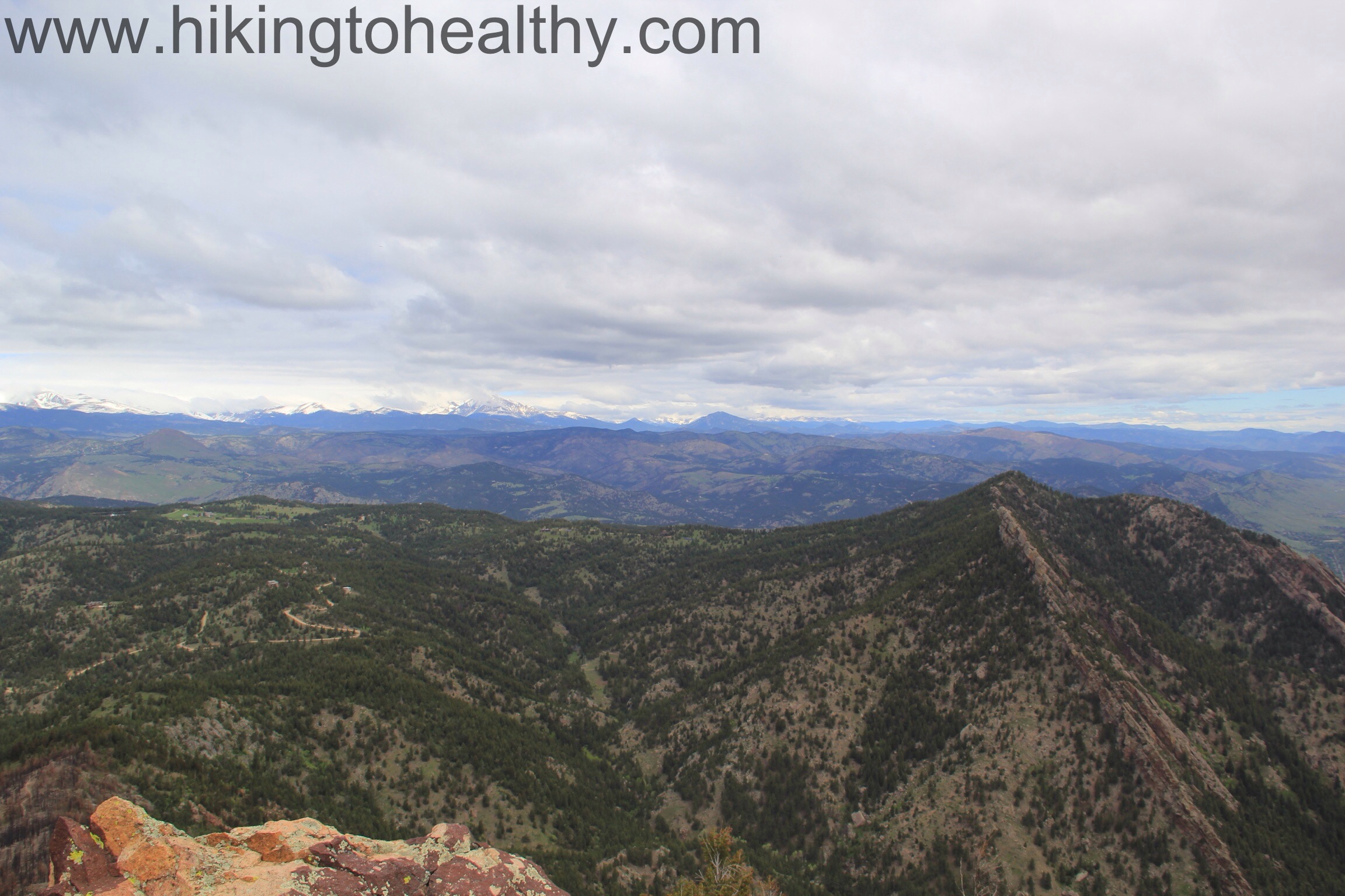
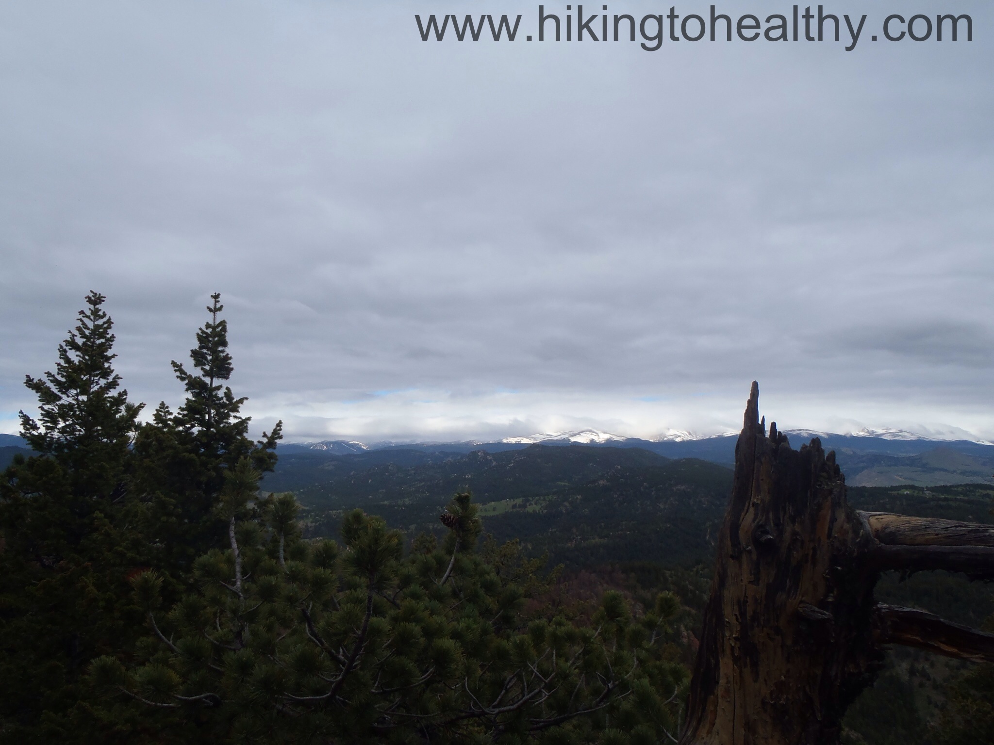
I have wanted to do this hike for a while, unfortunately much of it was effected last spring/summer when the back part of it caught fire during our horrible wild fire season. I kept checking periodically for when sections would reopen and then last weekend my hiking super hero Wendy did it and said that at least one of the ways were open again. Since the Continental Divide got hammered with enough snow on Wednesday and Thursday that they close I70 at the Eisenhower Tunnel in both directions Thursday morning, it was time to attempt this hike. A lot of hikers use it to get in 14er shape when they can’t get altitude hikes in due to weather because it is an almost 2700 foot elevation gain overall and because we opted to go up Fern Canyon, most of that( about 2200Ft) would come in just the 2 miles to get to the top. It was a great work out with great summit views!
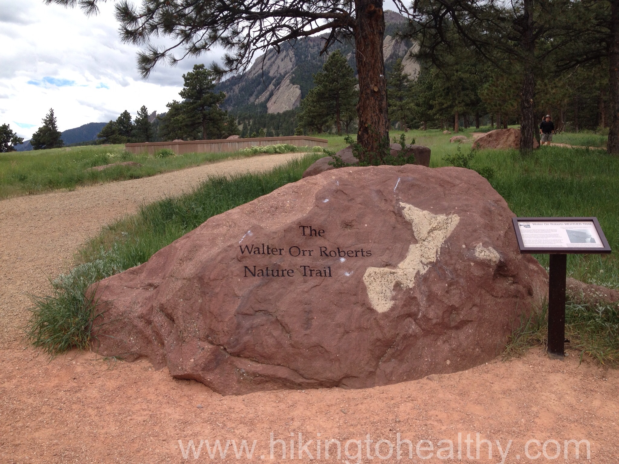
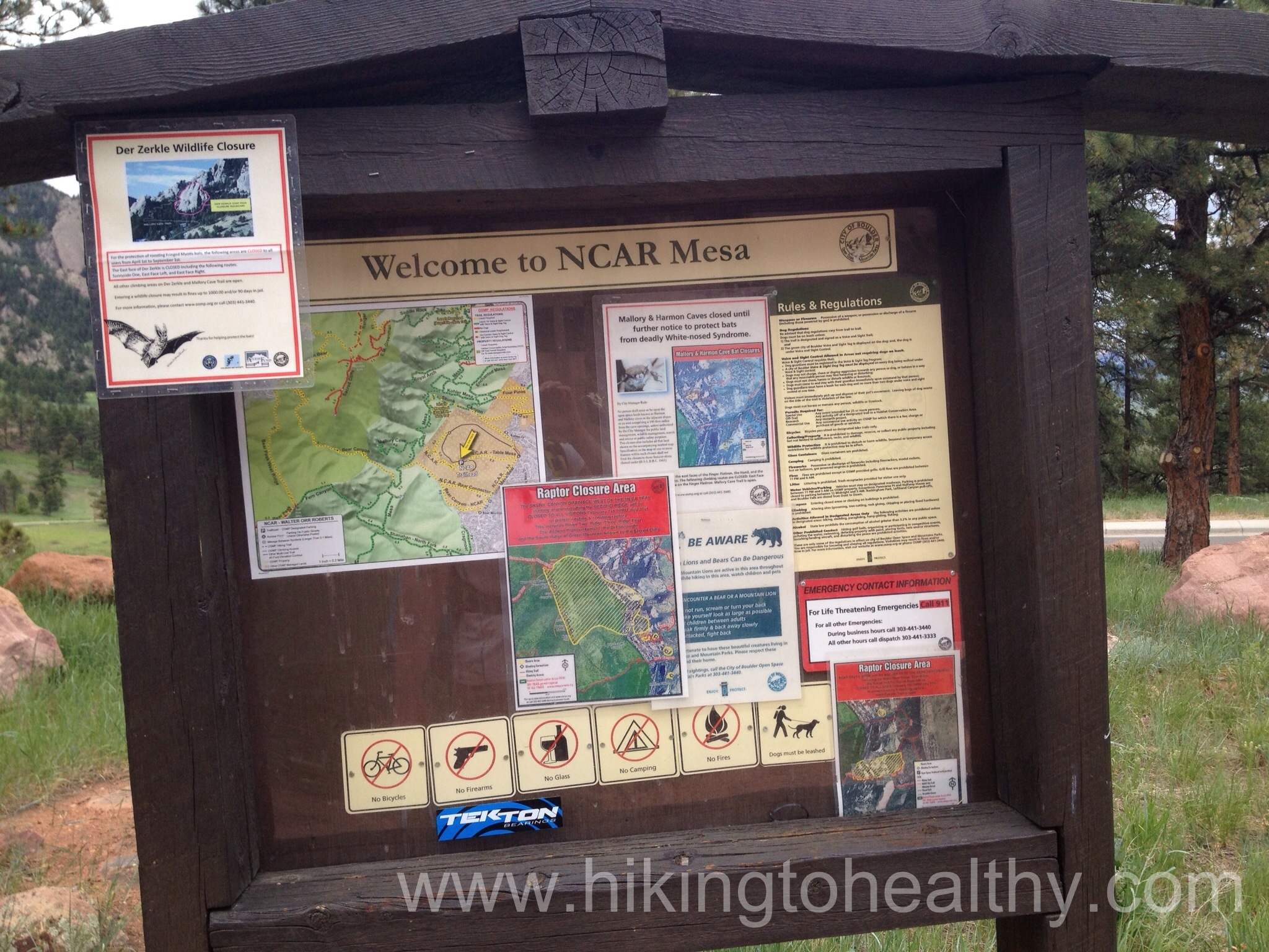

Lets talk trail, we opted to enter at NCAR( National Center of Atmospheric Research), which is easy to see from so many places in Boulder and the trail system is woven all around its ample parking lot. We got there early at 6:30AM and good thing because we got a close parking spot to the trail head, when we got back to the car a little before 1 it was packed. You drive right past the trail head as you pull into the parking lot, which we missed but as we walked west there is a huge rock with the trail name for the Walter Orr Robert Trail. If in doubt of where it is, follow the road west out of the parking lot and it will be obvious as you get closer to the building.
Take this trail around and down to the Mesa trail, you can also make it a little more interesting up here by taking in all the signs and displays that NCAR has set up, we paid more attention to them on the way back because we were too excited when we first started to take extra time reading. You will end up taking the Mesa trail to the Fern Canyon Trail head, most of the time you will turn left when given the option except when you get onto Fern Canyon that is a right turn off of the Mesa. Everything is really well marked with area maps and signs as you go, because of this I decided to not post the trail markers.
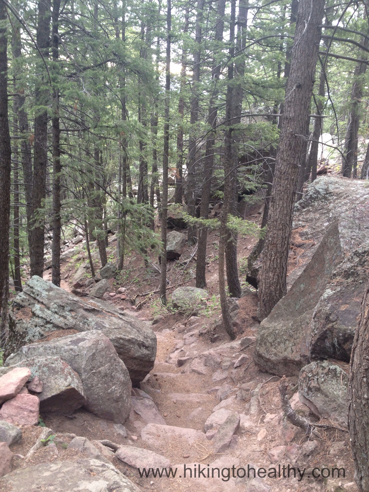
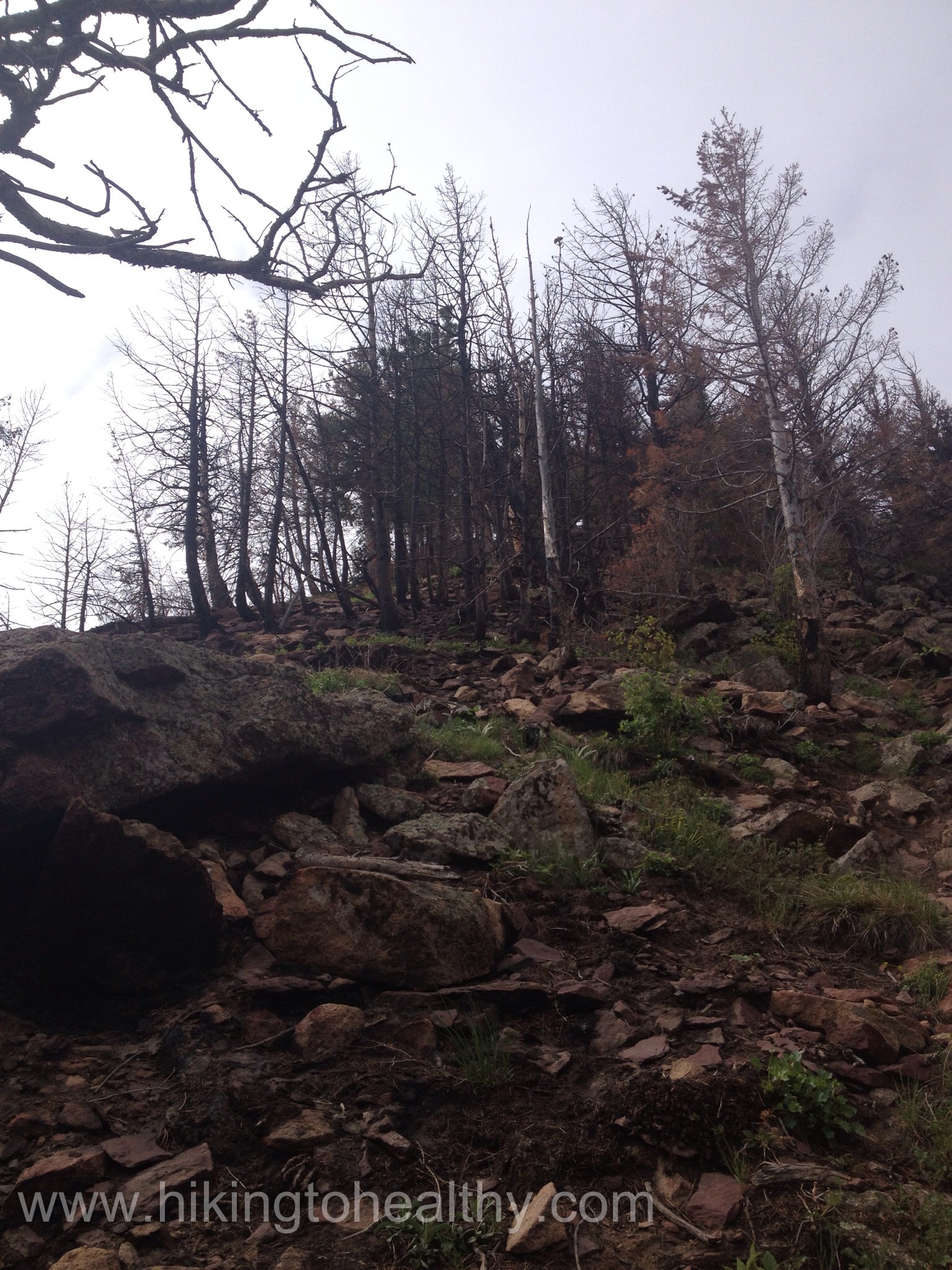
The Fern Canyon trail is steep, it starts out harmless enough then gets really steep and really rocky. In some places having poles didn’t help us and we would have to just use our hands to climb up, I am going to post a series of pictures of the different parts of the Fern Canyon trail so you can see how it changes as we made our way to the summit.


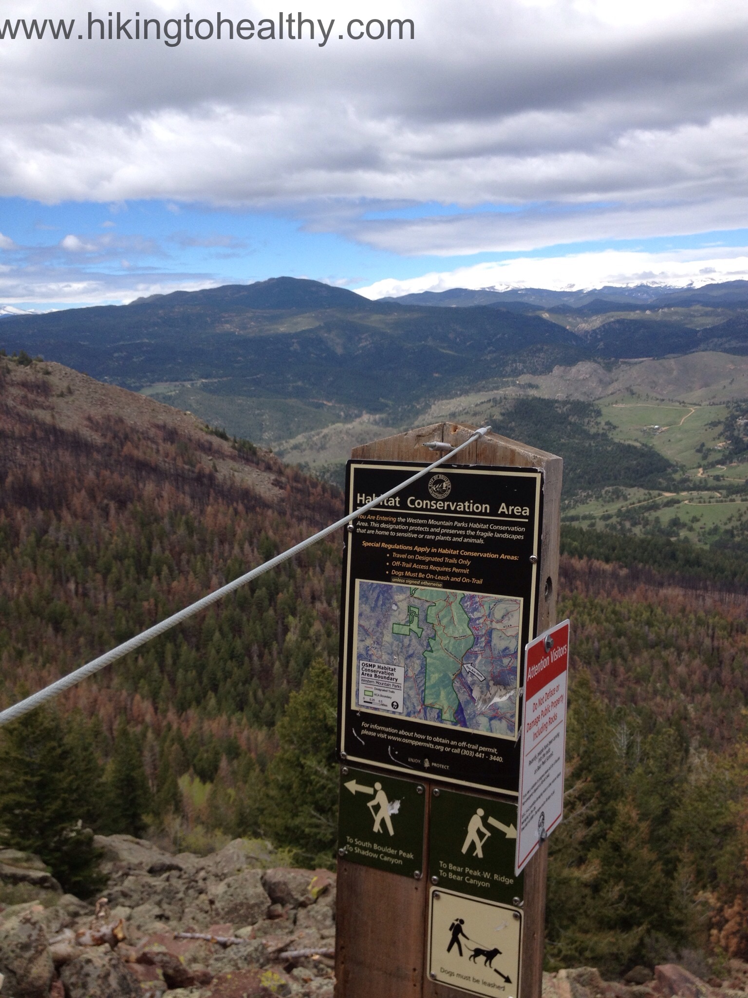
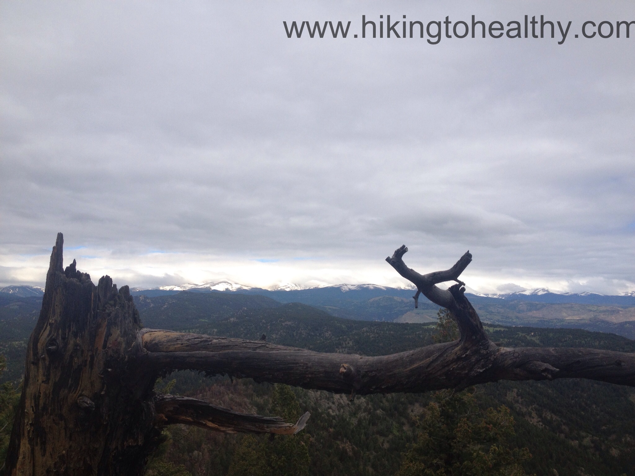
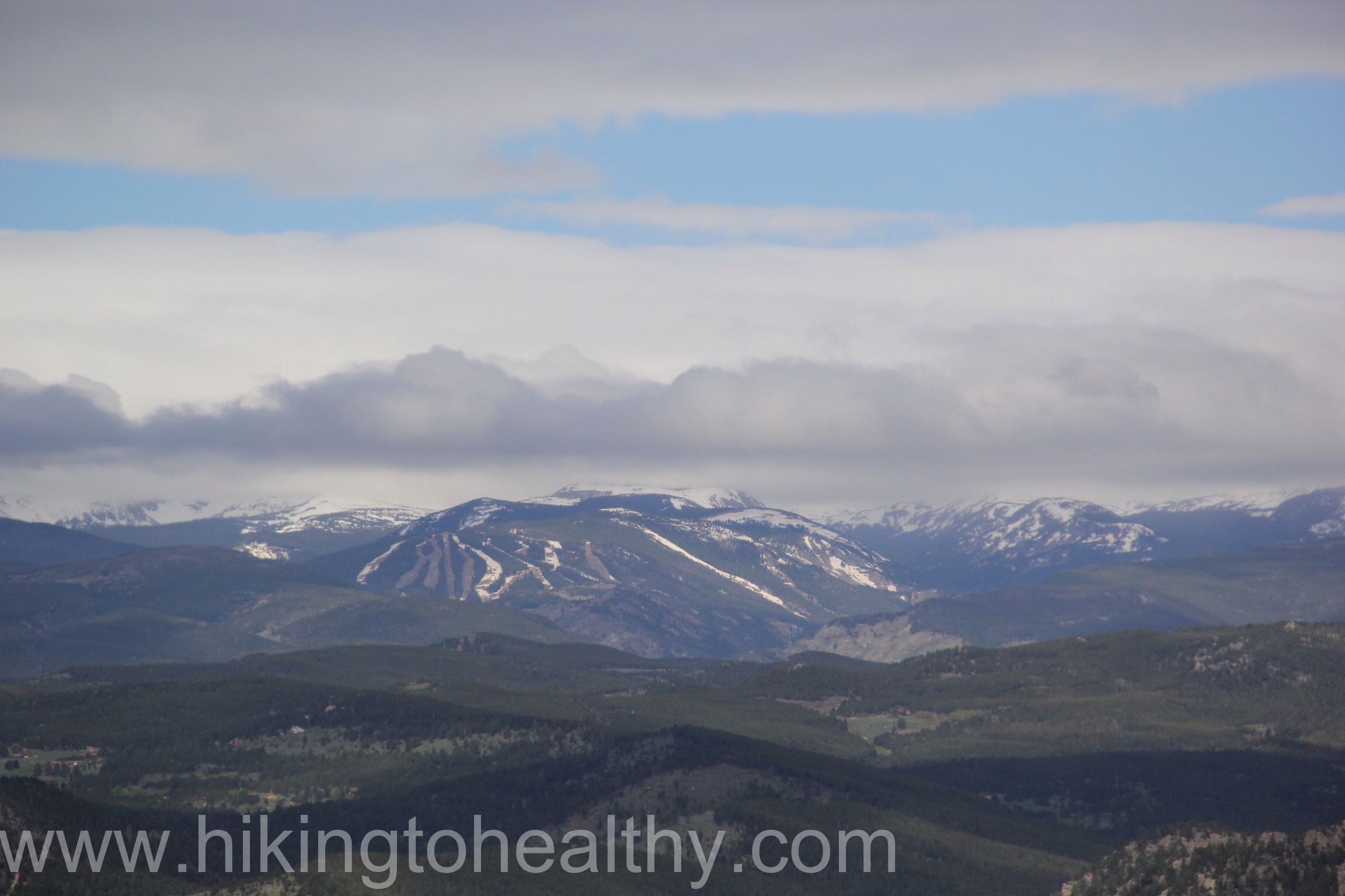
When we got to the summit we actually took turns climbing up, it is climb that requires both hands and concentration. There were a surprising number of hikers who didn’t even bother going up, they said that there is no point in going up as you can see everything good from the trail breaks. Plus the way to Boulder peak is still closed because of the fire as is Shadow Canyon. We had something to eat took a bunch of pictures and then headed down via Bear Canyon trail.

You head to the right and down from the summit climb, then you come to Shadow Canyon and the Bear Canyon trail heads as you can see the Shadow Canyon trail is still closed. Go Right and down….
We once again put away our poles and used mostly our hands to get down, the first quarter-mile down is steep but not as steep as Fern Canyon. Personally I feel like down is the harder part of a hike and so I wanted to take the less steep option down, this was not the norm on Saturday I have to say I was surprised. The truth is I was the biggest person on this loop so maybe the stress of down on knees and ankles isn’t a concern to all the super healthy in shape people who passed us. Bear Canyon is much less steep and after that first quarter-mile we made good time back to the car. My knees ankles and feet were very thankful.

The trail started leveling out and moved through more of the burn area, which was strangely beautiful with its blacks, golds and then bursts of green where the flowers were sprouting up.


It took us a solid 3-3:30 hours to get up the mountain and just 2 hours to get down. It was a lovely path and after we got out of the burn area, we got whiplash from all the flowers everywhere! We really loved this hike and were super proud of ourselves with how well we did on it. My legs were a little shaky at the top but quickly recovered for the hike down. I hope you try this one out some time, it is definitely strenuous so work up to it but so worth all the effort! After the directions I will put my favorite pictures.
Directions:
From 36, take Table Mesa Drive west past Colorado 93 all the way until you get to a large parking lot for the National Center for Atmospheric Research (NCAR).


What a great place for a trail and hike! Glad you were able to take advantage of it.
It really is a great place! There are no shortage of them here!
Love the composition of the photo of the purple flowers (irises?). Looks like a good outing and as always, beautiful scenery. Thanks for posting.
I am embarrassed to say I am not sure of the flower type, I just thought they were pretty…. Thanks for stopping by and checking it out!
I’ve done that hike. It’s a great one. Nice pics too!
I am sure you put our time to shame! Thanks
Love the photos! Breathtaking views!!
Thank you! I am lucky this is my backyard!
Congratulations on tagging Bear Peak. You are now ready for a 14er. You’ll find that the most popular 14ers (Bierstadt, Grays & Torreys and Sherman) are actually easier than going up Bear Peak. And thank you for posting such beautiful, crisp pictures of your enjoyment of the outdoors under your own power. Happy trails!
Do you really think so Didier? That is a strong endorsement from you! I am very nervous about if we have been preparing the right way! I have planned a very aggressive next 4 weeks in hopes that our 1st attempt the first week of July goes well! Thank you!
Absolutely! The last 1,000 ft of elevation gain from the saddle to the top of Bear Peak are tough on your quads. Unless you go off-trail and go straight up on a 14er such as Bierstadt, G&T, Sherman, Quandary (the easy ones), you will not encounter any terrain that’s as taxing on your quads. You’ve already been over 13,000 feet. 14k does not feel any different (nor does 15k for that matter!). Mountain Madness owner and world-class mountaineer Scott Fisher always said “it’s not your altitude that counts, it’s your attitude, bro!”. It certainly applies on 14ers. The difference between a 13er and a 14er is a psychological barrier only. If we were using the metric system, both types of peaks would be 4,000-meter peaks and nobody would be concerned about making it to the top of one and not the other. My advice for a successful 13er/14er experience would be two-fold: 1 – keep working on your endurance: this is what will get you to the top. 2 – Minimize breaks as much as possible. Fatigue and lassitude are common above 10,000 ft. The more you stop, the harder it is to start again. Find a pace you’re very comfortable with and that you can maintain for 5-6 hours.
Which one are you going to tackle first?
Great Advice! We are getting pretty excited about our first endeavor. I am thinking Quandry or Lincoln….
If Lincoln is on your radar, you might as well do the DeCaLiBron (Democrat – Cameron – Lincoln & Bross). To do Lincoln, you’ll have to head toward the saddle between Democrat and Cameron (not an official 14er, but still well above 14,000 ft high). From the saddle, Democrat is a quick 700 feet of elevation gain. The climb from Democrat to Cameron and on to Lincoln is beautiful, a magnificent ridge and an easy trail with great views of Quandary. The saddle from Lincoln to Bross is easy, as well. I believe Bross still is officially closed to climbing and there might be some signs to that effect (land dispute). However, at that point, Bross will be a mere 200 feet of vertical gain away, and you might as well do some “peak-poaching”, like everyone else does. Besides, I don’t think the land owner will climb a 14er to stop people from summitting!! The top of Bross is not exciting: huge, flat and rather boring. However, the view of your route and the 14ers you will have climbed is rather impressive. And the descent from Bross will make up for its summit blandness. You’ll go down scree for about 1,000 feet. It’s a fun, exciting descent that will require some focus. Not dangerous, just lots of loose rocks. We’ve done the DeCaLiBron 8 times, I believe. 7 times clockwise (the easiest way) and once counter-clockwise, going up Bross via the scree field. It wasn’t fun. Plus, doing it clockwise eliminates other hikers who decide to bag Democrat and call it a day. The crowds get thinner as you head towards Lincoln and Bross.
Finally, here’s a photo link of the DeCaLiBron (our last ascent in early June 3 or 4 years ago). Happy Trails! Don’t forget to breathe!
http://alyeska.smugmug.com/Colorado/co/Democrat-14148-Lincoln-14286/8557374_k2mvWp#!i=563597602&k=htd53rt
wow! I love your pictures! I was picking Wendy’s brain last night trying to be a better hiker, I am dreaming of the day I can do what you two do! We are so going to try this….just not as our first 14er attempt! I did a hike today and I have to tell you the entire time I was thinking I wonder if Didier and Wendy would like this one.