

Staunton Ranch > Scout Line> Marmot Passage>Bugling Elk> Stauton Ranch
Lowest Elevation: 8120 Ft
Highest Elevation: 9240 Ft ( I think total we got around 1800+ ft of elevation gain with the ups and downs)
Trail Length: Roughly 10 miles
Trail Uses: Most of the trails were hiking, biking & Horses Scout Line is hiking only
Degree of Difficulty: Most trails themselves are easy but doing them all together is moderate or difficult mostly
Fees: $7 a day OR $70 for the state park annual pass…. on this day we bought the pass since ours expired
Bathrooms: Yes at each parking area there are vault toilets or Port-o-potties
Pets: Yes Dogs On leash only
Work has been crazy and getting more crazy everyday, at the time I picked this trail I had not had even a minute the entire week to research hikes. It was at 10PM that Friday night that I saw Mark and Sandy over a buencamino2014.wordpress.com talking about their hike at Staunton State park that morning. They have been talking about the merits of this state park since it opened this summer while Mark worked there to get it ready for opening. One thing I love about Colorado is that when a new state park opens there is as much excitement about it or more, as there was when Ikea opened. I heard about the lines to get in the park all summer long and just didn’t want to deal with the crowds . On a pretty cold Saturday with potentially no sun, it was the perfect time to check it out! Mark & Sandy were nice enough to suggest a couple of routes that would get us around 10 miles and some of the best views in Park. Honestly I would never had picked this route if not for them so thank you Mark & Sandy!

We started the hike via Staunton Ranch trail, which also happens to start at the Mason Creek Trailhead. It is a little confusing as you walk up the trail but look up and left, you will see the trailhead:

This trail is not tough at all, the path is very well-groomed with a gradual climb as it winds up and around the park. I really like how they have marked the trails in the park, they use the initials of the trail name on a simple iron post. I would say this portion is easy to moderate, moderate mostly because round trip it is a 6.6 mile hike.

It felt like about 2 miles or just under, when we reached our trail break at the Scout Line Trailhead, also very well-marked where the 3 trails intersect and the signs have the mileage to the next trail break – I loved it!
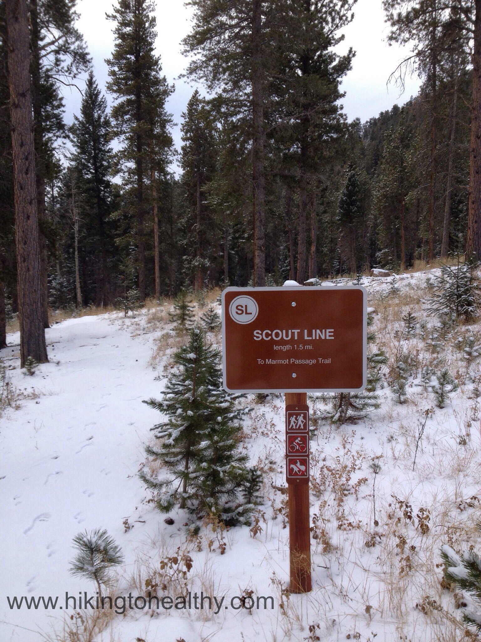
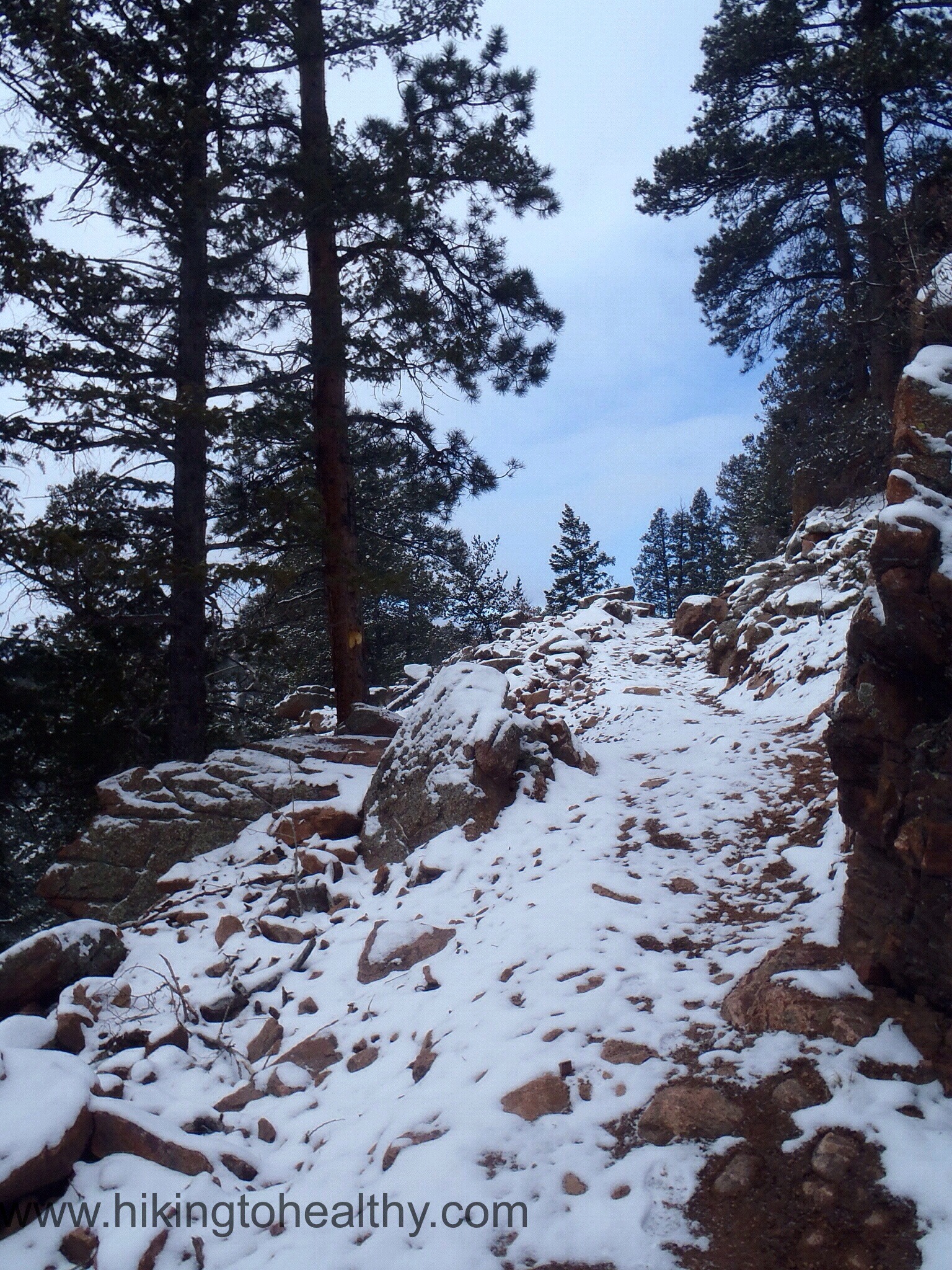
This trail is all single track and starts a pretty aggressive climb up to some beautiful bluffs. I have to say this was my favorite section of the hike, the views were amazing and the way they built up the trail using natural resources was actually really beautiful.

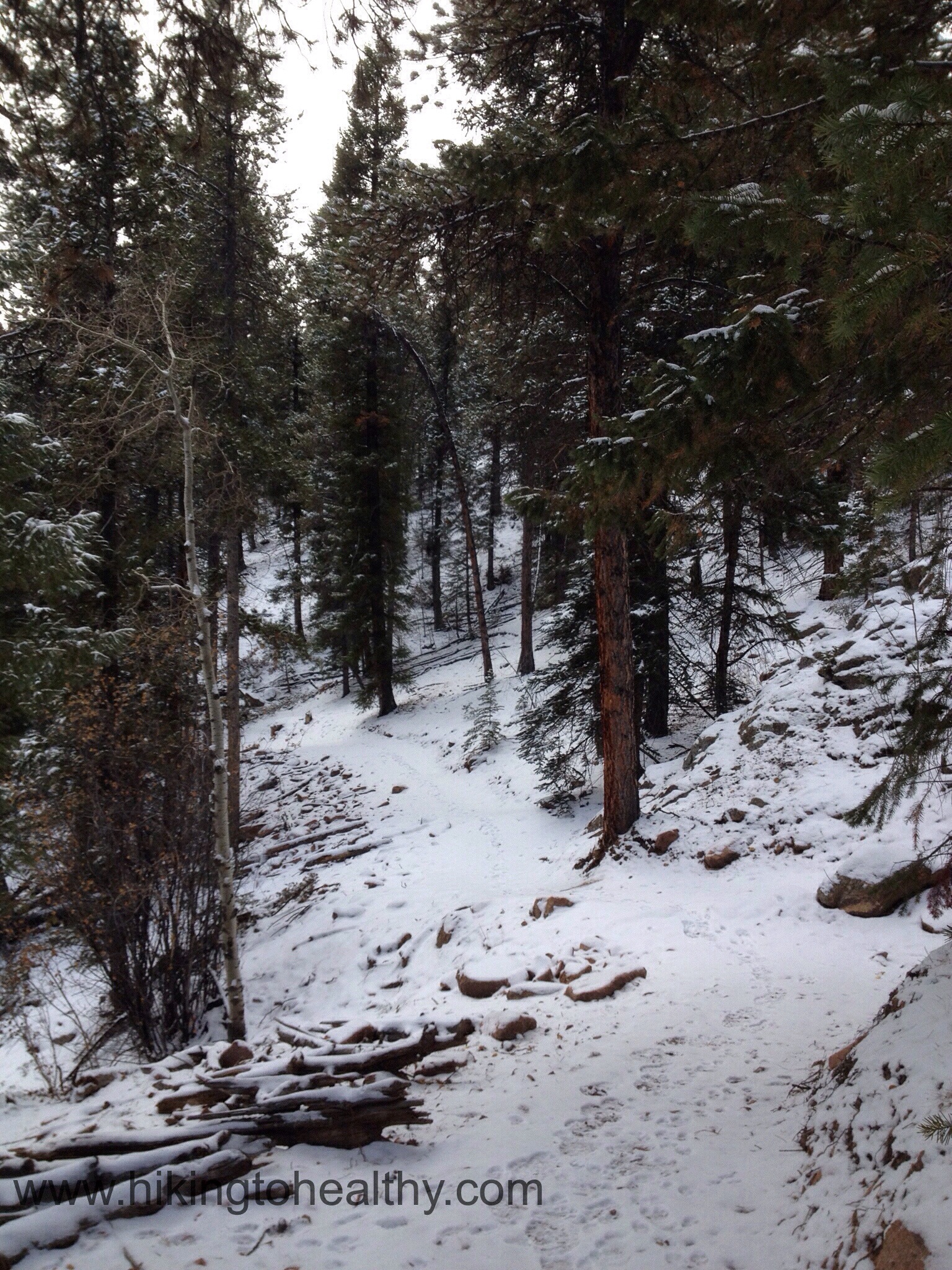

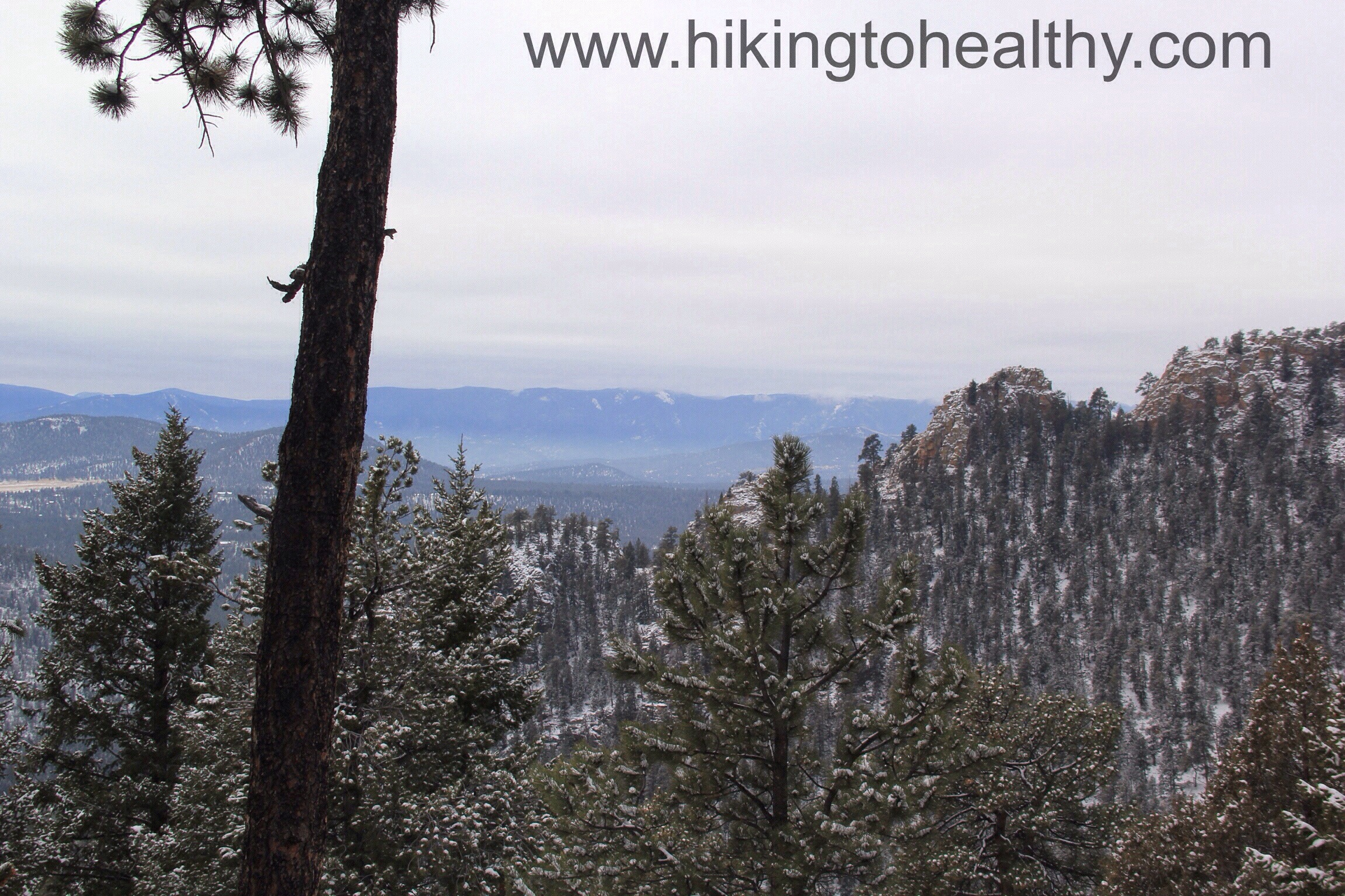

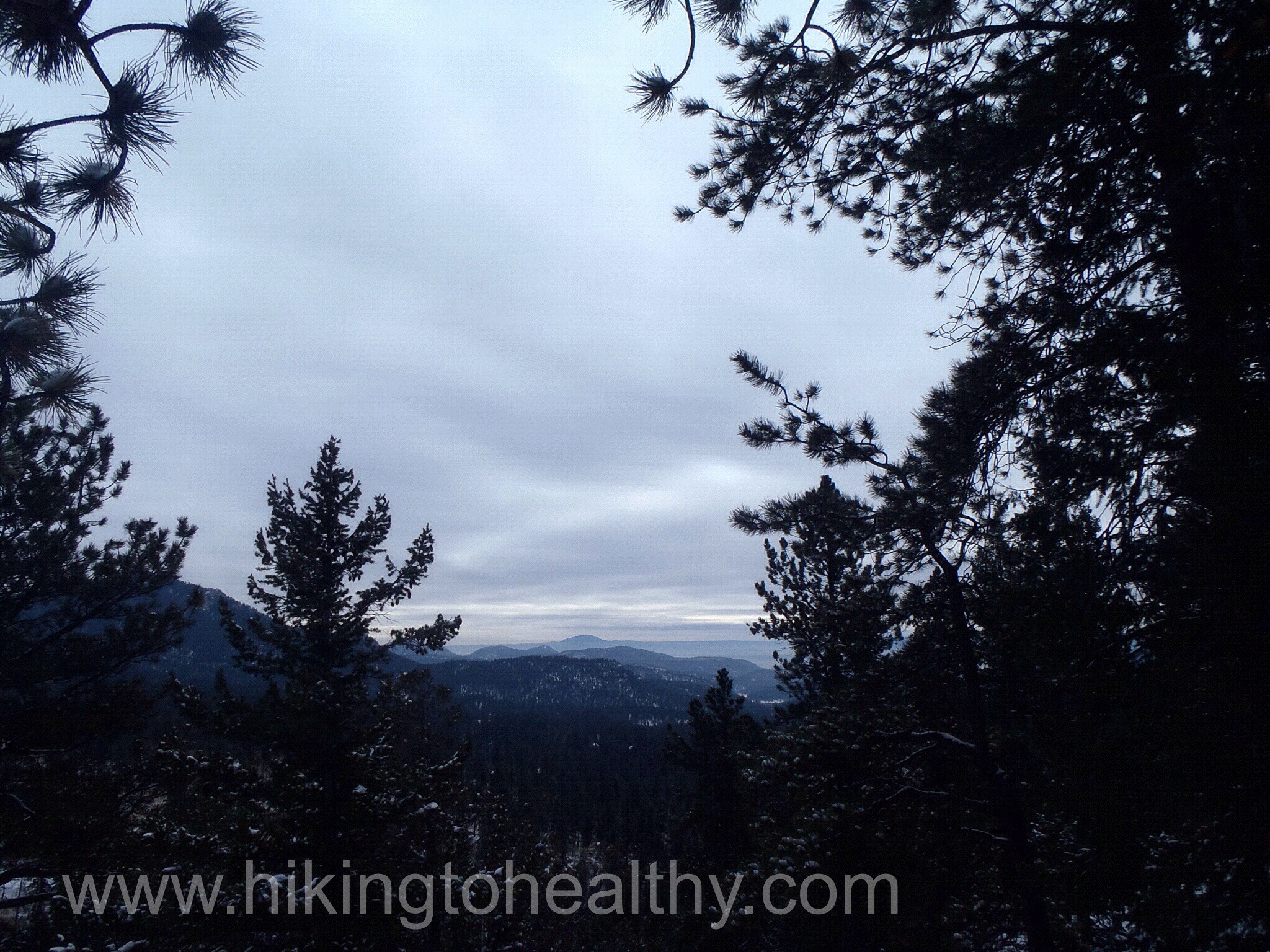
I have to tell you Scout Line was just gorgeous and reignited that love of discovering a new trail in me. We spent more time then necessary on the trail just taking it all in the were views all over as we hiked along it. As we got closer to the next trail break at Marmot Passage we had this great climb along the mountain.

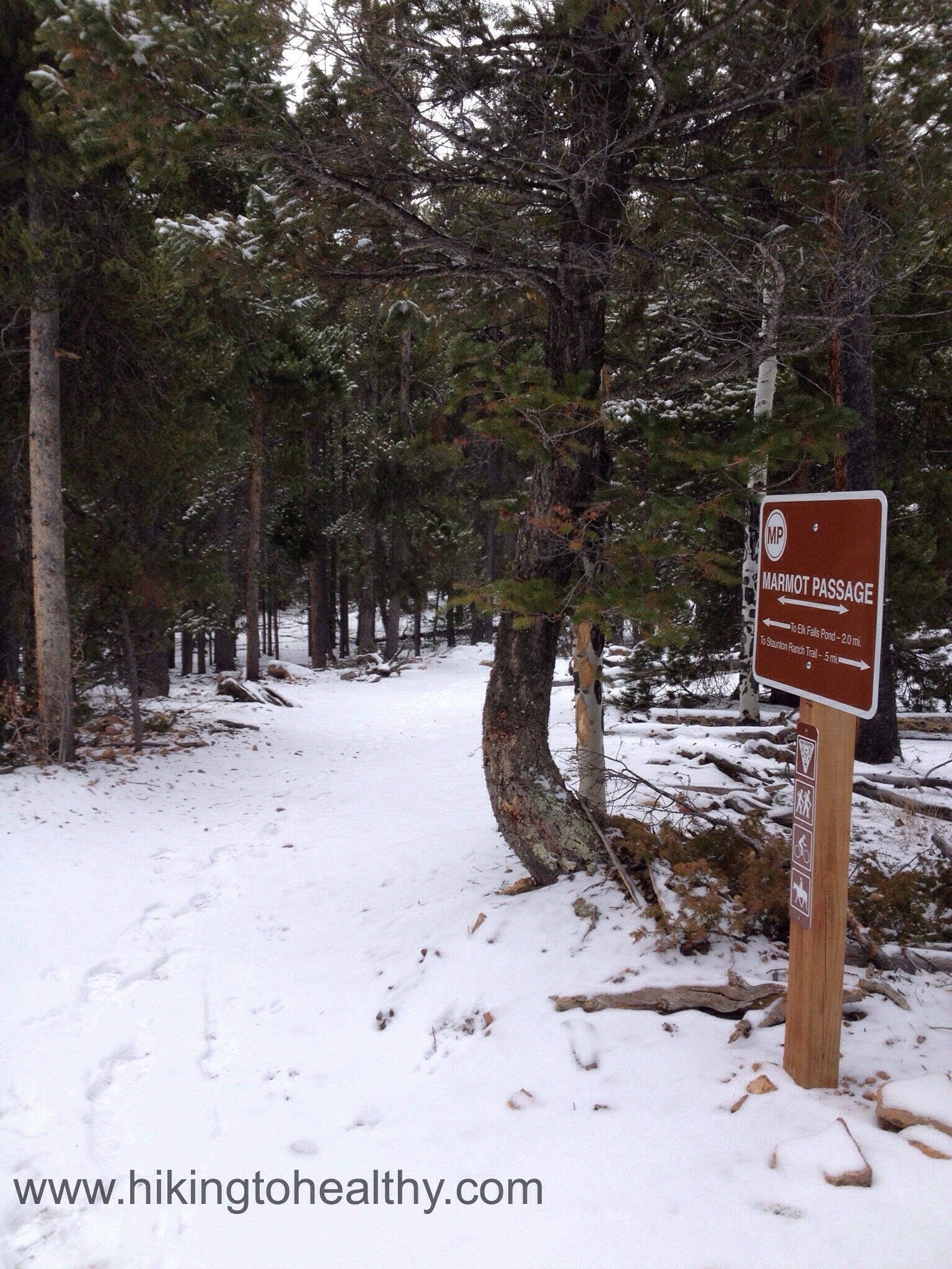
Marmot Passage is an easy trail that does a little climbing and then mostly heads back down. It actually started getting pretty cold while we were on this trail and so we started moving much faster. As we descended to the Elk Falls Pond, the cloud cover really settled in but the pond still looked pretty from above, it could not dampen our excited and joy.


Once down by the pond, finding Bugling Elk trail to head back was very easy and the trail itself is some type of access road very wide and easy to hike:
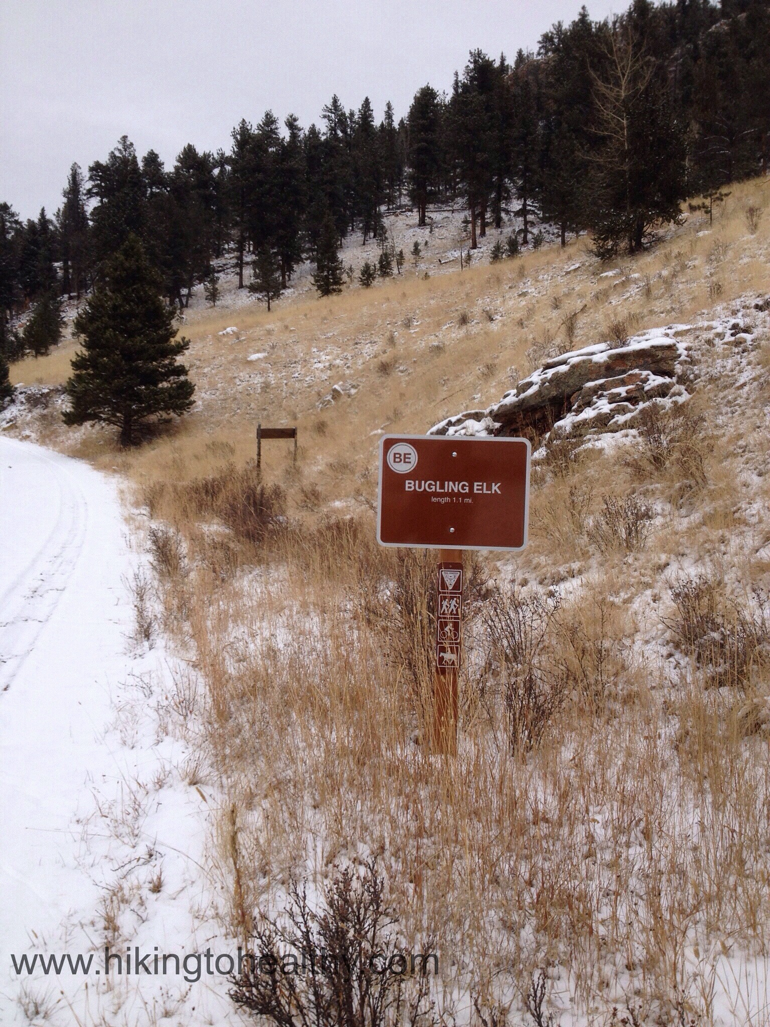
We climbed up a little and then headed back down to Staunton Ranch Trail.


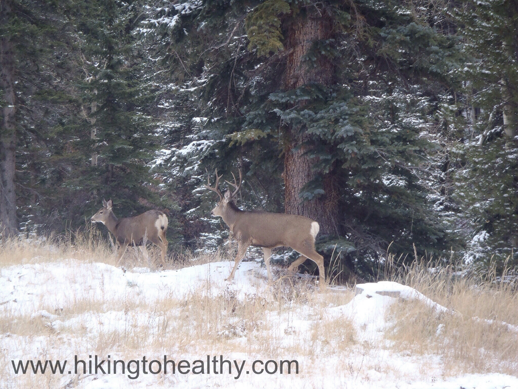
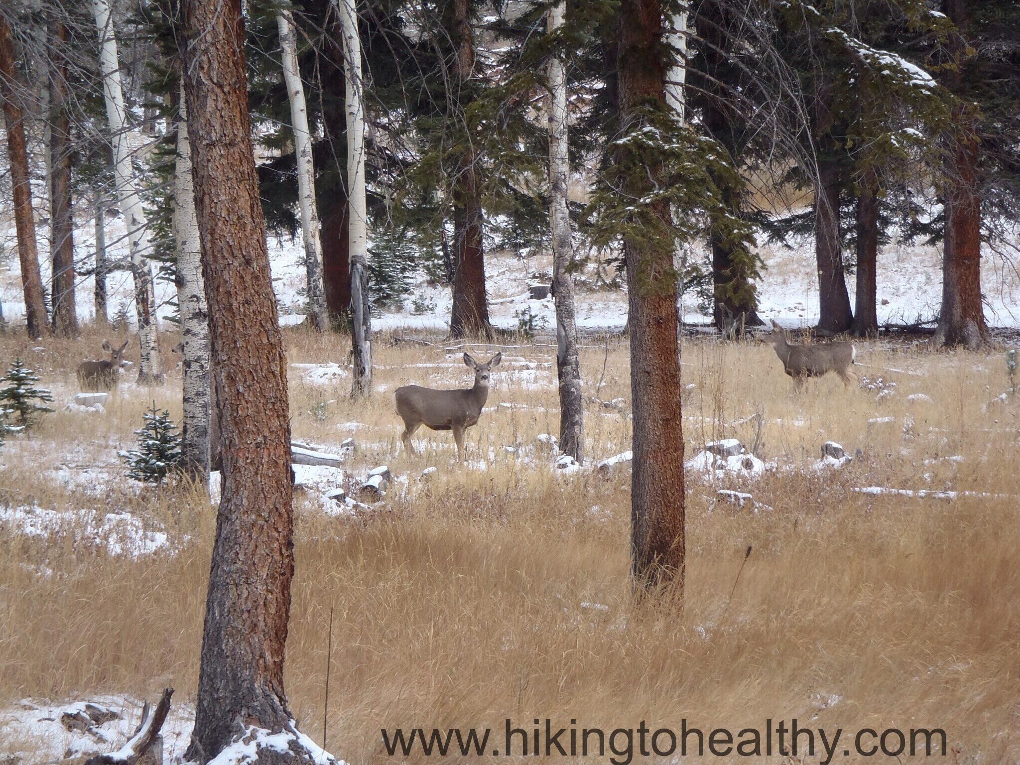
Knowing that we were just 3.3 miles from the end had us in great spirits, discovering this gem for ourselves…. well we were pretty chatty about it all. So chatty in fact we almost missed the herd of deer on our left. Then while taking too many pictures of them cavorting, we found out almost a minute too late that the main buck was on our right rounding up the rest of his herd and he was CLOSE. Honestly I have never been that close to a buck, I would say he was just 5-6 feet away from us and totally unconcerned with what we were doing as he got his last doe back in line.
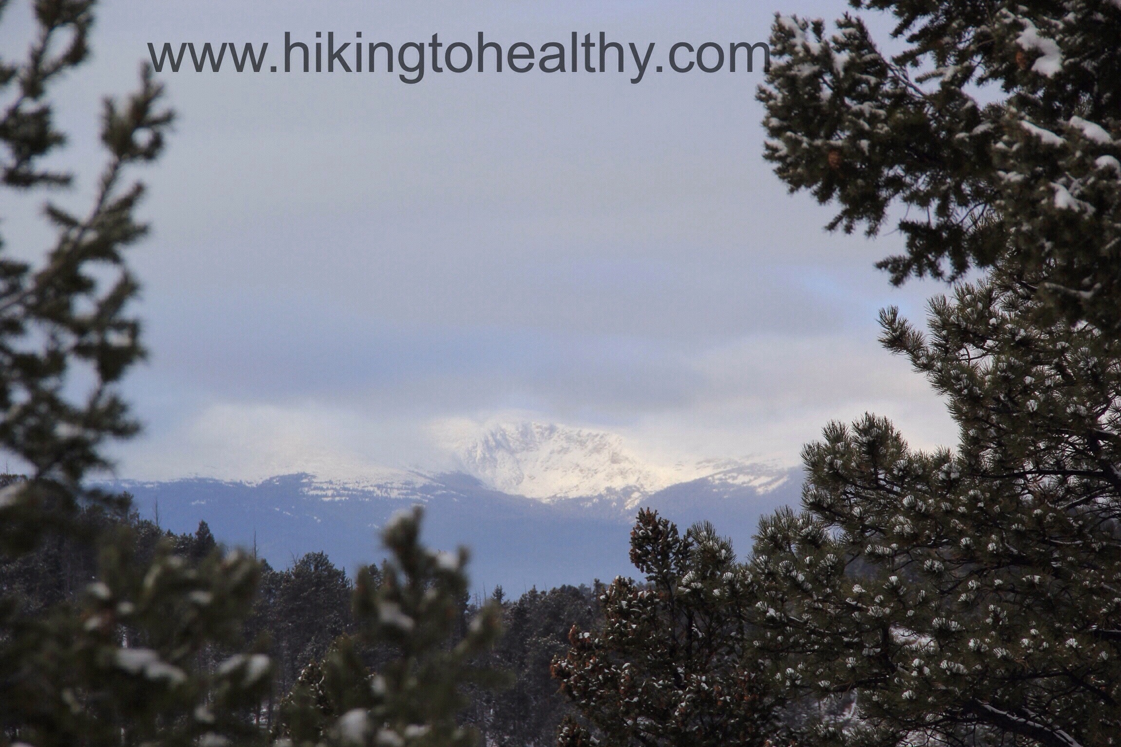
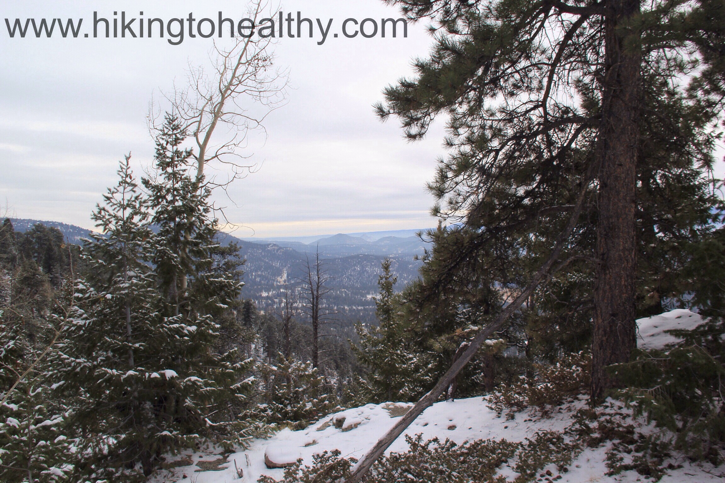
I have to tell you that this hike was awesome! I am so glad I happened upon Mark and Sandy’s most recent hike post to pick the park and even more thrilled they could give me advice on such short notice! There is so much beauty in this state park and I totally get why there were lines of people waiting to discover it all. Yes the route we took was long but it was crazy beautiful and so worth every step. For approximately 70% of the hike, we had it totally to ourselves which added to its awesomeness . We saw the most traffic on Staunton Ranch trail as we were returning to our car and what we did encounter still wasn’t all that much. Honestly I cannot wait to get back to this State park and see more, I hope you can find your way out here to see it all for yourself! After the directions will some of my favorite pictures from the day.
Directions: Take US Highway 285 south to Shaffers Crossing, about 6 miles west of Conifer. Turn north on Elk Creek Road and follow the signs 1.5 miles to the park entrance


Sandy and I are so glad you enjoyed Staunton. I have worked there for four years now as a seasonal ranger and have found every new day is more amazing than the last. I can’t wait until you get the opportunity to hike up to Elk Falls overlook. Watching and hearing the 100′ of cascading falls from a series of flat rocky ledges. It is a great place to eat snacks or have lunch. Another great hike is the Mason Creek Trail to the Old Mill site, after a few minutes of exploring there, continuing onto Borderline Trail. There is an overlook on Borderline that is spectacular. After taking in the views, continue north on Borderline and the sights of rocky cliffs to your right will open up – it is simply incredible. Another experience is hiking around the climbing access trails. These are seldom used by hikers, but offer heart pounding elevation gains into the hidden sheer face of Staunton Rocks. Take a few minutes of R&R to watch and be awed by Colorado’s amazing climbing community in action. I could go on and on….
ohmygosh now I can’t wait to explore these other options! I am so glad I got the annual pass when we arrived that morning! Lots to see and it looks there is still more to come!
What a great new park! Love the pictures in the snow.
You should check it out, very pretty!
Beautiful photos. Looks like a great area for a hike. By the way…happy belated birthday. 🙂
It is great! I can’t wait to get back there! Thank you!
Way to go on a tough, snowy hike!
p.s. Happy Birthday! I seem to recall it was early December from the old/previous goal/calendar you had up. 40 is the new 30! 🙂
Thank you!! It certainly is, well at least now I think it is …..
it will get better and better as you get healthier and stronger. trust me on this…you will feel like a total bad-ass!
The photos with the snowy mountain backgrounds are just gorgeous!
Thanks!
cool pictures, what a great place to hike.
check out my last hike, High on Siler Bald
Greetings from South Carolina! 🙂
Michael
Wow, It looks like a beautiful hike! Thanks for checking out my blog!!!