This is obviously no shock to me, seeing as I have been dodging the scale for months AND not really tracking my calories. I know it was worse last week and I lost some weight this week. I am ok not knowing how much I lost or how much more the gain back might have been. I really thought today’s weigh in would be worse so I will take this, either as a small win or a small setback… not sure how I am looking at it yet, but I think both are positive viewpoints.
As I get on track, I am going to focus on getting back into the groove of my workout habits and staying within my daily calories these first few weeks. I am still using the Lose It App and my fitbit as tools to help stay on target and keep motivated. There is something strangely stimulating about see 15-20K steps at the end of each day again.
This week I did Elliptical every morning before work, walked during the day while working, came home lifted weights and walked before dinner. I won’t lie, it was a struggle to get it all in like I used too but I knew if I could get back to it this week, next week would be easier. Getting back up to my summer level of activity is just around the corner. Here’s to hoping I am right!
It feels good to be focused again and have small wins! I like my muscles being a little sore each night and when I wake up in the morning. It wasn’t that I haven’t been active the last 2 months, because I was, but I wasn’t really pushing myself.
We have a repeater hike planned for tomorrow mainly just to get above 8000 feet. I wanted to try to find something new but the snow has been wonderfully abundant, which makes finding a new adventure above 8K a little trickier to commit to! I figure if we can get above 8k this week, going to 10k next week with snow shoes will be easier. I want to be hiking above 10K before our guided snowshoe adventure in February.
I am also going to try to get in a quick and easy hike on Sunday since I like that so much better than just walking on my path or working out in the house.
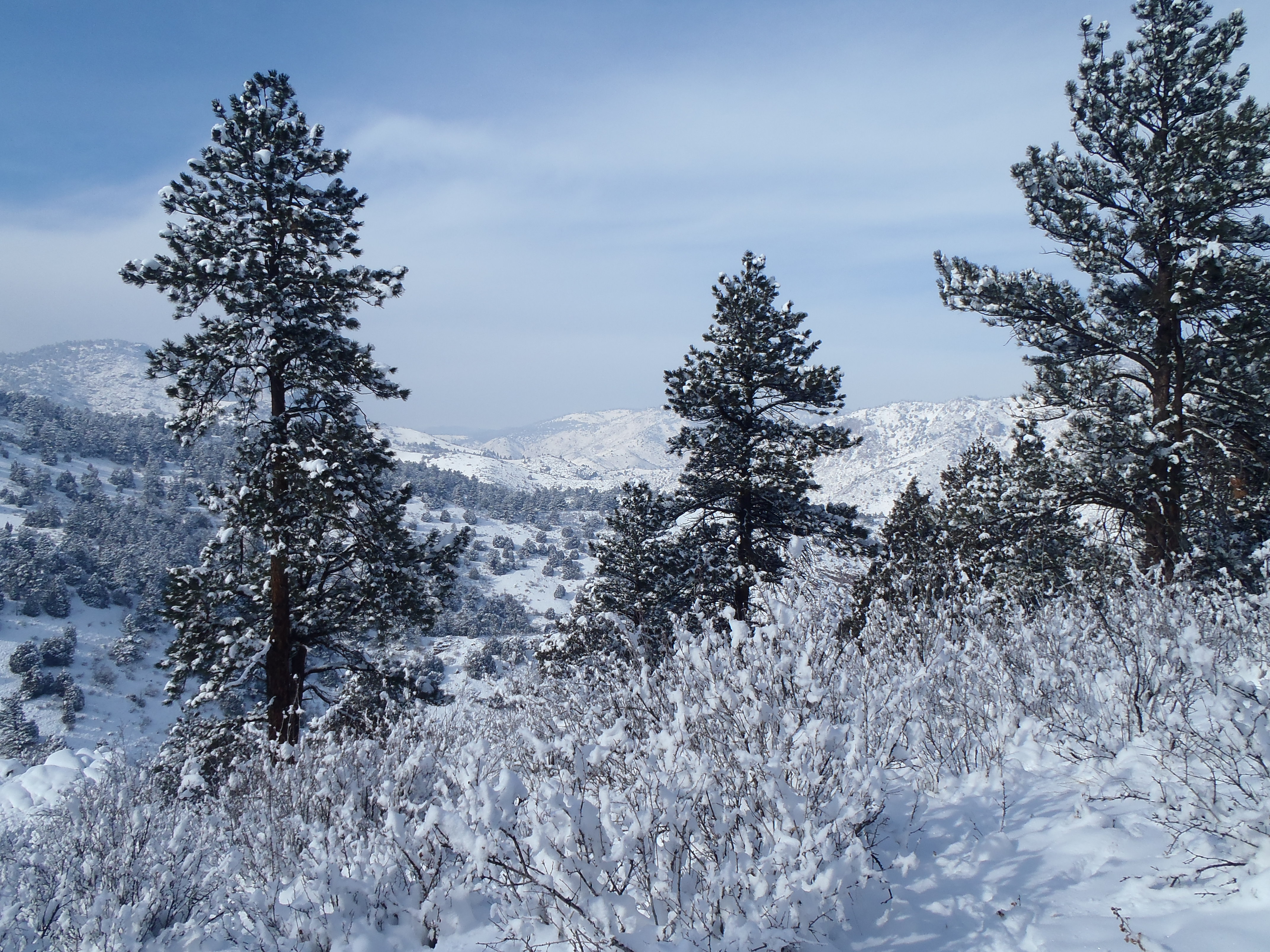
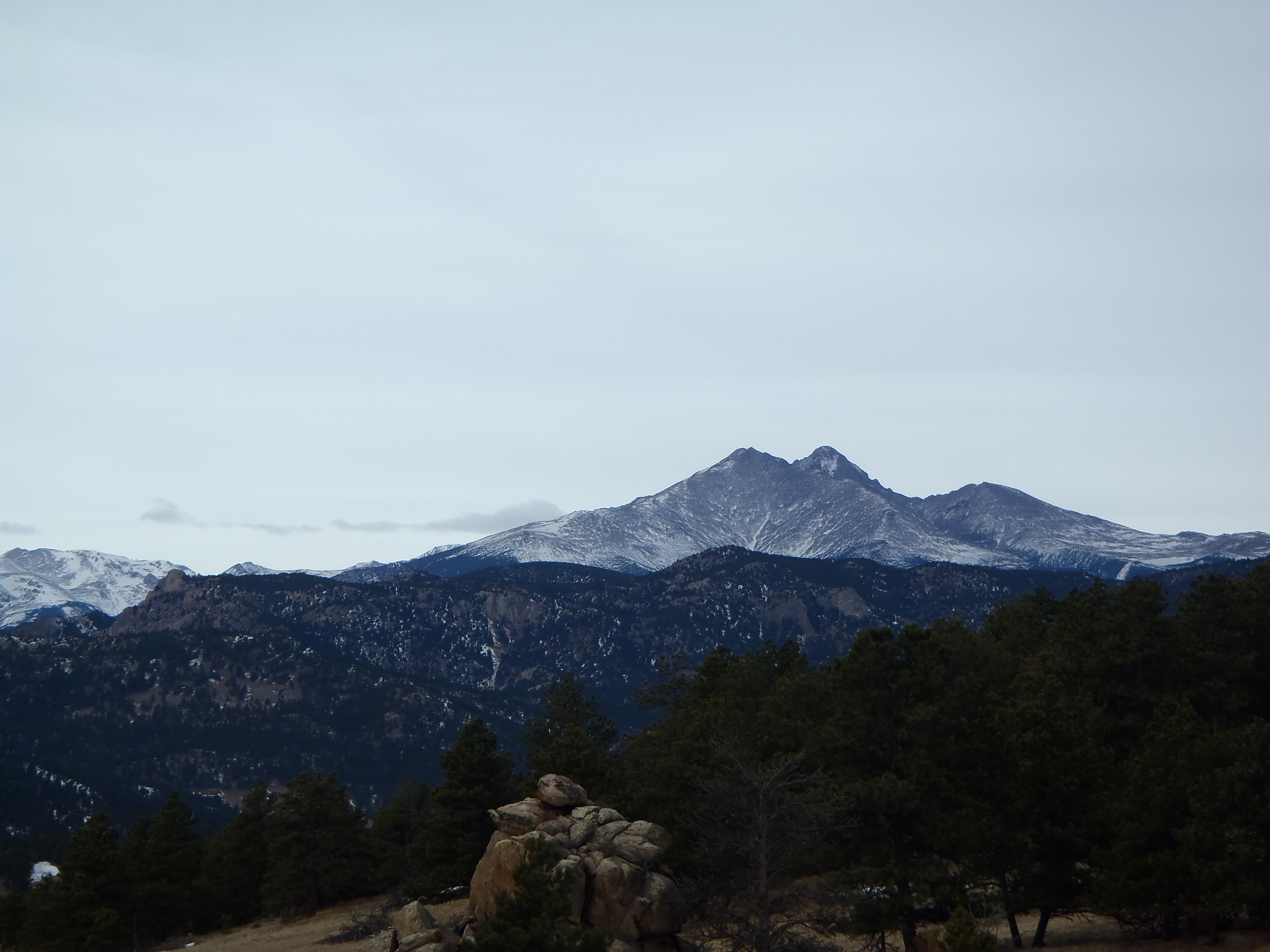
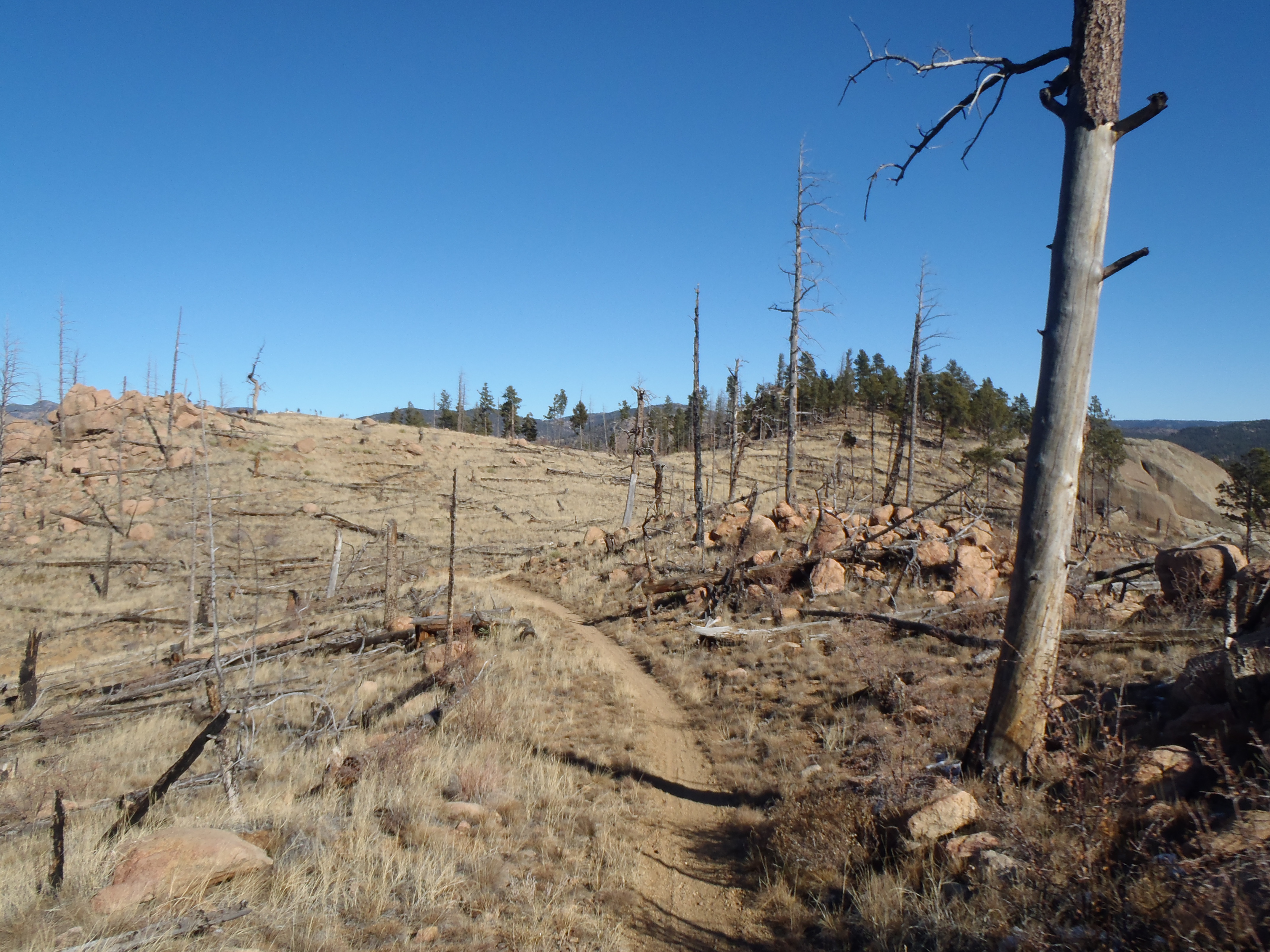
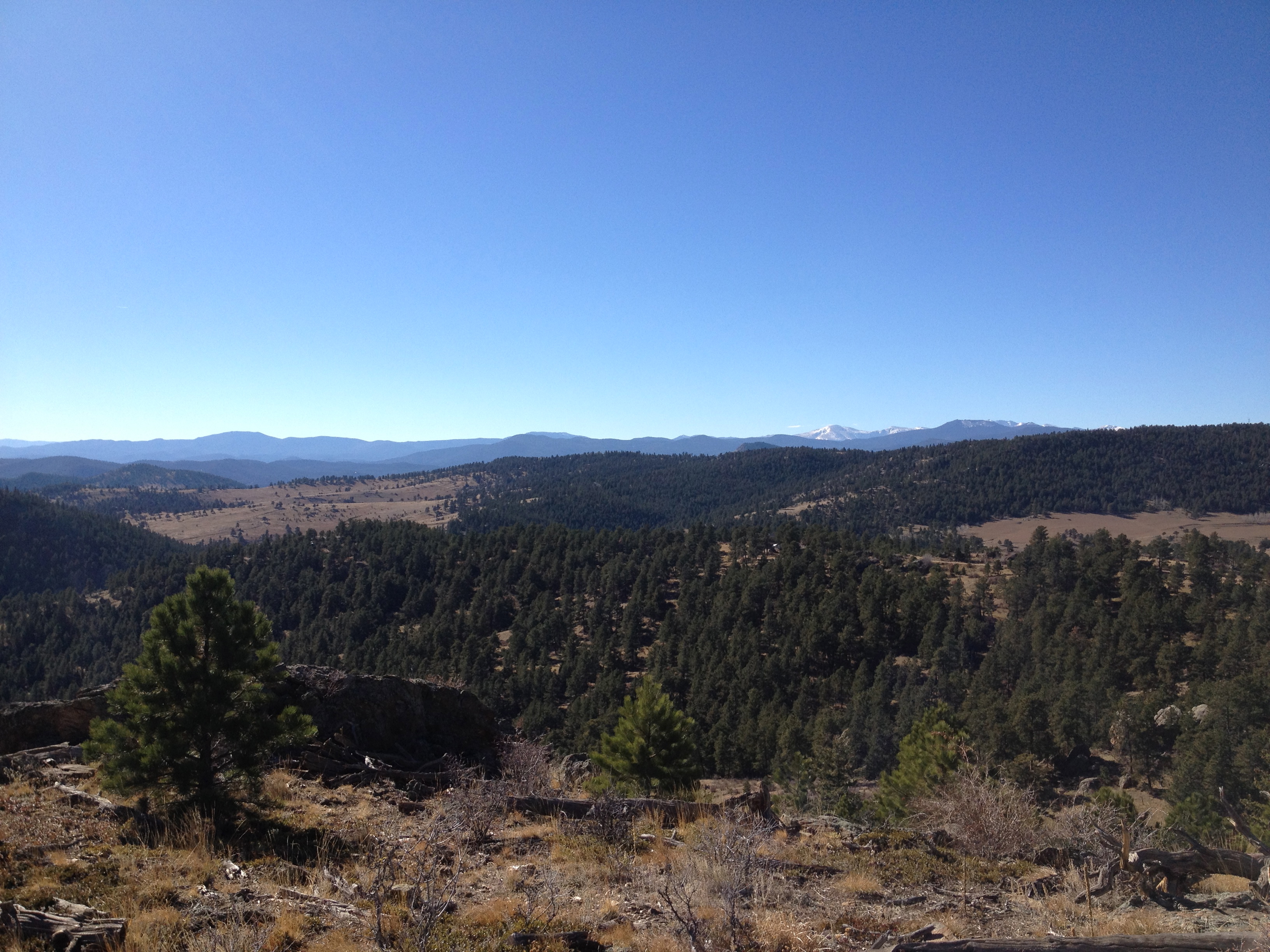
We started out the new year right by hiking on the one day off, I won’t lie we picked easy because we were hung over from ringing in the new year but it still felt good. Here is a shot from the trail at Spruce Mountain ( Hike details here).
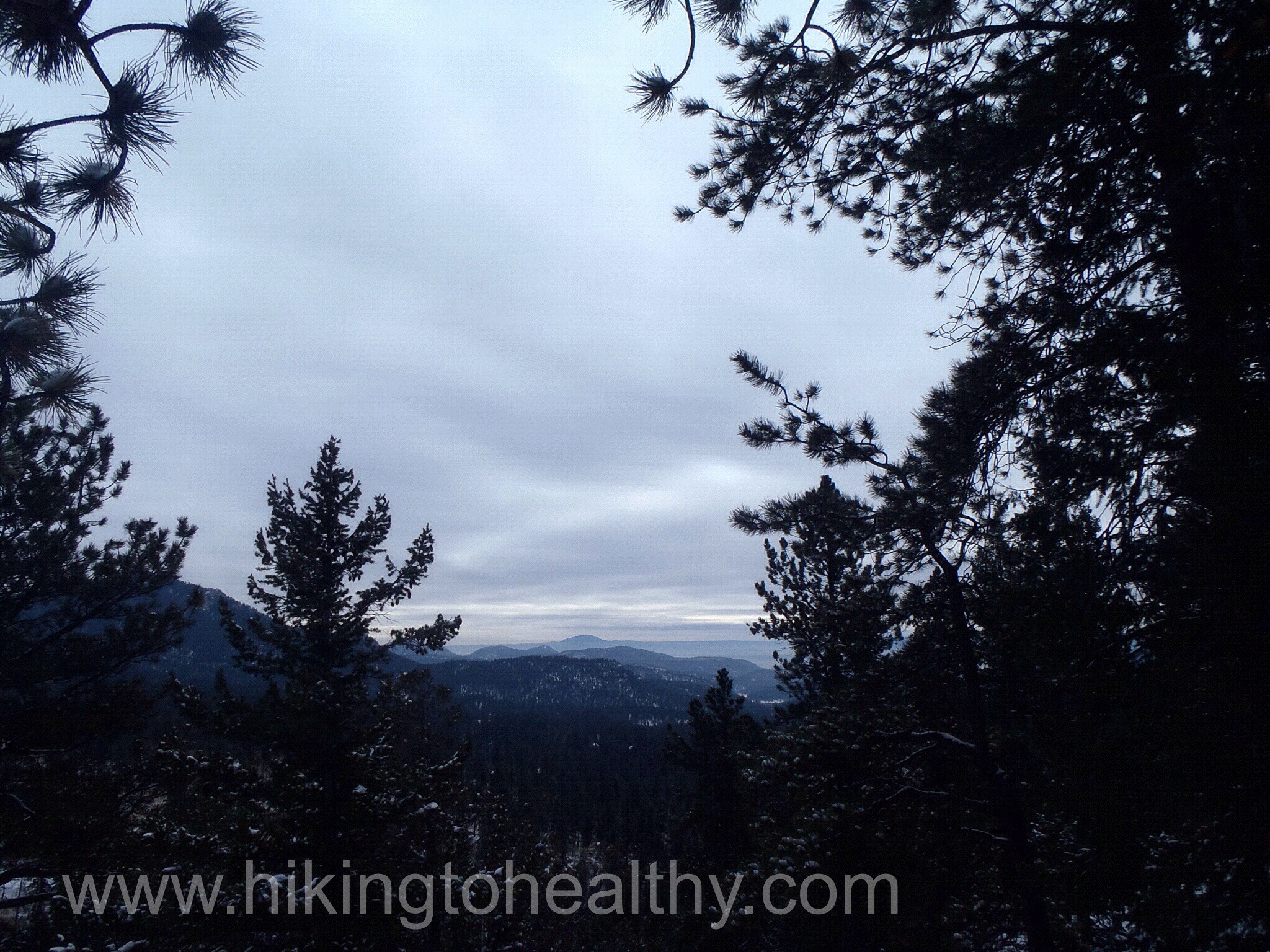
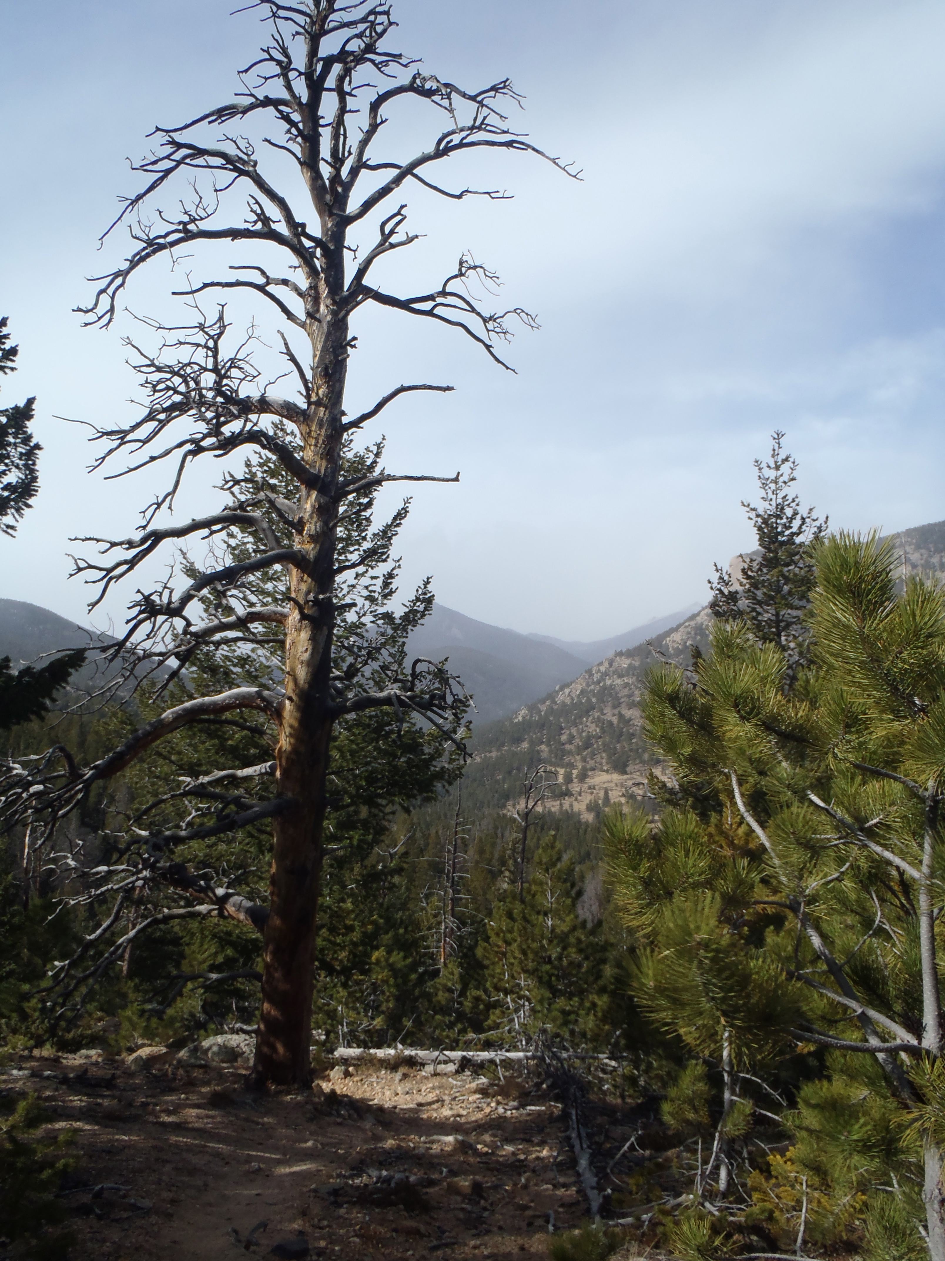
View from the bluffs facing south-west towards Pikes Peak.
Trail Length: 2.8 officially for one loop around, we did it 2 times for about 5.5-6 miles
Trail uses: Hiker
Degree of Difficulty: Easy
Fees: None
Bathrooms: Yes
Pets: Yes
It was crazy>thinking those weather forecasters might have it right. I laughed when Al Roker on the Today show said we would get 6-10 inches of snow on Saturday, because our weather people were saying trace amounts… maybe 2 inches on the front range at the most. Plus it was like 62 degrees on Friday so how bad could it be?
Apparently way worse than I thought, especially for my civic. That was bad decision #1, taking my Civic and not our CRV.
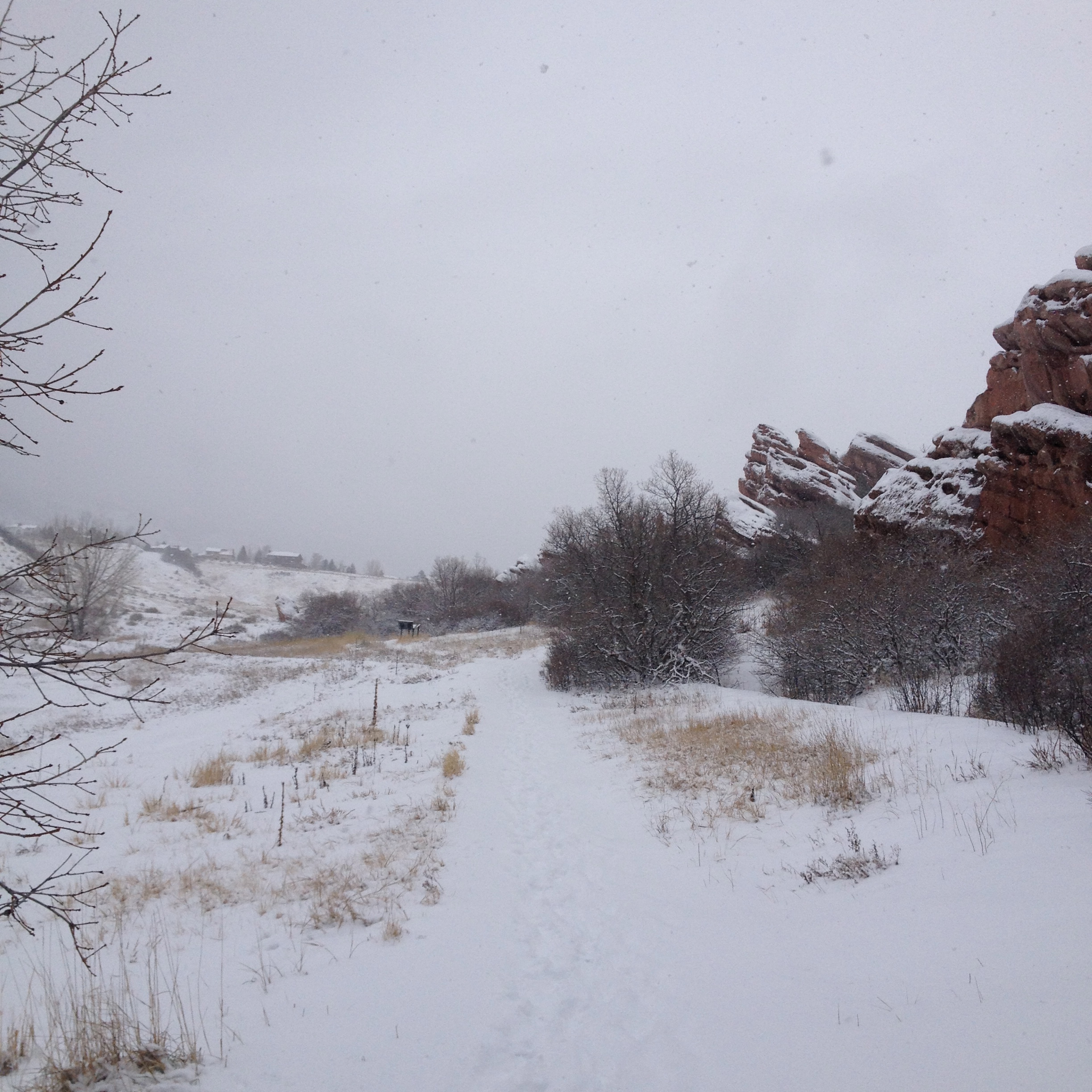
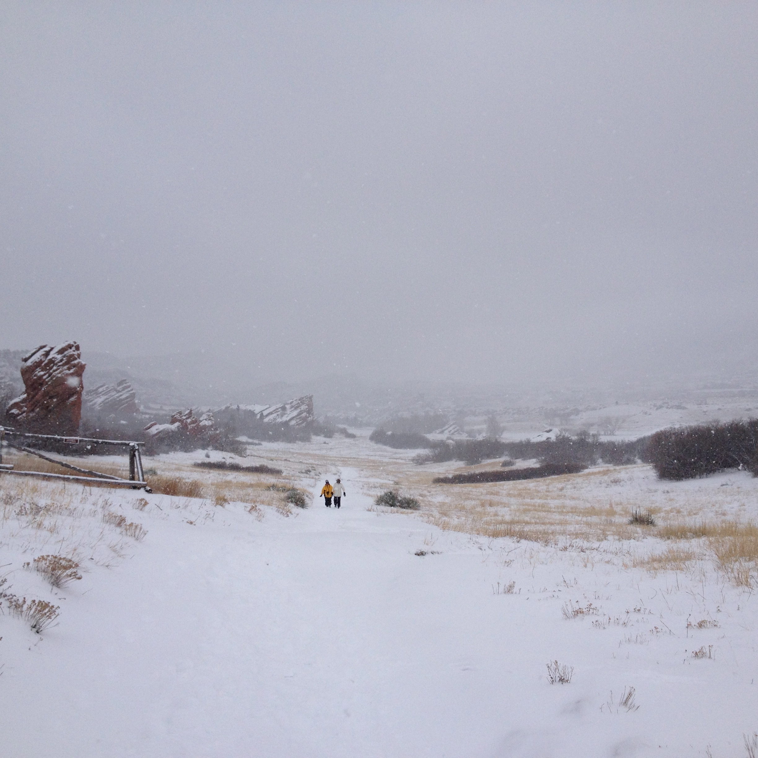
The first trail we planned on was to get over 8000 Ft. and along 70, which seemed impossible to get to about 10 minutes into the drive with terrible roads and pretty heavy snow fall. I switched directions going south thinking it would be lighter… again based on our weather forecasters. It was a slow but not bad drive and until I pulled on to the final road to the trail head, I got stuck about 200 feet in. Stupid decision #2, as it is a pretty steep uphill drive on a semi residential road that likely never gets plowed. The deer 4 feet away from where we got stuck actually had looks of disdain on their faces clearly thinking “stupid human”
This super nice guy driving past asked if we were ok and I said um…. I think we are stuck. He acted as a spotter while I drove down the road in reverse, taking advantage of gravity to get unstuck. Thank goodness for physics! When we got back on the road he seriously offered to drive us up to where we needed to go. How nice is that!?!?!? We didn’t take him up on his offer but instead hit South Valley Ranch on the road back towards home, a park I honestly thought I would never hike.
South Valley Ranch is a pretty easy hike with a simple 2.5 mile loop and almost no elevation gain, but the parking lot is totally flat and on the same level as the road for a hopefully easy out. AKA perfect in bad weather for a low clearance Civic.
South Valley Ranch Trail map
As we bundled up, I was super stressed about not being able to get out ever (drama queen) and thinking who do I know that lives close to here that I could hike to if we get stuck. In case you’re wondering, I have 2 friends a few miles away we could have hiked to if necessary.
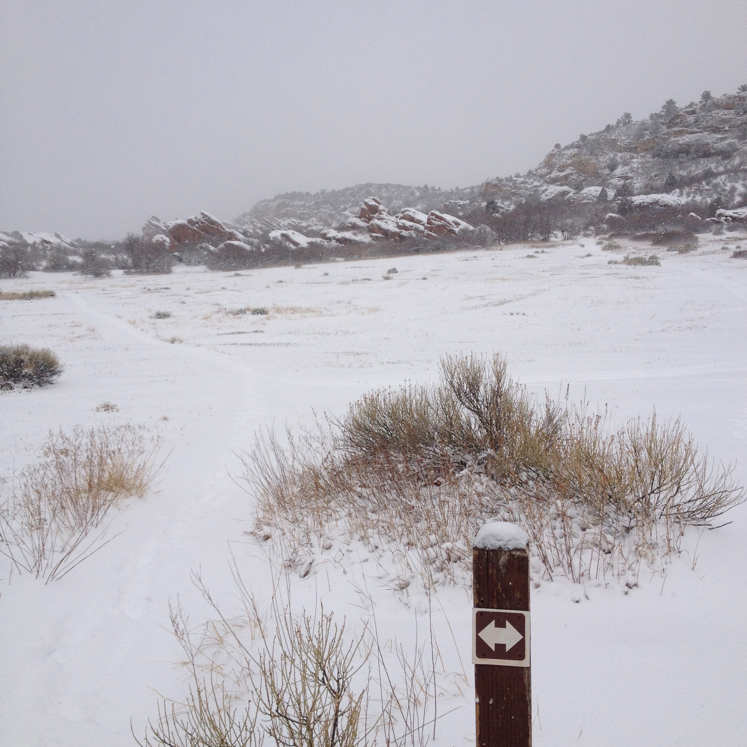
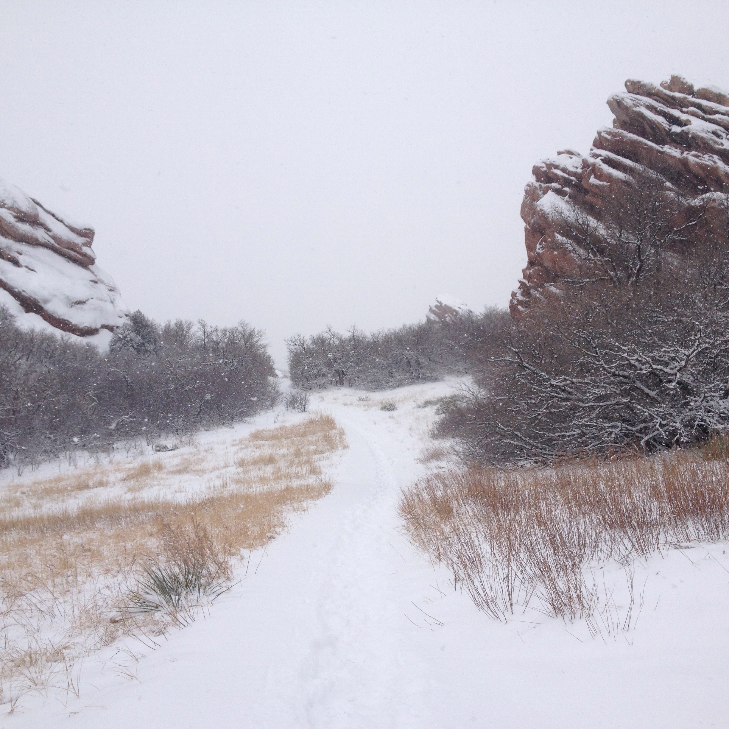
The trail starts out on the right of the parking lot, even with the snow it seemed pretty wide and level. In just .4 miles you hit the first trail break and we decided to go left, it is a simple loop so left or right is about the same. The first time through we could actually see Lockheed Martin and the community directly North of the park plus some of the mountains south of us on the trail. The snow was surprisingly deep too, like 3-4 inches, stupid weather people.
We went left here
It was actually a lovely hike and we had it mostly to ourselves, I guess others were making smarter decisions about going out in the bad weather then I was. We came up to this other trail break where, if the weather was better I think we could have taken it all the way to Deer Creek Canyon.
We went right onto Swallow Trail
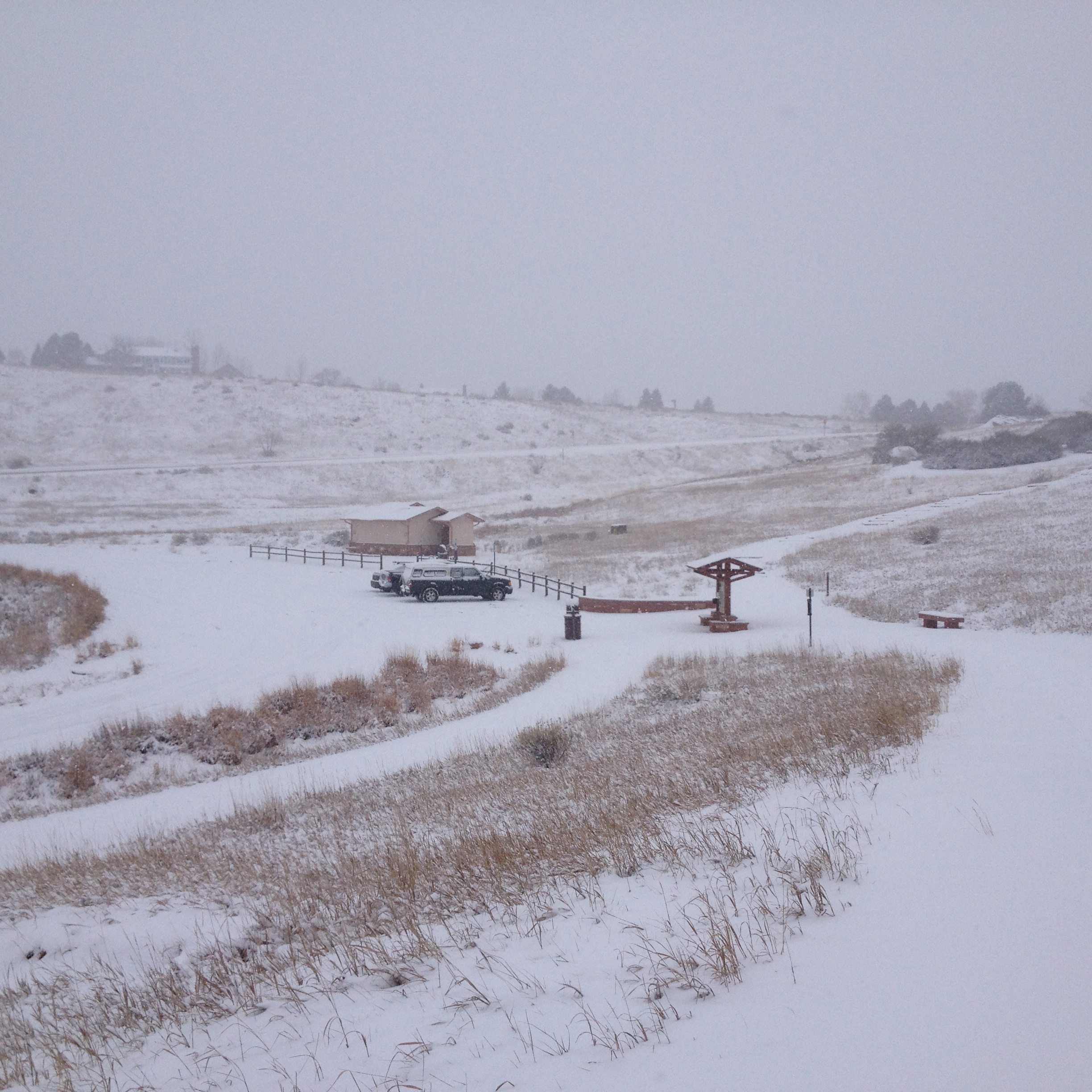
It is not too far to the 2nd parking lot which actually had more cars than I expected.
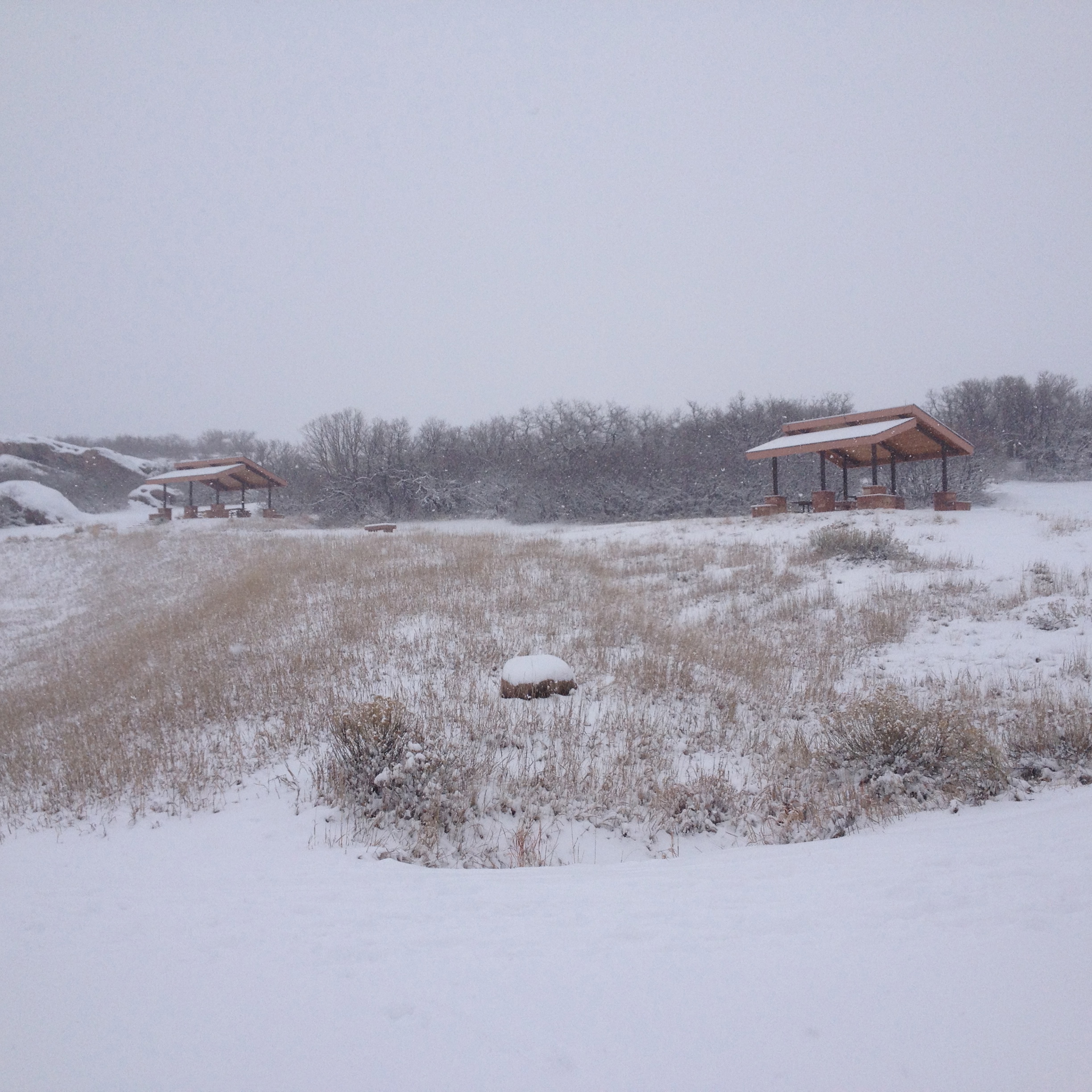
2nd Parking lotPicnic Area by the 2nd parking lot
We just went up and past this cute picnic area, I suspect in better weather employees from Lockheed Martin spend a lot of time over here.
From here we came to the Coyote Song Trail which looks like it goes further north and perhaps up along the hogbacks. I think another time we might have explored further but for this hike we just did the simple loop.
Taking the Coyote trail back to the car
We came across one more trail spike that looked intriguing but again just stayed on the loop.
The Loop the first time around was interesting, with the snow giving a nice challenge to an otherwise easy trail. We got back to the car at exactly 1 hour and we stopped a few times to adjust stuff. We did a quick survey of the car to see how much snow had fallen in that hour and decided to go around again. As we topped the one climb in the beginning, the snow increased significantly. We could no longer see Lockheed Martin or the Neighborhood to the north we saw on the first loop, then I noticed that our foot prints from the first time around had a lot of snow in it. I drama queened it up and practically ran the second loop, worried I would get stuck again. We worked up a crazy sweat and there were even less people the second time around. We finished in just 45 minutes, thankfully got the car out and home, no problem.
The park reminded m e a lot of Fountain Valley Trail ( hike details here) at Roxborough, even the way the huge rocks were shaped along the trail. I have gotten over my disinterest towards this hike, it would be great place to try cross-country skiing out and a good easy hiking day location, with doing more loops to extend your workout. On this day the weather helped increase its loveliness but I suspect on sunny days the views might be a little boring and it is totally exposed so sunblock it up. I am willing to give this open space another shot, we may even do it this Sunday to get 2 hikes in this weekend… who knows!
Directions:
Main Trailhead:90 South Valley Road, Littleton.
From C-470, exit westbound on Ken Caryl Avenue. Turn left onto South Valley Road to the park’s north parking area.
South Trailhead:12399 Deer Creek Canyon Road, Littleton. From South Platte Canyon Road (S. Wadsworth and C-470), take Deer Creek Canyon Road west to the smaller parking area.
It has been both an enlightening and tough 2 months at the end of 2013, the one constant that got me through it all… hiking! Well that and some amazing friends who totally gave me a that flash of clarity with how wonderful my life is!
I have spent the past 2 months off track and falling into my old habits of dealing with stress, which meant eating more than my daily calories and strangely, drinking a lot more than I have in years…. the only thing I kept on doing was working out(sporadically) and hiking. Well until I got my tattoo and then it was a week off working out, 2 weeks off hiking.
I also stopped weighing myself… not just not posting on it, I didn’t want to know how far I was falling off the path. But then I noticed the physical change in how clothes are fitting, how I am looking in the mirror and it sucked after doing so well for so long. I don’t want fall back into old habits.
I was hiking, thinking about what is next on my hiking journey and sad that it is winter with higher hikes out of reach for me. That is when it hit me hard right in stress-equates-to-giving-into-cravings stronghold, I need to get over myself! Stress happens, there will be times when I win and times when I lose but if I let the losing times take over well then how sucky is that? In the 18+ times that I did weight watchers over the course of my life, there was my one favorite and really good counselor that said it the best…. sometimes you spill the milk , but the goal is to not pour out the whole gallon as a result…. so this is me not pouring out the whole gallon.
So where was I, oh yeah the next journey(s)! I have to say I don’t want to work my way up high again when I can with a short window to get in as many summit hikes as I can over the shortish summer, that means snow shoeing is next! I have already booked a day long guided snow shoe in Rocky Mountain National Park in February. I hope to get one in before then, but for sure lots after and snow shoeing means being up higher than we are right now. I am so excited to try it!
Another new goal… backpacking. I want to be at the perfect spot at sunrise AND sunset, a lot of great places here require a journey that is more than a day hike. I want to be able to look at a possible hike and not care that it is 20+ miles to figure out how I can make it happen, all the while wondering what amazing things I will see. I am completely terrified about what it all means in terms of learning how far I can push myself oh and the whole I prefer a hotel to a sleeping bag thing, but I am also super excited… I mean what if I love it!?!?!?! That means another whole huge world of possibilities. I am willing to explore that for the end rewards.
Well, that is where I am at right now. We did do a new hike this morning… but after a series of bad decisions.
Ok my goal with this post is to catch up on my back log of hikes that I did in December, it was both busy and slow hiking wise by my choice.
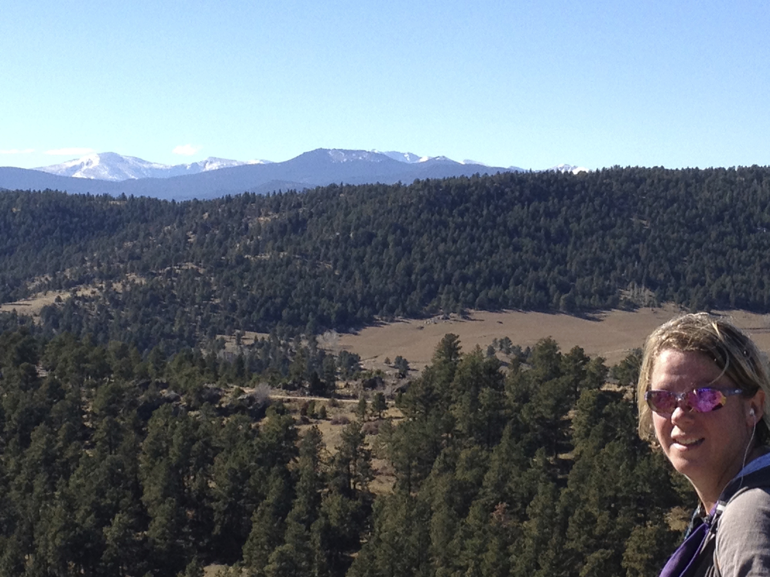
Best view facing West on Green mountain
We actually started out so strong and got a 3rd hike in 4 days done on 12/1/13. We hit Green Mountain in Lakewood CO ( hike details here)and just enjoyed a nice quick 4 mile hike to get a good stretch of our legs after the nice hike we had the day before. It was super nice outside and the trail was pretty busy> which I think is normal for the weekend. I have started to notice something bizarre about this parking lot… the bikers, and there are a lot of them, totally don’t care about getting hit by the cars coming in/going out of the parking lot or hitting the hikers/joggers that are trying to make their way to and from the trail. They just ride around the parking oblivious to anyone else using the park. It’s completely annoying, especially when you are trying to pull out but one strange biker just keeps doing little loops right behind your car…. or get into a spot while one zooms in front of you. Outside of parking lot stress, the hike itself was lovely!
Close up of Evans on Green Mt.Best view East at Green MountainThe best view West At Green Mt.
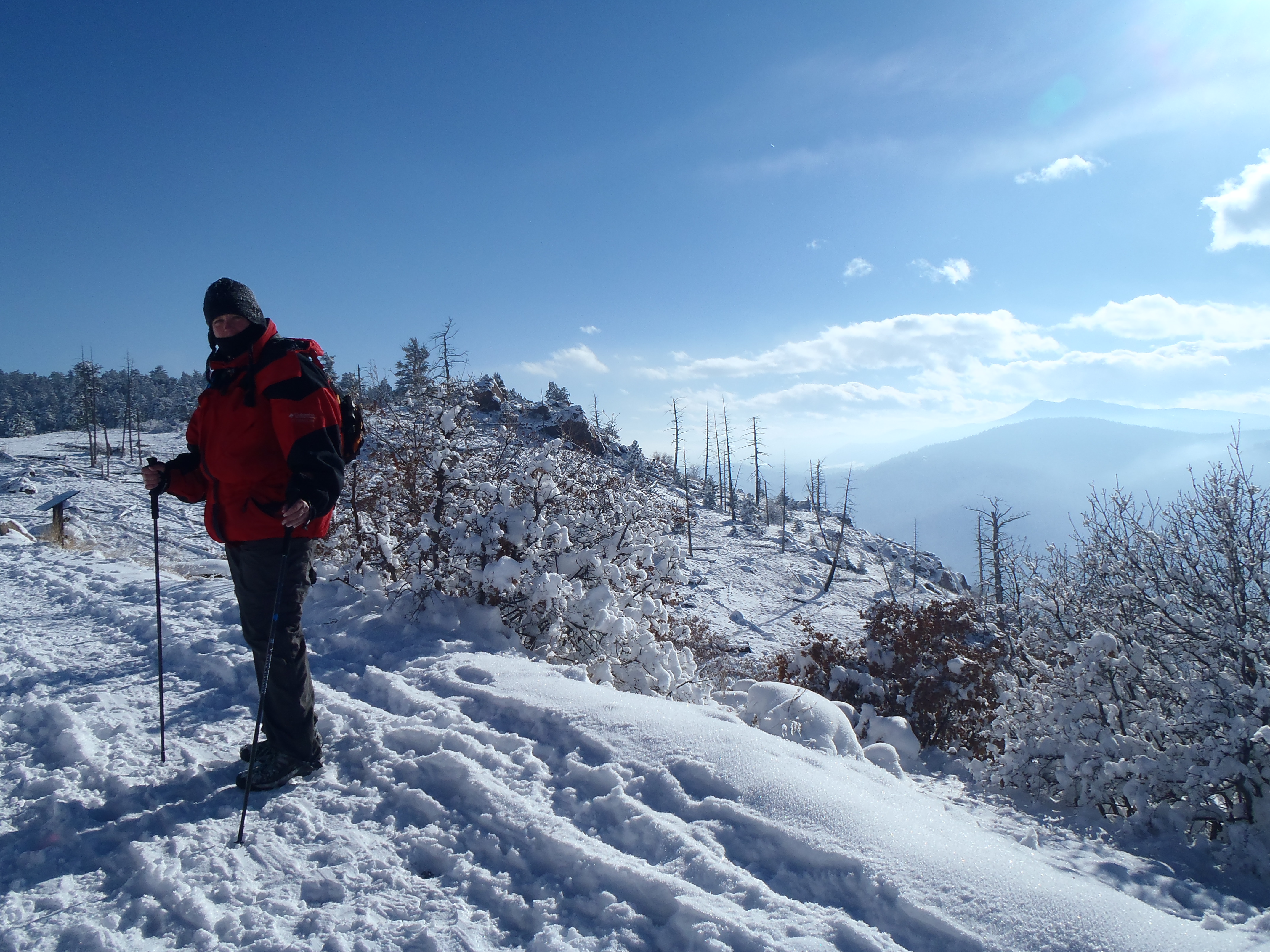
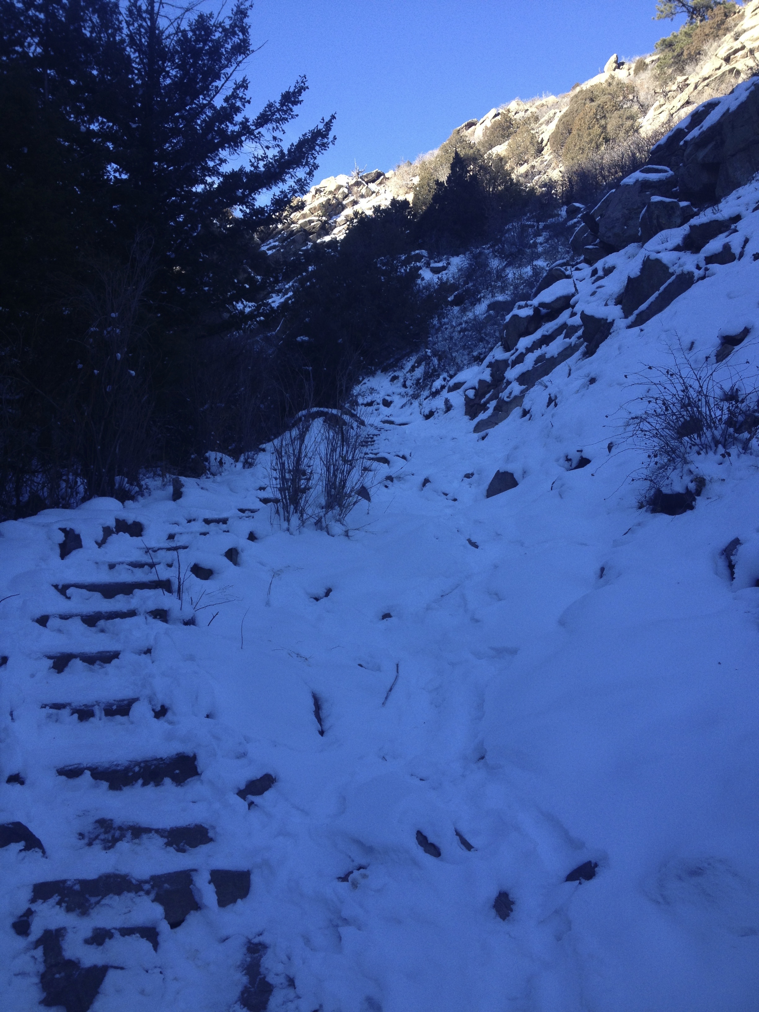
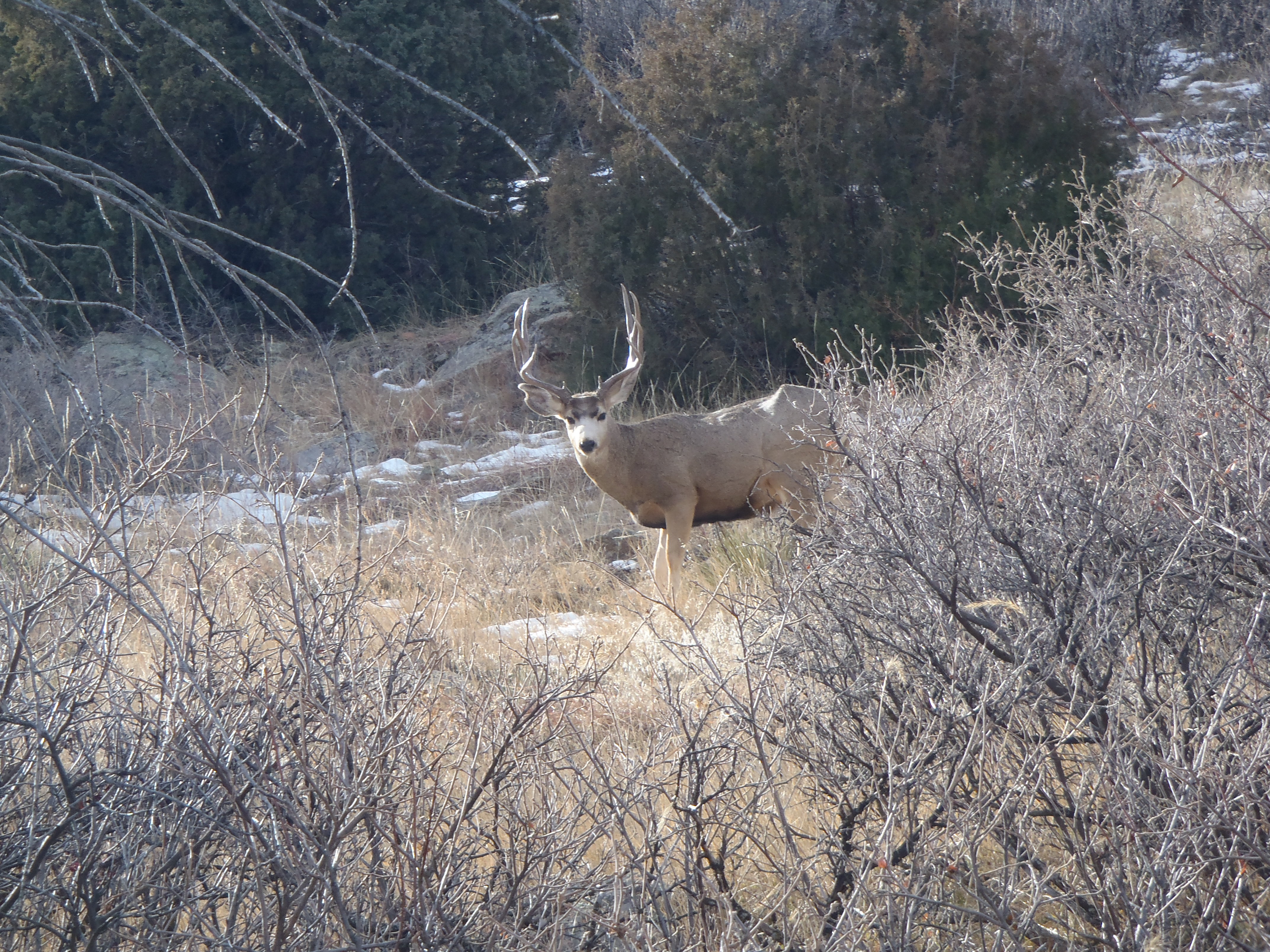
That first week of December was almost record cold in Colorado and on Saturday 12/7 the high was a hopeful 4 degrees. Knowing that I would get limited opportunity to hike this month, we bundled up and went somewhere close but challenging – Mt. Falcon. We had received some snow a few days before with all the freezing temperatures and knew that the window to hike comfortably with sun was limited. We actually started at 10AM and took a little over 4 hours to just go the normal 8.5 miles up and down the Castle view trail. The snow and cold really impacted our usual pace. It was so cold in fact that at one point( even though we would clear our water tubes after every drink) we had to melt our tubes with my freaky hot hands…. don’t ask I barely passed pie making in culinary school because of them(one of those blessings/curse things). We had almost the whole trail to ourselves with some cheeky deer for company . There was about a foot of snow on the trail in the beginning and it got deeper as we went higher, which is where we actually saw the most people, like 6 total…all day. There were a couple of people snowshoeing, something I haven’t done yet and I was fascinated but also a little confused because the snow didn’t seem all that deep. I am so renting some soon so I can try it out! Overall it was a tough day to hike but still felt great getting out, even if it did take me a day or so to warm back up.
Looking icy cold when we start at Mt. Falcon – my car said it was -2Yep coldIn the shade on the way up and I am bundledClimbing up in the cold and beautyGood Company on the trailI am both frosted and melting the ice in my water tube with my freaky hot hands
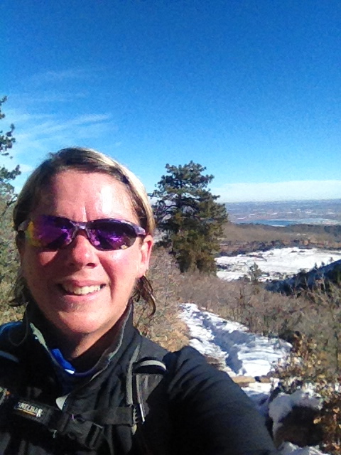
My birthday gift to myself was a new tattoo… so I planned on taking the day off before I got said tattoo to get my last hike in for a couple of weeks. I got to hike solo for the first time ever and I have to say I didn’t hate it. It was interesting to see how I drove myself without anyone else around motivating or inspiring me. I went to my favorite standby Deer creek canyon( hike details here) I didn’t go as fast as I might have other times but I wasn’t a slacker either, I just did 6.8 miles in around 2.5 hours. The day was beautiful but the snow and ice were annoying, fortunately I did have traction devices for my shoes(even though it took me 20 minutes to get them on without my usual assistance) that helped me keep a nice pace. I also just had a great attitude, I mean what a better way to start a long weekend then hiking? Oh and my new tattoo…. AWESOME!!! I mean seriously my tattoo artist rocks! If you find yourself in Colorado and want an excellent tattoo see Piotr at Godspeed he is amazing!!! The other huge impact to my attitude…. the night before my girlfriends surprised me and whisked me away in a limo for a night on the town to celebrate my 40th birthday. It really brought things in perspective for me and just helped me appreciate the wonderful life I have. Thank you Ladies, you have made my 40th year in life start out better than perfect!!!
Climbing up Plymouth Creek Trail in snow and iceAwesome views at Deer creekA poor selfie of myself on Deer creekMy Super Awesome new tattoo for turning 40
After 2 weeks of no hiking while my super awesome tattoo healed( so worth it), this morning I was anxious to get out and get some miles under my feet. But not just that, I wanted to try out my new prize, a true backpack. Yep my Christmas elves(or cats) picked out this bad boy for me…. them or the great staff at REI, it’s a toss-up. Either way, my new challenge for 2014, outside of losing the rest of my weight, is to try for my first backpacking trip. This morning we decided that NightHawk Trail at Hall Ranch ( hike details here) was a perfect place to get a feel for my new pack and it was an easier trail that had the challenge of distance if not total altitude gain. I have to say the hike itself was pretty awesome with lots of deer all over the place as company, wearing the new pack not so much. It was awkward and I hardly had anything more than water in it. Apparently it is like learning to hike a whole different way, I swayed when I didn’t want to, my balance was off and my knees and hips were throwing around curses I haven’t used myself….. EVER. At one point it felt like my ankles were hand cuffed! I still love this trail and know I will do it again and again, maybe even when the sun it out one time since we have never had it as a hiking partner on this trail…. but now I am sitting here with angry hips and knees thinking about when I can get out again with my new pack. Life it pretty awesome in Colorado!
View at the start of Hall Ranch with a little sunBest non animal view of the dayWhat… you think I can’t see you?I totally see youThe New Backpack.. Empty and lame but with great hopes
Pine Lake >Buck Gulch>Skipper Trail> Strawberry Jack Trail> Park VIew Trail
Lowest Elevation: 6800Ft
Highest Elevation: 7900 Ft( although total elevation gain was closer to 1300+ Ft)
Trail Length: 7-8 miles, it took us under 3 hours to complete
Trail Uses: Hiker, Biker & Horses
Degree of difficulty: Easy to moderate
Fees: None
Bathrooms: At the parking lot only
Pets: Yes on Leash only
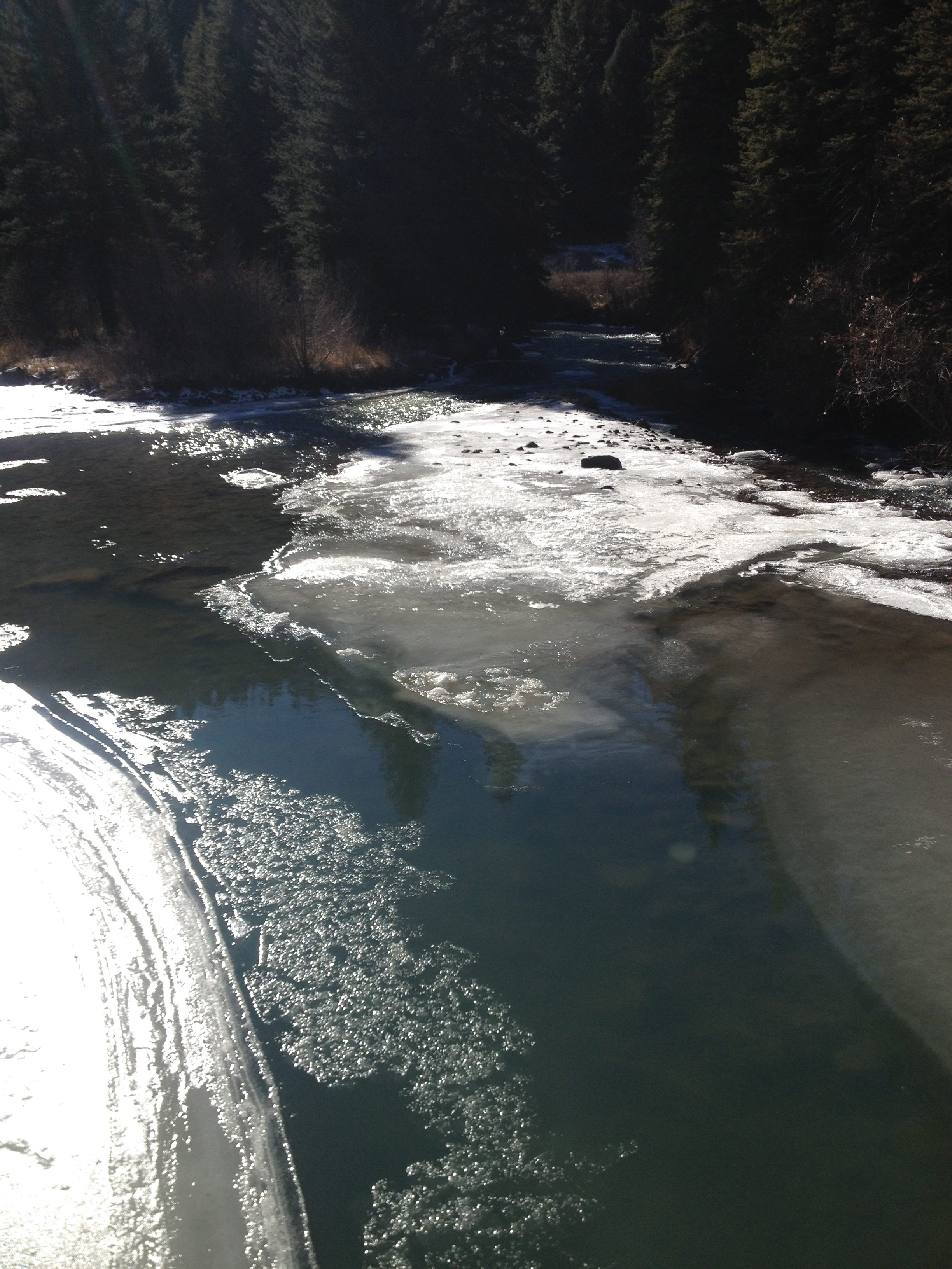
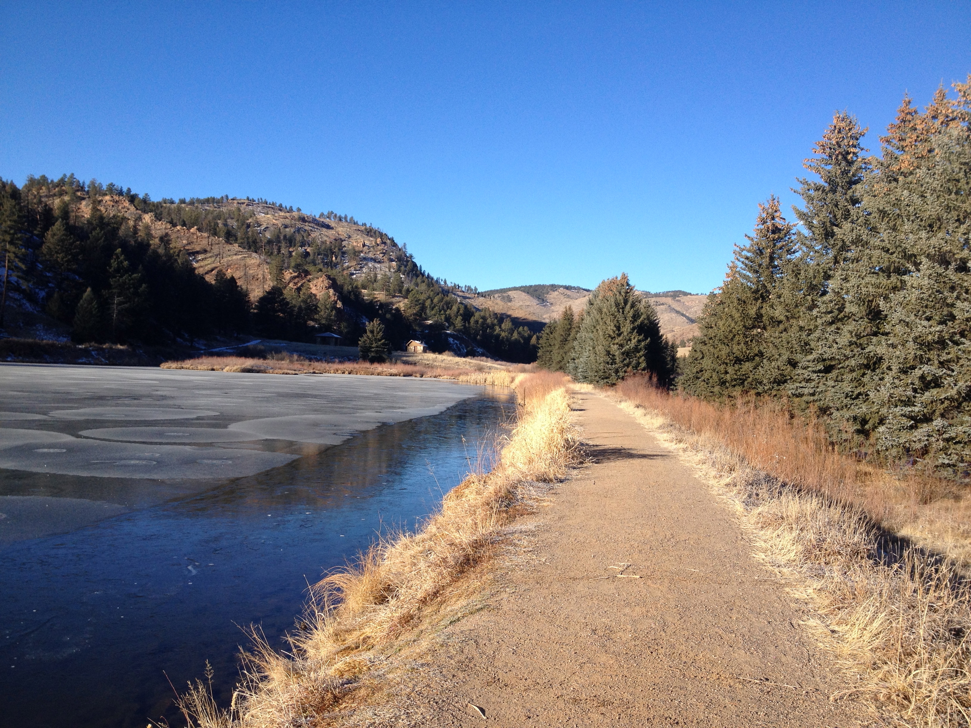
There is so much to see still of Colorado and for a while I wasn’t challenging myself to find that more but Staunton Park renewed that discovery lust in me again. I also wanted to make sure that whatever trail we did left us with enough energy to hike again on Sunday. Pine Valley Ranch seemed perfect! It is a small park mileage wise but right on the edge of the Pike National Forest, which makes the possibilities very expansive.
When I got there, I was pretty amazed by the 3 huge parking lots on the way to all the trailheads and main park. It also made me wonder how crazy busy this place might be in spring, summer & fall. On this morning it was freaky cold and so we had it mostly to ourselves. It was in fact colder then expected and we almost shy of enough clothing to stay warm.
Crossing over the beautiful river with its ice and flow.
Once we crossed over the river we had the option of walking along the shaded side of the Lake or the sunny side of the lake, given we were crazy cold it was the sunny side for us.
We didn’t walk along Pine Lake long before we hit the trail break for Buck Gulch Trail.
Buck Gulch Trailhead
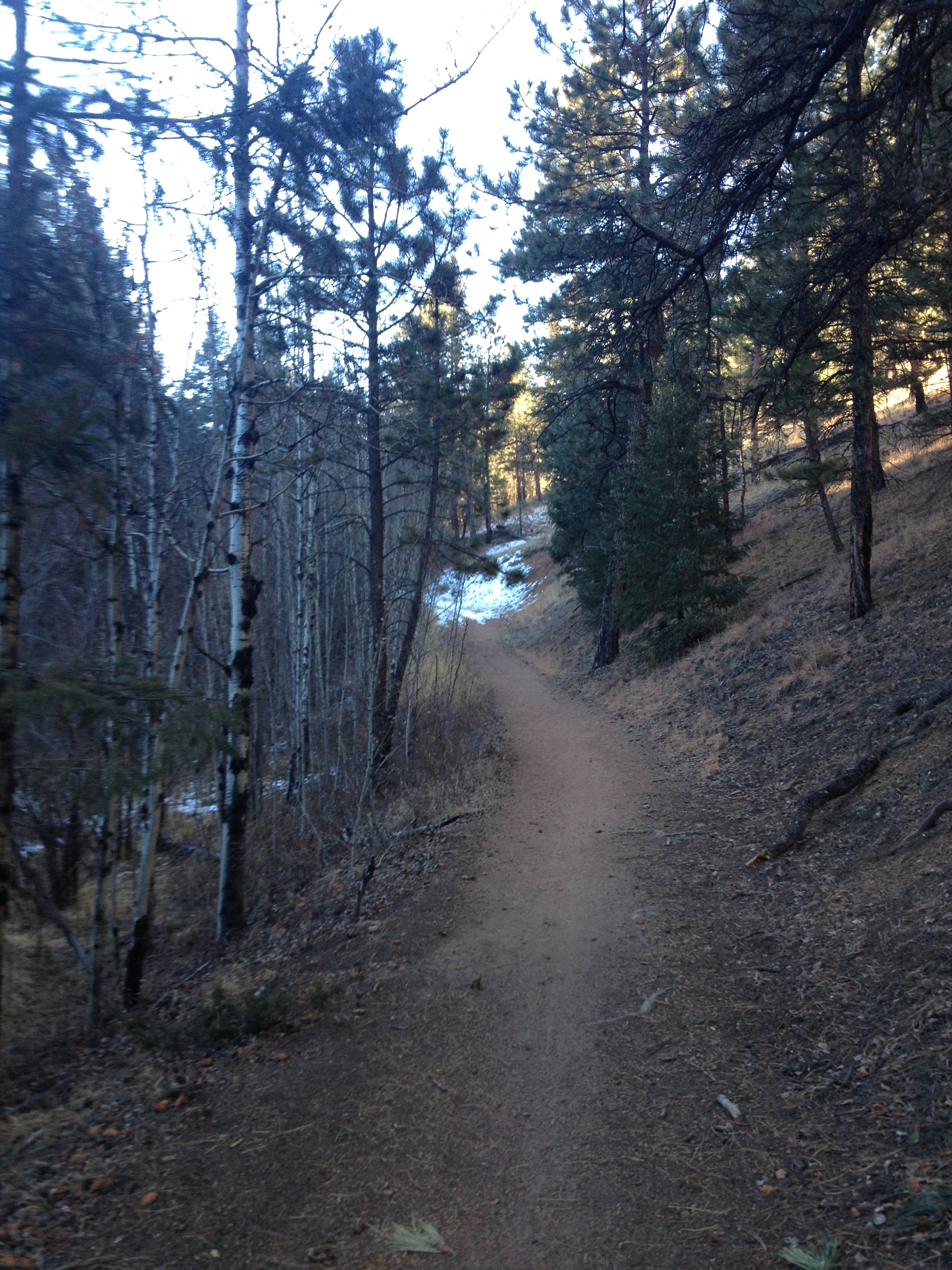
From here we started climbing and went into shade and I will admit I was thankful for the climbing just to warm up everything. Normally we are over prepared, but since I broke my day pack we have been cutting it close this was the hardest hike of them all with so little back up available. But the day itself was just lovely and as it warmed up we were dressed perfectly. This part of the trail had the most climbing of the entire hike but it wasn’t that steep.
Buck Gulch TrailEntering Pike National Forest via Buck Gulch Trail
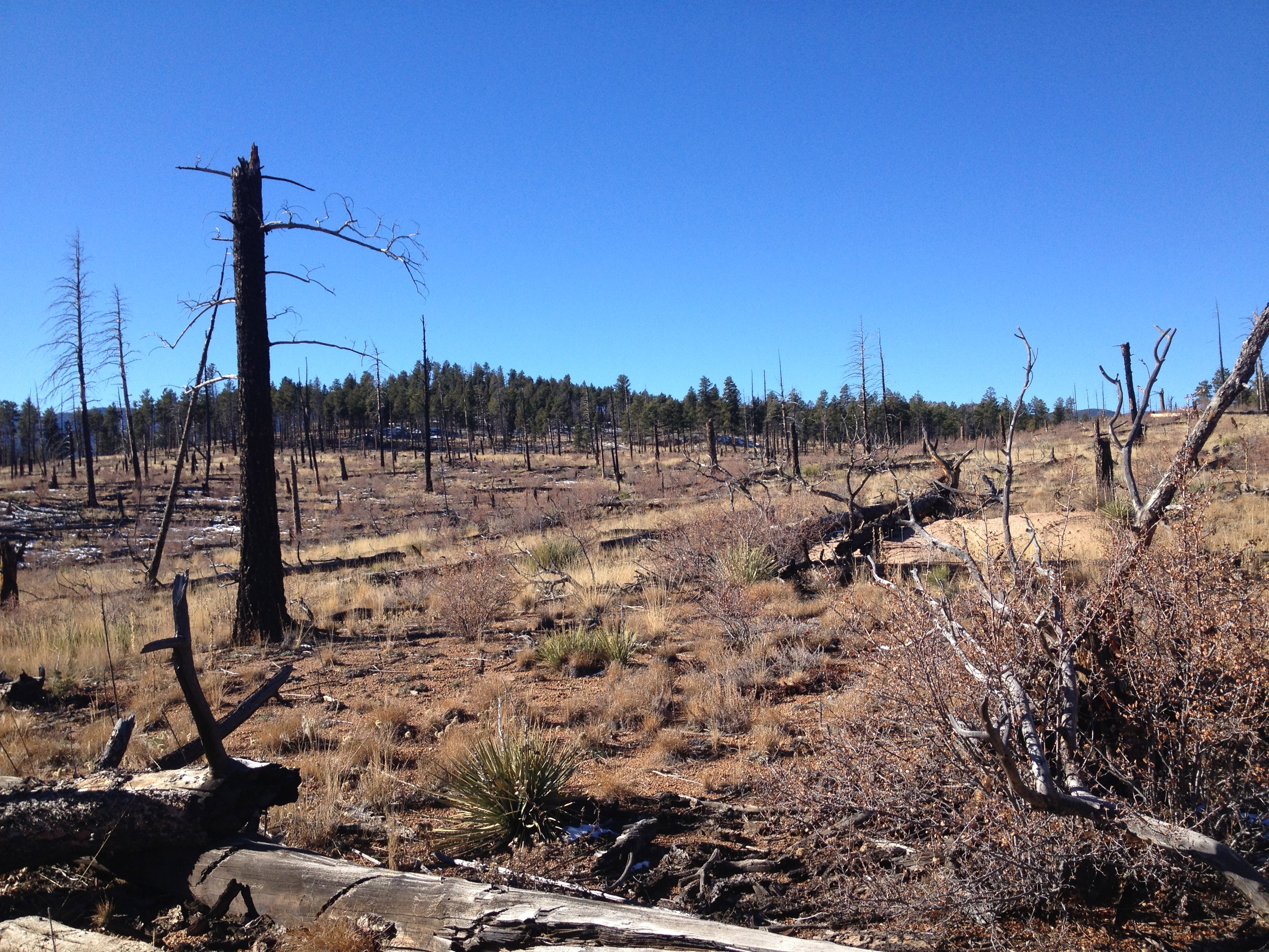
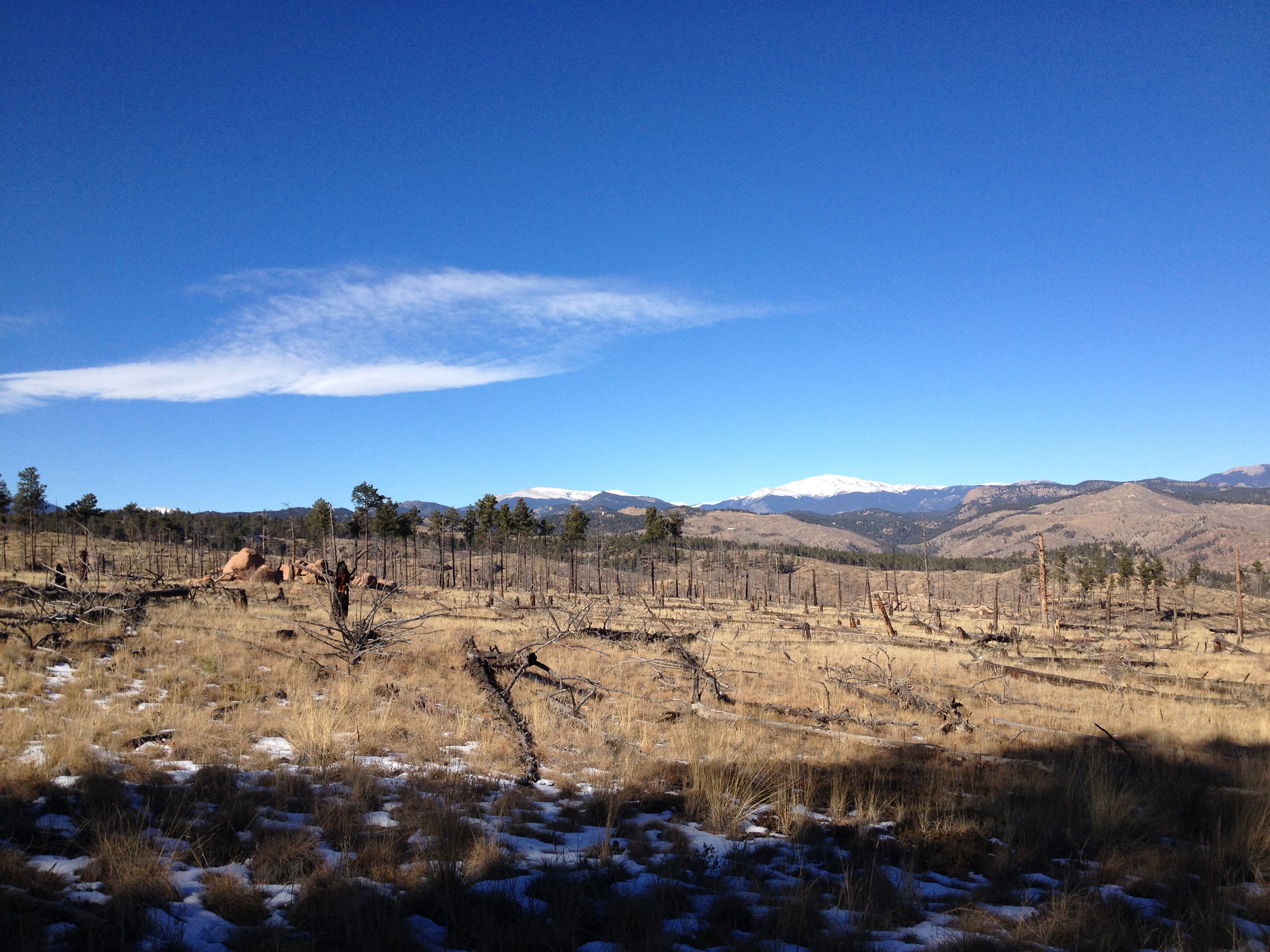
It wasn’t long before we left the Jefferson County open space and entered Pike National Forest. With that change over we also came upon an old burn area from the High Meadows Fire in 2000. I am becoming to really enjoy these areas, not for the devastation the fire causes but for the beauty it leaves behind. It is a different kind of beauty for sure, but it tells a story of struggle, desperation, loss and triumph. It forced me to reflect and identify that feeling while I hiked through and along the remains, it reminded me of how an old battleground would feel or a cemetery. For the record, I am totally one of those people that loves to walk through cemeteries, the older the better and more majestic. I guess it is no surprise I am falling in love with recovering burn areas.
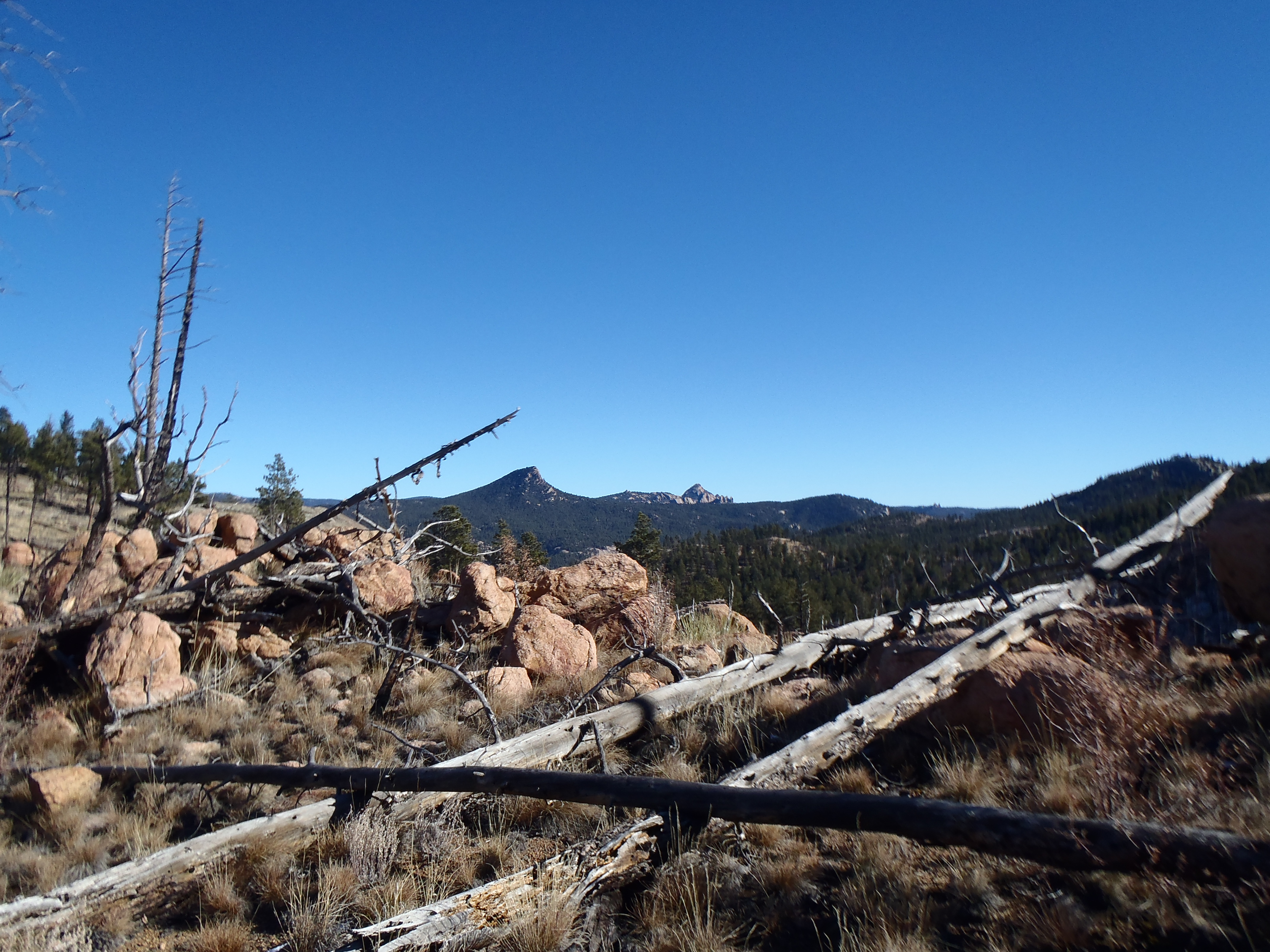
We were on the Buck Gulch trail for just over 2 miles, I understand it is a popular biking route that takes you into the Lost Creek Wilderness for a 11-13 mile route with lots of elevation gain. I have to tell you I totally want to hike it some time. In fact the only other people we saw that day was a huge group of bikers doing that route. The downside of the whole day…. there were some people shooting the whole time we were in the National forest and it felt like they were a little too close and/or moving in our direction. It was disconcerting and made me paranoid my colors weren’t bright or unnatural enough to point to a human AKA not a target.
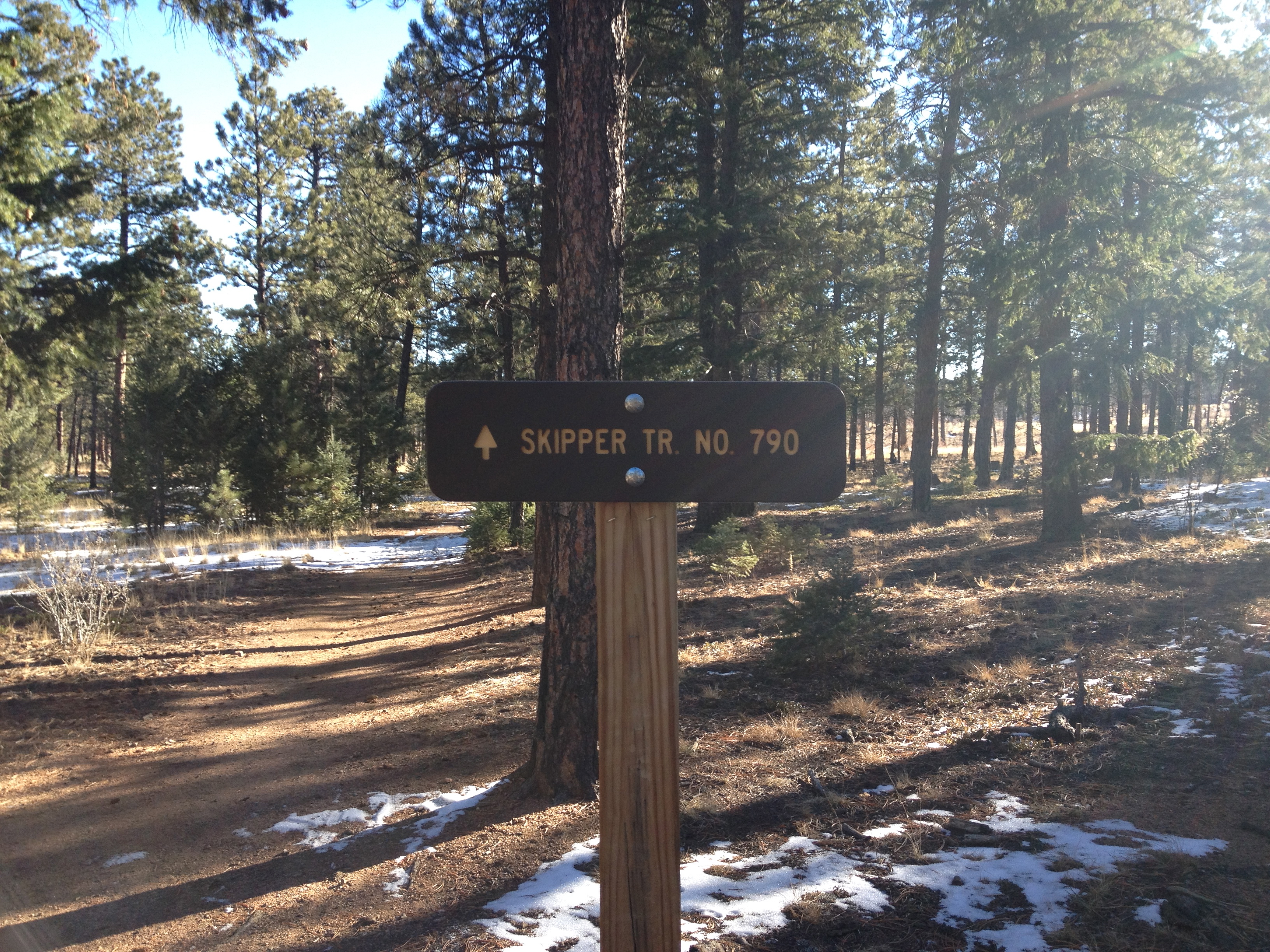
From here we took the Skipper trail to the Strawberry Jack Trail. This was the one of the easier parts of the hike, with slight ups and downs but nothing too aggressive. The views were lovely, if not breath taking and made me want to come and explore more.
Skipper Trail Just outside of Lost Creek WildernessStrawberry Jack Trail HeadSkipper trail conditions to Strawberry Jack
Outside of the lake in the beginning, there isn’t a ton of water on the hike but there was this one crossing and I am afraid I forgot if it was on Skipper or Strawberry Jack but somewhere along those trails.
Strawberry Jack Tail conditions
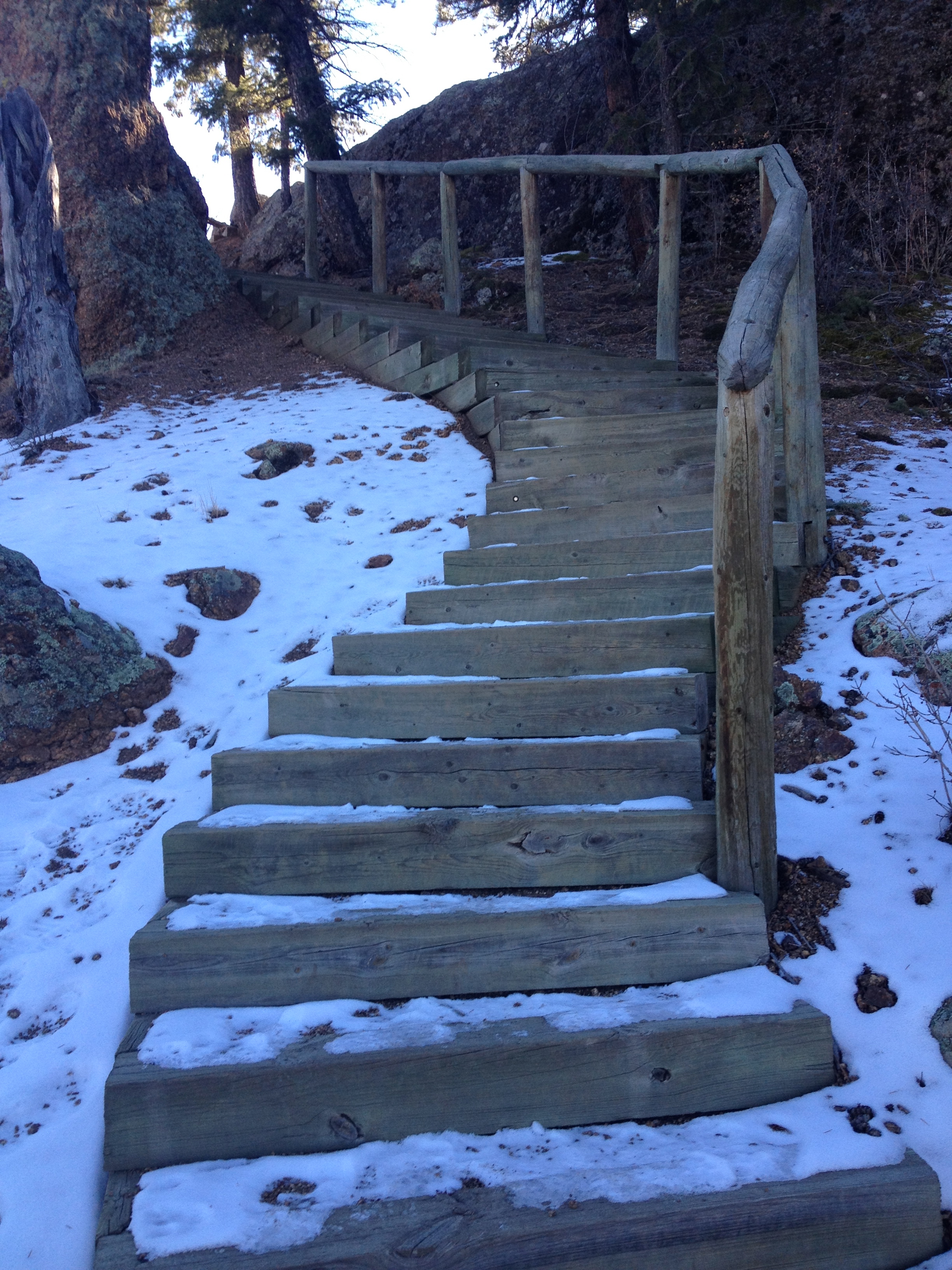
We made a good loop hike by taking the Park View Trail back to Pine Lake, it was incredibly beautiful coming down with the lake in view.
Park View Trail Break
The lower half of this section is mostly stairs back to the lake.
Stairs coming downThe Bottom of Park view trail on the other side of Pine Lake
Overall, this is a nice easy hike with lots of options to make it harder or not depending on your mood. On this particular day for me, a new issue had decided to present itself- interesting joint pain in my hips. It has forced me to slow down a little, which in turn has effected everything. Regardless, for this hike I was glad that it was a shorter and easier hike when the end came along. As my second hike in 3 days, I was feeling better than I thought I might but a little worried about my hip action. I cannot wait to get out here again, likely in the summer and challenge myself by doing the full Buck Gulch route for a tough day hike. I hope if you find yourself out this way that you check this one out, it is so worth it! After the directions a few favorites pictures from the day.
Work has been so crazy and with such craziness means not going home to Chicago for Thanksgiving. I also don’t get the Friday after Thanksgiving off so no crazy Thanksgiving party or over indulging for us! I decided that a morning hike would make the day perfect with a nice dinner to follow. I also thought something easier would allow us to hike twice over the fast approaching weekend.
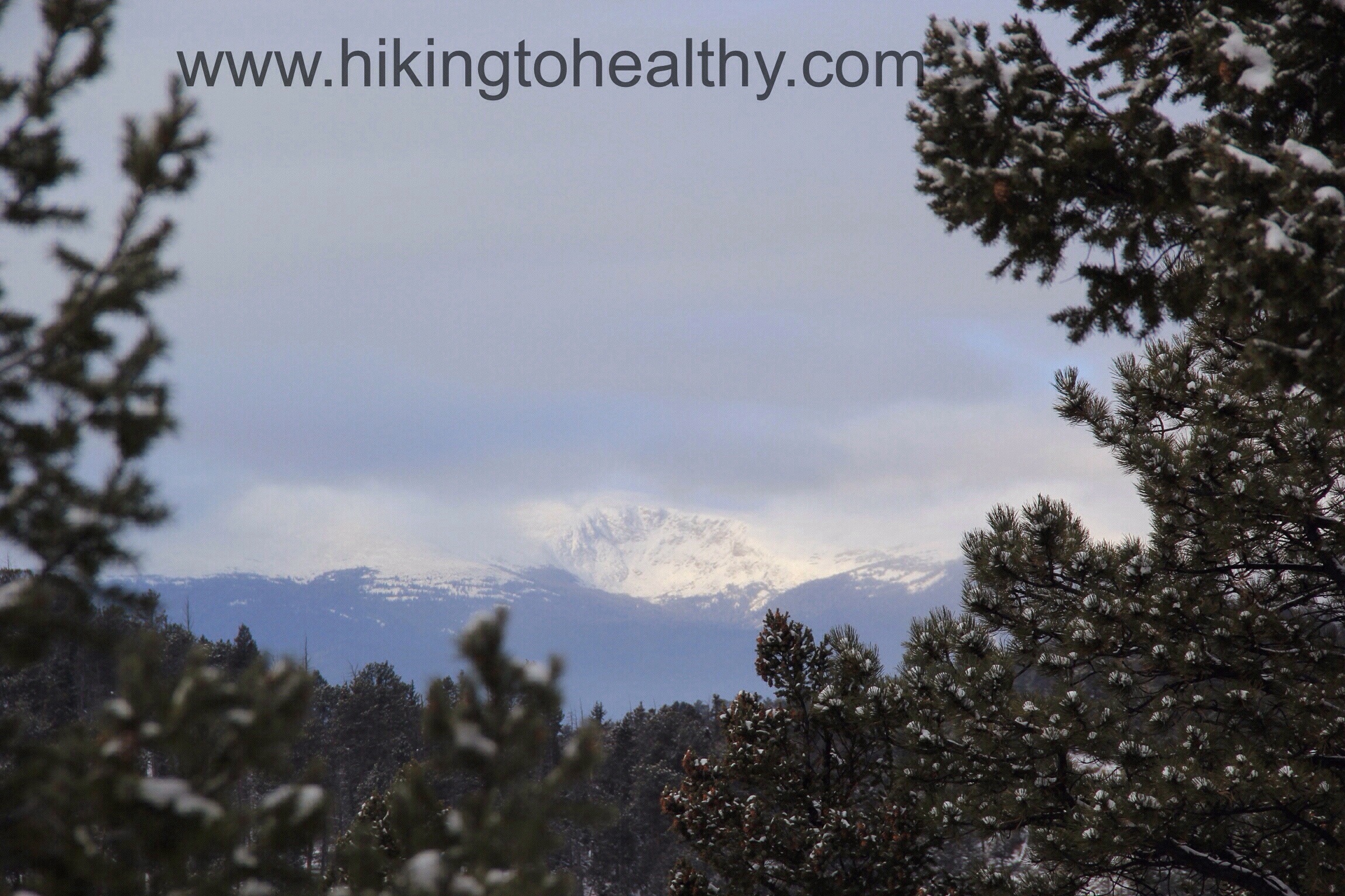
View from Carpenters Peak facing West.
With just one day off, I wanted to stay close to home so that I could relax and cook the rest of the day. We also bought an annual state park pass a few days before and so wanted to start getting our moneys worth. We went to Roxborough state Park and hit 2 trails, Caprenters peak ( Hike details here) and the South rim hike ( Hike Details here) to get a nice quick 8.7 mile hike. We finished in just under 3 hours and were surprised at how many people had the same idea as us. Leave it to Coloradans to make sure they keep Thanksgiving healthy!
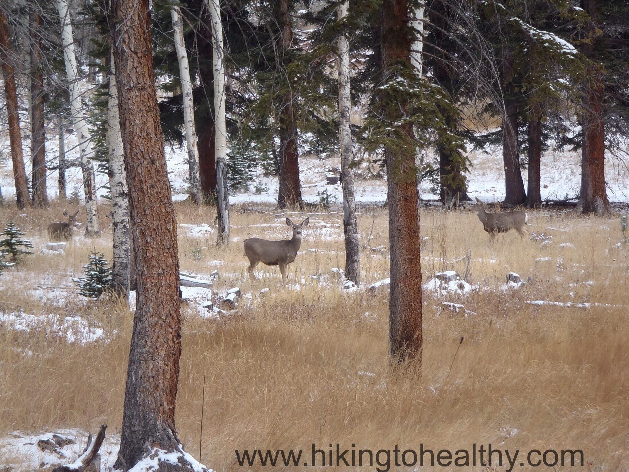
The day was completely perfect with a little snow on the trail and the sun shining bright. We were lucky enough to see these 3 beauties right on the side of the trail, it was pretty special!
3 deer just on the side of the trail.
I will never tire of this park, every time we are there regardless of the weather it is stunning! This particular day was no different… if you haven’t found your way out there yet, check it out, totally worth the $7 day fee!
View from the South Rim HikeView From Carpenters Peak East.
Highest Elevation: 9240 Ft ( I think total we got around 1800+ ft of elevation gain with the ups and downs)
Trail Length: Roughly 10 miles
Trail Uses: Most of the trails were hiking, biking & Horses Scout Line is hiking only
Degree of Difficulty: Most trails themselves are easy but doing them all together is moderate or difficult mostly
Fees: $7 a day OR $70 for the state park annual pass…. on this day we bought the pass since ours expired
Bathrooms: Yes at each parking area there are vault toilets or Port-o-potties
Pets: Yes Dogs On leash only
Work has been crazy and getting more crazy everyday, at the time I picked this trail I had not had even a minute the entire week to research hikes. It was at 10PM that Friday night that I saw Mark and Sandy over a buencamino2014.wordpress.com talking about their hike at Staunton State park that morning. They have been talking about the merits of this state park since it opened this summer while Mark worked there to get it ready for opening. One thing I love about Colorado is that when a new state park opens there is as much excitement about it or more, as there was when Ikea opened. I heard about the lines to get in the park all summer long and just didn’t want to deal with the crowds . On a pretty cold Saturday with potentially no sun, it was the perfect time to check it out! Mark & Sandy were nice enough to suggest a couple of routes that would get us around 10 miles and some of the best views in Park. Honestly I would never had picked this route if not for them so thank you Mark & Sandy!
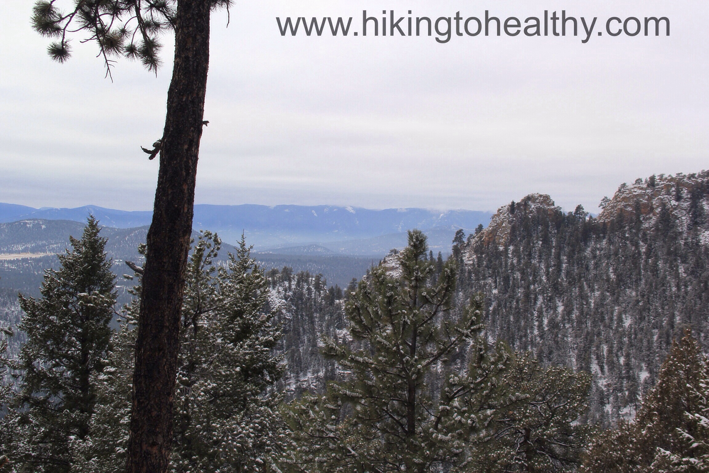
This particular view was like a beacon of beauty, all lit up from the sun above the clouds.
We started the hike via Staunton Ranch trail, which also happens to start at the Mason Creek Trailhead. It is a little confusing as you walk up the trail but look up and left, you will see the trailhead:
Starting out
This trail is not tough at all, the path is very well-groomed with a gradual climb as it winds up and around the park. I really like how they have marked the trails in the park, they use the initials of the trail name on a simple iron post. I would say this portion is easy to moderate, moderate mostly because round trip it is a 6.6 mile hike.
Staunton Ranch Trail marker
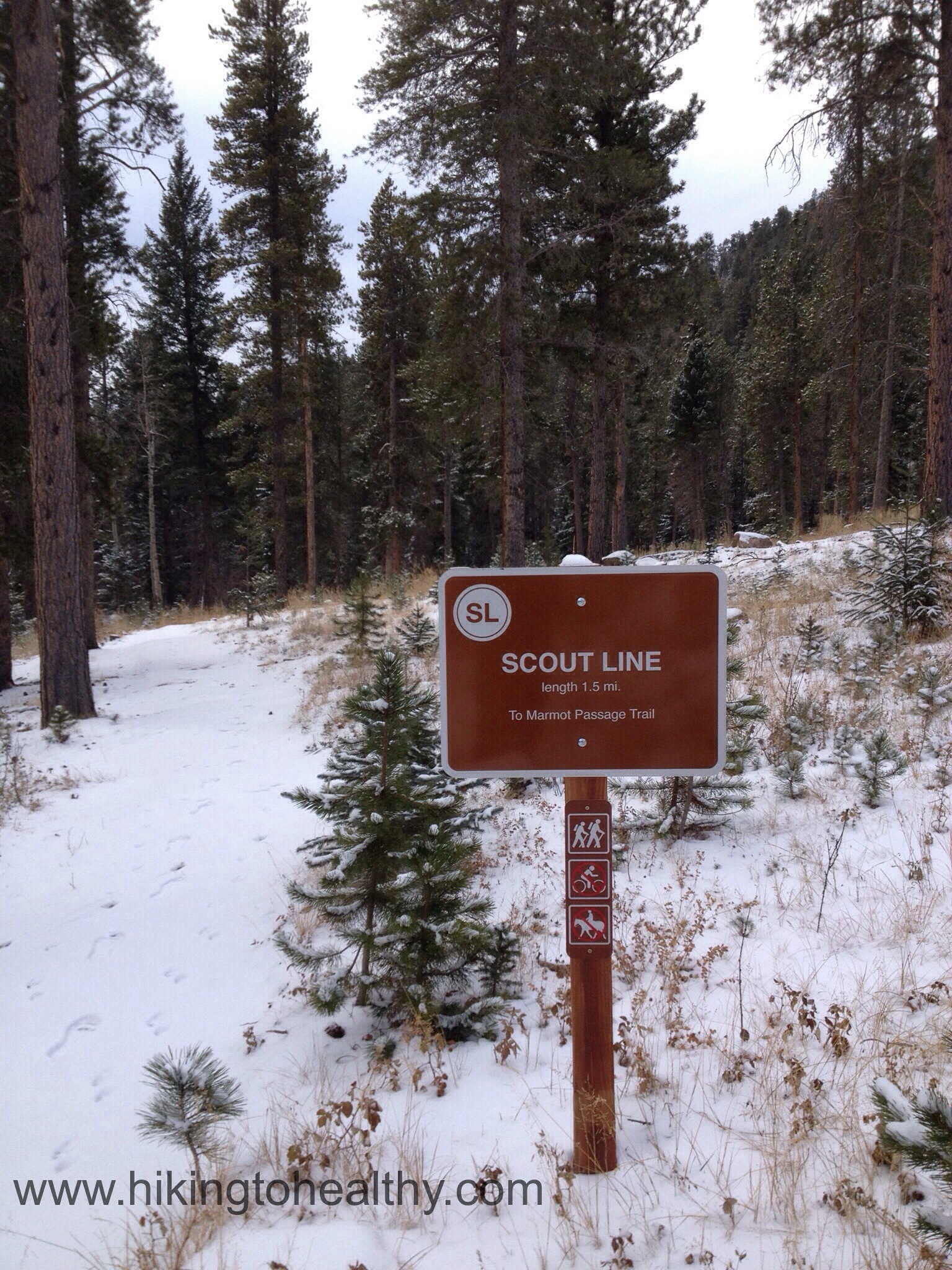
It felt like about 2 miles or just under, when we reached our trail break at the Scout Line Trailhead, also very well-marked where the 3 trails intersect and the signs have the mileage to the next trail break – I loved it!
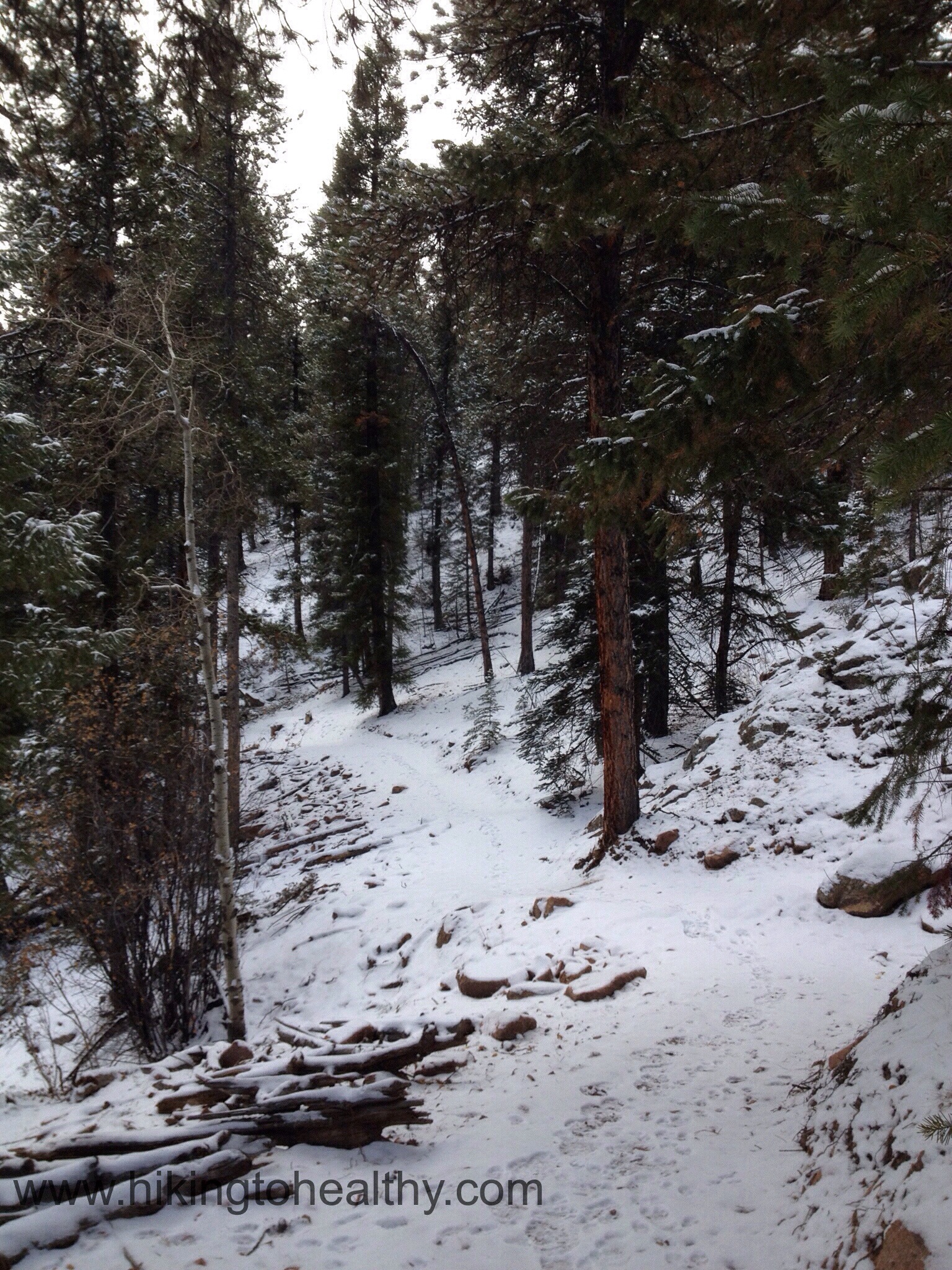
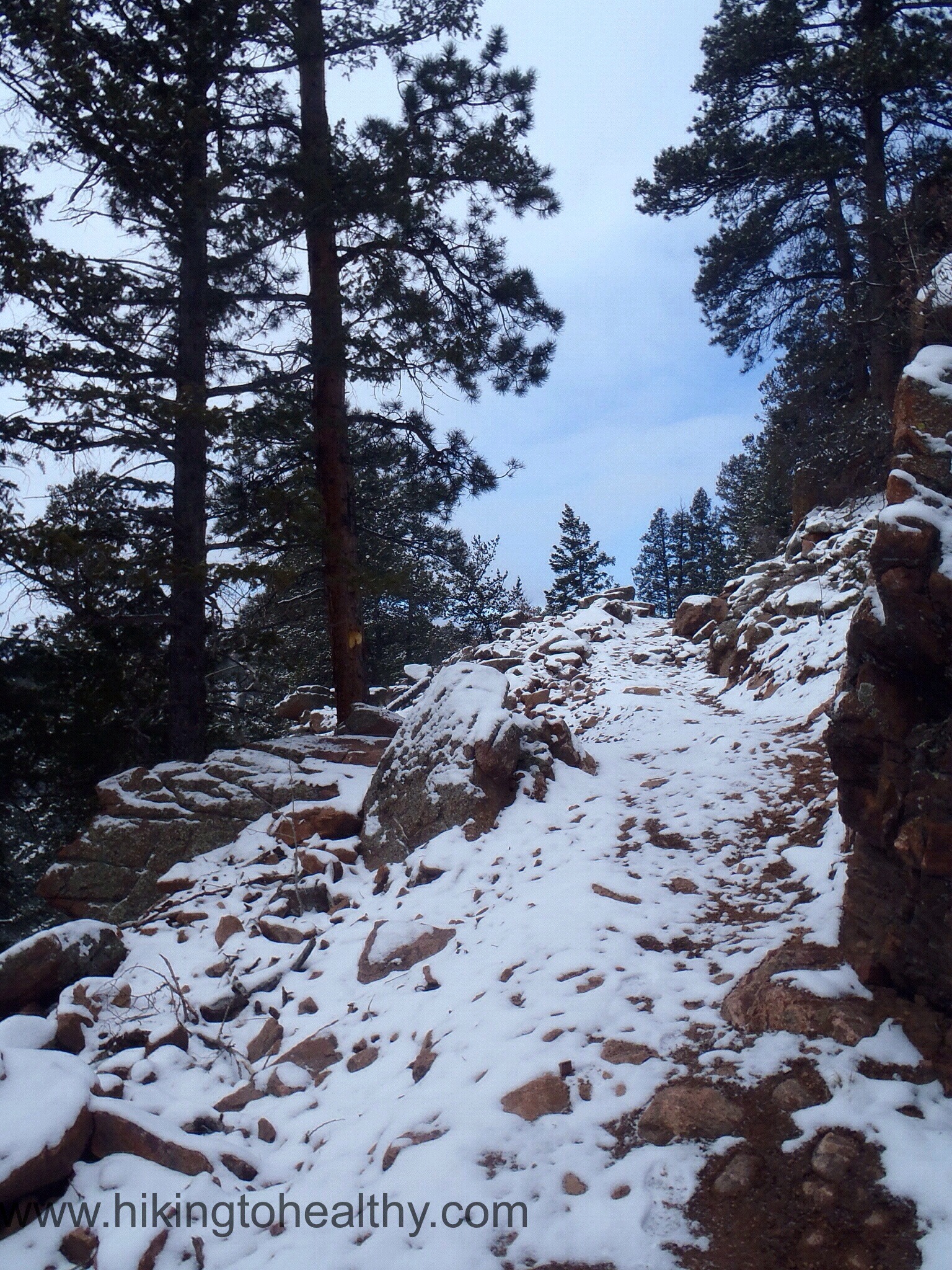
This trail is all single track and starts a pretty aggressive climb up to some beautiful bluffs. I have to say this was my favorite section of the hike, the views were amazing and the way they built up the trail using natural resources was actually really beautiful.
A creek crossing right at the trail break starting up Scout LineClimbing up SLuse of rocks as the trail… BeautifulMore Climbing after some stunning viewsOne of the views on SLMe on Scout Line
I have to tell you Scout Line was just gorgeous and reignited that love of discovering a new trail in me. We spent more time then necessary on the trail just taking it all in the were views all over as we hiked along it. As we got closer to the next trail break at Marmot Passage we had this great climb along the mountain.
Another great use of rocks to make the trail workMarmot Passage Trail Head
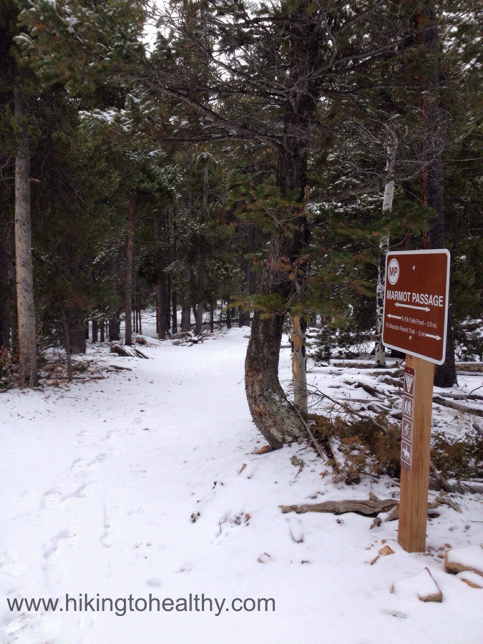
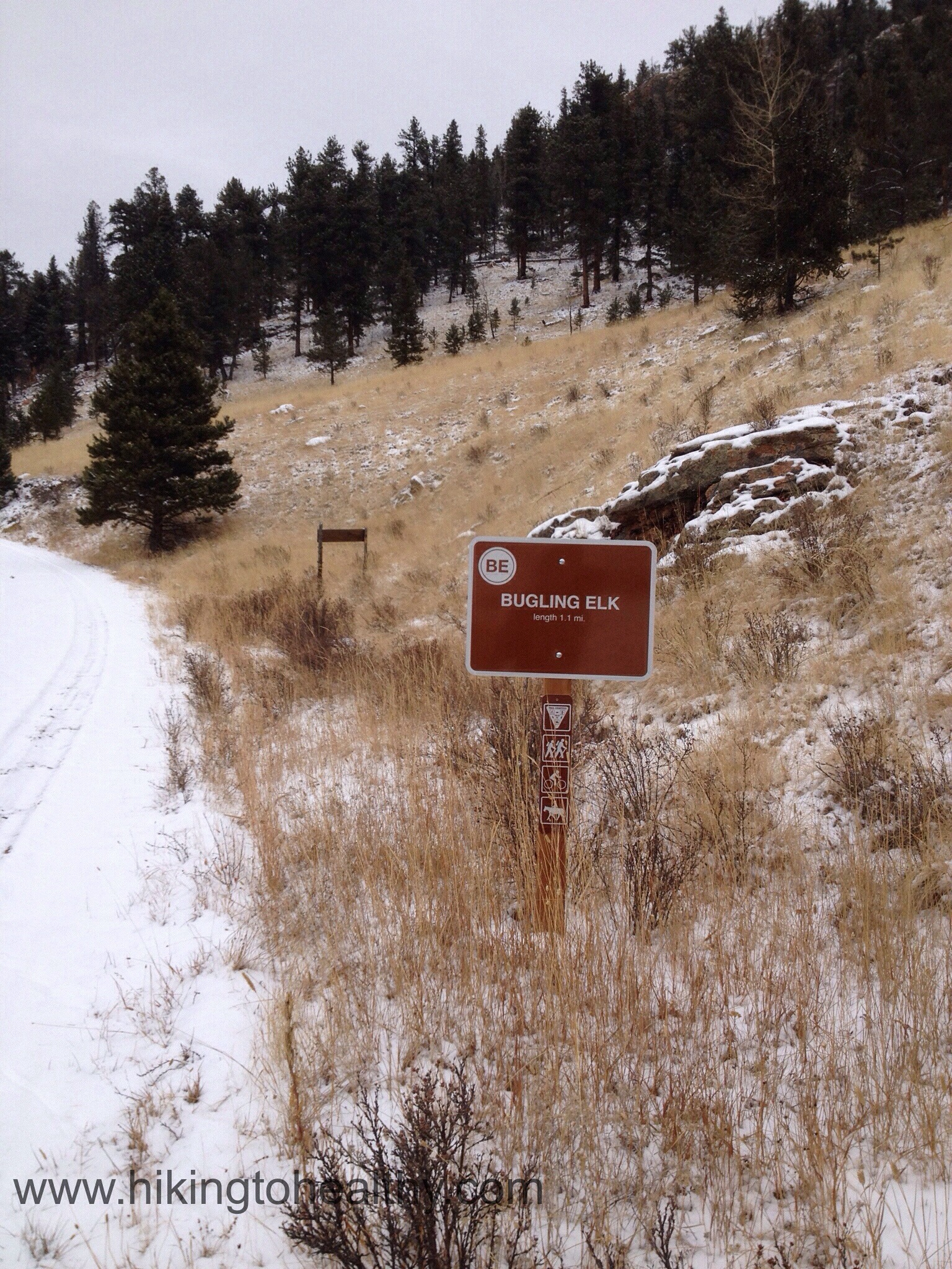
Marmot Passage is an easy trail that does a little climbing and then mostly heads back down. It actually started getting pretty cold while we were on this trail and so we started moving much faster. As we descended to the Elk Falls Pond, the cloud cover really settled in but the pond still looked pretty from above, it could not dampen our excited and joy.
Once down by the pond, finding Bugling Elk trail to head back was very easy and the trail itself is some type of access road very wide and easy to hike:
We climbed up a little and then headed back down to Staunton Ranch Trail.
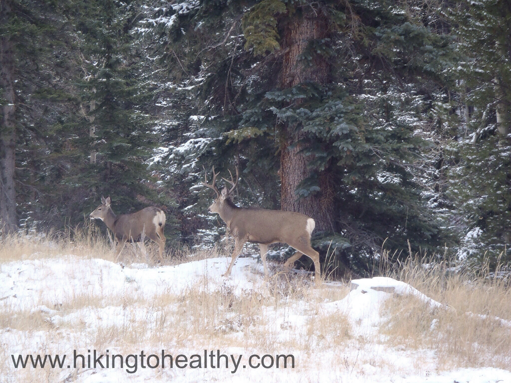
Knowing that we were just 3.3 miles from the end had us in great spirits, discovering this gem for ourselves…. well we were pretty chatty about it all. So chatty in fact we almost missed the herd of deer on our left. Then while taking too many pictures of them cavorting, we found out almost a minute too late that the main buck was on our right rounding up the rest of his herd and he was CLOSE. Honestly I have never been that close to a buck, I would say he was just 5-6 feet away from us and totally unconcerned with what we were doing as he got his last doe back in line.
I have to tell you that this hike was awesome! I am so glad I happened upon Mark and Sandy’s most recent hike post to pick the park and even more thrilled they could give me advice on such short notice! There is so much beauty in this state park and I totally get why there were lines of people waiting to discover it all. Yes the route we took was long but it was crazy beautiful and so worth every step. For approximately 70% of the hike, we had it totally to ourselves which added to its awesomeness . We saw the most traffic on Staunton Ranch trail as we were returning to our car and what we did encounter still wasn’t all that much. Honestly I cannot wait to get back to this State park and see more, I hope you can find your way out here to see it all for yourself! After the directions will some of my favorite pictures from the day.
Directions: Take US Highway 285 south to Shaffers Crossing, about 6 miles west of Conifer. Turn north on Elk Creek Road and follow the signs 1.5 miles to the park entrance
HIghest Elevation: 6804 ft ( 900 Ft Total elevation gain)
Trail Length: I thought 4 miles but we came up short at the summit and then went long…. so we got in 5 miles.
Trail Uses: Hiker and biker
Degree Of Difficulty: Easy to Moderate, although I have heard the Rooney Road start point is a considered a hell climb I don’t think it is that bad.
Bathrooms: Yes: at the parking lot
Pets: Yes on leash only
Fees: None
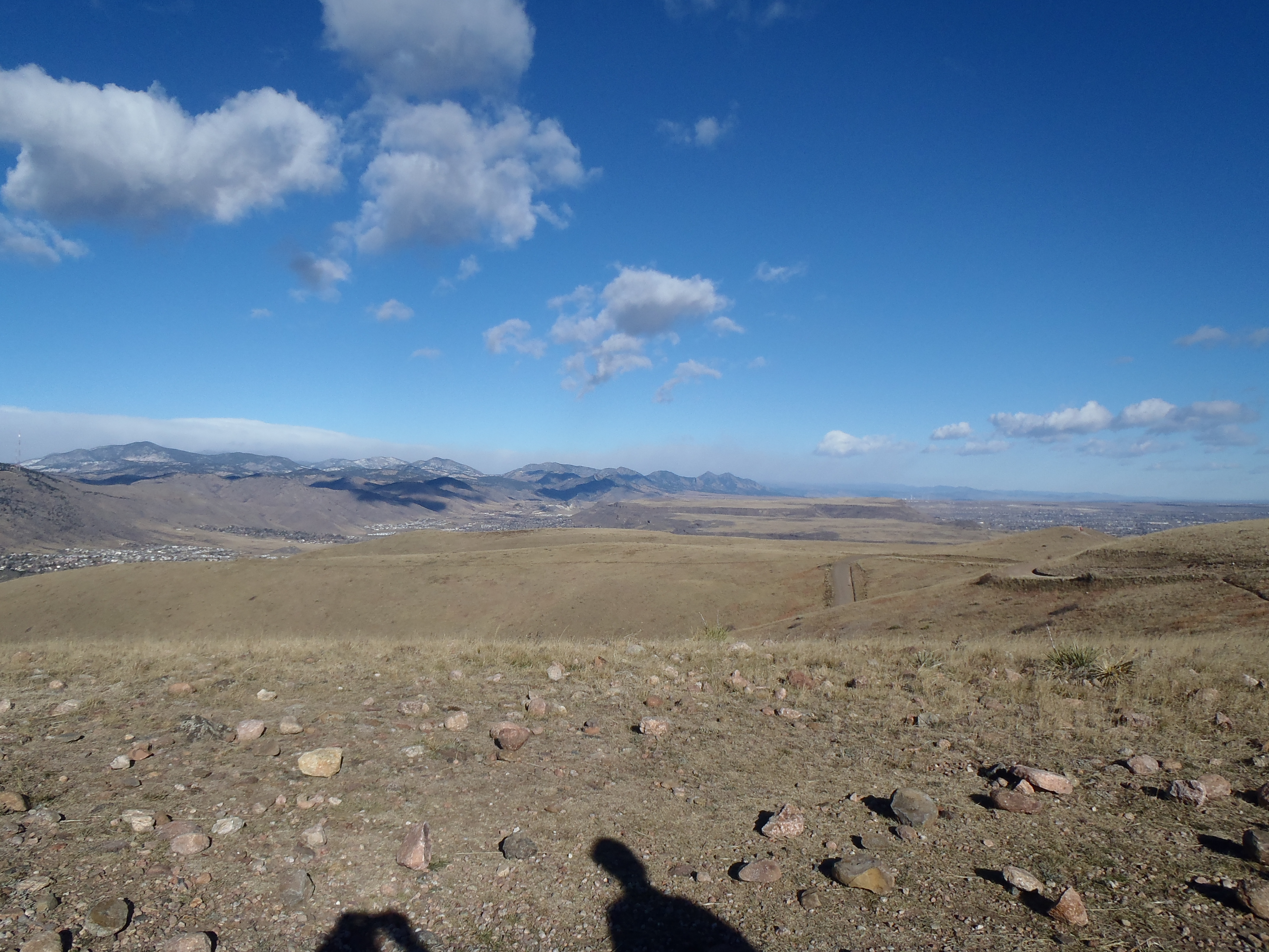
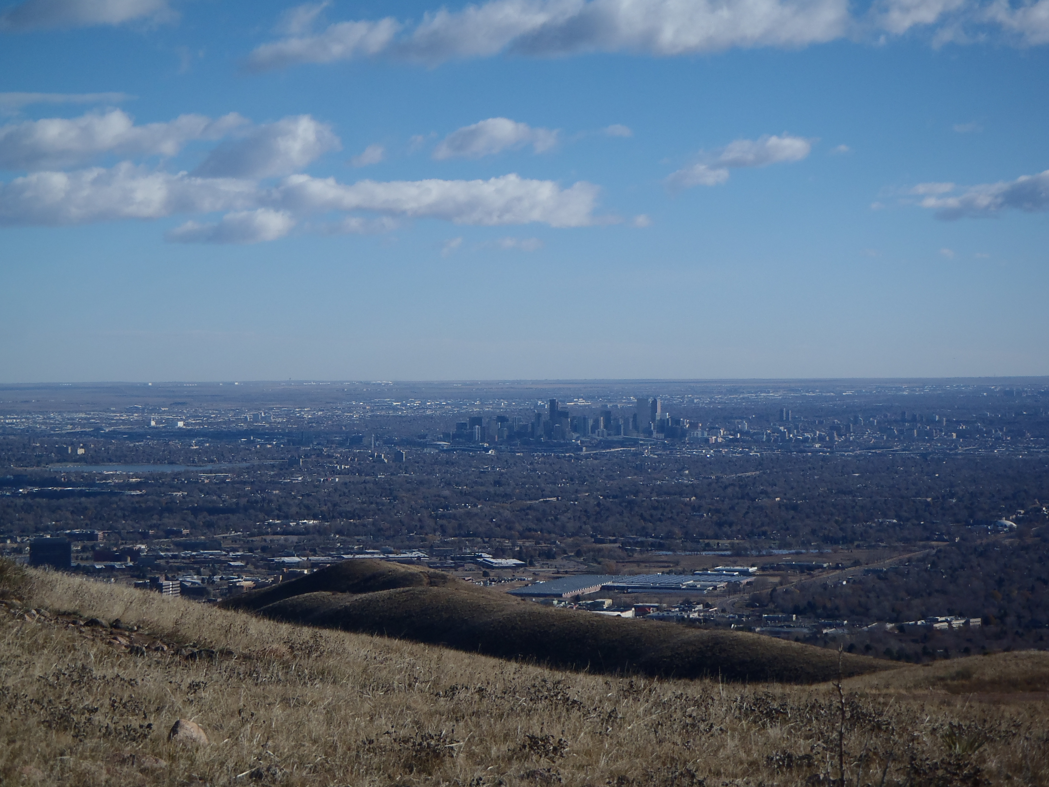
View of Denver from the summit of Green Mountain
I have come across meet up hikes a lot while researching for hikes we might attempt. A few months ago I realized I needed to spread out, meet new people and learn more about hikes in Colorado. So I signed up for Meet up… have you ever seen meet up or taken part of an event by them? I am strangely curious.
There is one group that is a hiking after work group and I thought, why not? I also asked my girlfriend Lisa if she wanted to try meet up and to submit for this hike….. we both got in. Come hiking evening, Lisa had a lot going against her and didn’t make it very far, while I went on to finish with lots of curiosity about what this trail looked like during the day. On the way home we were chatting about the hike and she really wanted to beat it, since we had a girls hike coming up I figured why not.
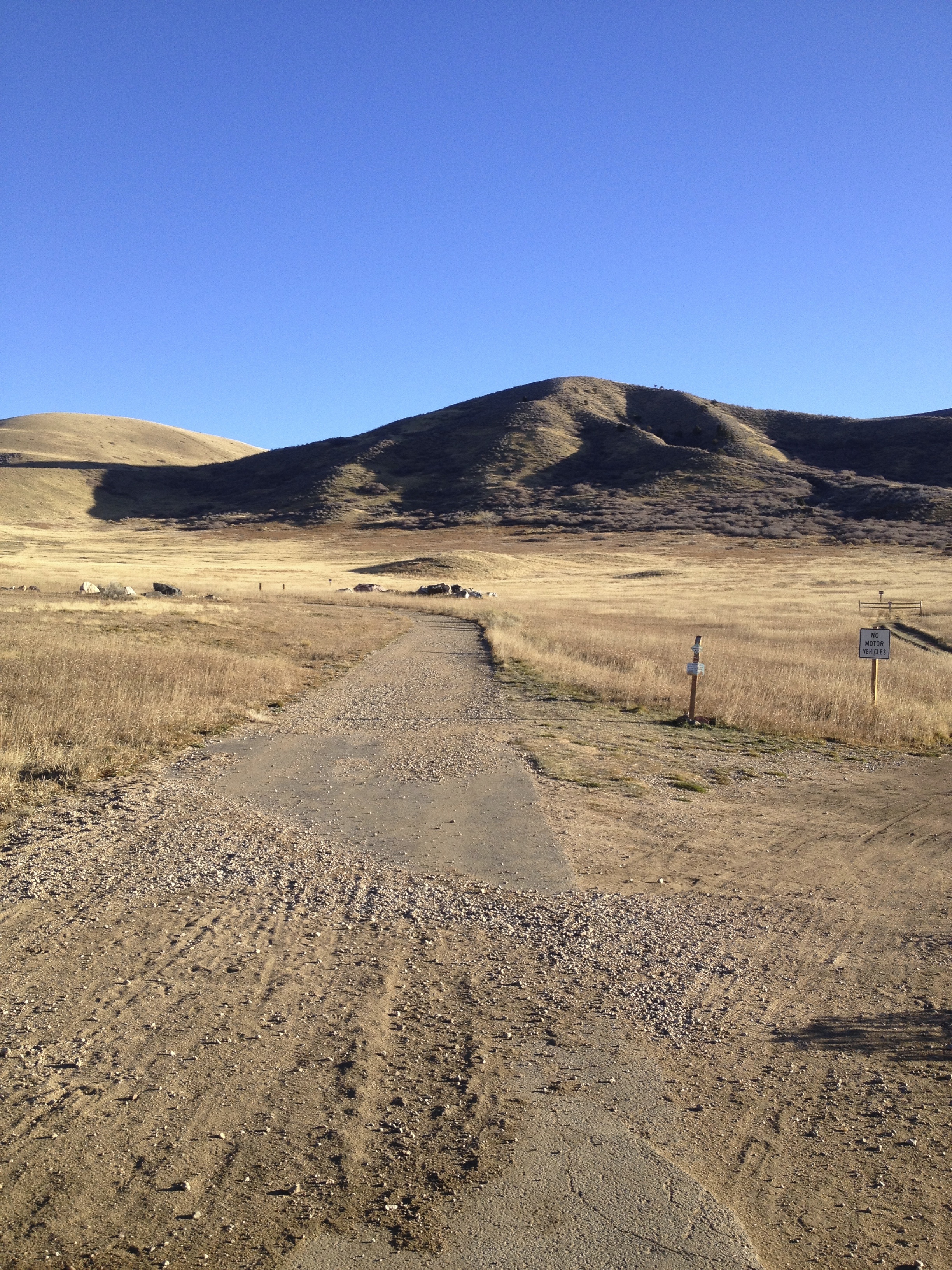
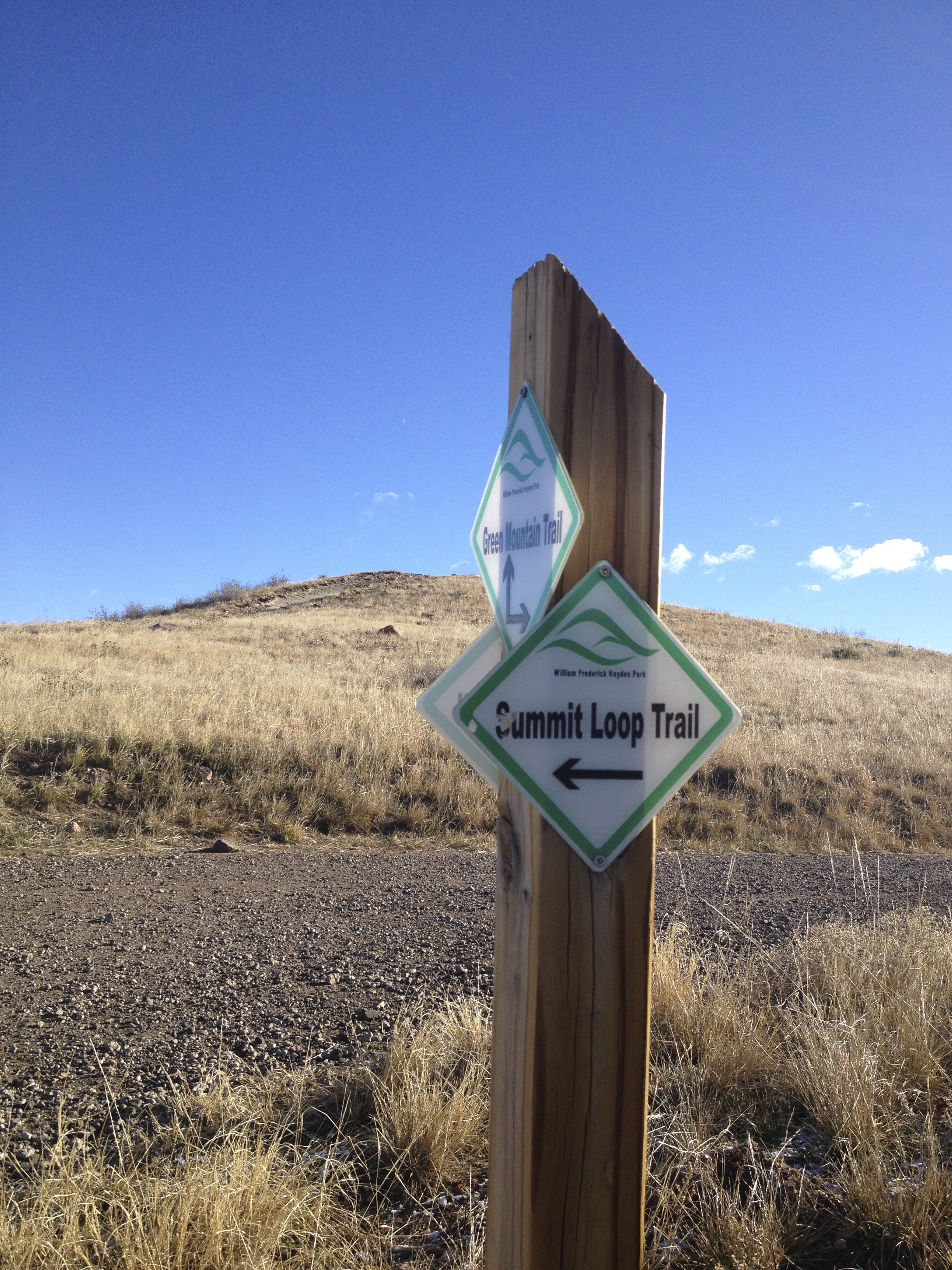
I usually try to pick easy hikes and this hike is at its core easy, what is hard is that initial climb but the rest of the park is relatively easy. The trails are very well planned out, wide and have VERY high usage.
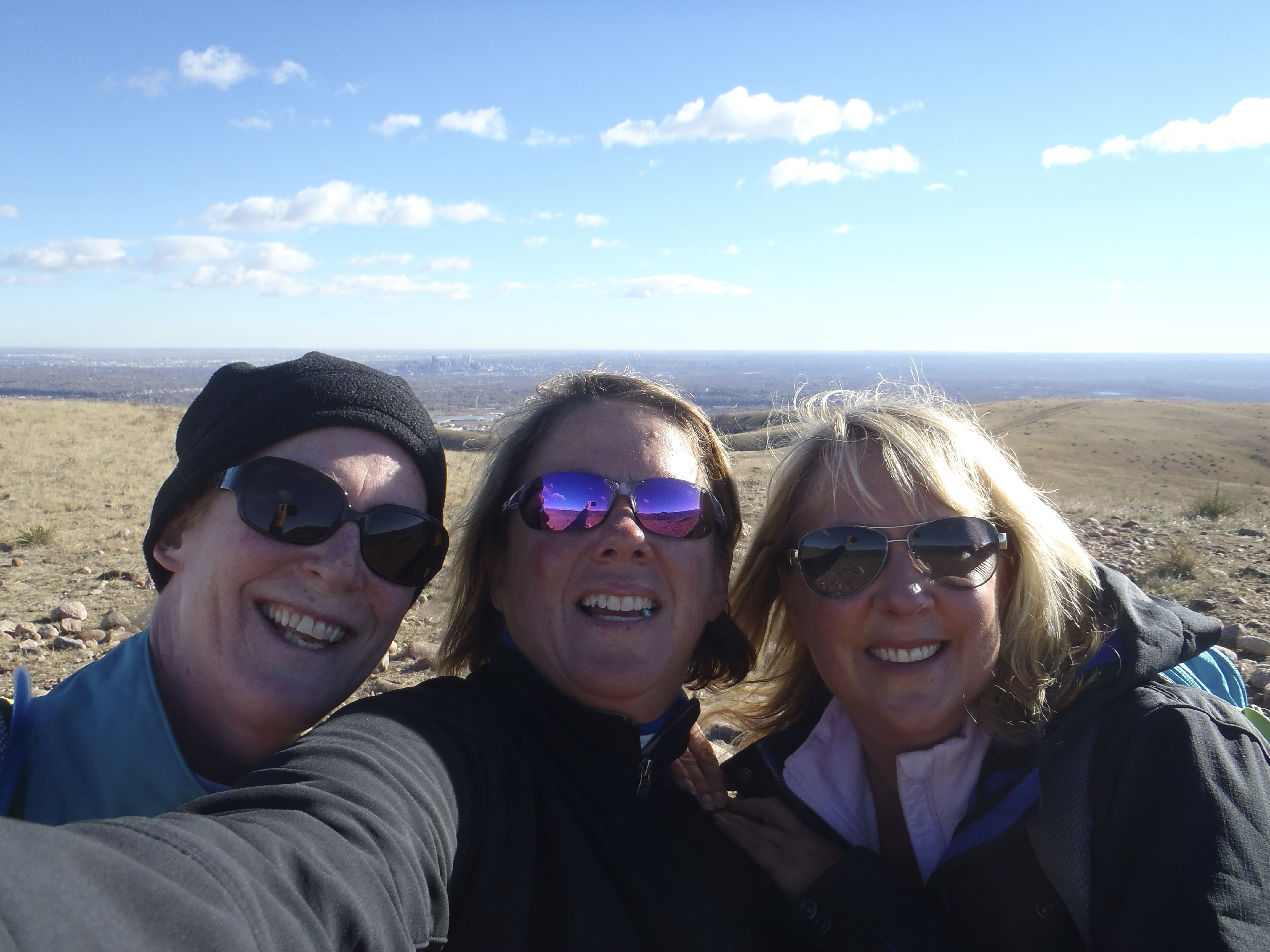
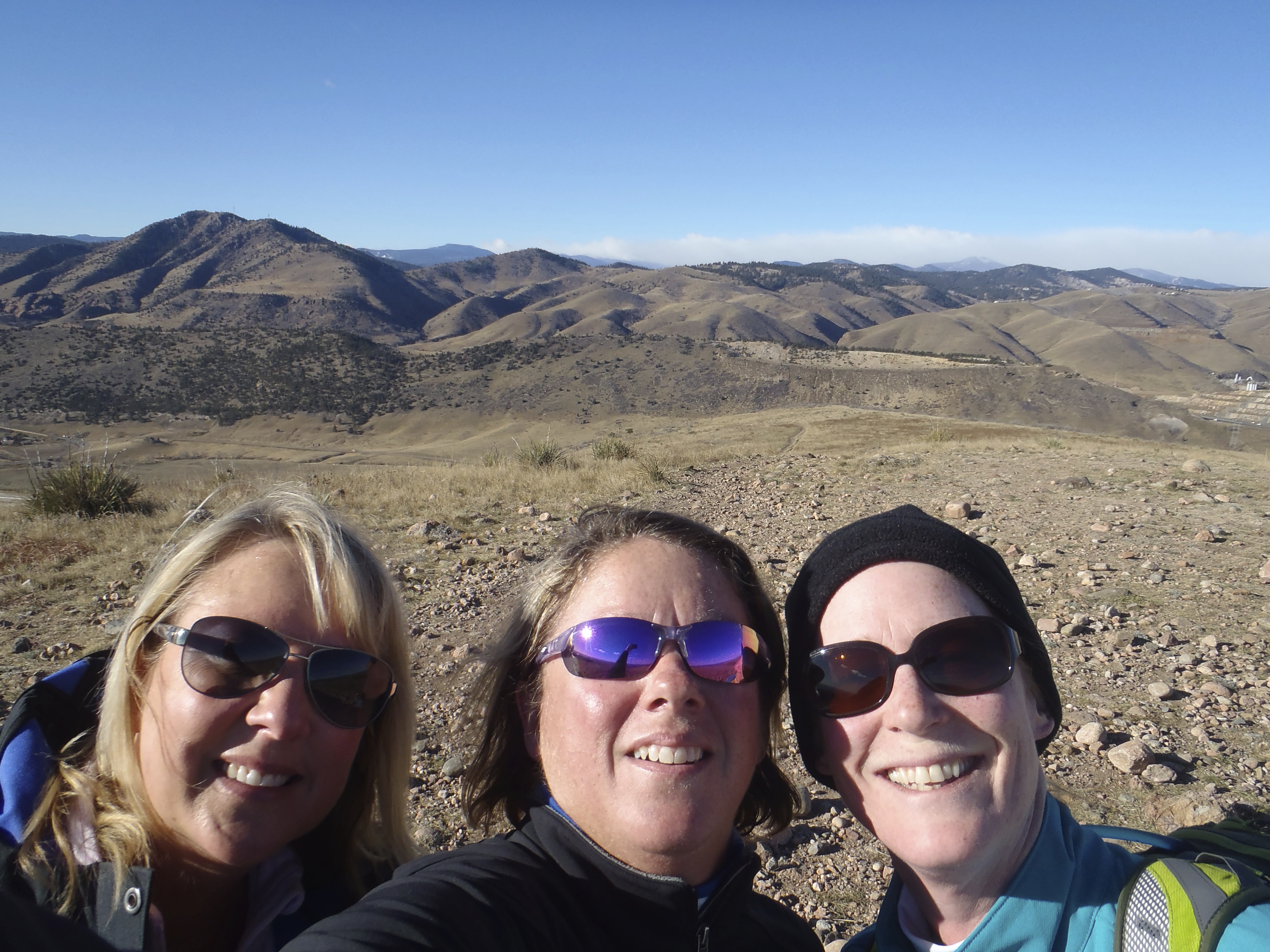
On this day, the forecast was for 40-60 mile an hour winds during our hike. I seriously considered canceling….. but I really super love these hikes with my girlfriends and I wanted to give Lisa that chance to beat this hike, plus sometimes the weather forecast is off. So instead I texted them all late Saturday night to say prepare for crazy winds.
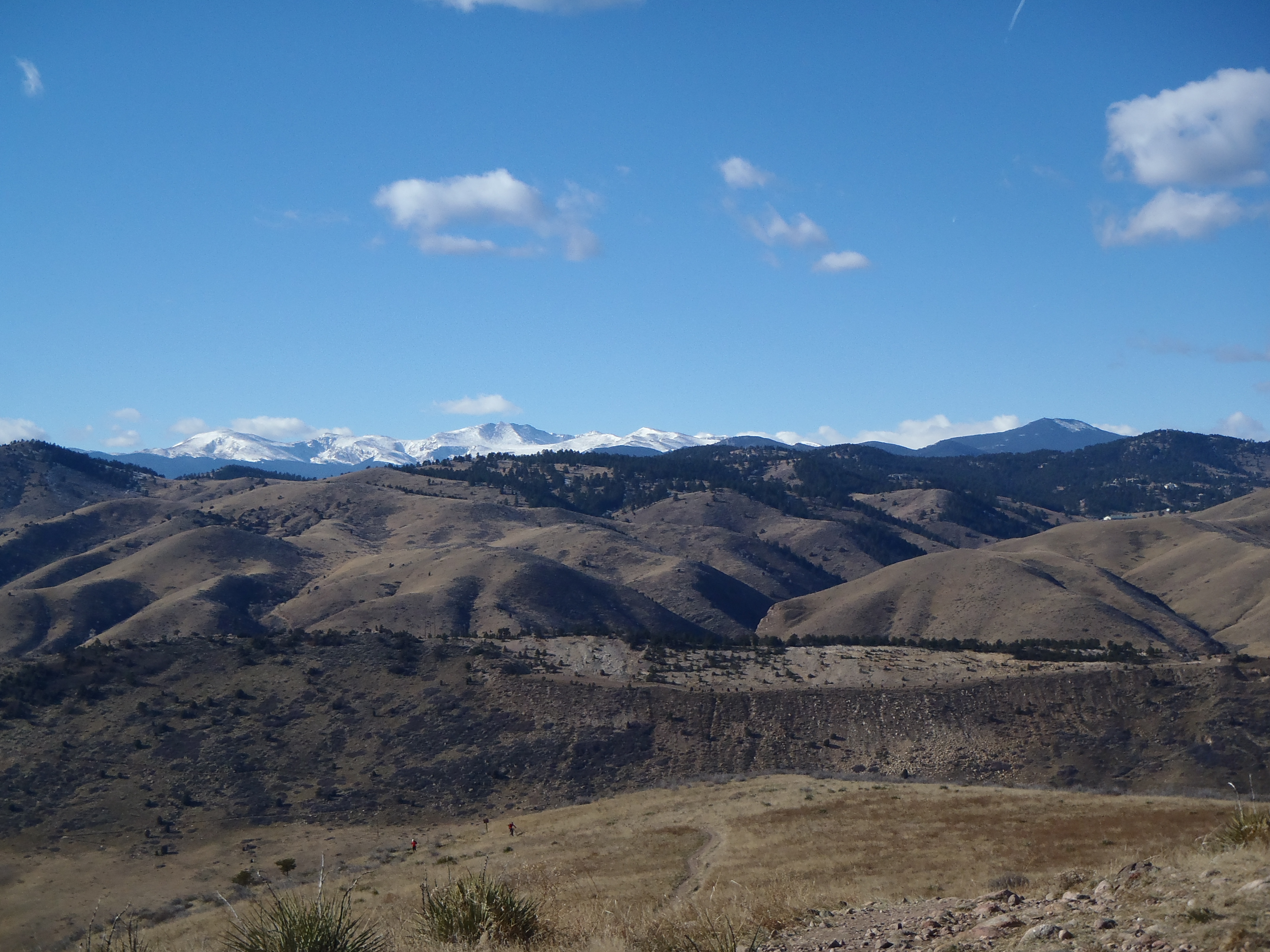
We got tot the trailhead at 7:30…. with NO wind (stupid forecasters) . This trail is really popular and that morning was no different, but we still had the freedom to move at our own pace. Our goal was to finish and not worry about time, my company was amazing! They hadn’t exactly worked up to a 700-800 foot elevation gain in just a mile but they were troopers every step of the way. We made our way up the beginning to come up to the most amazing views of the front range and Denver itself. The view is always the best part of any hike… oh and I am always looking to gain more converts to my love of hiking…. good views SUPER help with that.
Karin and Lisa did awesome! I promised them that we would summit and had own since I knew the summit was more than they had prepared for, what i didn’t expect was for them to want to do more. I was thrilled!
Lisa, Karin and Levi( Karin crazy adorable dog) were super troopers in wanting to push themselves a little further to see more and work harder that morning. I said I am totally willing to push when they say the word so we headed over to the tower further down the path. It was a great morning I could see the summit lust in their eyes, it happens when those views are perfect like there were that day. The nice thing about getting a taste of summit lust, is it makes you want to see more. We were talking about harder hikes in the future for more amazing views…. I think I am getting them hooked, yay me more hiking buddies!!!
LEVI!!!!
I have come to appreciate this hike for how close it is to home and how easy it is to get too. I am looking forward to getting more people there to feed their summit lust.
Trail Length: Officially we did 9.2 miles around trip, my Fitbit said we did close to 11 miles ( it took us approximately 5.5 hours)
Trail Uses: Hiker only
Degree of difficulty: I consider Gem Lake Moderate, after the floods I think there are many more strenuous parts. If you are going to Cow Creek I think difficult would make sense with all the ups and downs and distance.
Bathrooms: Yes at the trailhead parking lot
Pets: No Dogs allowed as this is all Rocky Mountain National Park
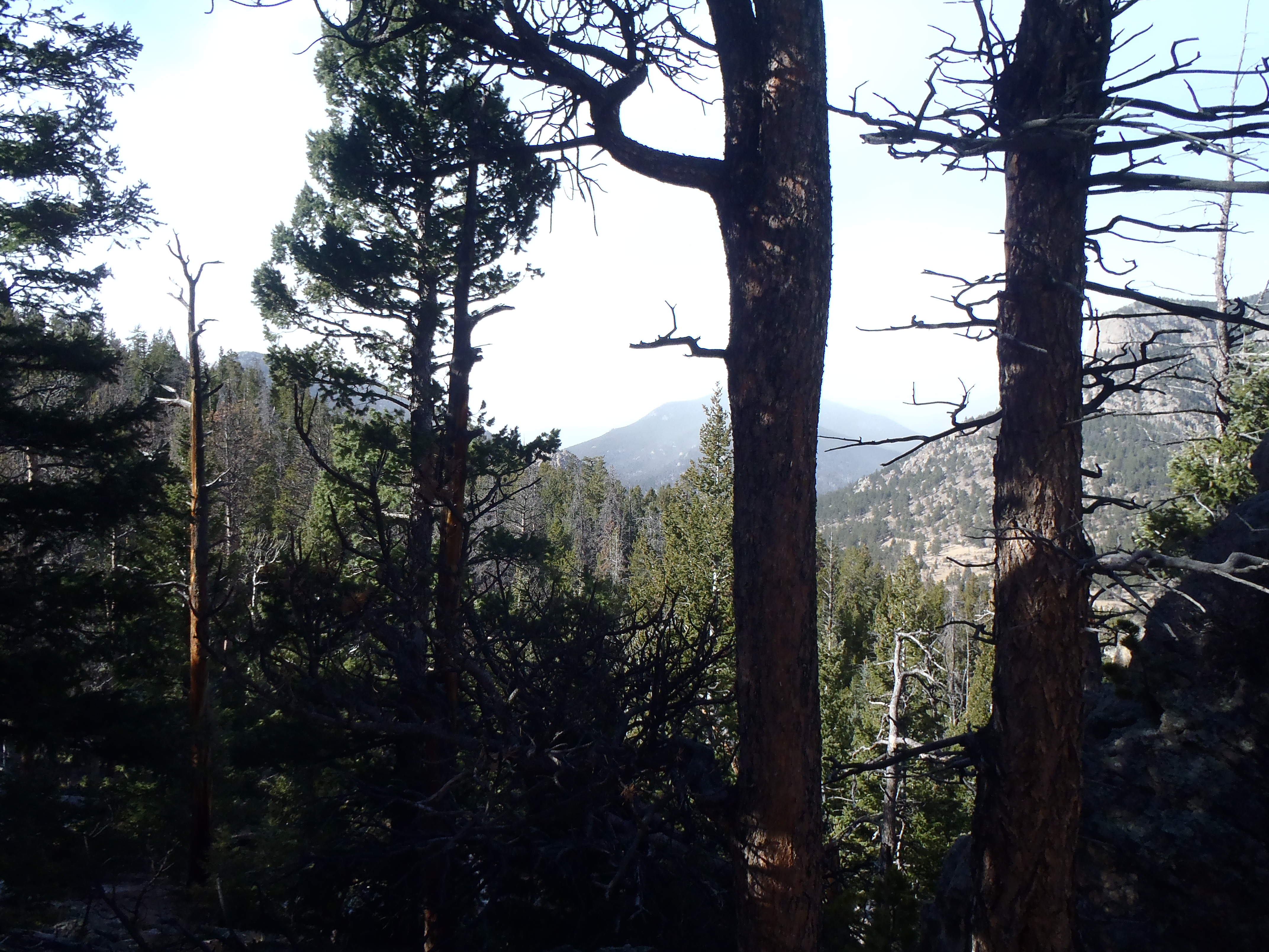
VIews on the way to Cow Creek
It had been just over 2 months since those devastating floods hit so much of our front range and no where was harder hit then Lyons as well as the most of the ways in to Estes Park. I have been reading about the recovery and the how desperate things are in those hard hit communities for small businesses. The amazing part is how quickly CDOT has managed to repair so many major arteries helping to get tourism back as quickly as possible, but for some businesses it is already too late. That is why on this particular weekend I searched long and hard for a hike near both Estes Park and Lyons so that we could spend some money in each town trying to help out where we could. What I didn’t expect was how hard it would be to find a trail we could get too that hadn’t been obliterated in parts or in total. Finally at 10:30 the Friday night before I saw that the Gem Lake/Lumpy Ridge Trail system was intact and not just the trail but the roads to get there was all open too.
Map of trail system
I had wanted the trail to be more challenging but I also knew that I had a girls hike on Sunday so it was worth it just to get up there and spend some money in those towns.
The weather forecast wasn’t that great either, we had a small window before a nice snow storm hit Estes Park and a huge wind warning went into effect. We maybe had until 2 when we left our house. When we got to the trailhead it was already snowing and the wind was whipping up pretty good at 8AM. But it was also so beautiful being both sunny and snowing with almost no cars in the parking lot – we took off.
Wind and storm coming in early
The trail has taken quite a bit of damage from the floods but was still hike-able, although RMNP had put up “hike at your own risk” signs at the beginning. We flew up the Gem Lake trail, when we got to the lake itself the wind was so hard it pulling off drops of water off the lake, turning it to ice which was pelting us as we walked by. It was so fun to watch, not so great to walk through. We went right past the lake to the next section of trail starting our long journey down to Cow Creek , what we didn’t expect was how flipping cold that wind would make everything. I had a first on this hike…. I actually took off my pants on the hike to put on long underwear, thank goodness we didn’t see any traffic ….because that would have been quite a show. It was crazy insane cold taking off my pants but I can tell you it saved me for the rest of the hike.
Trail signage just past Gem LakeOne more trail break before Cow Creek
After putting on those extra layers on, we started moving at a good pace but steadily down with a few small ups. Having never done this part of the trail before, I can’t say for sure but it seemed like there was some damage from the floods it was still easily hike-able with little worry about a lot of risk. We did 2.8 miles out to the Cow Creek trailhead and then headed back. I imagine the views on the way to Cow Creek are usually pretty astounding, but they were mostly obscured by the storm moving towards us. Even so it was amazing to behold.
Climbing back up to Gem Lake was beautiful and getting back to the lake was interesting in that the wind was twice as bad as it was a few hours before. Once we pushed back through the wind, we hung out in the shelter of trees and rocks for a few minutes just to marvel at ferocity if the wind.
Snow blowing at Gem Lake
On the way down from Gem Lake we saw a lot more traffic but nothing like there is on a good day. Upon finishing the hike, we quickly drove over to Estes Park and hit a few stores to spend as much as we could afford. Those owners were crazy appreciative.
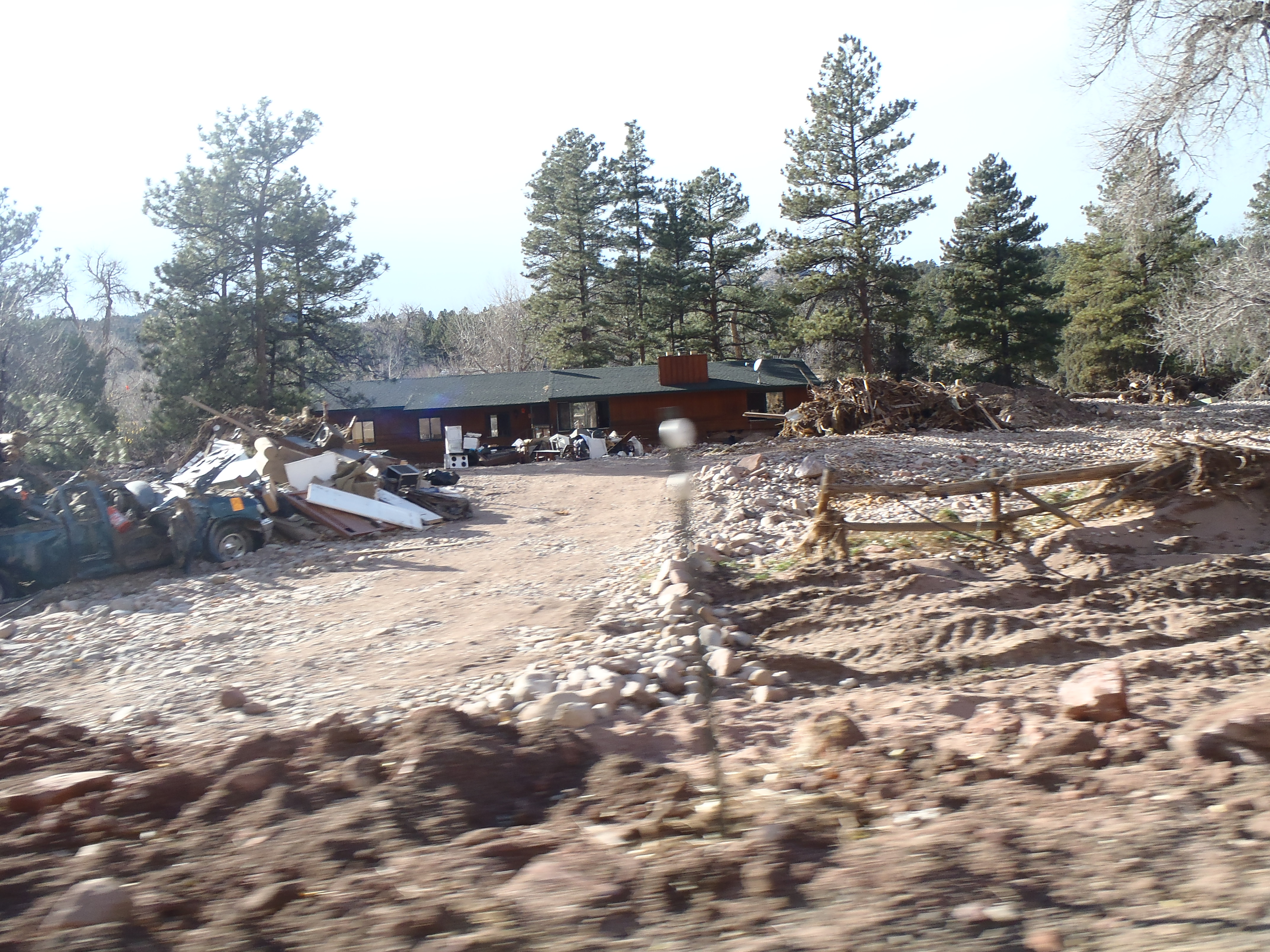
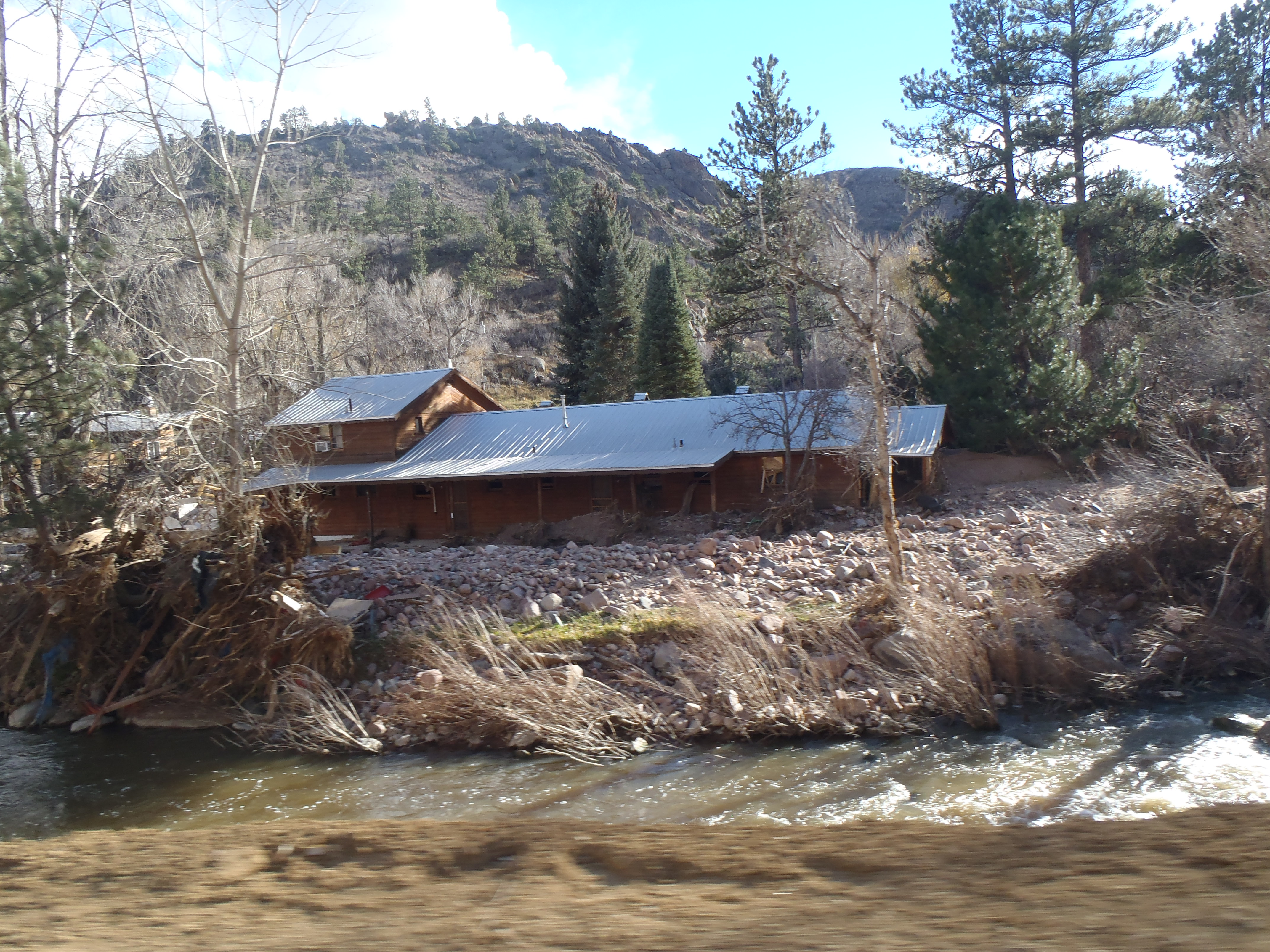
Driving back, I was able to be the passenger and take in the damage from the floods. It was heartbreaking, I don ‘t know how all those people are coping and moving forward. There were pieces of route 36 on the other side of the St.Vrain Creek, so much debris or trees with guard rails wrapped around them….. it was weird and sad and hopeful.
I don’t know if you ever find yourself close to these communities, but if you do please spend some money and help out these small businesses. They are hanging on by threads and struggling to make it through this mess. I caught a few pictures of the damage and a few favorites…….
Me at Gem Lake on the way back… Man those winds are cold!
I was thrilled 2 weeks ago when my friend Tricia from California was in town for a wedding. That meant I got to spend all of Saturday with her just laughing and drinking…. not so great for my goals but super really good for my psyche! We had soo much fun!
Ever dedicated to hiking, I pulled myself out of bed on Sunday to hike, even a little hung over because I can’t miss hiking on my weekends anymore, that next week just doesn’t feel right! Even worse now, I don’t feel right – but worse meaning really good and awesome.
White Ranch park was really hard hit in the floods we had jut 2 months ago….it has been mostly closed and had just reopened a few trails not too long ago Belcher Hill (Hike details here) being one those. We took advantage of that reopening and headed out there that Sunday morning!
The day was just spectacular 68, sunny and no wind what so ever. It is one of those days where you want to be outside all day long doing whatever makes you happy. Fortunately that was exactly what I was doing, hiking and being happy.
The trail itself was still rough from the floods with lots of debris, mostly rocks and pebbles pushed down, adding a new dimension to the trail and some dry debris sliding. There was also a lot of deep grooves from rushing water that changed the degree of pitch in some places, forcing a lot of the bikers to walk with their bikes. I also added to the challenge by trying out a smaller hiking shoe size, my feet have gotten a little smaller as I have lost weight and my toes are paying the price so I figured it was worth a shot to go down a half of size. On the way back down my right foot felt the best it had in 8 months…. my left the worst. The result of my experiment…. I started one size on my left foot and a smaller size on my right, my feet have been feeling awesome!
Despite the toe thing, the hike was just wonderful there were lots of people out enjoying our mild weather.
Sorry for the delay on posts. I am hiking every weekend no matter what, last weekend I even got 2 hikes in and both mostly new. Work has just been super intense and when I am not working late or getting some more work done at home, I am squeezing in exercise where ever I can. I won’t lie, sticking to eating well has been hard as I am a serious stress eater currently under immense stress, I have really good days and really bad days but my weight hasn’t changed too much. I swear I will get back on track with telling you all about it again soon!!