I have to tell you this week was really tough. There were work lunches I had to participate in that were catered in with no input from the attendees, so my choices were limited and I guessed on calories eaten on those 2 days. I wont lie, I also indulged in the crazy rich, fat full brownie one day for no other reason than I was bored with the topic and struggling to stay focused… so I ate a brownie. It was delicious and guilt ridden. The next lunch was at one of those places that is on Diners, drive-ins and Dives and seriously everything in the place was bad for you… not only was it all bad for you, all the good for you stuff sounded extra terrible next to the regular menu. I was weak-willed and went bad.
The upside is I exercised off most my guilt and kinda got over myself.
In 2 weeks I will have been on this journey for 2 full years and I thought I had moved to the lifestyle stage, but all week I struggled with old feelings of wanting to eat whatever I want, when I want and in obscene quantities. It felt like a diet for the first time in a long time.
This loss is coming at the right time, because I fought so hard against old behaviors and had success, it actually made me feel stronger in my determination to get to my goal weight this year.
I know the struggle will never end, I didn’t get 100 pounds overweight in a week or after a bad year, it was a lifetime of bad habits. I guess that I need to start working on the “some days will be harder than others” aspect of it all and managing it better emotionally.
On a different note, the snowshoes showed up!!!! I can tell you we are like kids on Christmas eve today. I cannot wait to snowshoe tomorrow, I have 2 trails picked out and it will all depend on traffic as to which one we do.
I hope where ever you are, you can get out there hike soon!
Highest Elevation: 7570 Ft ( total elevation gain around 1800 feet)
Trail uses: Hiker, Biker & Horses
Trail Length: Officially Approximately 8 miles, my fitbit said a little over 9 miles
Degree of difficulty: Moderate, it is steep in some parts but I am not sure I would say it is difficult.
Bathrooms: Not at the entrance off of 6th Avenue but there is one at the Windy Saddle parking lot and at the Lookout Mountain Nature Center.
Pets: Yes on leash.
View from the Lookout Mountain Nature Center
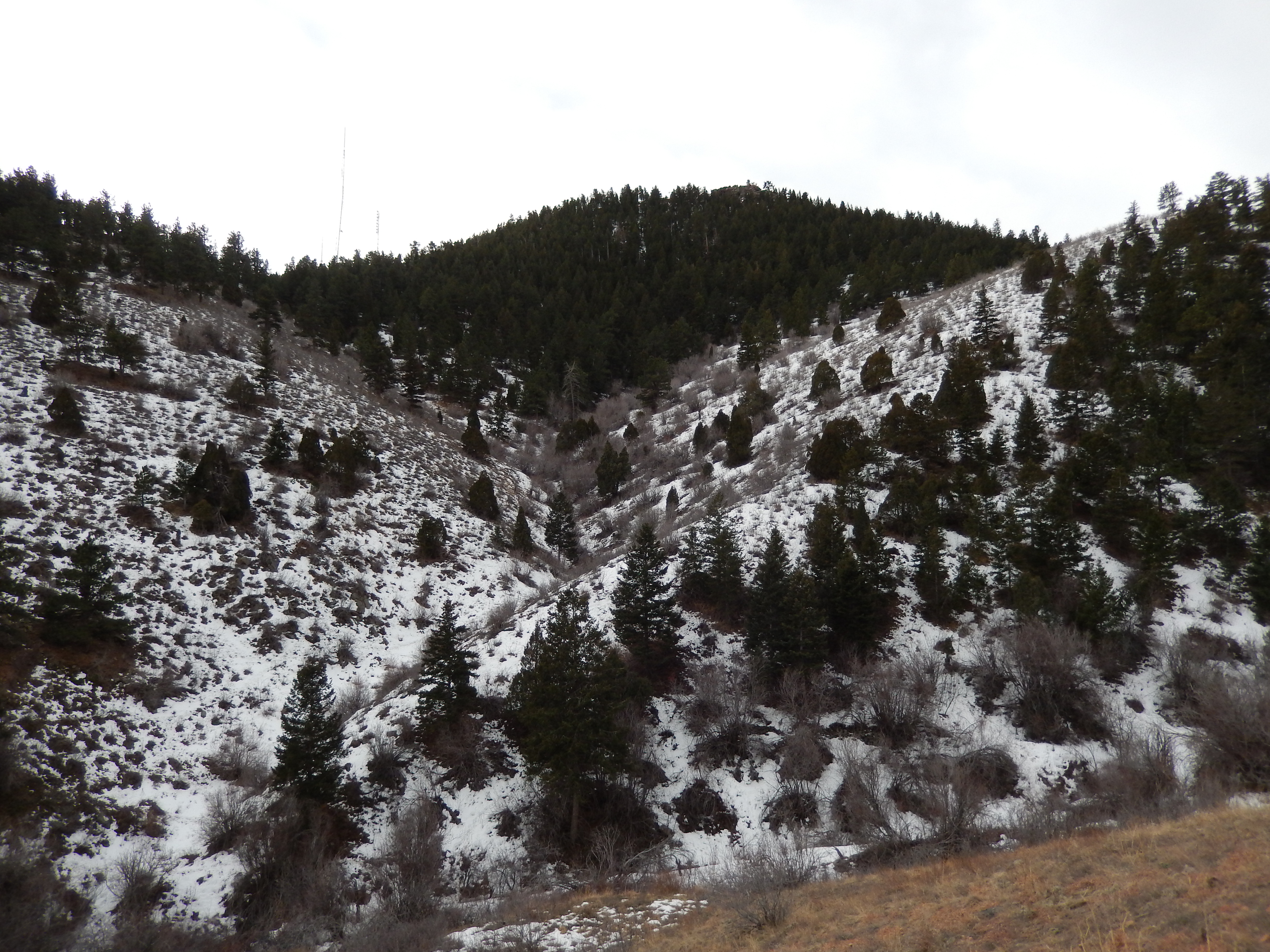
I have driven past this hike a million times and I am always wondering 2 things. First, what a weird place to pick up a trail and second, dang that is crowded! It has seemed crowded regardless of conditions too!
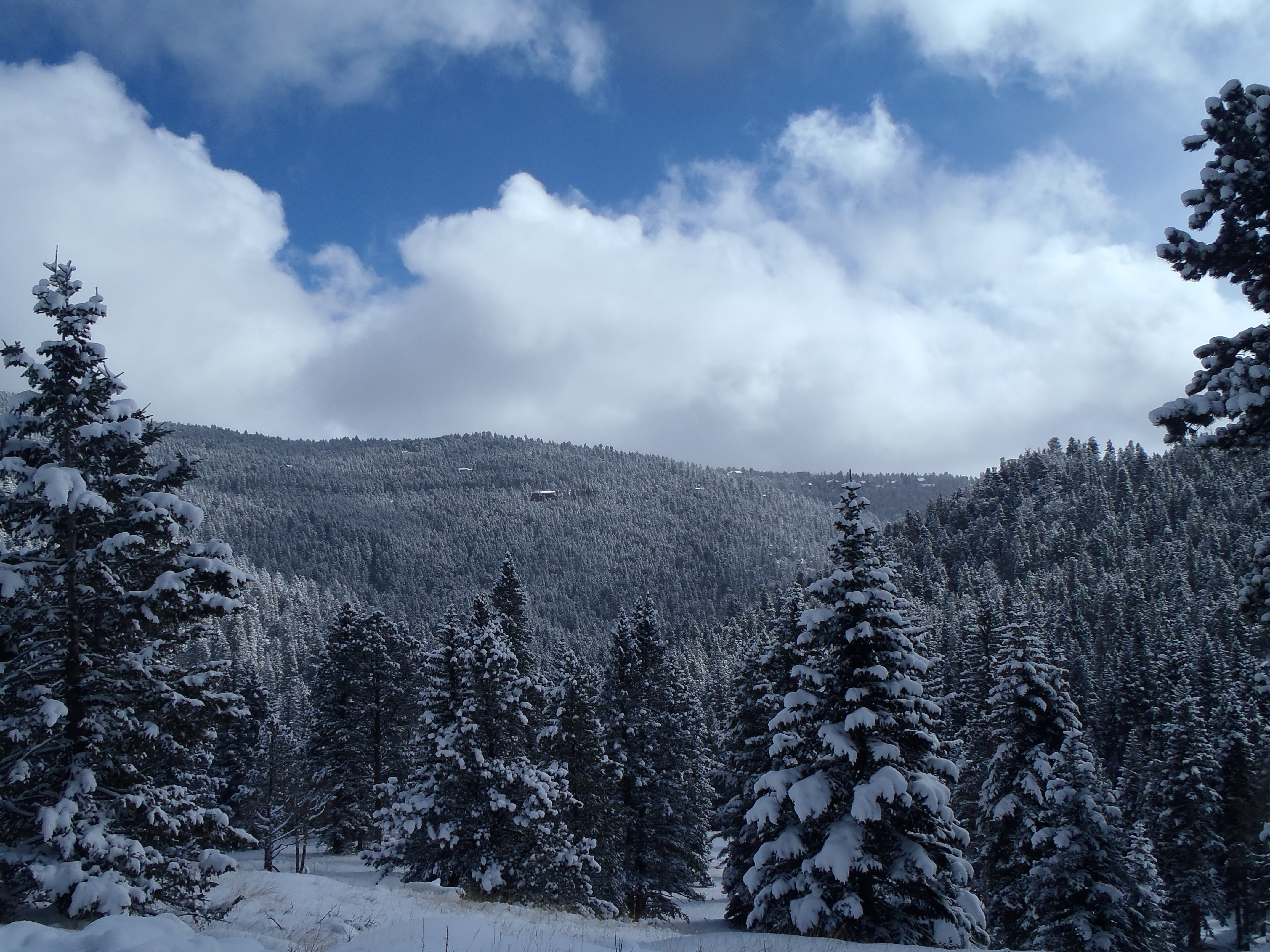
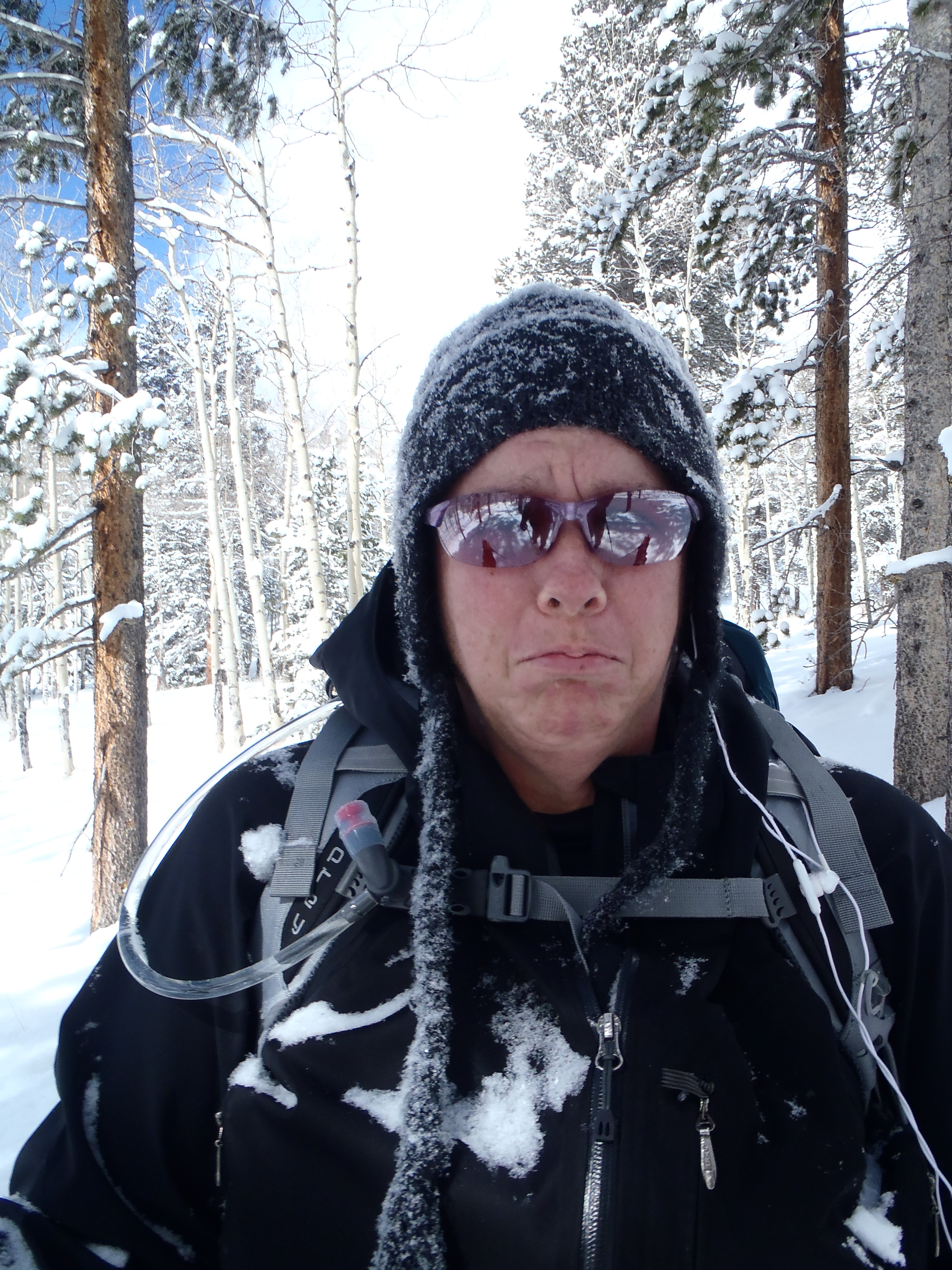
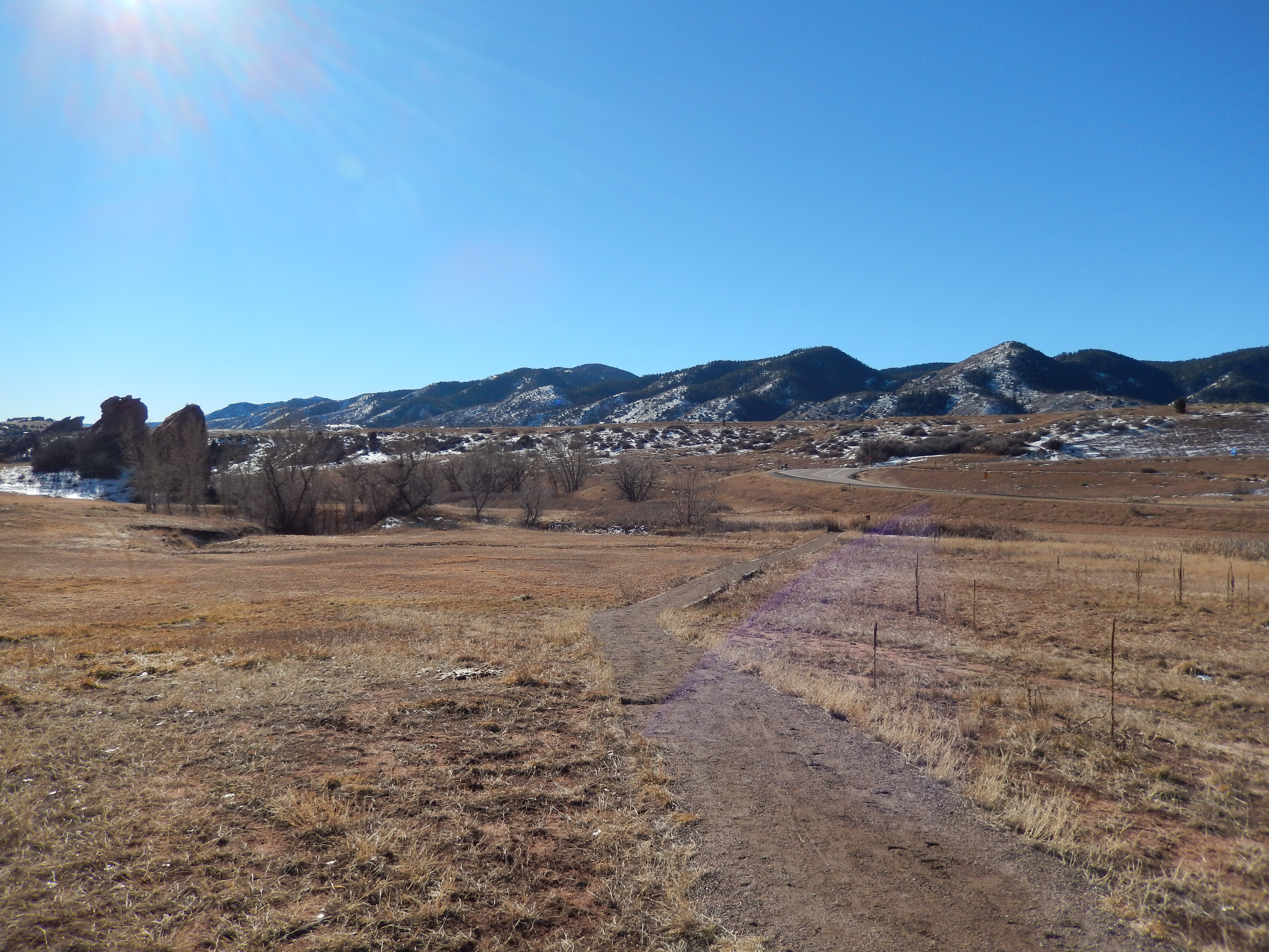
This past Saturday, I had hoped beyond hope that we would have our new snowshoes but we didn’t so I decided it was time to check this particular trail out. I am not sure why I have been avoiding this one for the past 2 years, but strangely I have manged to completely block it out of my mind. It is a shame too because after the first mile and a half it is beautiful.
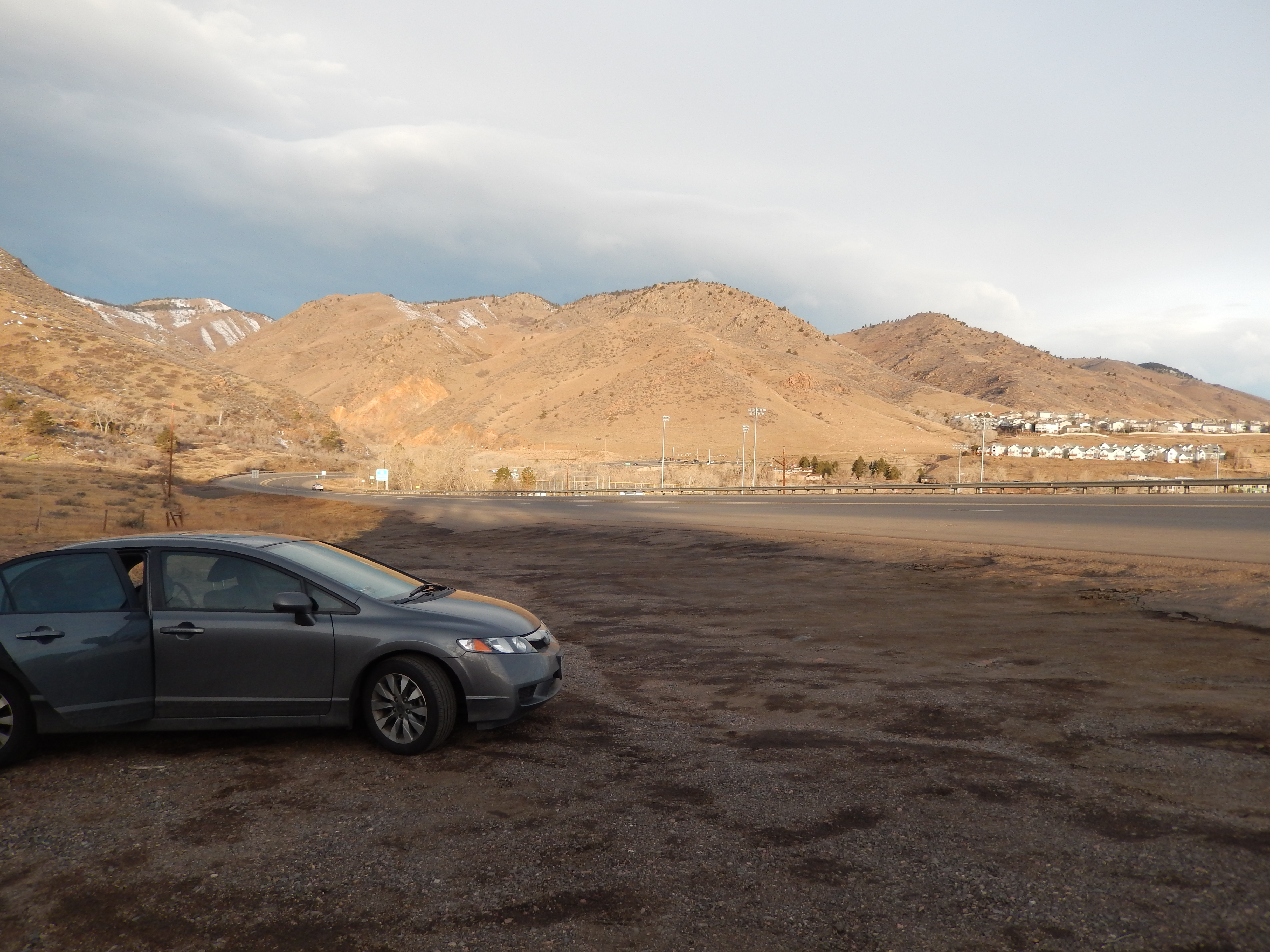
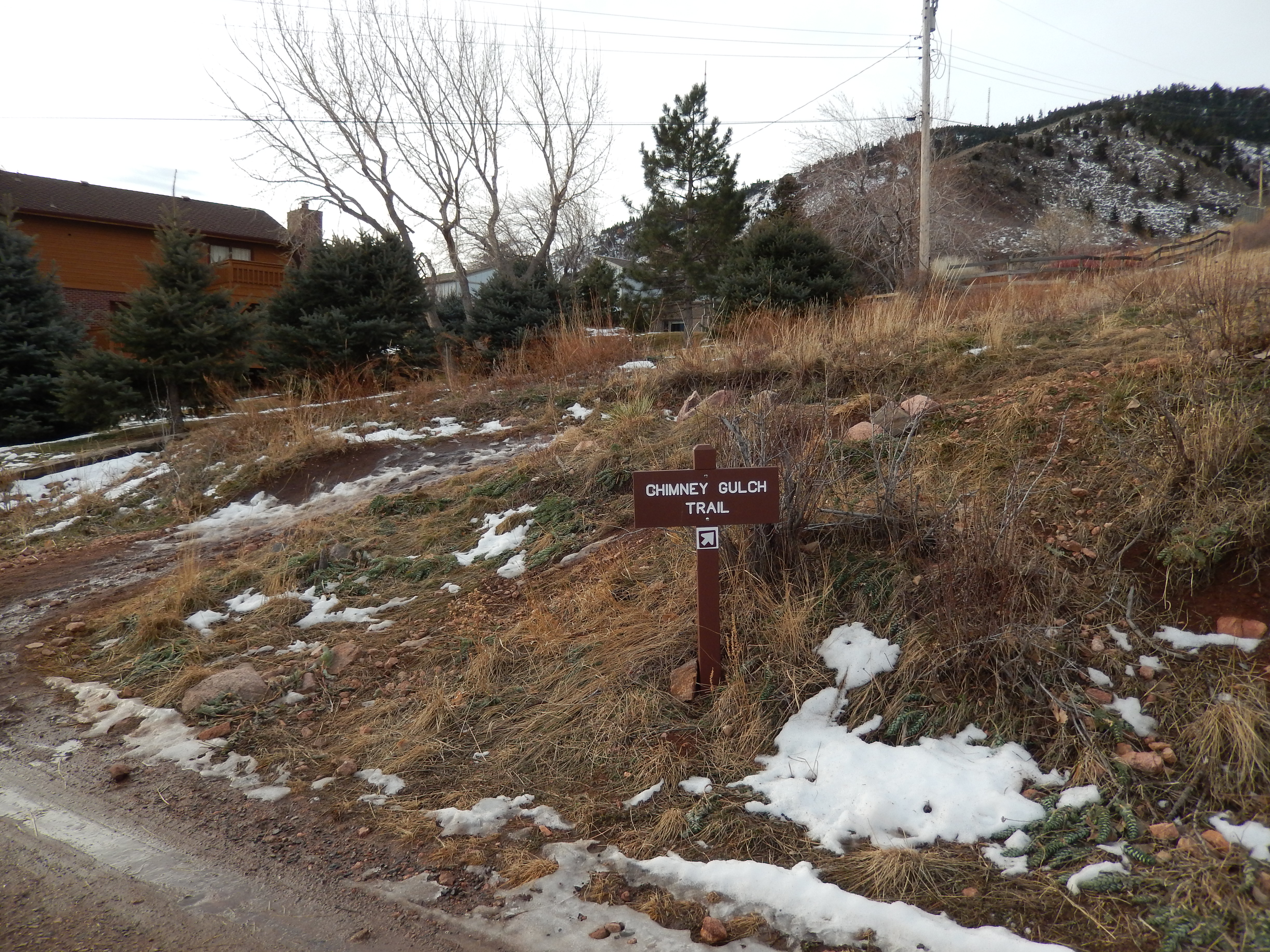
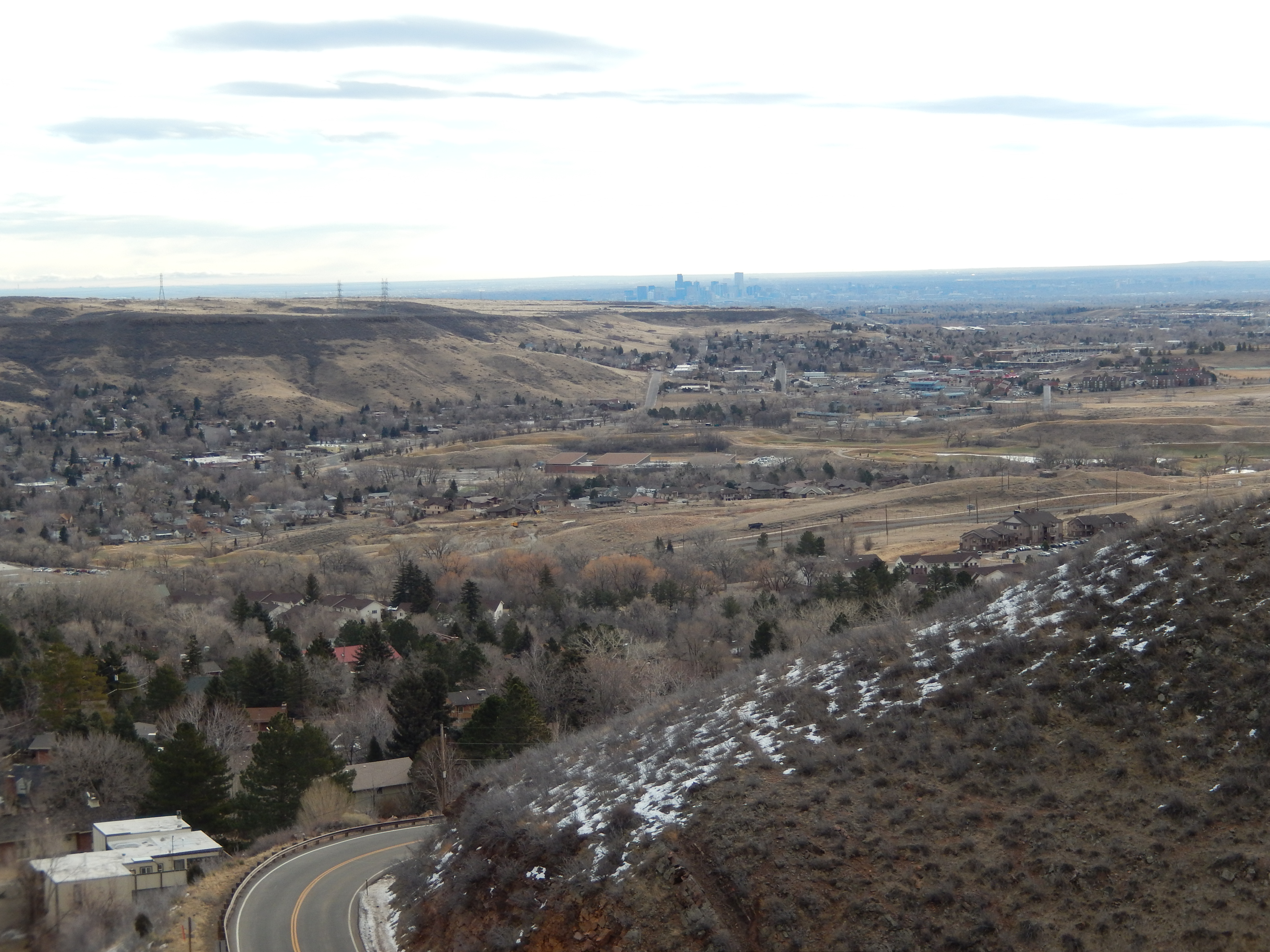
You start out literally on the side of 6th Avenue in Golden… And I mean on the side of the road. If I hadn’t passed it a million times I would never know the Chimney Gulch trail head was here.
The pull off On 6th Avenue to start the trailStarting out on Chimney Gulch
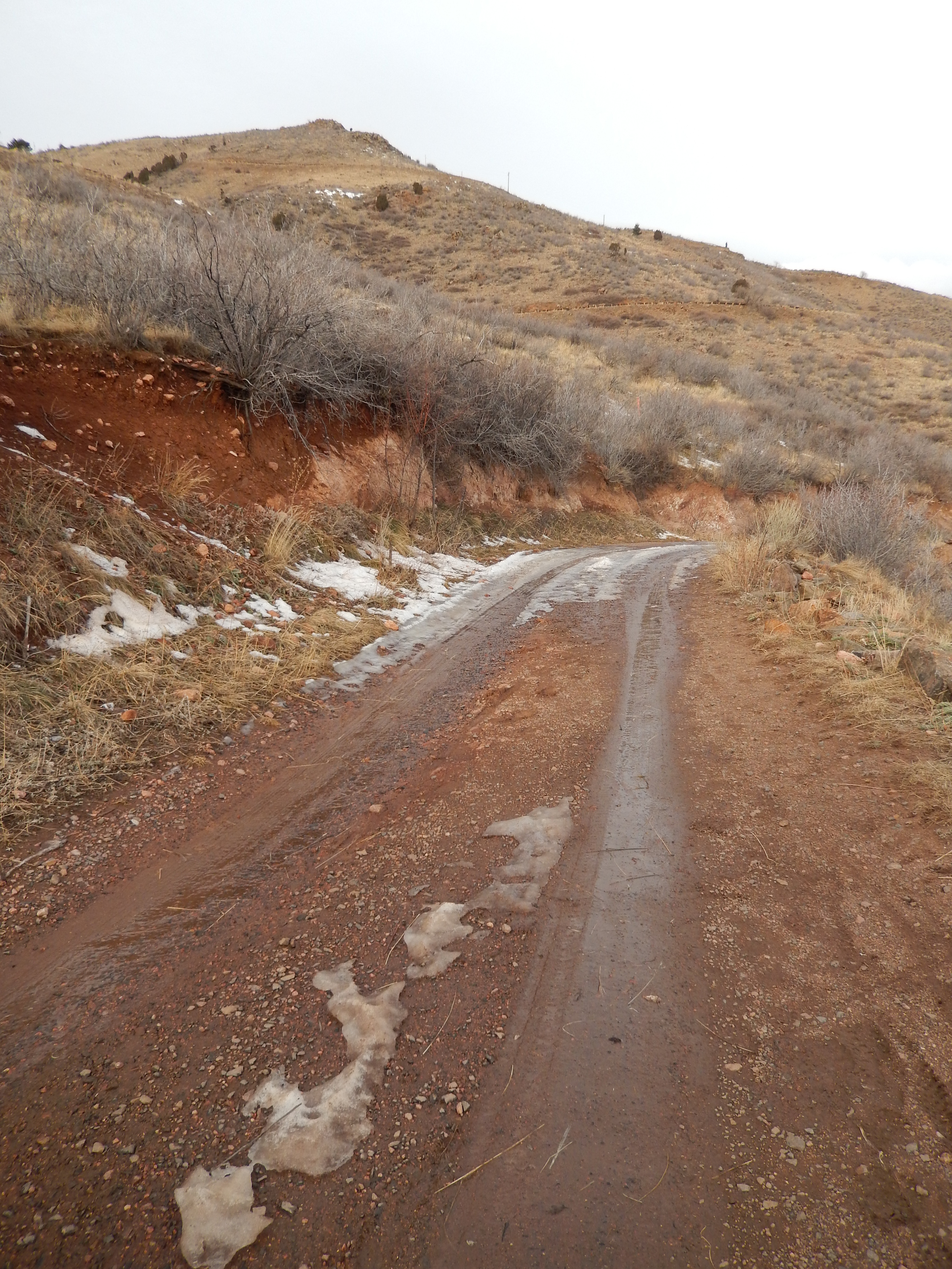
The first mile just starts climbing up along the road and the neighborhood. Before it gets steep, we came to this cement something or other that acted as a bridge over a little creek or drainage crossing. I only mention it because there is also a path you can take over to your left which seems more likely but it is the neighborhood access trail, not the Chimney Gulch Trail. So climb that cement thing and cross over, continuing up.
Drainage Crossing
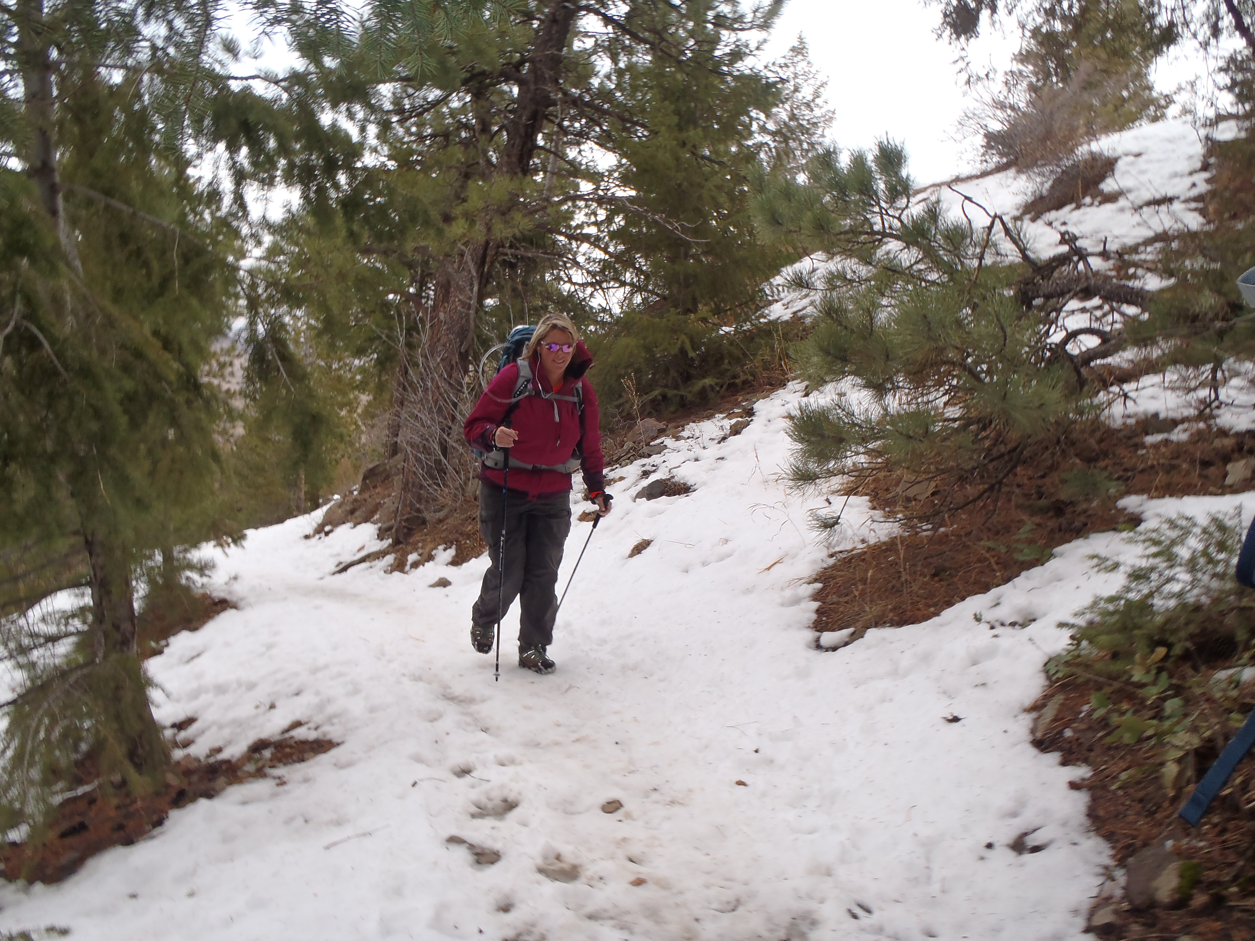
On Saturday the trail was super muddy all through this section, with the wind blowing good and strong but strangely warm, we were sliding all over the place!
trail conditions on the first half of Chimney Gulch
After the first mile you come up to a dirt road/driveway… more likely driveway, go left and look on your right and you will see the continuation of the trail.
Me at the Driveway break with the sign Aaron made for my backpack advertising my blog…isn’t he sweet!?!go left when you get hereTrail picks up again on the right
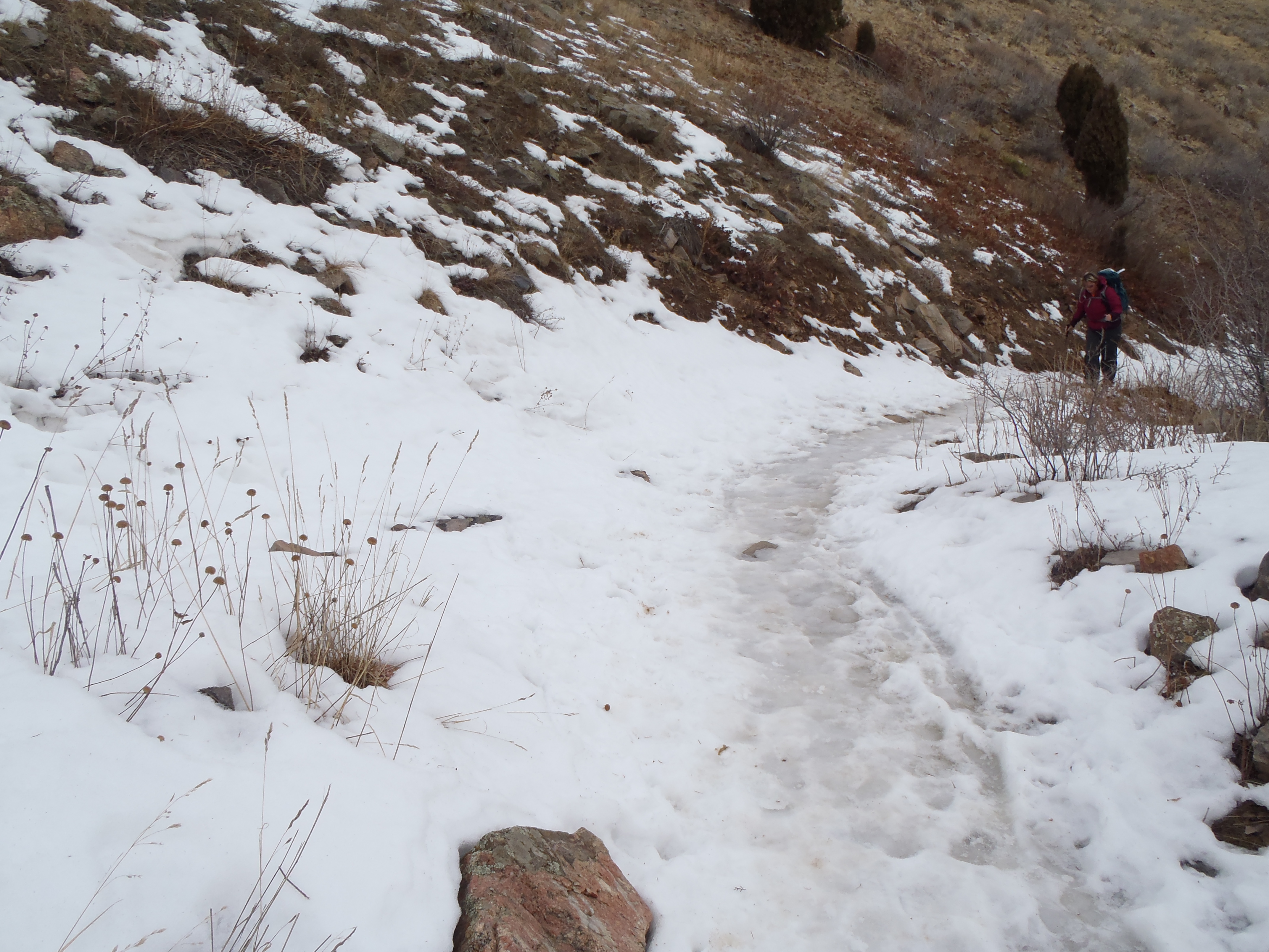
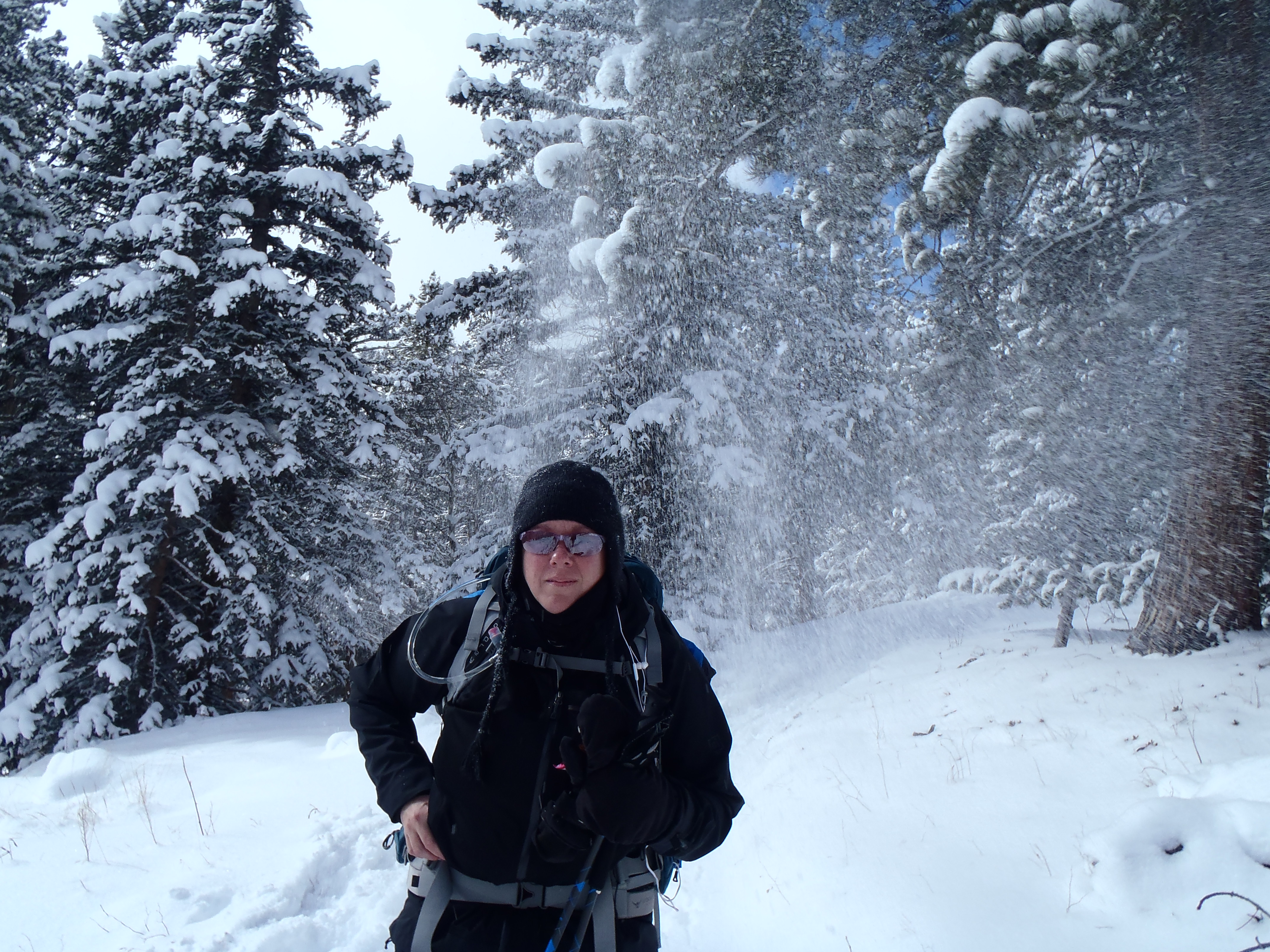
This next section of the trail goes for 1.5 miles and crosses over a true paved road 2 times. This is a windy mountain road that I assume ultimately goes to the top of lookout mountain too, but you have to watch out for both cars and bikers. It was pretty slick from snow/ice, we did have to put on traction devices to help us walk through it safely about a half a mile in. We must have hit at the right time or the wind and clouds kept everyone at bay, because we had most of the way up to ourselves.
Crossing the road to get to the second section of Chimney GulchIcy conditionsViews are changing
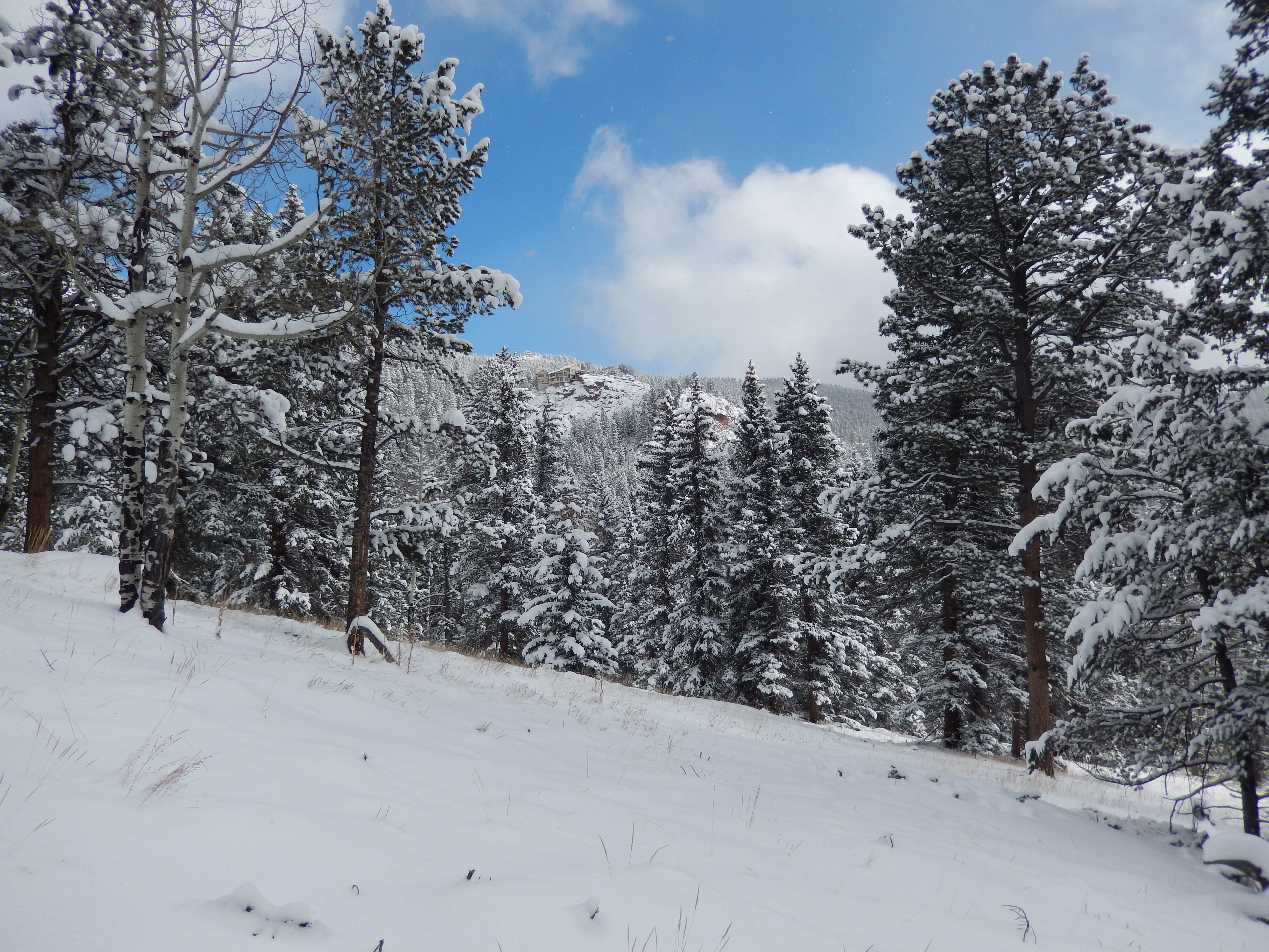
At the second Road crossing you come to this very picturesque parking lot with a great view of mountains and beautiful stonework. This is the Windy Saddle Trailhead and parking lot where the one port-o-potty is. From here it is just over a mile to the Lookout Mountain Nature Center and top of the mountain.
As we climb up to the Windy Saddle TrailheadWindy Saddle Parking lot
Windy Saddle Trail
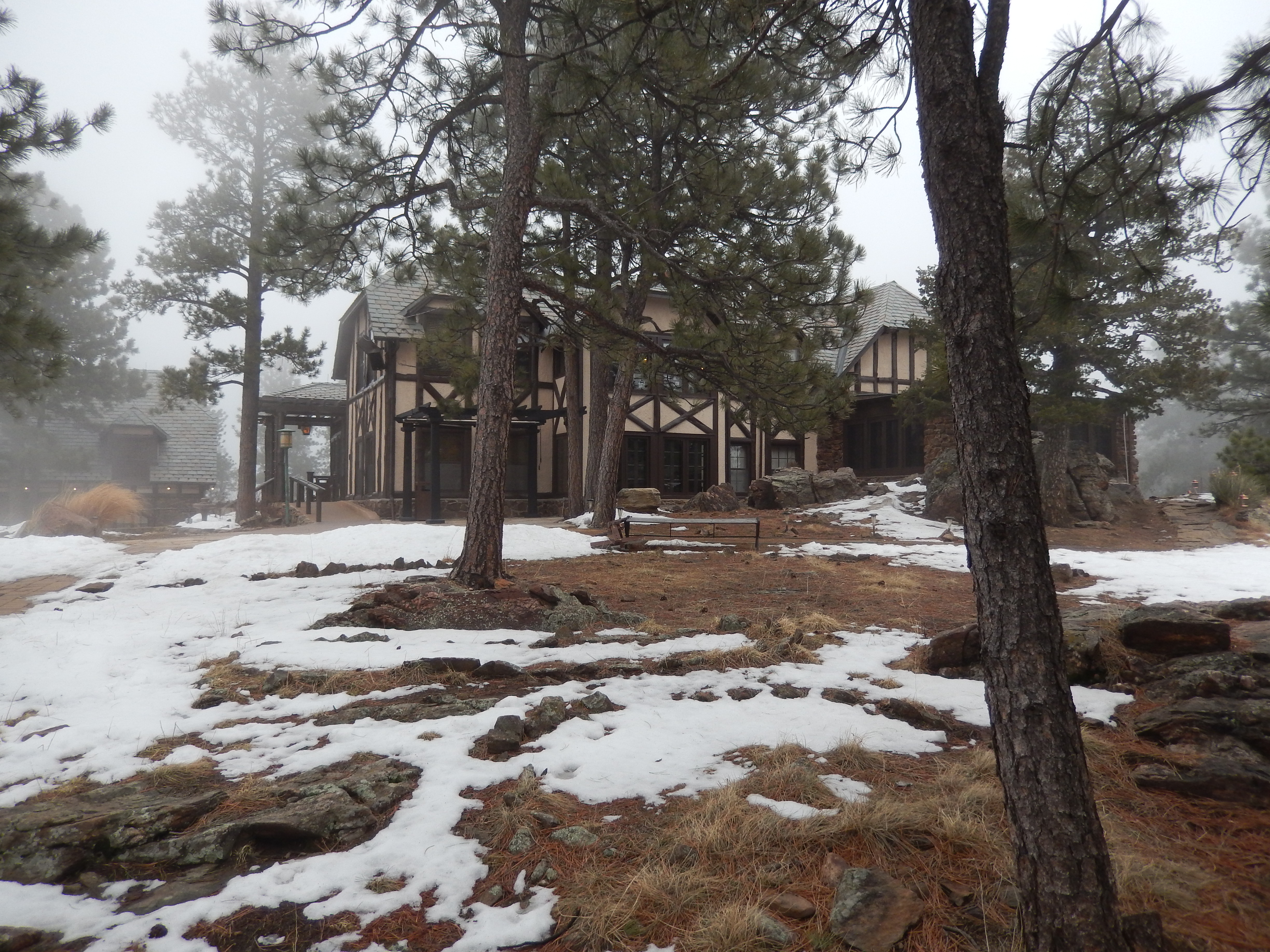
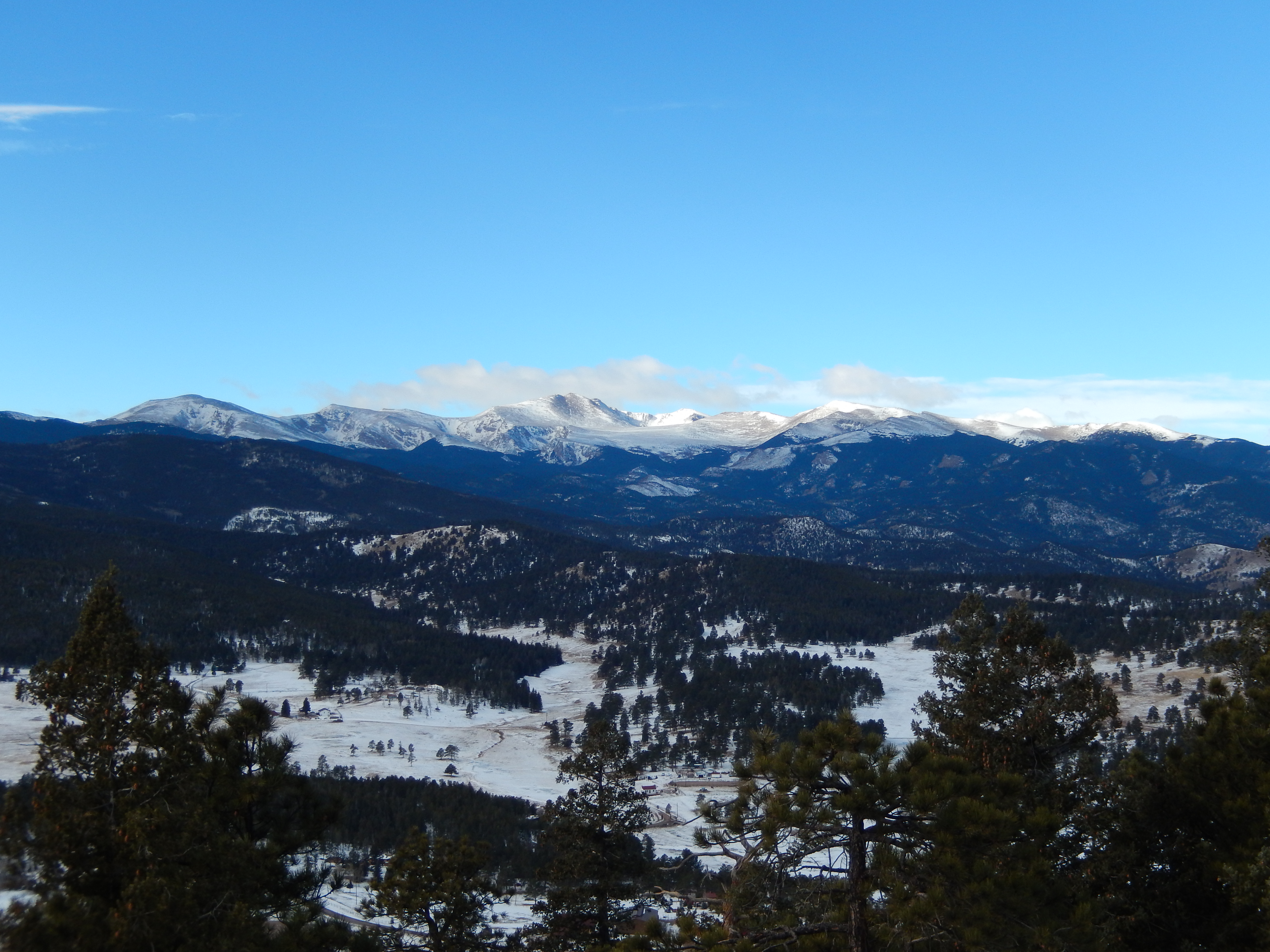
I am not sure exactly when it moved in, but about half way up this final climb, clouds encompassed the top of the mountain and all views evaporated. Don’t get me wrong, the cloud and fog brought its own beauty to the hike, but I have no good summit shots for you. Instead of ohhing and ahhing at Golden down below, we hit the Nature Center talked to the people running it that and found out that Boettcher Mansion was open to the public right that minute for wedding reception tours. I didn’t want to miss an opportunity to check that out so we walked through there too. I am sure the views are spectacular here but the clouds just got thicker. The house was hauntingly beautiful in all the fog.
Take the Lookout Mt TrailTrail Conditions on Lookout Mt TrailAt the Top of Lookout MountainNature ReserveInside Nature ReserveBoettcher Mansion
We made a super quick descent because it was cold up in the clouds! There were way more people out on the trail now and much of the ice that caused problems on the middle 1.5 miles was melting at a good pace.
On the way down
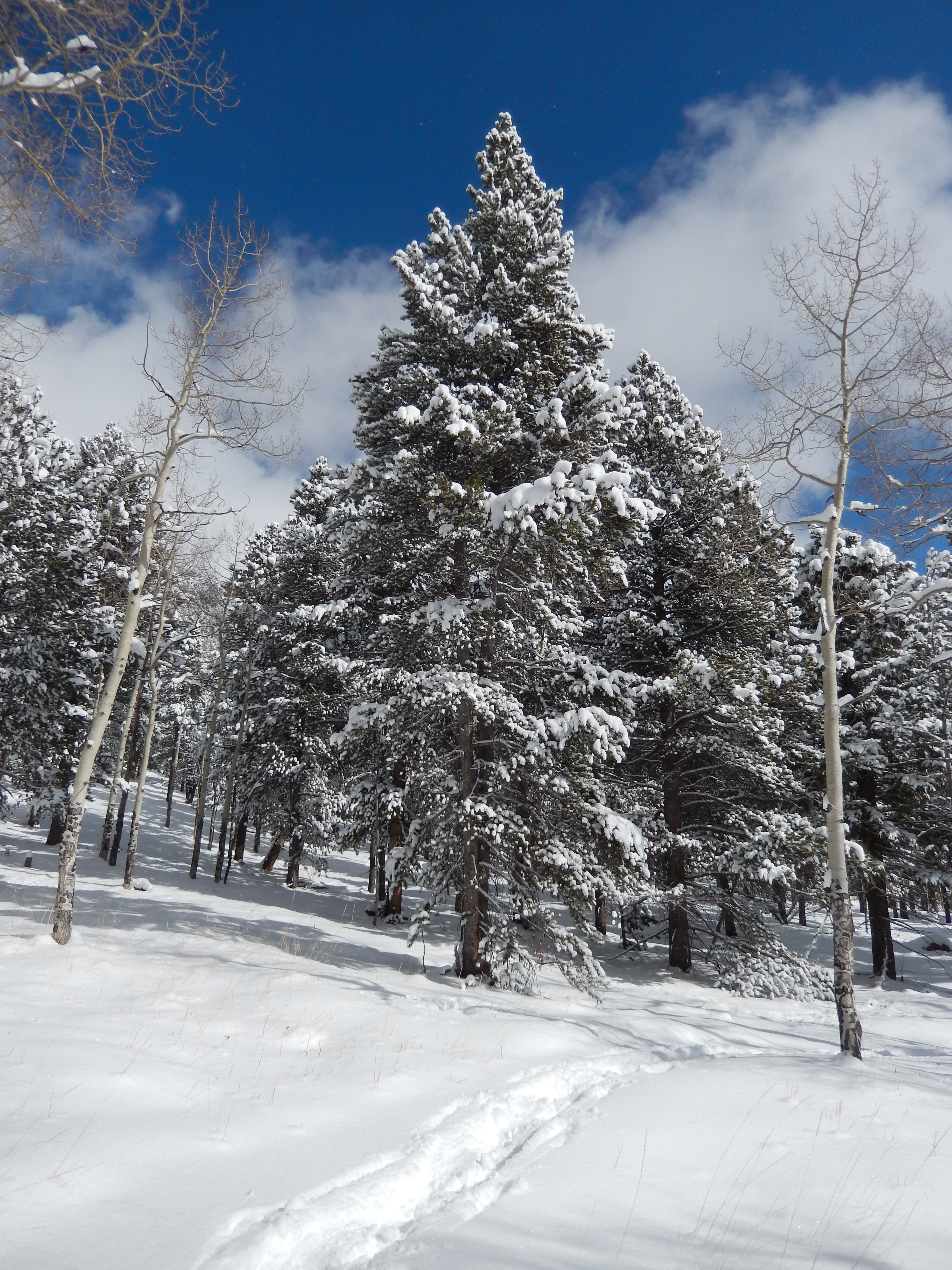
I will tell you I am not very fond of the first mile of this hike, it is kind of boring and your views are of houses with some of Golden spread out below you. But once we got to that second part, the surroundings totally changed and it was all trees, mountains and terrain which was all lovely. I think if we do this one again, I would start at the first road crossing on the second section of Chimney Gulch. I am not sure how to get to that road but I think it is the light just south of the turn off for the first section. If you find yourself in Golden CO and need a good diversion, check this hike out, I think you will like it. My Favorite Pictures from the hike will be after the directions.
Directions: Take 6th Ave West from Denver to Golden for about 12 miles. About ¼ mile before the 6th Ave/Route 58/Route 93 intersection there will be an unmarked pullout on the left side of the road. Park here. You will see some single track leading up the mountain. Take this.
I know the loss isn’t much but in my mind it is huge because I had my monthly visitor hit this week and was still going through it on weigh in day so any loss is monumental at a time like this. I worked out hard all week and patiently waited for my snowshoes to arrive… but they didn’t. I got in almost every workout and ate within my calories every day. Work has finally become more manageable and all I can think about is all the hikes I have before me. I love and hate this time of year, the mountains look so impressive but impassable with all that snow and avalanche risk, every weekend is up in the air in terms of what we can do. Oh and still no snowshoes….
I was more sad about my snowshoe situation than anything else all week, because it meant no snowshoeing for me this weekend but we hiked this morning on a new trail I have kinda avoided until now and I was surprised at how much I liked it. I am hiking with my hiking superhero, Wendy tomorrow. All in all has been a pretty good week.
I think my snowshoes will arrive this week… fingers and toes are crossed! I seriously cannot wait to go again and already know what trail we are doing first.
I don’t know your situation but if you can get out and hike this week do it…life is too short to not hike more!
I know I usually start with all the details of a new hike but this snowshoe was not what I expected, instead it was everything I could have hoped for and more. Because of that I have no hard facts and no path to tell you to follow but I can tell you I am totally in love with snow shoeing and even purchased some snowshoes this week….just waiting for them to arrive.
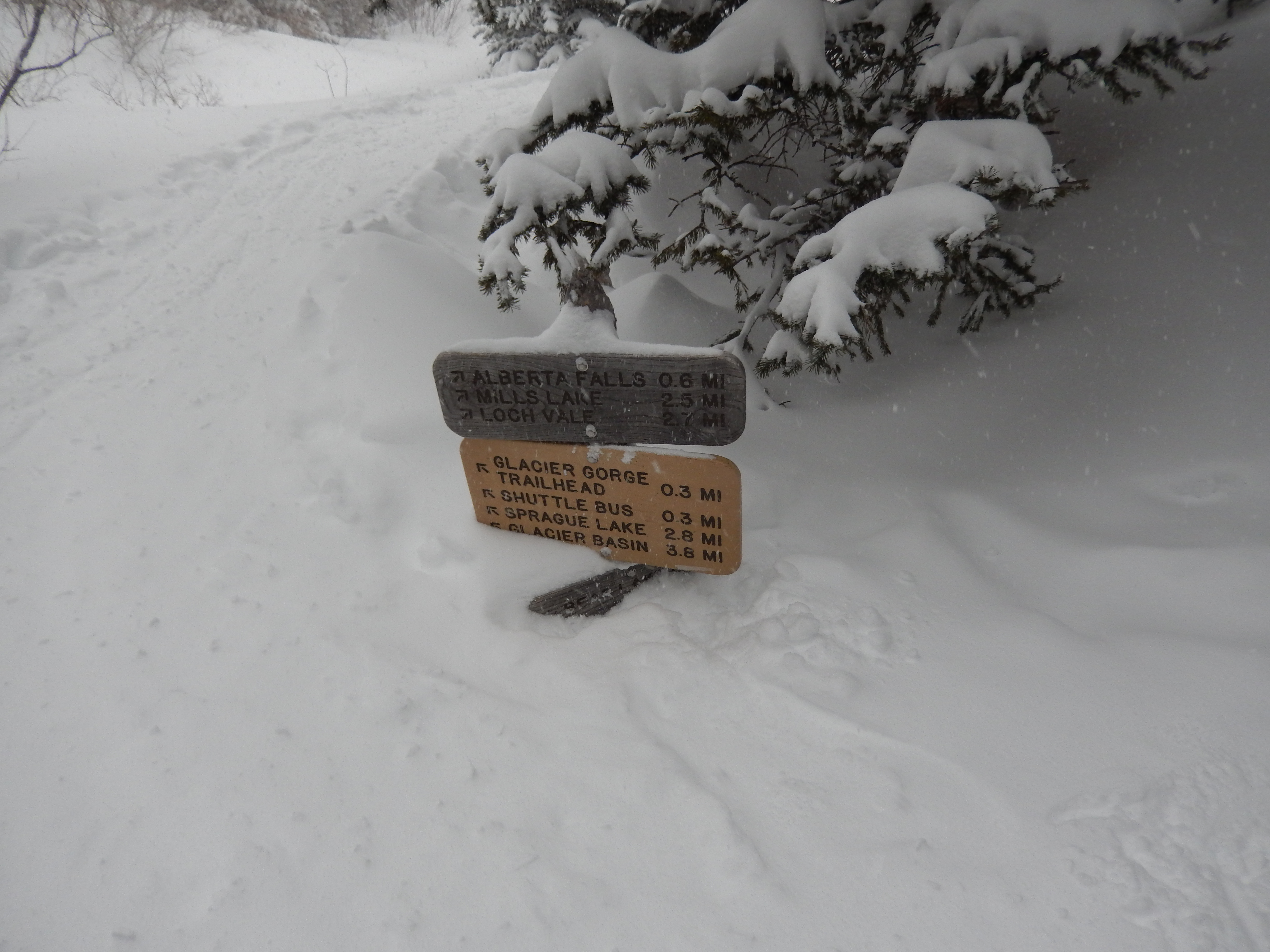
these signs are usually about chest high in the summer. We are almost walking on it
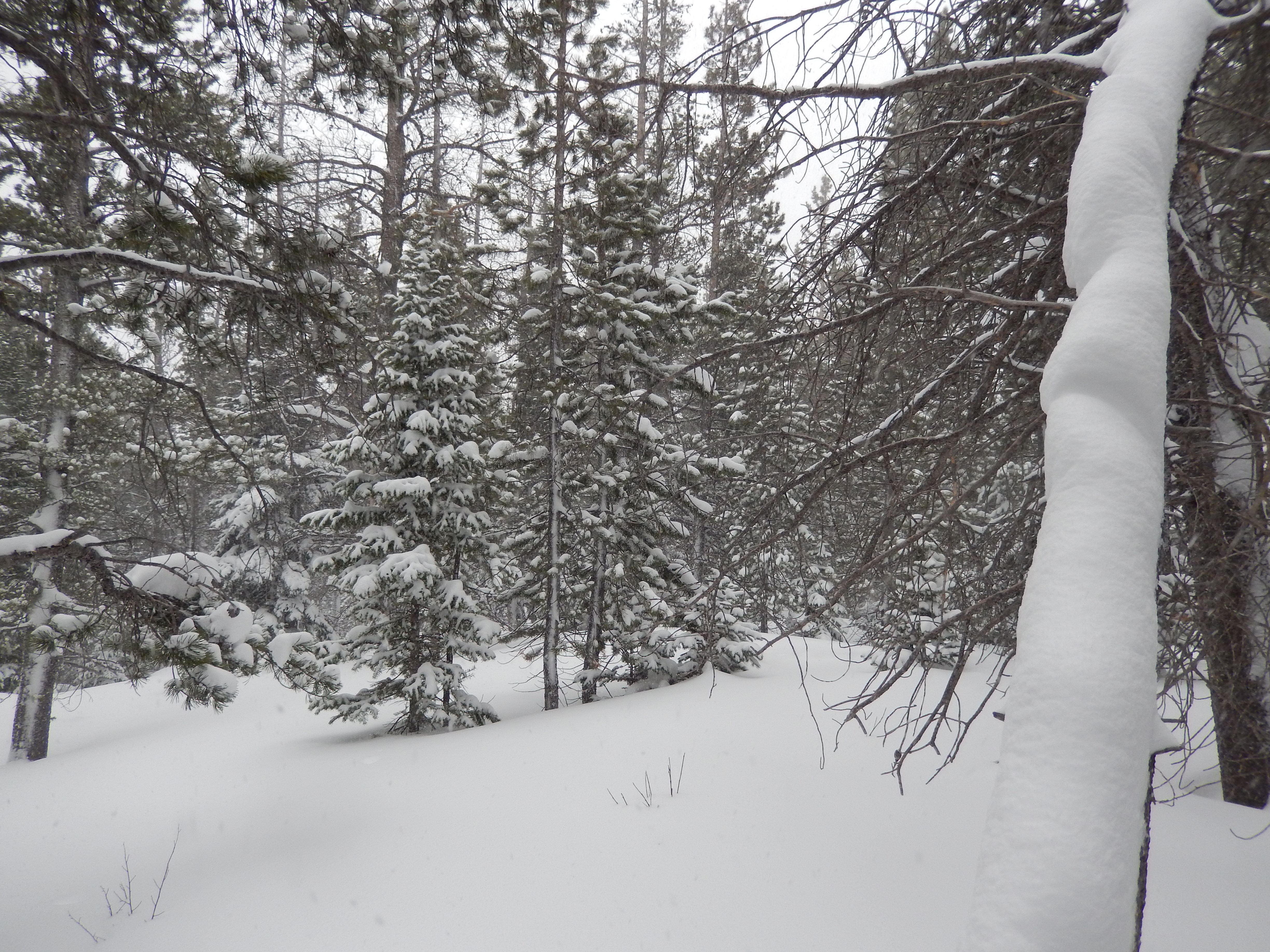
On the way up we were hardly on a path… we broke our own trail and eventually made our way up to Mills Lake in Glacier Gorge. The weather was terrible, heavy snow and the wind just got worse the higher up we climbed but I still had an amazing time! The best part about the snowshoe was the guides and their comfort with the area, with that knowledge they said we could pretty much explore where ever we wanted and let me tell you it got pretty creative. If I was honest with myself, I was ok with this approach because the weather was so bad that there were no views to see anyway, but on a nice day this might have been a little bit of a bummer as I have read that this trail has amazing views!
The view as we went off the winter trail
I think originally the plan had been to sort of follow the summer trail to Mills Lake, we wove in and out of huge drifts of snow and along a creek bed until we eventually came to the Alberta Falls, which were of course covered in lots of snow.
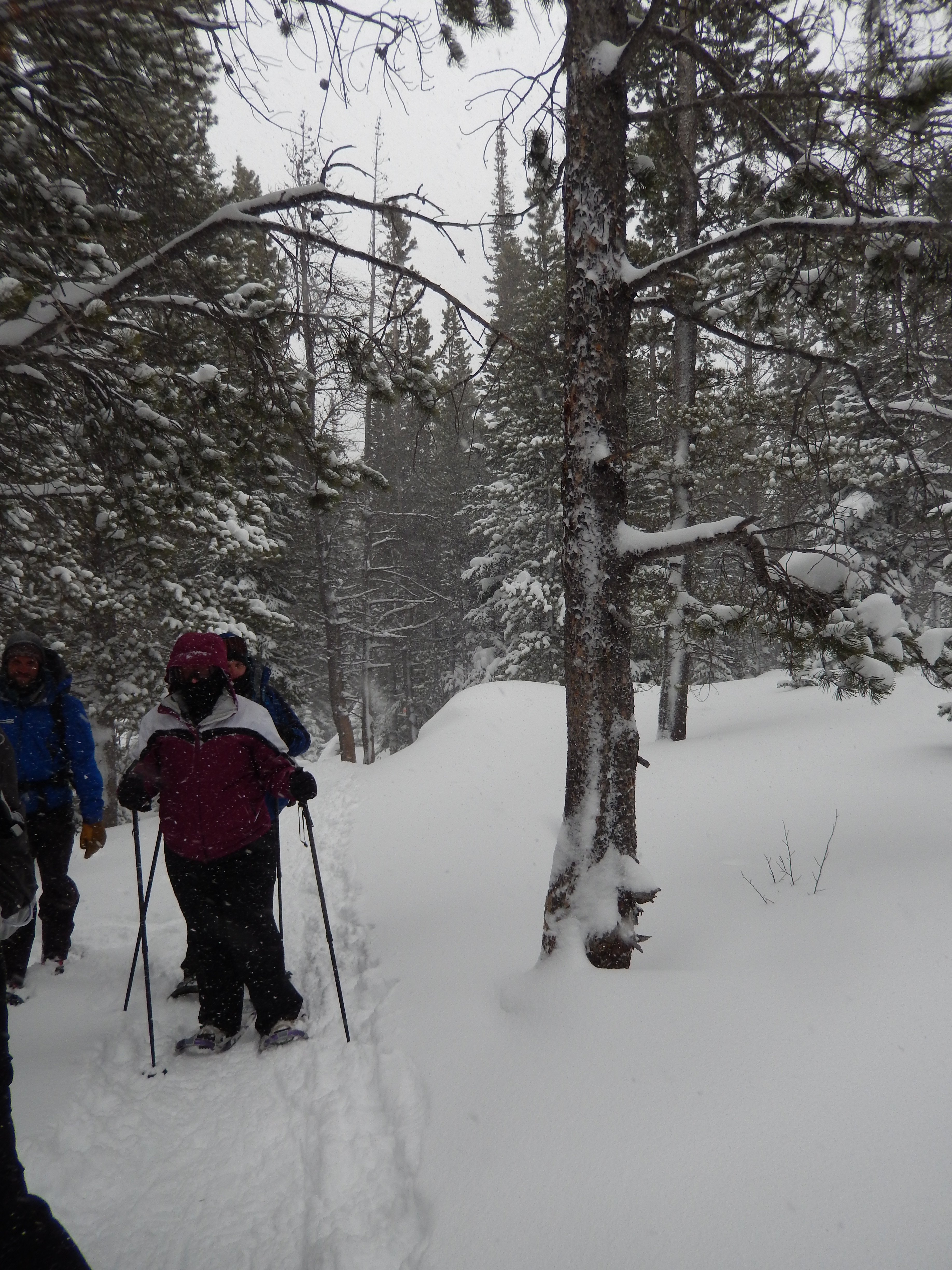
Once we got past the falls we crossed over the creek a few times until one of our group broke through the ice and soaked her foot. This wouldn’t have been a big deal except she had on gym shoes…. yep she wore gym shoes to snowshoe in even after the email and phone call the day before said how important waterproof boots were. To make it worse, for whatever reason she insisted on breaking trail… in gym shoes and the guides were not going to fight with her so they gave general directions and told her to just have fun with it. Needless to say after they got her out of the creek, into dry socks and caught back up with the rest of us, we had gone pretty far afield of the summer route.
Alberta Falls Somewhere over there
Again not a problem, as they just took the lead and got us back on track, we did everything you could hope to do in snowshoes during this correction path and it was so fun. We climbed up steep inclines, through thick trees and around massive boulders, I fell a lot but it wasn’t a big deal because it was in like 6 feet of snow so no injuries!
Leaving Tracks
As we got closer to the lake, the wind and snow really picked up intensity it was pretty much like walking in a blizzard. One of the guides knew of a great spot for the fondue across the lake… like walking across it…. so we snowshoed across Mills lake and had a lovely fondue out of the wind while watching it whip around the lake with a crazy amount of snow. Did I mention it wasn’t supposed to really snow at all on Saturday, maybe an inch at most? On Monday I read the park itself got around 35 inches of snow, most of that was on Saturday.
These guides were quick in getting the fondue together, it was simple but delicious and ready in like 5 minutes. We had been snowshoeing for 4 hours before the fondue and everyone was spent but exhilarated. When we had all had our fill, they asked us if we wanted to go straight down or take the longer way down. If it had been different weather I know I would have gone longer but it was wicked windy and the snow was very heavy at this point, as a group we agreed fastest way down was best. We took the winter route back down which gave me great comfort in terms of our first solo snowshoes that we certainly have in our future. How awesome is it that the guides were completely ready to take us out for as long as we wanted? An hour later we were back at our cars and heading home.
On the way back
I will tell you the weather could have made this a miserable experience but the guides were so great, laid back and engaging, it kept everyone’s attitude happy and fun.
Here are the details behind the trip, this was a groupon that I got for a day long guided snowshoe with fondue and cider lunch. It included the snowshoes and poles all for $98, the additional cost was tipping the guides and the $20 fee daily car fee to get into Rocky Mountain National Park (OR you can pay $40 for annual pass to the park, I bought the pass,) I can see us spending a lot of time in Rocky Mountain National Park this year so it was a good investment! Normally the Day long guided snowshoe with fondue and cider is $399 per person.
It was run through Apex Ex , they do all sorts of Mountain activities and adventures in Rocky Mountain National Park. I was very leery of how it may turn out as I always am a little fearful of groupons, but I cannot convey strongly enough how truly awesome our guides were. I don’t know how many of you have a chance to take advantage of something like this but if you are here in Colorado and want to do it , request Tyler and Mike they made it a perfect trip.
I cannot wait until our next snowshoe adventure, I wish those snowshoes would show up quick!
Yay! My first loss of the new year… that seems a little shameful since we are 6 weeks in but I am ok with it. I traveled in that time and gave up diet coke and now I finally feel like I am back in a groove.
Working out has felt really great each day and I managed to get weights in 4 times this week… to be honest I hate weights but I know it is important for my future well-being and for getting ready to backpack. I think the best part of the week was not chowing down sweets because I gave up diet coke.
The other great part of this week, I worked out with my backpack on for 3 of my 4 morning workouts. It totally made a difference, Aaron was right! Even though it didn’t have water or much weight just having it on while I did the elliptical was a huge jump in comfort on the snowshoe today.
I don’t know what your options are this week but if you can get out and hike, do it!
Highest Elevation: 9300 isn feet( Total Elevation gain 1100Ft)
Trail Length: we were shooting for 7-9 miles, what we got was 6 miles round trip.
Trail Uses: Hiker, Biker, Horses and in winter snow shoe and cross country skiing
Degree of difficulty: Moderate
Fees: $7 a day OR $70 for the state park annual pass.
Bathrooms: Yes at the parking lots
Pets: Yes, Dogs on Leash only.
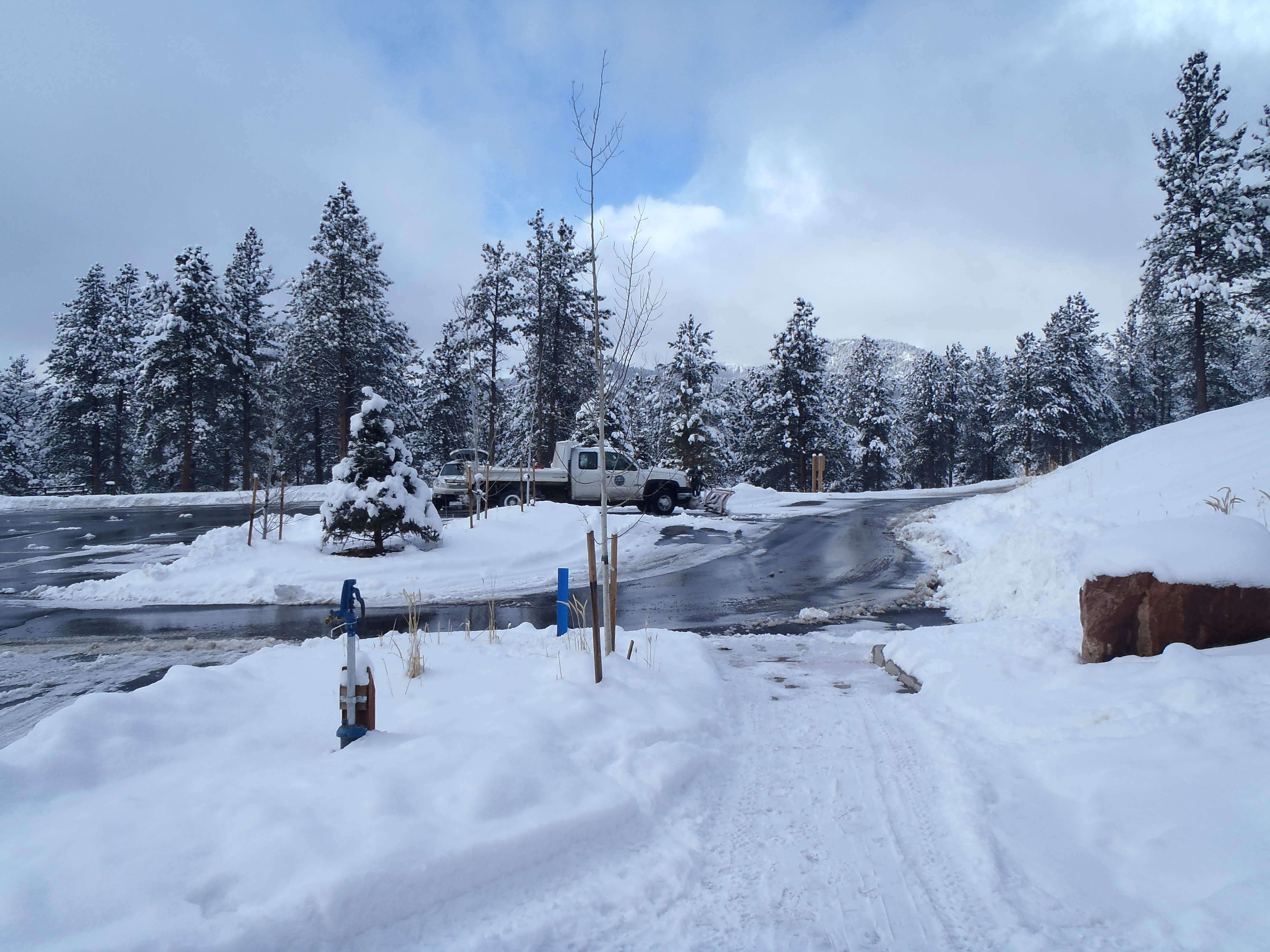
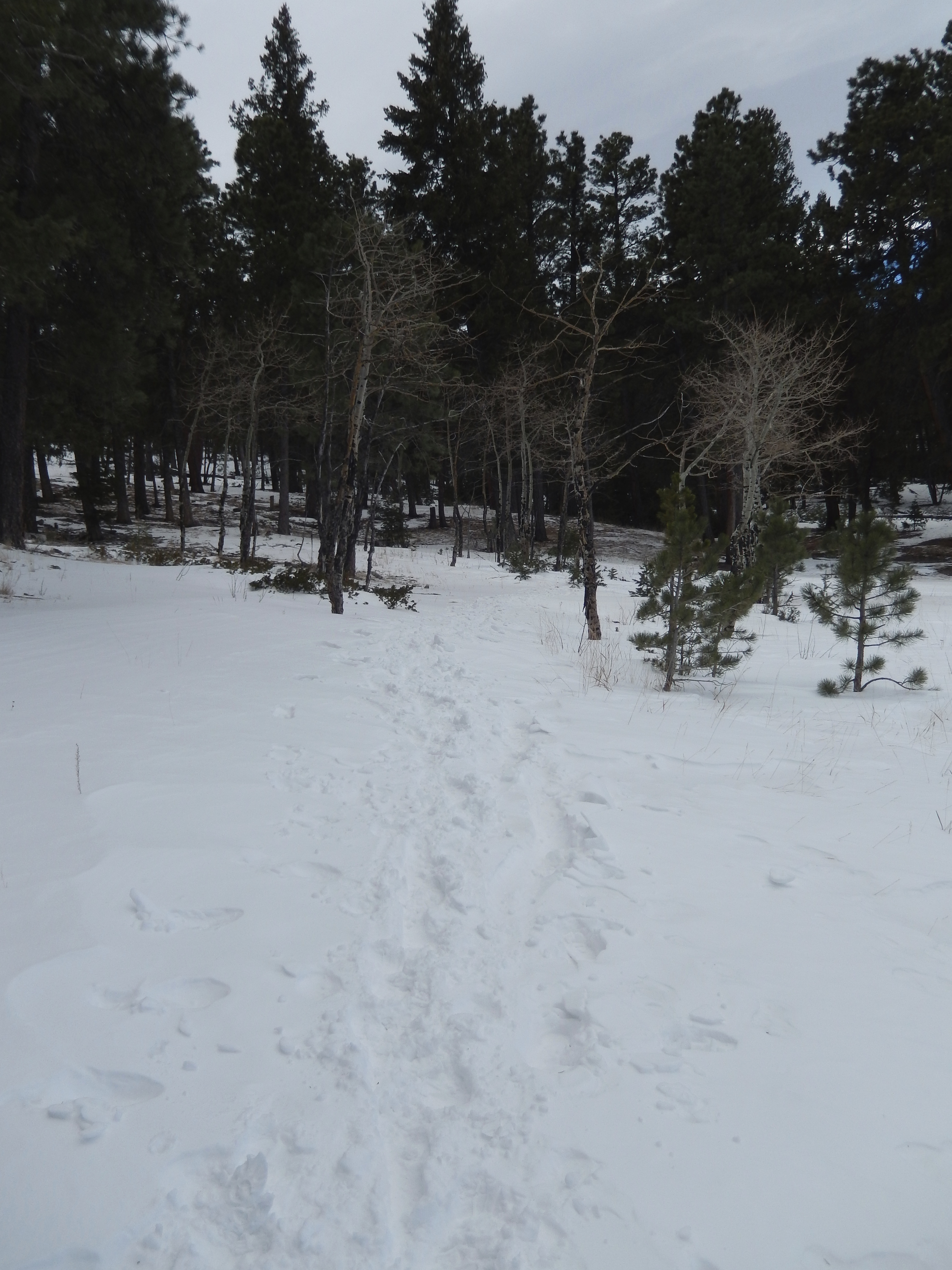
My biggest challenge after going to sea level is always getting my altitude lungs back, this past weekend I only had this one chance to get back up to 9,000ft in prep for our snowshoe this upcoming weekend. I had decided that Staunton State Park would be great to revisit as there were so many trails we didn’t yet explore and the trails we had done were pretty tame with altitudes between 8000-9500FT. What I hadn’t planned for was the 1-2 feet snow that started falling in the high country the 2 days before our hike and was set to continue through Saturday afternoon.
When we got to the trail head around 9AM, there was just one other car and we had passed a group of snowshoers who had not yet started their journey. As we bundled up, I will admit I was a little put off by how much snow I was seeing… I had somehow convinced my self that this area wasn’t hit as hard as other mountain areas. The bonus to that snow, everything was stunning! The sky was becoming more cobalt blue than cloudy, while it was still snowing with clouds moving and changing like crazy.
starting out
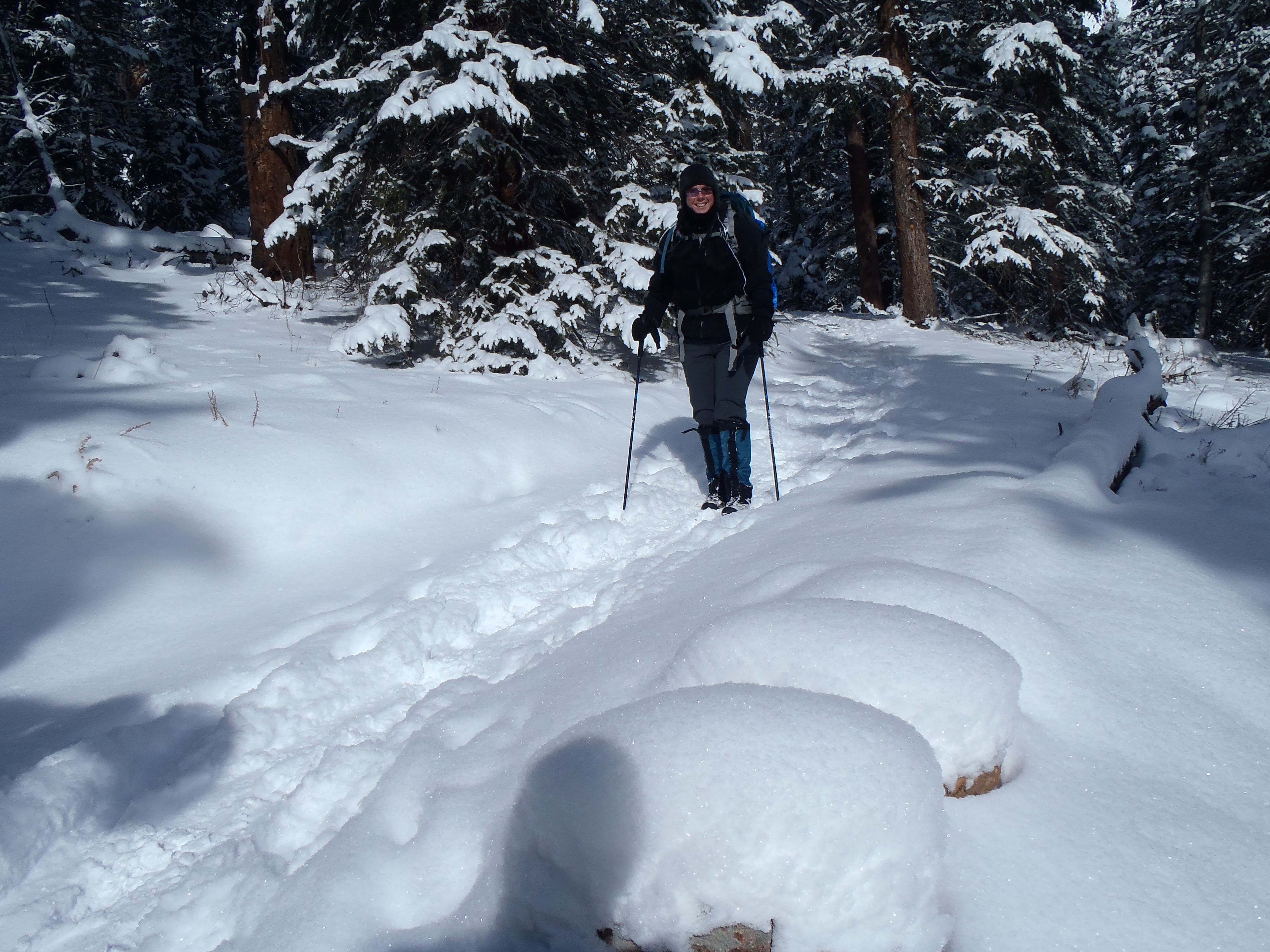
We started out pretty optimistic that we would be able to hammer out 11 miles, but planning on only doing 7-9 and it seemed possible that first quarter-mile. Then we had to start pealing off layers and at the same time the snow shoeing group passed us. They all looked so happy and fun. At this point the trail was somewhat broken in with traffic from either super early morning users or the day before, so there was only a couple of inches to really deal with.
As we moved on, I took a turn at being in front because I want to make sure that I take equal time in finding the path and getting us to our destination once we start backpacking. It wasn’t long before we passed the snowshoers as they peeled off layers. I didn’t think much of it at the time and just kept plowing through.
We really started to climb about half a mile after passing the group and then slowed down. The snow was much deeper, no one had come this way in a while, likely since before the storm and under the snow was not so fun ice. It was hard work! The trail moved along a nice ravine, the trees were heavy with all the snow but crazy beautiful…We pulled over to peel off another layer and the group of Snowshoers were there again. I was thrilled no more breaking trail for us…but then they stopped….right next to where we kindly pulled off the trail…. and waited. I admit at first I was wondering why they wouldn’t want to get ahead of us, but it turns out they didn’t want to break trail either.
I will tell you that this felt like the longest 2.25 miles I had ever hiked and when at just over 2 hours we hit that trail marker for halfway on the Mason Creek Trail. I started laughing, knowing we would be lucky to make the shorter loop I had planned, let alone do anything more than 7.5 miles. Oh and clearly at the halfway sign was where everyone had been turning around, there were NO trail prints after this sign.
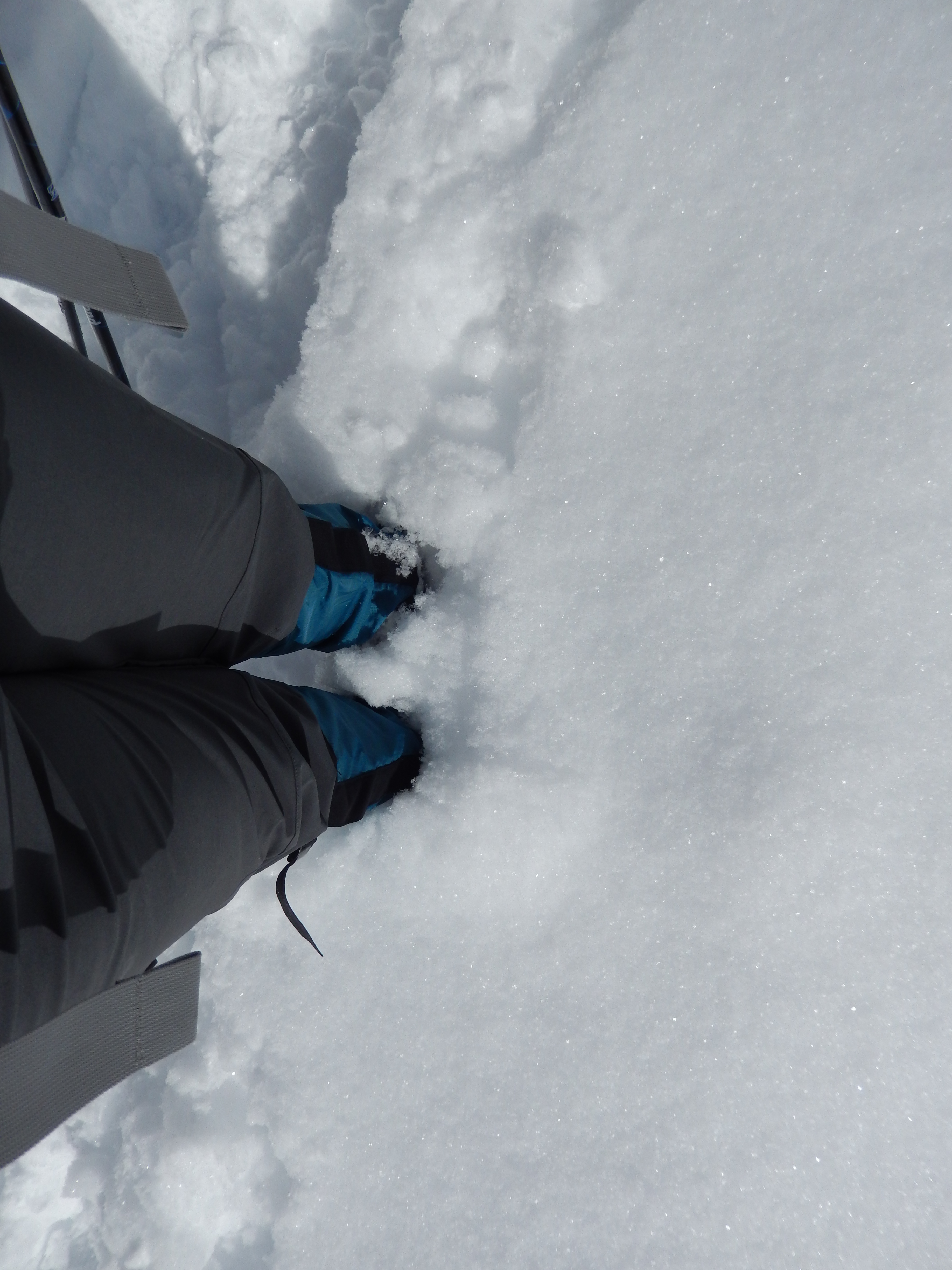
getting close to the halfway mark of the Mason Creek TrailThe snow is just below my knees…although this looks odd
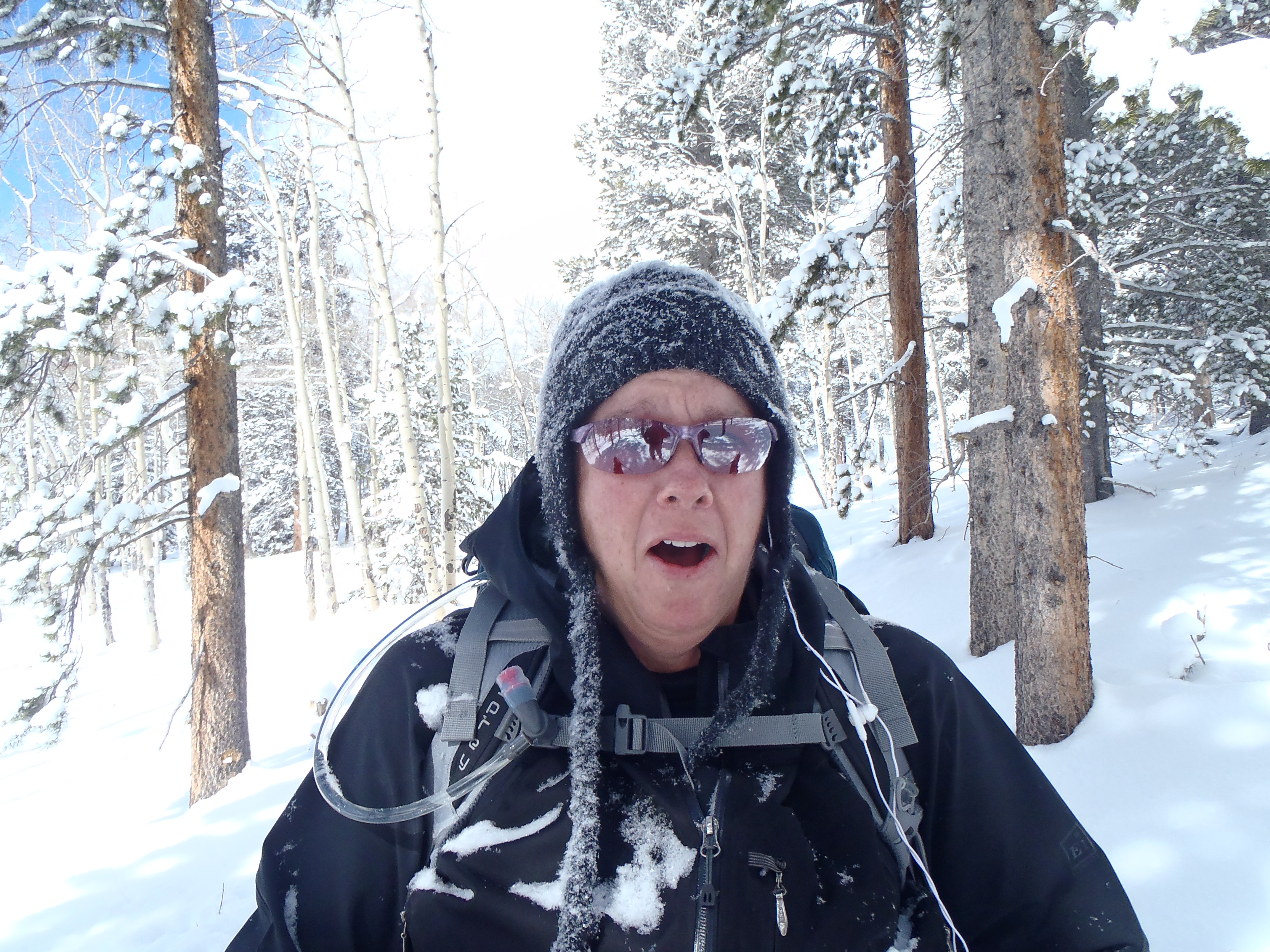
We went just 3/4’s of a mile further and my legs were straight up jelly mush, we were taking pictures of a pretty aspen grove(aka – catching our breath) when I had a heart to heart with myself. If my legs were in this shape and we weren’t even half way through, how likely was I to hurt myself if I continued on. It was then that I called the hike and we headed back. I am glad I did, as on the way back down I did indeed fall but it wasn’t too bad.The best part of the day was insane beauty all round us! We had moody skies with breathtaking blues, grays and whites. The snow-covered surroundings made me feel like we were in a fairy tale of some sort, we even had some serious snow fall as we were hiking at one point. And the treevalanches ( when the snow all falls off of a tree for no apparent reason) were fun to try to catch with the camera… until one caught me… all down my back …. with all my base layers showing since I was so hot from the climb and trail breaking. Surprisingly Aaron caught it on film…
Before TreevalancheGetting hit by the treevalanchepost treevalancheNear missTurnaround point
After 4 hours of hiking just 6 miles we headed home a little defeated and a lot worked out, we wimped out our Sunday hike and just enjoyed the sore muscles from Saturday. After the directions are some of our favorite pictures from the day.
Where ever you are, I hope you get out and hike soon!
Directions: Take US Highway 285 south to Shaffers Crossing, about 6 miles west of Conifer. Turn north on Elk Creek Road and follow the signs 1.5 miles to the park entrance
On the way back
The state park did a great job plowing the parking lot!
Yep I gained weight and I am so not surprised…. I mean I ate amazing food, a lot of it, then drank lots of alcohol and had a great time in Seattle last weekend! The damage was much worse when I stepped on the scale upon my return so I am thrilled with this modest gain after a good 5 days of working hard.
The other strange twist to this gain, how much I craved sweet food after giving up Diet Coke. I mean I like something sweet occasionally but without a doubt, I am a salty girl. Give me chips over chocolate any day, but the first 2 weeks of no diet coke and all I could shove in mouth was sweet stuff in frightening quantities. I am over it now, but that is a side effect of giving up diet coke no one ever mentioned. I am resoundingly diet coke free though. I even passed the tough yummy-breakfast-out-at-my-favorite- breakfast place-and-it-only-tastes-perfect-with diet coke-test and had water with my pancakes. It still tasted good…. For the record I totally miss diet coke and want it with every meal, but the headaches are gone along with the bizarre sweet cravings.
I am just trying to stay positive and hope this next week is a better one!
On a different note, I am just 5 days away from my guided snow shoe and am so excited!!! The mountains have been getting hammered with snow, like feet(s) of it so it should be the perfect way to learn!
Along that line, I started out my morning workout today with my backpack on in hopes I can carry my own camera and tripod on the snowshoe, along with my water, extra gear and food. Aaron suggested it as he found a lot of success in getting used to more weight in his that way. I sweated way more than I usually do with that bad boy on, but it wasn’t too bad. I cannot see today how I will get to carrying 40lbs in it by summer but I am sure I will!
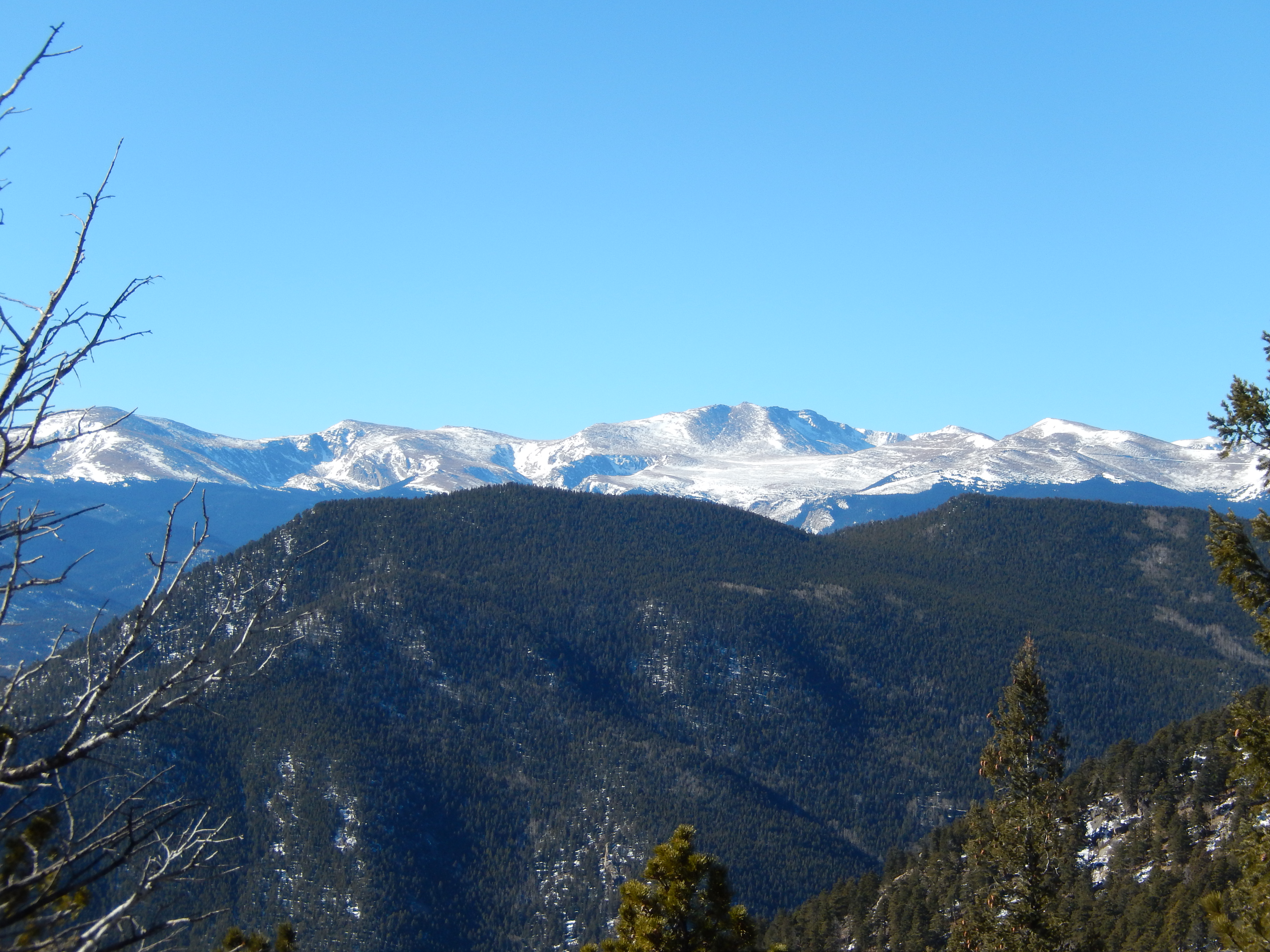
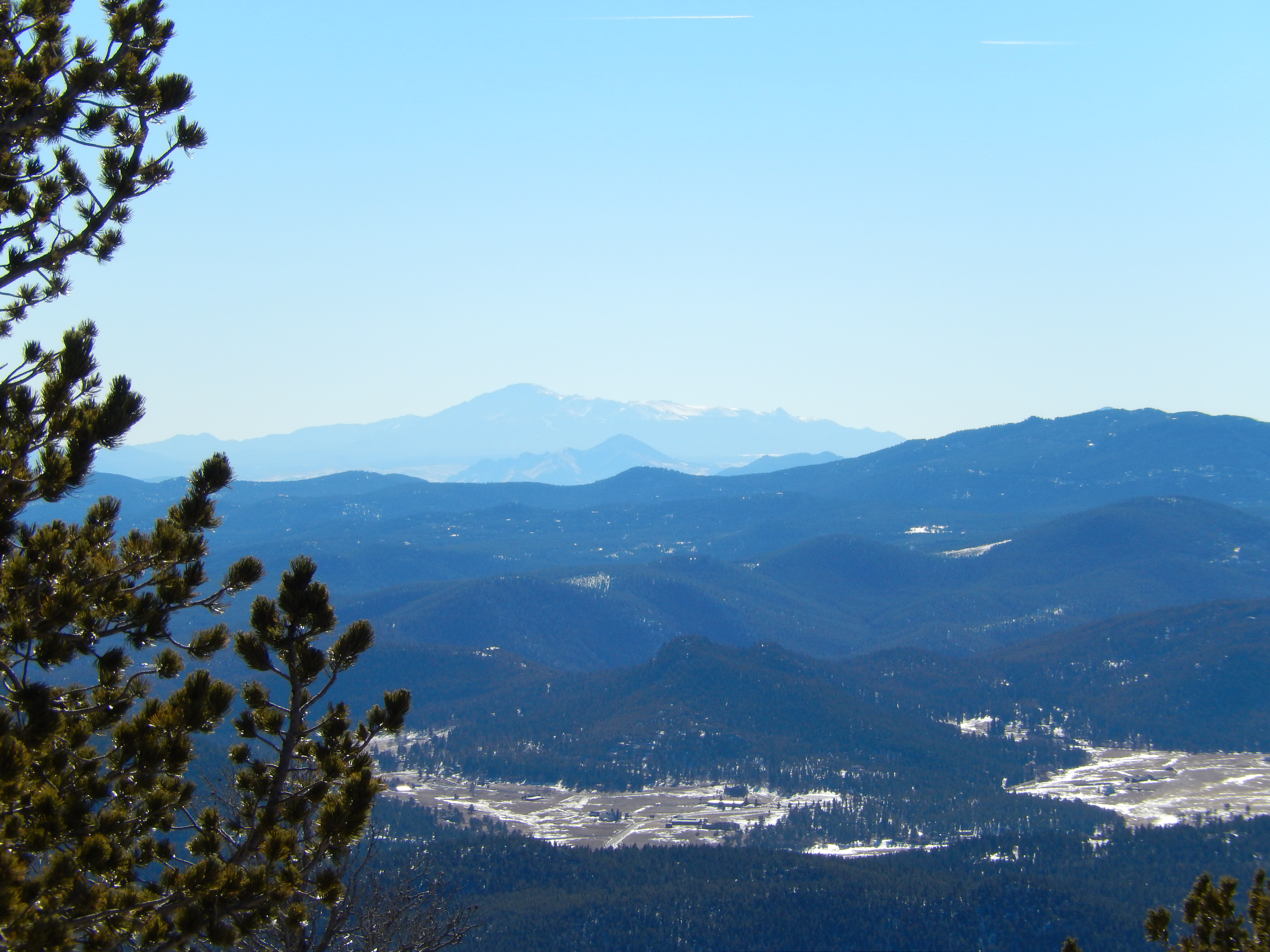
My one goal this past weekend was just to make it above 9000Ft on our hike. I had wanted to hit a new trail and then we got on I70 going west on a Saturday morning. It was a parking lot even before Evergreen which is pretty bad. With the traffic nightmare ahead of us, I just pulled off at Evergreen and hit Bergen Peak( Hike details here). It gets above 9500Ft and is an excellent workout. Can I tell you how nice it was to have the knowledge to switch hikes at the drop of a hat! It was a proud moment for me.
Traffic with a view
The trail wasn’t too bad at all, yes there was snow and ice but not near the levels it was last spring or even this past fall. In fact, it had less snow than Evergreen Mt the weekend before, which is just down the road from it. It did still slow us down, that and hiking with our new backpacks on with some added weight made the whole hike take about 5 hours. It felt great! I was exhausted from the added intensity that snow brings to a hike. Plus the day was almost perfect with beautiful blue skies and almost no wind.
Oh and everyone must have been skiing, because we practically had it to ourselves until the last mile down. A great day of hiking for sure.
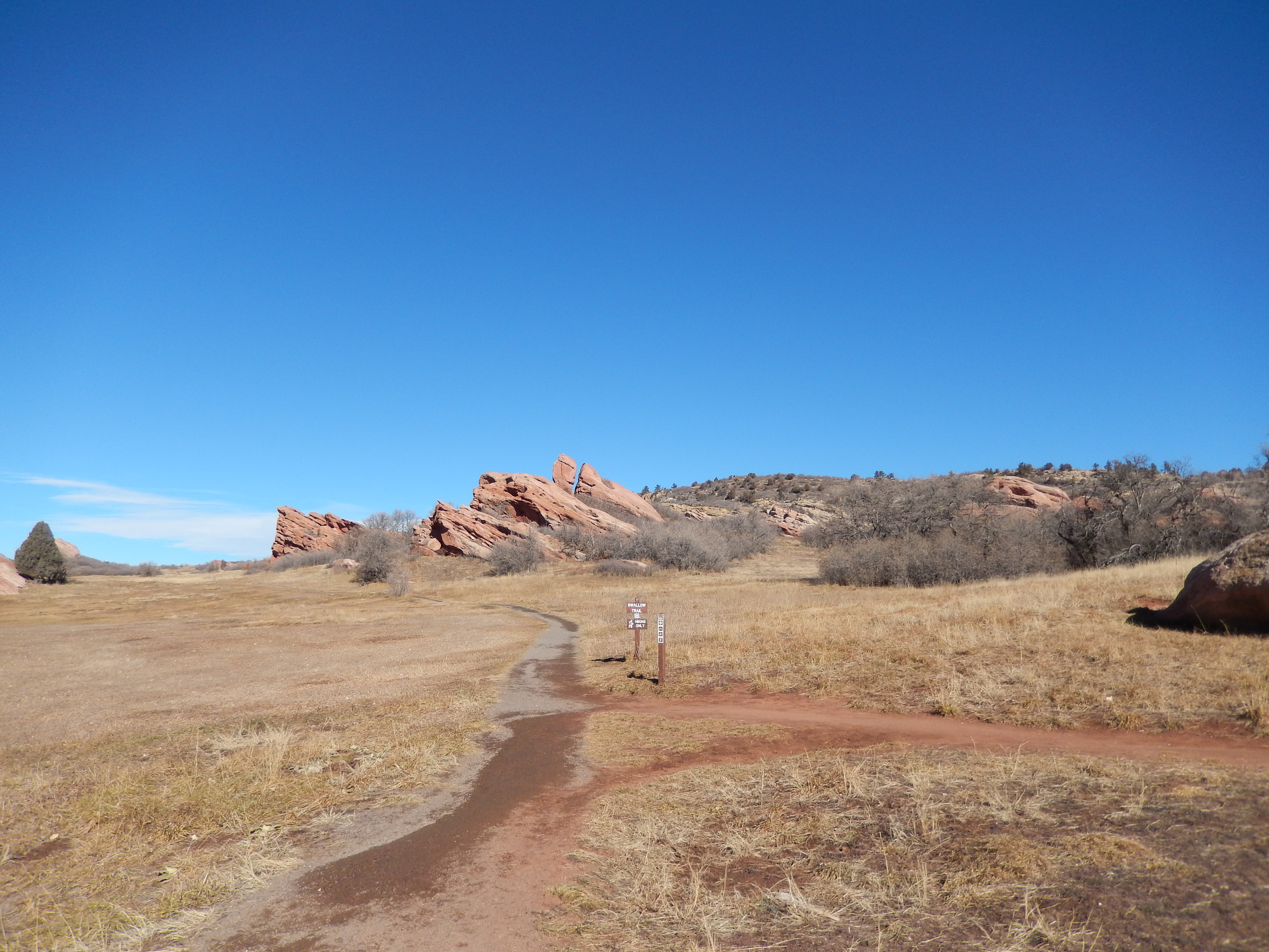
We felt very good Sunday morning and so suited back up and hit an easy 5 miles at South Valley Ranch. I felt so good, in fact, I added 5 lbs to my backpack for Sunday’s hike which effectively made it suck. Who knew 5 lbs would kill me like that!?!?! I was like the little kid being dragged along with my head and shoulders hanging down the whole way. And while Aaron was sweet enough to offer to take my extra weight, I refused because how else am I going to get used to it if I just throw stuff in his pack when it starts to feel hard. It made our quick 5 miles take a little longer then we hoped.
The day itself was AMAZING – 63 and sunny. We were hiking in shorts and just our shirt. Being on this trail on a nice day showed how insanely busy it gets. We were hiking with 100 or more other people, while more were showing up all the time.
Last Thursday I got to go to Seattle for a weekend of fun with my bestie Jason and his fiancé Molly, so no hike last weekend, but we plan to make up for it with 2 hikes again this weekend. I need to get my altitude lungs back quick because on 2/8 is our all day guided snow shoe and I am crazy excited for it.
I am itching to get out and hike now, it is going to be a long week of work!
So this sucks… not because there is no change but because well…. I did GREAT this week. I mean seriously great! I worked out and stayed within my calories every day.
The down side, I had events… I had my hair cut and colored( no washing for at least 24 hrs,, which means no hard sweaty working out for at least that long ,oh and I sweat like a crazy person at the drop of a hat). but I did other stuff that caused no sweating…. which was tricky.
I had too much fun out with my favorite lovely lady, Carrie, to celebrate how awesome she is another year older…
Oh and I was on track to lose…. until Thursday at 5PM when nature intervened.
Next week will bet better in terms of weight loss.
The other killer challenge I have taken on… getting off diet coke, yep I am giving up pop. This is crazy hard for me, I have seriously been drinking diet pop since I was 5 years old… the only time in my life I got spanked, opening a bottle of Tab when I was 5 or 6 before the party started( we only got pop on weekends and at parties in those days). My last few cans of diet coke ran out on Thursday and I have had anxiety dreams for weeks about it, you know the end of the world and the only thing you want is a cold diet coke… or trade your husband for a diet coke to save your life(no way… um I mean sure or of course). Do not offer any guests my diet coke ….I NEED THEM….. what is more important, diet coke or a healthy lifestyle(…. DIET COKE….) I mean a healthy lifestyle. man I love diet coke…..
Crafty Diet Coke for making me so addicted….. my goal this week to only succumb 1 time a day to my evil monkey on my back, diet coke. Oh and actually lose weight.
Anywho…. another week awaits with aspartame deprived headaches and cold sweats( and hot sweats because I sweat like a dude), I am committed.
The weather has been questionable lately and on Friday, high wind warnings were given to any place above 6000 Ft, which just about everywhere on the front range. Hiking in high winds is not fun especially when the warnings are for 80+ mile an hour winds at times. With this new little wrinkle thrown in, we decided a good old standby was in order… Evergreen Mountain (Hike Details here). The best part about going to Evergreen Mt is that it gets above 8500 Ft and the exit for the hike is right about where traffic was getting super bad for the skiers heading up for the day.
We timed it perfect, the winds slowed down right when we started at 9 AM, knowing that it would be picking up again around 11 or 12, our goal was to finish in 3 hours. There was snow throughout the hike but it wasn’t too bad, although it was bizarrely heavy and felt more like sand. The best part, we had the whole way up to ourselves which has never happened before! I think the wind warnings scared a lot of the other hikers off, so yay us!
The first time we saw anyone was at the summit and then it picked up a little traffic wise, I think saw about 10-15 people on the way down. Not bad for a Saturday at this open space. The other great thing was the sky and how it was changing through out the whole hike. At one point Mt. Evans was lit up like a spot light was shining down on it.
We finished the hike in just under 3 hours, right as the wind gusts really started picking back up. The hike was beautiful as always and challenging in terms of getting used to the higher altitude again. I want to get above 9000 Ft this upcoming weekend but I am not yet sure where to go.
The wind warnings stuck through Sunday, when we were planning on doing our second hike and then I slept in later than planned with company coming over around noon, getting to an actual hike was out. So I improvised, in between doing sets of weights I would just climb the stairs in my house. When we finished the weights, I did 30 minutes straight of stairs to get a total of 109 flights done in an hour. I officially named the stairs Mt. Hikingtohealthy. Having hiked the equivalent of 135 flights of stairs the day before, I figured my legs would be in good shape afterwards…. they have been so sore I can’t believe it!
Bottom half of Mt. HingtohealthyTop half of Mt. Hikingtohealthy
It was a great substitution for a day, but I did miss my views. Mt. Hikingtohealthy will be seldom visited…. unless we take the next step by printing off all our hiking pictures and line the walls with them so I have manufactured views. Right now there is still too much of Colorado to see to stay locked in my house climbing stairs, so that is low on my to do list.