Herman Gulch Trail #98 to Herman Lake, Bakerville CO hiked 6/28/14 & 7/4/14

1

Starting Elevation: 10,340

Highest Elevation:  12,000 is where the Lake is at.  We had a total elevation gain of  around 1800ft

Trail Length:  8 miles officially, we made it about 7 miles on 6/28 and the full 8 today.

Trail Uses: Hiker, Biker & Horses

Degree of Difficulty:  Moderate to difficult Mostly because of elevation.

Fees: None

Bathroom: Yes in the parking lot

Pets:  Yes

2

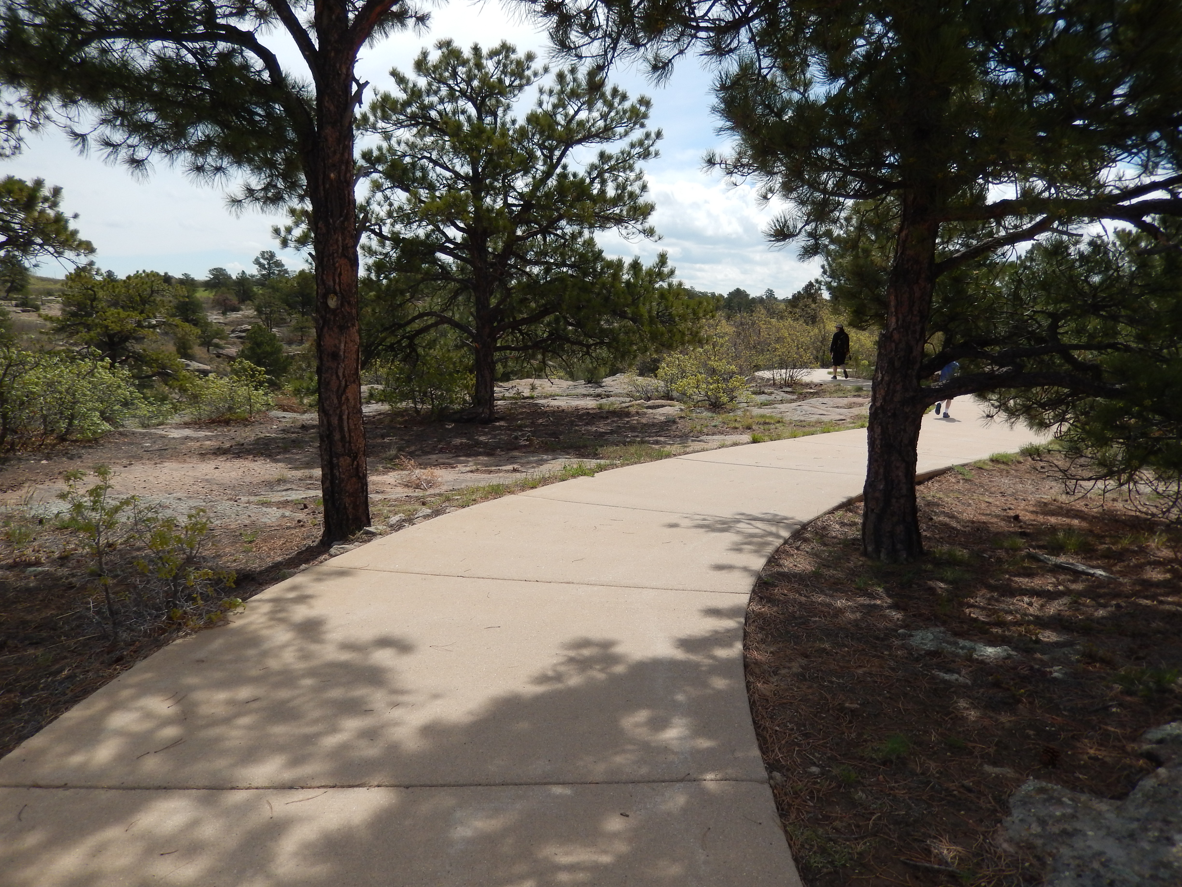
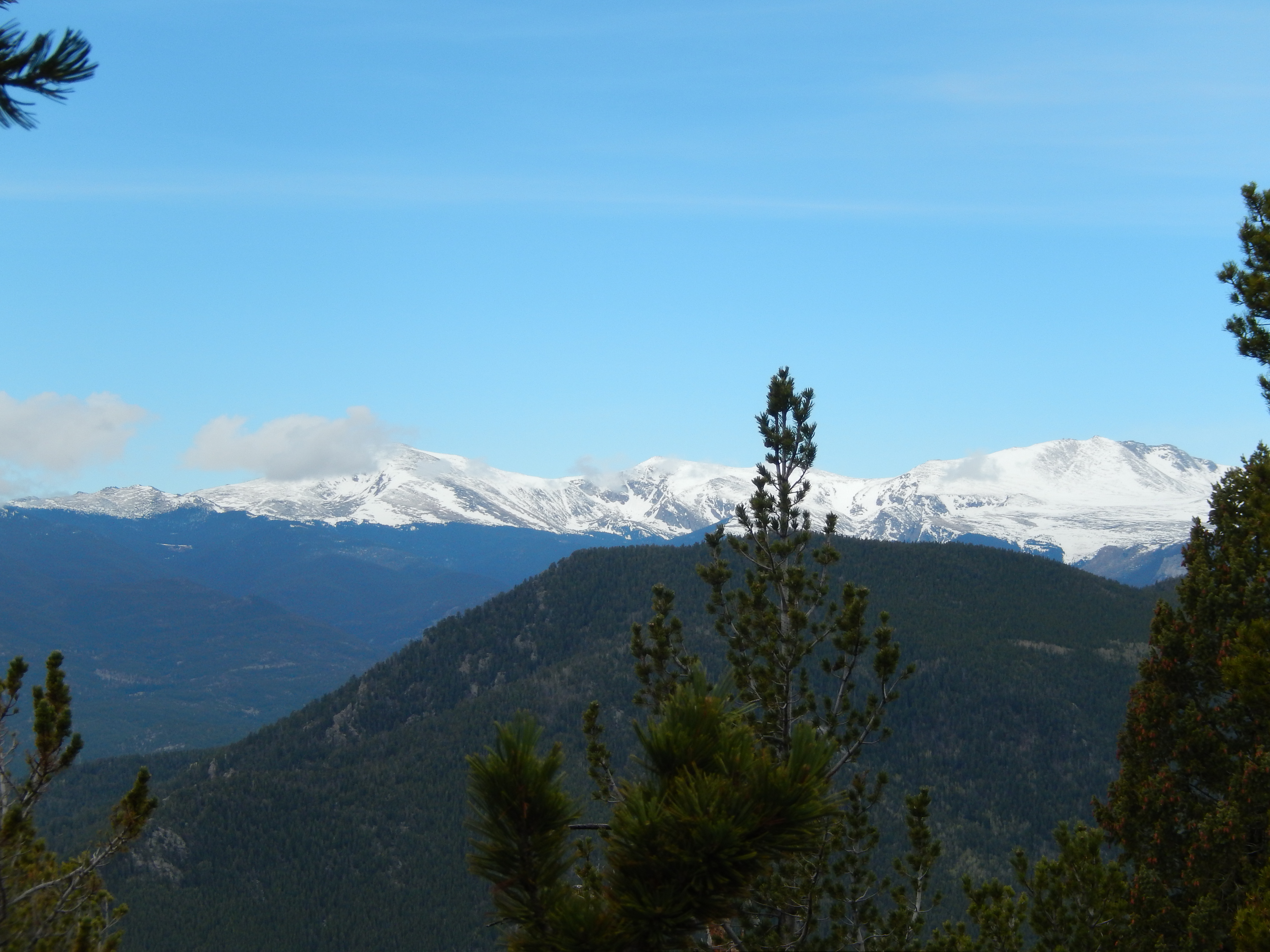
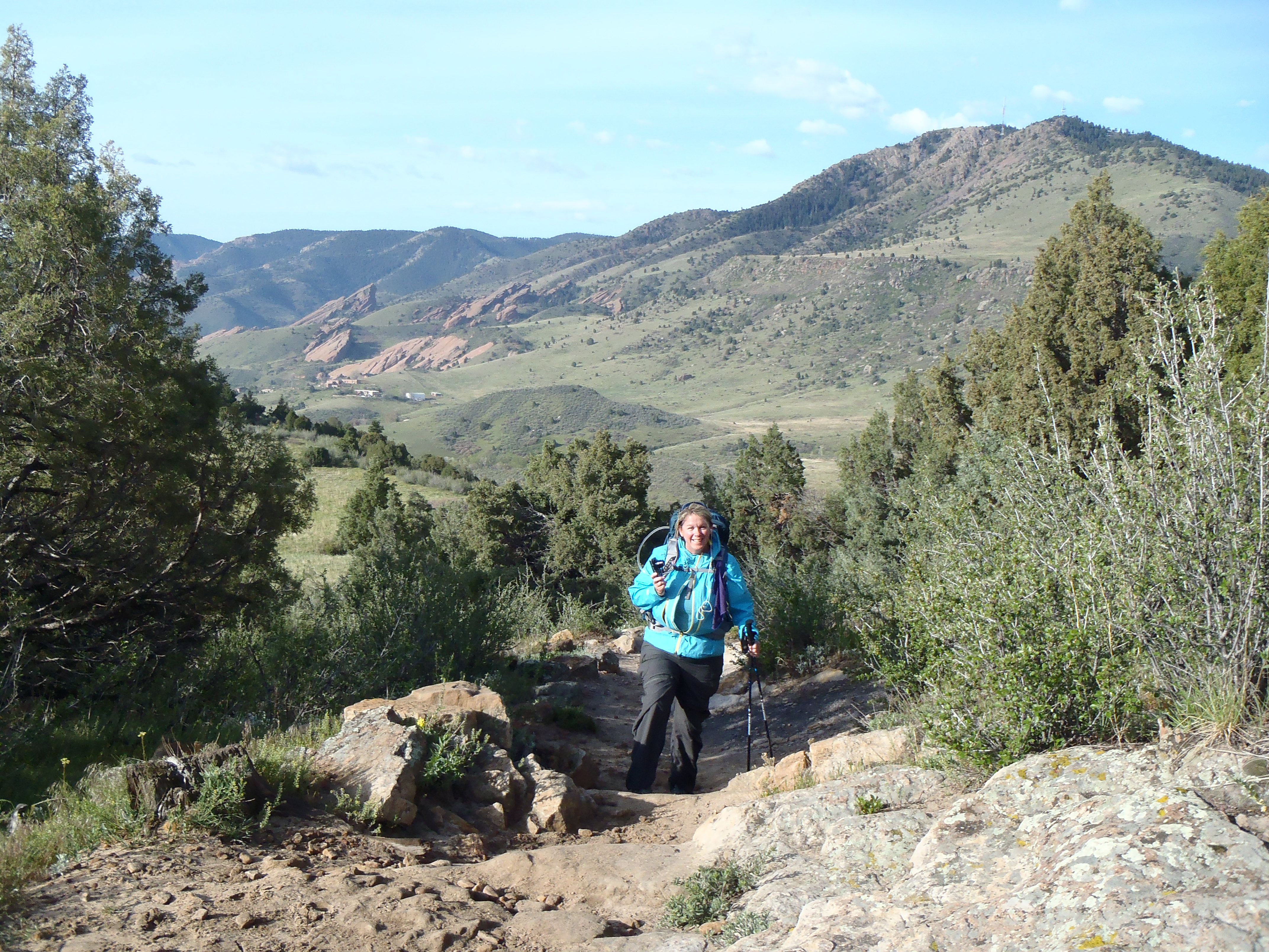
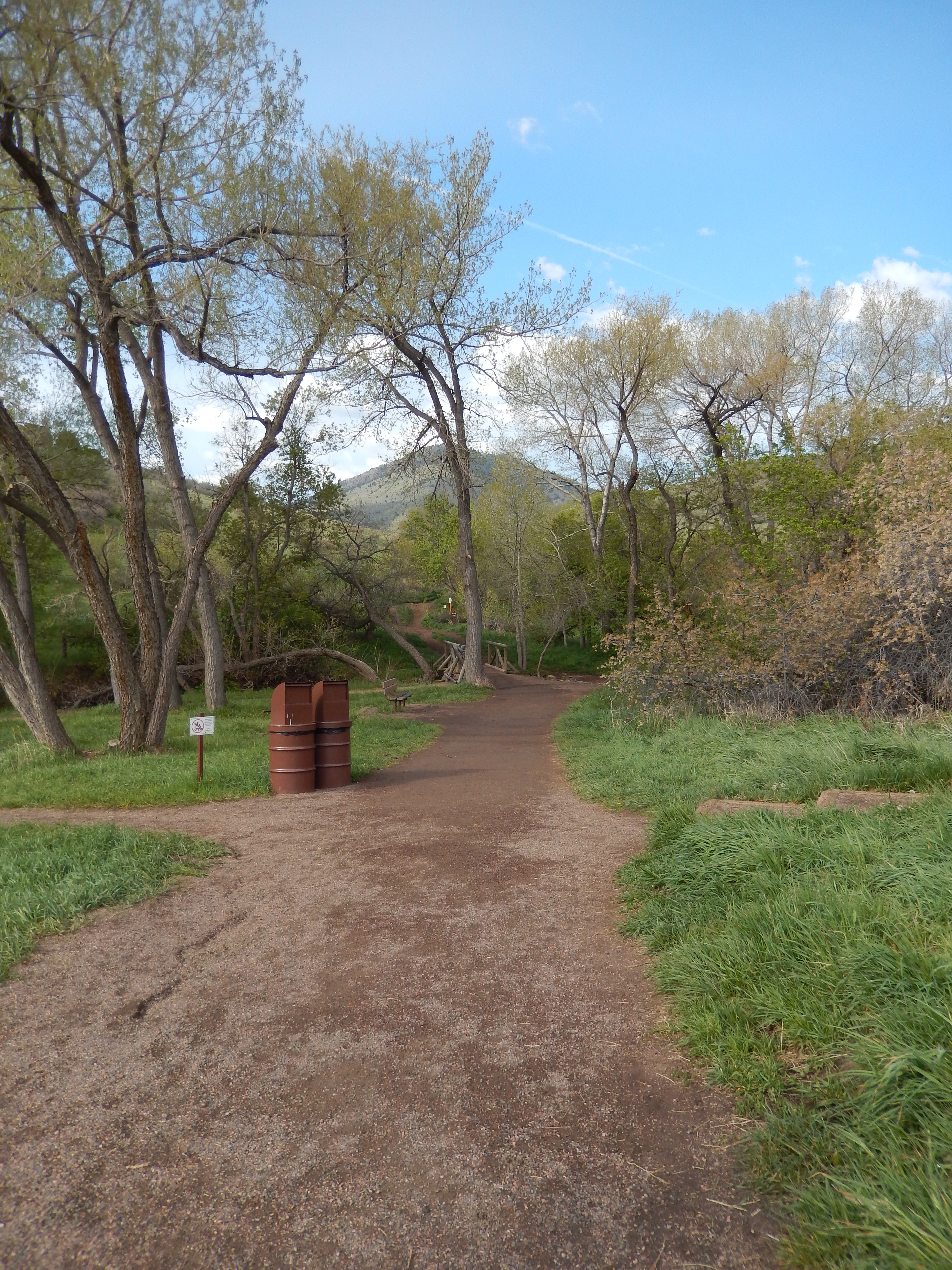
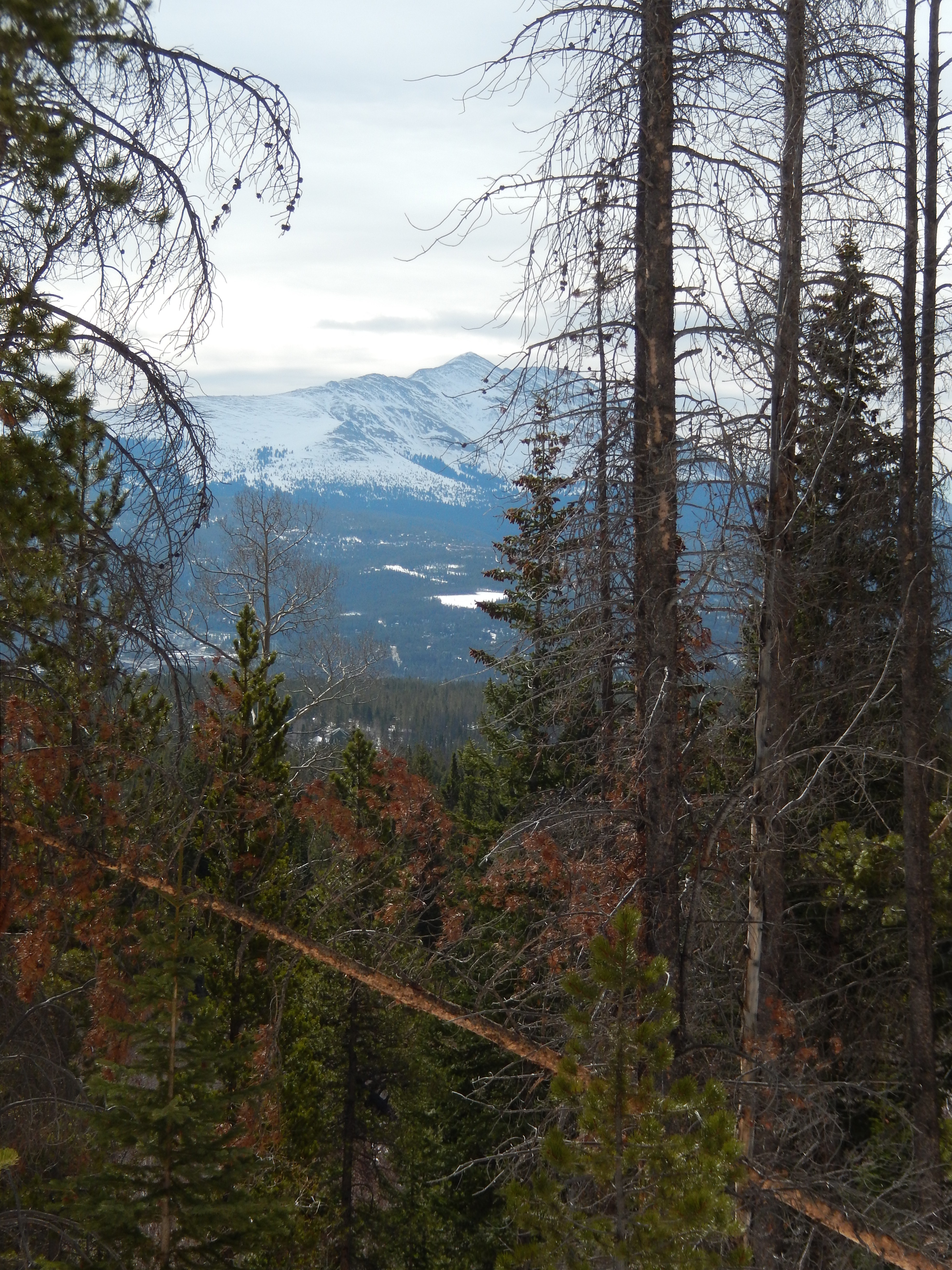
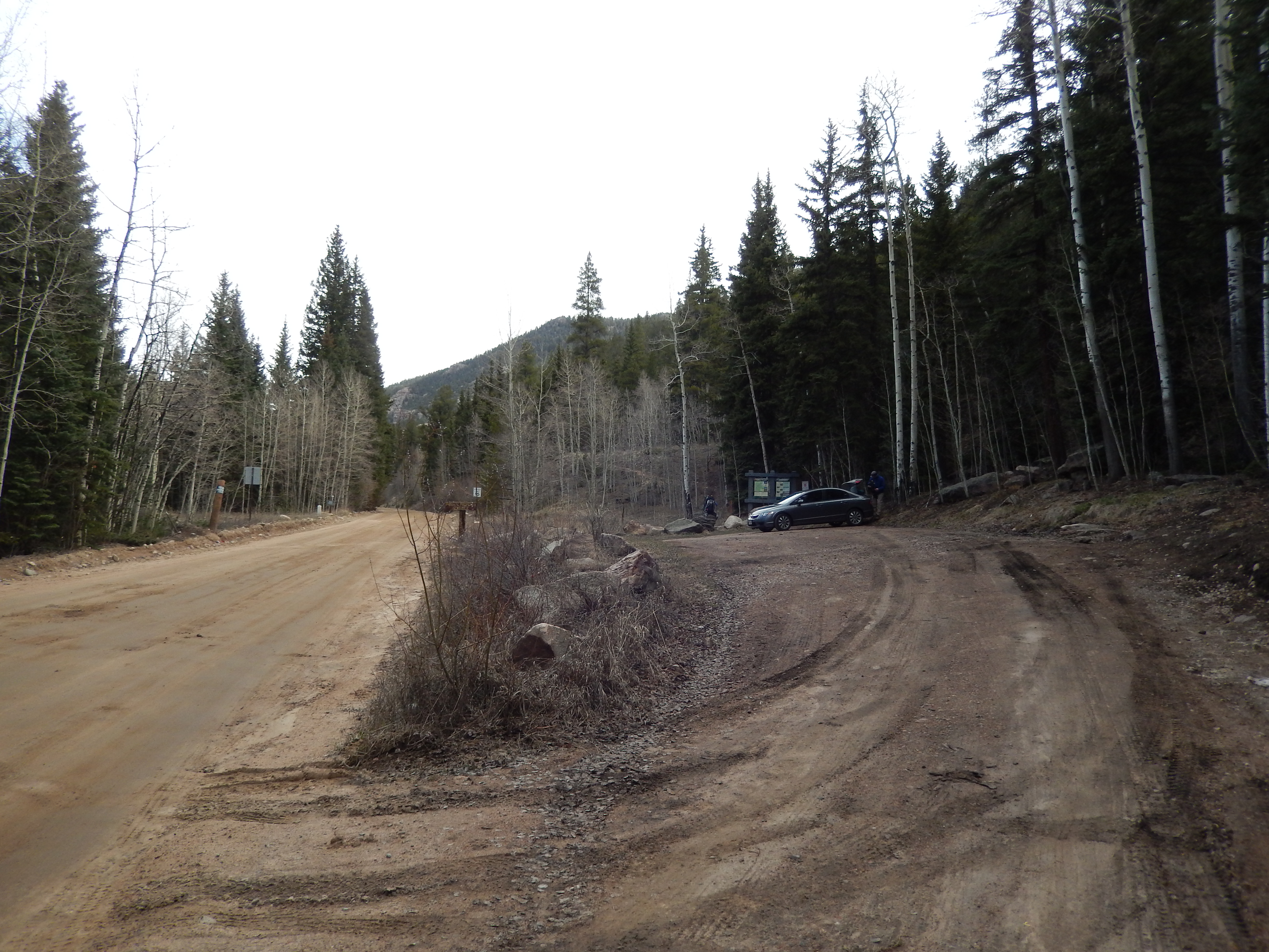
Being in that meadow behind Torrey’s(hike details here) last weekend made me want to keep seeing more amazing views.  I have had my eye on Herman Lake for a while, like 2 and half years kind of a while.  At first I was too nervous I couldn’t do it and then I was so focused on getting to a certain elevation each week that I kept skipping it.  I also know it is a really popular trail.  It is not overly long with a reasonable climb and astonishing views from almost every part of the hike.  Even starting at 7 AM, the parking lot was filling up fast and it is a big parking lot.   There are signs and a bathroom where the trail starts.

Parking lot Map Strating out

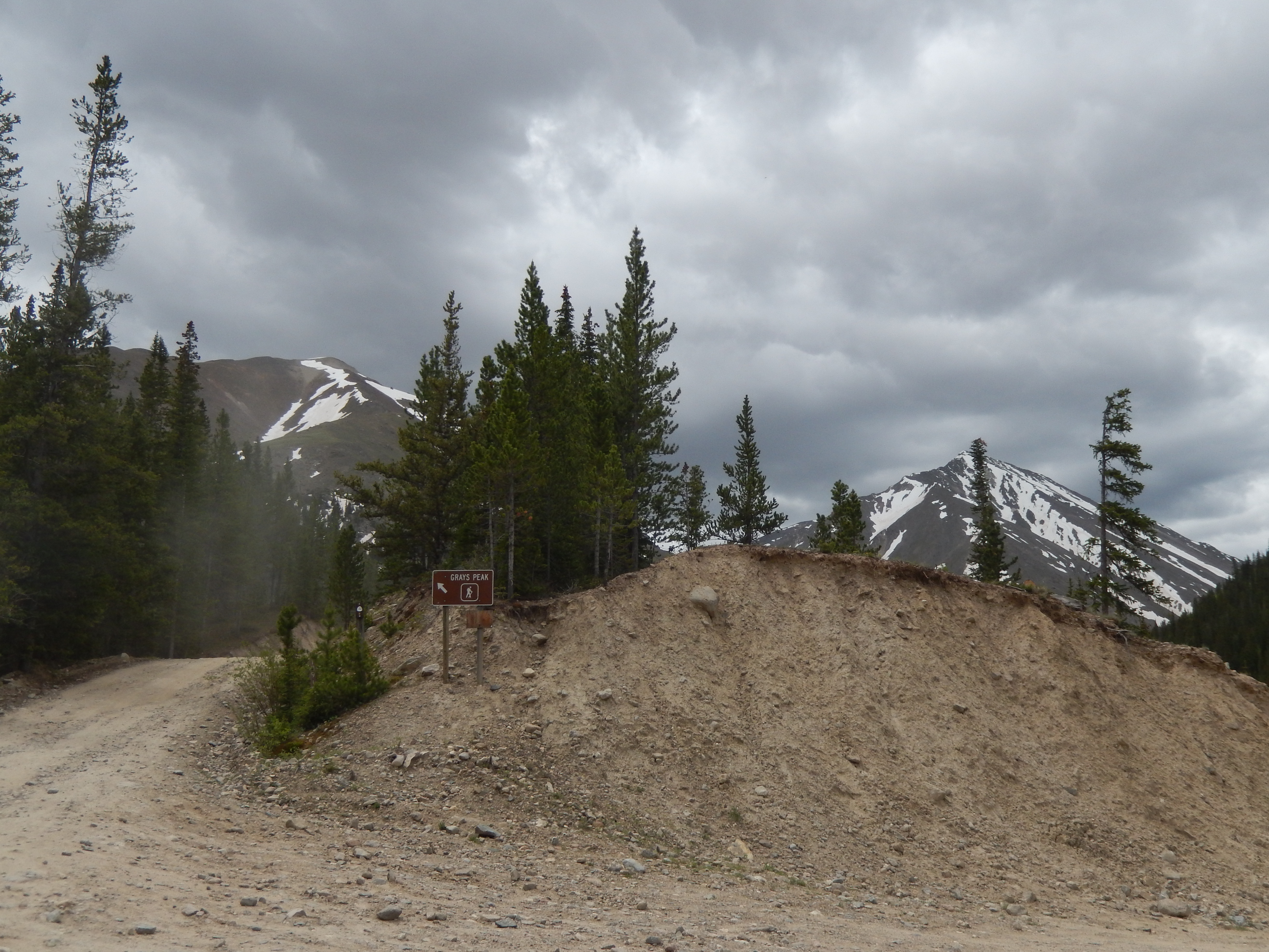
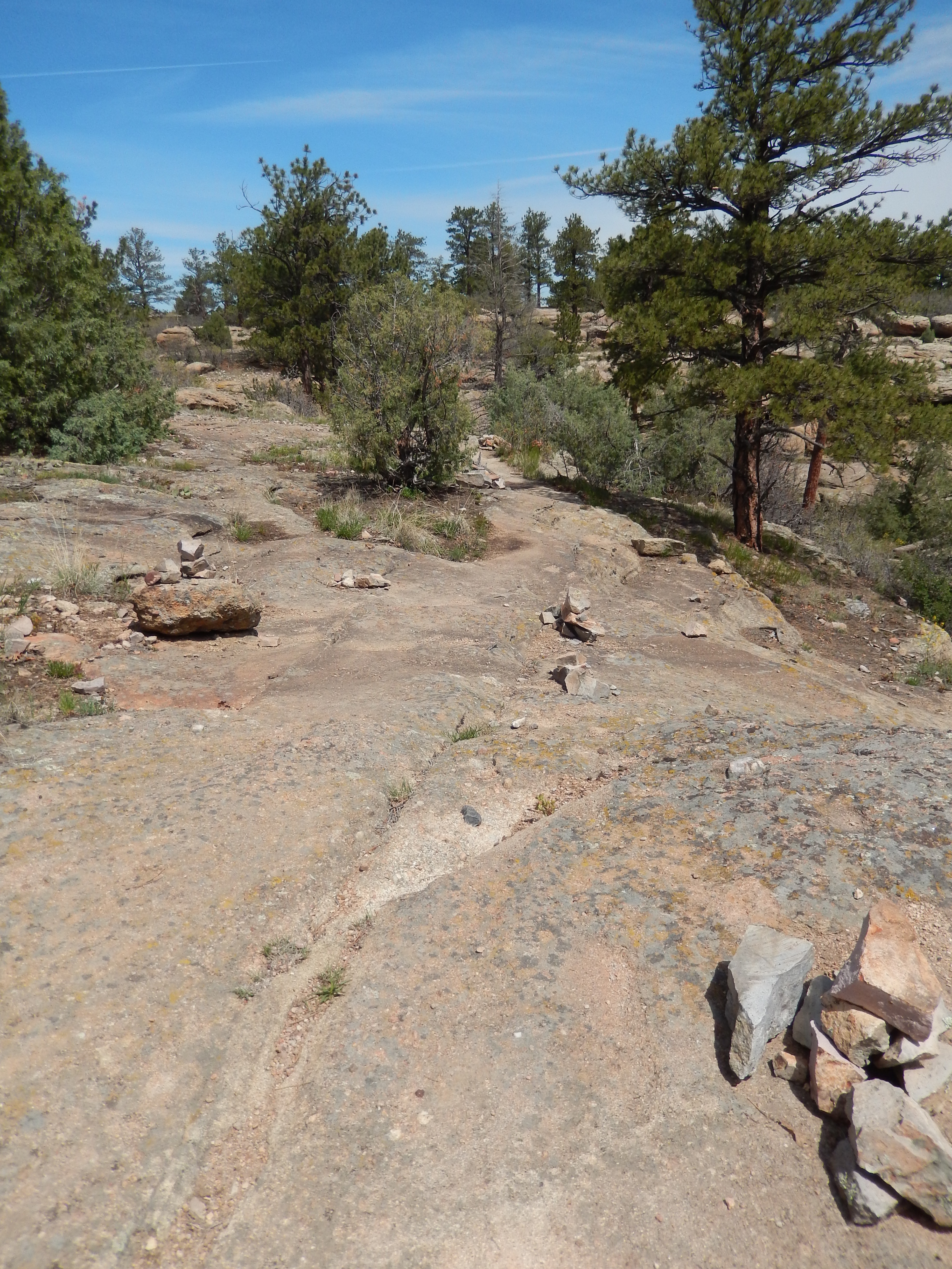
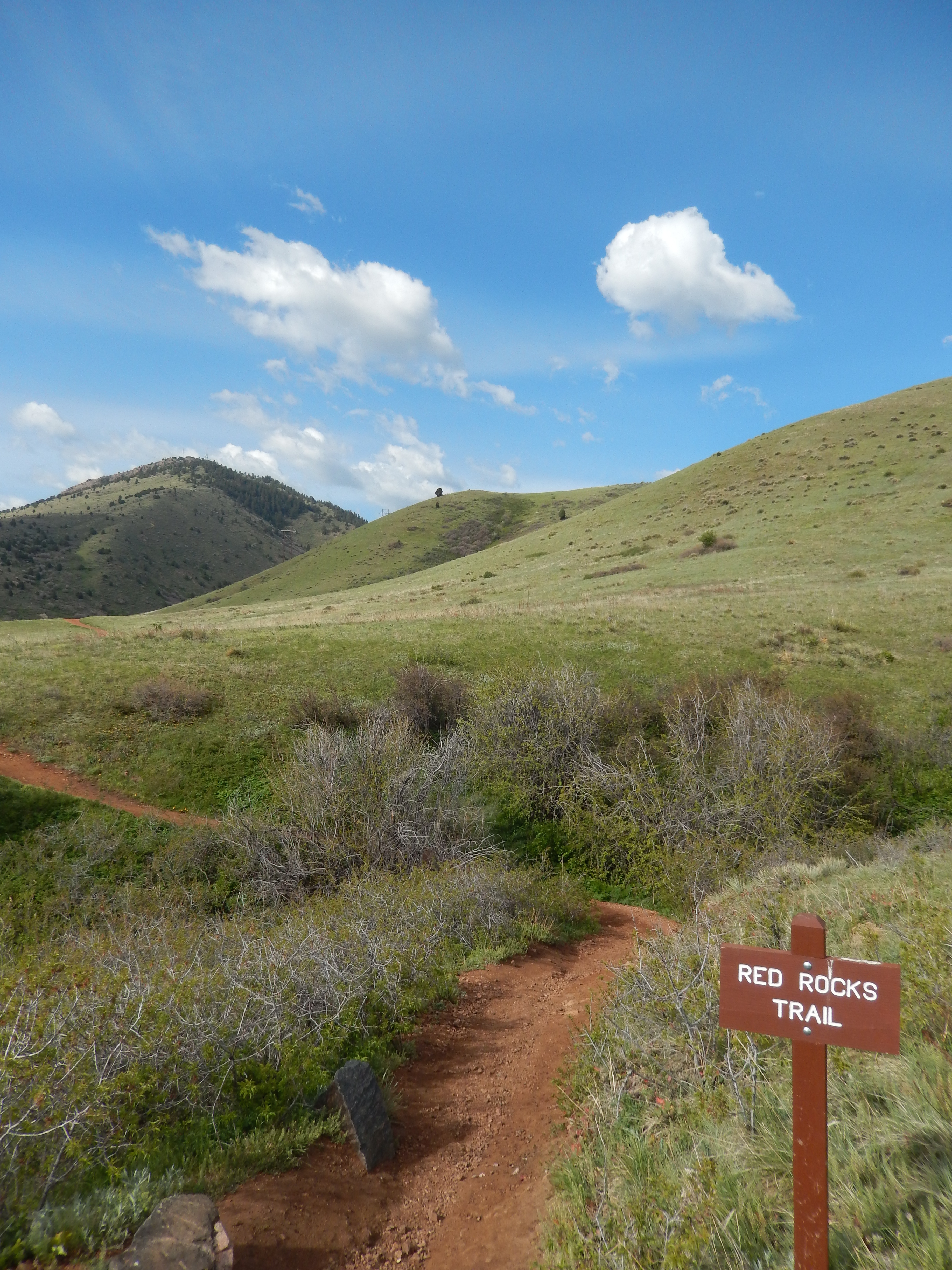
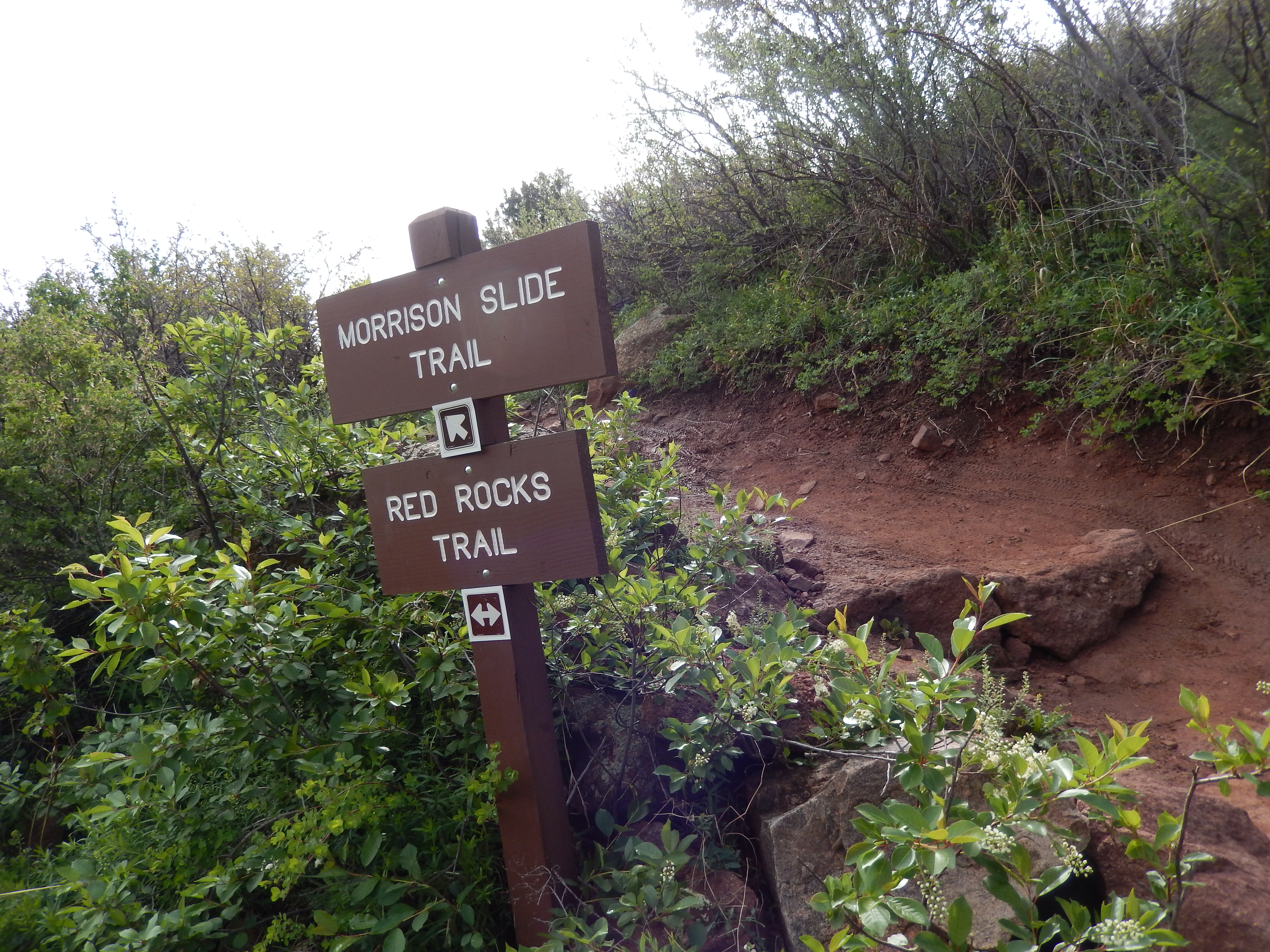
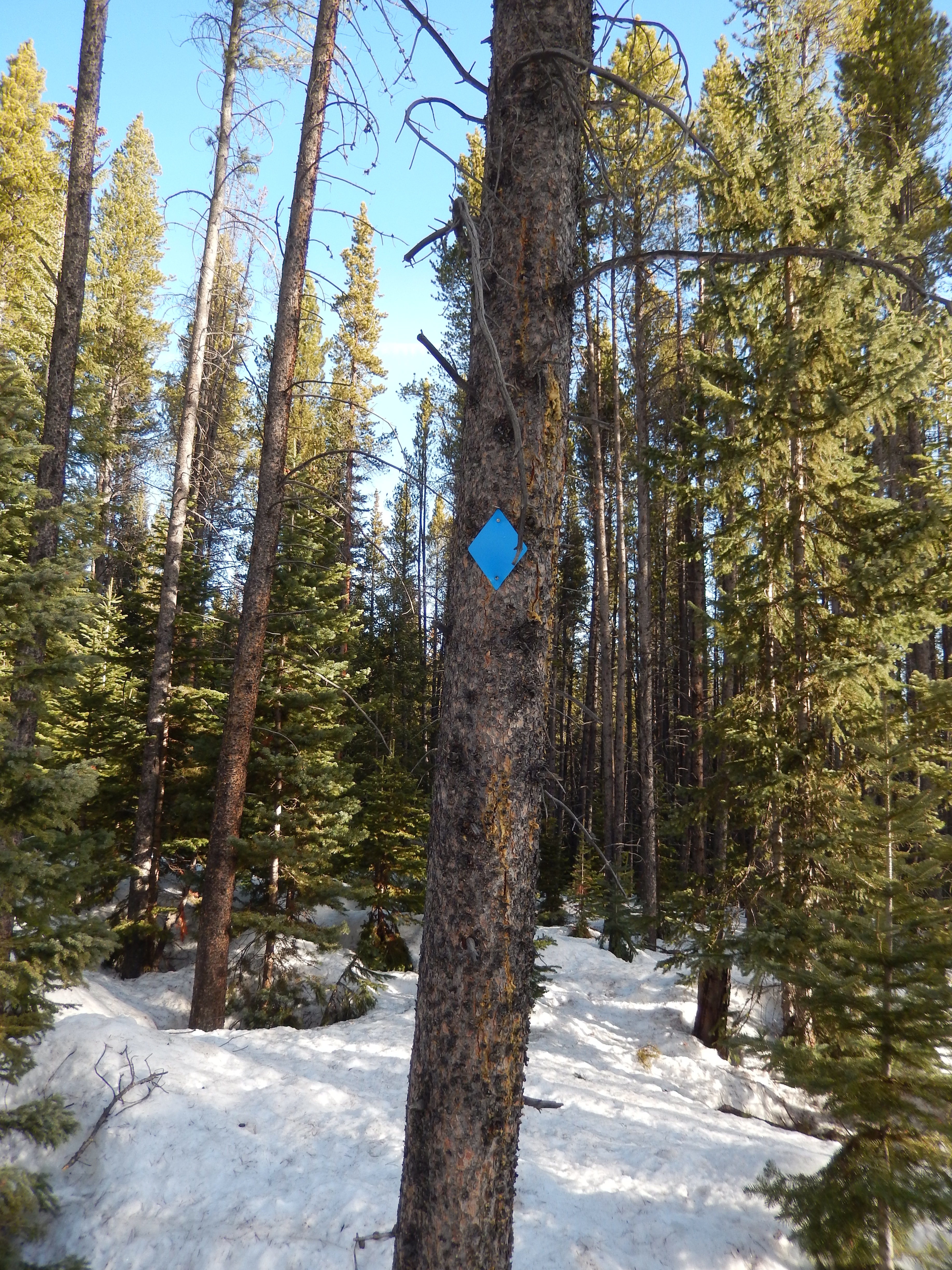
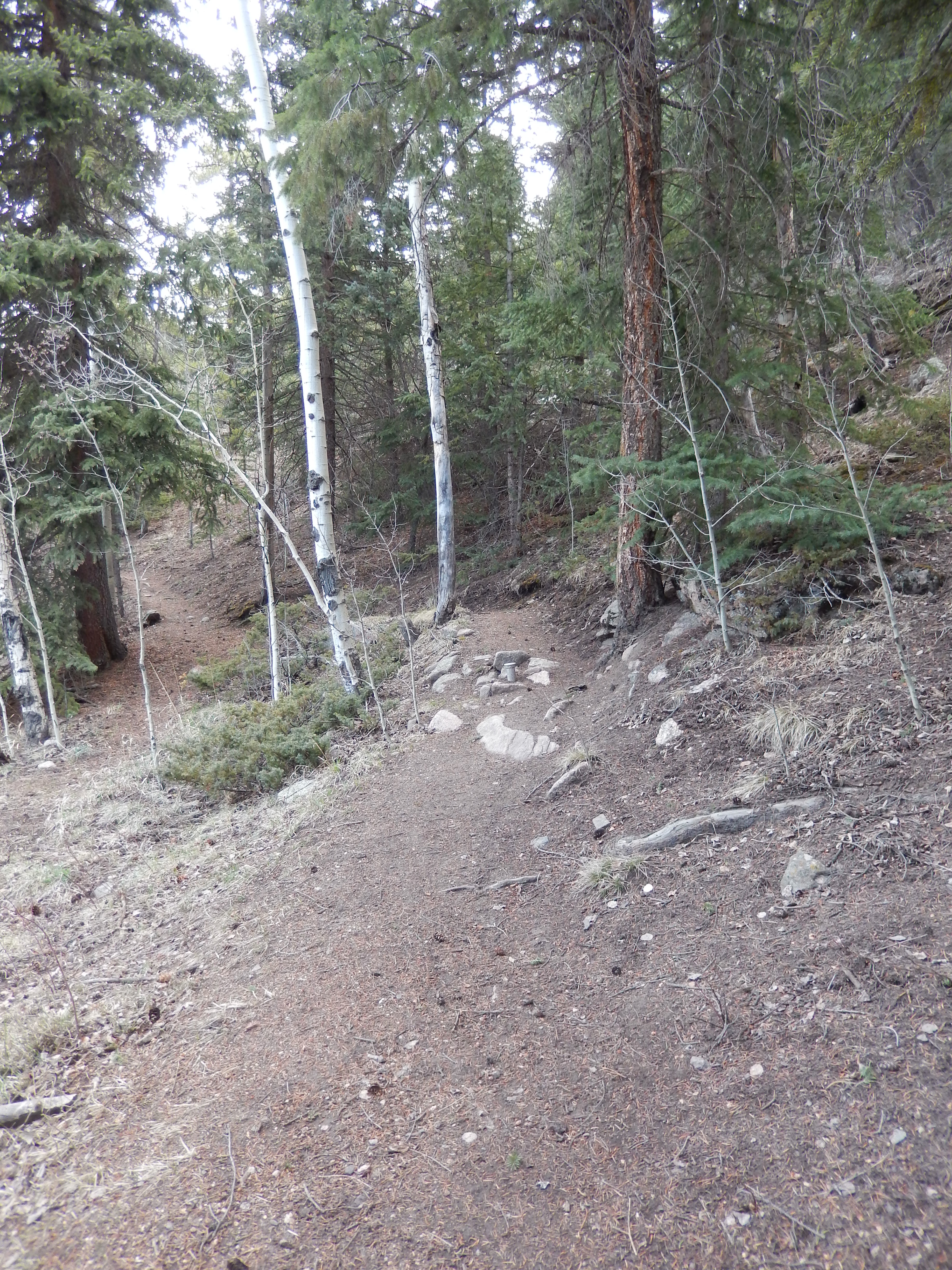
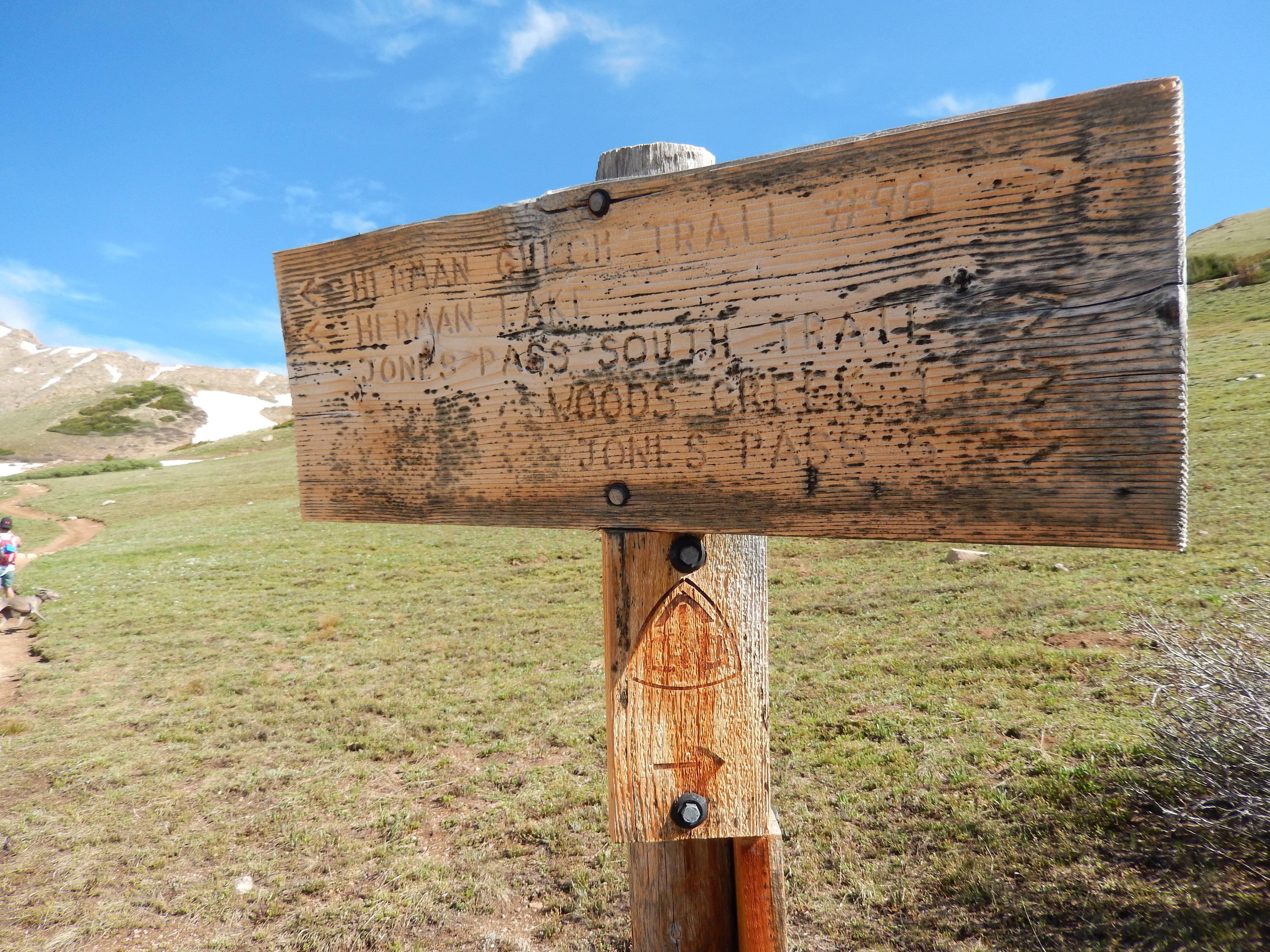
The first quarter-mile is a gentle climb to the T-section with a sign listing the trail options with an arrow.  Take the trail on the left.

Trail Sign

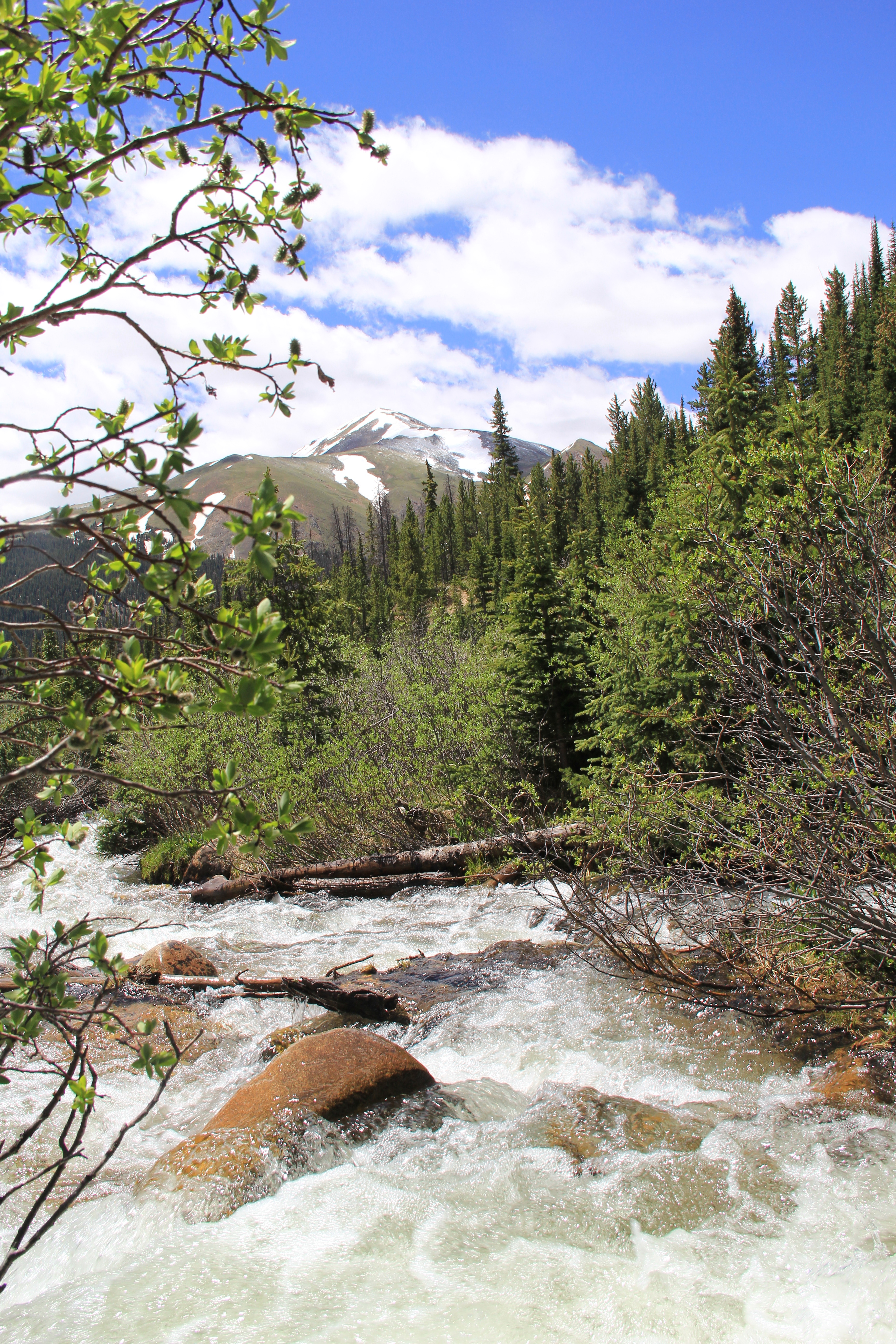
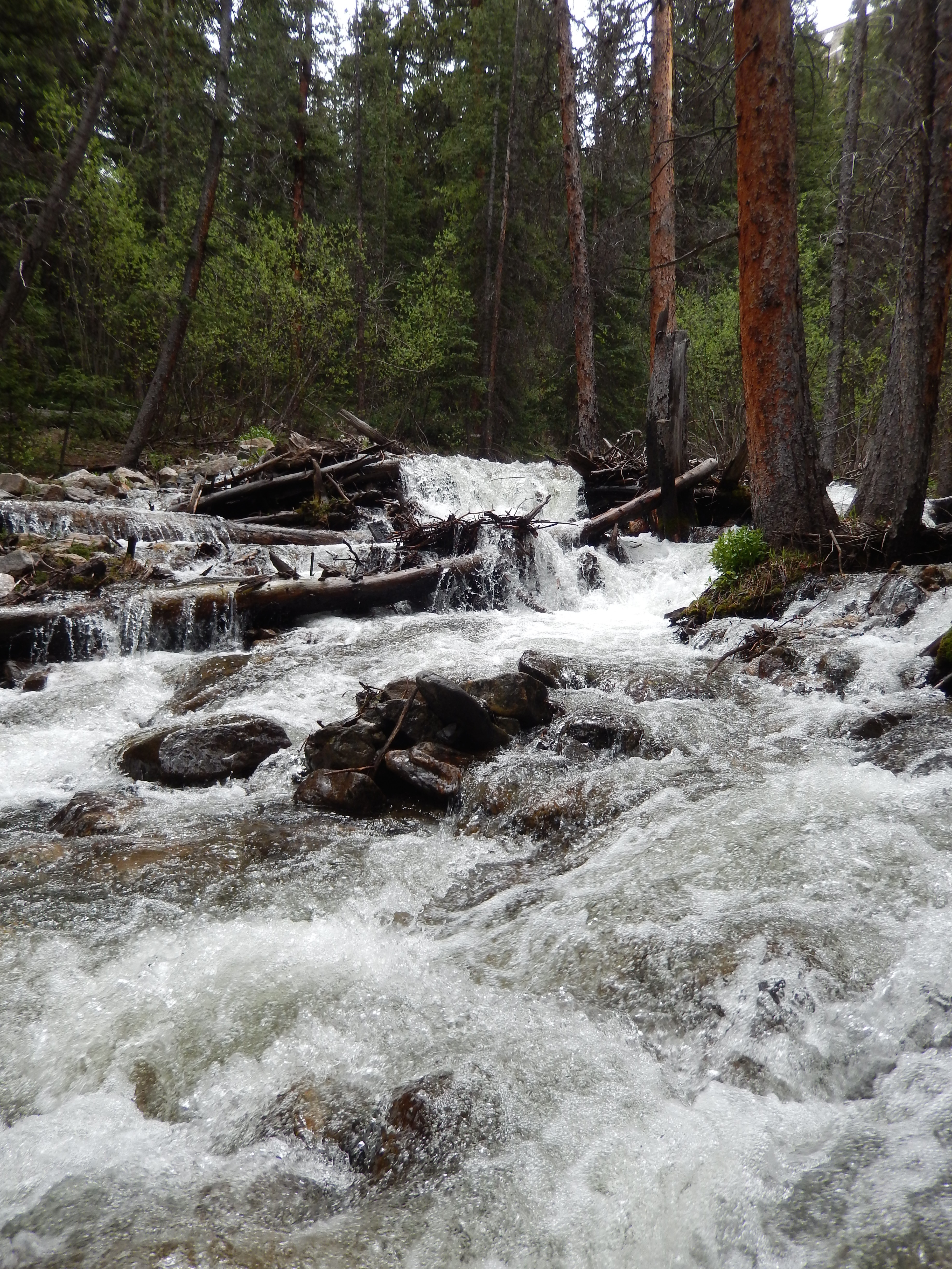
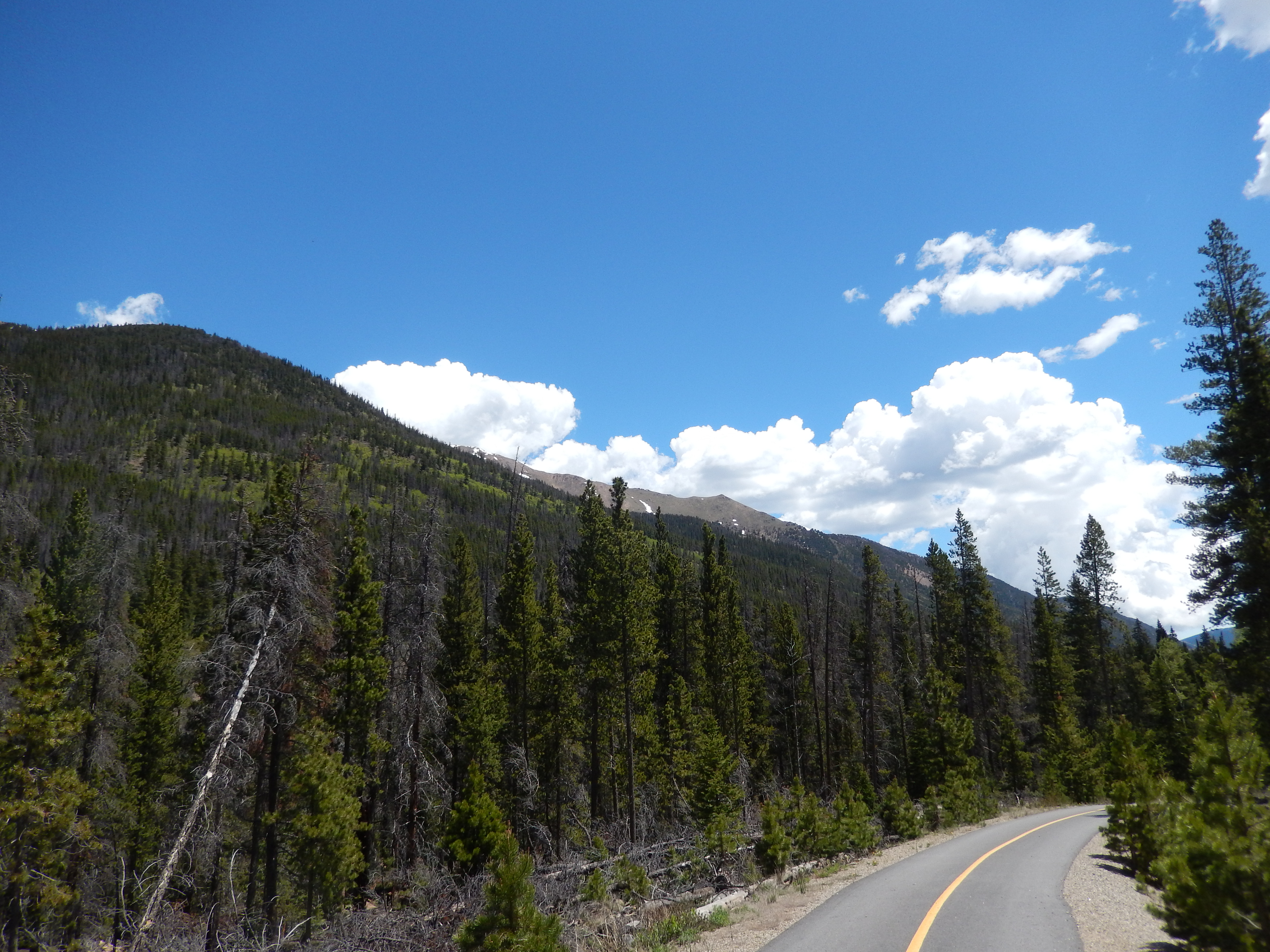
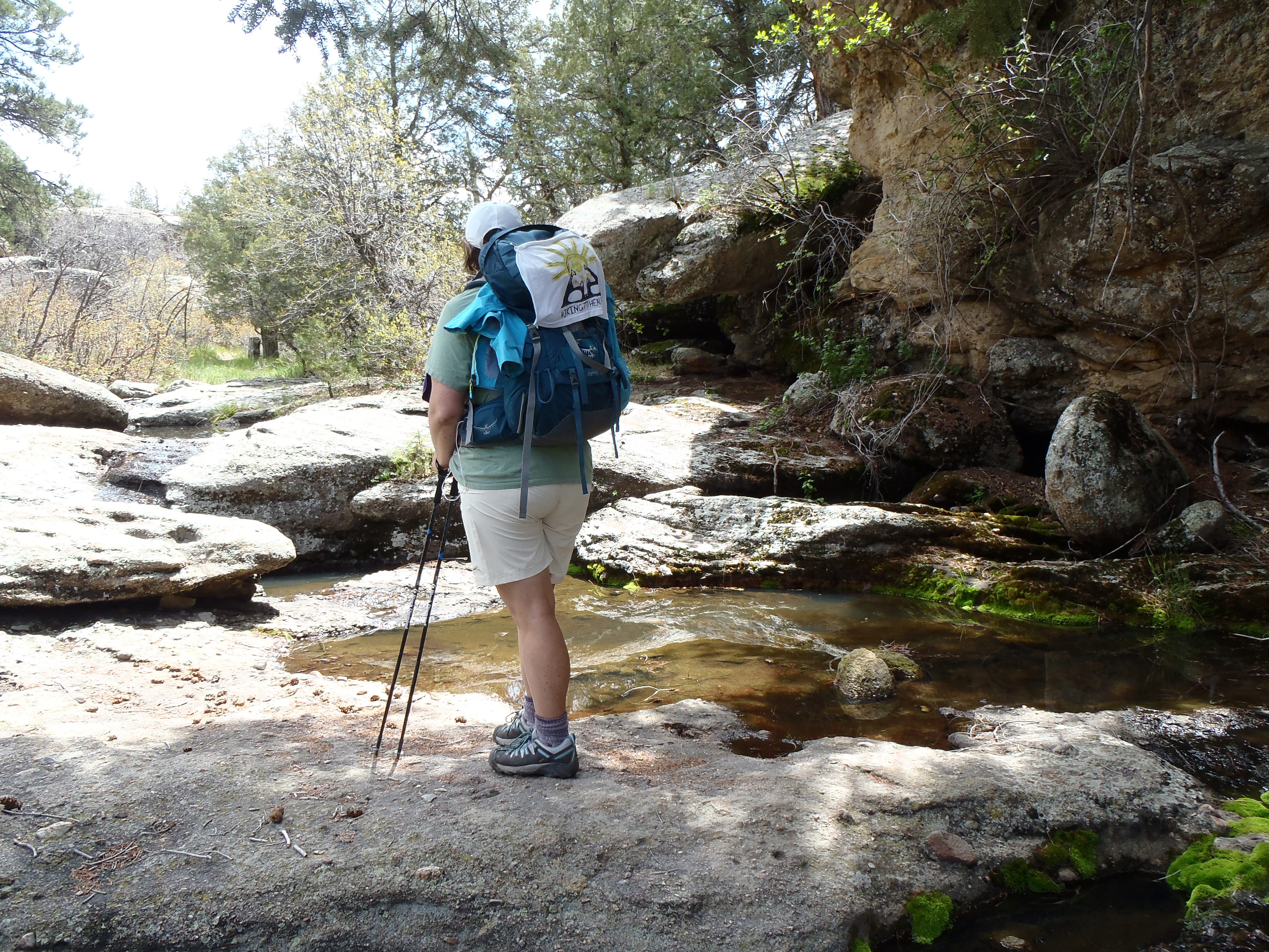
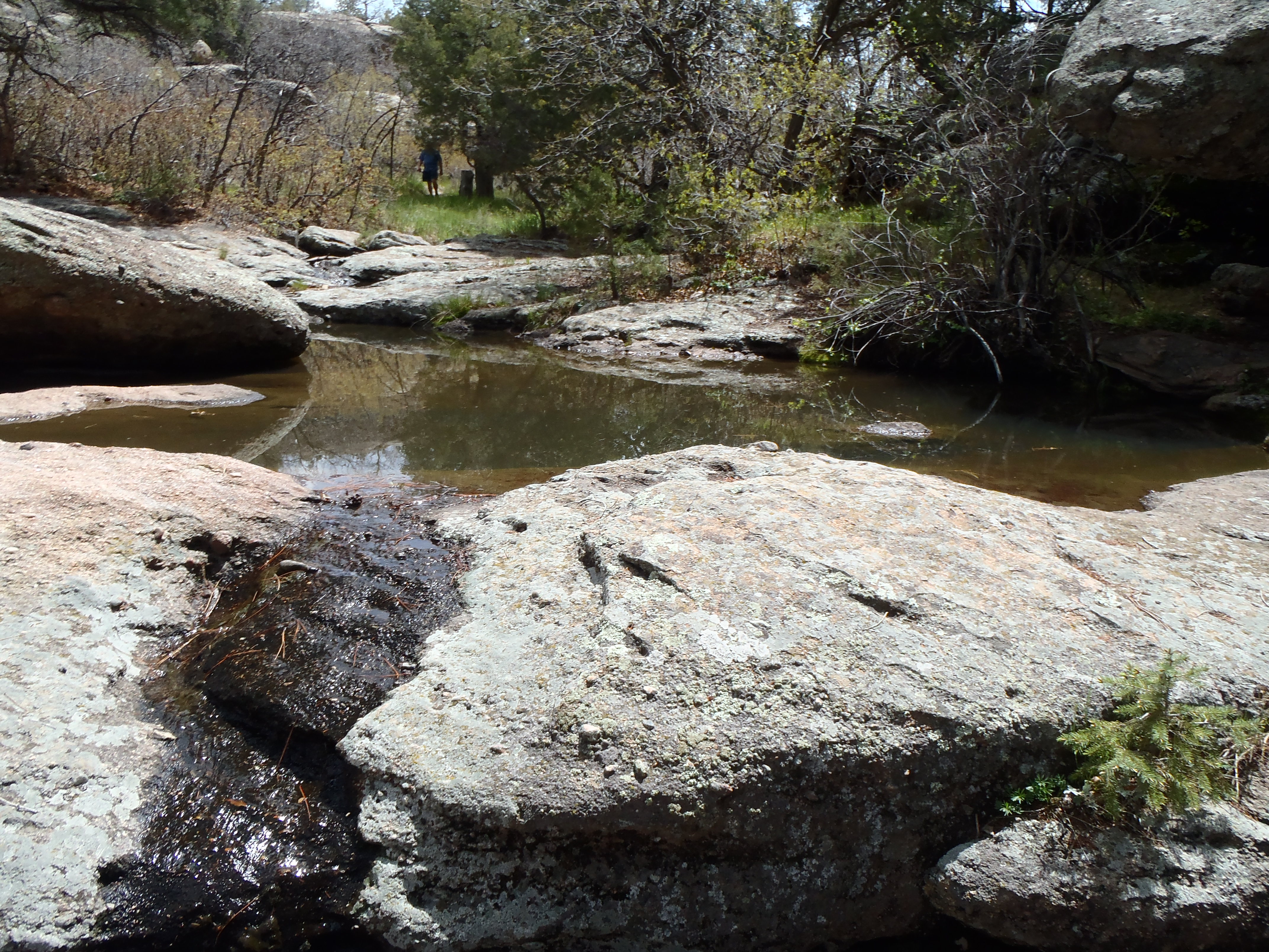
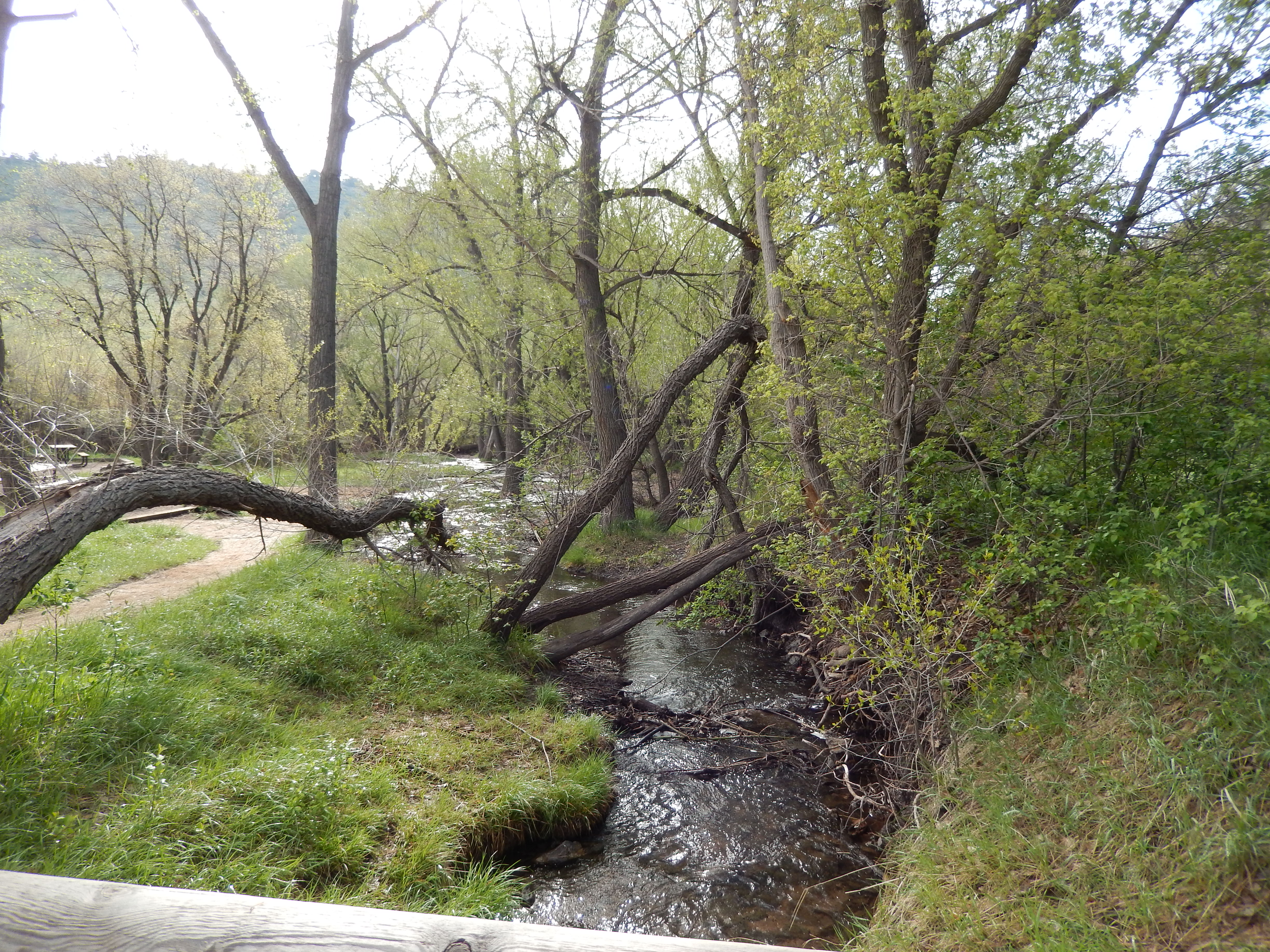
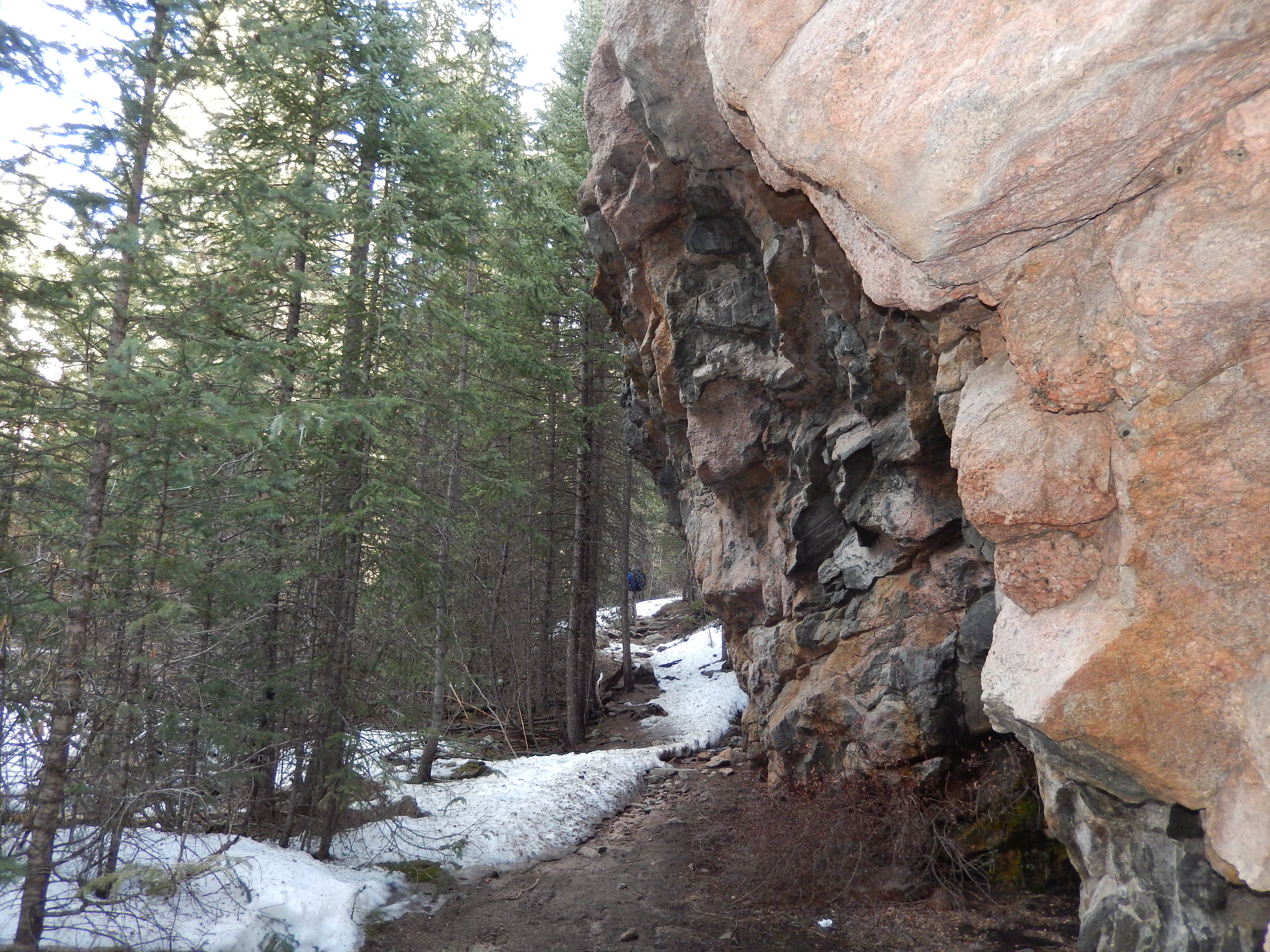
The next mile was much steeper and rockier, the best part was when the stream came up along side the trail because it totally drowned out the noise from I 70.  This is one of the steepest parts of the hike.

Nice and steep
Nice and steep
The stream is just to the left and it is high
The stream is just to the left

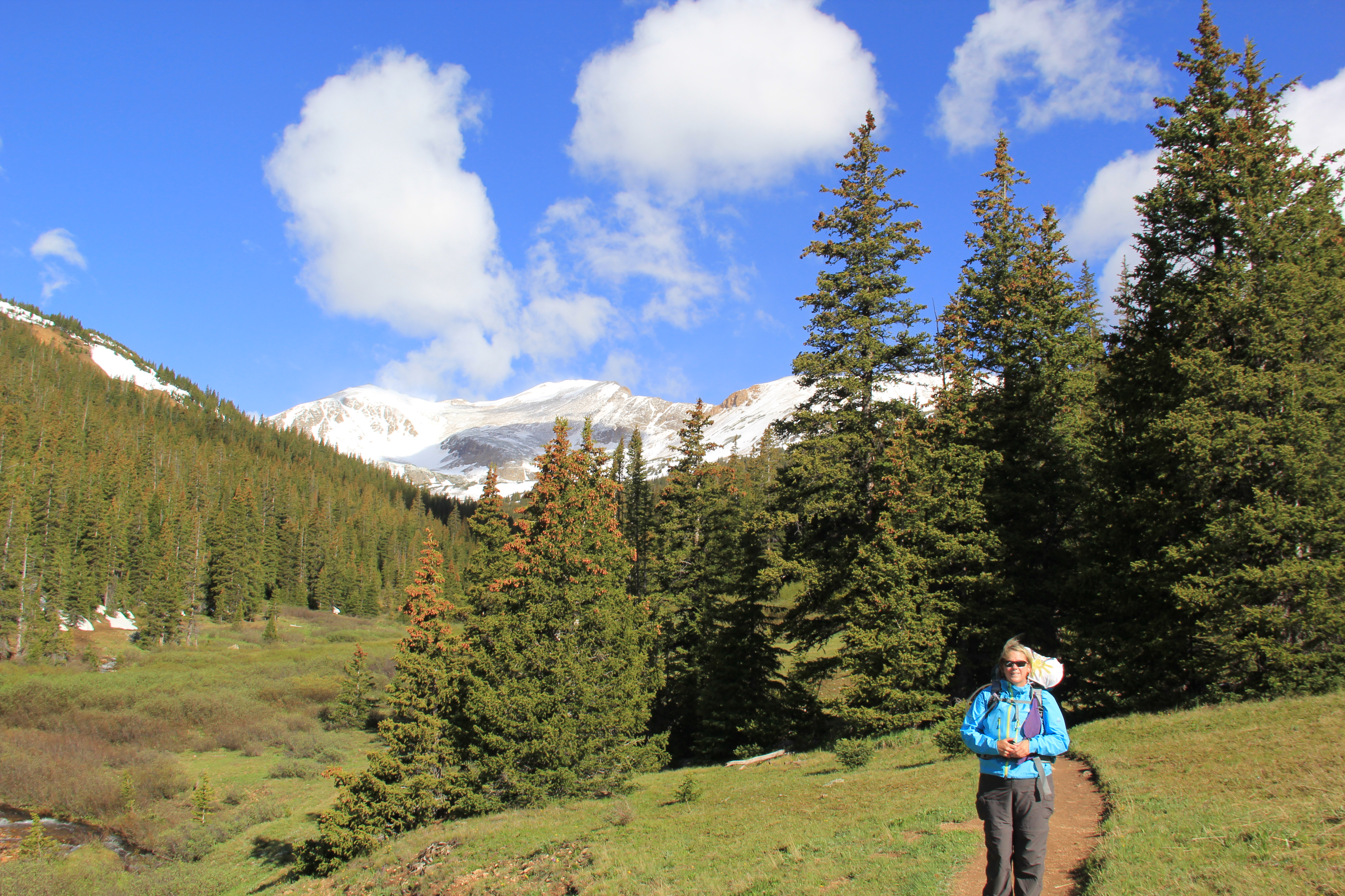
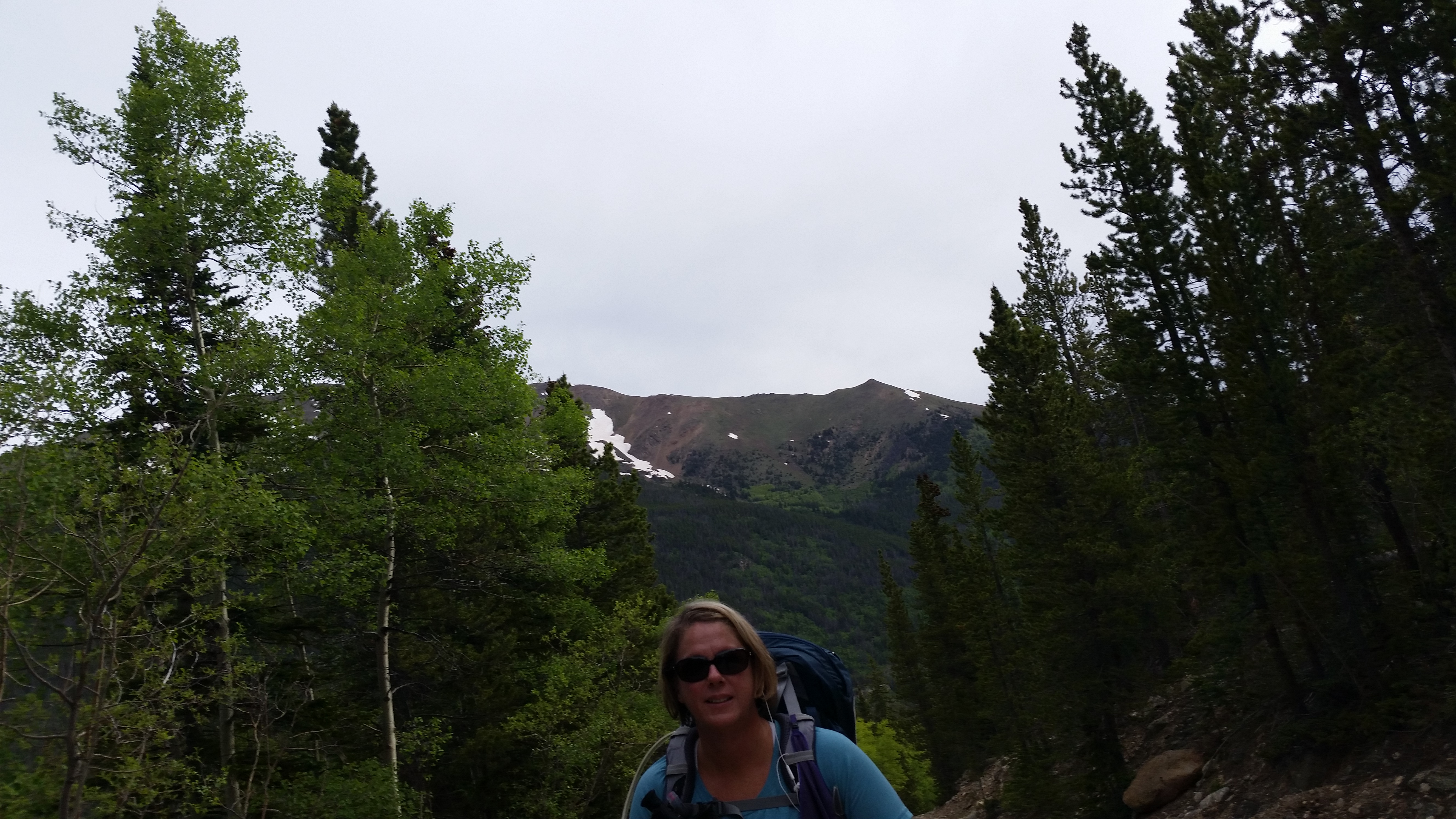
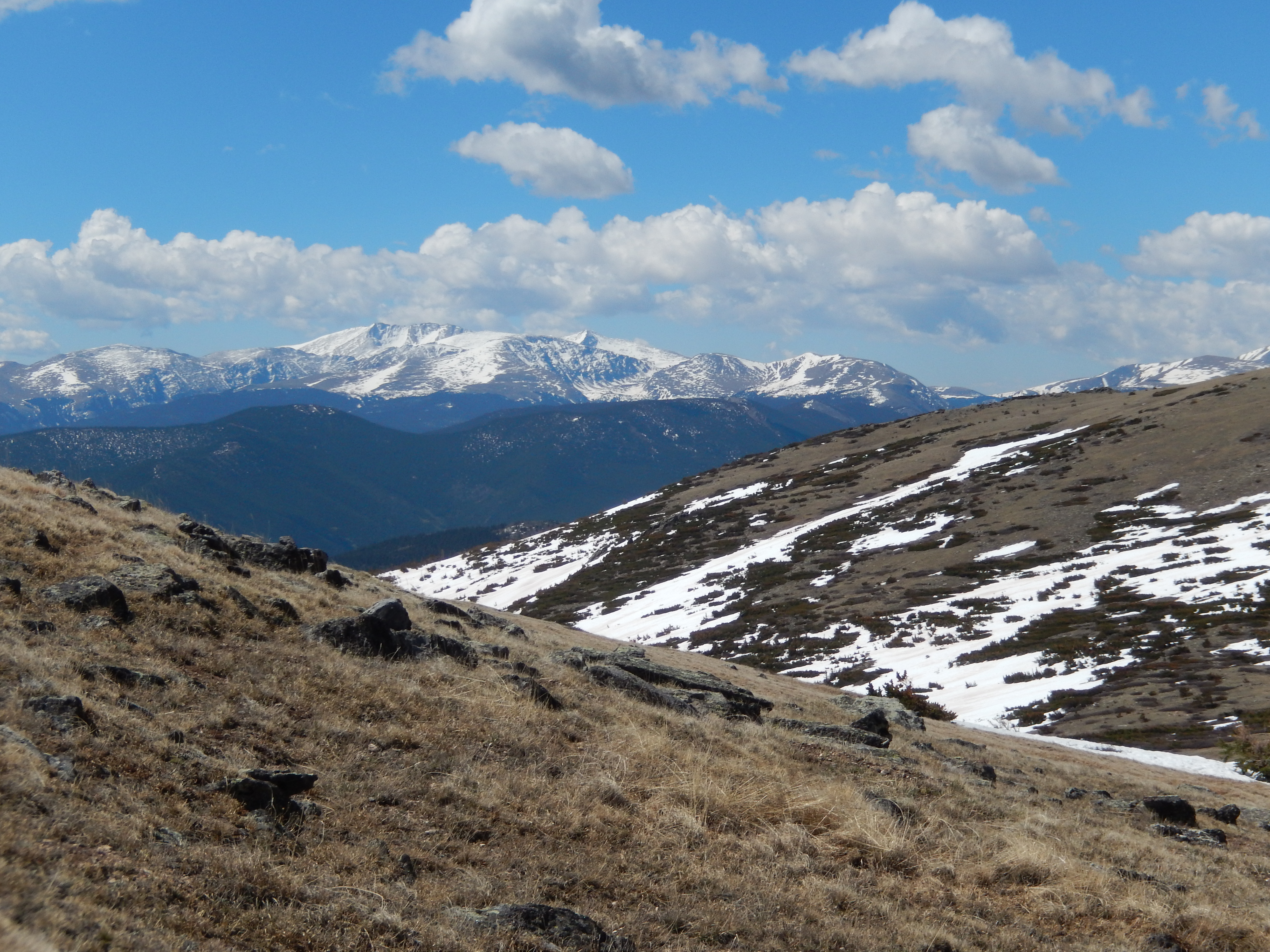
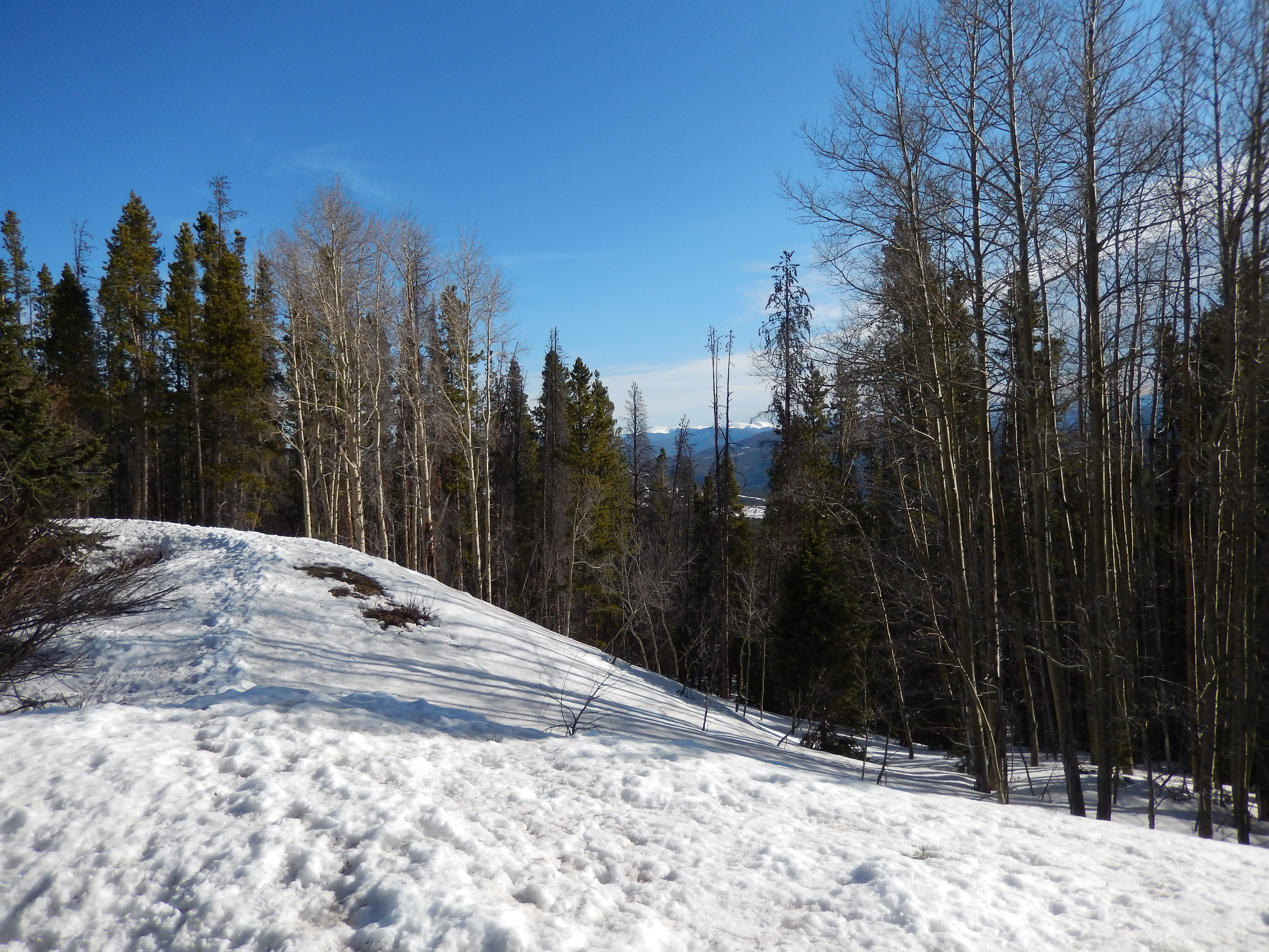
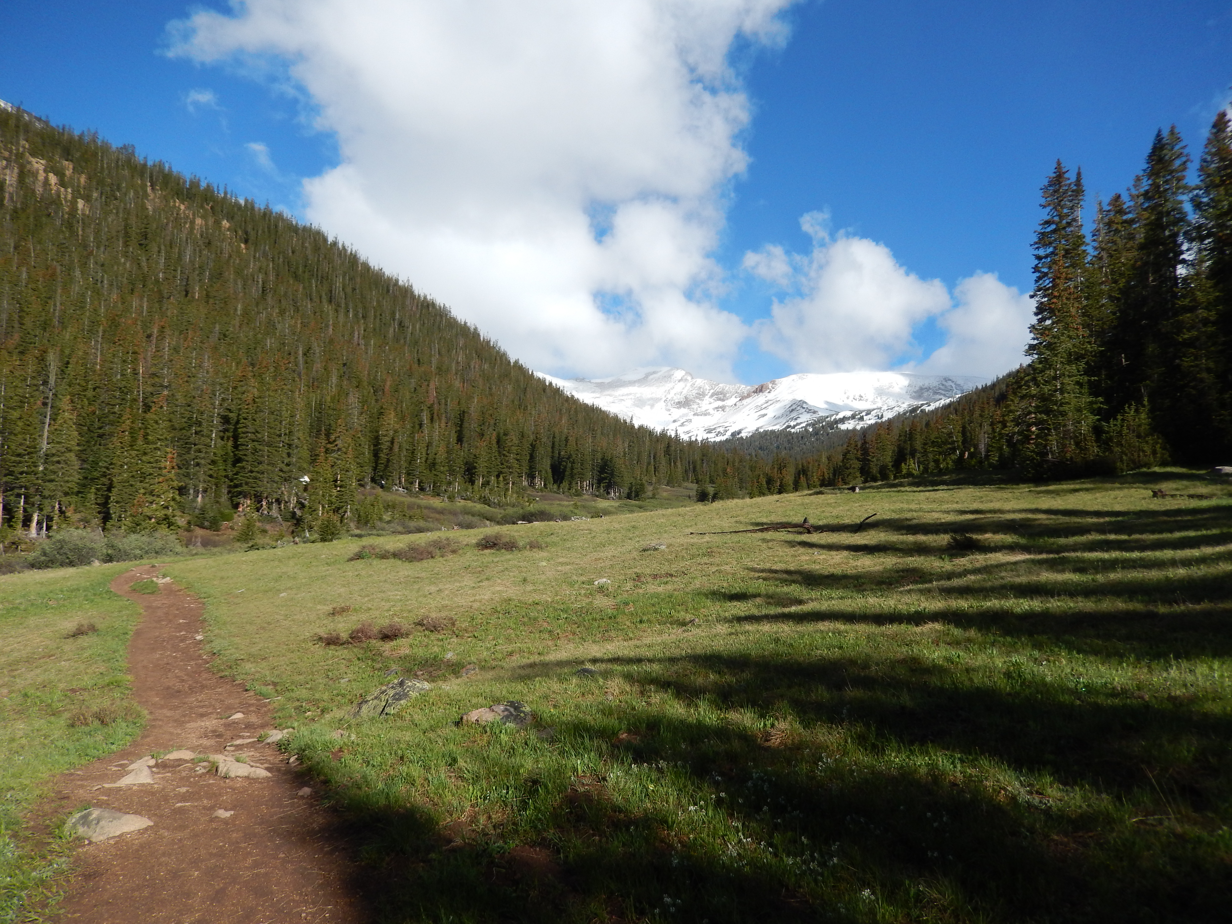
After this initial climb, you come out into this meadow and really if we made it no further than this point it would have been enough.

Looking ahead
Looking ahead
Looking behind
Looking behind

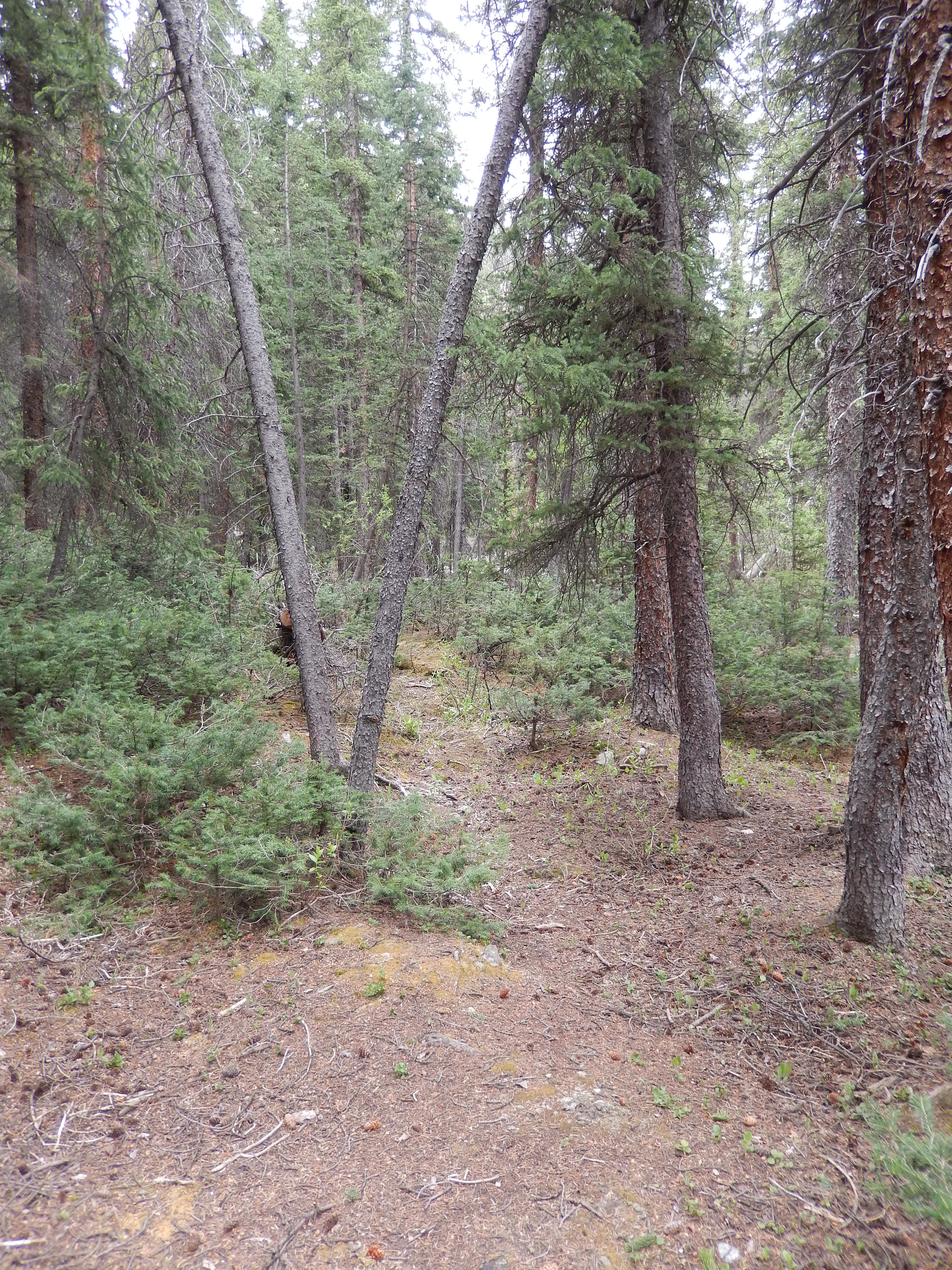
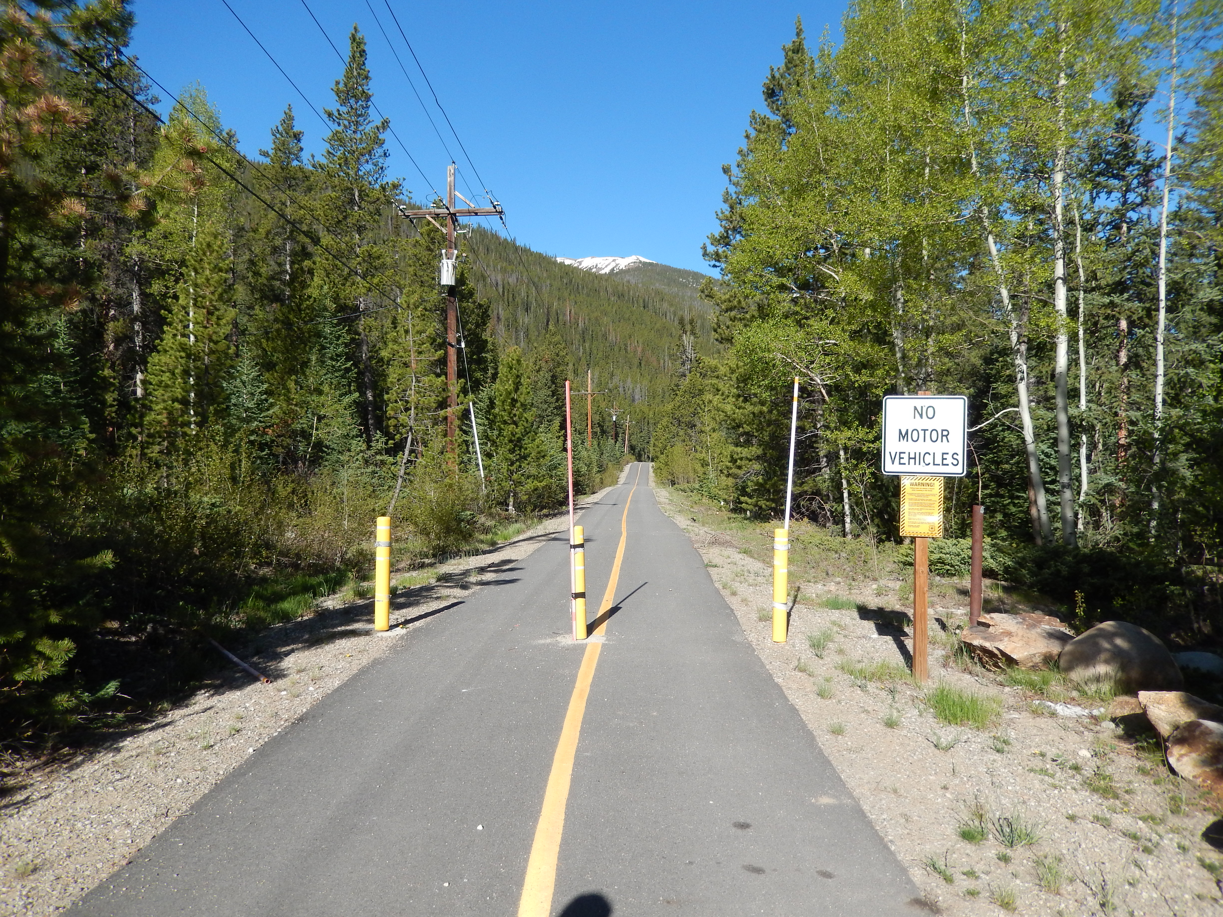
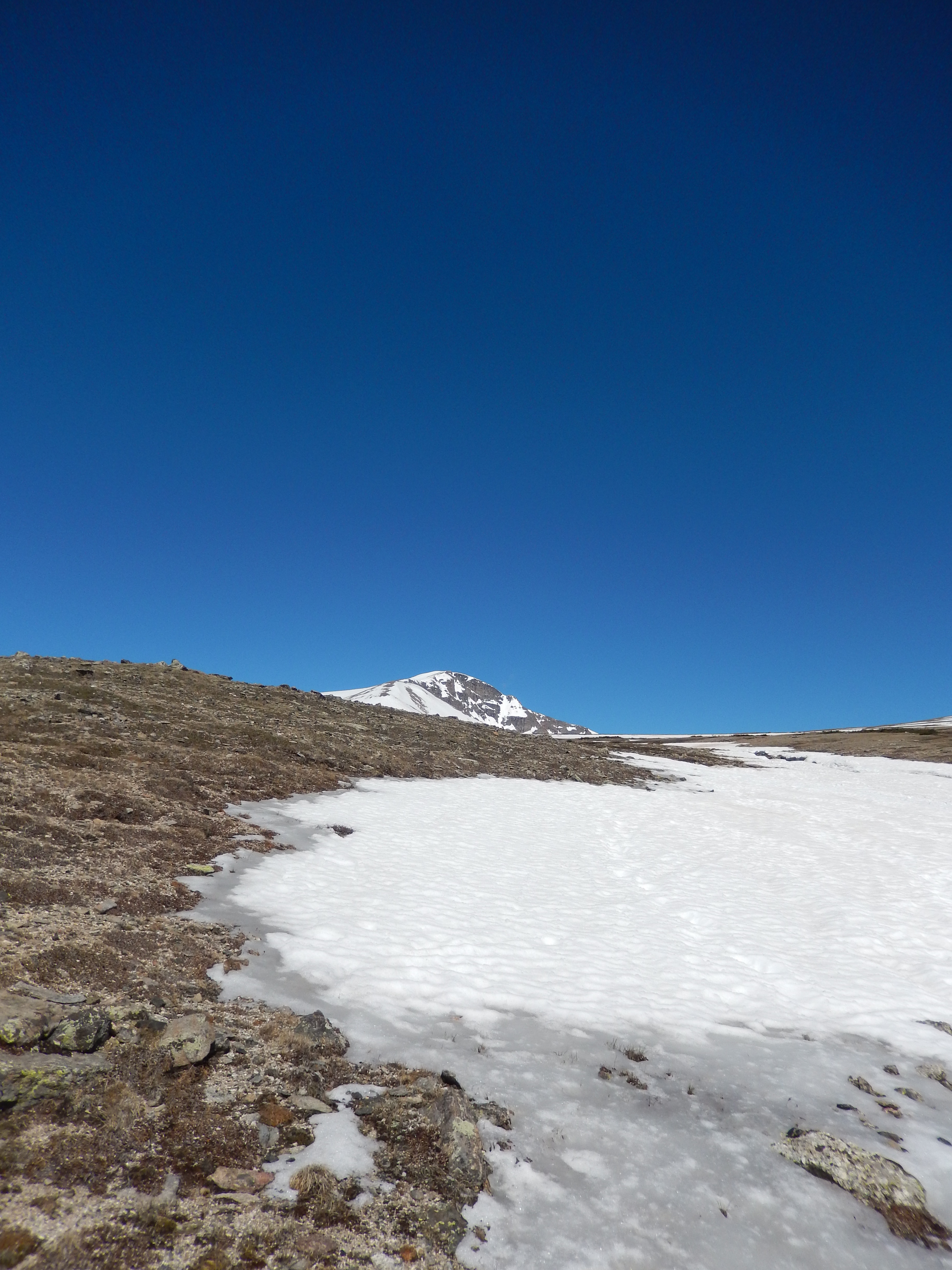
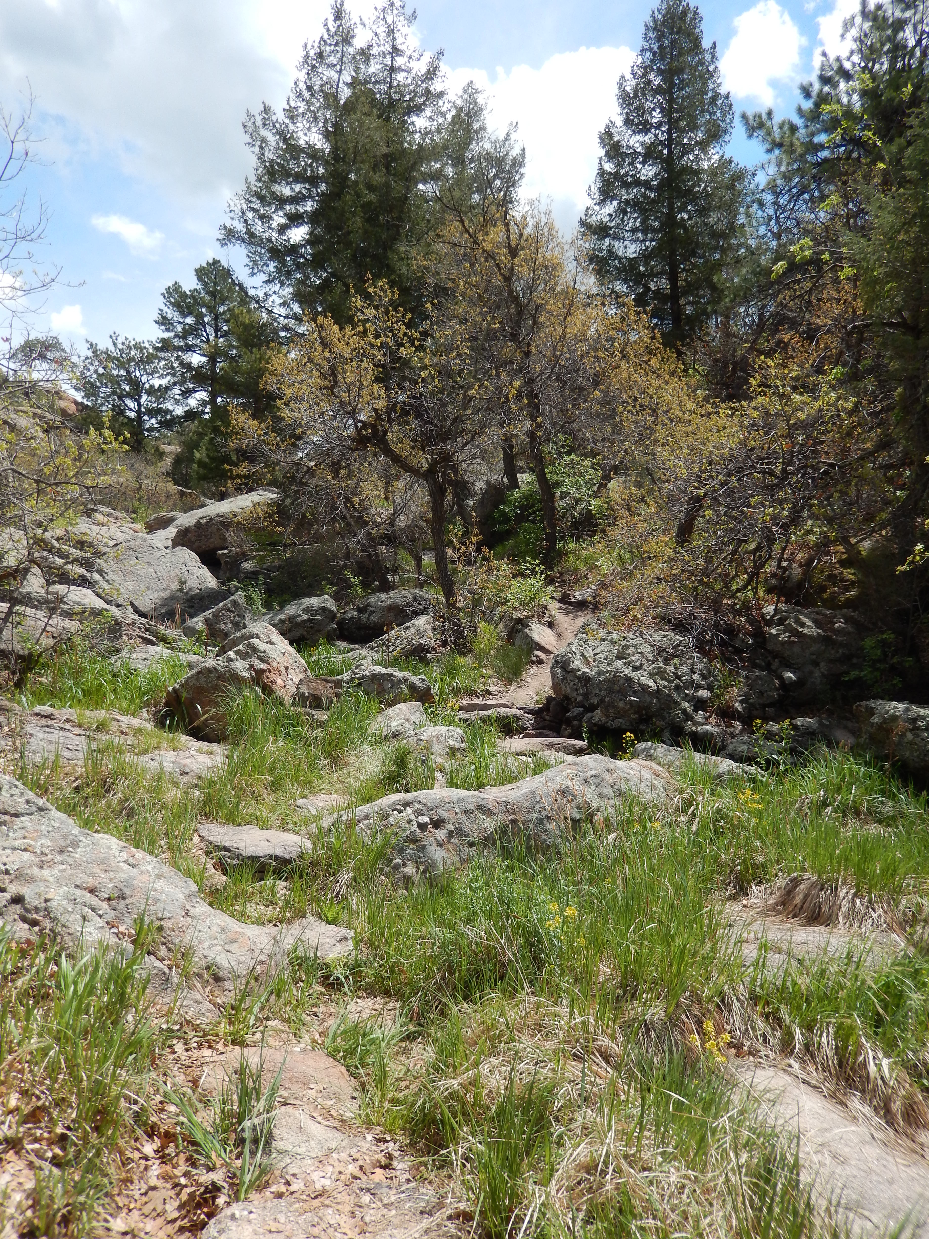
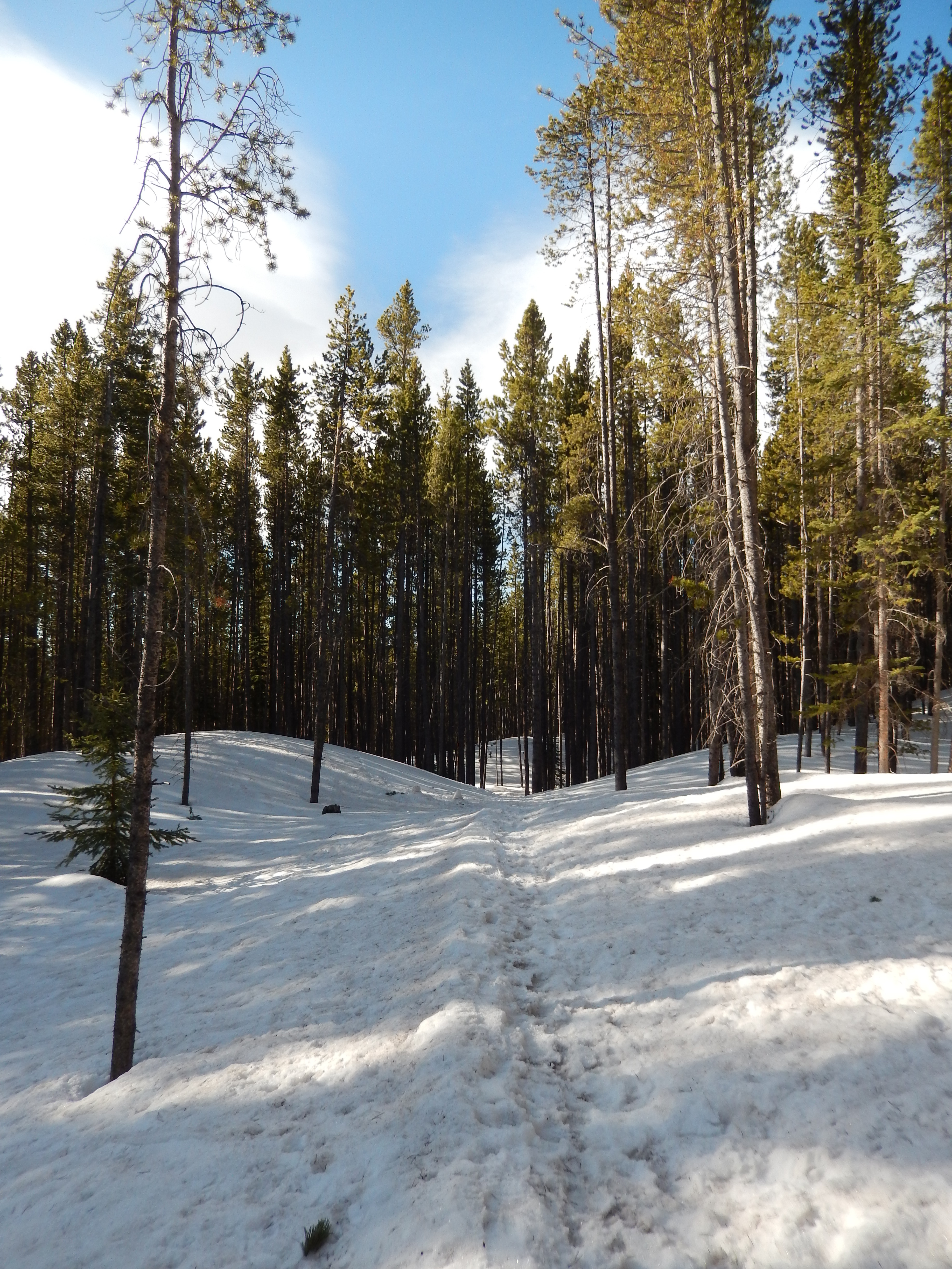
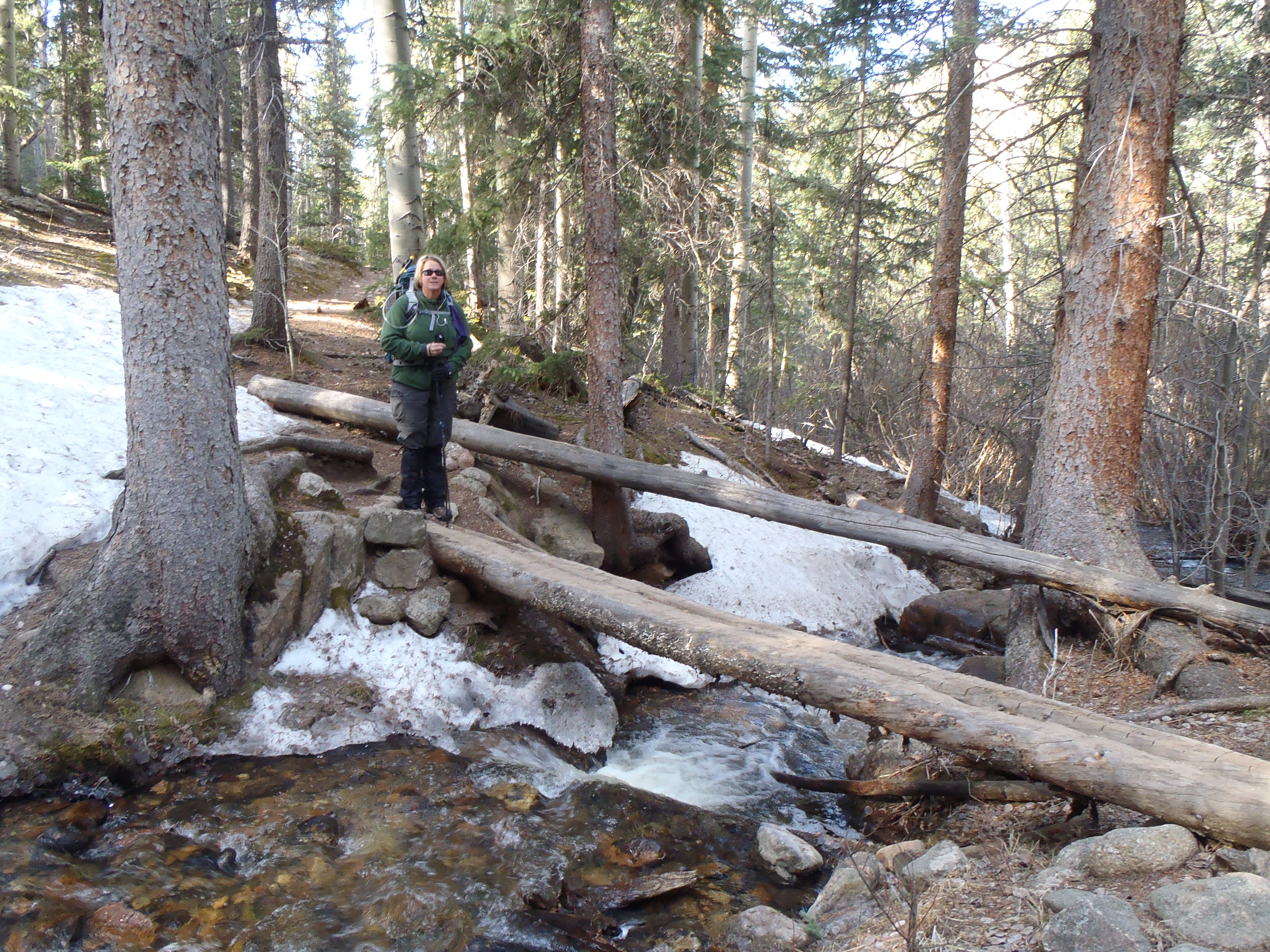
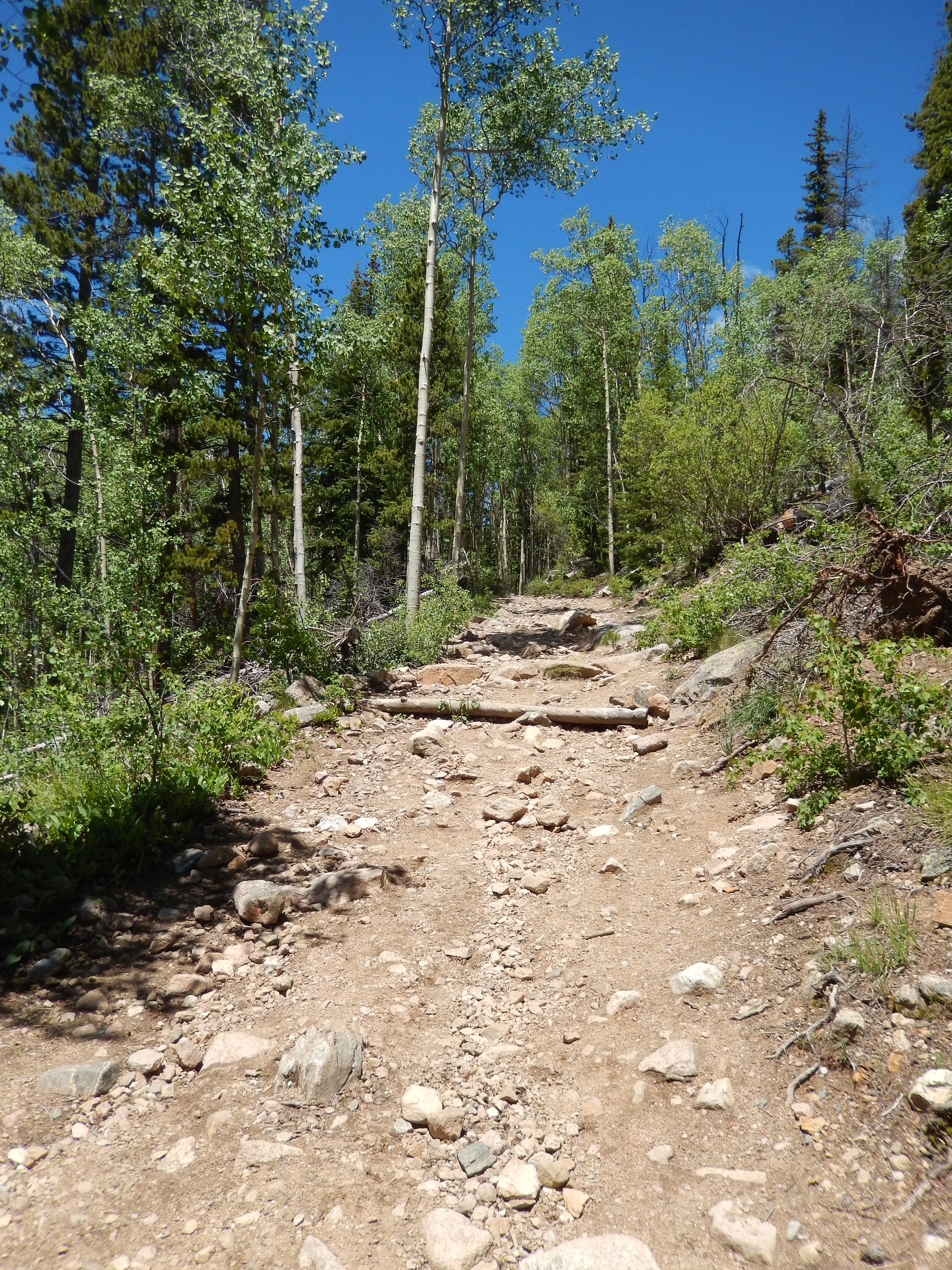
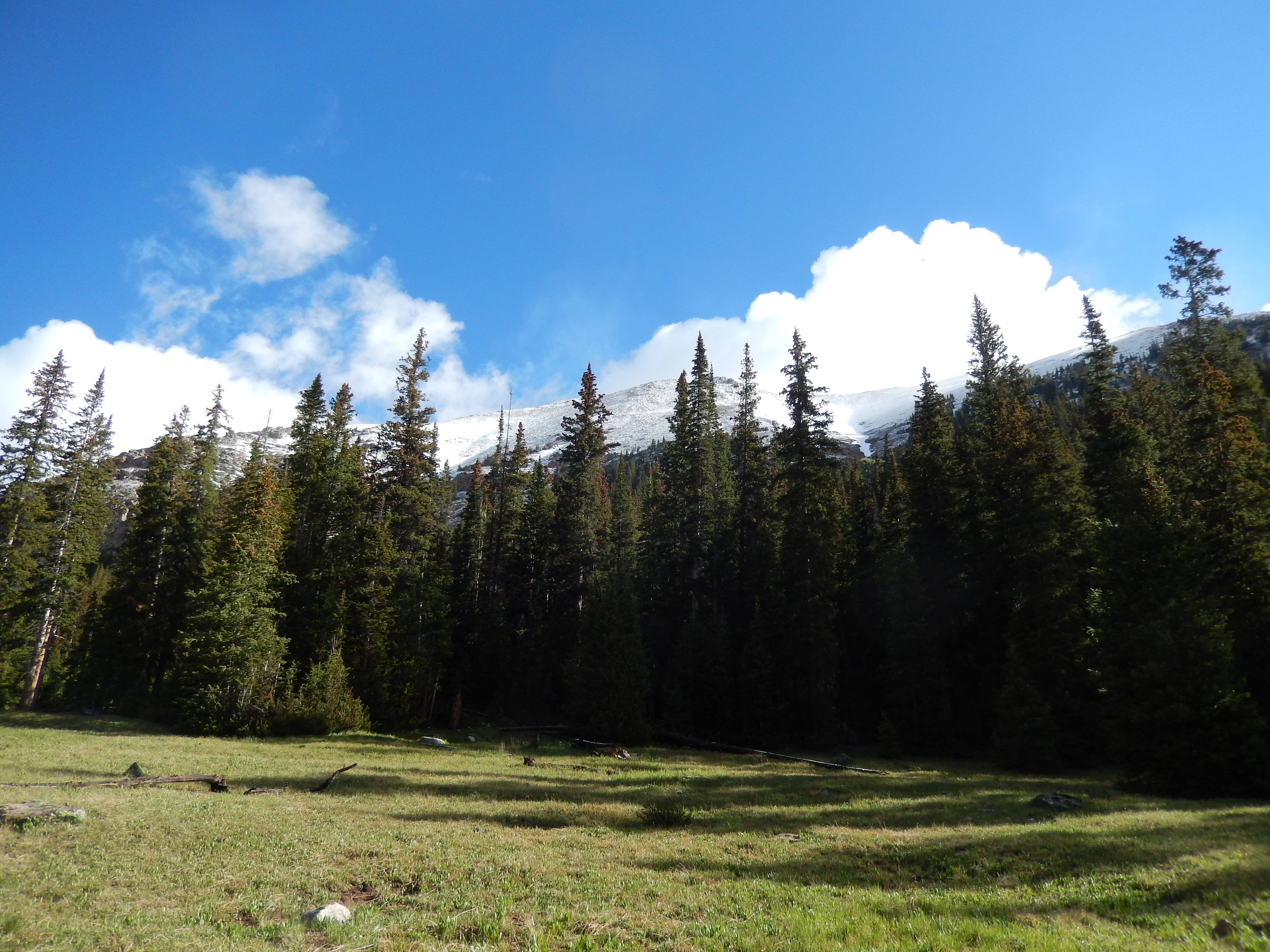
The next 1-2 miles is through sections of pine and then beautiful meadows.  It was pretty muddy from this point forward with much of the trail an actual stream itself.   Last Saturday the snow was quite the obstacle, this morning more like scenery.

Good and muddy
Good and muddy
second meadow
second meadow on 6/28
Views behind
Views behind
The sides were even amazing
Not one bad spot
Not one bad spot
Trail is a stream
Trail is a stream
I loved breaking out of the pines to see views like this

There were a couple of water crossings, some clearly are there normally some are only there when the snow is still crazy deep at the end of June.

water crossing

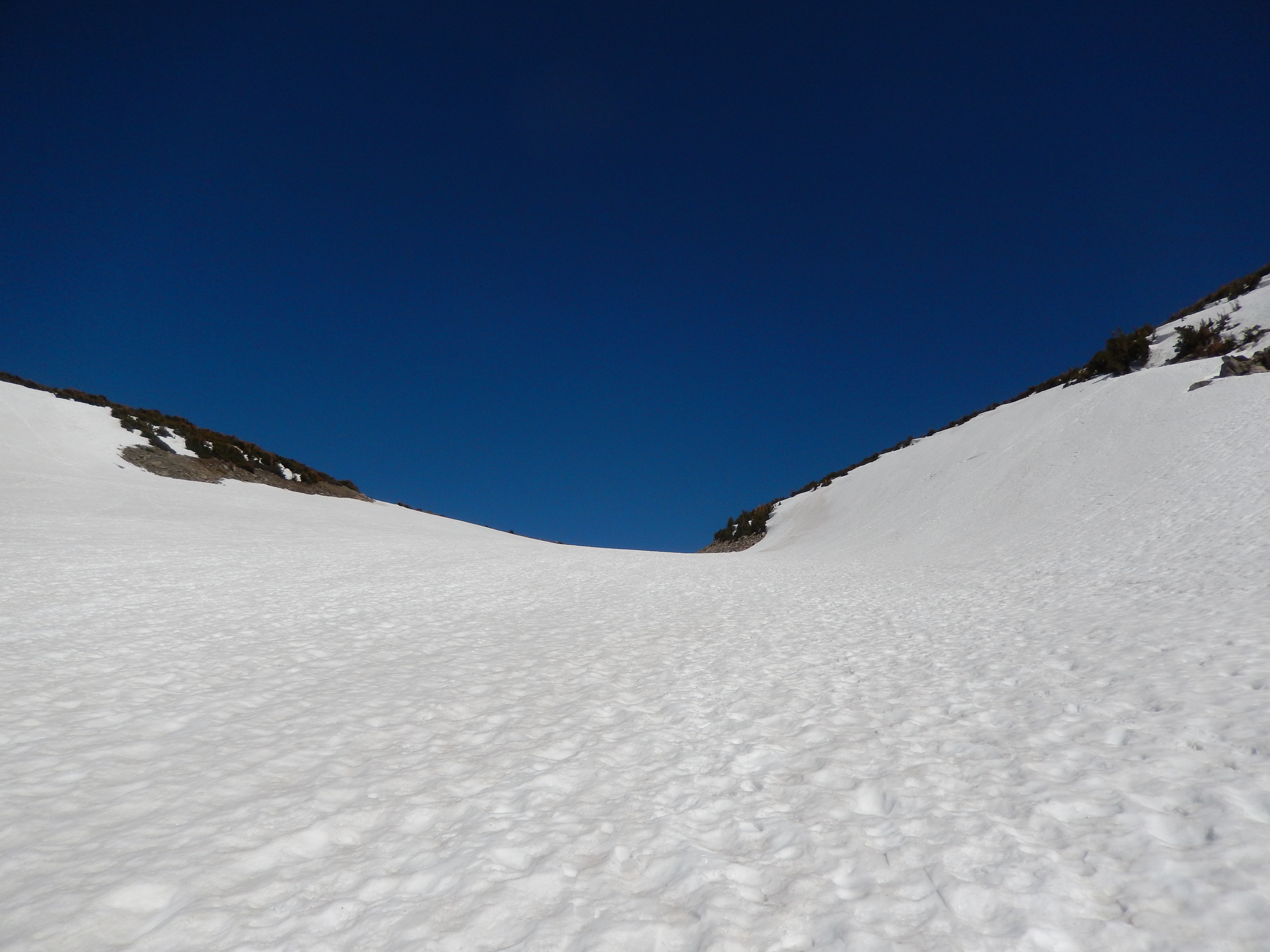
When we got to the last set of pines we started the final climb up to the lake, it gets steep here, actually the most steep section of the whole hike plus it close 12,000 feet above sea level so just breathing is a work out. Last Saturday the snow was to our knees but hard packed because so many people had gone before us.  We met up with a gentleman who had been to the lake and he said the snow around the lake was hit or miss, some places to your knees some places chest high.  We lost the trail in here but just kept following other footprints until we saw the trail again.  This morning a lot of that snow had melted. We still lost the trail but it was much easier to find again after some obstacles.

Thru the last set of pines Thats snow

The lake is supposed just half a mile from the last set of pines.  Unfortunately we didn’t make it on Saturday.  It turns out Aaron was working on a  decent inner ear infection and his head was to the about to explode point.  We had to turn around.

The lake is just up there
Views ahead when we turned around

We could tell as we drove towards the hike Saturday morning that is had snowed in the mountains the night before.   Which is kind of surprising, but it made the hike extra muddy while also making everything in sight beautiful, like frosting.  I knew the trail would be crowded but I had no idea how popular it truly was, the nice thing is the path itself is mostly wide enough to pass easily so lots of people was no problem.

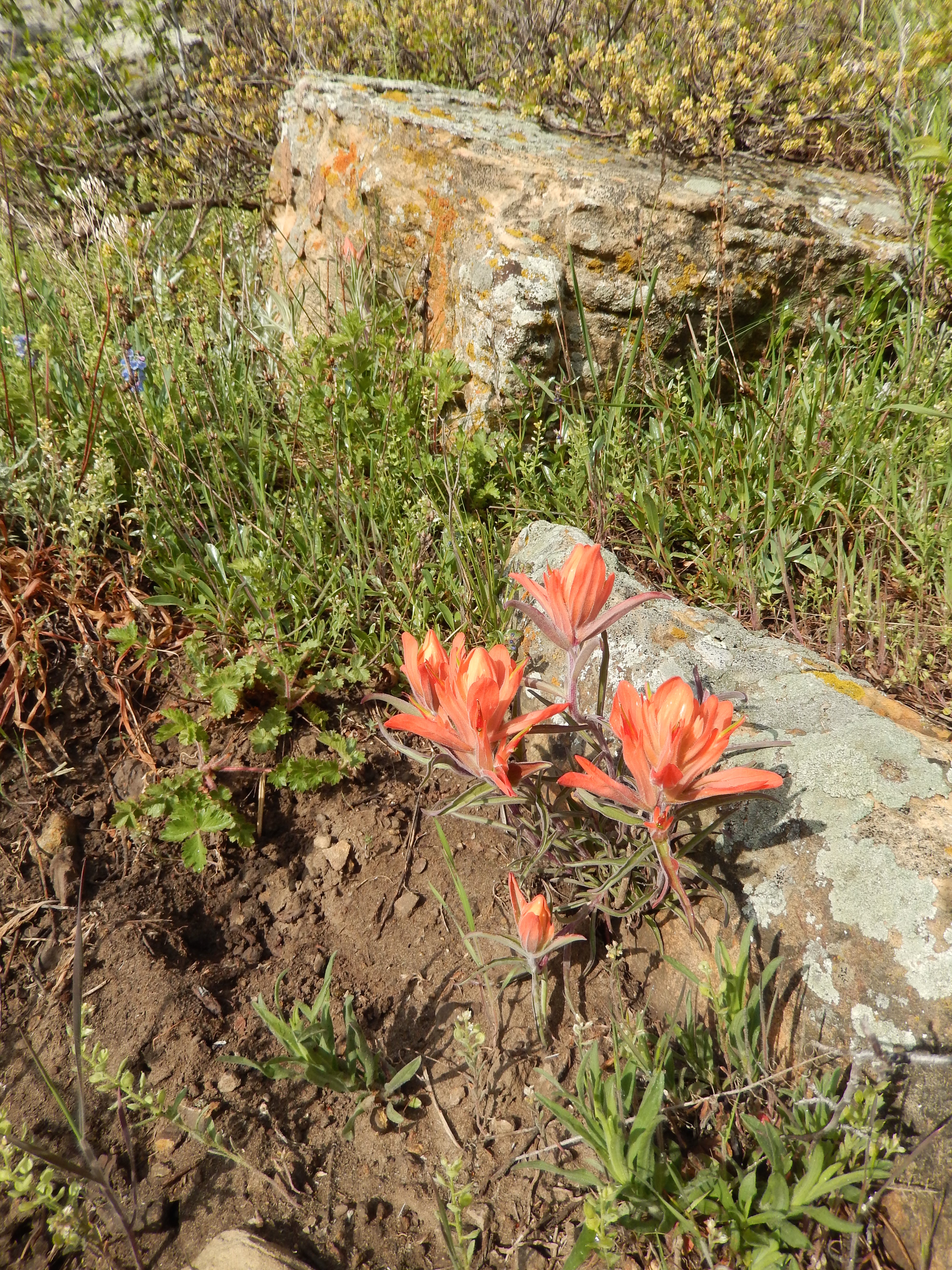
It turns out, I could not wait to get back and we went back this morning.  We cruised up and in, the trial was completely different that last weekend with probably a third of the snow and like a bazillion more flowers.  What a difference 6 days makes.  We were maybe a quarter of a mile from the final trail break before lake when we turned around last Saturday. This time we went left, it is not long to the lake and there was a super small pond on the way… it is not the lake.  Continue on Herman Lake is just ahead.

SIgn to the lake Trail to the lake

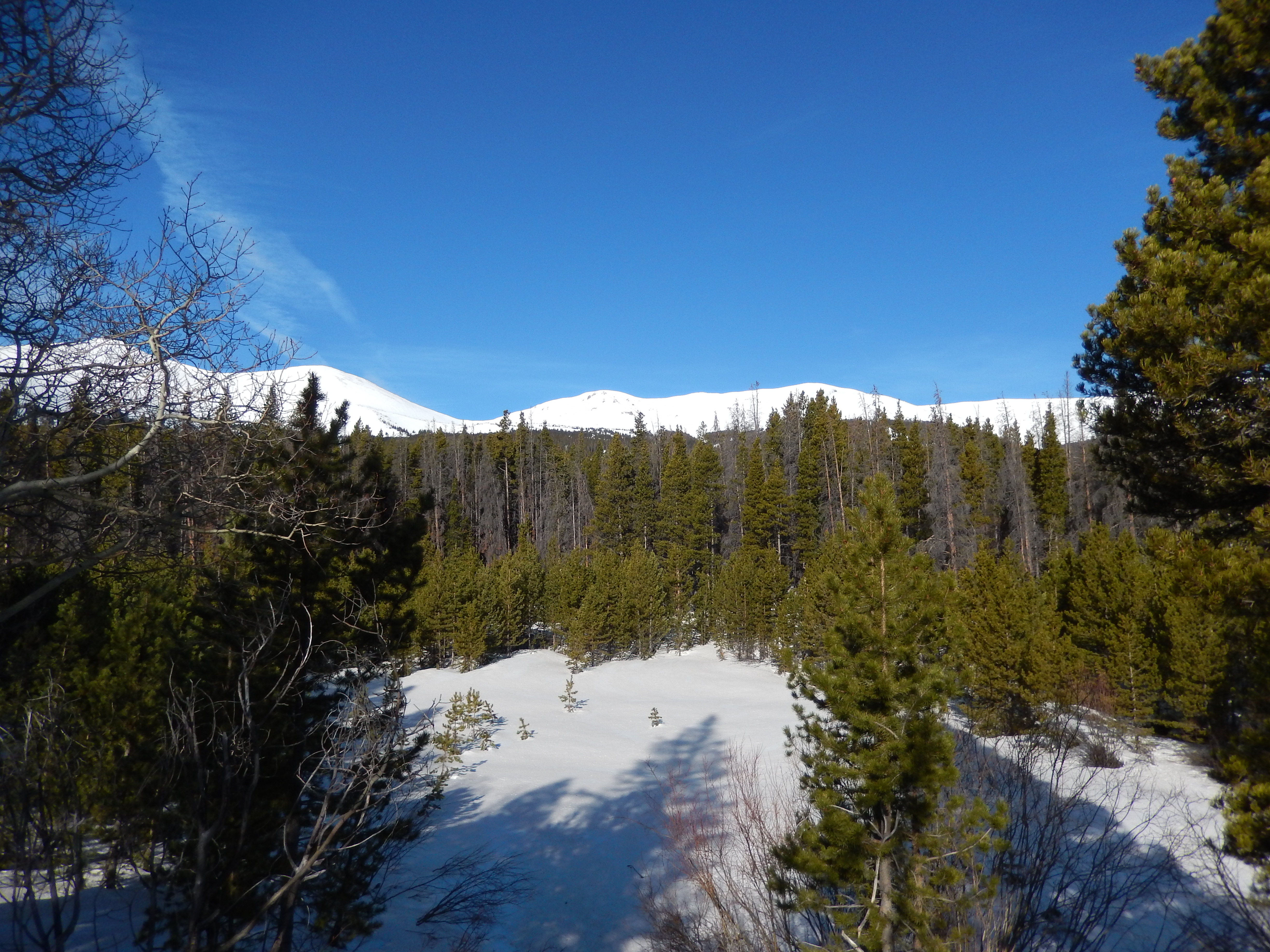
When we got to the lake, it was so rewarding. everywhere we looked it was spectacular.  There were still snow fields all over the place but getting around them were easy.  I kinda wish I we had seen it last weekend to have a good comparison.

Herman Lake
Herman Lake

fav1

We could have been done in 3 hours both times but we actually hung around taking pictures at every turn, spending 5 hours on the trail last Saturday and just over 4 hours today.  It was’t enough, there so much to see.   If you are ever in this area and you can only do one hike, do this hike there is not one boring part.  The whole thing was a series of ohhhhinng and ahhhing.

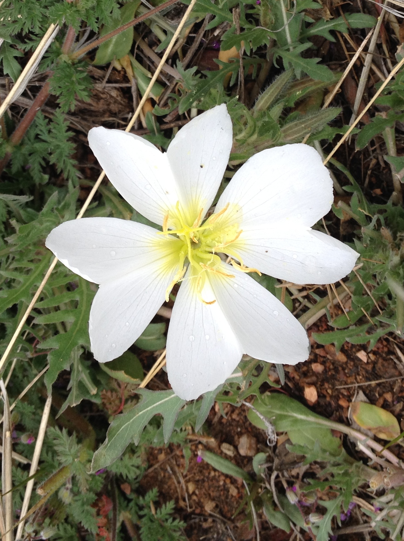
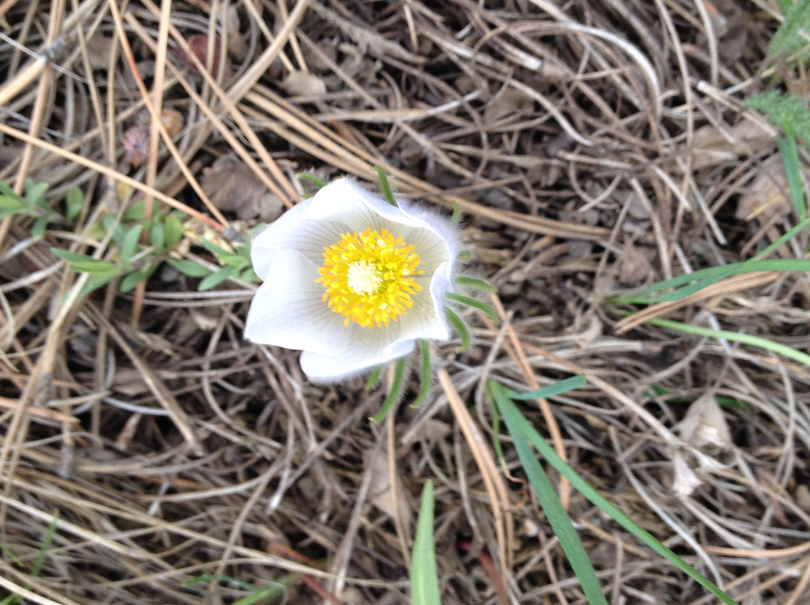
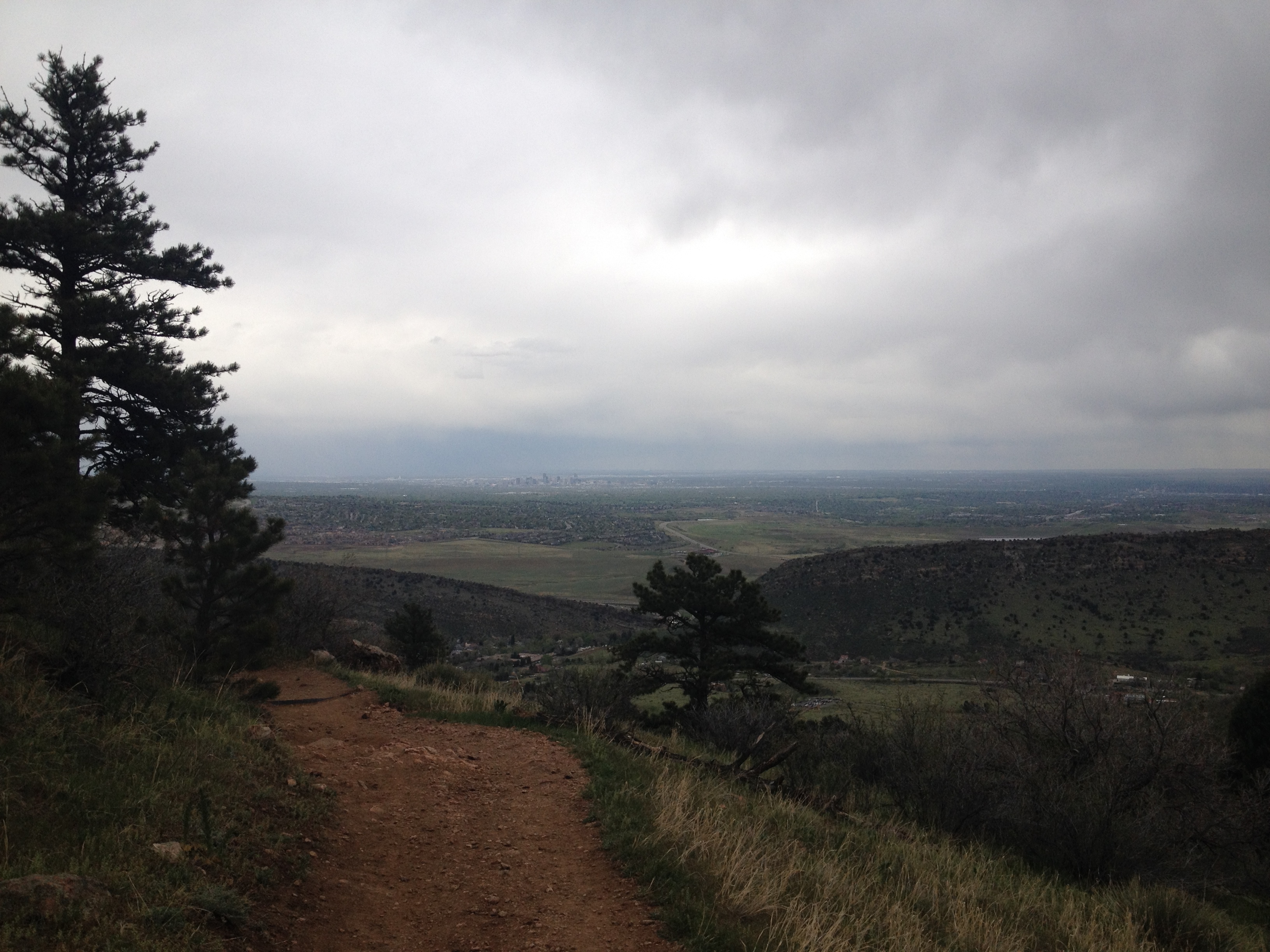
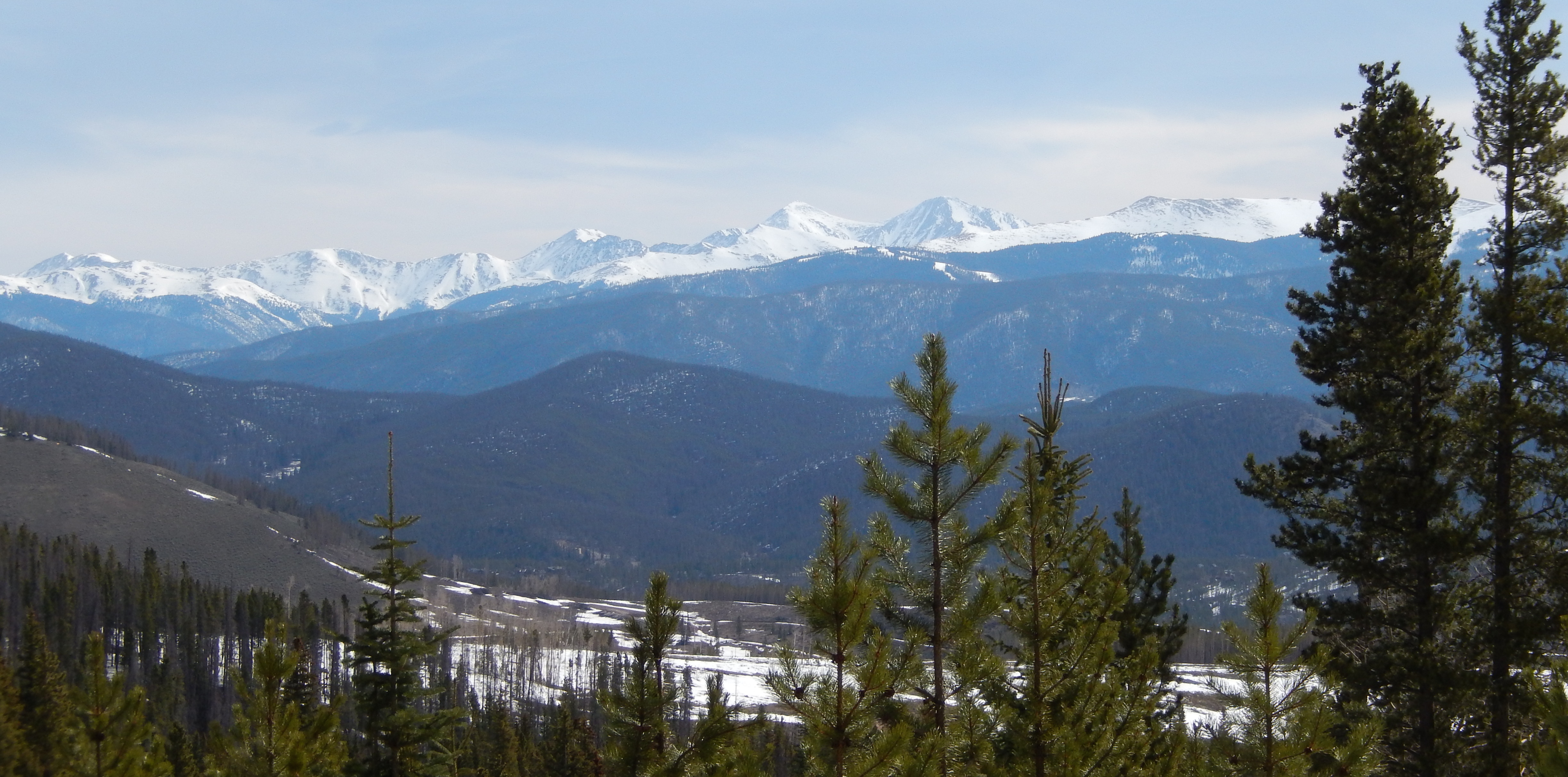
After the directions will be a few of my favorite pictures.

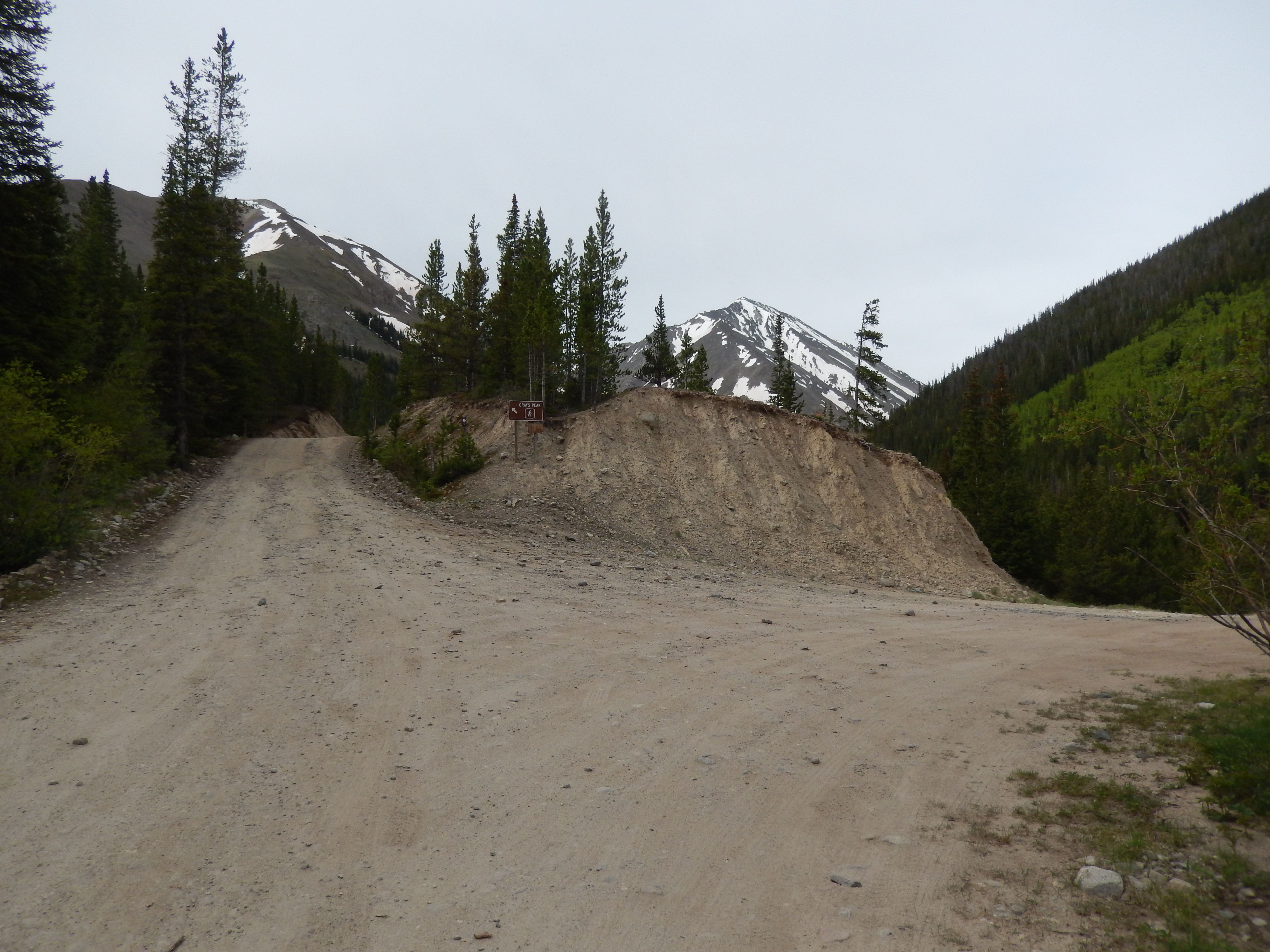
Directions:  Take I70 West and just before the Eisenhower tunnel, exit at the un-named exit #218.  Turn right at the end of the ramp, you will see the sign for Herman Gulch.


me with a view me in meadow fav5 fav6 rapids On the way down fav 2 fav4 fav1 Views ahead fav3

Grizzly Gulch, Bakerville CO Hiked 6/21/14

Torrey Peak
Torreys Peak

Starting Elevation: 9800 ft

Highest Elevation: 11,000Ft ish (we didn’t have our watch and I can find almost nothing on this trail.  I know the parking lot is at 9800 ft and I got 100 flights of stairs so 1000 ft total elevation gain)

Trail Length:  6 Miles from the parking lot right off the exit- 4 miles if you have 4 wheel drive and can go to the pull off a mile up the road.

Trail Uses:  Hiker, biker, 4 wheel drive cars, horses

Degree of Difficulty: Moderate but only if you have to climb the road from the parking lot – if you drive up the road to the pull off easy

Fees: None

Bathrooms: None

Pets: Yes

2

Taking 2 weeks off of hiking and exercise was killer for me. honestly by week 2 I was so antsy I snuck in a few walks and some elliptical just not in shoes with backs.   On my weekend off hiking I went to REI and met a shoe fitting guru.  Seriously he took a look at my heels, measured my foot and simultaneously started listing all the things that happen while I hike.  Like I have no flexibility at all in my feet and that I come down super hard when I walk or that my plantar fascia was screwed up.  Then he proceeded to go through all the different shoes and why they wouldn’t work.  He handed me a pair of Adidas trail runners in an awful mint green.  I super didn’t want to like them and at first I didn’t, I walked around and my feet were coming right out.  He switched up the laces and tied them a specific way > then they were HEAVEN… ugly heaven but heaven none the less.   He also found me a delightful boot, it too is strangely ugly but I think I am going to test them out this weekend before I commit.

Yes I am wearing purple socks with mint green trail runners.

I picked a hike that I had written down on one of my many lists of hikes I found on some random webpage, Grizzly Gulch at just 4 miles round trip with maybe 900 ft of total elevation gain.  I knew after 2 weeks of almost no exercise I needed to take it easy but I still wanted a view and supposedly this hike would take us to 11.300( I don’t think it did). But when I started to research the hike I could find almost nothing, the only thing I knew was it went to a meadow behind Torreys peak.  Then I found a few trip reports that said they couldn’t find the meadow.  I found pictures but no directions ….. any where. At like page 8 in a google search on my 5th combination of words I found a snowshoe with a hint of the two turns to look for.  I decided at 10 PM on Friday we would risk it.

From the parking lot

The start of the hike is along the road to Grays and Torreys which are 2- 14ers (Mountains 14,000 +ft above sea level) that are insanely popular.  If you have 4-wheel drive this hike could be just 4 miles, since I didn’t know where the trail break would be I figured if we couldn’t find it we could at least hike up to the trailhead for Grays and Torreys and get 8 miles in.

stevens gulch road View on the way up

At almost exactly 1 mile from the parking lot, we came to the first fork.  The sign for Gray’s Peak said stay straight and then there was a small parking lot with road heading off on the right.  We went right.  Taking the road for 2 miles of the hike is kind of challenging only because of all the trucks heading up to Grays & Torreys and the dust clouds they create, otherwise it is surprisingly beautiful.

Go right to Grizzly Gulch Road
Go Right at Grizzly Gulch Road almost exactly 1 mile up on Stevens Gulch Road

The view is great

Grizzly gulch road
The Grizzly Gulch Road/trail

From here the road/ trail gets much more rustic, we passed a few people camping long here and since I didn’t really know where the meadow was I went on guesses.  We passed one road going right then in just a quarter of a mile we came to what I was guessing would be my second right.  You come up to the fork, you will know it by 2 things. there are 2 old cabins on your left and what looks like another parking area than there is also 2 road signs, 189.1G & 189.1C…. Take 189.1C on the right and stay on it.

189.1C on the right
189.1C on the right
Go past the Cabins
The cabins are on the wrong road unless you want to go to an old abandoned mine

From here  it is not far and the trail has a ton of snow melt water on it.  At first it wasn’t bad

The snow melt isheavy

It wasn’t deep until we get to an impassable part.  For a second we thought about turning around, but the feet felt great and we had hardly gone anywhere so we took off our shoes deciding to cross.  For the record a knee-deep snowmelt streamed F@$#ing cold

I see the trail over there
See the trail over there

In theory it sounded  way easier than it actually was.

My Face Sums it up
My Face Sums it up

Seriously, it took all my tough girl genes to not start crying right about here, it was so cold.  I toughed it out, got to the other side and thought “I am not sure I can make it back over”.

From here we continued up the road past this lovely gentleman who was burning some fallen trees. At first I thought we went the wrong way and asked if it was ok that we hiked through, we were looking for Grizzly Gulch.  He was so nice, he is literally living in heaven with the most amazing scenery all around his home.  He let us hike through and told us we might find a bridge across the stream if we went along the stream little bit off the trail down on his property.

The Hardest Part
The Hardest Part

From here the trail was just a road that had some ups and downs but nothing like the first mile up.  The views were breath-taking, the stream and snow melt had transformed everything into this idealized hike and even with all the clouds it was perfect!  We had more fun enjoying all the views then we had in weeks!  The trail was still wet in places and we crossed the stream one more time but in just 1.5 miles we got to the meadow and it was amazing!!!

The Stream
The Stream
Getting closer to the Meadow
Second stream crossing
Way easier to cross
Way easier to cross and a view
The Meadow
The Meadow

I was so happy we found this elusive meadow, I honestly just stood there for almost a half an hour taking it all in.  We could have easily have gone on ….well sort of, the next river crossing is just to right of the fence in the picture above and it was like a 4 lane road wide.   My feet felt great but I didn’t want to push it in my new shoes, healing heels and really I didn’t want to feel that icy cold water again.   We took our time before turning around and heading back.   I know that we could have gone on and hiked to that ridge but for now I was satisfied with what we had seen!

Beautiful!
Beautiful!

Honestly the whole way back all we could talk about was how beautiful it all was and how happy we were that we found the meadow.  The other great part, we had almost the whole trail to ourselves.  The only time we saw other people were when we crawled out of the trees after finding a way to cross that uncrossable part… it was a fallen tree that was super stable in front of some wicked rapids.

Rapids where we found an out to taking our shoes off
This tree was heaven sent
This tree was heaven-sent

It was just maybe .2 miles to the road again….. it was also right off the road on the other side.

the path to avoid a water crossing

The way back from here was even better with weather coming in, sometimes dark clouds are as good as blue sky.  I honestly cannot wait to get back there again, this a gem that it seems like no one knows about or else takes a wrong turn too soon.  If I was honest with myself, no one hikes it because they are all hiking Grays and Torreys, but what a miss on their part because while summiting is awesome so is a really great meadow and this is an amazing meadow.

Directions:  Take I 70 to exit# 221 and go south, for the full 6 miles park in the lots there.  Otherwise drive up a mile to the road fork and park there for a 4 mile hike.

Looking back at Torreys
I couldn’t stop turning around and watching the sky change around Torreys
view on the way back
The view going back down Steven’s gulch road wasn’t bad either
me on the way up
Me on the way up Stevens Gulch road
bird
Cool Bird

flower 1

fav 2 fav 3

Baker Loveland Trail #60, Bakerville CO Hiked 6/7/14

good view

Starting Elevation: 9800

Highest Elevation 10,714 ( 900ft total elevation gain)Ft

Trail Length: 10 miles round trip

Trail uses:  Hiker, Biker, Snowshoeing, Crosscountry skiing

Degree of difficulty: Easy

Fees: None

Bathrooms: None

Pets: Yes

OLYMPUS DIGITAL CAMERA

My new Keens have not been kind, I am so sad because these bad boys have kept me hiking relatively pain-free for the past 2.5 years and this latest release of them have not been good.  Why do they have to change these things when they are perfect?  I could go from old pair to new pair with no problems the last 3 purchases.  After last weekends bizarrely blistered heels I decided to take it easy all week and only walked/exercised in shoes with no backs.  I know lots of people are not fans of Keens but they have been perfect for me until now. Because of the blister situation and the fact that Aaron was at sea level the just the week before this one, I picked an easy paved hike that took us above 10,000 ft but  for a 10 mile walk/hike.  It seemed like the perfect trade-off to me to help my feet. I really had targeted it for snowshoeing at some point but thought it might be a nice alternative for my current situation.

Looking up the paved road towards the trail head

The trail is literally right off I70 at the Bakerville exit, to the right of the road that goes to the Grays and Torreys trailhead.   These are twin 14ers that I hope to climb this summer, they are incredibly popular but the road is 4 wheel drive so some people actually park where we did and hike up the road in addition to doing the hike up the mountains.  In the late summer it is so popular cars are parked all long the road down to this point, think super painful crowded. I was a little embarrassed to be doing this easy paved hike instead of something like Grays.

The start of the trail
Baker Loveland Trail #60

Our trail for the day goes along I70, but up in the pines to the Loveland ski resort parking lot so we only had views of I70 once or twice through the hike.  It was mostly the surrounding mountain tops and trees, which were lovely with the perfect blue sky.  It was even better knowing that everyone on the front range was getting clouds and rain all day!

The 1st of 2 budge crossings
One of 2 times we actually saw I70

The trail is very nicely maintained and seemed to be mostly used by bikers.  Outside of that, there was nothing special about it.  It filled a need and I think it would be better as a snowshoe or cross-country ski route, well and ideally biking but I don’t do that.

There were lots of snow melt stream and waterfalls along the path to drown out the traffic noise

There was actually still a lot of snow along it and on it at times, which was surprising but kinda fun to watch the bikers try to deal with it.

Snow on the trail

Getting to Loveland ski resort was pretty anti-climatic as we came up at the end of the dirty parking lot right by a huge dumpster, close to the bend of I70 as cars are approaching the Eisenhower tunnel.

Turnaround point and Loveland Ski Resort

This was not a fun hike for me, not because the trail was paved or the views lacking, but because I was on the edge of an anxiety attack before I even got on the trail.  I have been trying to manage a difficult person/situation at work and that Friday night there was an email on my crackberry that just super stressed me out.  I am also so frustrated at my stupid feet and Keen for changing it up, after 2.5 years of constant hiking, I am suddenly at ground zero all over again. At just 3ish miles into the hike my feet were killing me and I literally melted down in a full-blown crying fit/tantrum.  I was so mad at my work situation and dreading Monday morning.  I was so mad at my feet and F#**ing Keen.  I was mad that the trail was paved(even though I knew that before going)….. there were lots of other irrelevant reasons I was mad…. fortunately only Aaron got to see me break down with snot all over my face, while I made pathetic sobs and snorts.  It was not a good moment.

The view a few minutes post melt down

I pretty much threw any sort of logic out the window at that point and just kept walking.  Not back to the car like I should have, but onward because I was going to finish this damn trail at any cost.  I am so stupid.

It took us 4 full hours to do a trail that should have only taken 2.5.  When I got back to the car my heels were REALLY bad.  I got home, I cleaned up and took the stupid shoes back to REI, where they told me they have been getting some rumblings about this release but nothing as bad as what I had done to myself.  The worst part, they have no suggestion on what to use other than Keen because their heel structure is exactly what I need  and there are no other women’s waterproof hiking shoes they know of that would be similar.

Totally cool stump that looks like an iron maiden

Unfortunately when Sunday came around, I could smell my blisters from like feet away.  Monday it was so bad I didn’t want to go into work where other people could smell me too.  Tuesday I made it to the Dr first thing, where they confirmed a decent infection had set in.   I love my Doctor, no lectures, no outward judgement on why I didn’t just turnaround, just straight up lets treat this and get you back hiking as soon as we can.  Outside the crazy amount of antibiotics I have to take for 10 days, she also said no cardio for a week or 2 and absolutely no hiking this weekend and possibly next.  I can’t really put on shoes if I wanted too anyway. Right now they itch so bad it is distracting, but no more smell or pain, so yay for antibiotics.

I am wondering if any of my female hiker buddies have chronic heels issues like I do can suggest a waterproof hiking shoe or boot that they love? I need a comfy heel box, Merrill is way too small for me and while I may give Salomon another shot, those have typically been bad all around for me.  I have never tried Lowe or Vasque….

The views were fantastic..my mind set not so much

Directions:  Take I70 West to the Bakerville exit #221, at the end of the exit ramp, turn left.  Immediately over the highway on the right will be a small parking lot and the trail head is just a little ways down the PAVED road on the right.  There is a large dirt area also used for parking on the side by an old fireplace as there are only 6 spots in the paved parking area.

Hiking repeaters over the weekend of 5/31 & 6/1/14

DSCN1915

My usual hiking buddy was not available for a Saturday hike so I leaned on one of my friends…. and frankly kind of tricked her.  At first I was all sweet, I will pick something easy but with good views…something close.  But Lisa has been working out like crazy so after a few probing questions I had originally picked Carpenters peak (Hike Details here) in Roxborough State Park.

And then the weather just kept getting better and better. I mean it was crazy beautiful and warm all week, the forecast for the mountains was just as good.  I started dreaming of beautiful vistas and a high hike without snow or the need of snowshoes  up high.

I have been craving a high hike for weeks and as the week went on I decided  to sweet talk(trick) Lisa into something a little more challenging. I was very strategic.

She innocently thought it sounded great, I am very good at playing it as easy….

I told her it would be fun to do St. Mary’s Glacier and if we got to the top of the glacier then we would go to the base of James Peak(hike details here).  It was a huge stretch and I felt super bad for making her try it but at the same time I needed to be there on Saturday even if we only made it to the lake and no further.  In fact that was all I hoped for, because the truth is you need to work up to 10K and above and Lisa hadn’t but I was in good shape from that standpoint.  St. Mary’s starts at 10,400 and getting to the flats meant we have to get to at least 11,700ft ,  I would not put Lisa in danger just to get my views.

Starting out on the trail no snow

Getting to the lake was no problem, there was no snow until there was a there was a ton of snow but it was early enough in the morning that we could walk on top of it without traction devices.  The lake was beautiful, partially frozen with the most amazing blue skies overhead and a crazy amount of snow ….. on the Glacier.

Us on the Lake
Us on the Lake

I seriously had resigned myself to going no further because the glacier can be daunting but Lisa was totally game.  When we started up I told her to be honest and take her time, our only schedule was to beat the storm that would eventually hit.

Check out how blue the sky is.

We started climbing up, the glacier was decidedly mushy but no postholing, I had traction devices for us both which helped prevent unnecessary sliding which I am sure would have killed Lisa’s resolve.  It took just a few minutes of climbing and she asked so is that the top? To which I replied, do you want me to be nice or honest?   She hesitantly said honest and I reminded her in the car when I told her the glacier was about a mile long so no that wasn’t the top.  Then I made her turn around and look at the view, it was the prefect motivation!

I am pretty sure my name is tied to a lot of swear words right about here.

About halfway up I am pretty sure Lisa was ready to kill me but she kept moving up.  When we were with in view of the top I asked her if she wanted me to remain ambiguous or tell her the truth?  That brave girl picked truth again which was good because we were almost up.  We took our time and when we got to the top we were both so excited, I am so proud of Lisa she did amazing!

Success - We are at the top
Success – We are at the top

We were sweaty after all that climbing even though it was in the 40’s on the way up, but the wind at the top was cold and so jackets went on.  We walked around on the flats looking for a way without snow to James peak but there was just too much of it, where there wasn’t snow it was wet or a full on snow melt streams.

Top of the Glacier looking towards James Peak

We climbed a little more and saw Grays and Torreys (14ers) in the distance while looking at James Peak ahead of us. There was also the amassing clouds making their way around James peak for the predicted afternoon thunderstorm so we took our few pictures and headed down.

Garys and Torreys (14ers)
Grays and Torreys (14ers)

Lisa loved the hike and the views were spectacular.  I have to agree with her, I had great company and the pleasure of showing someone such a beautiful place for her first time.

DSCN1943 DSCN1953

In the end we did 5 miles total with 1300ft of elevation gain.

Sunday Aaron and I hiked Deer Creek Canyon( Hike details here) to get him acclimatized to the altitude after him being at sea level for a week.  The trail was crowded and it was crazy hot…. I did terrible like could barely breathe terrible. and my feet were again torn up.

views at Deer Creek on Sunday

I have taken it easy this week with my heels and refused to wear shoes that might aggravate them any further.  We are doing an easier hike tomorrow that won’t require much climbing since we have had a week light in exercise.  But we are still getting out and I am hopeful that this next week will be a better one all around.

I hope whatever you are doing this weekend, it includes hiking some where!

East Castlewood Canyon Trail, Franktown CO hiked 5/26/14

1

Starting Elevation: 6604 ft

Highest Elevation: 6653 Ft ( there is some up and down overall I think we climbed maybe 400 ft total)

Trail Length: 4 Miles from the trailhead but we had to park a mile away so we hiked 6 miles total.

Trail Uses: Hiker Only

Degree of Difficulty: Easy

Fees: $7 a day

Bathrooms: There are bathrooms at the visitor center and some of the parking lots.

Pets: Dogs are allowed in the park on leash but on this particular trail NO dogs at all are allowed because of the fragile ecology of the trail.

2

The best part of a 3 day weekend is that it means 2 hikes over the course of the weekend is guaranteed. This was our 3rd walk of the weekend and strangely my heels had been chewed up worse than I thought on the previous 2 walks.  I needed something easy and had learned that Castlewood Canyon State Park had recently re-opened the East Canyon Hike it was rated as easy as well as one of the longer hikes in the Park.  I think everyone in Colorado decided Castlewood Canyon State Park was the place to go on Memorial Day, when we drove into the park the first 2 parking lots were full so we drove on to the 3rd one which was huge but filling up fast.  Besides the droves of people getting some good outdoor activity in, we were now a mile away from the trail I wanted to hit.

The trail from the car to the trailhead was paved

I am going to be honest, putting on shoes was tough with my blisters… walking on pavement was even harder.  The mile to the trailhead wasn’t too bad but I was trying to ignore how bad my feet were hurting, so far so good….

Trailhead

The best place to park for this hike is the very first parking lot upon entry into the park from Route 83.  We actually walked right past this sign but when we saw a park volunteer he told us to go off the pavement and look for cairns these would take us through the path.

Looking for cairns
Looking for cairns

This hike turned into a treasure hunt at this point, as the majority of the trail was over huge boulders so we were just looking for cairns the whole time.  I have to tell you it was pretty fun, the geology of this place was totally different then what we were used to and so beautiful!  I have done other trails in this State Park but this one is so much fun!  I mean like I wish I had some kids with me fun.   After cairn hunting for a short period the trail goes under Route 83.

Cairn hunting
Cairn hunting
Going under Route 83
All the way under route 83

Then back to the treasure hunt.  Slowly we made our way down into the canyon where we hit water – slowly not because the treasure hunt was hard but because my heels were in really terrible shape already.

Creek crossing
Creek crossing
Views while crossing the creek
Other side of the creek

After this low point we started climbing again but not very much, we turned a corner and there were these awesome pools with some fun rock jumping…..again perfect for kids.

OLYMPUS DIGITAL CAMERA OLYMPUS DIGITAL CAMERA

It is not far from here that we hit the 1.14 mile loop and all we could talk about was who kids could we take here?

thru canyon

The loop itself was unremarkable and strangely empty of much traffic.  We did get some amazing views of Pikes Peak and all of the front range, plus there were lots of flowers, lizards and an array of butterflies.  That doesn’t even cover all the birds we saw.

Trail loop conditions

All in all it was a fun trail, perfect for a short easy hike when your feet are in trouble.  I think it would be a great place to take kids for a million reasons but mostly because the whole time I was thinking I would have loved this as a kid.  As an adult it was beautiful and fun, bringing me back to those days when I would explore the creek behind a school as a kid.  It is really exposed and so meant more for spring, fall or winter, I would never do this one in the summer unless it was the end of the day or the very beginning.

In the end I had to take off my shoes and walk in my socks the blisters were so bad but I pushed it to the paved part and as close to the parking lot as I could.  I hate blisters and really I am not sure how I got back here but it was a bad place to be after years of hiking every weekend.  We did the whole 6 miles in just 2 hours which is right for easy and had my feet been in better condition we would have moved faster.

This State Park is really beautiful, not just because of the canyon but because of the endless views, beautiful flowers, adventurous trails and fun discovery.  I may not come out here often as I am currently addicted to summit views, but I will for sure brings lots of friends and families here because it is FUN!

Directions: To reach the main entrance of Castlewood Canyon State Park, take I-25 to Castle Rock, exit onto Founders Parkway eastbound. Take Founders Parkway to Hwy 86, go east on Hwy 86 four miles to Franktown. Turn South on Hwy 83 (S. Parker Rd) and go five miles south to the main park entrance.

flowers flowers 2 pikes peak lizards


Bergen Peak(Repeater), Evergreen CO hiked 5/24/14

Mt. Evans

The snow is still plentiful all over the mountains and frankly I didn’t feel like dealing with it last weekend but I really wanted to get close to 10,000 ft high.  Plus I have been feeling sadly out of shape so I picked my favorite standby, Bergen Peak (Hike Details here).  The day was actually pretty cloudy and we were racing against a flash flood warning that popped up as we were driving to the trailhead.

Outside of the changing weather, which is a normal threat in Colorado like all the time, the hike was great. We spent about 4.5 hours hiking around 10.5-11 miles and the trail was CROWDED.  Plus all the snow from the weekend before created snow melt streams in places we had never seen water at before while on this hike.

When we got to the summit, Mt. Evans was totally drenched in sun and blue skies while we hung out under clouds, it was awesome!

Mt. Evans2

I started out this hike not wanting to be there for like the first time in years…. literally.  It was not just a tough morning but a tough week, with a tough week before that one and another ahead of me.  I was struggling at first but like it always does, the hike helped me process through some of that. and get to a place of happiness.

There are always tough times, the one thing that always makes me happy is hiking. I am so glad I forced myself out because it made this past week just a little easier to get through.

For the record there was no snow on Bergen peak.  It was a little muddy and definitely crowded, people are getting anxious to get to get as high as they can right now, but overall it was the prefect place to hike and avoid snow.

I was happy to be out there and find some peace, that peace kept me moving all weekend and on a beautiful 3 day weekend no less!

OLYMPUS DIGITAL CAMERA

Matthews/Winters Park, Lakeview CO Hiked 5/17/14

best view

Zorro Trail> Dakota Ridge Trail> Village Walk>Red Rocks Trail> Morrison Slide> Red Rocks Trail> Dakota Ridge> Zorro Trail

Starting elevation: 6055 ft

Highest Elevation: 6800ft ( total Elevation gain was around 1600 ft)

Trail Length: Approximately 9 miles, it took us 4 hours to do the whole hike

Trail Uses: Some sections are hiking & horses only, most are hiker, biker & horses

Degree of Difficulty:  Moderate-mostly because of length

Fees:  None

Bathrooms:  At the parking lot of both Green Mountain and Matthews/Winters Park parking lots

Pets:  Yes – On Leash

2

At 5PM on Friday I found our hike for the weekend, it didn’t give me the climbing I wanted for the but it did give us some good mileage plus we had never done this one, extra bonus.  I had wanted to do this one for over a year, but I had written across the map “lots of snakes only hike in winter”  and yet this winter we were obsessed with snowshoeing and completely forgot about this one.

Saturday was strangely humid for Denver so when we pulled up to the trailhead we were cold but determined to not overdress this time.  We actually parked in the lot for Green Mountain (hike details)in Lakewood because that was the best place to start for the loop hike we wanted to attempt.

Starting out
Starting out looking towards the trailhead
The trailhead across Rooney Road

Zorro is a nice easy climb up about 500 ft over the course of almost of a mile to the Dakota Ridge Trail.  The bad part of this section is all the noise from 470 on this side and then when we got over the ridge, I70 noise was also super loud.

One of the views as we approached the top of Zorro
Some rocky steps close to the top of Zorro.

As we were on this side of the mountain or hogback, there were clouds all over the front range and they were low.  Green mountain just across the road was covered in clouds, when we got to the top it was all blue skies over Red Rocks.

Green Mountain all cloudy
Dakota Ridge Trail - Go right.
Dakota Ridge Trail – Go right.
Yay Blue skies
Yay Blue skies
Me on Dakota Ridge with Red Rocks in the background

We walked along this until we crossed over to the west side and through some trees, had a small break from traffic noise until we could see I70 and then the noise was all back.  We could also see the parking lot for Matthews/Winters Park below us.

Coming down Dakota Ridge
There is Matthews/Winters Park...and I70
There is Matthews/Winters Park…and I70

Coming down Dakota Ridge was the most muddy part of the whole hike but wasn’t super bad and before we knew it we were at the road crossing to get to the next set of trails.

Matthews/Winters Park
Trail Map
Trail Map

As we got to the next section of our hike, there were a bunch of vault toilets that we could take advantage of.  It was also the start of all of this fantastic red beauty and because of all the snow the weekend before, the green was amazing against the red.  We took Village Walk ( no Bikes allowed) To the Red Rocks Trail.

Changing over from Dakota Ridge to Village walk.
The next trail section starts just after this creek crossing.

Village walk

There is an old Cemetery just off the Village Walk Trail.

Red Rocks goes back to bikers and hikers

Red Rocks Trail start

I have to tell when we got to this part of the hike, I was so glad it snowed the week before because the flowers were so plentiful and as we got to the lowest part on this trail there was an oasis of green & red with the running water was stunning.  It was the best part of the hike!

An Oasis
An Oasis

2nd creek DSCN1721

From here we started climbing back up to the Morrision Slide trail, which climbs up to a lovely flat with lots of views of everywhere we had been so far and where we were going.  It is also the highest part of the hike.

Picking up Morrison Slide
Views of Red Rocks and the Part of Dakota Ridge we had already been on
Views of Red Rocks and the part of Dakota Ridge we had already been on
Morrison Slide flat part on a beautiful day

After the beautiful flat top of Morrison Slide we started descending back to Red Rocks Trail.

Back on Red Rocks Trail
Trail Conditions coming down Red Rocks Trail

I have to tell you coming down this portion of red rocks trail was really hard to not keep looking behind us as it was just a perfect view.  Which made the next section a little disappointing because it was detour on a regular road with car traffic, down to the other side of the Dakota Ridge Trail which also is known as Dinosaur Ridge.  I saw that the construction in Red Rocks had forced a detour of the trail but I never guessed it was actually on the road.

Boo - Detour :(
Boo – Detour 😦
Crossing over to the Dinosaur Ridge part and a closed road.
This is cool!
This is cool!

I have heard about this place but I have to tell you it was way cooler then I thought it would be.   They left dinosaur bones in the rock so that people could see what they look like when they are discovered!  We were like little kids checking it all out, oohing and ahhing

Dinosaur bones

As we finished up reading about all the bones and the changing landscape, we got back to the original Dakota ridge trail.

End of detour

no more paved road
no more paved road

This last section of the hike was all white and felt so different from the rest of the hike and I loved the change!

The last stretch

I really enjoyed this hike and I honestly think we did it with perfect conditions, on the best day possible.   It is a really exposed trail which means in the summer it is likely HOT, I mean it didn’t get much above 60 while we were hiking and the sweat was pouring off of us-now I get why there are typically a lot of snakes here.   The downside(outside of the snakes of course) is how close it is to both 470 & I70, the noise went away for a good portion of the hike but when it was around it was pretty bad.   Despite that, I will for sure do it again and likely bring guest hikers here because of the great views of Red Rocks.  After the directions will be pictures of all the flowers we had the good fortune to catch before they burn off in the sun.

This 3 day weekend we will get in 2 hikes that will both likely be repeaters!  I hope you all have great plans for the holiday weekend that includes a hike!  Life is too short… you should hike more!

Directions: Take I-70 West from Denver for about 9 miles to C470-East exit (exit 260). Go about 2 miles on C470 East and take the Alameda Parkway exit. Turn right onto Alameda Parkway, then take your first right onto Rooney Road. Go about 1.5 miles and the trail head parking lot will be on your right.

flowers 1 flowers2 Flowers 3 flowers4

Mt. Falcon (repeater), Morrison CO hiked 5/10/14

Red Rocks from the trail

This past weekend I had a meeting I had to attend  at 11AM on Saturday and to be honest I figured we would just hike on Sunday.  Then this wicked storm was predicted to hit on Sunday, it started out not being so bad and moved to a couple of feet in the mountains several inches on the Front Range.  Given this impending weather wrinkle we decided to get the best bang for our late start buck by hitting something close but challenging, yay Mt. Falcon ( Hike Details here)!  Unfortunately the weather forecast continued to change dramatically even between Friday and Saturday morning, so our day of beautiful sunshine turned into breaks between rain during our hiking window.   The worst rain shower actually hit before we started hiking when we first pulled up, nothing like a rain storm to make you question if you should go or not.  We decided we had enough gear to risk it and fortunately the rest of the hike ended up being pretty tame weather wise.

Flower3 Flower1

The best part of the hike was the flowers, they were everywhere and just lovely!  It was also obvious that Jefferson County had some trail work done on the bottom half of the trail to repair damage from the floods last fall, it was all leveled out at the bottom of Turkey trot and then nicely packed as it wound up to the trail break with Castle view.  The volunteers did a great job fixing it up!

Flower2 flower4

Because of the rain, this normally high traffic trail was decidedly pretty empty on Saturday which was a nice change.  We also were coming down late enough in the afternoon that we could hear music from Red Rocks  coming over to the trail, it was kinda cool.

denver Denver2

I keep forgetting how fickle May is for high altitude hiking, all the snow that hit on Sunday is still lingering as low as 7ooo ft.  Plus the mountains have been getting hit once a day with snow/rain since Sunday and I don’t know if I have mentioned it yet, but I am kinda done with the snow!  I know we have been trudging around in it for months, but spring snow is different you can’t float on it in snowshoes and  you are guaranteed postholing anytime after 10AM when the sun starts really to ramp up.  I am not a fan of postholing.

I am struggling to find a hike for tomorrow and praying that inspiration hits me sometime tonight!  Wish me luck!

I hope where ever you are, you find time to get out and hike soon!

These lovely ladies were just a few feet away from us on our way down

Peaks Trail #45, Breckenridge CO Hiked 5/3/14

1

Starting Elevation:  10,075 Ft

Highest Elevation: 10,221 Ft

Trail Length: We did a total of 6.5 miles round trip but you can take this trail all the way to Frisco for 10 miles one way.

Trail Uses: Hiker, biker, cross-country skiing, snowshoe,

Degree of Difficulty:  Moderate to difficult depending on how far you want to take it.

Fees: None

Bathrooms:  None at the trailhead but the Grand Lodge on Peak 7 is a resort right next to the trailhead and does have public bathrooms

Pets:  Yes – I think they are supposed to be on leash but there were some(most) not on leash

2

Three years ago we impulsively bought a time share in Breckenridge and because we have spent that money I make sure to always take advantage of it when I can.  They offer something called bonus time to owners, which means when the resort isn’t full they sell the rooms for a third of the cost they normally are.  This past weekend was one of those weekends there was availability via bonus time and on top of it if we sat through another sales pitch, we got the room for 2 nights for $38.  Needless to say we took advantage of the deal.   The best part of the stay is that this trail we wanted to do is right next to the resort…. well that and the hot tubs.

mileage sign DSCN1530 DSCN1528

The not so great part is the resort allows pets and guess where everyone comes to walk their dogs…. this trail head, where apparently none of them ever bother to pick up after their dogs.   It was a poo minefield for the first quarter-mile, it was actually hard to miss stepping in it all while walking through this first section.

We were out on the trail just 30 minutes after we got up, at 7AM.  The snow was icy and stable so all we needed for most of the hike was traction devices.  The sky was the most beautiful blue, I don’t think the day could have been more perfect for us to be out hiking.  After the poo-field, the trail goes up a little, then down a little then up and down some more.   Nothing too crazy but a good workout on snow and ice regardless.

These trail markers make following the path in the snow easy. Very well marked
These trail markers make following the path in the snow easy. Very well-marked
Trail Conditions in the beginning

We came to this road a little less than mile in, but the trail was well-marked on the other side.

crossing the road

It isn’t far from this junction that the views just open up on both sides of the trail.

Looking North and East
Looking West
Looking West

We started to hear the melting snow all over and then we crossed over a snow melt stream, this one is the first of 3 or 4 we would cross from this point forward and while the picture doesn’t quite capture it, we are 4-5 feet above the stream on snow

crossing over snow melt

It was just after this we ended up on a Nordic Center snowshoe trail, which threw us because we didn’t remember seeing a trial break.  Fortunately, I had sort of  remembered from our snowshoe at the Nordic Center(snowshoe details here) that there was one part of the trail system that merged with the Peaks Trail so we kept moving forward and kept an eye out for a blue diamond.  I do have to say when it went off on its own there was absolutely no snow the way it went, I was a little jealous, I am definitely done with snow.

Snowshoe routeroute has no snowOLYMPUS DIGITAL CAMERA

We continued on and got the absolute best views of the day in the next section which was pretty flat until it started to descend to the three mile marker and this beautiful pool about 6 ft below us but the picture doesn’t show how high the snow was.

fav2 good view

trail conditions 2 OLYMPUS DIGITAL CAMERA turnaround point turnaround stream

We felt really good and almost went further but we didn’t want to go too far and then spend hours post holing back to the trailhead.  Instead we decided to turn around and promised each other to walk the 2 miles down to town for a little extra movement.  We did walk those 2 miles to town and around town for a total of 12 miles over the course of the day which isn’t too bad.

This trail was spectacular and I cannot wait to try it in the summer or fall, the trees were perfect, the views amazing and frankly I would love to say I walked to Frisco on it.  You can really get out of it whatever you want, just make sure to go a mile to a mile and half in so you can see the best views possible,

I hope whatever your plans are for the weekend, they involve hiking!

Directions:  from I70 to Breckenridge take 9 to Lincoln/Ski Hill,  turn right.  Take Ski Hill for approximately 2 miles to Grand lodge on Peak 7 – drive just past the Resort and follow the road, as soon as it is unpaved you will see the trailhead on the left.

I thought these looked like ice ornaments instead of icicles

nice view

Three Mile Creek Trail, Grant Co Hiked 4/26/14

DSCN1520

Starting Elevation: 9022 ft

Highest Elevation:  11800 ft but we only made it to 10,100 ft for a total of 1100 feet of elevation gain.

Trail Length: Officially it is 13 miles round trip, on this hike we only made 5.2 miles round trip because of the snow.

Trail Uses:  Hiker, Biker & Horses

Degree of Difficulty:  Moderate to difficult, depending on how far you go

Fees: None

Bathrooms:  No, but there are 2 scary vault toilets along the road before you get to the trailhead, personally going outside would be easier….

Pets:  Yes on Leash

DSCN1499

Last week Burning Bear Trail made me fall in love with the area around Guanella Pass and the Mt. Evans Wilderness.  Three Mile Creek was another trail I had found late last year and it is in the same area so we headed out that way first thing Saturday morning.  The morning was absolutely perfect,  sunny with blue skies and the whole day was supposed to be that way with maybe some wind later in the afternoon.

parking lot trailhead

We started out and there was no snow or ice on the trail, it initially climbs just a little bit and goes along the road and then the creek.

starting out

I have to admit I was so excited in the beginning, I really thought we were going to make the whole trip with not too much snow. it was a nice steady climb through this stretch.

Views at the beginning

I had read that on this trail that as you go along the creek, it actually crosses over it 15-18 times in the first 3 miles, get to the first meadow and then climb on switchbacks up to the next Meadow where all the views are.

First creek Crossing

We made it over the creek about 6 of those times when the snow got to about 3-4 feet deep and while we had our snowshoes with us, the snow was getting so unstable from the warmth building throughout the morning that it was obvious at 2.6 miles in we weren’t getting in any further.

Along the creek
Along the creek

We turned around and just enjoyed what we could see of the trail.  We will for sure go here again and as soon as we can, maybe even backpacking here over the summer.  I had found out that this trail is considered a centennial trail, in that there is supposed to be a 100+different varieties of  flowers to be seen once the snow melts, that it has been written up a number of times.  That also means it is a busy trail during the summer and this summer promises to be epic for flowers given all the snow we have had.

Not too far from our turnaround point
Last picture I took before the snow was too much

At times we have made impulsive decisions that can be expensive, getting snowshoes was one of those.  We bought them from the Clymb for half the cost they would have been had we gone for this year’s versions and say I had gone for women’s versus men’s… but we got the adventure ones that are most useful for climbing mountains in the snow with backpacks on.  In total we spent $270 total with shipping and use of a coupon for 2 pairs of snowshoes.  This is how we figured we would pay them off; it costs $18-20 a day per person to rent snowshoes – each time we used our snowshoes we took $20 off what we paid.  We had hoped to have paid them off by the end of next season or spring of 2015.  This week was the 9th time we brought/used our snowshoes which means we paid off our snowshoes in just 3 months!  It is a stupid way of looking at things but it makes us happy, we did a little happy dance after our hike!

Not too many pictures from this hike so here’s how to get to this hike.

Directions: Take 285 from Bailey 10.8 miles to the town of Grant, turn right on to Park County Road 62( often referred to as Guanella Pass Road).  Drive 2.9 miles on the road and you will see the trailhead on right immediately before the Private property for the Next Mile signs.  It is a tiny parking lot so come early!