

Zorro Trail> Dakota Ridge Trail> Village Walk>Red Rocks Trail> Morrison Slide> Red Rocks Trail> Dakota Ridge> Zorro Trail
Starting elevation: 6055 ft
Highest Elevation: 6800ft ( total Elevation gain was around 1600 ft)
Trail Length: Approximately 9 miles, it took us 4 hours to do the whole hike
Trail Uses: Some sections are hiking & horses only, most are hiker, biker & horses
Degree of Difficulty: Moderate-mostly because of length
Fees: None
Bathrooms: At the parking lot of both Green Mountain and Matthews/Winters Park parking lots
Pets: Yes – On Leash

At 5PM on Friday I found our hike for the weekend, it didn’t give me the climbing I wanted for the but it did give us some good mileage plus we had never done this one, extra bonus. I had wanted to do this one for over a year, but I had written across the map “lots of snakes only hike in winter” and yet this winter we were obsessed with snowshoeing and completely forgot about this one.
Saturday was strangely humid for Denver so when we pulled up to the trailhead we were cold but determined to not overdress this time. We actually parked in the lot for Green Mountain (hike details)in Lakewood because that was the best place to start for the loop hike we wanted to attempt.


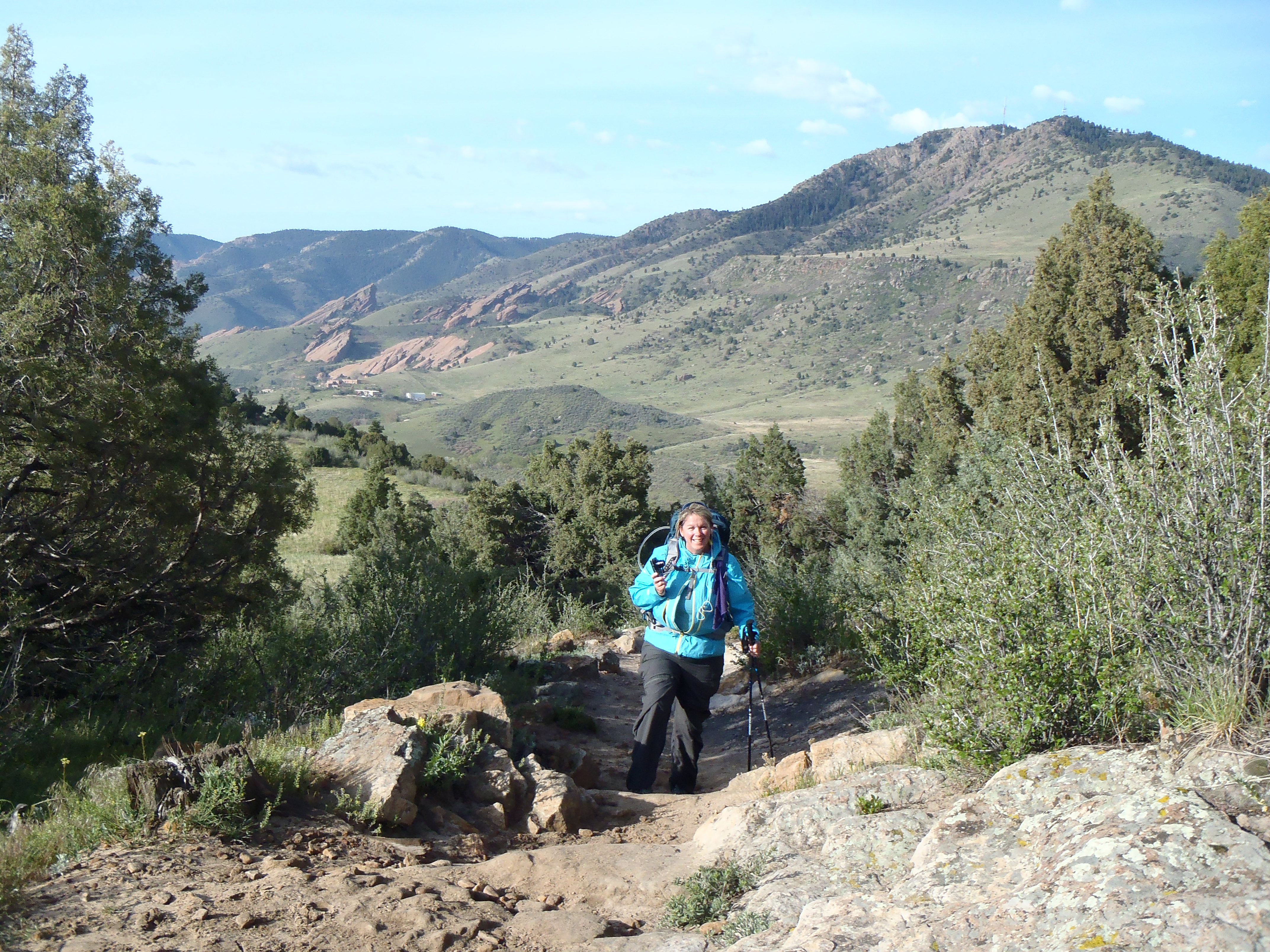
Zorro is a nice easy climb up about 500 ft over the course of almost of a mile to the Dakota Ridge Trail. The bad part of this section is all the noise from 470 on this side and then when we got over the ridge, I70 noise was also super loud.


As we were on this side of the mountain or hogback, there were clouds all over the front range and they were low. Green mountain just across the road was covered in clouds, when we got to the top it was all blue skies over Red Rocks.


We walked along this until we crossed over to the west side and through some trees, had a small break from traffic noise until we could see I70 and then the noise was all back. We could also see the parking lot for Matthews/Winters Park below us.
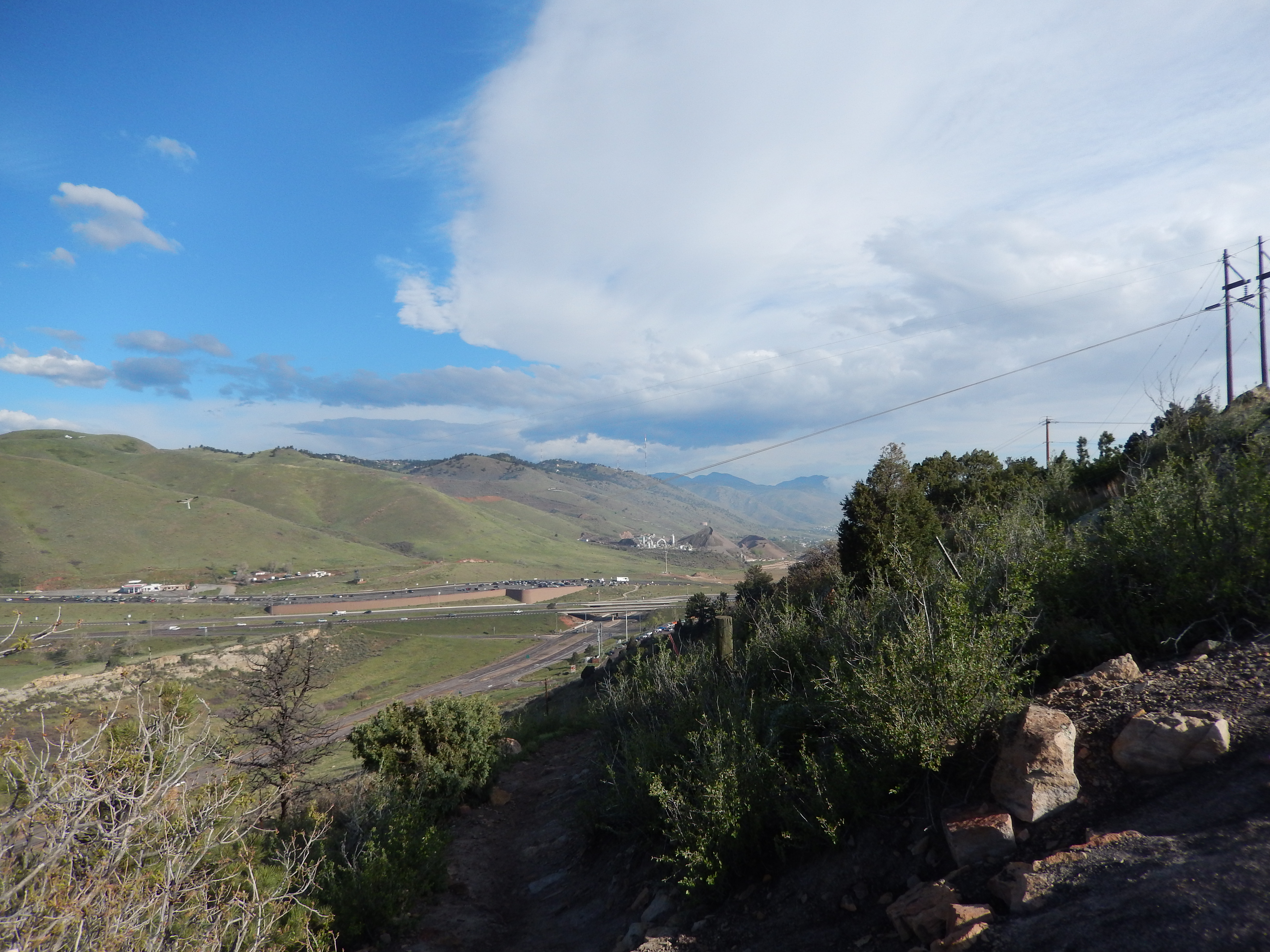

Coming down Dakota Ridge was the most muddy part of the whole hike but wasn’t super bad and before we knew it we were at the road crossing to get to the next set of trails.

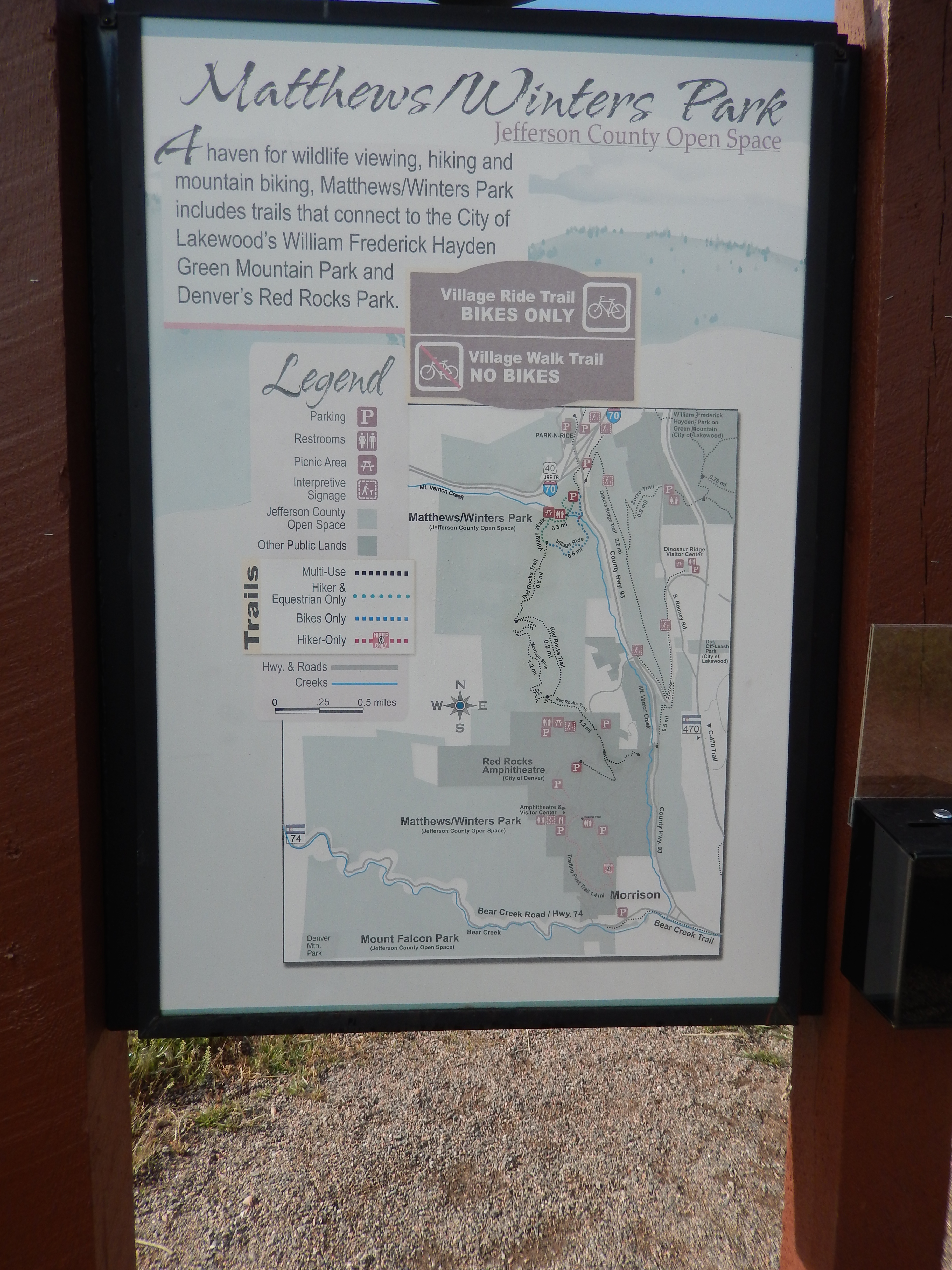
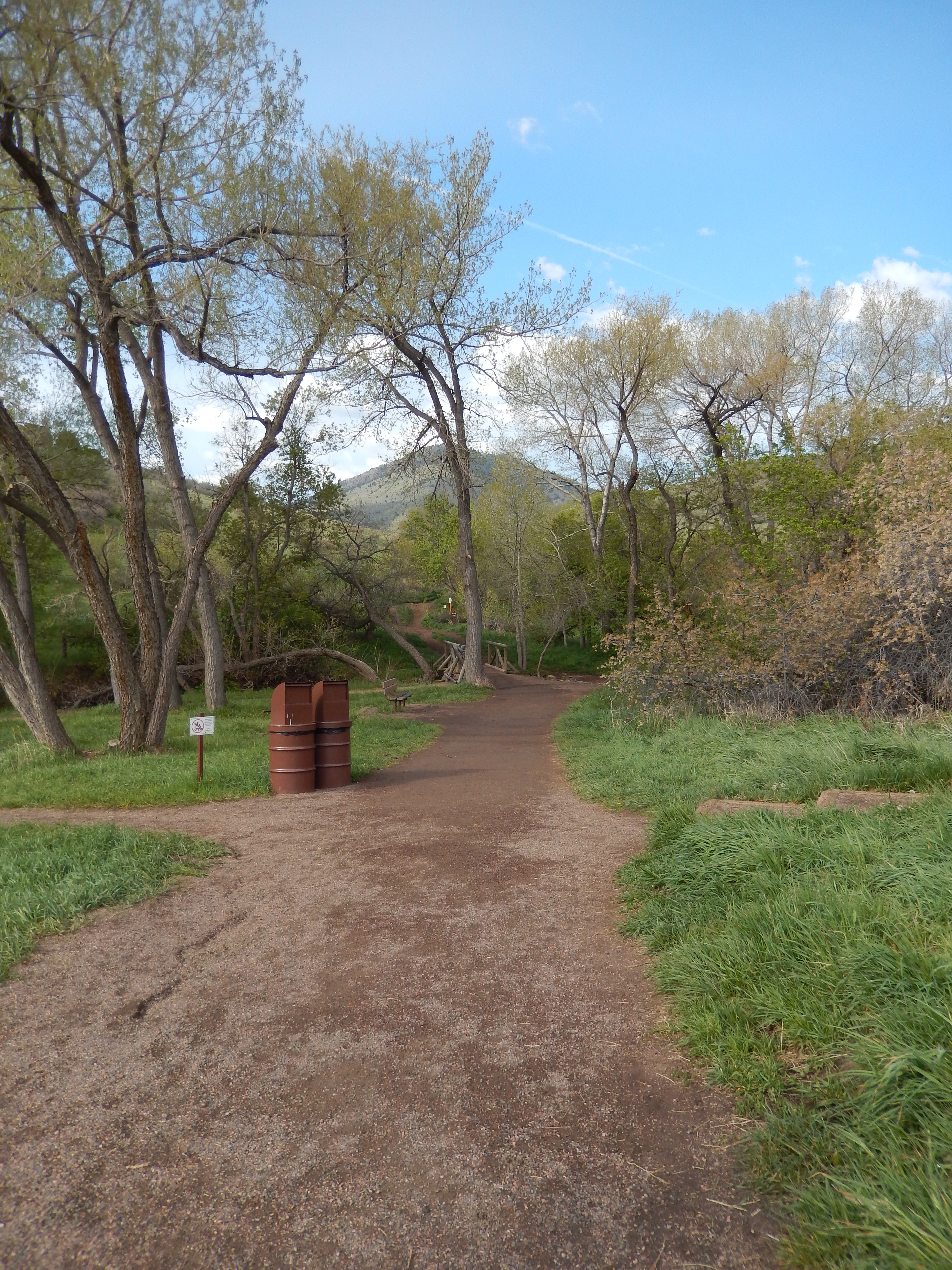
As we got to the next section of our hike, there were a bunch of vault toilets that we could take advantage of. It was also the start of all of this fantastic red beauty and because of all the snow the weekend before, the green was amazing against the red. We took Village Walk ( no Bikes allowed) To the Red Rocks Trail.

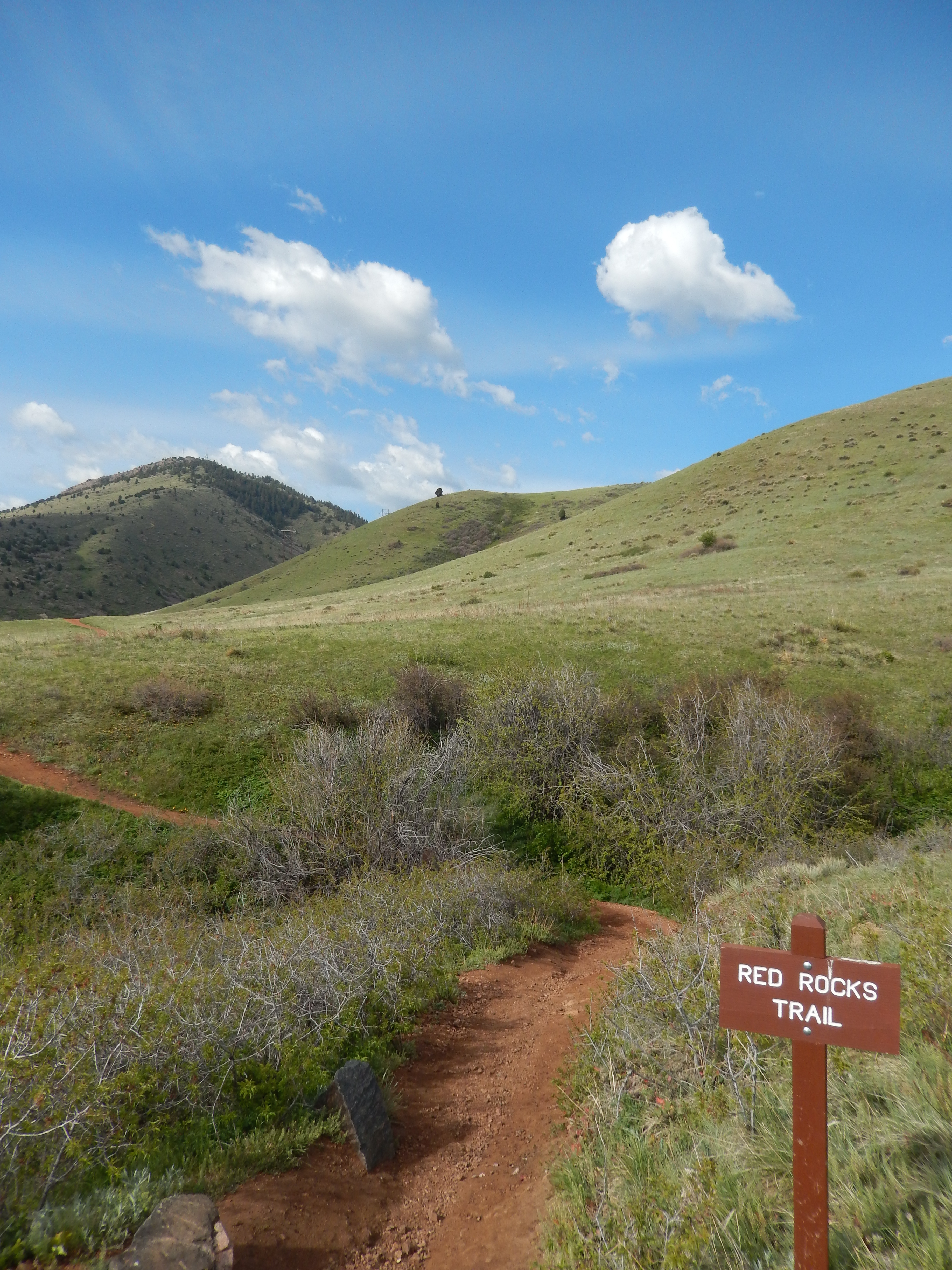
Red Rocks goes back to bikers and hikers
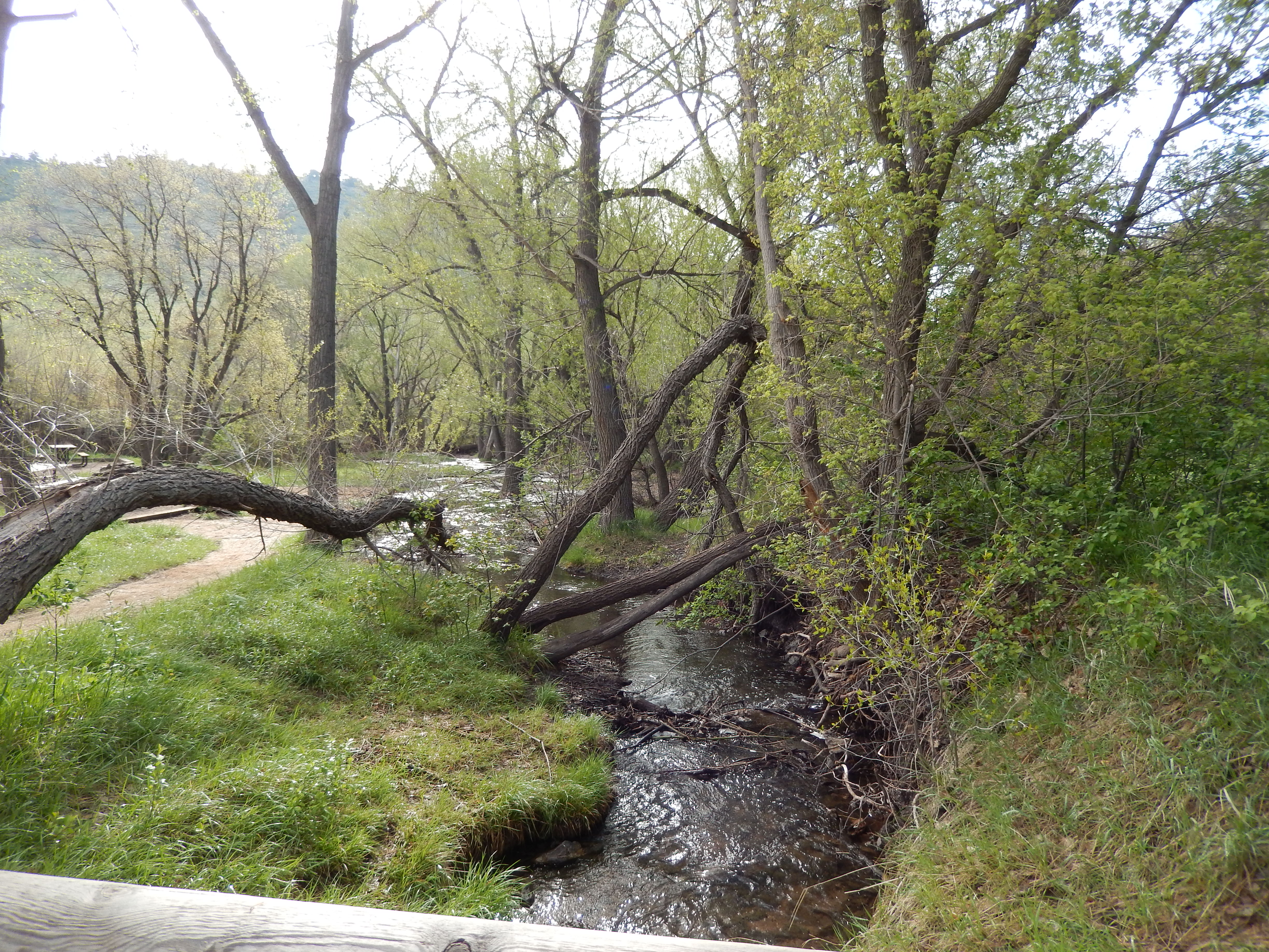
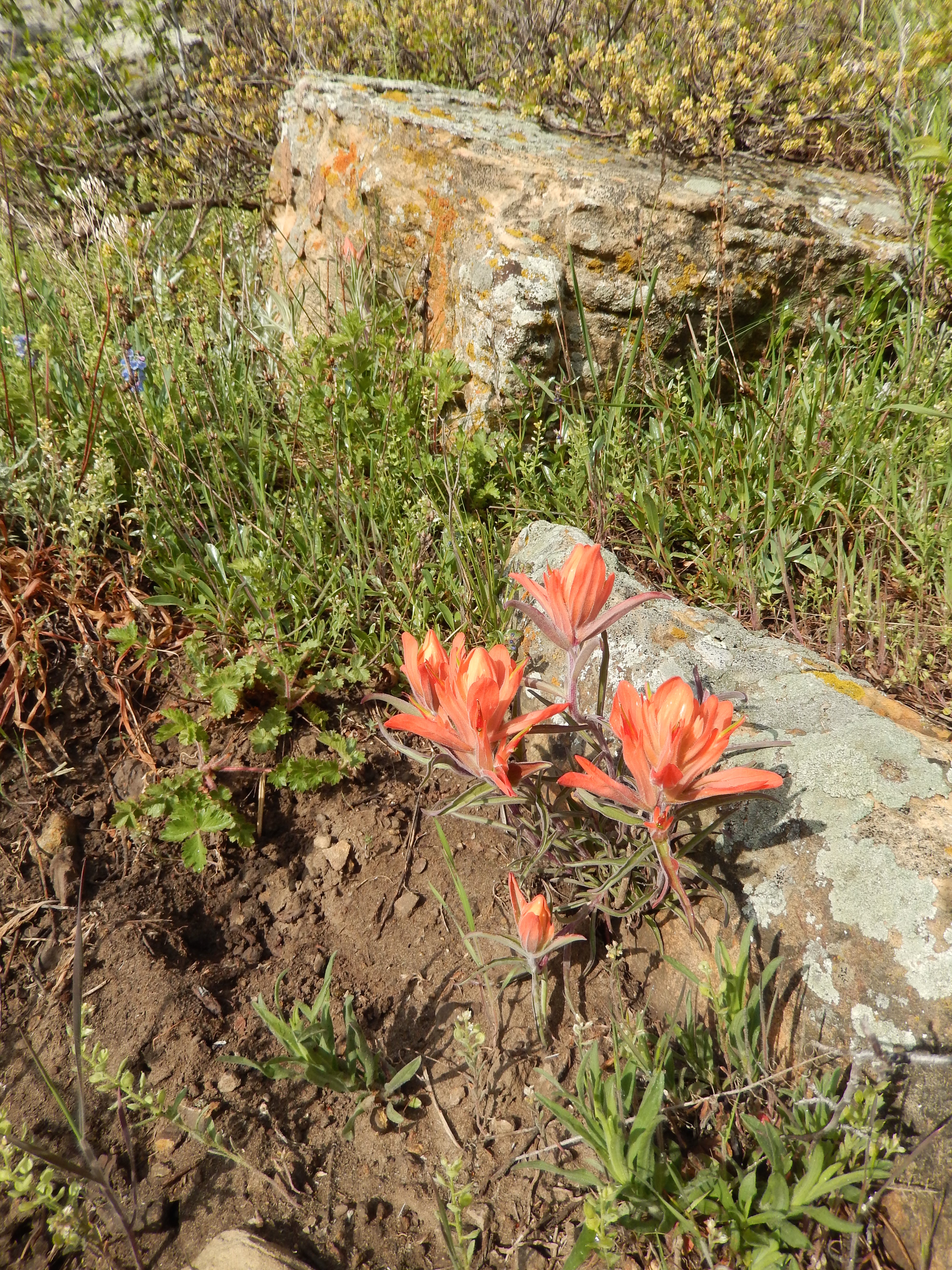
I have to tell when we got to this part of the hike, I was so glad it snowed the week before because the flowers were so plentiful and as we got to the lowest part on this trail there was an oasis of green & red with the running water was stunning. It was the best part of the hike!


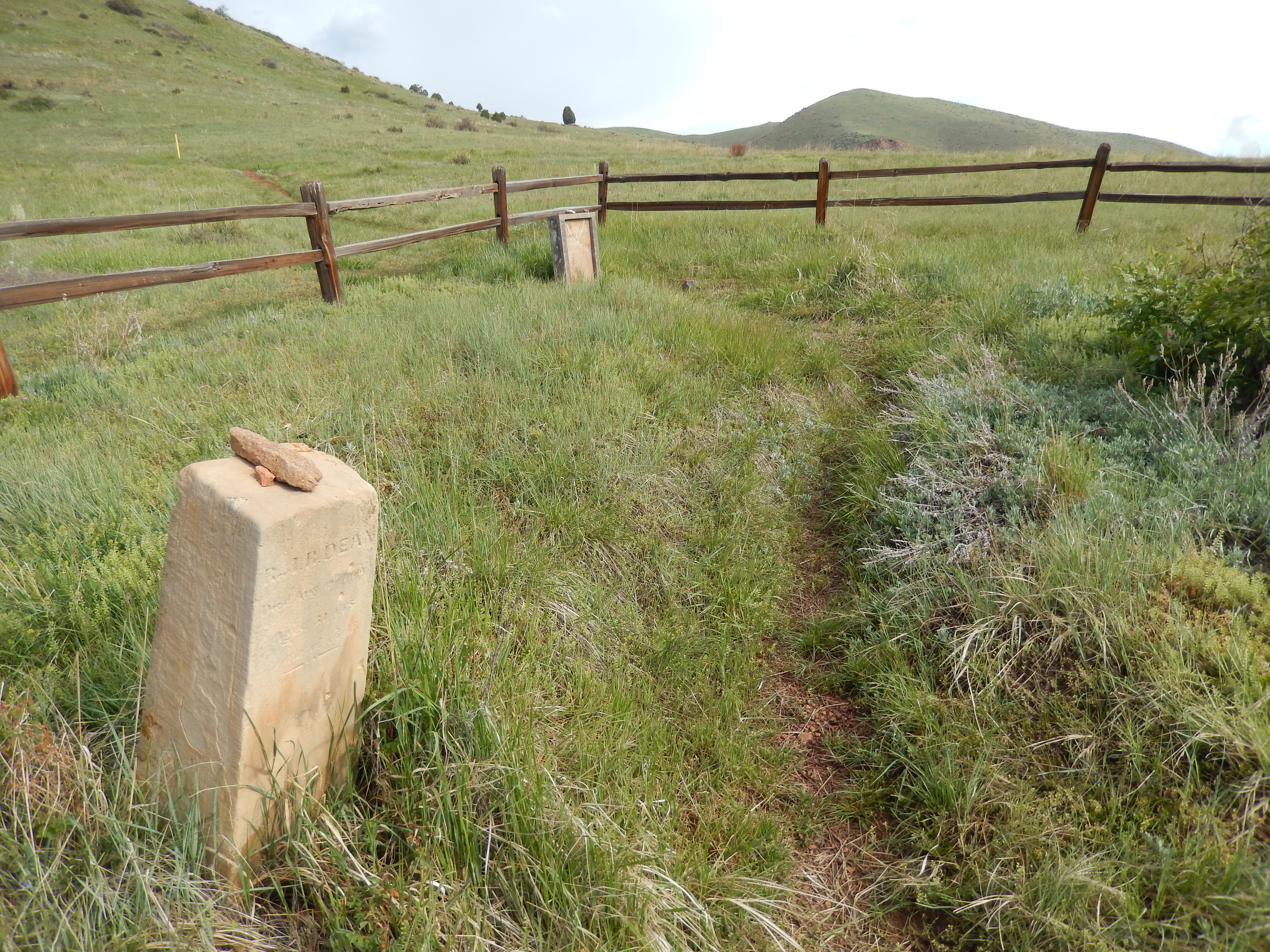
From here we started climbing back up to the Morrision Slide trail, which climbs up to a lovely flat with lots of views of everywhere we had been so far and where we were going. It is also the highest part of the hike.
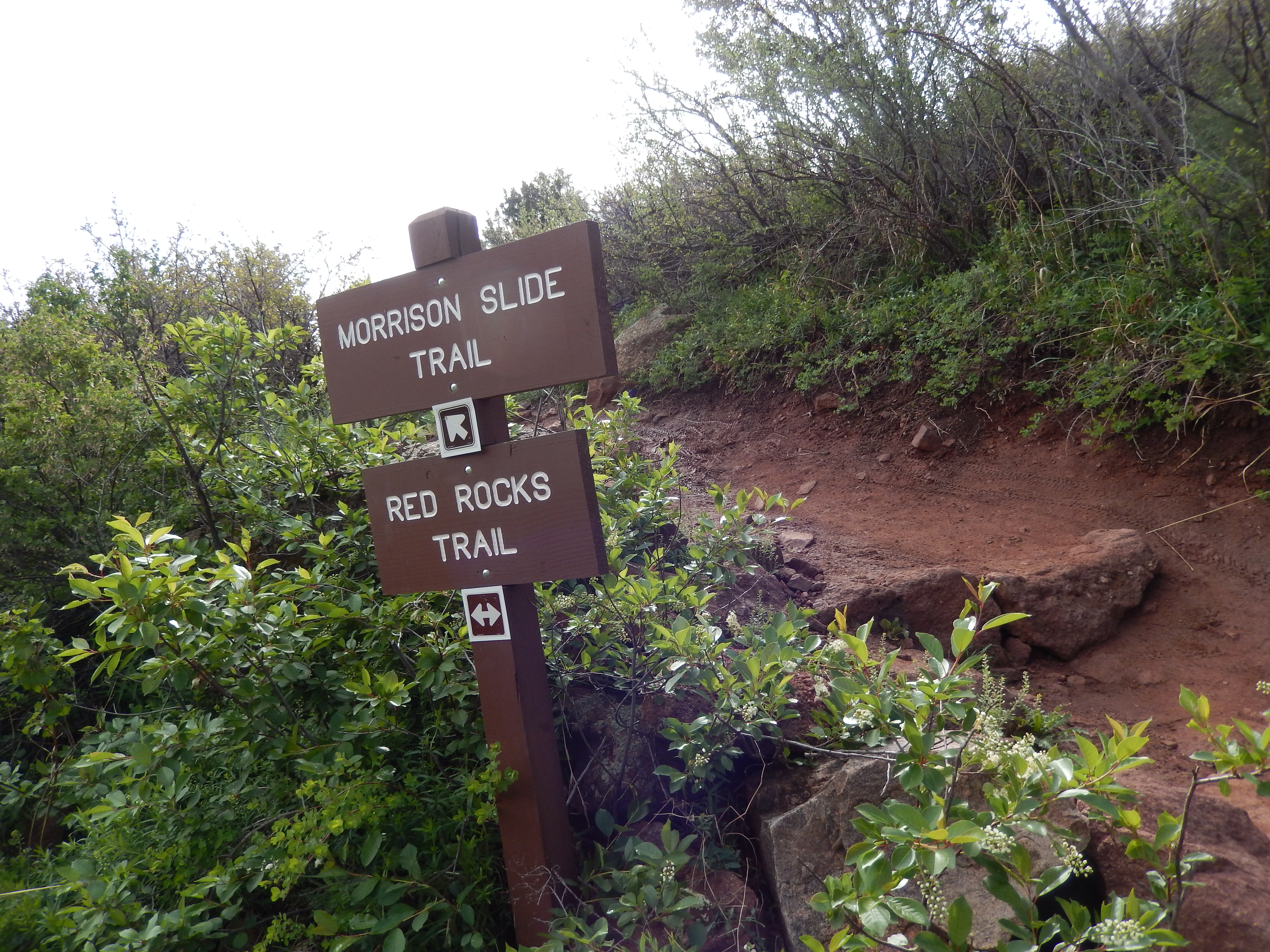


After the beautiful flat top of Morrison Slide we started descending back to Red Rocks Trail.


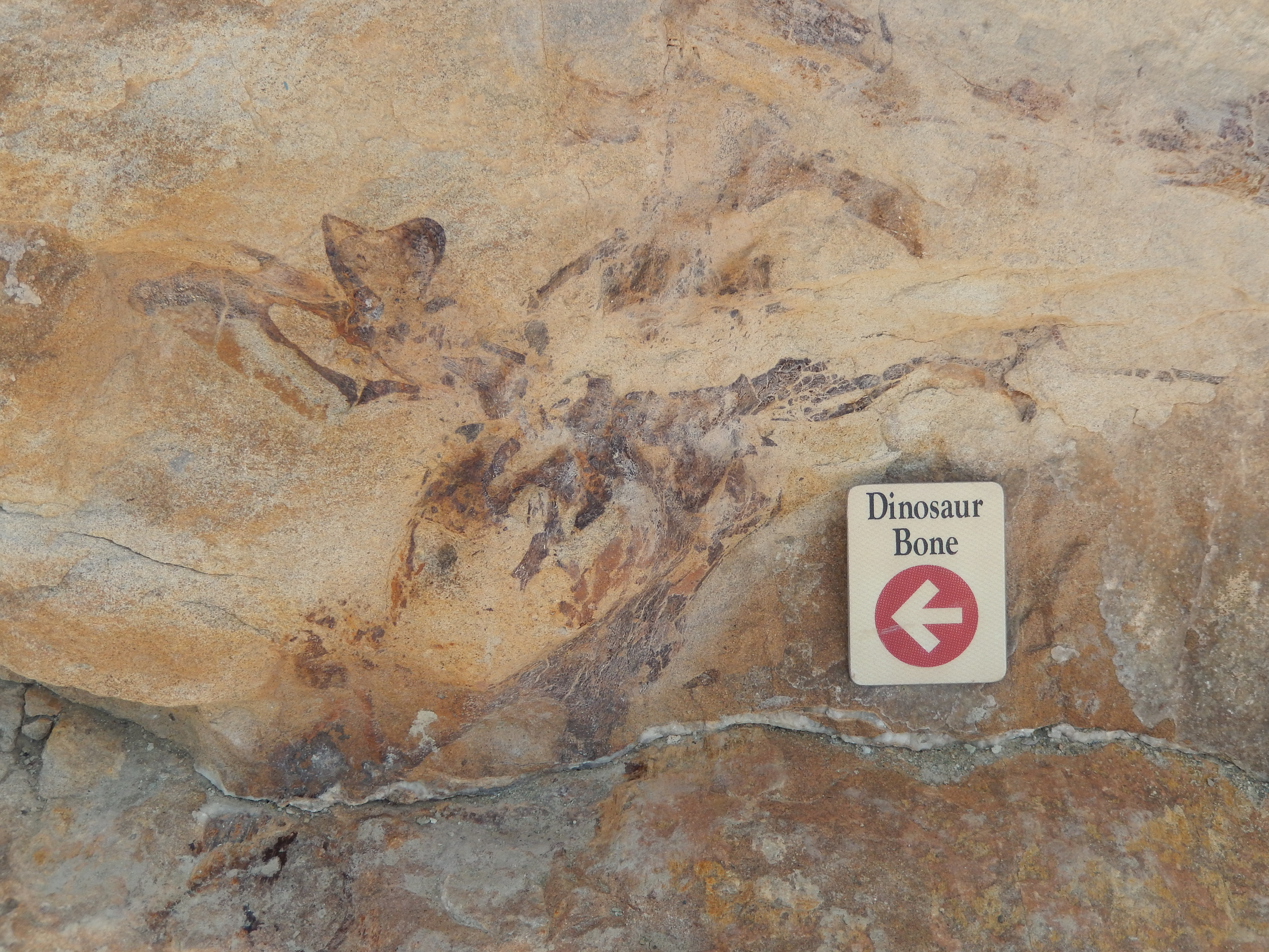
I have to tell you coming down this portion of red rocks trail was really hard to not keep looking behind us as it was just a perfect view. Which made the next section a little disappointing because it was detour on a regular road with car traffic, down to the other side of the Dakota Ridge Trail which also is known as Dinosaur Ridge. I saw that the construction in Red Rocks had forced a detour of the trail but I never guessed it was actually on the road.


I have heard about this place but I have to tell you it was way cooler then I thought it would be. They left dinosaur bones in the rock so that people could see what they look like when they are discovered! We were like little kids checking it all out, oohing and ahhing
As we finished up reading about all the bones and the changing landscape, we got back to the original Dakota ridge trail.


This last section of the hike was all white and felt so different from the rest of the hike and I loved the change!

I really enjoyed this hike and I honestly think we did it with perfect conditions, on the best day possible. It is a really exposed trail which means in the summer it is likely HOT, I mean it didn’t get much above 60 while we were hiking and the sweat was pouring off of us-now I get why there are typically a lot of snakes here. The downside(outside of the snakes of course) is how close it is to both 470 & I70, the noise went away for a good portion of the hike but when it was around it was pretty bad. Despite that, I will for sure do it again and likely bring guest hikers here because of the great views of Red Rocks. After the directions will be pictures of all the flowers we had the good fortune to catch before they burn off in the sun.
This 3 day weekend we will get in 2 hikes that will both likely be repeaters! I hope you all have great plans for the holiday weekend that includes a hike! Life is too short… you should hike more!
Directions: Take I-70 West from Denver for about 9 miles to C470-East exit (exit 260). Go about 2 miles on C470 East and take the Alameda Parkway exit. Turn right onto Alameda Parkway, then take your first right onto Rooney Road. Go about 1.5 miles and the trail head parking lot will be on your right.


That second photo is a spectacular view! Nice little puffy clouds…
Thank you! It was really a perfect day in general!!
What fantastic geology (and paleontology)! I had to hop on google maps to follow where you went. Looks to be a lovely area, and like there are options for shorter hikes, too.
It really is an amazing place! And yes lots of shorter options to really get the full feel of all the open space has to offer!
It *is* hot in summer, and your pictures are beautiful. I had no idea that snowmelt would make that much of an oasis. Good work on your goals, btw.
I was shocked at how lush everything was! It made the hike perfect!!!
We’ll be in Denver for a month this summer and my daughter wants to take us on the Dinosaur Ridge hike….it’s one of her favorites. We’re using your blog for more hiking ideas. Happy trails 🙂
Oh yay! I can’t wait to see what you think of it!!! Thank you for using my blog for ideas, I Hope you find some that you like as much as I have! Travel Safe!!!
Looks like a great hike, it’s so beautiful there!
Thanks Helen! It was a great hike and I am so lucky to live in a really beautiful place!!!
9 miles in 4 hours is awesome, Kathy! Can’t wait to hear about the rest of your weekend hikes.
Thanks, it was a really beautiful place to hike through! Our hikes were great this weekend and the weather was perfect!
Awesome combo!
Nice distance and pace! Have you guys ventured into the mountains in the last couple of weeks? We are getting so anxious to hike without the snow…wondering how close it is to melting out….
Thanks! We did Bergen Peak this weekend at 9700 and not a hint of snow but I heard the mountains got hit yesterday. I am hoping to try something a little higher this next weekend.
Reblogged this on denverspeax and commented:
Reblogged on Denverspeax.com – this hike looks perfect for us! We need to get back into hiking this season and feel this would be a great start. Nice post from Hiking to Healthy!