

Starting Elevation: 9800 ft
Highest Elevation: 11,000Ft ish (we didn’t have our watch and I can find almost nothing on this trail. I know the parking lot is at 9800 ft and I got 100 flights of stairs so 1000 ft total elevation gain)
Trail Length: 6 Miles from the parking lot right off the exit- 4 miles if you have 4 wheel drive and can go to the pull off a mile up the road.
Trail Uses: Hiker, biker, 4 wheel drive cars, horses
Degree of Difficulty: Moderate but only if you have to climb the road from the parking lot – if you drive up the road to the pull off easy
Fees: None
Bathrooms: None
Pets: Yes

Taking 2 weeks off of hiking and exercise was killer for me. honestly by week 2 I was so antsy I snuck in a few walks and some elliptical just not in shoes with backs. On my weekend off hiking I went to REI and met a shoe fitting guru. Seriously he took a look at my heels, measured my foot and simultaneously started listing all the things that happen while I hike. Like I have no flexibility at all in my feet and that I come down super hard when I walk or that my plantar fascia was screwed up. Then he proceeded to go through all the different shoes and why they wouldn’t work. He handed me a pair of Adidas trail runners in an awful mint green. I super didn’t want to like them and at first I didn’t, I walked around and my feet were coming right out. He switched up the laces and tied them a specific way > then they were HEAVEN… ugly heaven but heaven none the less. He also found me a delightful boot, it too is strangely ugly but I think I am going to test them out this weekend before I commit.

I picked a hike that I had written down on one of my many lists of hikes I found on some random webpage, Grizzly Gulch at just 4 miles round trip with maybe 900 ft of total elevation gain. I knew after 2 weeks of almost no exercise I needed to take it easy but I still wanted a view and supposedly this hike would take us to 11.300( I don’t think it did). But when I started to research the hike I could find almost nothing, the only thing I knew was it went to a meadow behind Torreys peak. Then I found a few trip reports that said they couldn’t find the meadow. I found pictures but no directions ….. any where. At like page 8 in a google search on my 5th combination of words I found a snowshoe with a hint of the two turns to look for. I decided at 10 PM on Friday we would risk it.

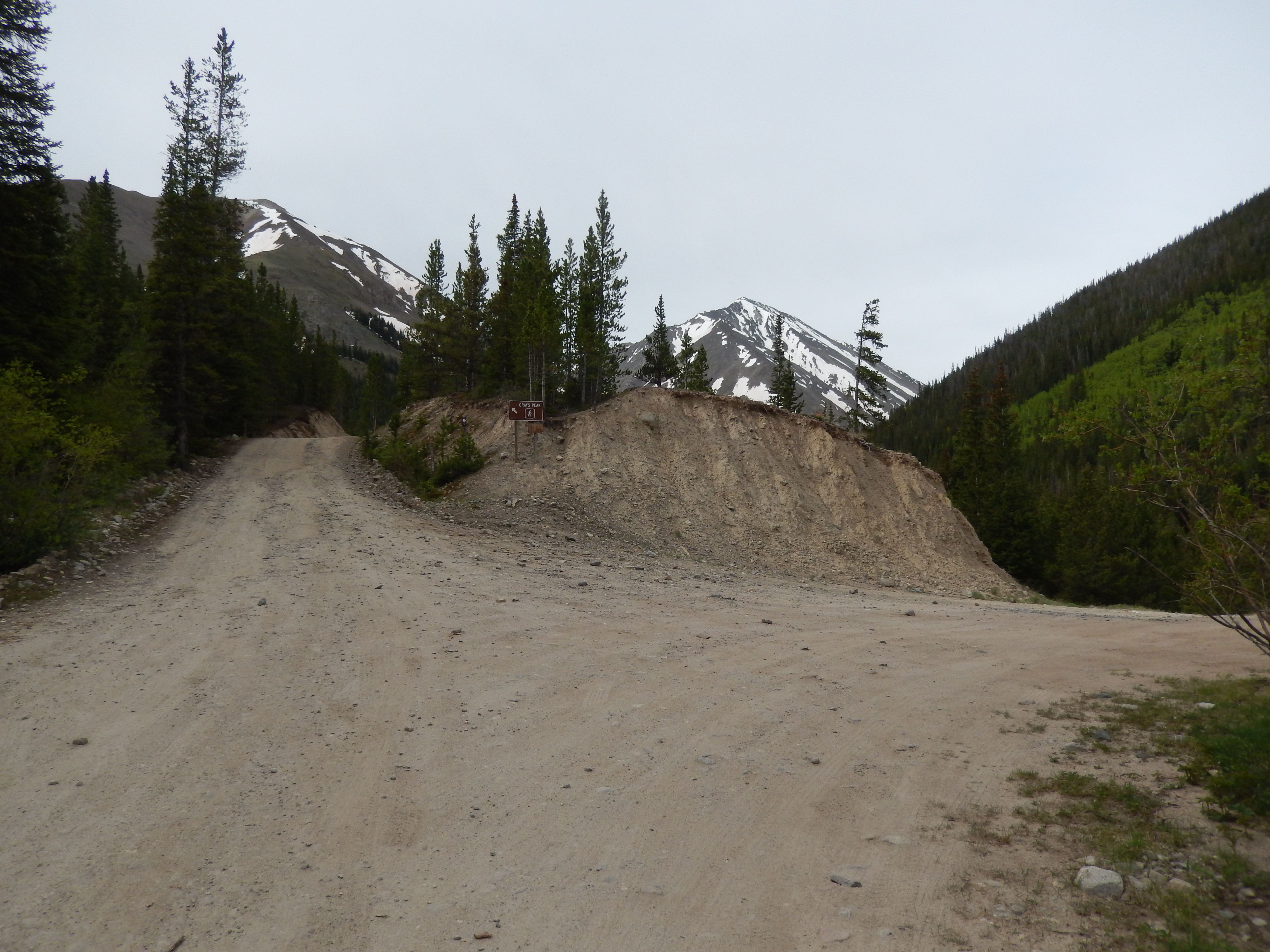
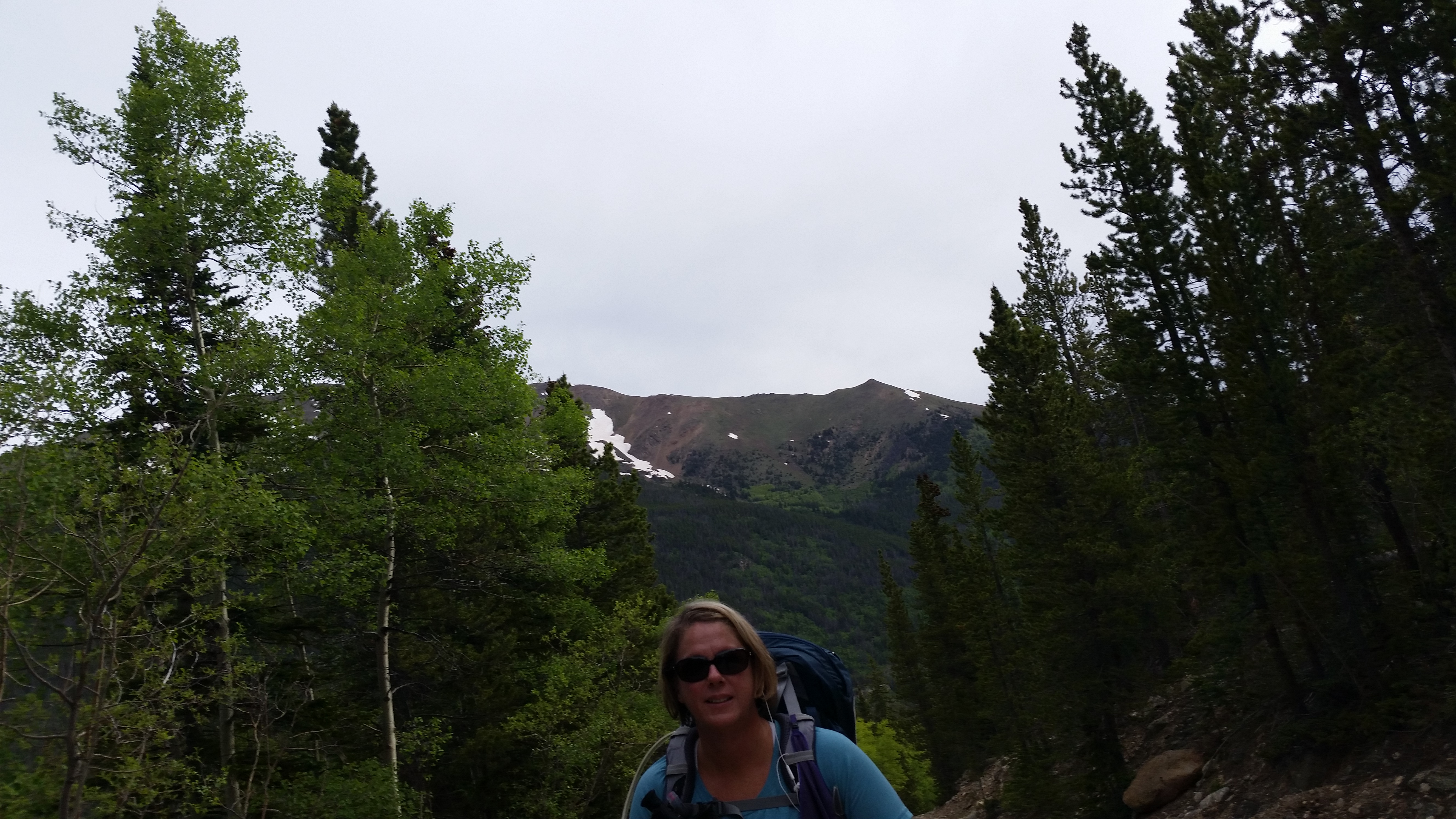
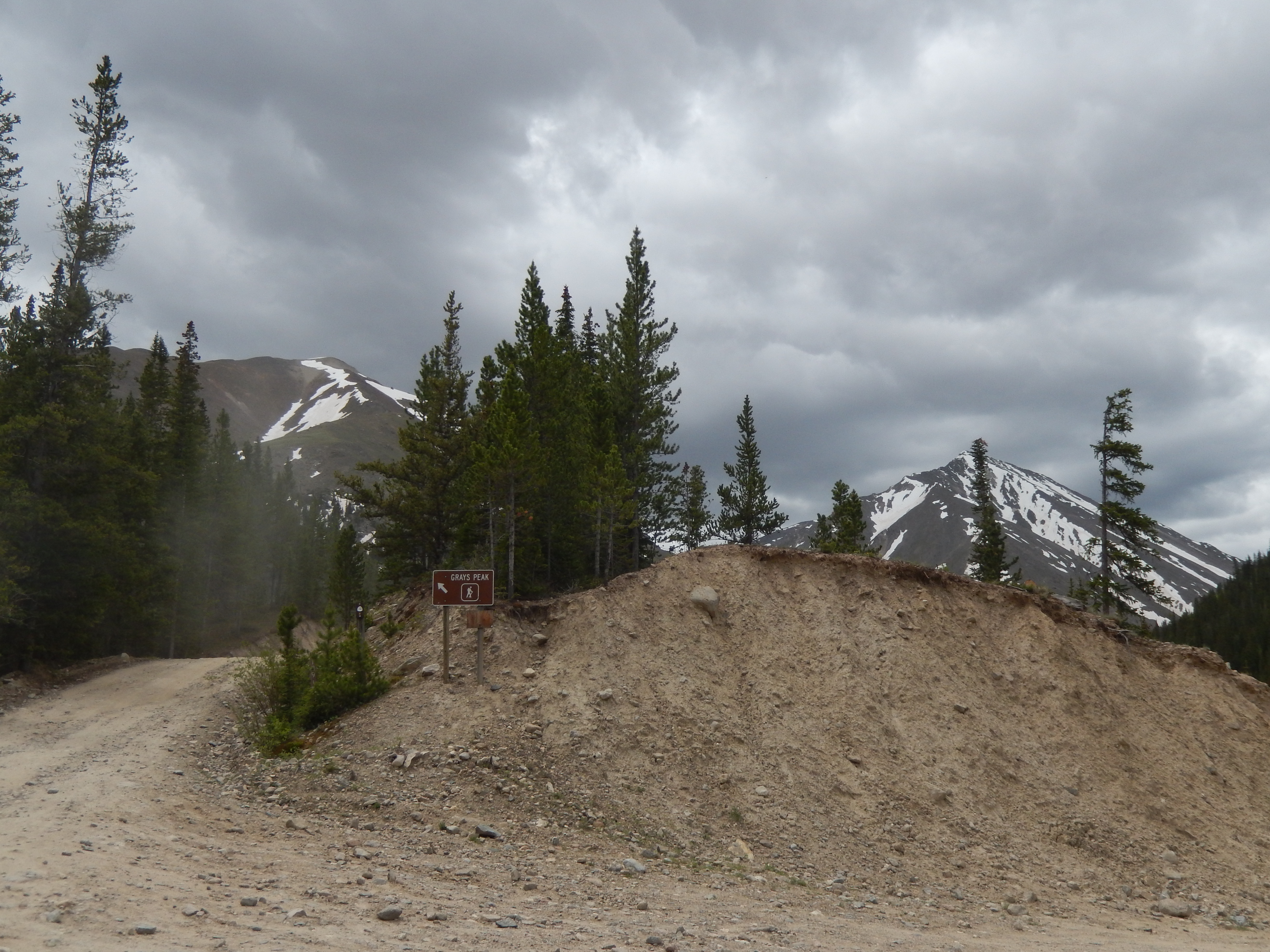
The start of the hike is along the road to Grays and Torreys which are 2- 14ers (Mountains 14,000 +ft above sea level) that are insanely popular. If you have 4-wheel drive this hike could be just 4 miles, since I didn’t know where the trail break would be I figured if we couldn’t find it we could at least hike up to the trailhead for Grays and Torreys and get 8 miles in.


At almost exactly 1 mile from the parking lot, we came to the first fork. The sign for Gray’s Peak said stay straight and then there was a small parking lot with road heading off on the right. We went right. Taking the road for 2 miles of the hike is kind of challenging only because of all the trucks heading up to Grays & Torreys and the dust clouds they create, otherwise it is surprisingly beautiful.

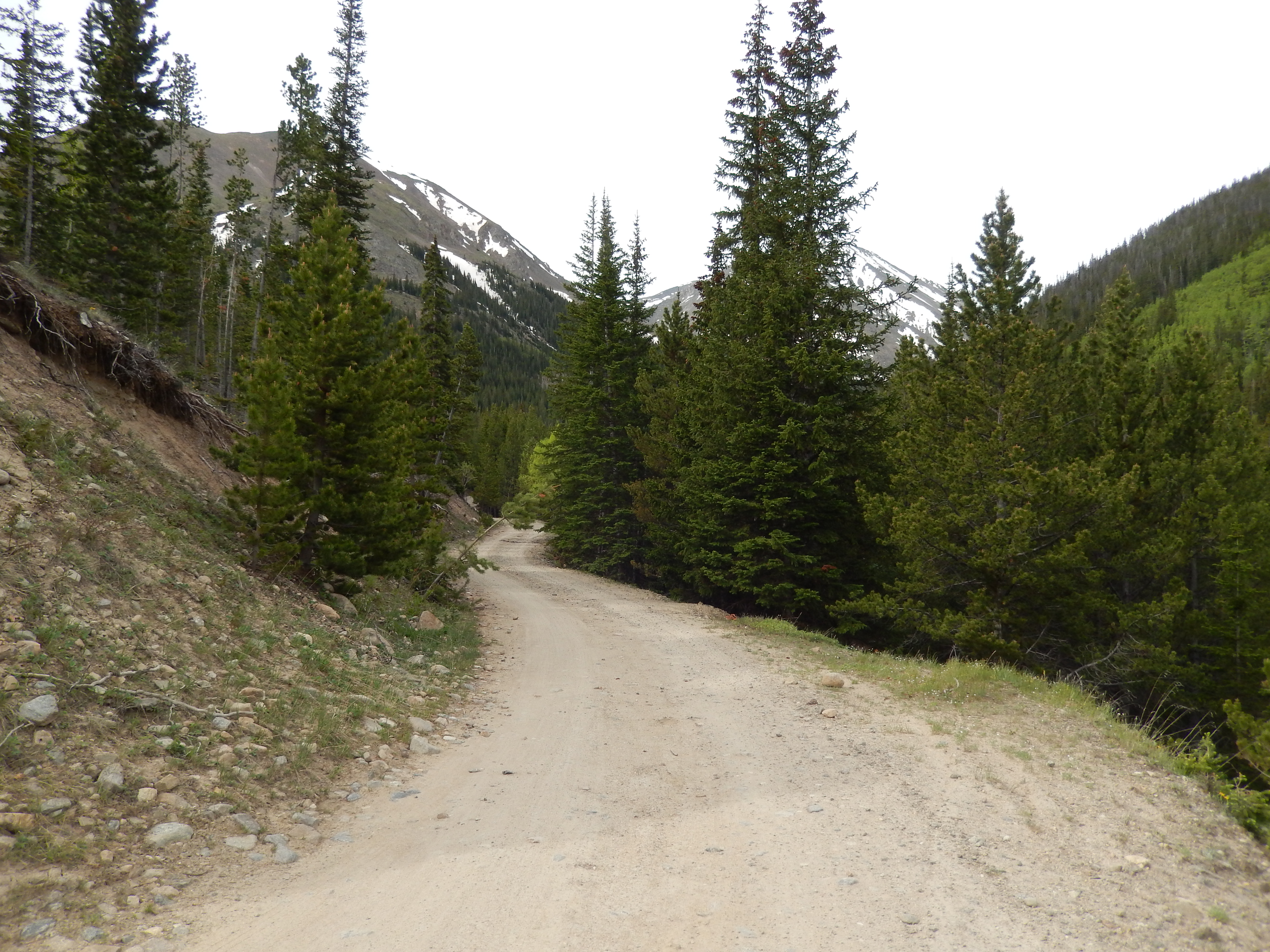
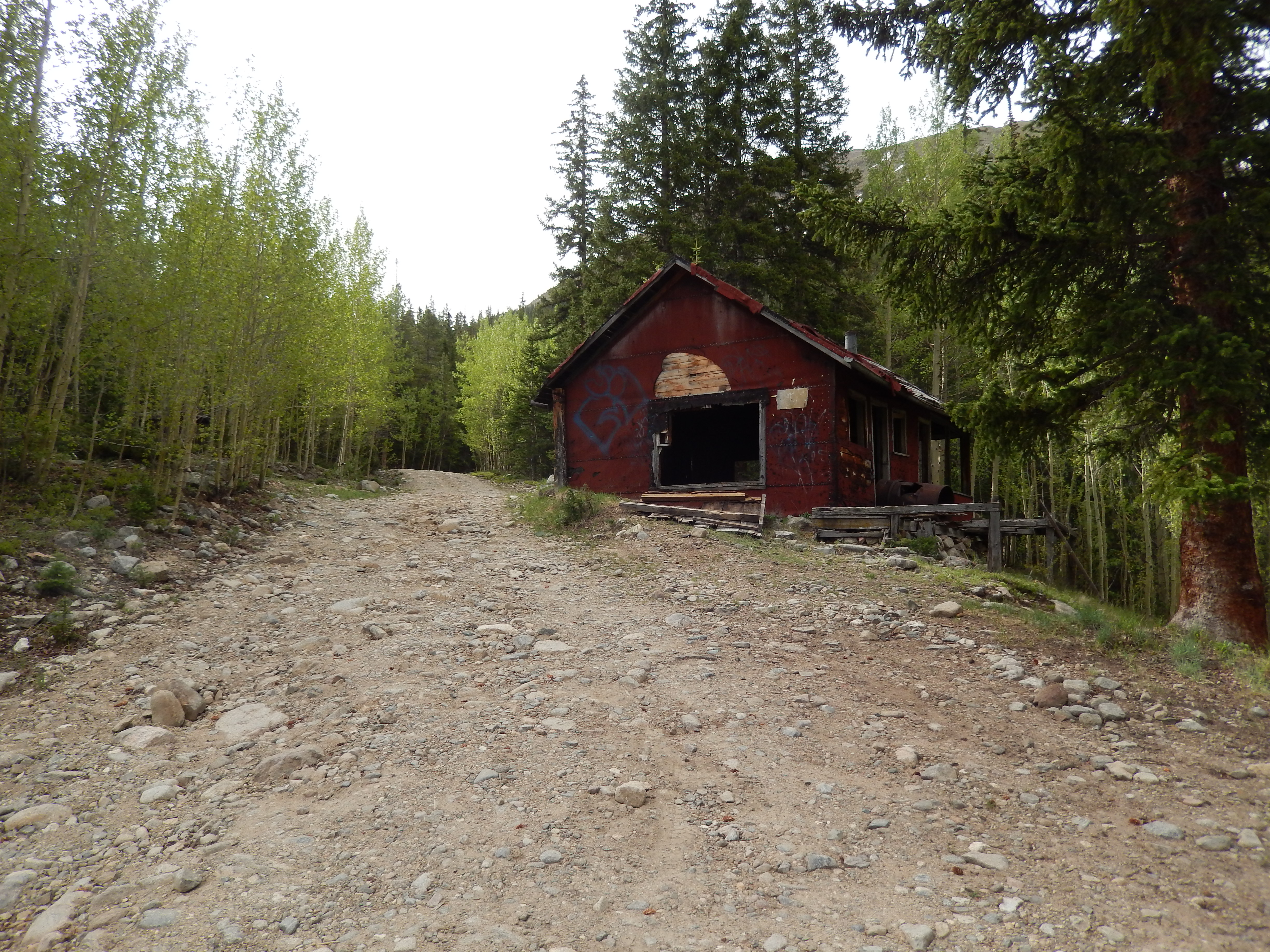
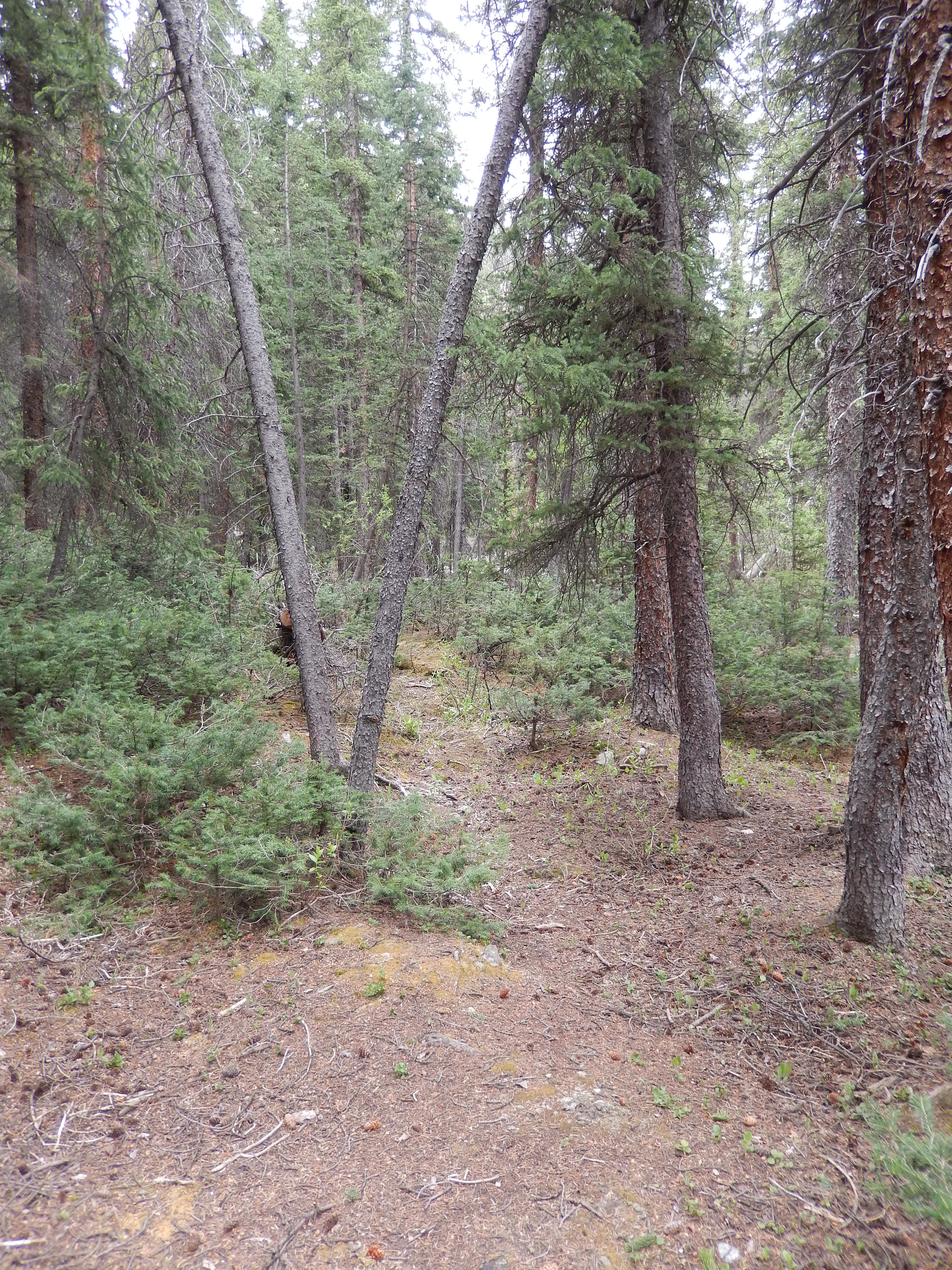
From here the road/ trail gets much more rustic, we passed a few people camping long here and since I didn’t really know where the meadow was I went on guesses. We passed one road going right then in just a quarter of a mile we came to what I was guessing would be my second right. You come up to the fork, you will know it by 2 things. there are 2 old cabins on your left and what looks like another parking area than there is also 2 road signs, 189.1G & 189.1C…. Take 189.1C on the right and stay on it.

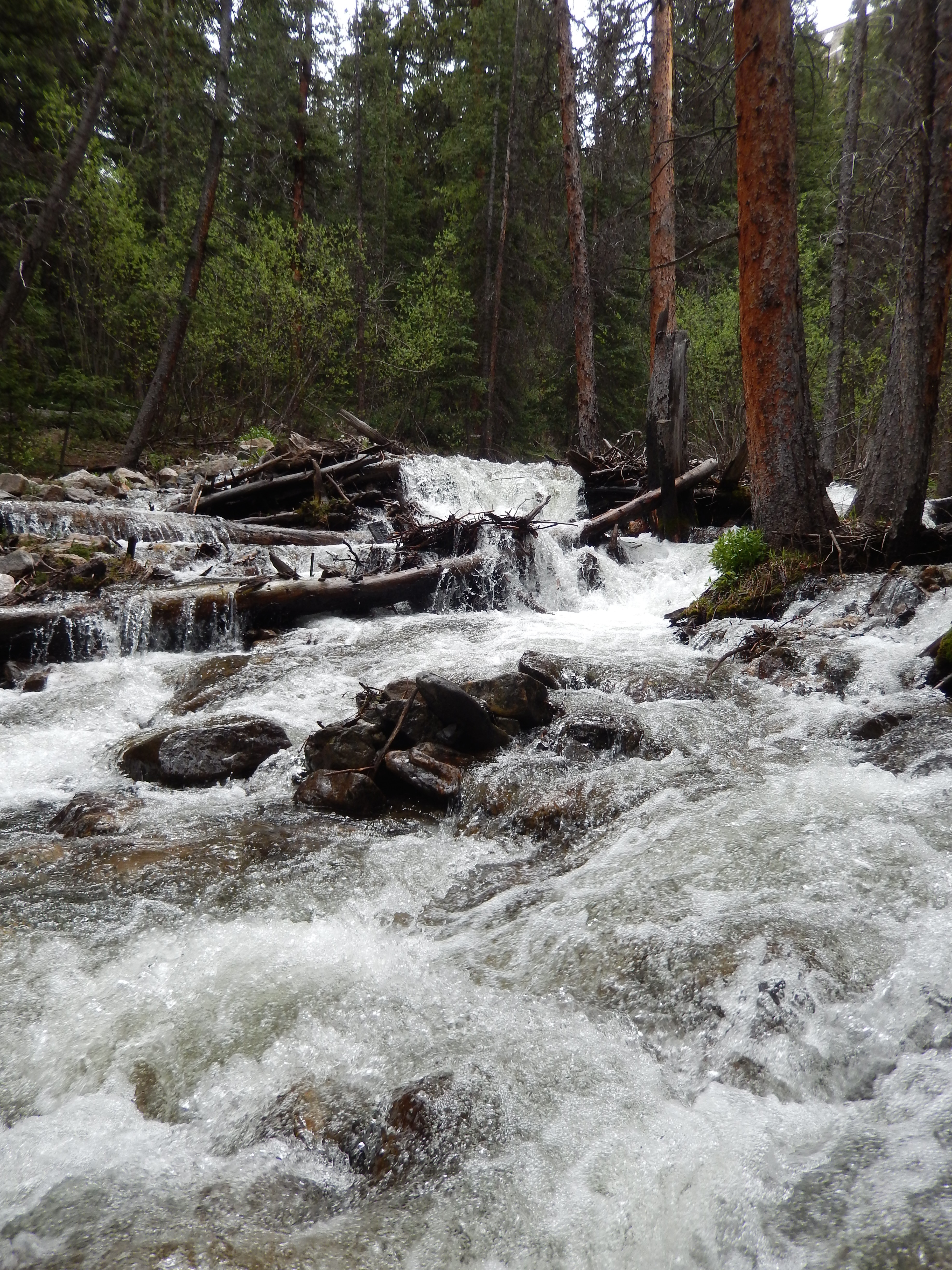
From here it is not far and the trail has a ton of snow melt water on it. At first it wasn’t bad

It wasn’t deep until we get to an impassable part. For a second we thought about turning around, but the feet felt great and we had hardly gone anywhere so we took off our shoes deciding to cross. For the record a knee-deep snowmelt streamed F@$#ing cold

In theory it sounded way easier than it actually was.

Seriously, it took all my tough girl genes to not start crying right about here, it was so cold. I toughed it out, got to the other side and thought “I am not sure I can make it back over”.
From here we continued up the road past this lovely gentleman who was burning some fallen trees. At first I thought we went the wrong way and asked if it was ok that we hiked through, we were looking for Grizzly Gulch. He was so nice, he is literally living in heaven with the most amazing scenery all around his home. He let us hike through and told us we might find a bridge across the stream if we went along the stream little bit off the trail down on his property.

From here the trail was just a road that had some ups and downs but nothing like the first mile up. The views were breath-taking, the stream and snow melt had transformed everything into this idealized hike and even with all the clouds it was perfect! We had more fun enjoying all the views then we had in weeks! The trail was still wet in places and we crossed the stream one more time but in just 1.5 miles we got to the meadow and it was amazing!!!


I was so happy we found this elusive meadow, I honestly just stood there for almost a half an hour taking it all in. We could have easily have gone on ….well sort of, the next river crossing is just to right of the fence in the picture above and it was like a 4 lane road wide. My feet felt great but I didn’t want to push it in my new shoes, healing heels and really I didn’t want to feel that icy cold water again. We took our time before turning around and heading back. I know that we could have gone on and hiked to that ridge but for now I was satisfied with what we had seen!

Honestly the whole way back all we could talk about was how beautiful it all was and how happy we were that we found the meadow. The other great part, we had almost the whole trail to ourselves. The only time we saw other people were when we crawled out of the trees after finding a way to cross that uncrossable part… it was a fallen tree that was super stable in front of some wicked rapids.

It was just maybe .2 miles to the road again….. it was also right off the road on the other side.
The way back from here was even better with weather coming in, sometimes dark clouds are as good as blue sky. I honestly cannot wait to get back there again, this a gem that it seems like no one knows about or else takes a wrong turn too soon. If I was honest with myself, no one hikes it because they are all hiking Grays and Torreys, but what a miss on their part because while summiting is awesome so is a really great meadow and this is an amazing meadow.
Directions: Take I 70 to exit# 221 and go south, for the full 6 miles park in the lots there. Otherwise drive up a mile to the road fork and park there for a 4 mile hike.


Yikes, that first stream crossing looks like a real scream! 😀
LOL! It was more a series of screams… a good lesson learned!
It was! I don’t ever need to do that again but I am sure I will….
Jealous! 🙂
Thanks! It was an awesome trail!
Oh I’m so happy to hear the foot whisperer straightened you out with some great and comfy (of not stunning) shoes. I need one of those at my local Sail store. Maybe I’ll ride your good mojo on over and find a shoe whisperer if my own.
Oh I hope you find one! I am loving my new shoes….
I suspect our feet are similar. Mine are also on the wide side and I have a very heavy/hard step (stomp!). 🙂
Ugh I have always wondered how I stop doing it but I am liking my new shoes with 2 hikes under my belt with them. They are so lite!
Awesome! No more blisters!!
So happy you are back to hiking! Ugly shoe hiking is better than no hiking!
I keep trying to “fall’ in some mud to help lower their visibility… but they are doing a great job so far
“Tough girl genes” – I love it!!
I barely made it through with out crying… it was so stink in cold!!!
Like the pic of Torreys — you can see some decent detail on Kelso Ridge.
Thanks! I will never be one to take the Kelso route but I am hopeful I will be able to summit it this summer!
Yeah, you can definitely tag that one. No prob!
Any weight loss updates? Today is July 1st.
I am working on a post… needless to say I didn’t make it but I am getting back on track after a lot of bad decisions on my part. I haven’t gained any more back but I haven’t been losing either. Thank yo so much for checking in!!!
I’m always amazed at how bad good footwear looks. The boots I recently got are in an embarrassing shade of luminous green-yellow, but luckily the mud and dirt is starting to take care of that. I wish manufacturers would make their kit in more neutral colours! 🙂
I am impressed with how ugly mine are and not just the shoes the boots he picked are terrible too… I haven’t tried those yet but I am optimistic they will work out well!
Great story. I laughed at the image of getting the cactus spines out. Been there…
Glad to have you back. It’s tough to stay disciplined and write regularly when you have life going on besides.
Amy