Two steps forward, one step back….I think I am officially cha-chaing.
I am trying really hard to be ok with this slight gain, I understand what is happening logically but emotionally I am a little bummed. It wasn’t an overly tough week but one thing I couldn’t fit in was my weights with all I had going on. I still got in my Elliptical each morning before work, I got in 3 walks at work during the day and my Thursday Yoga class. I know I am stuck and instead of figuring out what I need to change-up to jump-start me again, I just keep doing the same old same old.
It is a journey and it took me years to get this bad shape, I need to accept it will take me a while to get healthy and in such a way that I will keep it off….. so I am breathing deep and trying hard not to beat myself up, it is only .6 after all but it sucks none the less.
I am optimistic about the next week and what I can turnaround. Either way I am doing this so this week sucked, next week will be better!
Highest Elevation: 8700Ft ( according to the Nike GSP watch Aaron wears) We think we had a total gain of 2000 ft with the ups and downs.
Trail Length: The route we took got us 10 miles give or take a little
Trail Uses: Hiker, biker, Horses, cross country skier
Degree of difficulty: Moderate due to length and conditions
Bathrooms: Yes at the trailhead
Pets: Yes on leash only, and all the dogs were actually on leash which was a first. This leads me to believe that there is strict enforcement of the rule.
Return trips views
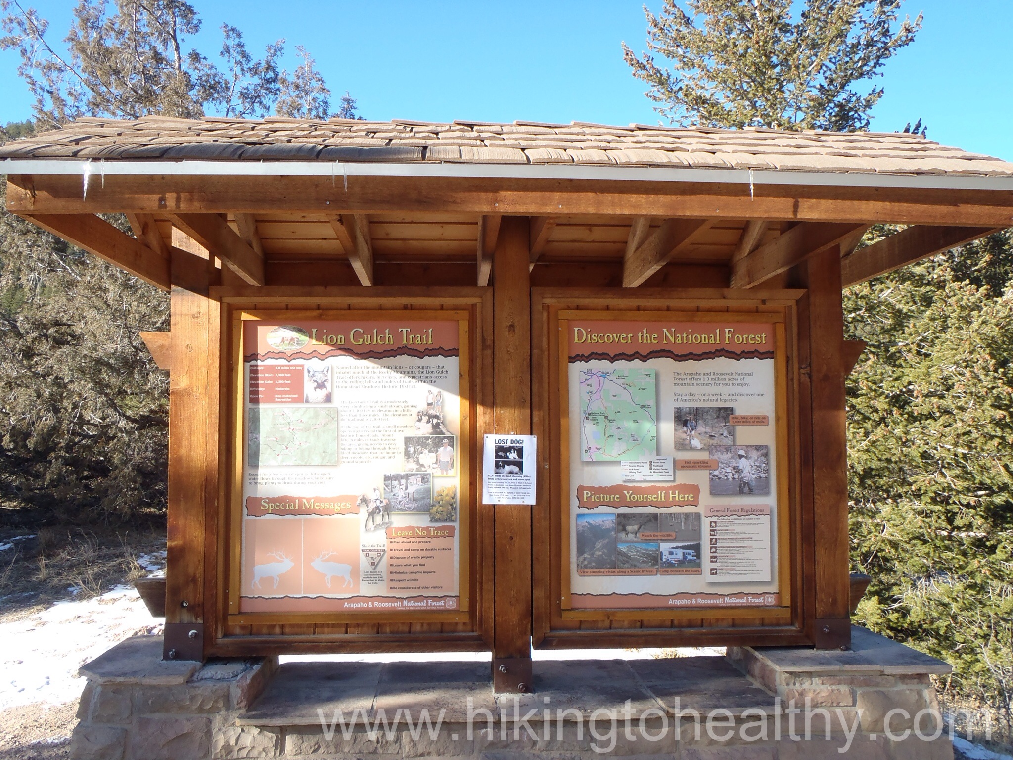
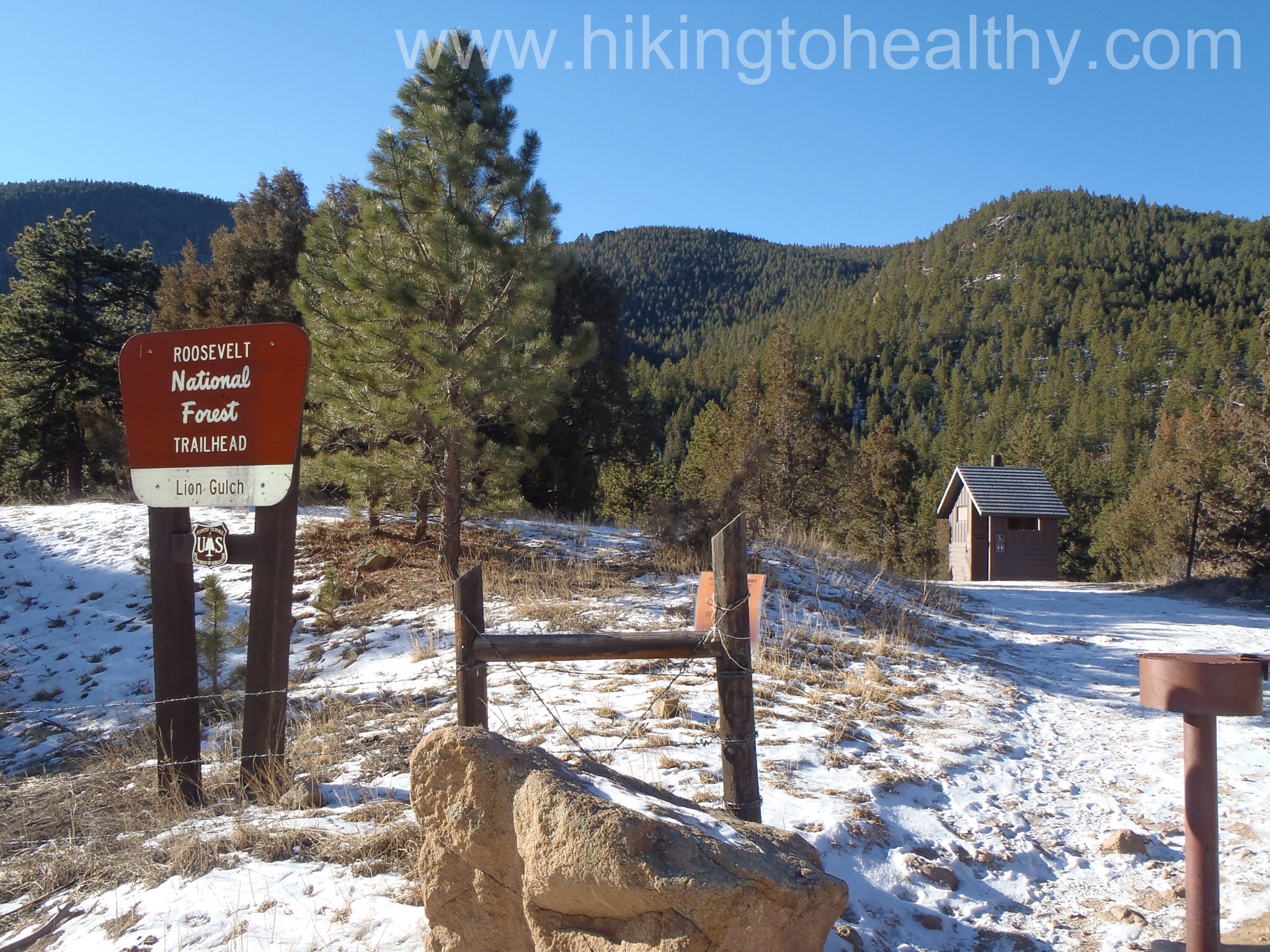
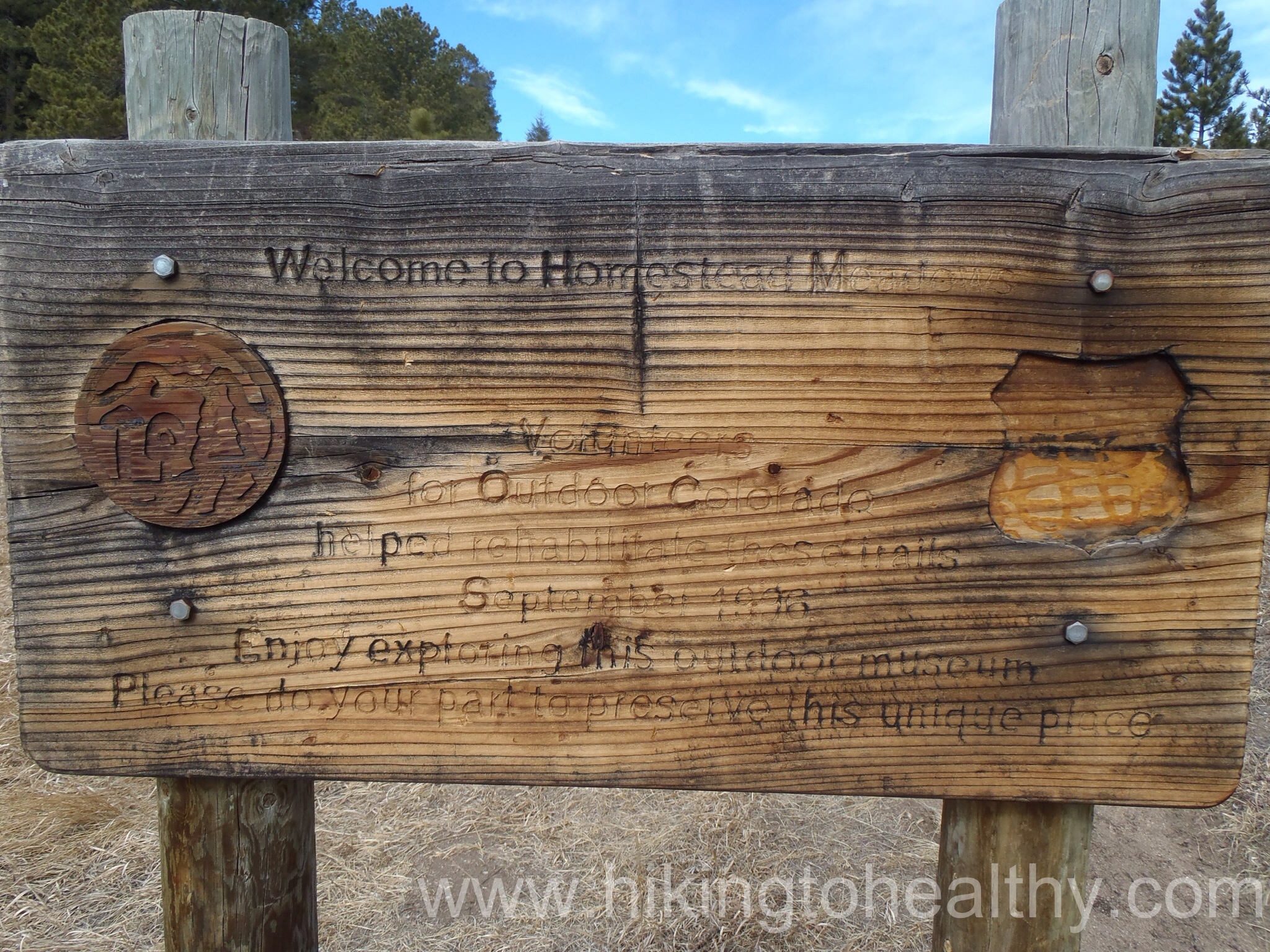
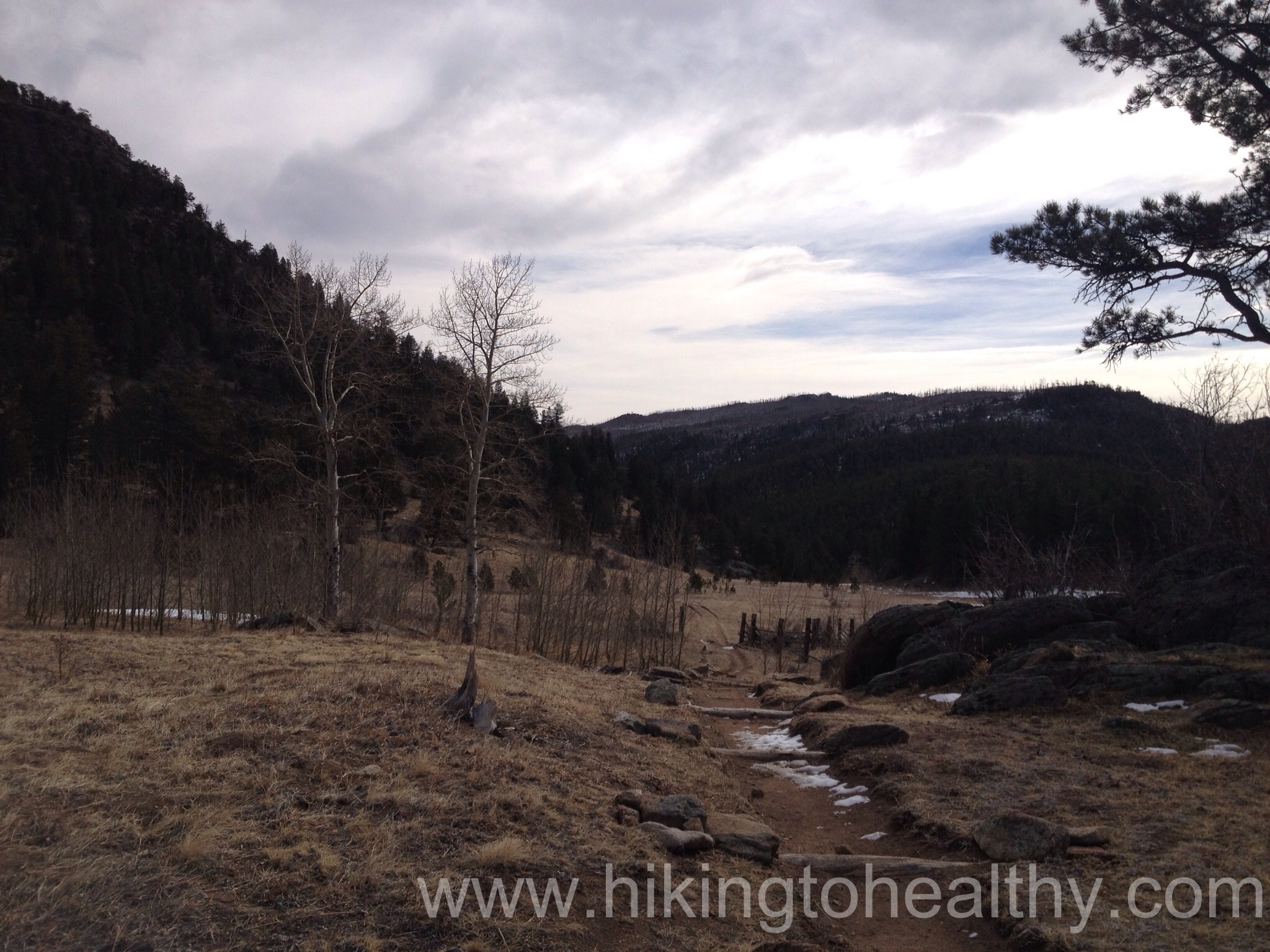
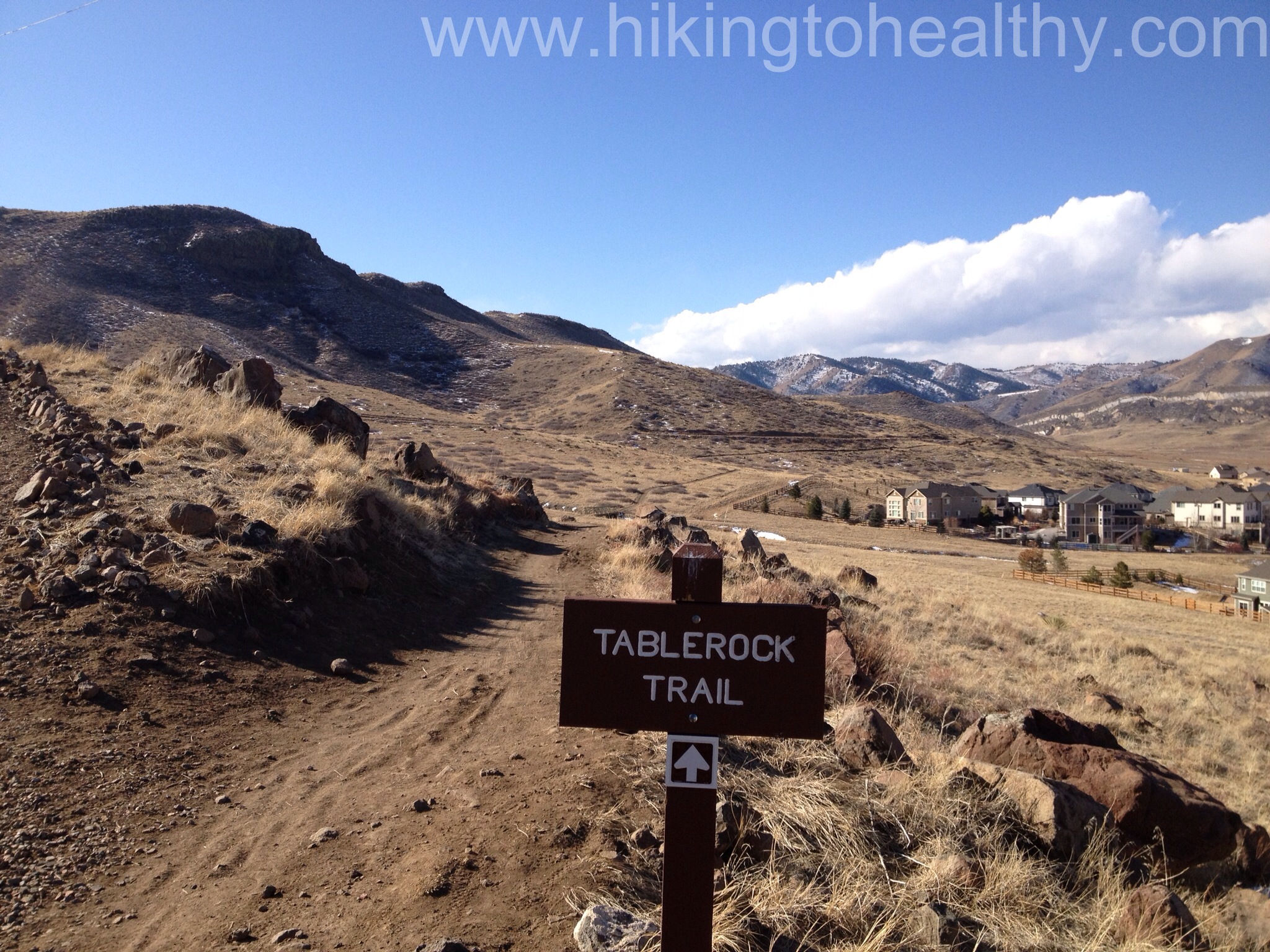
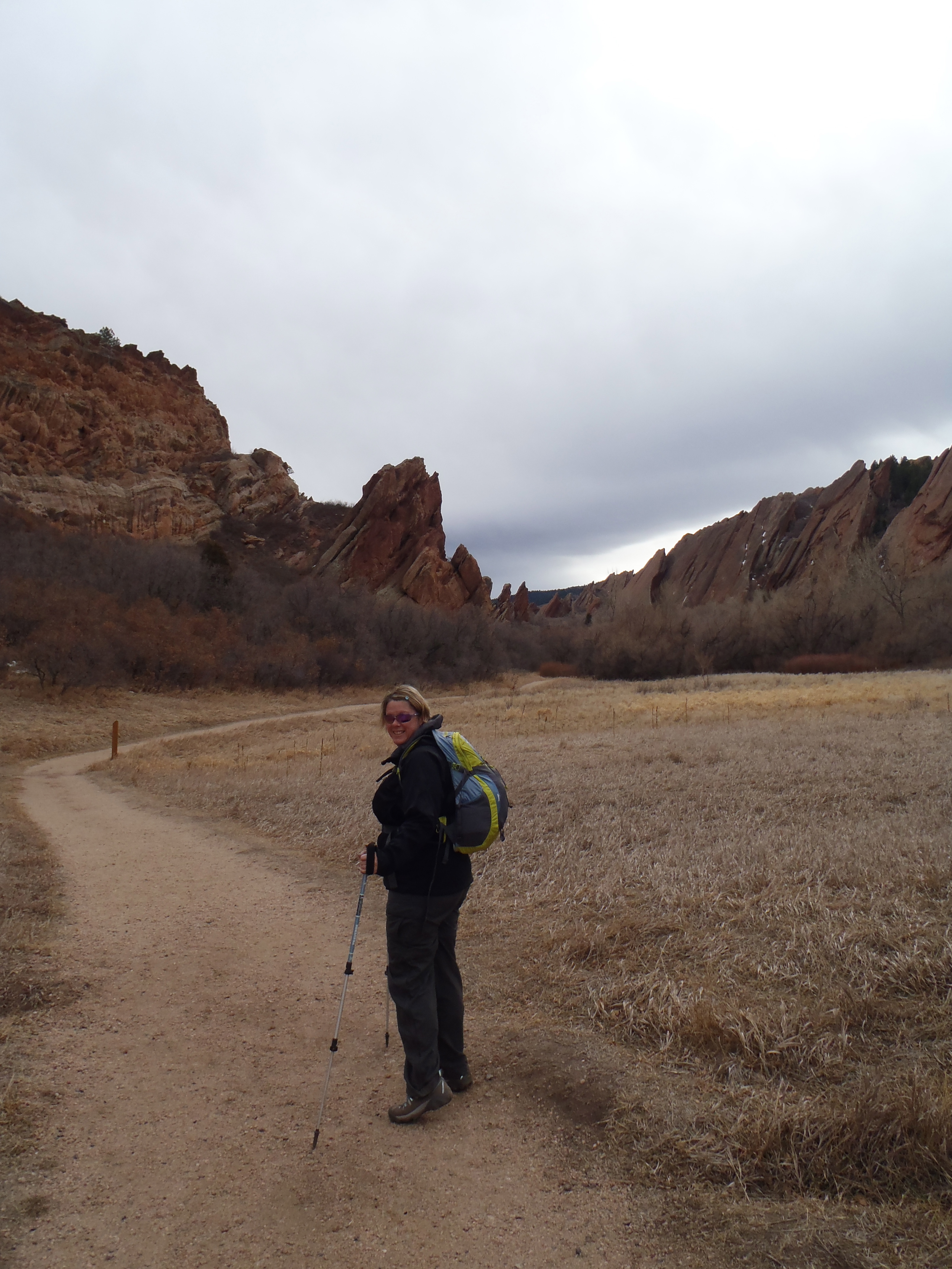
I picked today’s hike from the Falcon Guide – Best Hikes Near Denver & Boulder for the Homestead Meadows hike. What is really interesting about this particular hike is that the Meadow Loop itself is an outdoor museum that reflects those brave people who took advantage of the homestead act in the 1860’s. The original hike suggestion has the hiker starting from Hermit Park Open Space which is privately owned and so has a fee associated with going in that way. It also is not that tough of an elevation gain at just +720 and we didn’t do a tough elevation gain hike last week either, so I started reading as much as I could on the area and my options. At the end of the hike description are some options and we took one of those which had us starting at Lion Gulch, this gave us an extra 2.1 miles with elevation gain of almost 1400, not counting the numerous ups and downs so it was closer to 2000 feet in total elevation gain. It was exactly what we needed.
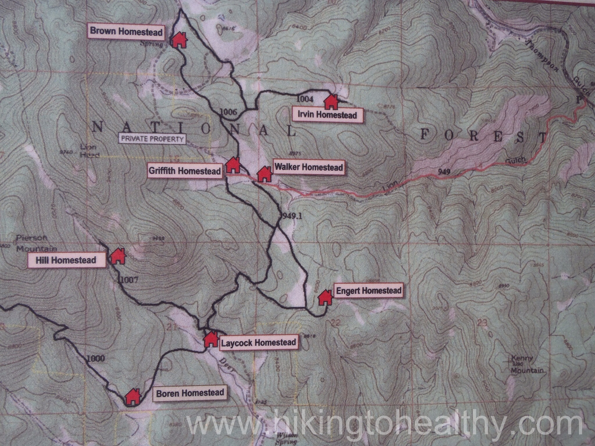
Lion Gulch & Homestead Meadows Information boardMap of the Homesteads you can visit.Our first view of the hike from the parking lot
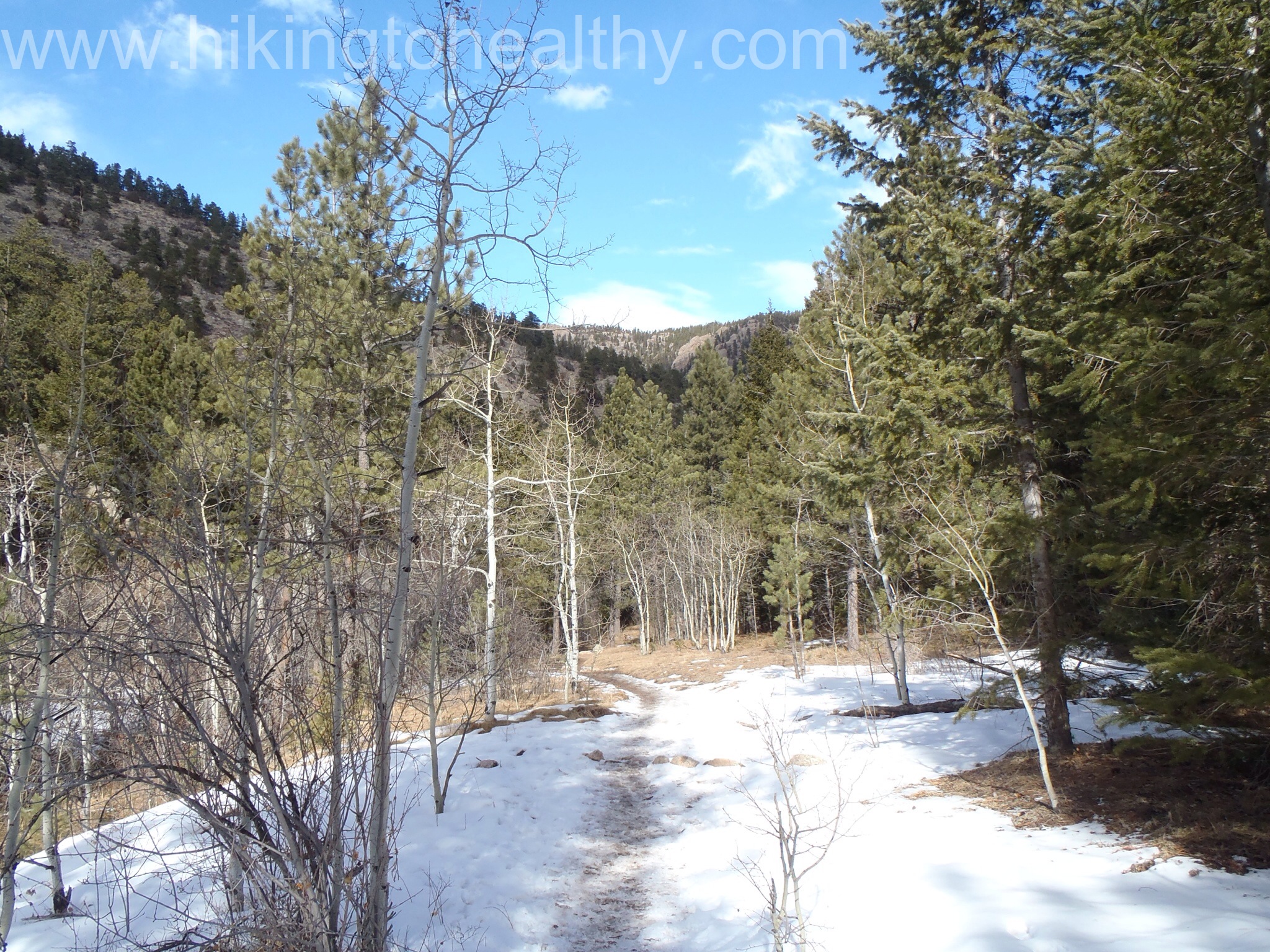
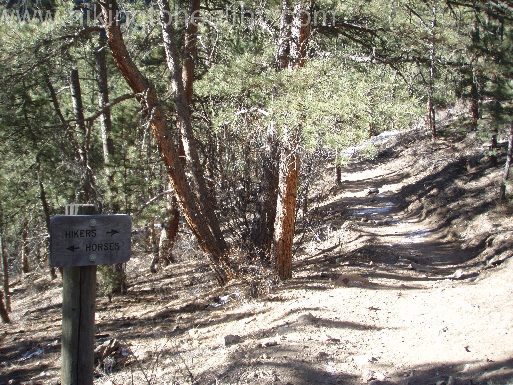
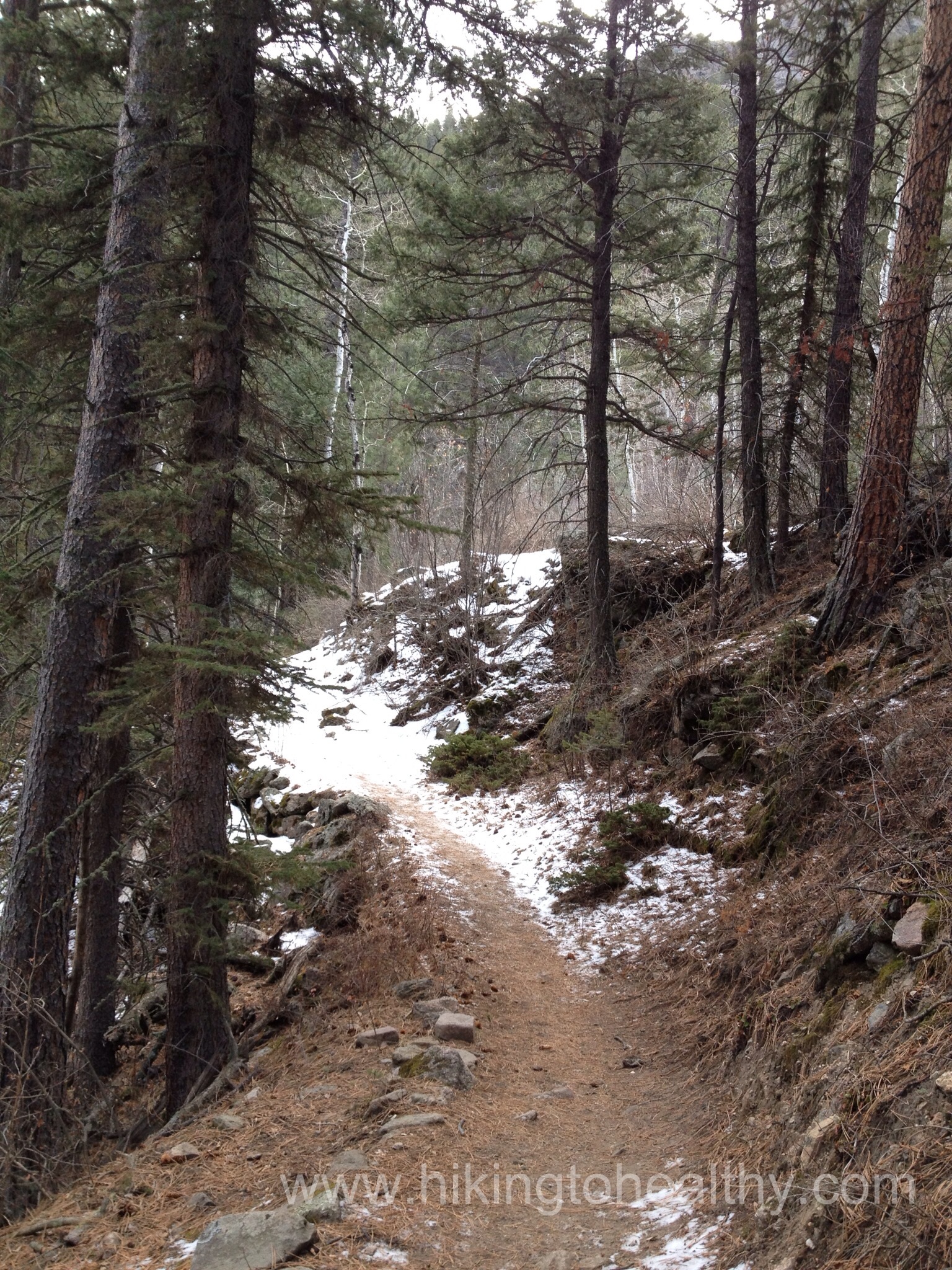
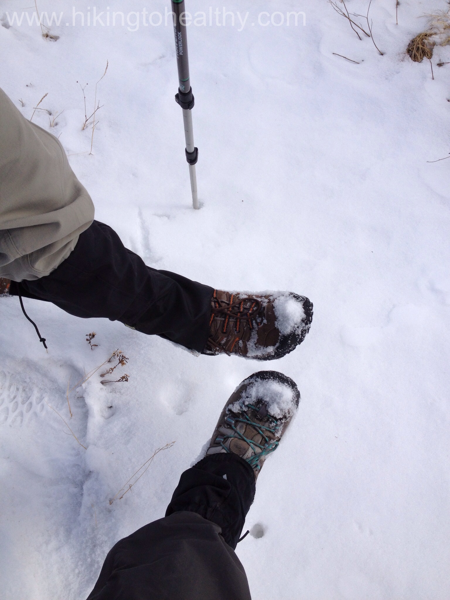
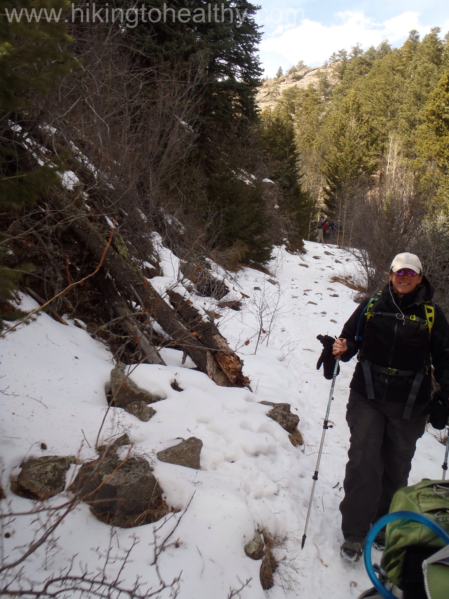
What is really cool about going this way is that those original homesteaders would use this exact path to go to and from Lyons and/or Estes Park to sell their goods or work. I know all the trails have great history, but this one really stuck with me for some reason maybe it was their sense of adventure and hope. It climbs up and over the creek, crossing it about 10 times, maybe more and in some places there is an option between the horse path and hiker path. I loved this climb, it was constantly changing between challenging and easy both because of the elevation we were gaining and the snow/ice on the trail.
Hiker/Horse trail indicatorStarting to get snowymostly snow
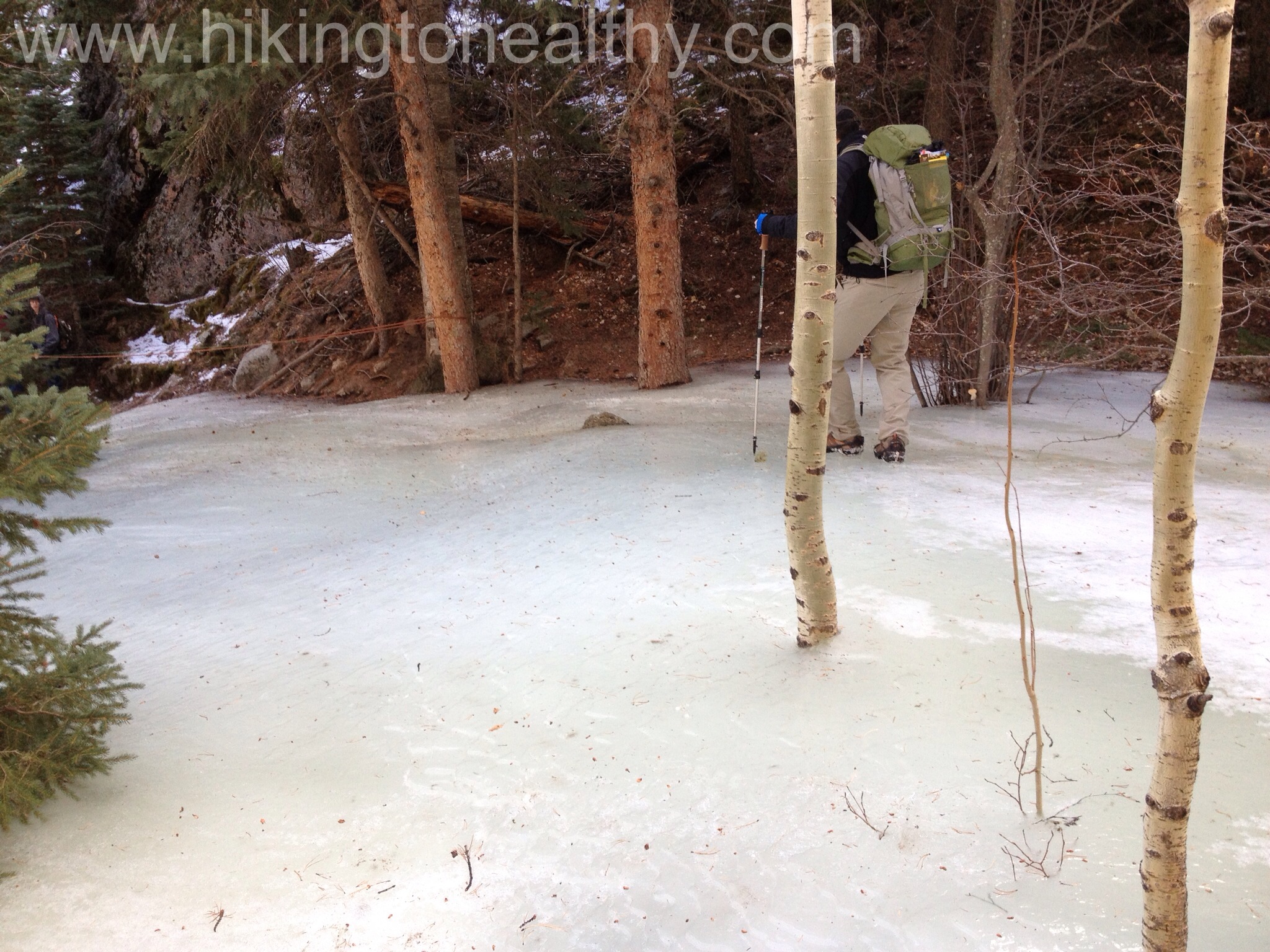
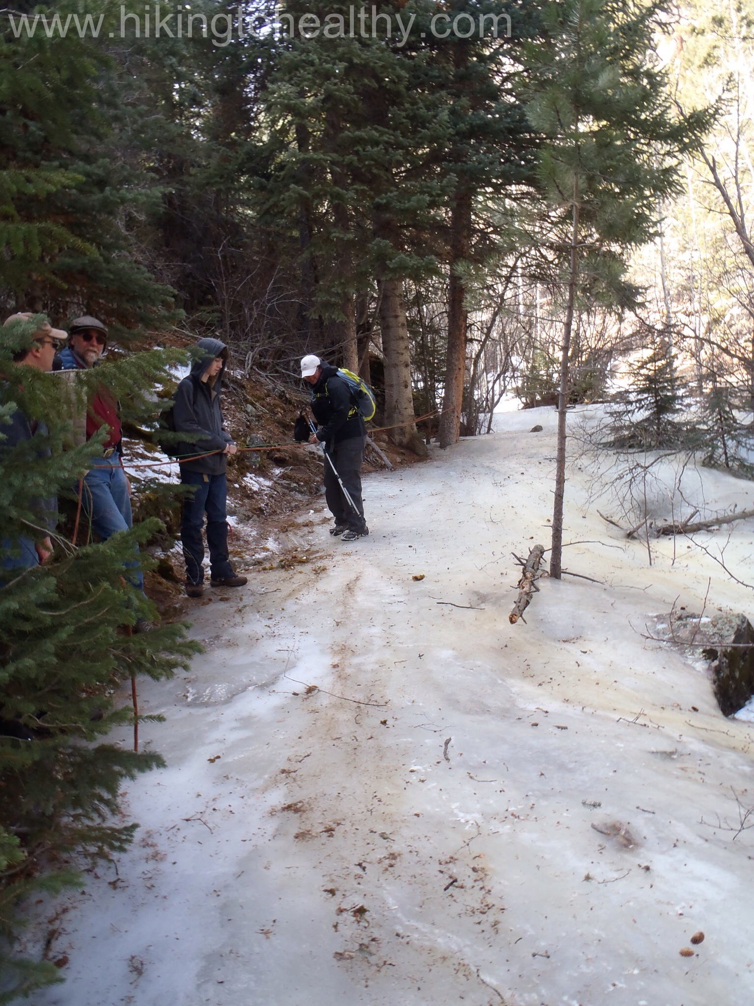
As we were getting closer to the top of our major climb, we came across the trail’s ice skating rink portion. It’s not really mentioned anywhere on any hike description and was a surprise to every hiker that had to try to pass, fortunately we had brought our crampons so getting through it wasn’t nearly as tricky for us as it was for everyone else not similarly equipped. It was our first time using them and man did they rock, going up was easy going while down was just ok. Fortunately there was a group of scouts who came prepared and I was able to grab their rope before I bit it. We think it actually prevented a lot of hikers from making it to the meadows above.
Aaron on the ice skating rinkMy turn ice skating
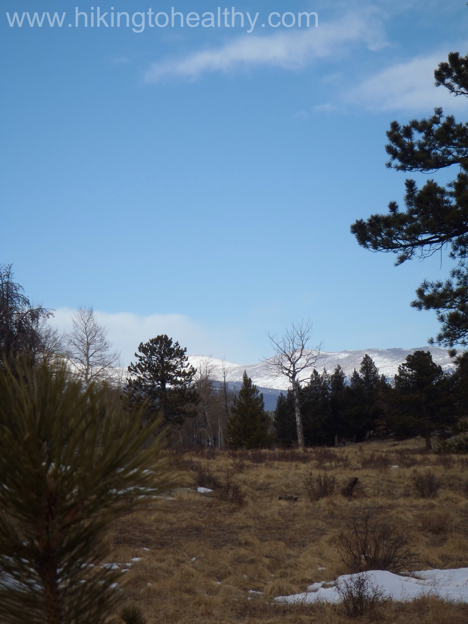
This is also where the trail starts to leave the creek with the beautiful tree cover and opens up in the meadows of the Homestead Meadow trails.
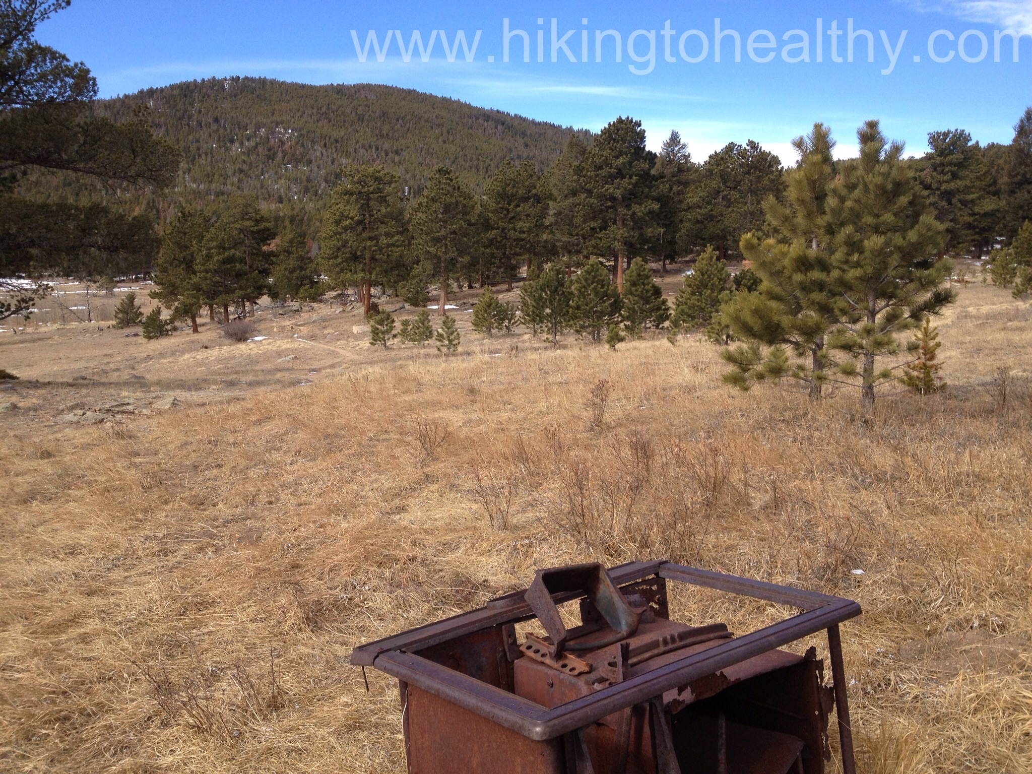
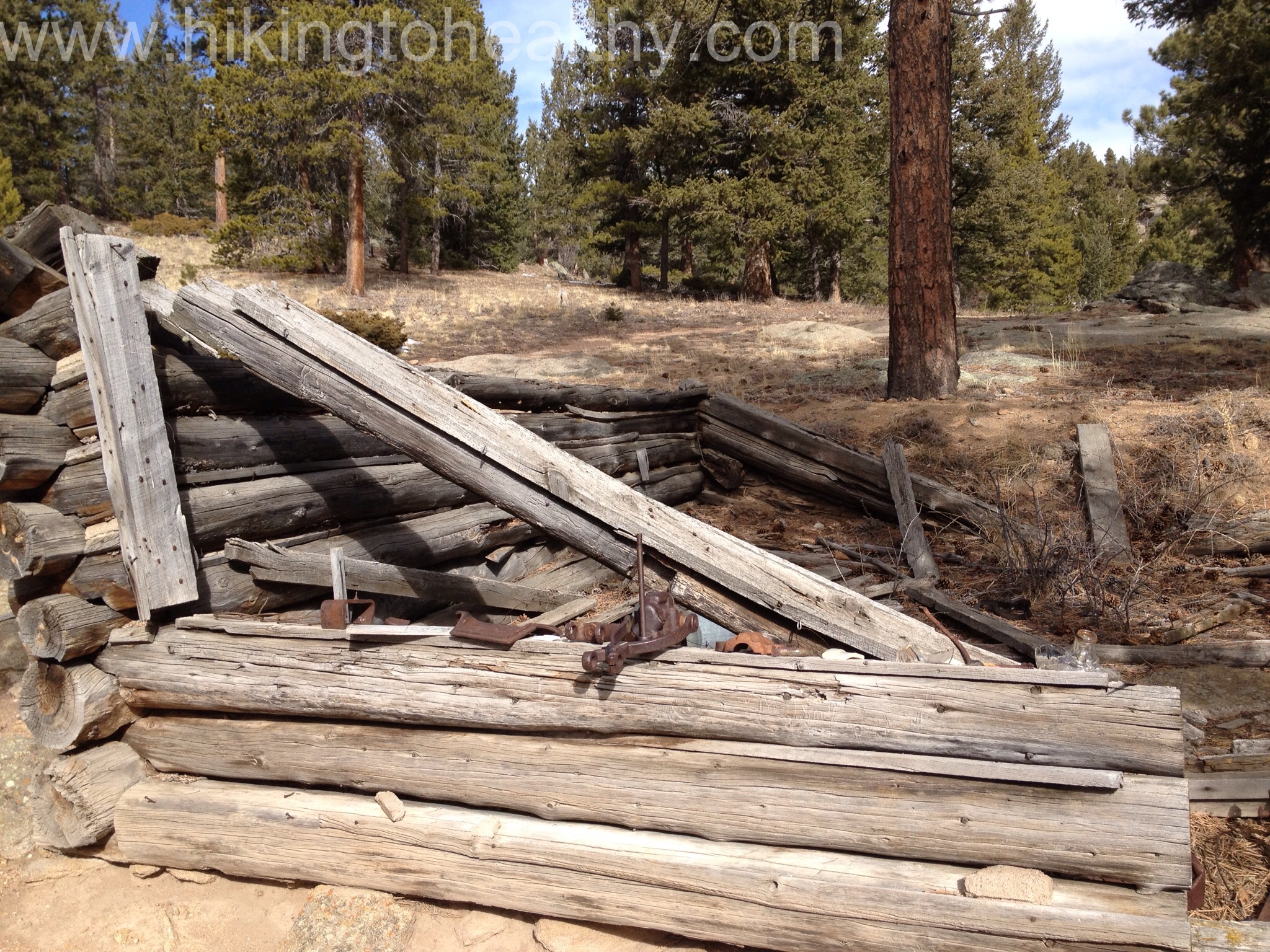
Homestead Trails
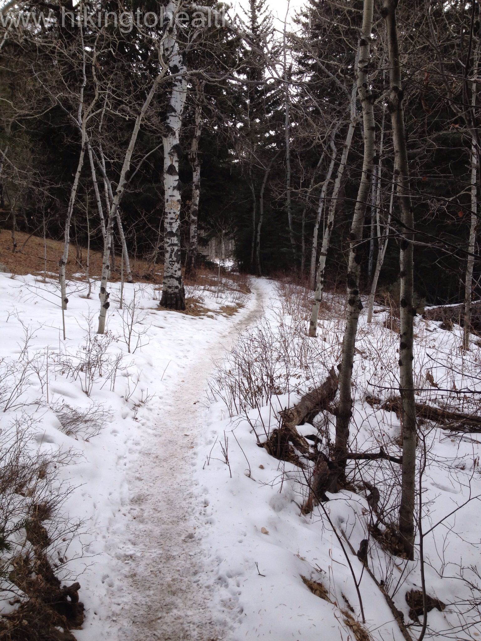
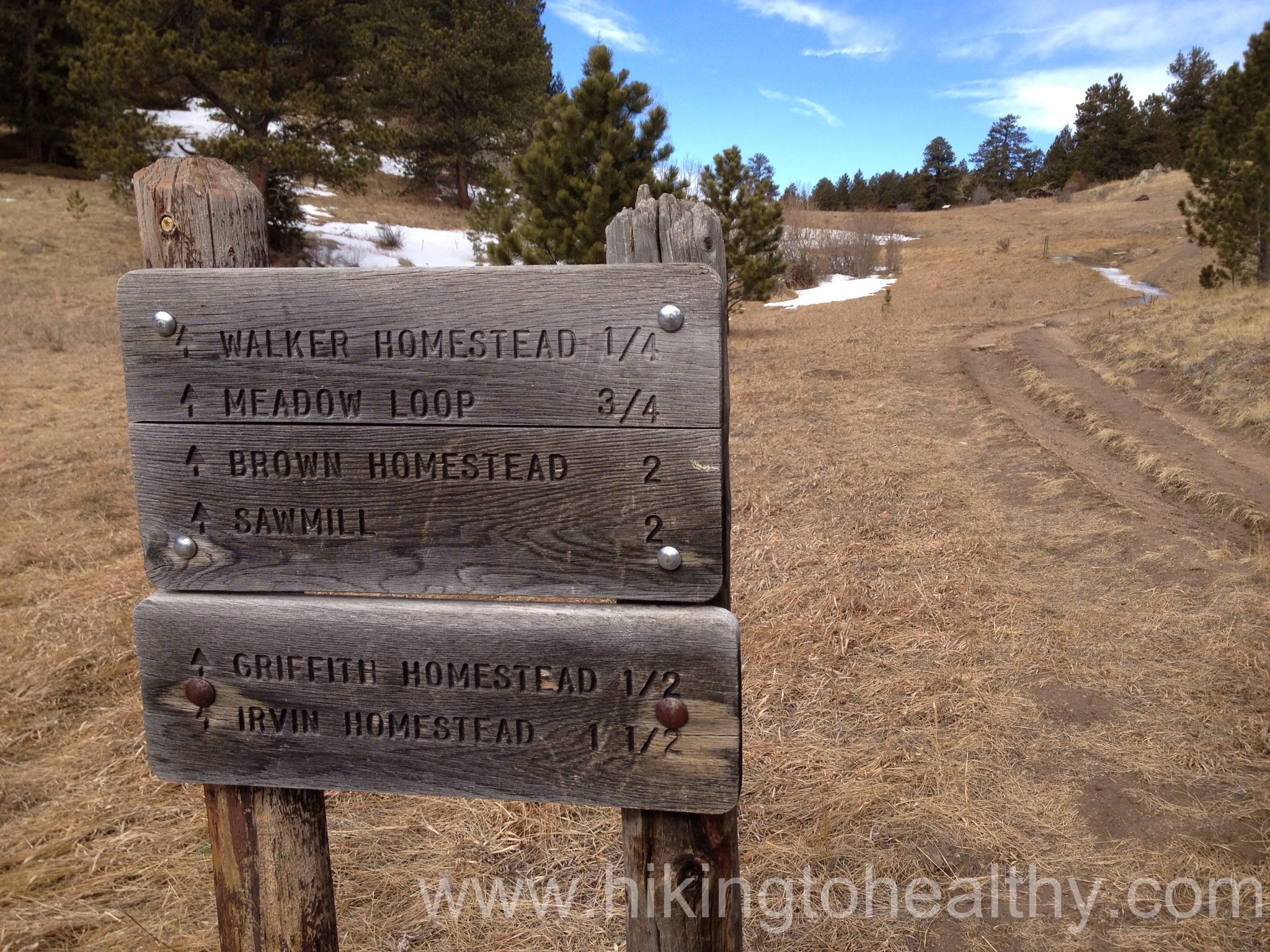
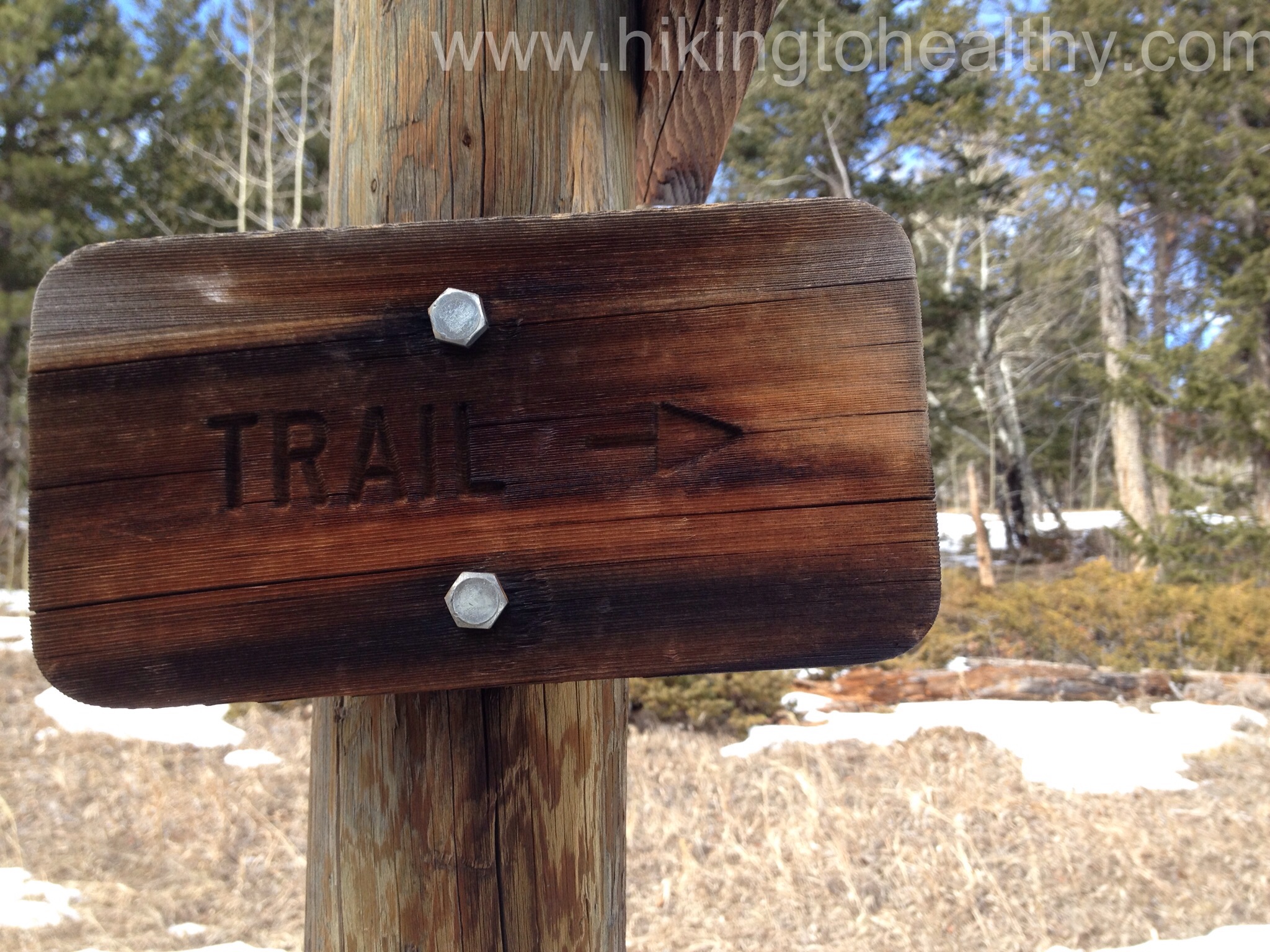
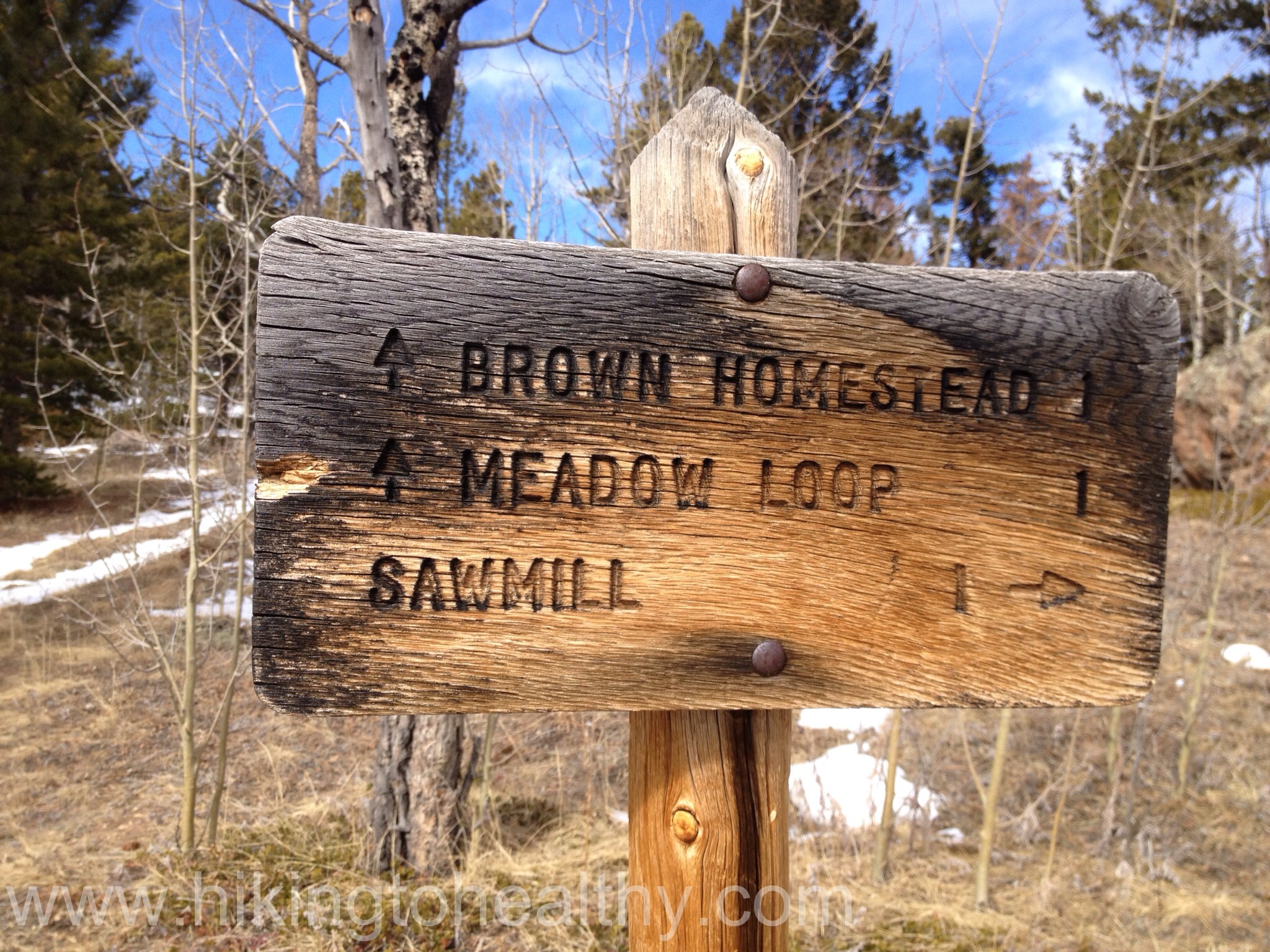
After walking up to the main trail break we went to our right, to go past the Griffith homestead and then onto the meadow loop. I would like to say it was all pretty easy to follow by the trail markers alone but it wasn’t, in fact I referred to my hiking book a lot to make sure we were going the right way for the hike we wanted. Also this loop is not popular in the winter/spring, we had to walk through a lot of snow on the path and ours were often the only and first foot prints.
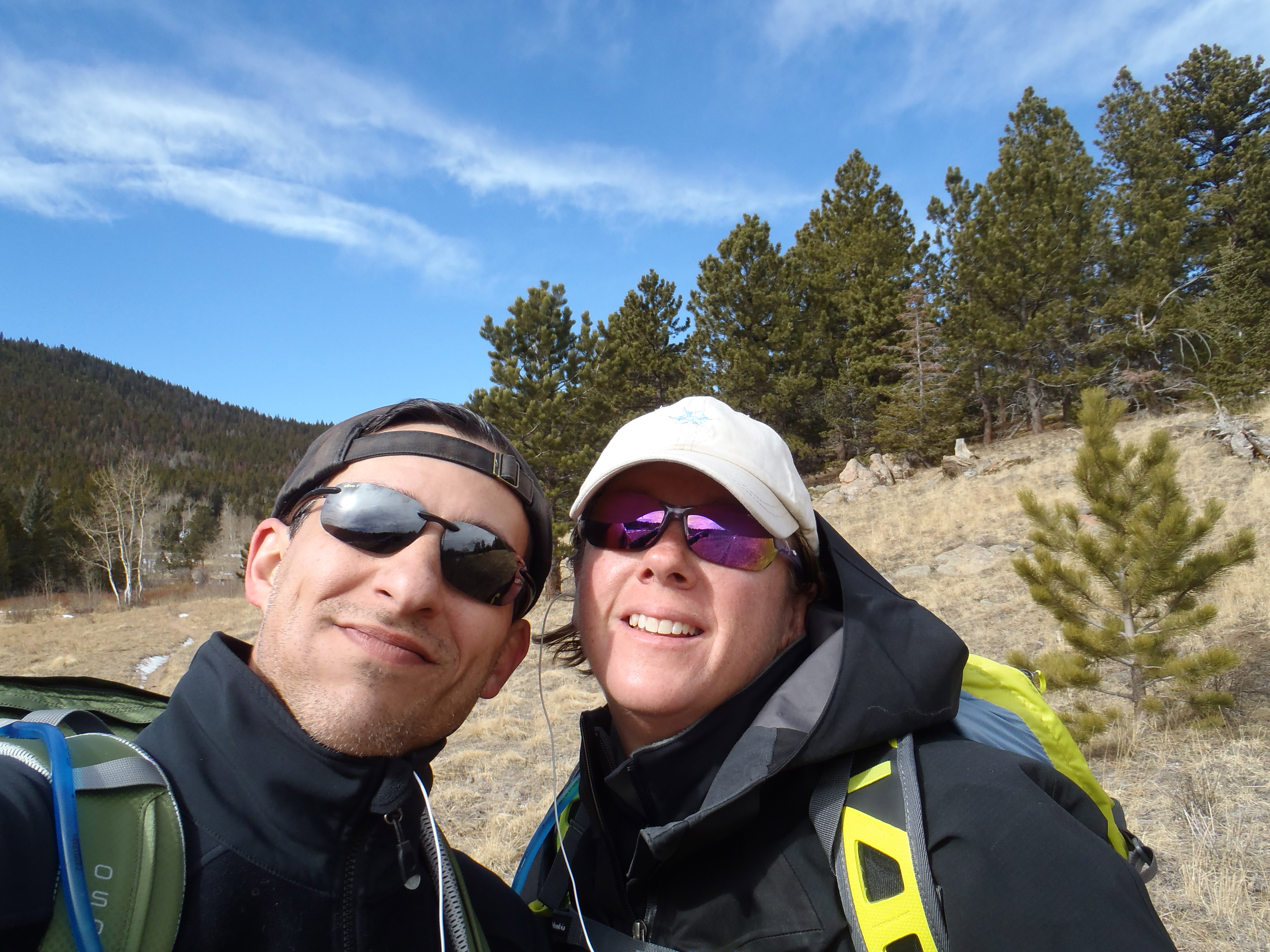
After we went past the Griffith Homestead we started hitting that snow and then got to use our gators also for the first time too, it was pretty exciting! It made us feel like we knew what we were doing, well really like Aaron knew what he was doing because I couldn’t get these or the crampons on without his help. Plus we were the only ones there, we had the whole loop to ourselves and we loved it!
Stove with view
Gators
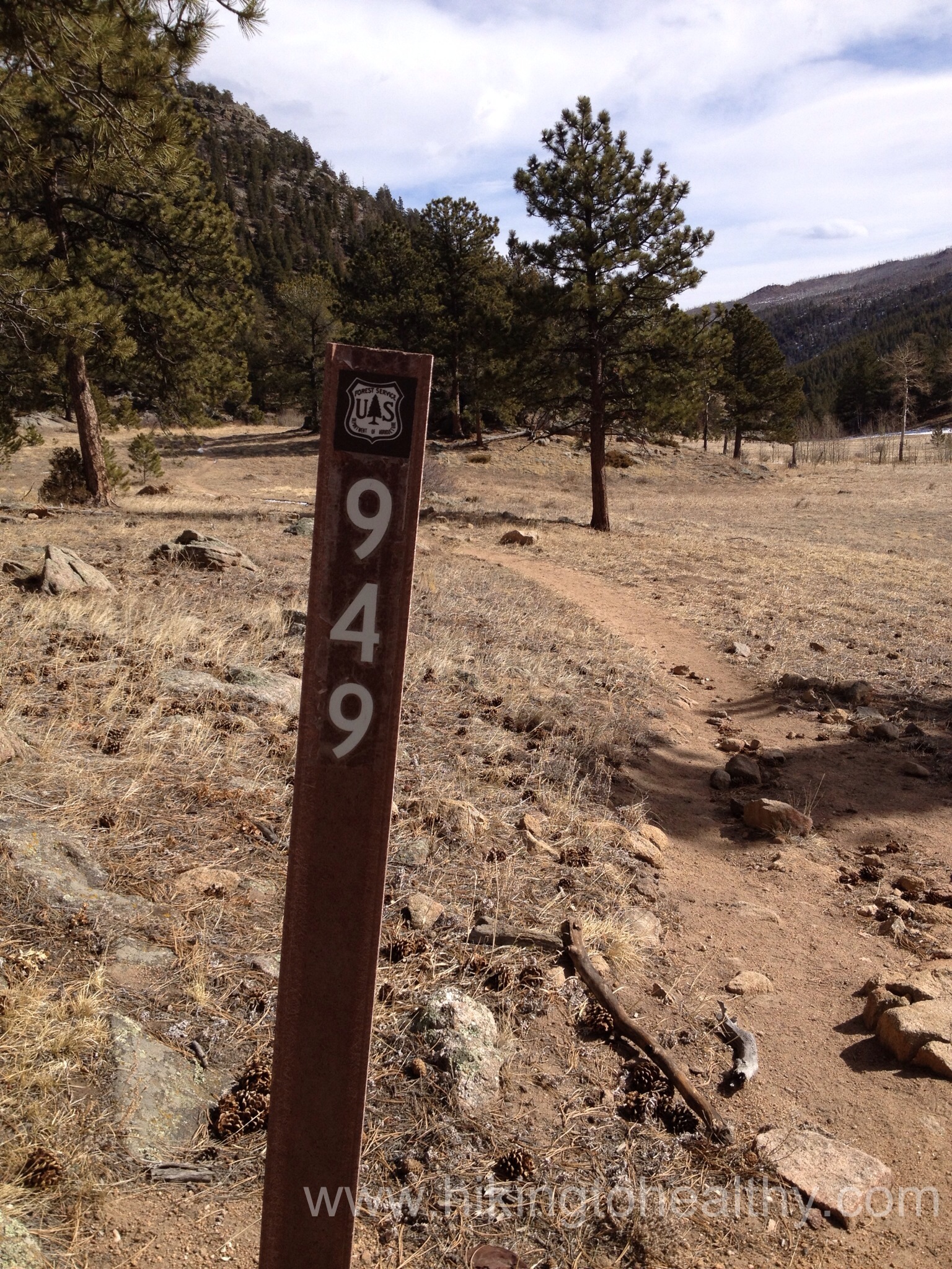
The loop took us past the Brown Homestead and we could have gone to see the Irvine Homestead which has the most intact buildings on it, but we decided it was getting late, we had already covered 5 miles and needed to make sure that we could handle the return trip. It gave us a reason to come back again to check out more of the homesteads. Getting back to Lion Gulch was easier, that trail was well marked…
Lion Gulch #949
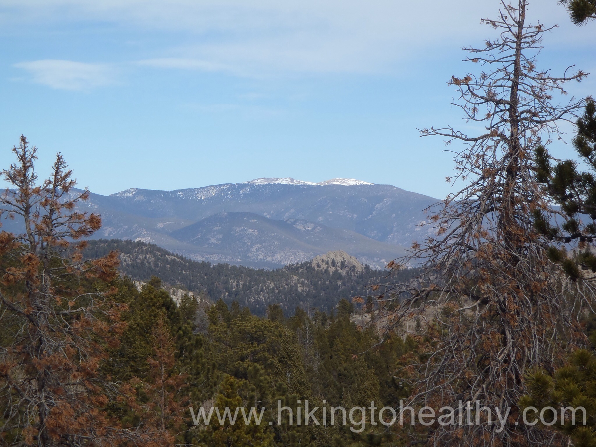
While there are some beautiful views to been seen once you get to the Homestead Meadows, they aren’t totally spectacular. Strangely though it is now one of or favorites, the whole trail is just beautiful in its composition. The way it winds along the creek through beautiful lodge pines and Aspens while the tops of the surrounding mountains are constantly peaking through. It was really motivating and peaceful. Then the meadows are rich in their feeling of history and perseverance of those brave people. I have read it is a high traffic trail in the summer and fall, but it was not that crowded this weekend which is probably not when it is at its best but I loved the solitude we got to have while explored. It is a great trail and I hope I can take more people through there in the future. I will put our favorite pictures after the directions to the trailhead.
Directions:
From Lyons, take 36 towards Estes Park. The parking lot and trailhead are 12.3 miles from where 7 & 36 split right at mile marker 8 on the left side of the road.
The end of the ice is so close….Cool looking treeView back towards Lion Gulch after reaching the next section of trail
Well we made it to the trailhead and about a mile up the trail this morning. It wasn’t too high or even that hard, but something was off with Aaron’s diabetes and we tried to figure it out but he was feeling too bad so we turned around before it got worse or too dangerous for him. We are going to try again tomorrow morning because it looked like a really beautiful hike and I need to see how it ends!
That said, I probably won’t get to post on it until Monday or Tuesday, sorry for the delay but from what I saw today this hike is pretty awesome!
Yay me!!!! I feel like I am truly back on rack with my weight loss journey and personally I feel like 2 weeks of weight loss in a row is pretty awesome. Plus the amount lost isn’t too shabby, especially since I got my monthly pain-in-the-butt-proof-you-are-a-woman-in-the-most-annoying-way-possible on Tuesday. I usually put on a few pounds when I get it and the way my mind is working, that weight is still on since I am not yet done so next week should be a good one too!
I kept up lifting weights a few times this week and then all my usual cardio. I stuck to my calories each day, even though it was really hard this week. I actually feel better than I have in the past 2 months and that is the best part.
I am really excited about our hike tomorrow, it is an unusual one with different things to look at while we hike. It has been snowy here this week and the foot hills should have some pretty scenery for us to enjoy.
Highest Elevation: 6500-ish feet (we went up and down a few times so the overall elevation gain was 900-ish feet)
Trail Length: Officially 7.5 miles via a full loop and my fitbit wasn’t too far off at just over 8 miles. It took us almost exactly 3 hours to complete
Trail Uses: Hiker, Biker and Horses and rock climbing cliffs ( at least 3 designated areas)
Degree of difficulty: Moderate but mostly due to length and the initial climb but the trail is very nicely planned the declines and inclines (mostly except the first one) seem mild and easy to conquer.
Bathrooms: At the trailhead and so nice, brand new and super clean….as I stepped towards the toilet a fan went on, I don’t know if it was a heater or just ventilation but I was impressed.
Pets: Yes – But Leash only.
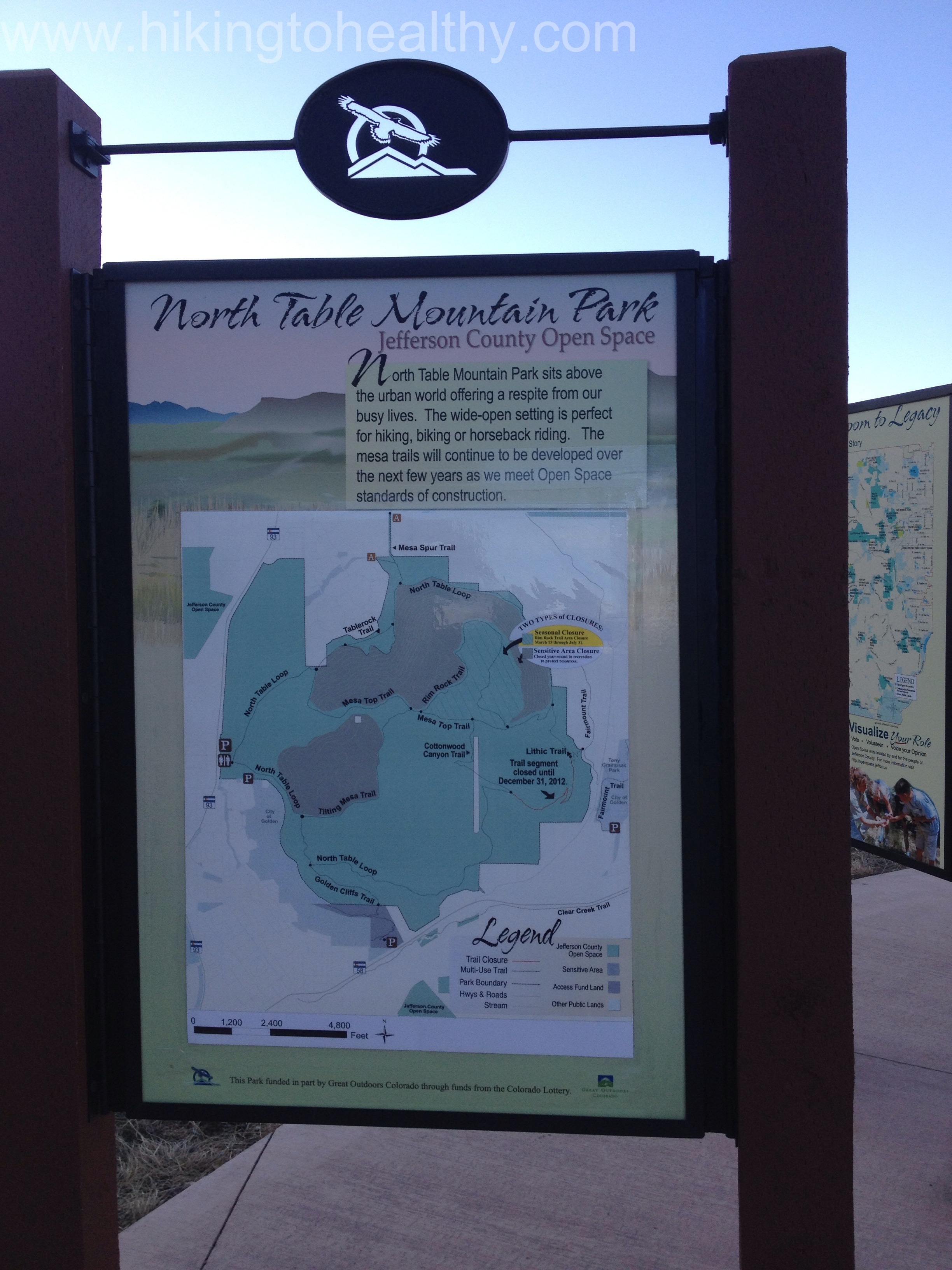
Park Map
Today’s hike was one I learned about from my hiking super hero friend Wendy. She said that it is a staple for her and her husband on bad weather days and when they want to focus on inclines. Not because the whole park has hard inclines but the first one is a killer and so they just go up and down it to help them get in shape….after hitting it myself, she has once again cemented her reign as my hiking superhero! I have been holding it in my back pocket for a bad weather day and today was supposed to be a bad weather day here, so all week this is the trail I prepared for us to do. It was supposed to start snowing around noon and continue to Sunday, then 1, then 4……it actually started at 2 but then it only lasted for a sneeze, which is way too bad because we desperately need it here. I guess the good thing is the mountains were supposed to get the majority of it and I think their storm at least came through.
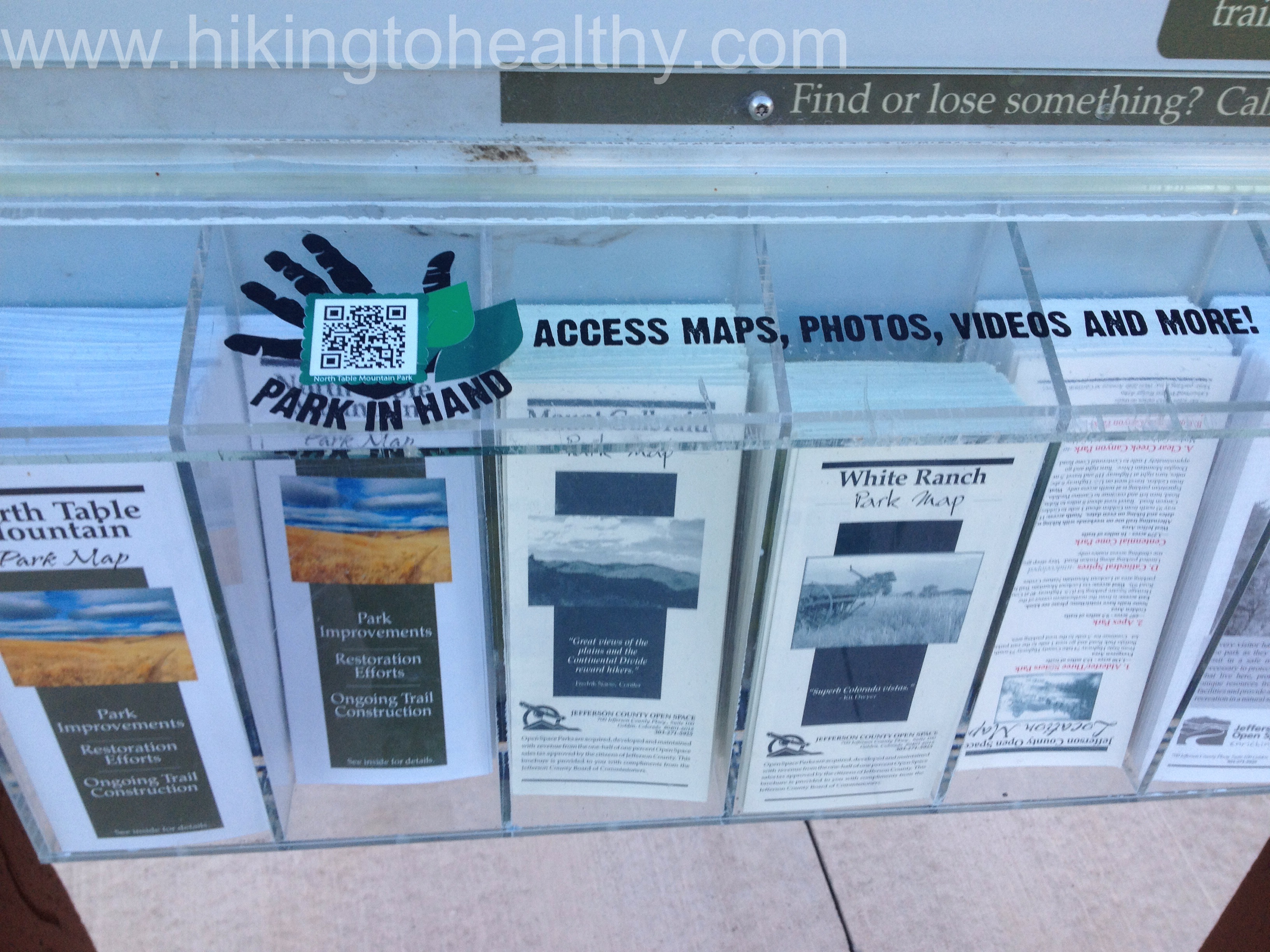
As we went to grab a map and a surprise to me, they had it app enabled so that you can scan the code and have the park details handy on your phone….strangely I haven’t downloaded the bar code app so we went old school and just took the brochure… But I thought this was so cool! I love how the Boulder and Jefferson county open spaces are on top of social media and smart phones!
wicked Incline
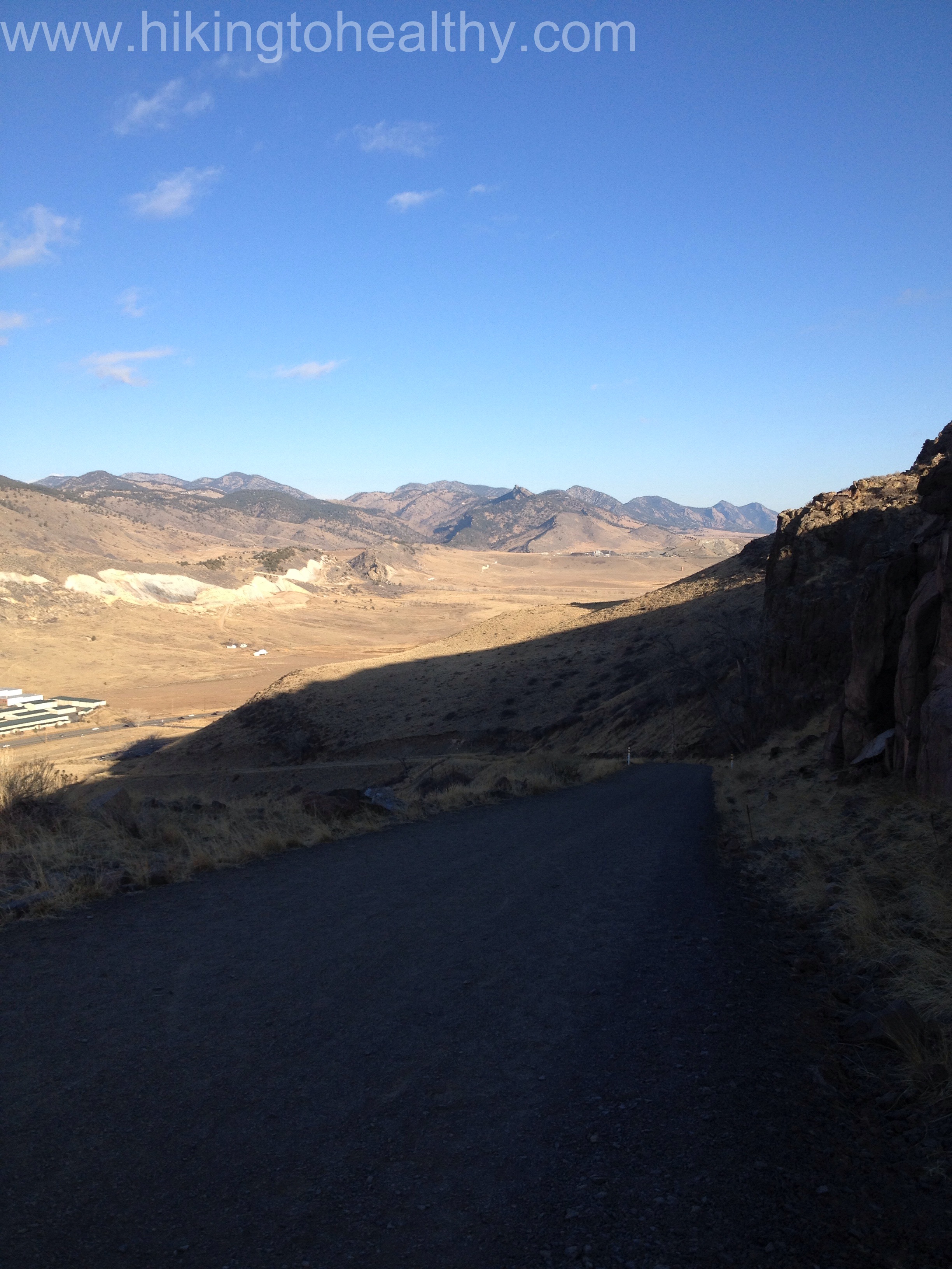
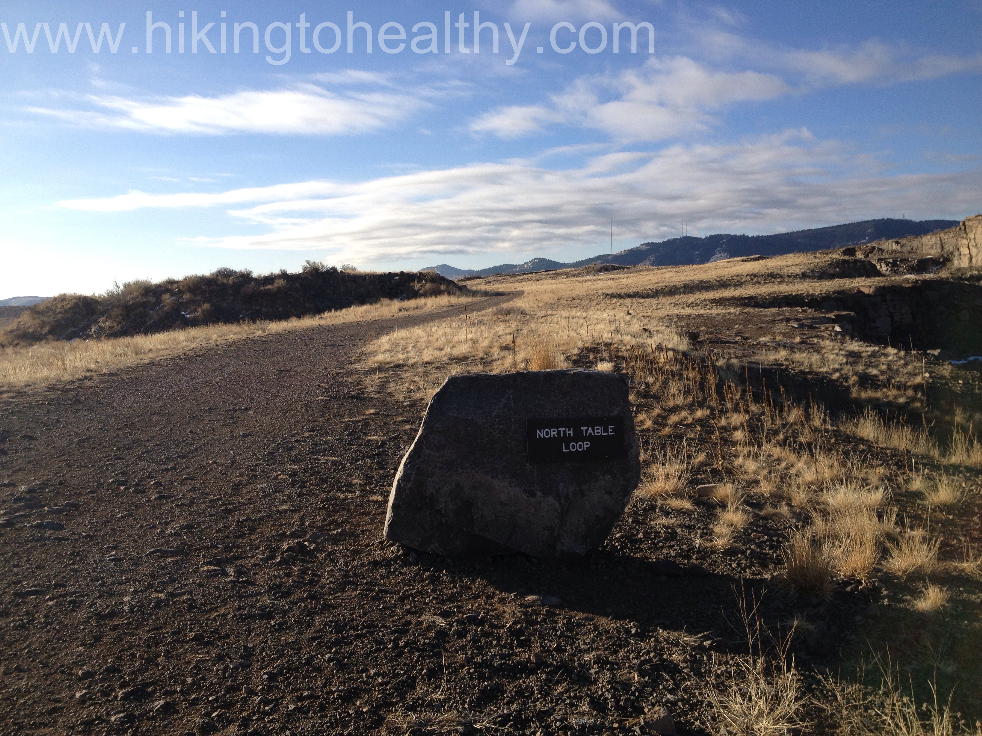
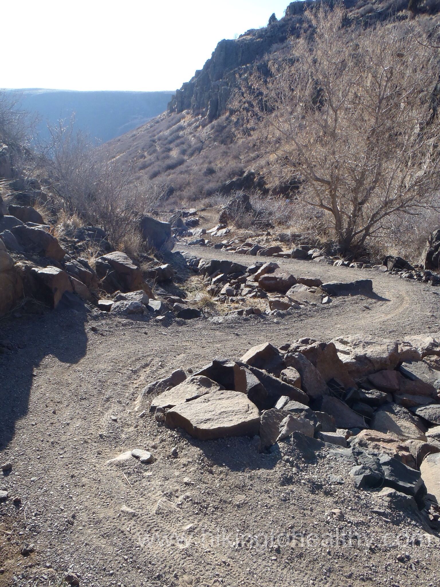
Let’s talk trail, we did the whole North Table Loop which starts right at the parking lot. You can grab it 2 places but either way you are making the climb so like ripping off a band-aid we took the trail that starts right at the park map and heads south. We huffed and puffed and struggled up an almost 500 foot elevation gain in just under a mile, it is definitely a calf and butt burner. Usually this would have me concerned about the rest of the trail but in fact I knew already this was the hardest part but maybe still harbored a little doubt.
This trail was recently lengthened, and it looks like they updated everything but I liked this part the best, half the trail markers are on rocks and the North Table Loop is incredibly well-marked so getting lost is impossible. After climbing up initially, there is then a very slow descent that is just lovely.
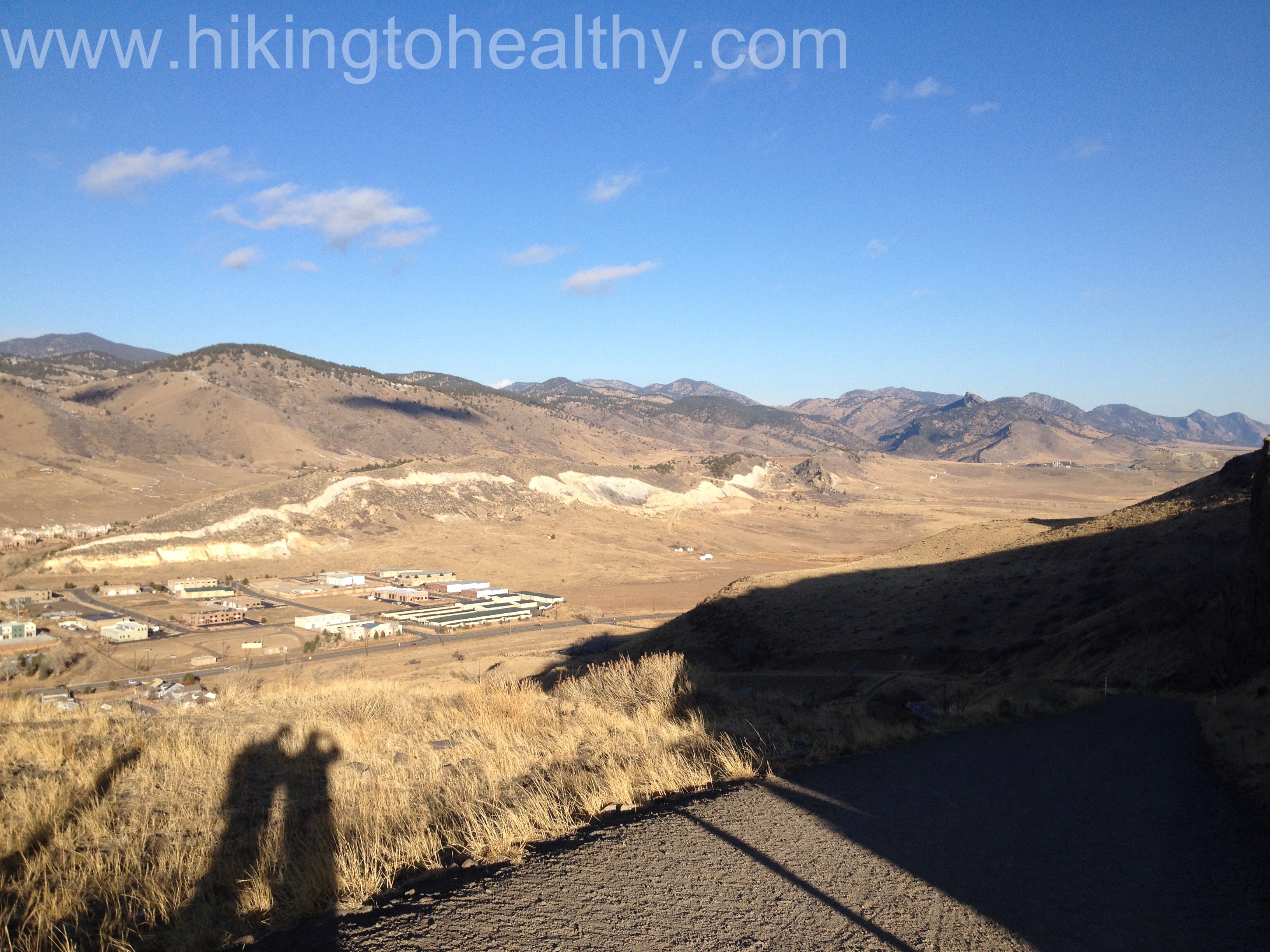
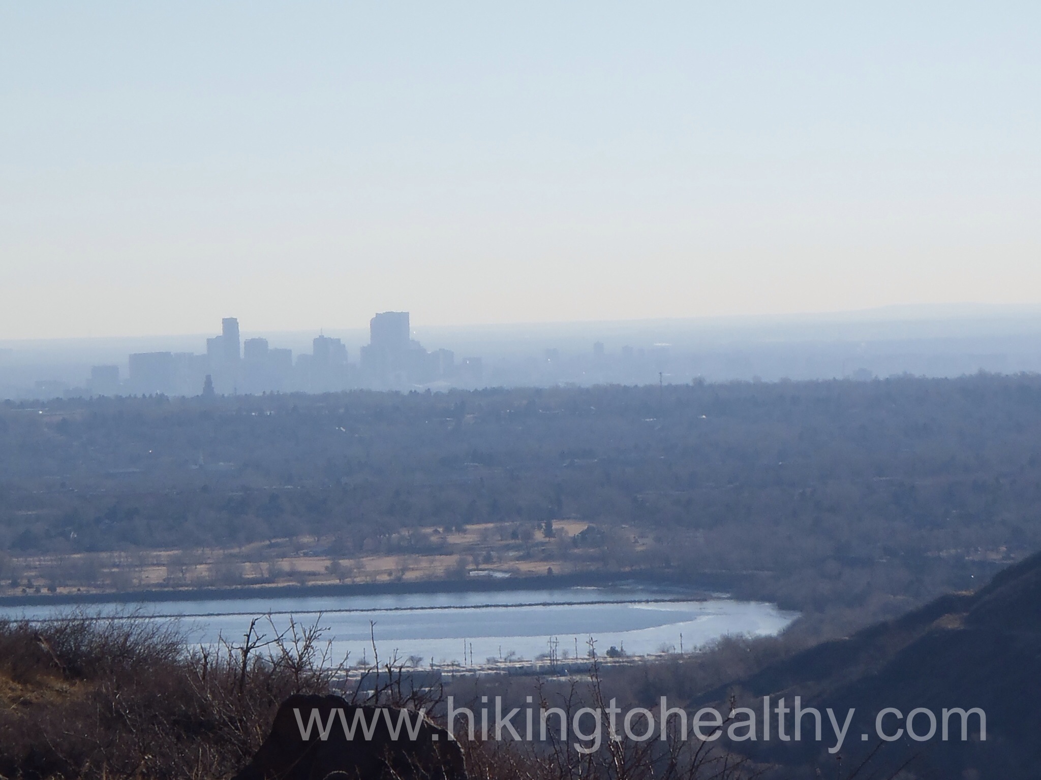
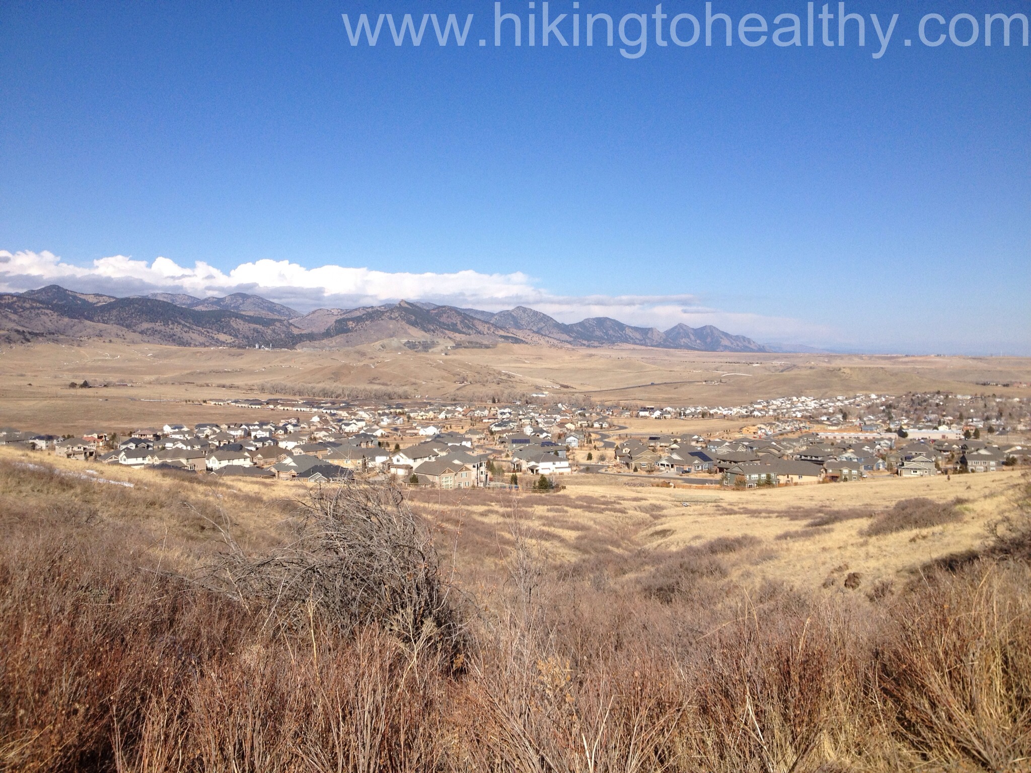
As we came out of this beautiful canyon we started getting views of Coors Brewery and then Denver in the distance and for some reason today there was a bizarre fog/smog early in the morning surrounding Denver so my picture wasn’t great but this is exactly what it looked like to us too.
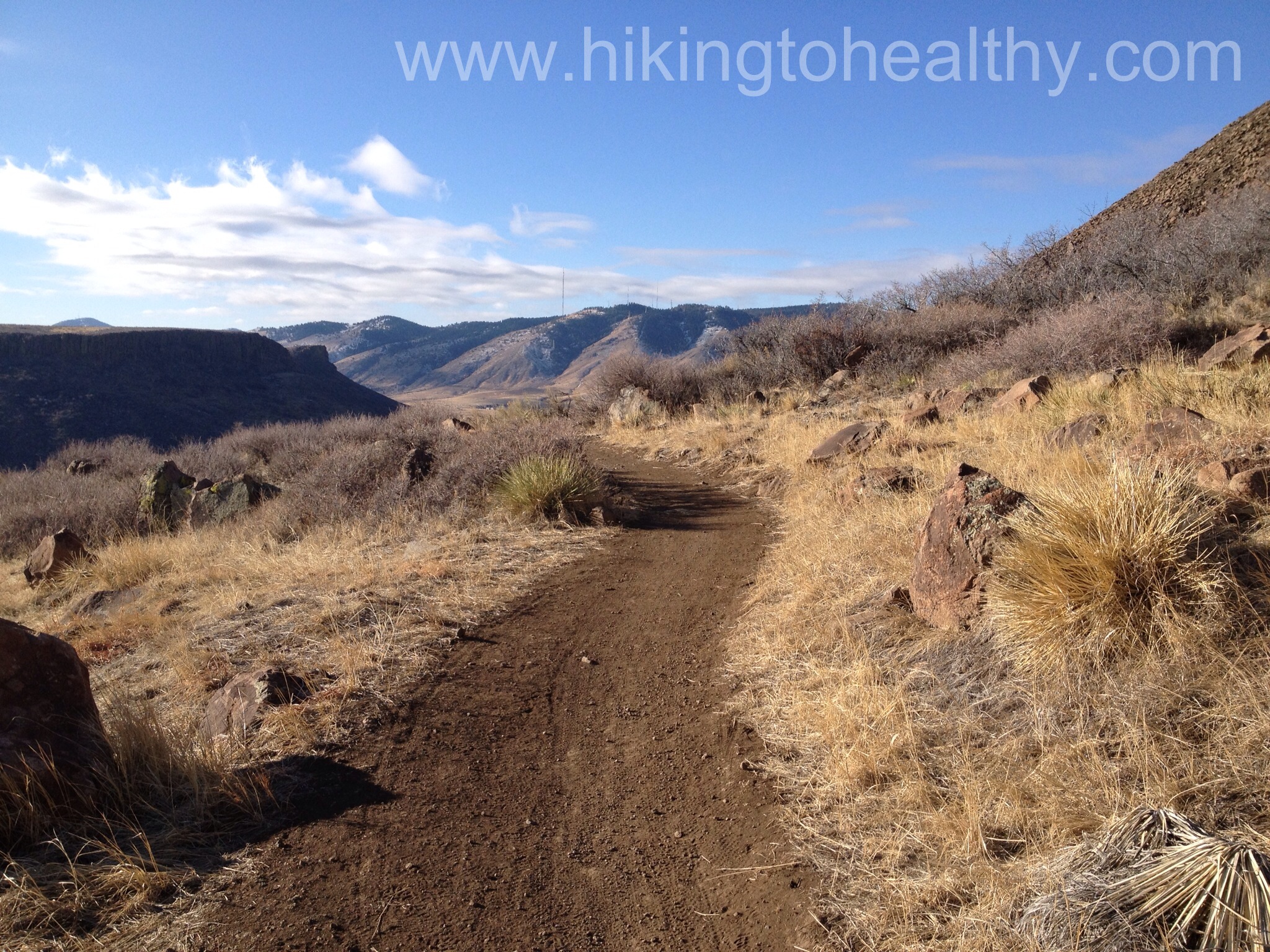
The trail itself goes from a wide road to a single track and back again which was nice because passing was easy and there were sections we could walk side by side.
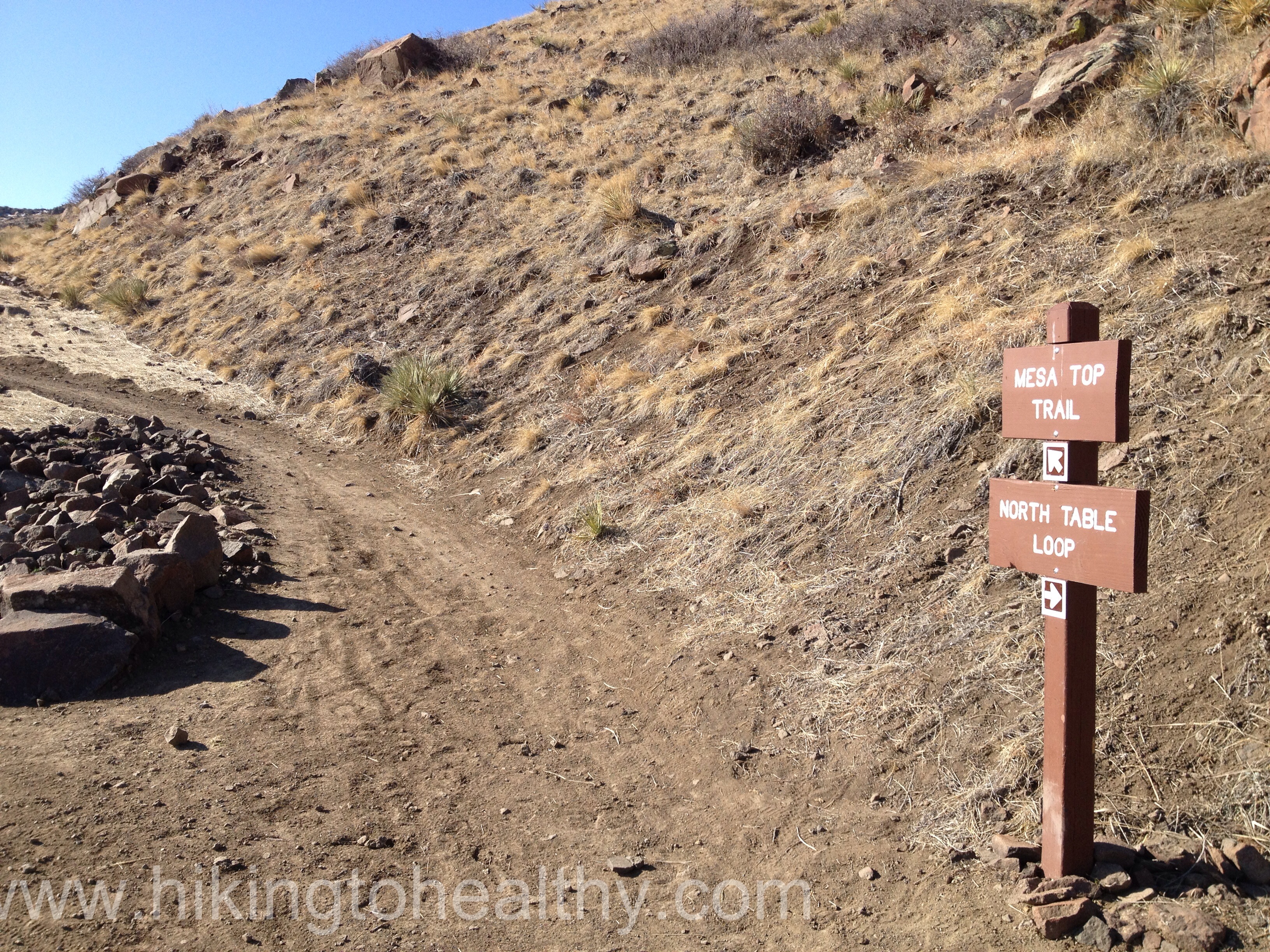
If you want to cut the trail down to just 5 miles you can take the Mesa Top trail back to the parking lot, otherwise keep on the North Table Mountain Loop.
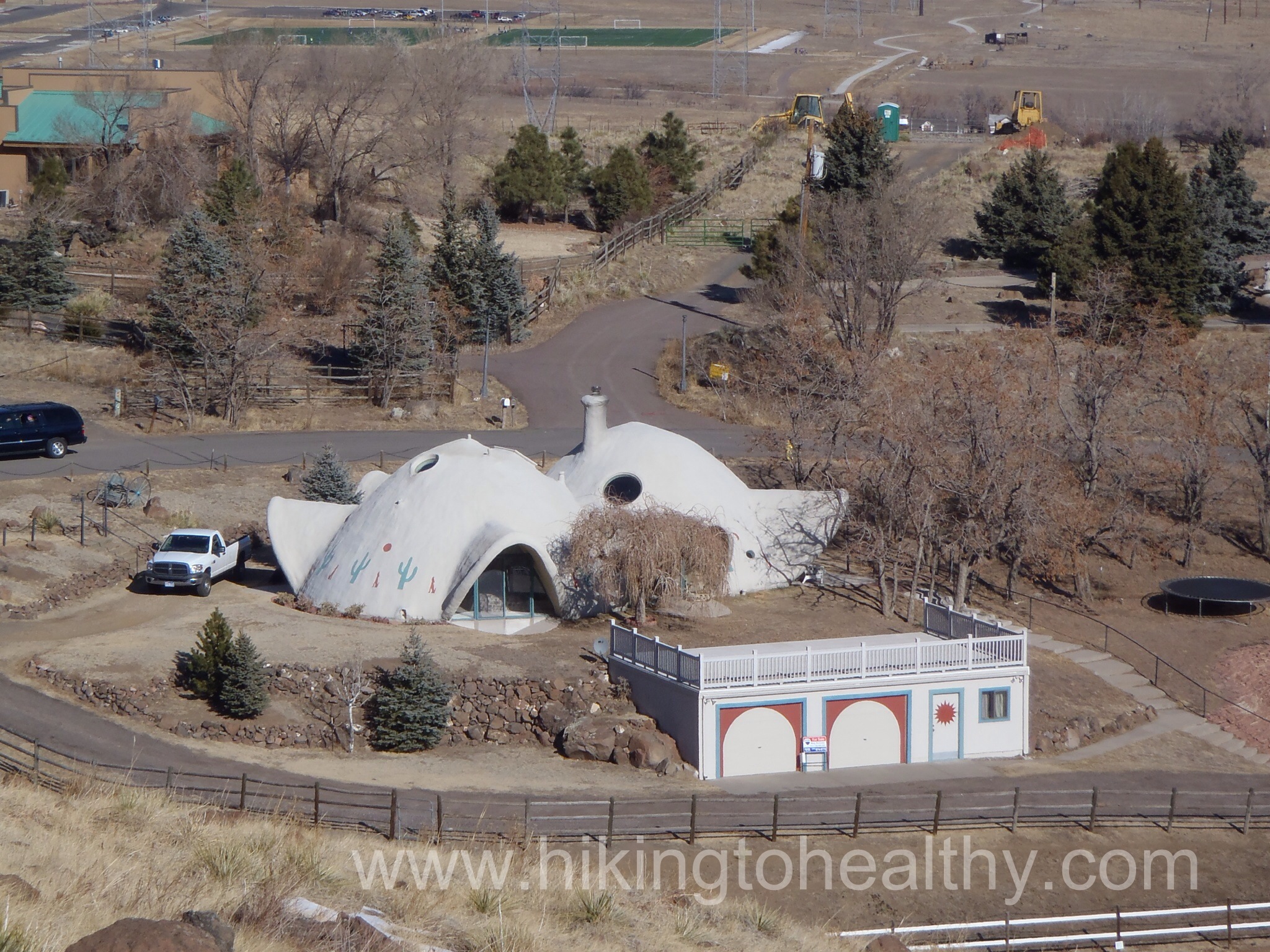
As we came around the Mountain it got decidedly residential but still very beautiful, I couldn’t help but grab a picture of this house it was so interesting and it kinda made me think of a Hobbit hole…..
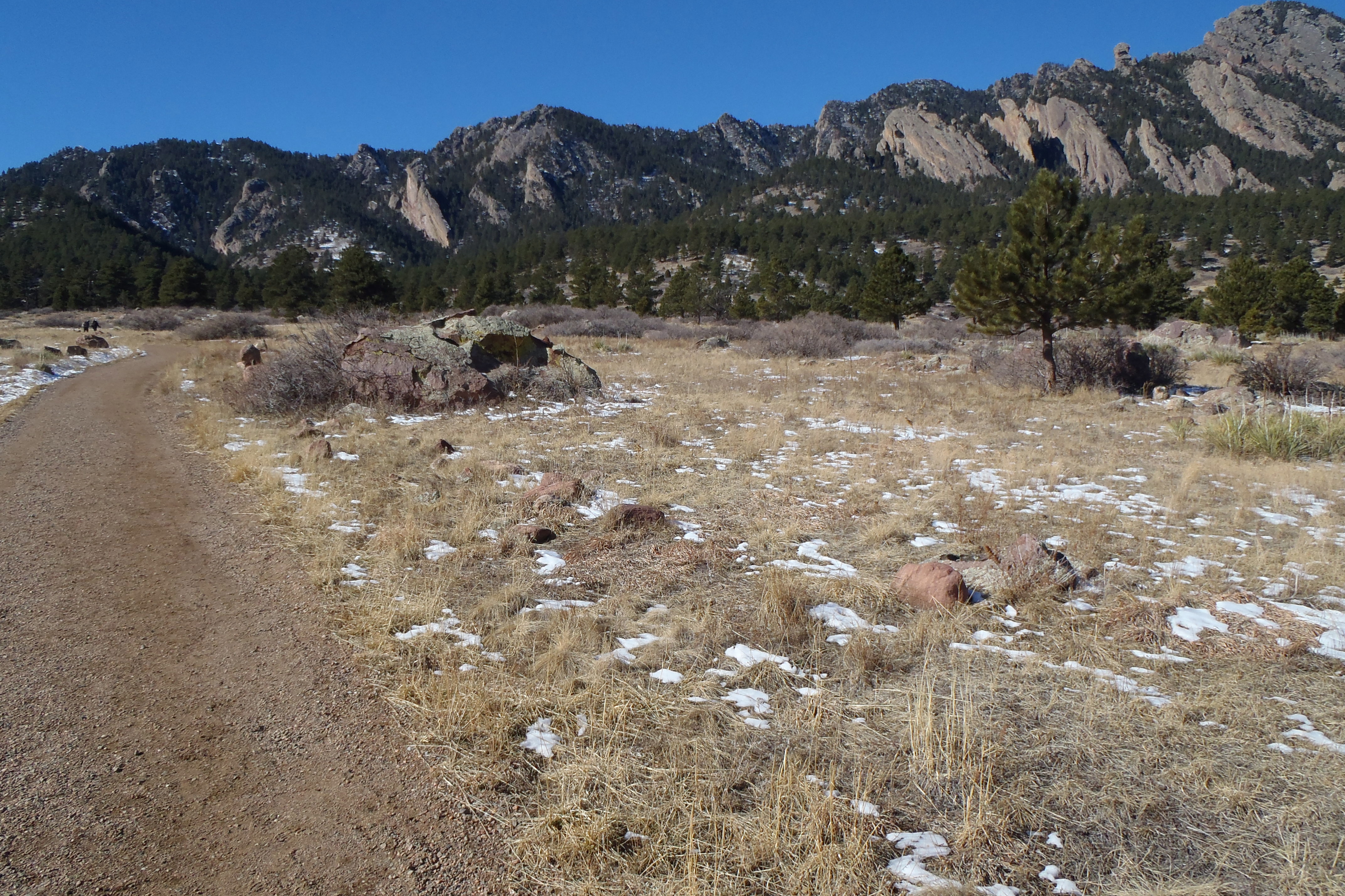
And then the views of the front range just took over, we saw where we hiked the weekend before in front of the flatirons and way northwest.
Then Southwest as the storm clouds started rolling in.
This is the worst part of the trail in the last 2 miles there is a brief stretch where you walk past these power lines and man were they crackling
Just before the second power line tower is the last trail break and then it is not long before you get back to the parking lot. It is an alternate to the final small incline to the end of the trail, plus residential access we decided it would be awesome to have this park be your backyard it was perfectly challenging and beautiful.
We were surprised at how much we liked this trail, I will admit that the residential views were a little concerning at first but the overall views of the mountains west, north and south not to mention the beautiful views of Denver and Golden, put it all to rest. We encountered moderate traffic, mostly bikers and joggers and everyone was so nice and friendly such a refreshing change from last weekends bizarre meanness. I had expected there to be a lot more people there since the new section just opened a little over a month ago but it wasn’t too bad although I am sure it was because of the uncertain weather expected for the day. One other thing worth mentioning is this trail is entirely exposed, there are almost no shady parts which means it is HOT trail in the summer so go early or late and slather on the SPF! There is also a seasonal closure fast approaching on the Rim Rock trail 3/15- 7/31 as it is a nesting ground for cliff nesting birds. This is a new favorite for us so I hope you check it out if you get the chance.
Directions:
4758 Highway 93, Golden CO 80403 The trailhead is north of Golden on State Highway 93, just north of Pine Ridge Road. There are six dedicated spaces for horse trailers. Left turns are not permitted when leaving the parking lot and turning onto Highway 93.
I was pretty thrilled this morning when I stepped on the scale, I had been expecting a loss but not one this big. It is still losing the same 5 pounds I have been gaining and losing for the past 6 weeks but I am super proud that I lost so much. I changed it up just a little in our workouts, I still did my 50 minutes of Elliptical in the morning Monday through Thursday and my almost 3 mile walk before lunch at work 4 days but at night we only lifted weights. The week before we only walked and didn’t get in any weights and I know weights are really important but I always make excuses not to do them. Next week I will make no excuses not to do them, I want to keep up this downward moving trend!
It is a great way to jump back into my goals. Our hike was great today and I felt really strong throughout the whole thing, I can’t wait to tell you all about it!
Highest Elevation: 6482 Ft ( but the trail goes up and down the whole way like we covered 8 ascents and 9 descents, giving an overall elevation gain of 2600- ish for what we completed) It is a great leg workout!
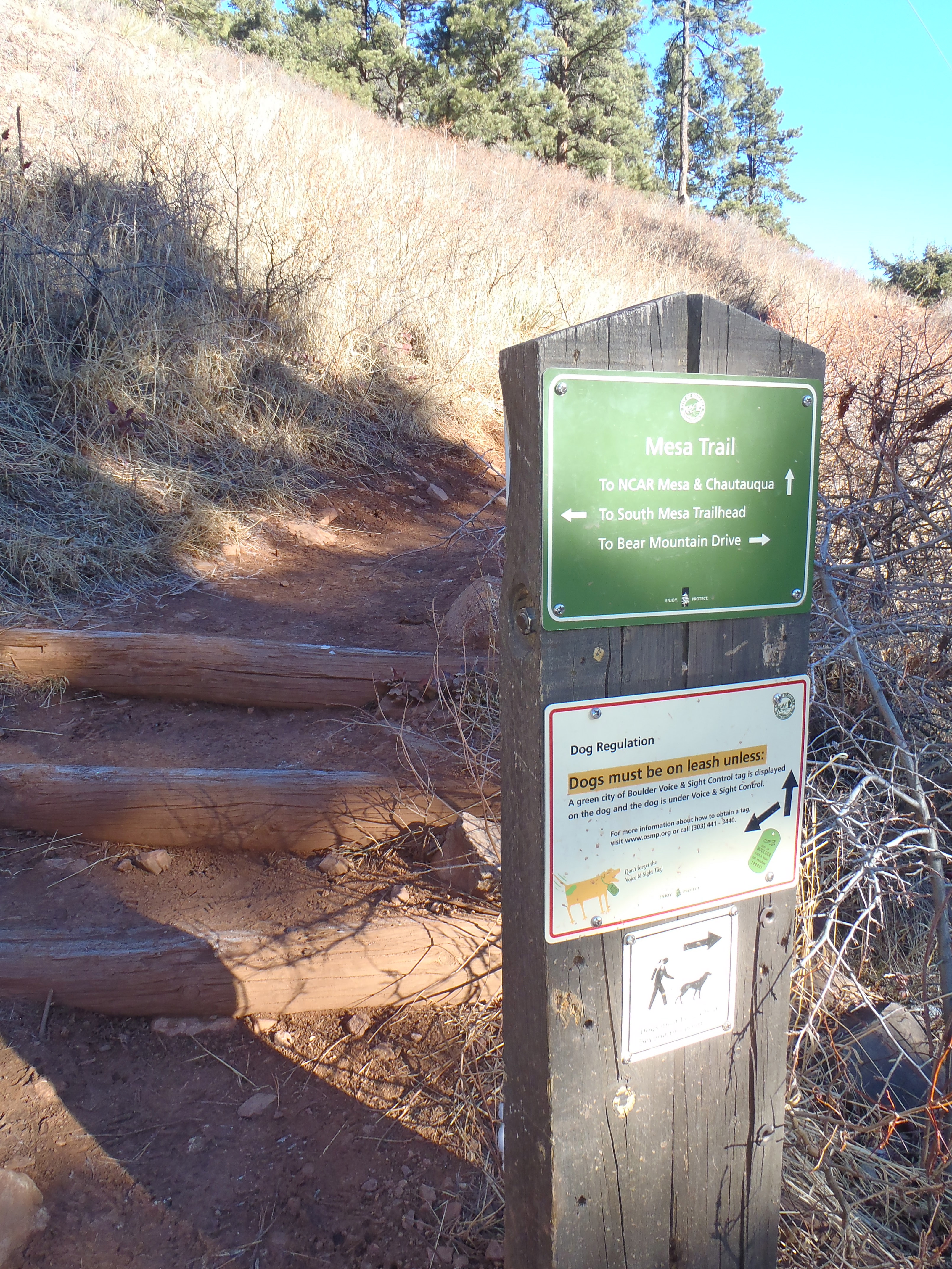
Trail Length: Officially the Mesa trail is 6.7 miles from Chautauqua Park all the way south to the Southern trailhead just outside Eldorado Canyon State Park for 13.4 round trip and our goal was to do the whole trail round trip. What we managed to hit was 5.7 one way, 11.4 miles round trip according to the map, but my fit bit said 6.5 miles. So I am taking the middle of the road and saying we finished 12 miles today. It took us 5.50 hours 8AM-1:30PM to finish.
Trail Uses: Hiker, Running and I think horses….NO BIKES
Degree of Difficulty: For the first time, Aaron and I cannot agree – my assessment moderate to difficult, Aaron’s = Moderate the book says easy
Bathrooms: At each end North and South. Otherwise this thing is insanely busy all year round so use good judgement…..unlike me
Pets: Yes, but dogs must be either on leash or have the green tag indicating they passed the voice control test for Boulder.
Fees: None!
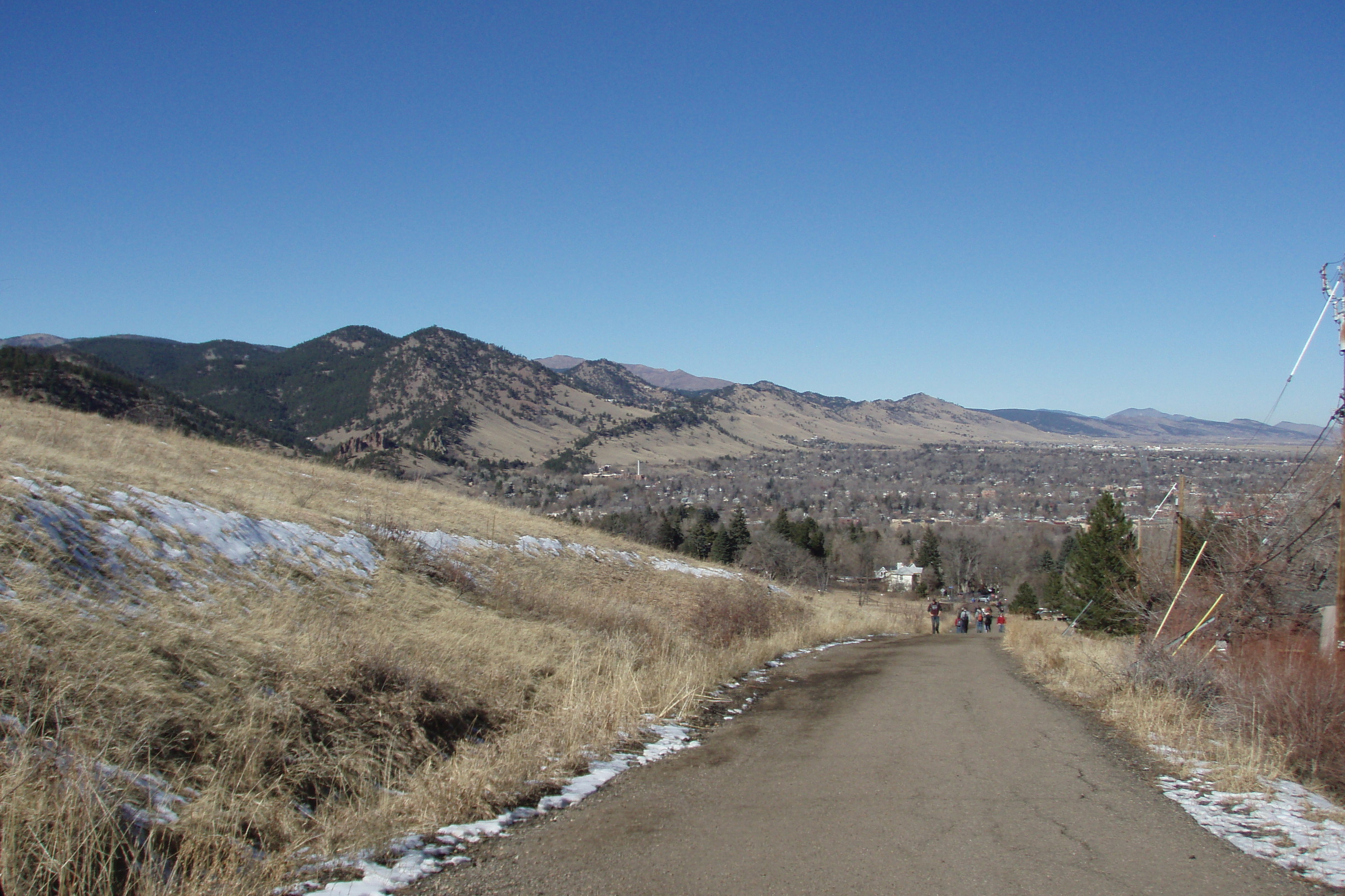
View of the Front range from Bluebell Road
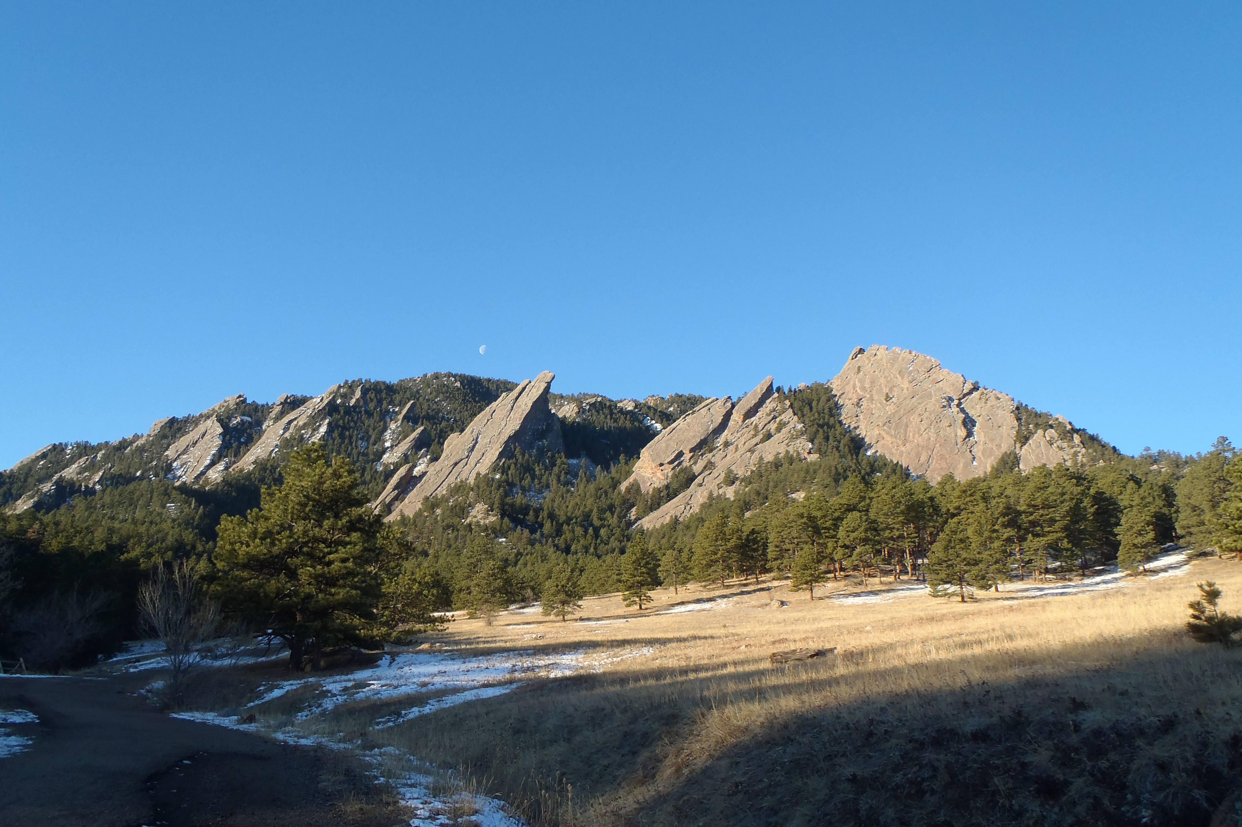
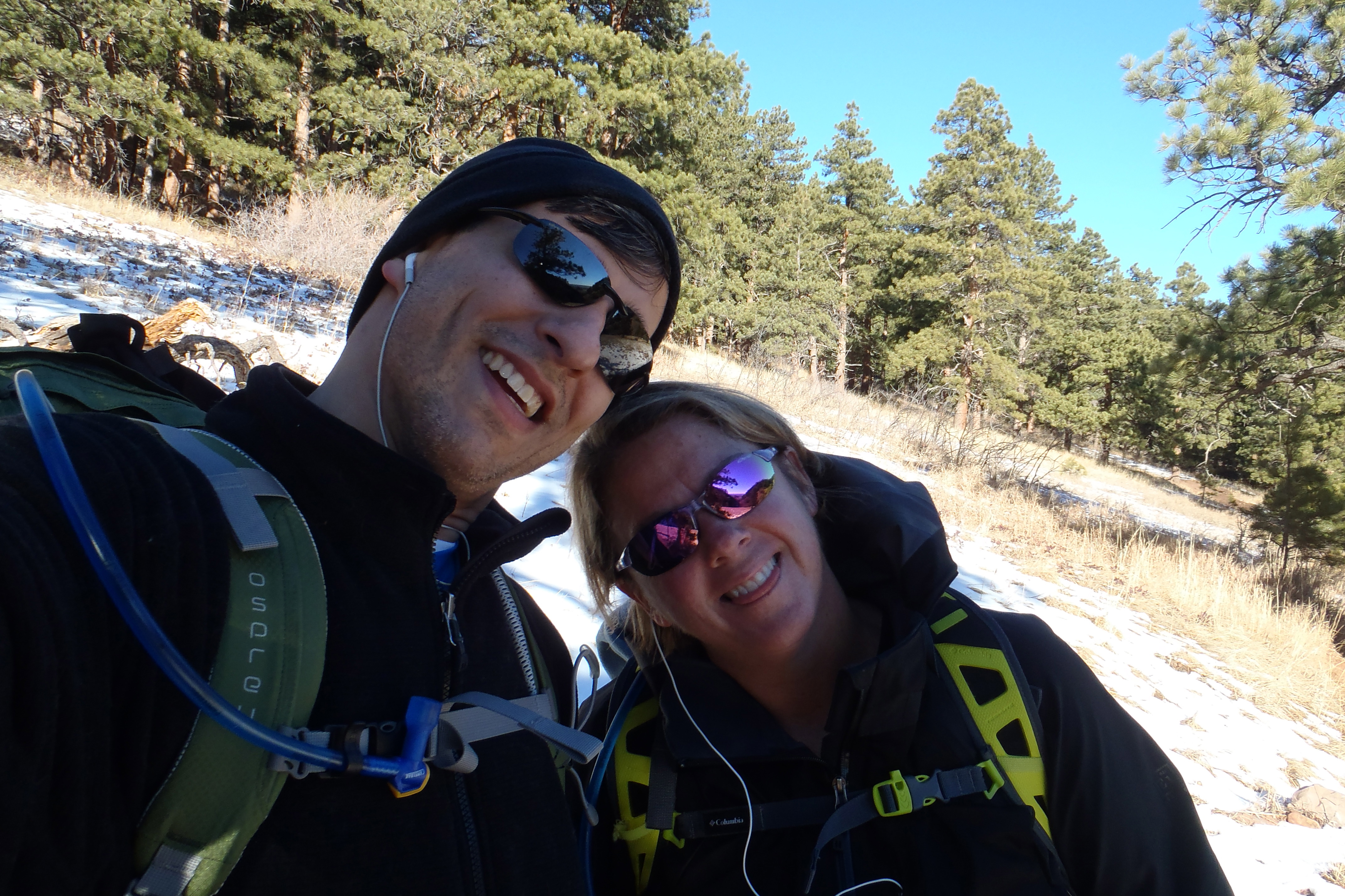
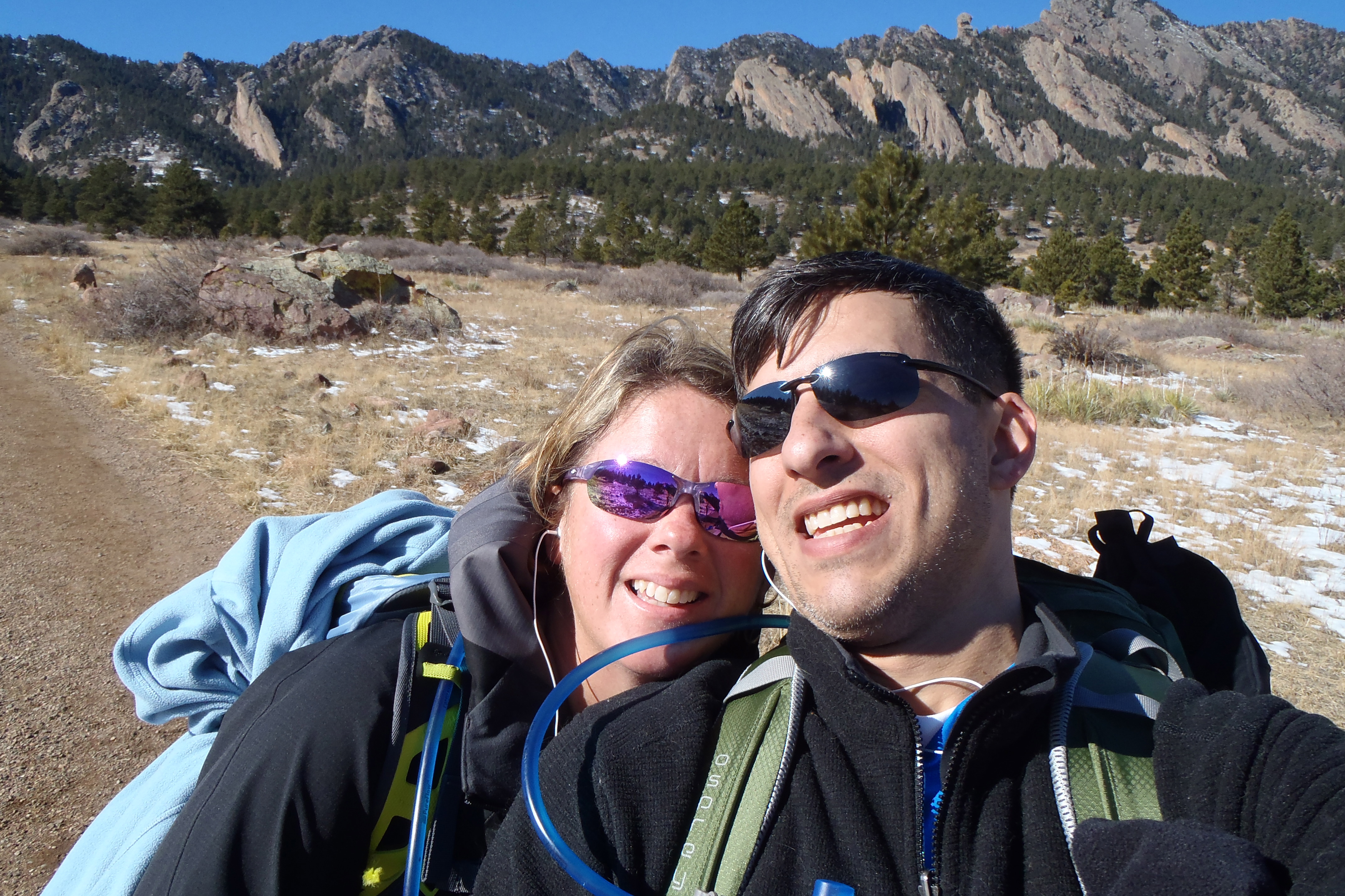
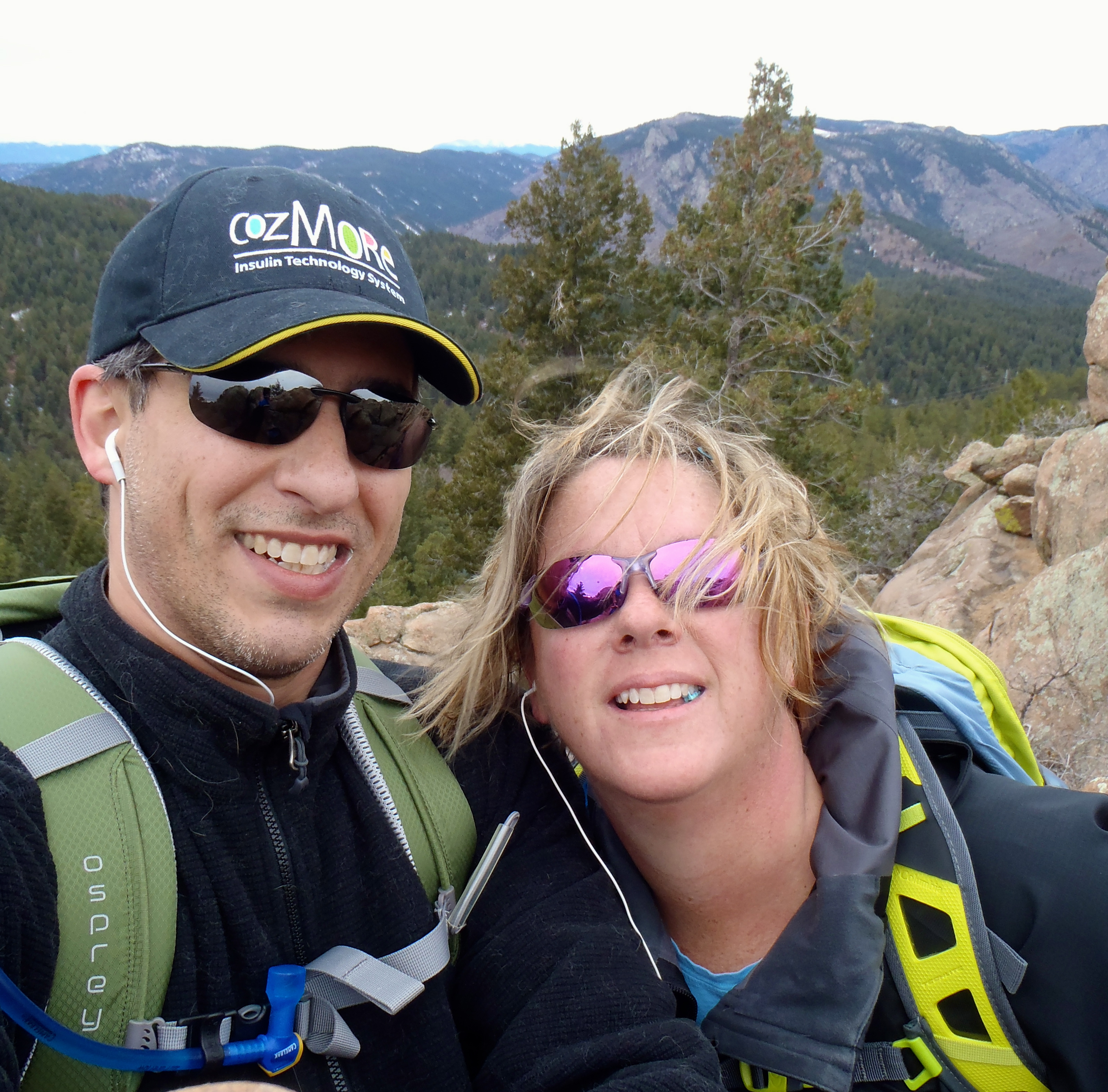
We were feeling pretty awesome after last weeks hike and decided ambitious was the best way to jump into this weekend’s hike. I picked this hike because it was long and while it is considered an easy trail, I think that rating is only given because if you do any one section it is easy compared to where you are going. The Mesa Trail is the main artery along the Flat Irons of Boulder, it leads to the some of the best and hardest hikes on the front range. It goes to Shadow Canyon, Fern Canyon, Bear Peak ( Closed due to fire damage until 7/31/13), Bear Canyon among others. The total up and down elevation gain is around 3200 feet, which is a pretty tough butt burner, calf builder or cardio challenge. At the end I think I counted roughly 8 ascents with 9 descents, I am wiped out!
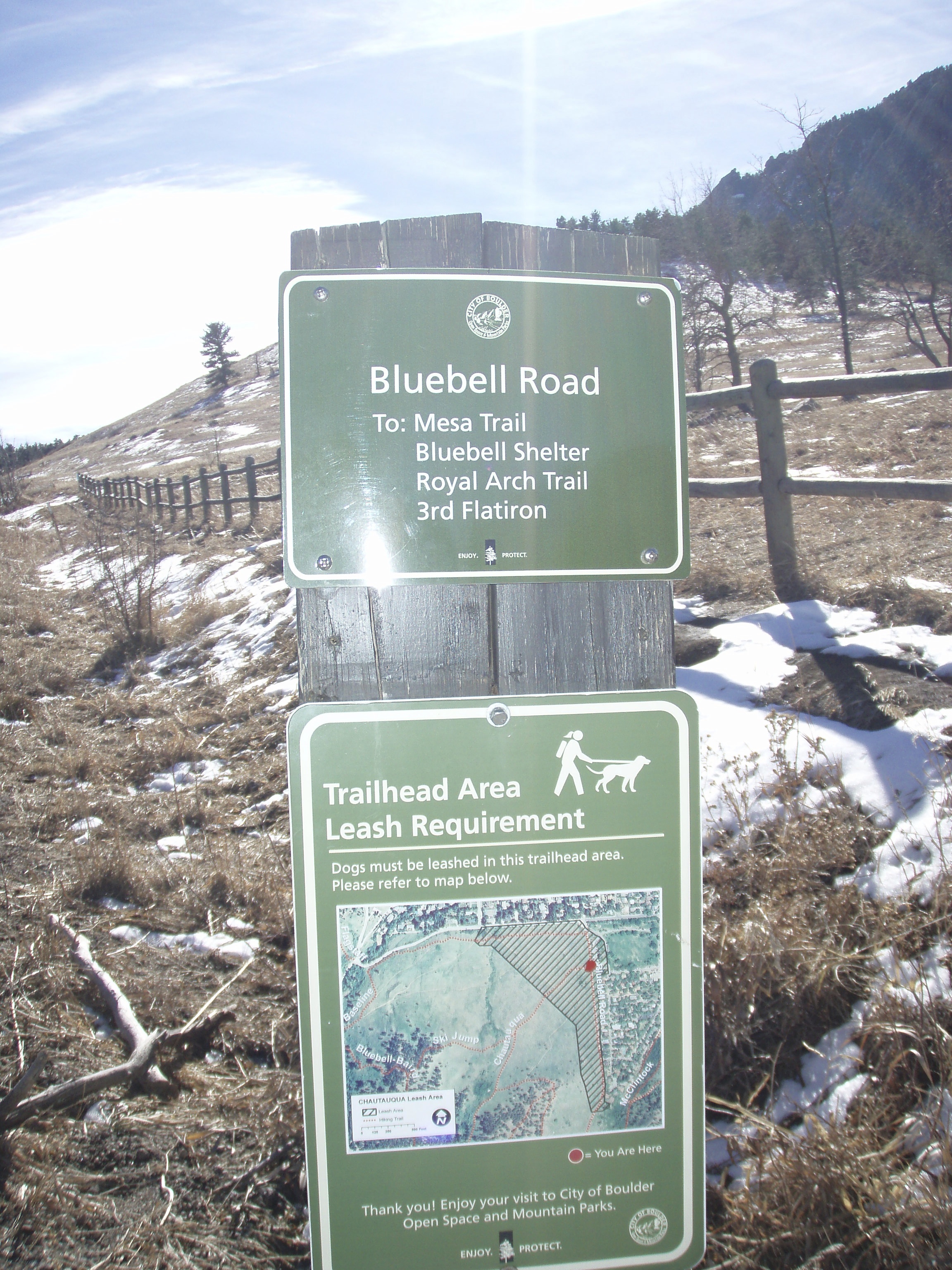
You can pick up any portion of this trail at 3 parking lots, today we chose to go from North to South so the only choice was to start at Chautauqua Park in Boulder or the beginning ( You can also start at NCAR and the South trailhead by Eldorado Canyon). Take Bluebell Road, directly west of the Rangers station up( South) to the Mesa Trailhead.
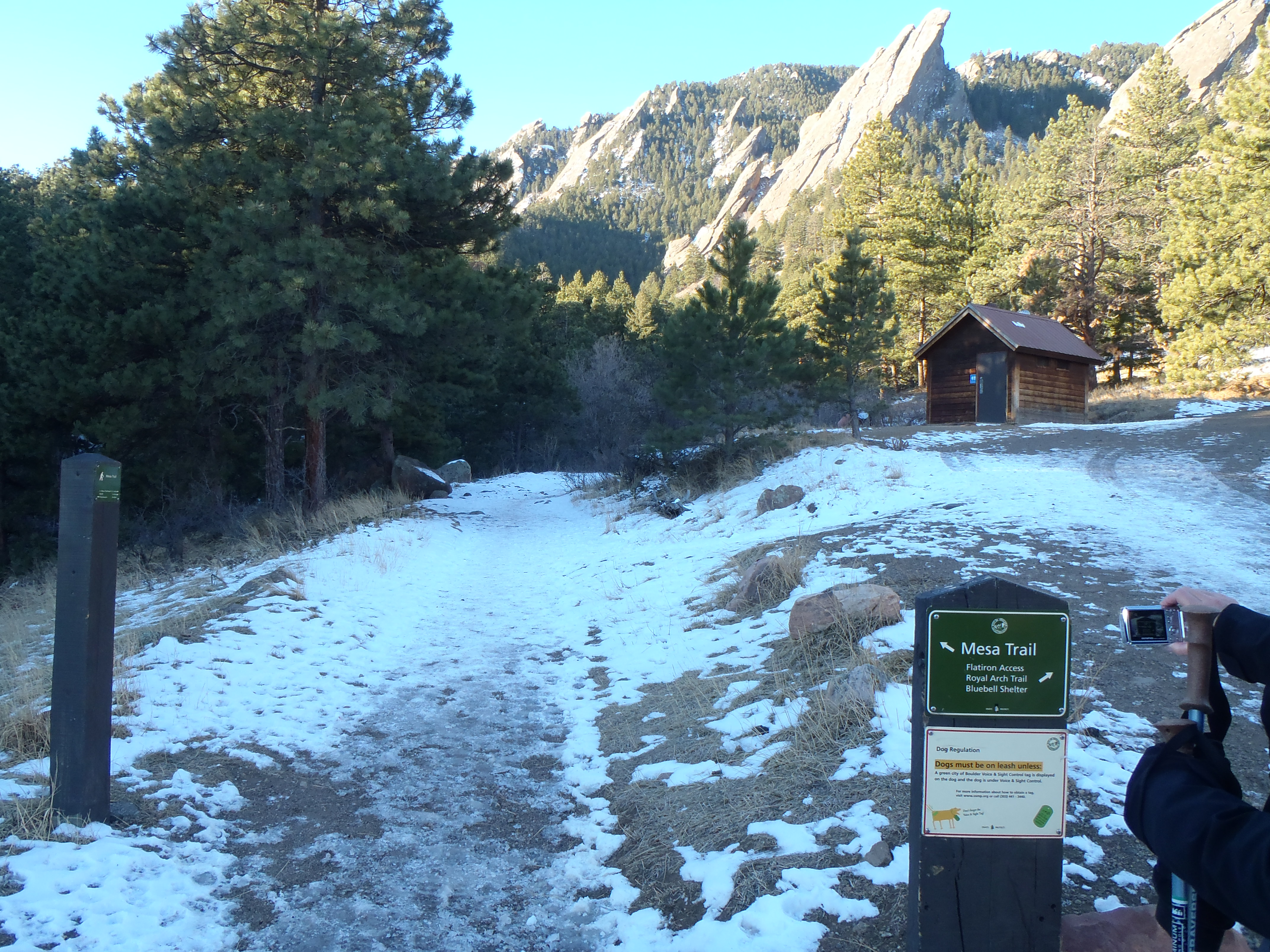
Hike starting point.
Mesa Trailhead
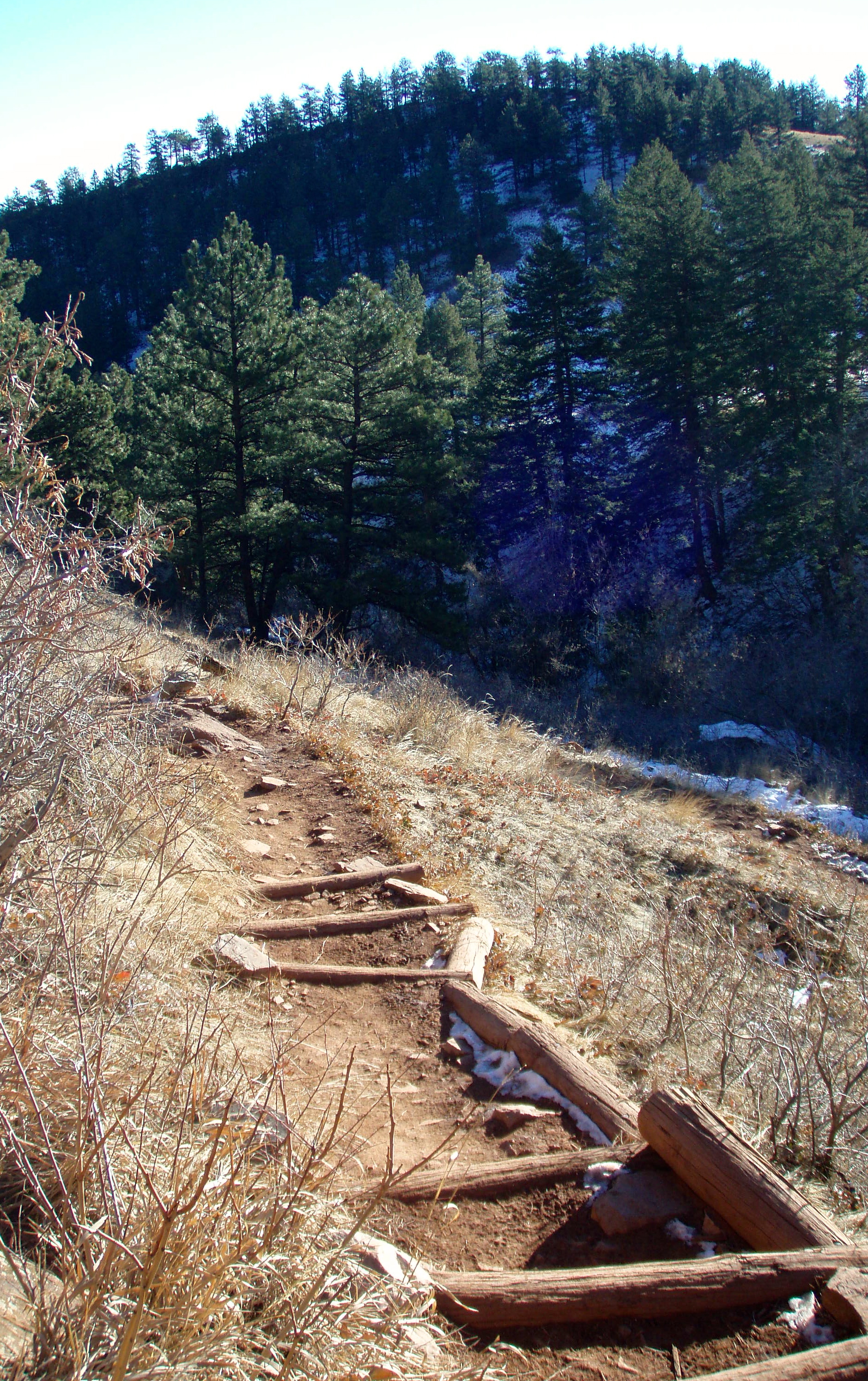
It isn’t a killer climb until you realize it goes on for roughly 2 miles and 700 feet in elevation. It did warm us up super quick! In the distance of the picture above, there is another outhouse which I thought was poorly placed since it was just over half a mile from the parking lot…. but at the end of the hike I actually ran to it. The trail was so busy and after mooning 6 fellow hikers I was a little outdoor solution shy….. Anyway we took the left smaller trail, the right is supposed to be a butt buster up to Royal Arch but we haven’t tried it yet. From the left, this is really the most narrow the trail will ever be. It was often wide enough for 2 groups to pass each other easily. As we got to the ice/mud stairs, I was feeling great thinking how awesome I was, hehe if only had a crystal ball.
The top – so easy looking
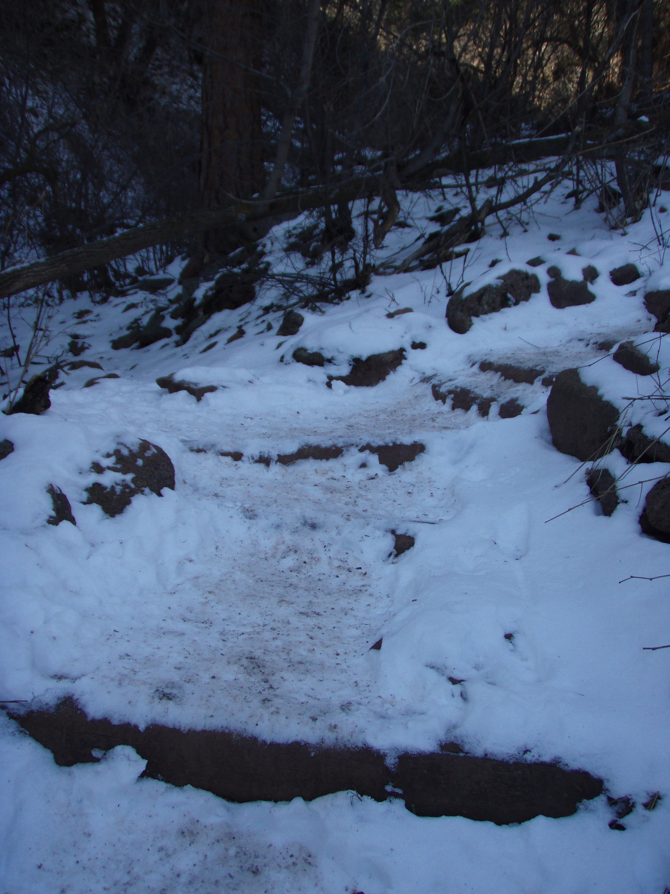
The Bottom of the mud stairs….not so cute now
The whole time I was thinking, man those stairs are going to suck on the way back if all that mess melts…it did! The trail is so well-marked, each trail head is very well identified, as is the Mesa trail and what way is the way you want to go. I was super impressed. We stuck to following the signs for 5.7 miles until we turned around.
NCAR entrance and trail info
This trail is interesting for so many reasons. It is really a beautiful hike, in and out of pines, around canyons, the views East and along the front range are stunning. It makes you want to be out there every weekend to see how it is different each day. What makes you kinda not want to ever go there again is your fellow trail users. At first, early in the morning everyone was sort of nice but then the later it gets the nastier your trail companions become, no courtesy or consideration for other people on the trail. Runners are huge here, and no joke, on the way back as we were on a tough climb up, 2 runners tried to “run” us off the trail as they came down making sure that we knew their workout was more important than ours. I was shocked and really disappointed at how many mean or indifferent people there were after 10AM, honestly it made me not want to ever come back.
There was one more thing that made me not want to come back. On a slow trail, finding a secluded place to “take care of business” is challenging as it is. On a busy trail like the Mesa Trail it is almost miraculous, which is how I found myself mooning several hikers after my best efforts to find a secluded spot, shortly before we turned around. I am newly comfortable to peeing outside so this new hiccup was unexpected and REALLY embarrassing. Aaron was trying to so hard to misdirect the passing hikers stares by talking to the decoy me on the opposite side of the trail but I just chose unwisely. It did lead to a ton of laughter and trying not to make eye contact with those hikers that passed Aaron as they realized it was my butt they saw in the trees not so long ago……
This is a year round place to hike, the ice can get tough in the shade just as the mud is super tough on the sunny parts. It is worth doing at least once and honestly we will probably do it one more time to try to get to the end.
After the directions to the hike will be our favorite pictures.
Directions:
From Boulder, take Baseline Road west of Broadway 1 mile to the Chautauqua Park entrance on the left hand side of the road.
From Denver, take I-25 North to HWY 36 towards Boulder. As you enter Boulder, turn left onto Baseline Road and turn left. Take Baseline Road for about 1-2 miles and Chautauqua Park will be on your left.
Yes its a weight gain and not all that great of a feeling but if I really thought it through, I am sure I lost around 5 lbs from my trip. Which means I ate enough in a little over a week to put on almost 7 lbs…….. WOW! Ok a good thing to know about my vacation brain and eating habits.
I did it, its done and I am moving on. Life is going to continue to happen and I need learn from my overindulgence if this change is going to stick.
The past 7 days I have been working out like crazy, we are actually close to our summer level of activity but no where the intensity. Last Sunday we did 7 miles on the path behind our house. I hit the Elliptical every morning before work for 50 minutes. I took an almost 3 miles walk near work 4 times. We got in 2 long walks in outside at night. It feels so good to be moving at that rate I didn’t even realize I missed that tired muscle feeling for the past 5-6 weeks. I think I like to work out which I kinda knew but if only I liked to eat crap less, I am working on it.
I have 5 weeks to bury my head and focus on exercise while tracking my calorie versus activity ratio, then my nieces are coming to visit me for their spring break. I have a lot of activities planed, including 2-4 hikes for while they are here. Aaron and I are like kids waiting for a Disney vacation counting down the days until they are here. It is so much fun to have them here and to show them why I love it here so much ( and maybe trick them into moving here) instead of Chicago.
Now is a clean slate with everything to look forward to this summer.
View on the Carpenters Peak trail about half way up.
Whenever I go out-of-town, especially to sea level, coming back to Denver is an adjustment, an almost 2 week adjustment. Since I went to LA for my annual girls trip last Thursday and returned just this past Tuesday, I was not optimistic about my ability to hike anything new or tough. We decided to go back to Roxborough State Park to see what we could manage. Plus this would be our 11th visit to a Colorado State park which means we made money on our pass today, yay us! The really nice thing about the park is the trail set up, you could easily hike all 3 big trails without crossing over the same terrain or going out of you way to get to the next segment. When I got up this morning I was worried that the Carpenters Peak Trail ( for trail details click the link ) may be too much for me and a couple of times it was. I definitely struggled up this mountain and had some altitude tough moments, but the physical activity wasn’t at all a problem. I was surprised when we came down this trail, I could do more. Between our 2 options I decided the easier Fountain Valley trail ( for trail details click the link) was the wiser choice. At the end of the hike we had cleared 8.7 miles based on the map and 9.5 miles based on my Fitbit, not too shabby. Plus we got a total of 189 flights of stairs climbed, I love my Fitbit I am obsessed with finding out how many flights of stairs we have climbed.
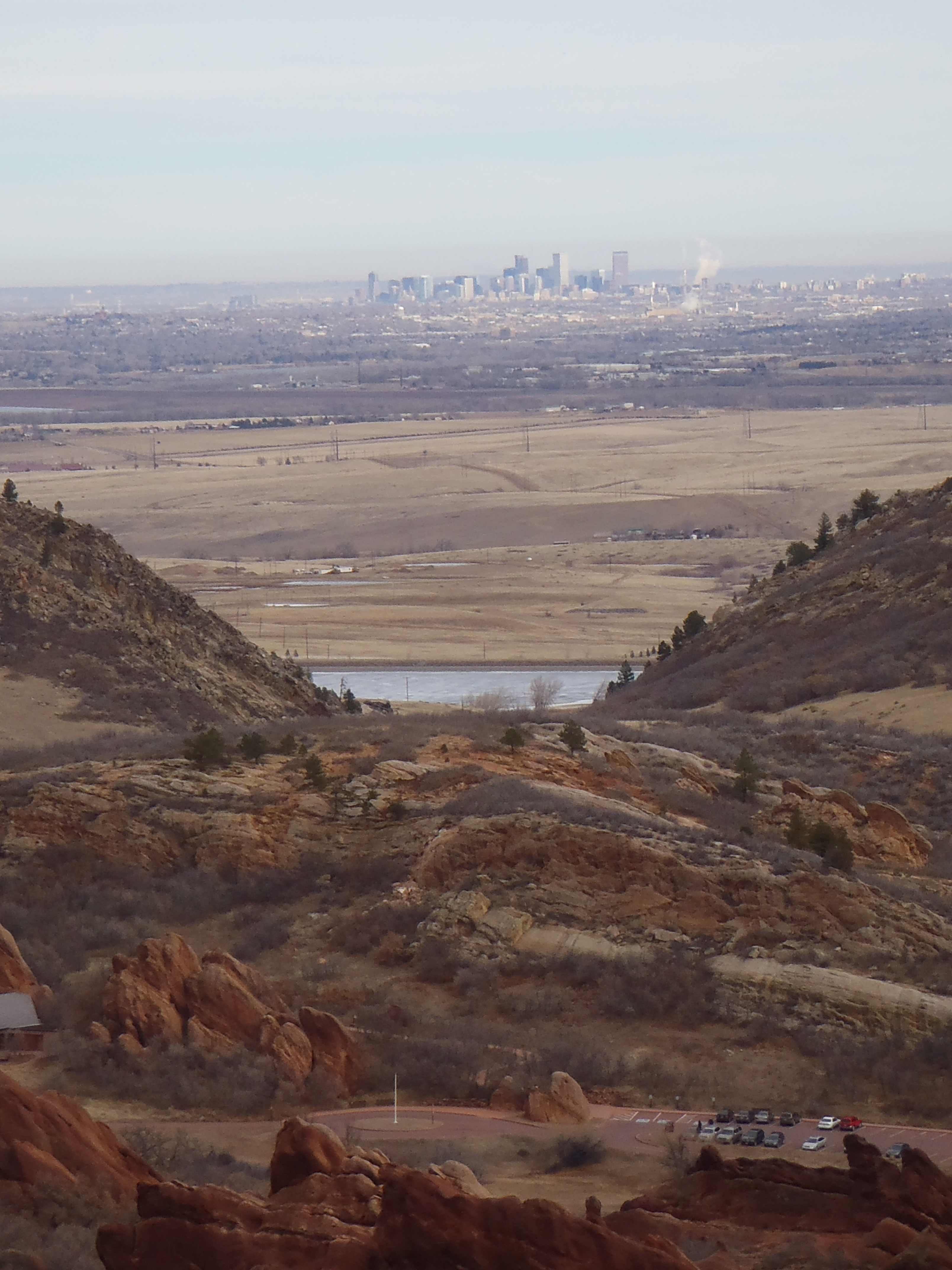
The quirky thing about hiking today was 2 fold, one we are desperate for some moisture here. It is so dry that our fire season is actually starting now instead of during the summer months. I remember our first month here people were thrilled that it was raining and at the time I thought it was cute, now I totally get it. I find myself trying out rain/snow dances in hopes the gods will favor us! The insanely dry weather along with warm temperatures also means the brown cloud of the front range ramped up early and got thick. You can actually see it in the picture of Denver at the beginning of my post. By the time we got home it was 10 times worse. The air quality warnings were red or high today, saying to avoid driving and stay indoors….which we ignored of course.
The other quirky thing is the temperature. It was nice and sunny this morning and while just under 40 when we started, we were quickly sweating and stripping down, but at the top of Carpenters peak it was windy and chilly we turned around almost immediately. I almost went to the shorts feature of my hiking pants during my second stage of taking stuff off but was so glad I didn’t do it. The trail itself had a ton of ice on it and so we knew it would be a muddy trip down. This trail is not one you want to do when it is muddy, its like hiking with 3 extra pounds of mud on your shoes or wearing 4 inch heels, going downhill on a moving platform.
Trail conditions
The mud was pretty bad and another reason why I chose the Fountain Valley trail as my add-on option, because they cover it with pebbles pretty regularly and the mud and ice are not a problem.
Trail Conditions on Fountain Valley
The best part about today was practically flying out of bed to get on the trail. It has been a weird month+, traveling home for Xmas, getting sick for so long and then barely a week of exercising before heading off to my girls trip. I have felt like a slug and staying on track with my weight became really hard, harder than I thought it would. I need to learn how to control my eating and drinking behaviors on trips. But getting out there and hiking a hike that has gorgeous views and a nice climb is exactly the medicine I needed. Nothing charges my batteries like a good sweaty hike!
Next week should be a brand new hike and repeaters shouldn’t so frequently anymore.
It feels like a long time since my last post and so soon after the holidays and my weight gain from that! Every year I am lucky enough to have 4 wonderful friends I meet up with to celebrate our friendships and love for one another. It is usually 4 days of laughing, drinking, shopping and eating with a little crying here and there, all in that order. This year because my friends from Chicago could get a better rate by leaving on Thursday, we made it an extra day long.
We were so excited about our planned trip with a hike on Saturday in the agenda, I figured I would have something to share with you all in the way of hiking. Then we had reservations at a great restaurant in LA, again a great opportunity to share, but it was not in the cards. Friday our hostess came down with the nasty flu that has been going around, we drugged her up and put her to bed hoping she would wake up feeling better. However, since most of us had some form of the current funk going around, we all knew it was wishful thinking that she could do any of the stuff we had planned….sure enough she woke up feeling worse. So we canceled our hike and our reservations because it wouldn’t be the same without her.
We winged our trip, which unfortunately involved more drinking and eating then normal with less movement because we wanted to be home with our girlfriend. She really rallied on Sunday but by then another girlfriend was starting to get to sick, I think you can see where this is going. Again more eating and drinking with no movement. It was a great trip as always, but man did I eat sooooooo painfully much!
Add onto the unplanned inactivity and overall consumption of bad food, the fact that I struggle for about a week when I come back to high altitude and well I am not weighing in this week. I know I have gained weight so I am giving myself this next week to get back on track and I will be honest with you all next week when I do get back on the scale. I should be able to get back to my old workout schedule by Saturday which I know will help me feel a ton better.
I have a low altitude but decent hike planned for this weekend, but I may hit an old standby since I was at sea level for almost a week. I can’t wait to get back into everything at full speed I am not sick and I have no more trips planned for a long time!!!!