Mt. Falcon Repeater + more, Jefferson county Open Space Hikes 3/30/13

Castle Trail - Mt. Falcon
Castle Trail – Mt. Falcon

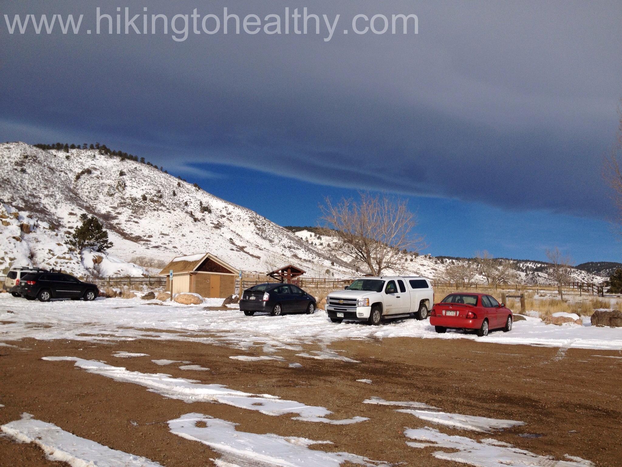
Today’s hike needed to be both inspiring and challenging but I was also worried about the condition of the trails I originally had planned on doing with all the snow we got the last weekend.  I had hoped  that the warm up being forecasted would happen earlier in the week and be more intense than it was, but it was enough that anywhere that received a ton of snow would have melted to the point of  being annoying once we started hiking over it which pretty much covered those hikes I had planned.  There was one trail I thought would be a good bet for this weekend after all our weather, but it was a repeater so I decided to add-on more mileage and elevation gain.

We originally went to Mt. Falcon Park Jefferson County Open Space (details of the trail in the link) at the end if July last year.  The first time we hiked this park, we were there on a really hot day thinking “I bet this hike is really great in spring or fall”.  Plus there are a great set of trails at the top that we could use to challenge us to go further and climb more.   That is how we ended up back at Mt. Falcon Park today.   Here is what we took on for our hike:

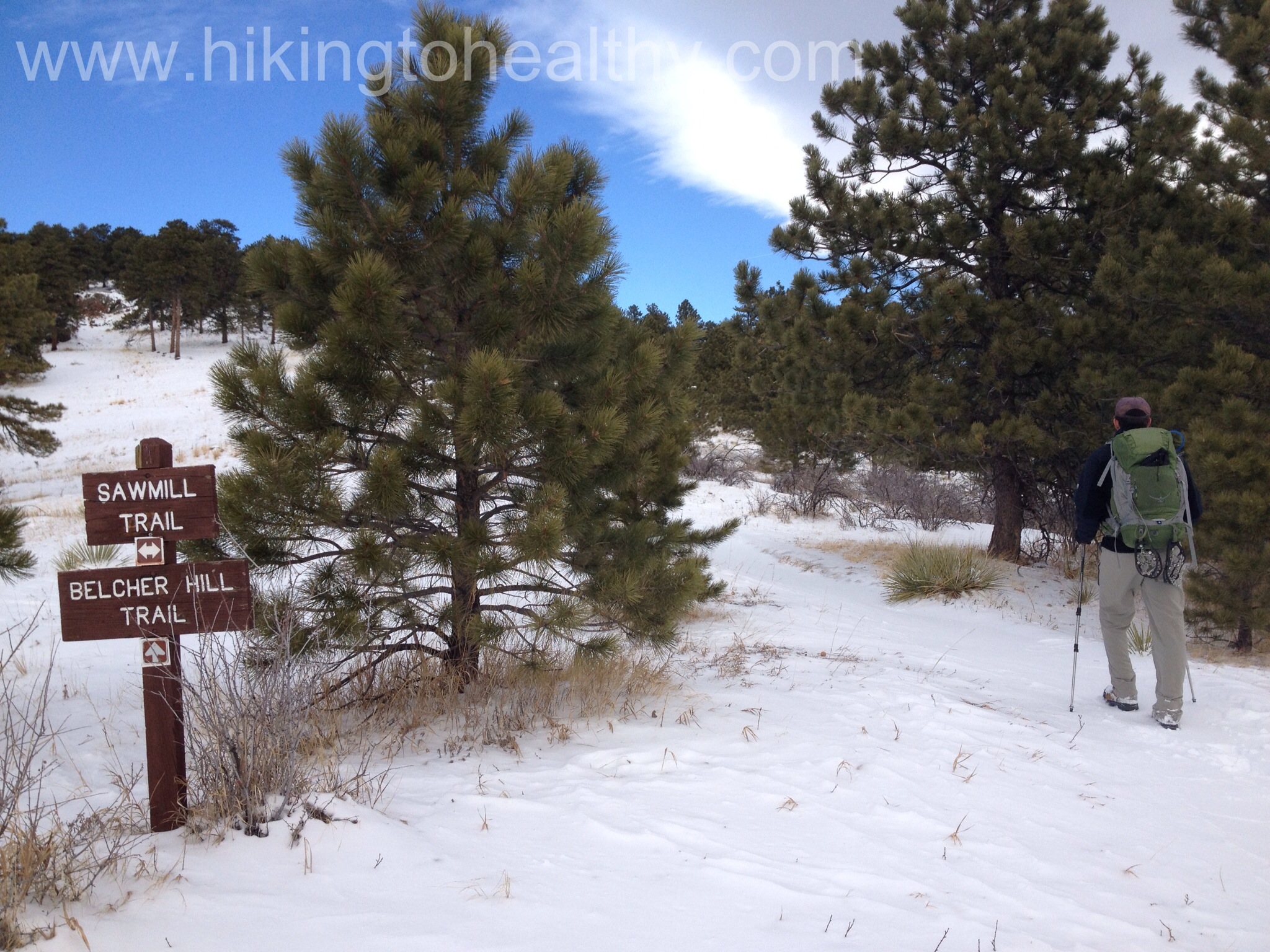
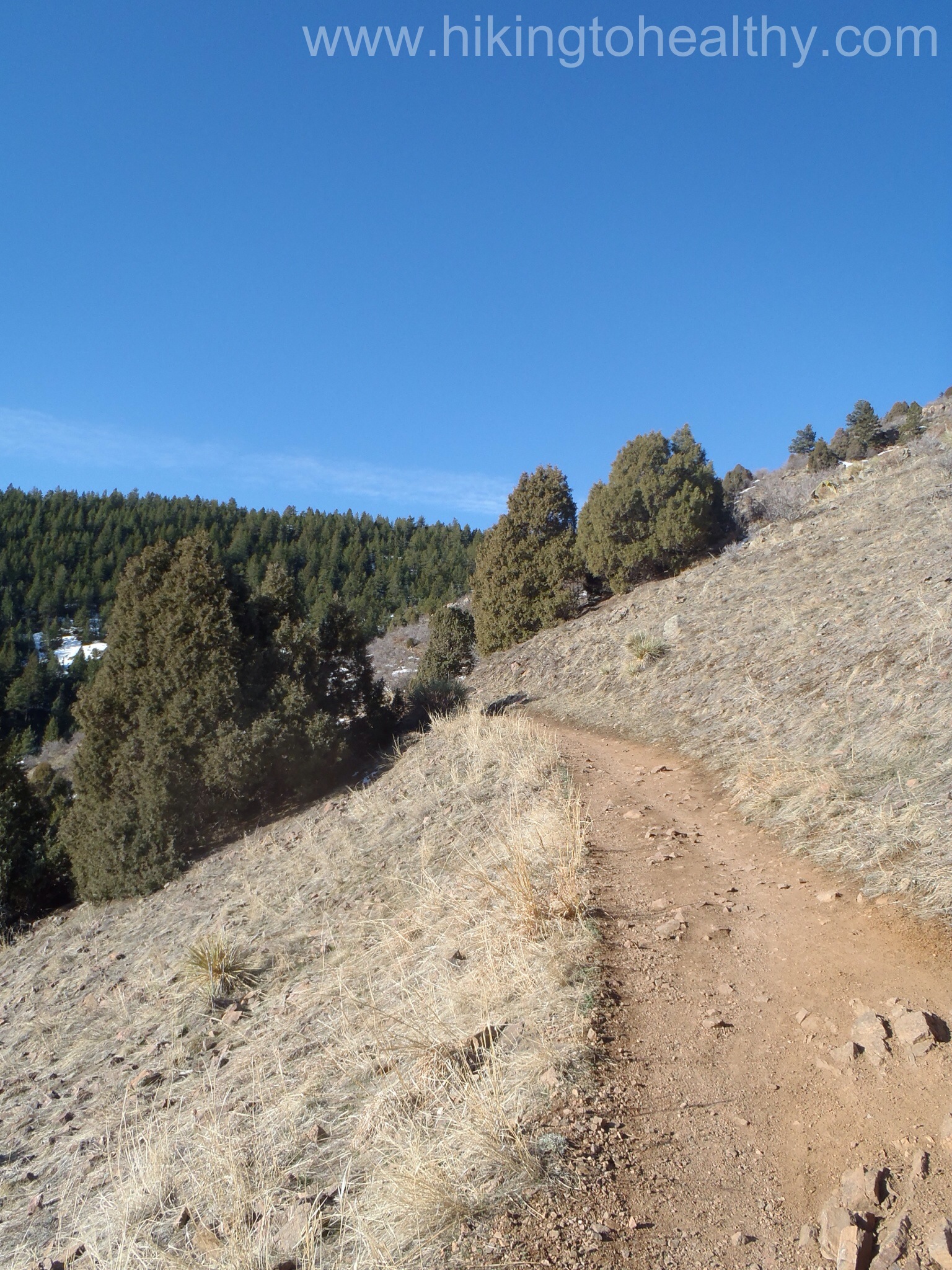
Turkey trot> Castle trail> Parmalee Trail>  Meadow Trail > Castle > Turkey Trot  : Officially 10.5 miles, my fitbit said 11.8 miles total it took us 4 &1/2 hours.  A total elevation gain of  2100 feet.

Castle trail
Castle trail

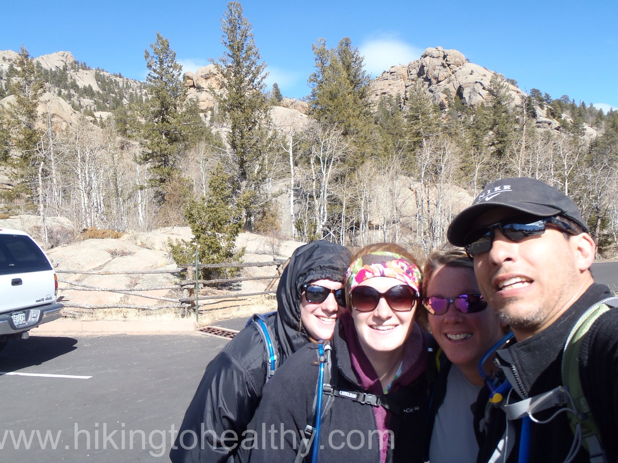
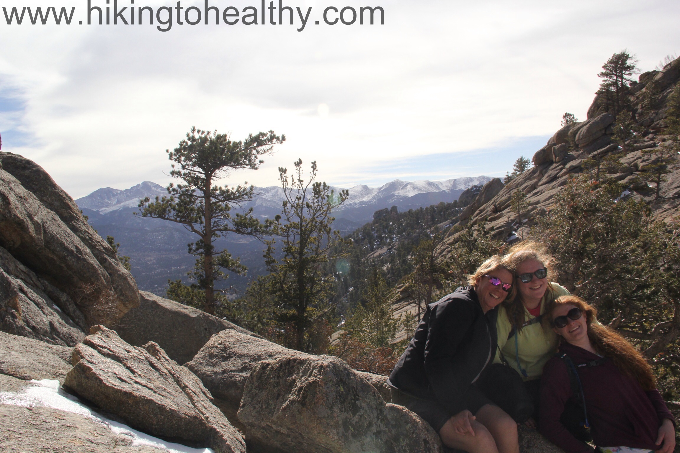
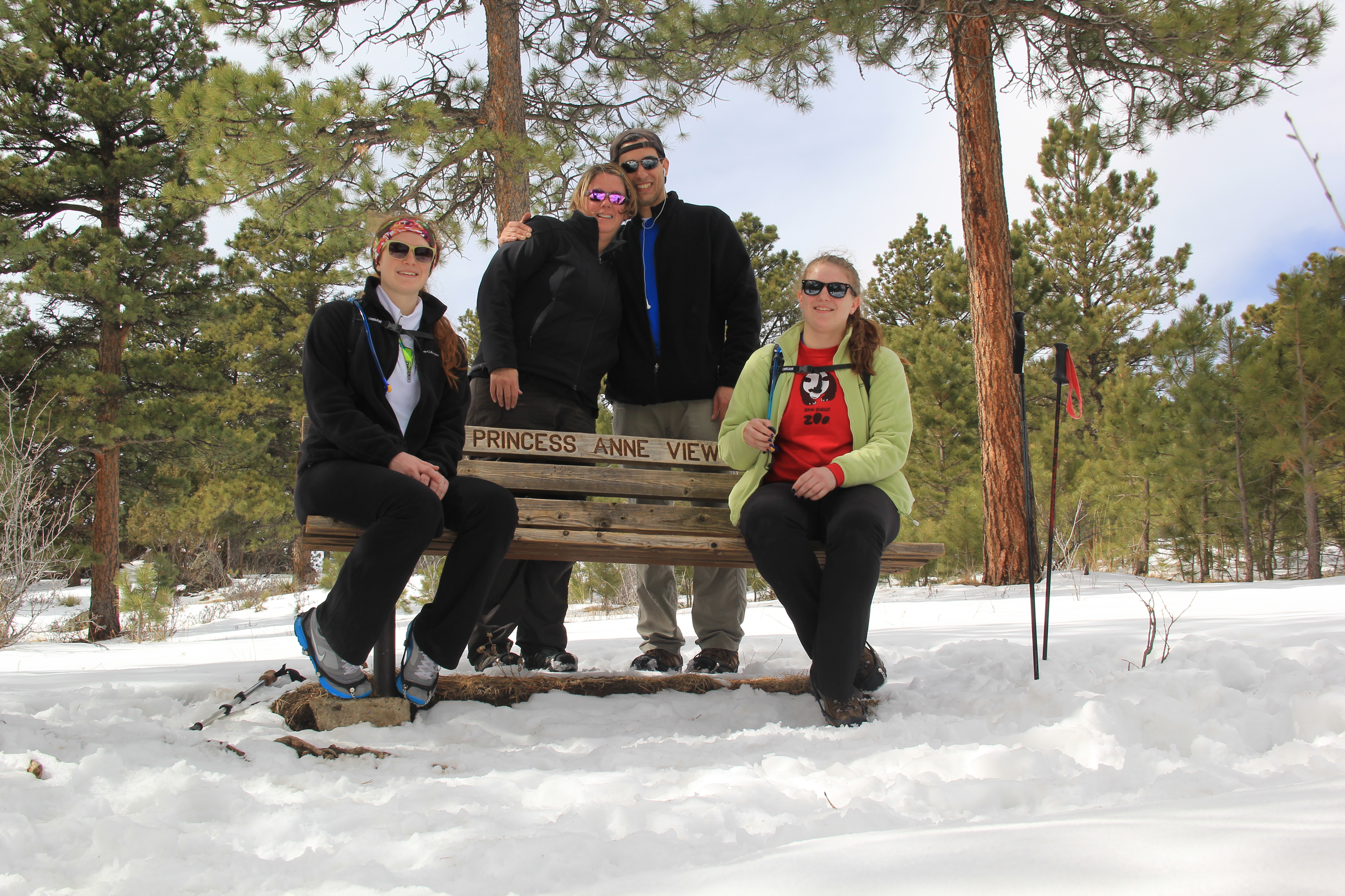
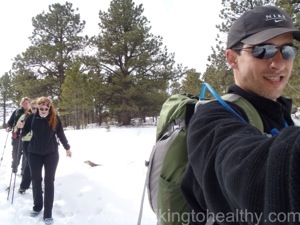
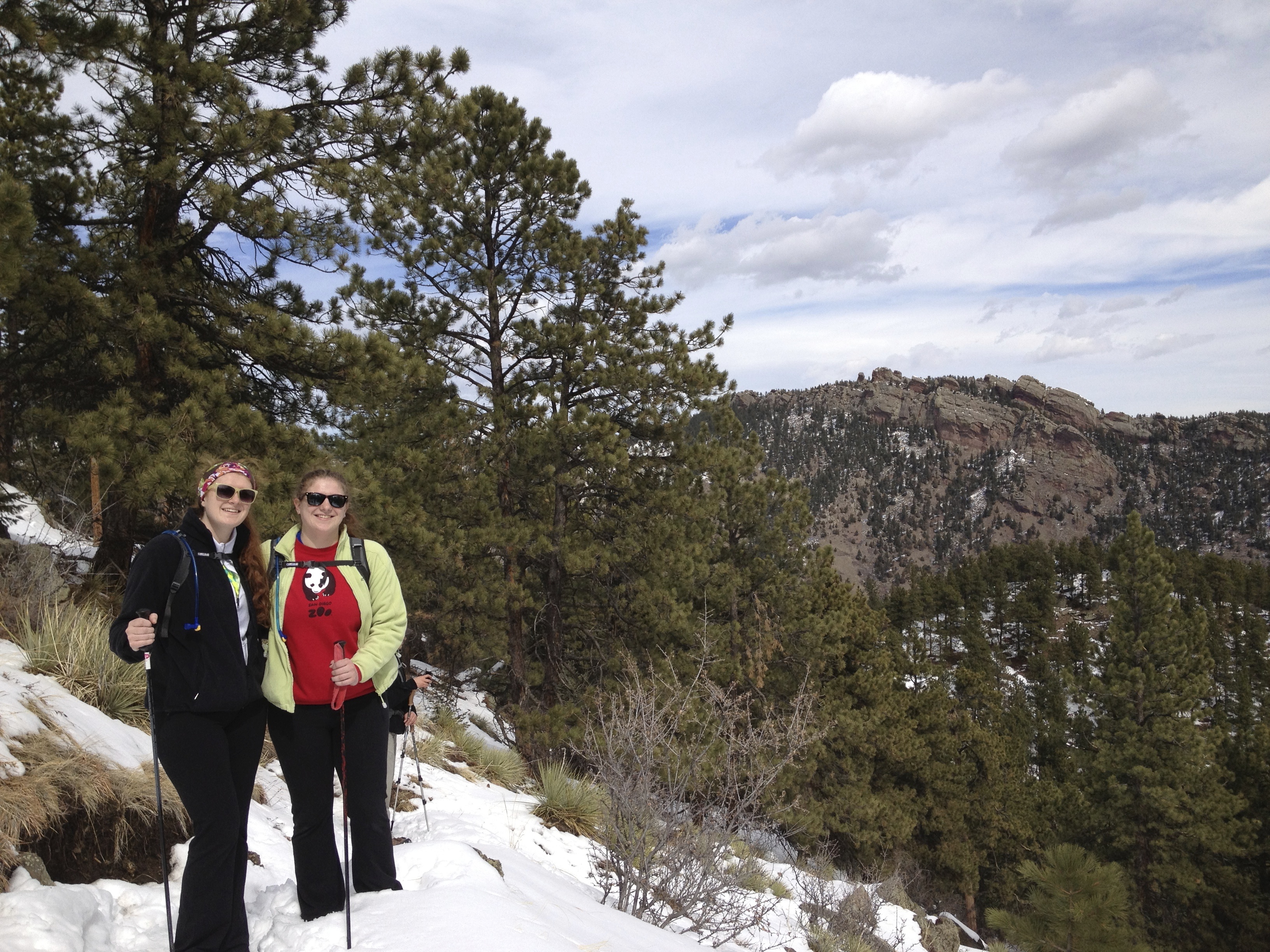
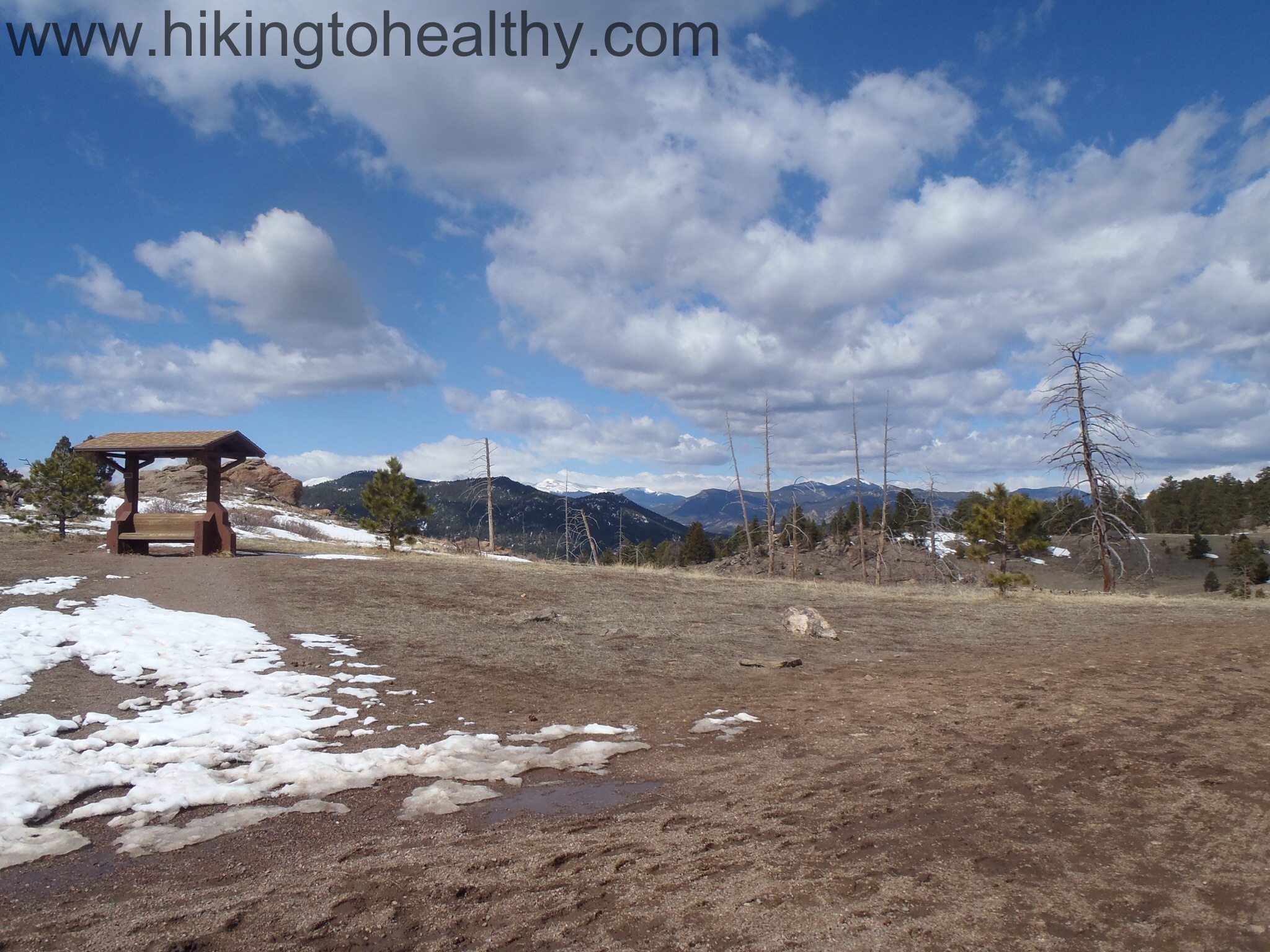
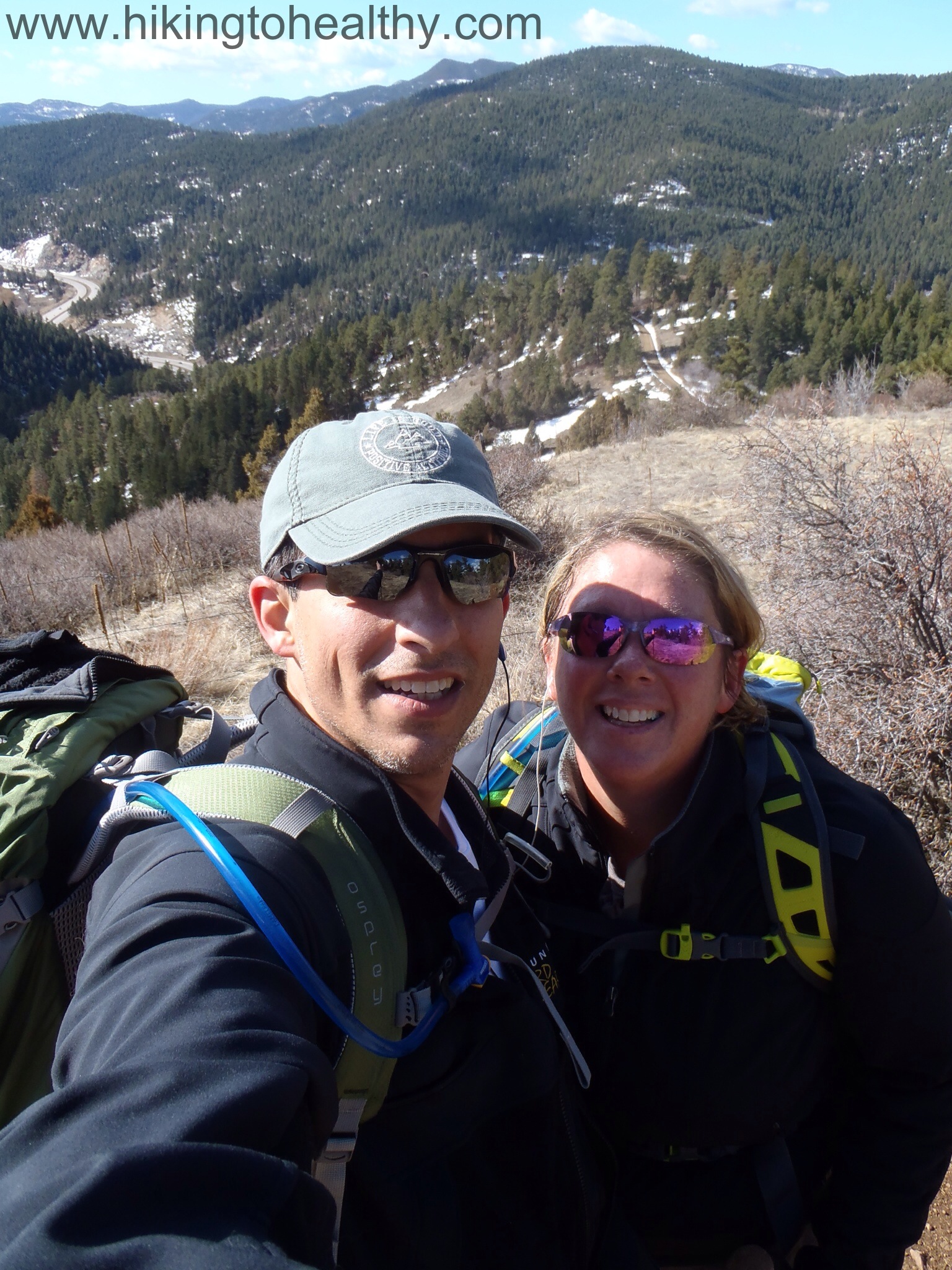
It was a little cold and windy at first, but before we knew it we were peeling off layers of clothes trying not to sweat through everything.  It didn’t take long for us to remember why we wanted to come back to this trail again, the views were beautiful again and the changing sky made them new when we passed them again later.  We were lucky enough to have these 3 ladies greet us as we got closer to the west parking lot, too bad for the runner that came by before I could snap the perfect picture but at least I got this one.

Deer
Deer

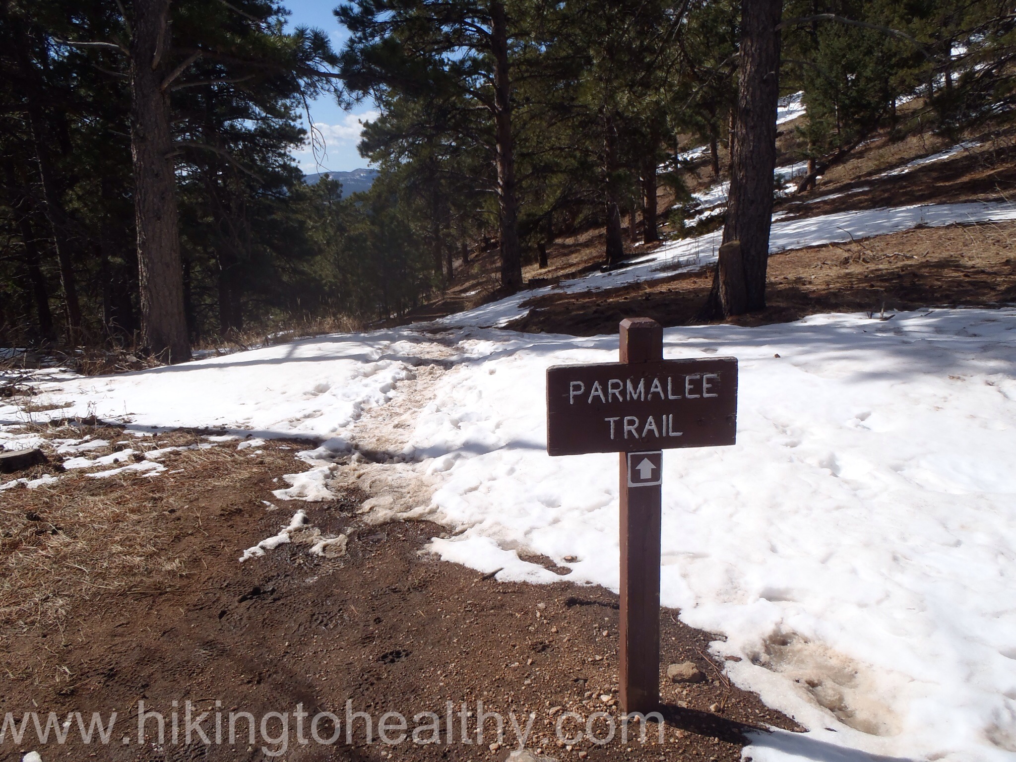
We have been here before, but that first time we were competing with a race so we kept dodging runners.  This time it was still pretty active but it was a nice mix of runners & hikers but nothing like the last time, it was such a nice hard workout with all the beauty!   Instead of going from the East parking lot to the west parking then back, we wanted to get more mileage so at the top we decided to take on the Parmalee Trail because it had a nice elevation decrease then regain and it was a loop that brought us back to the Castle trail.  It was a perfect add-on!

OLYMPUS DIGITAL CAMERAOLYMPUS DIGITAL CAMERAOLYMPUS DIGITAL CAMERA

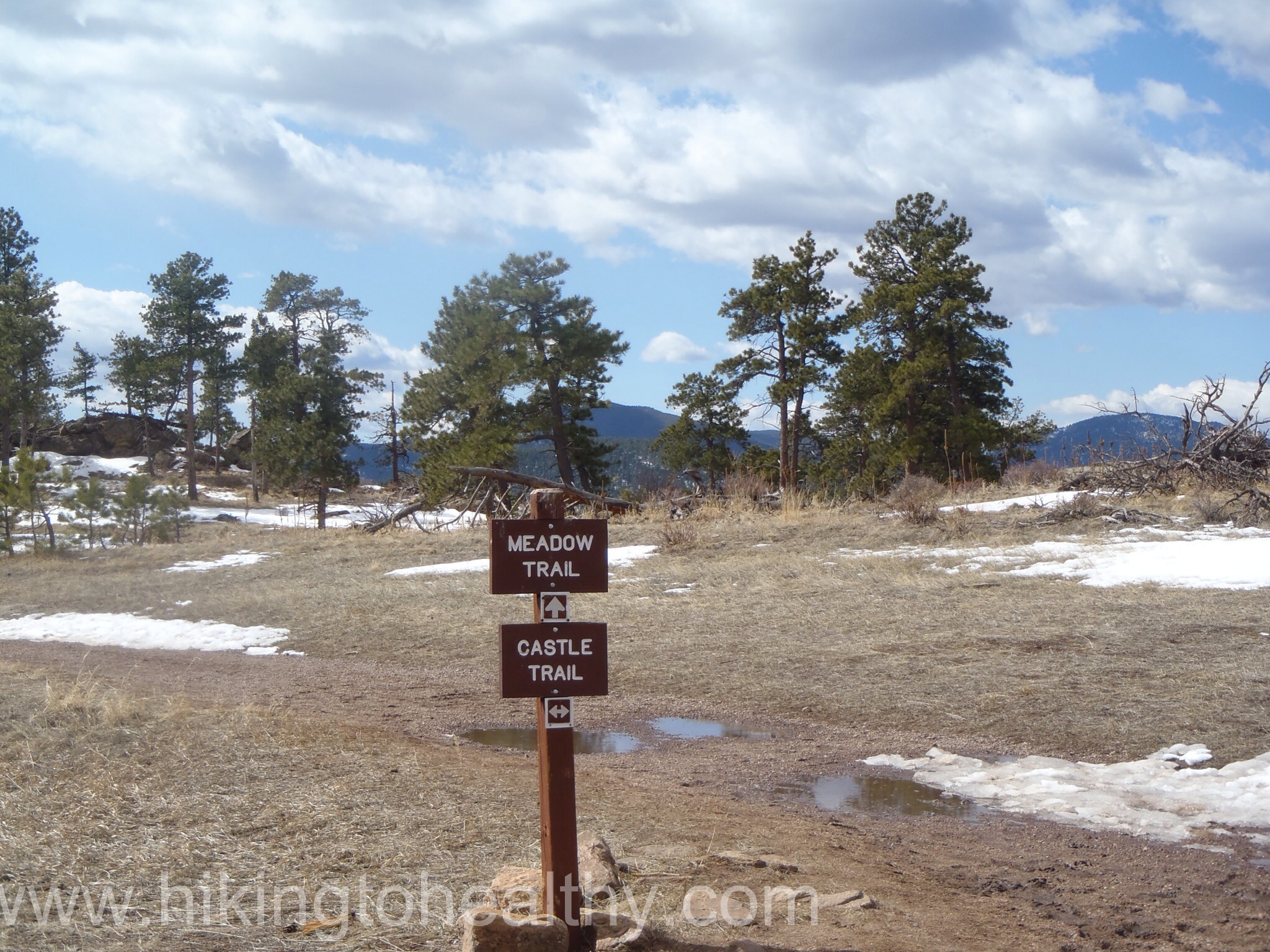
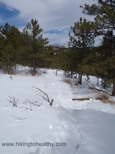
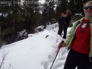
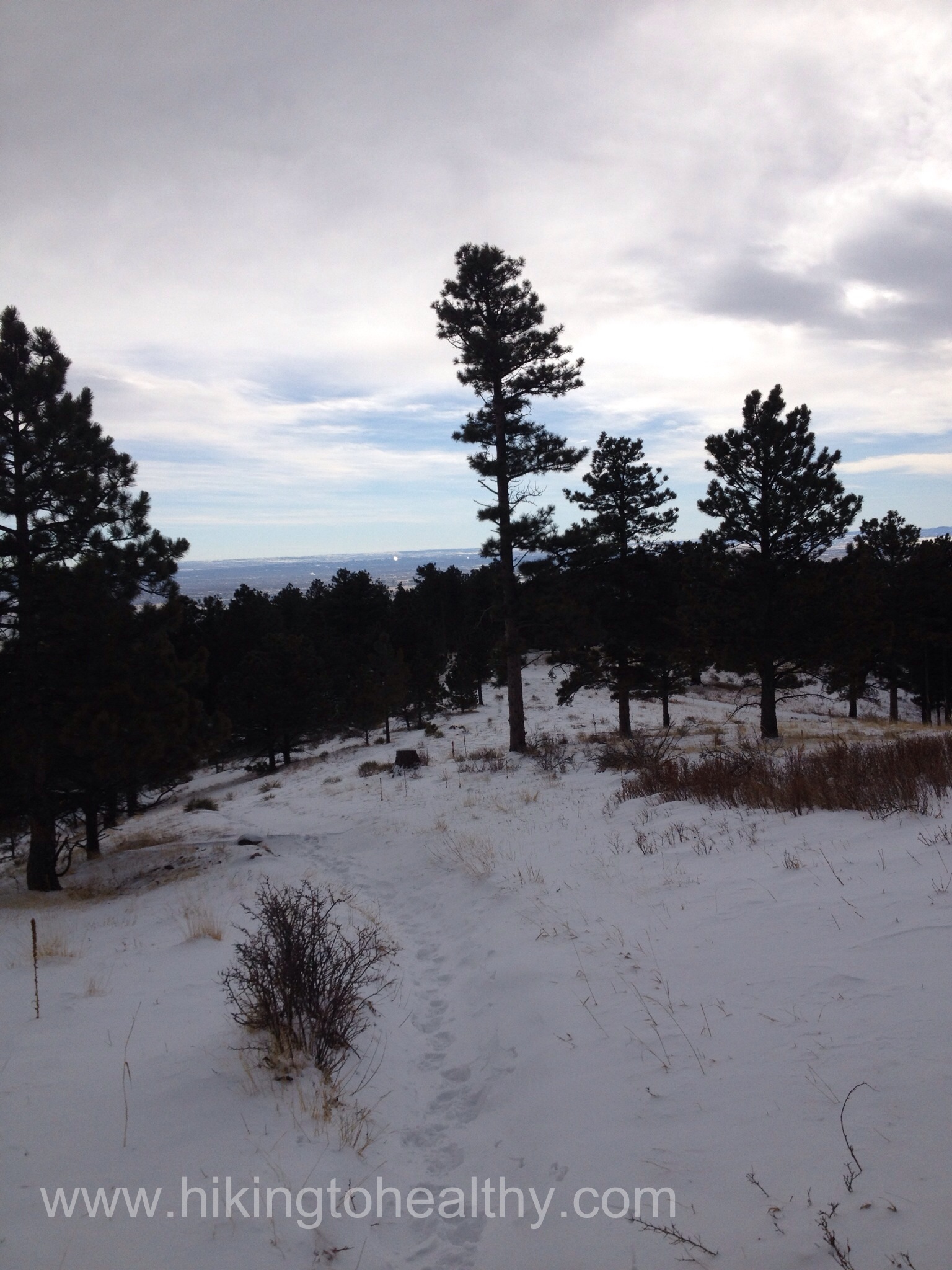
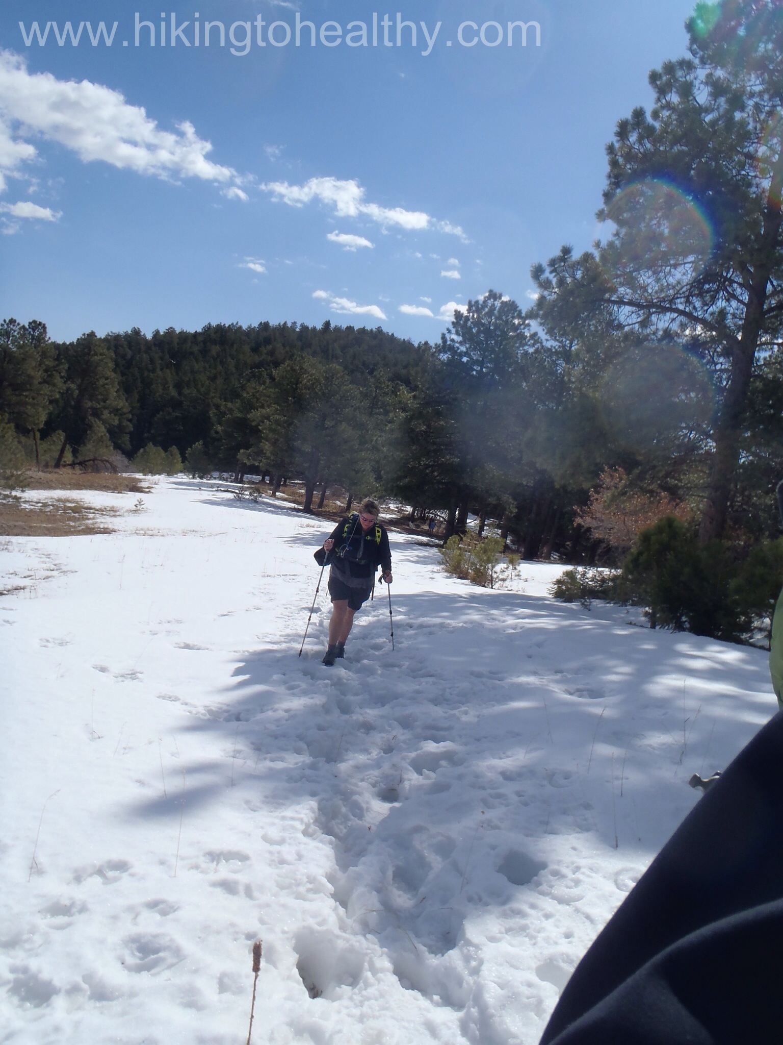
The Meadow Trail was actually the toughest part and not because it was hard but because it had a couple of feet of snow we had to walk on.  Since we had already taken the legs off  our pants it made for interesting half mile.

OLYMPUS DIGITAL CAMERAOLYMPUS DIGITAL CAMERA

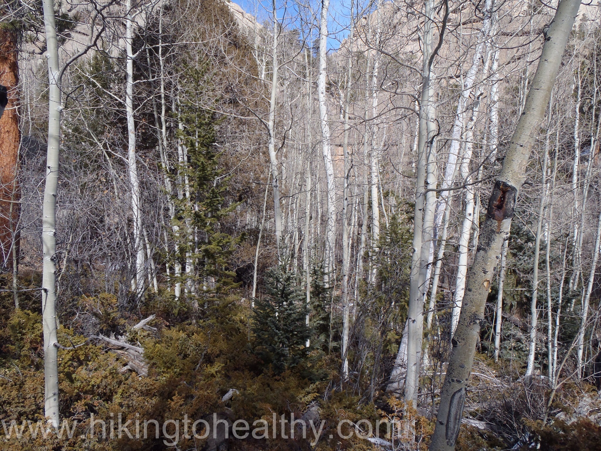
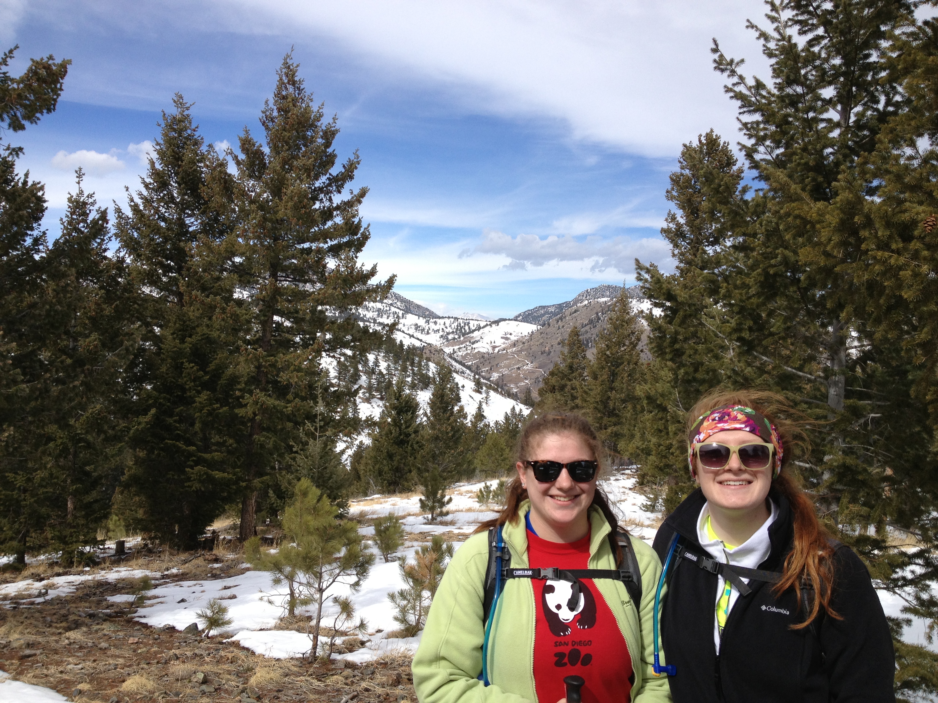
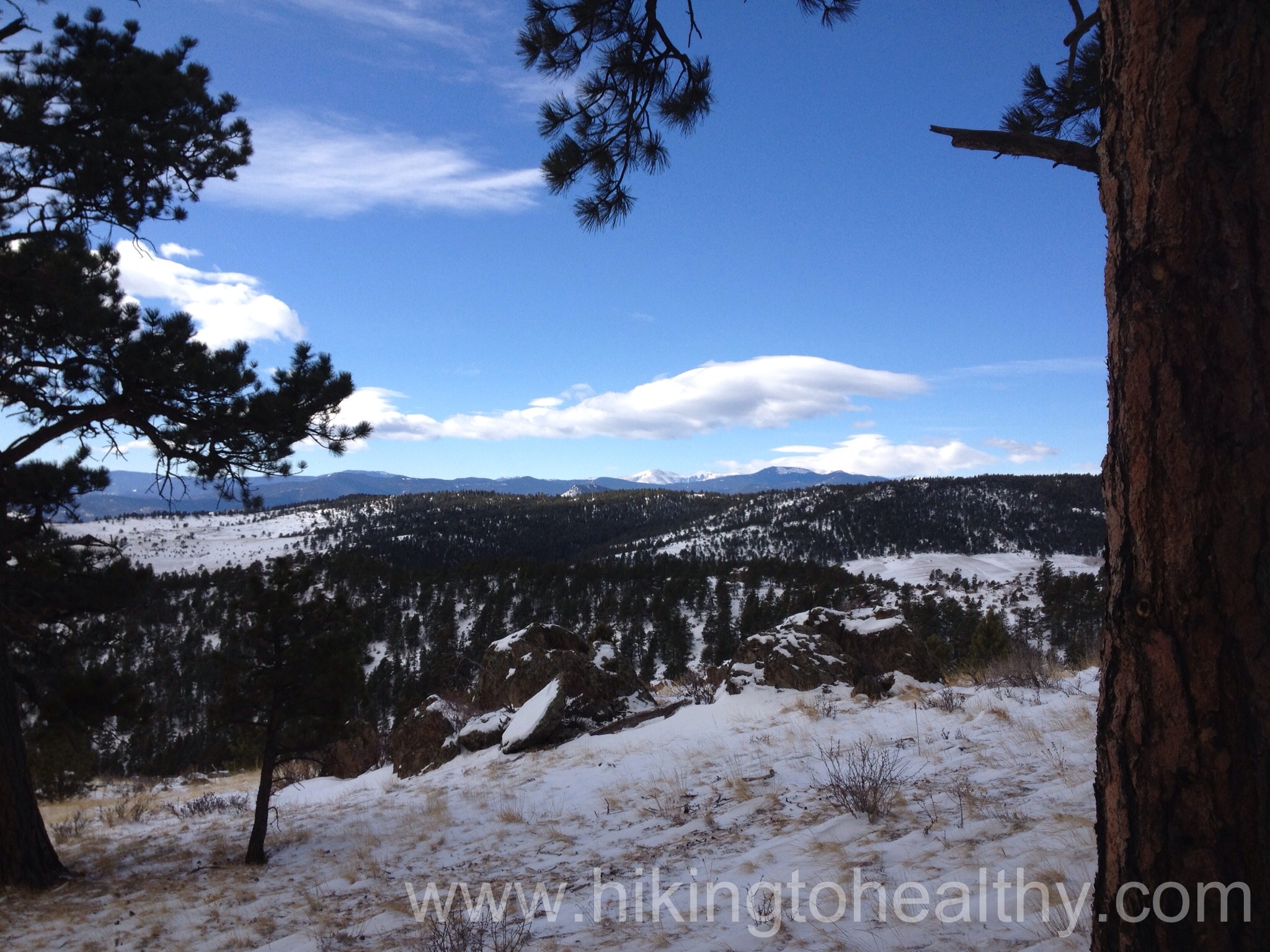
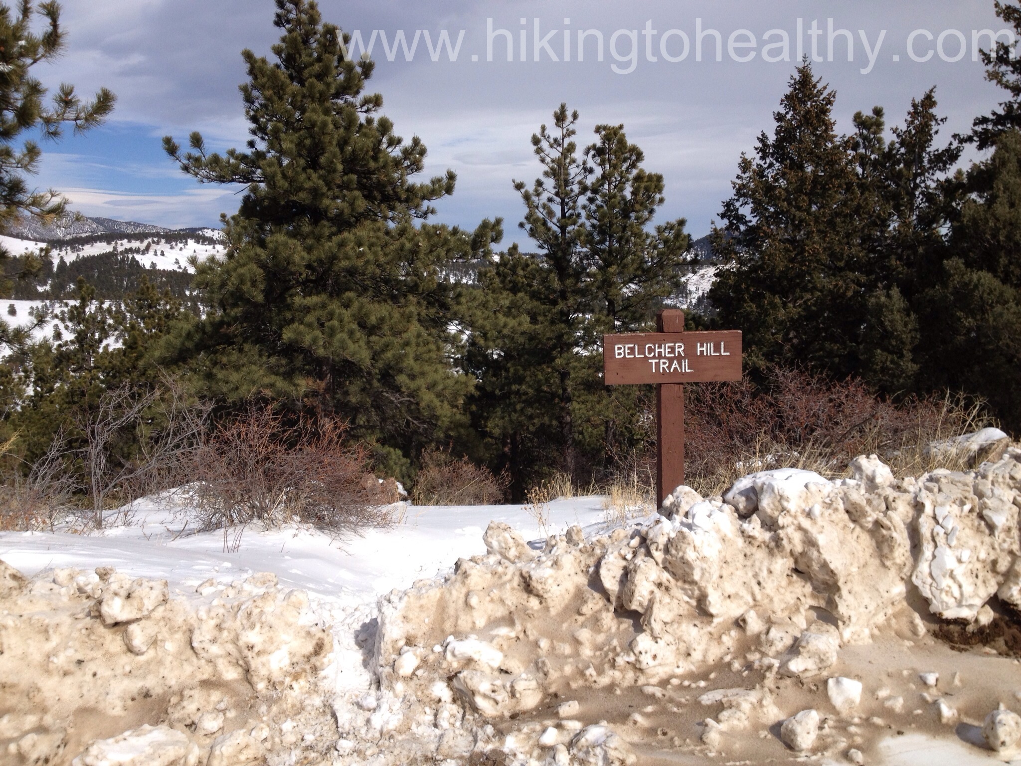
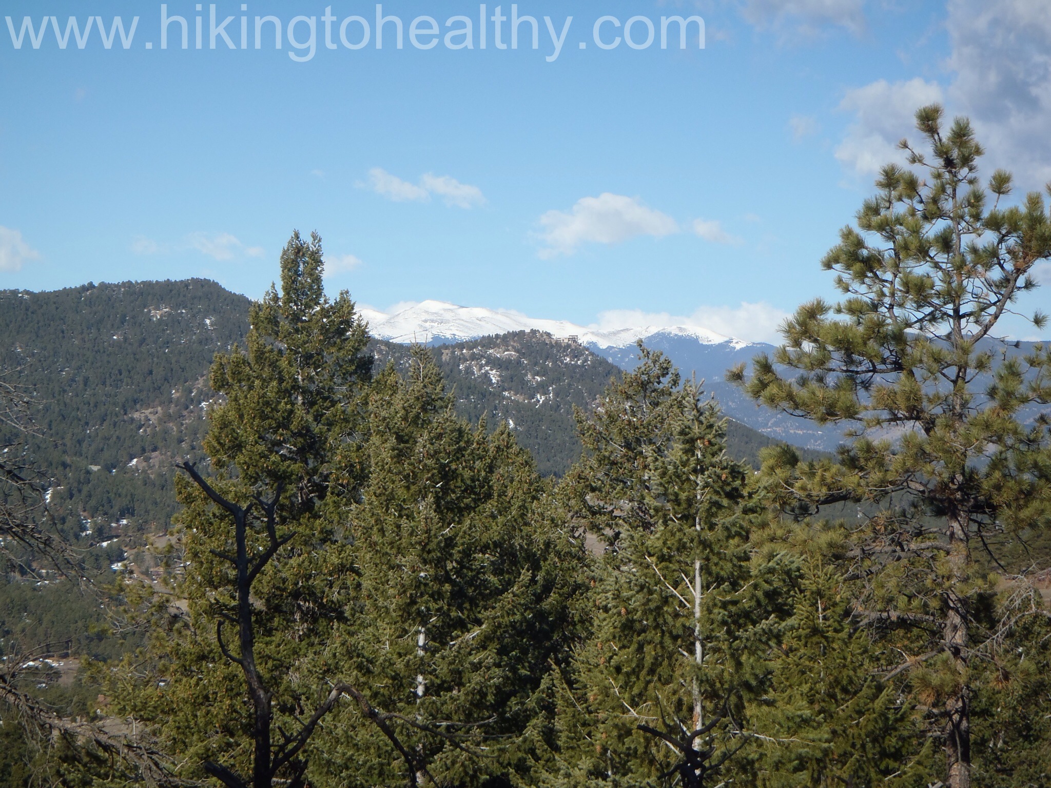
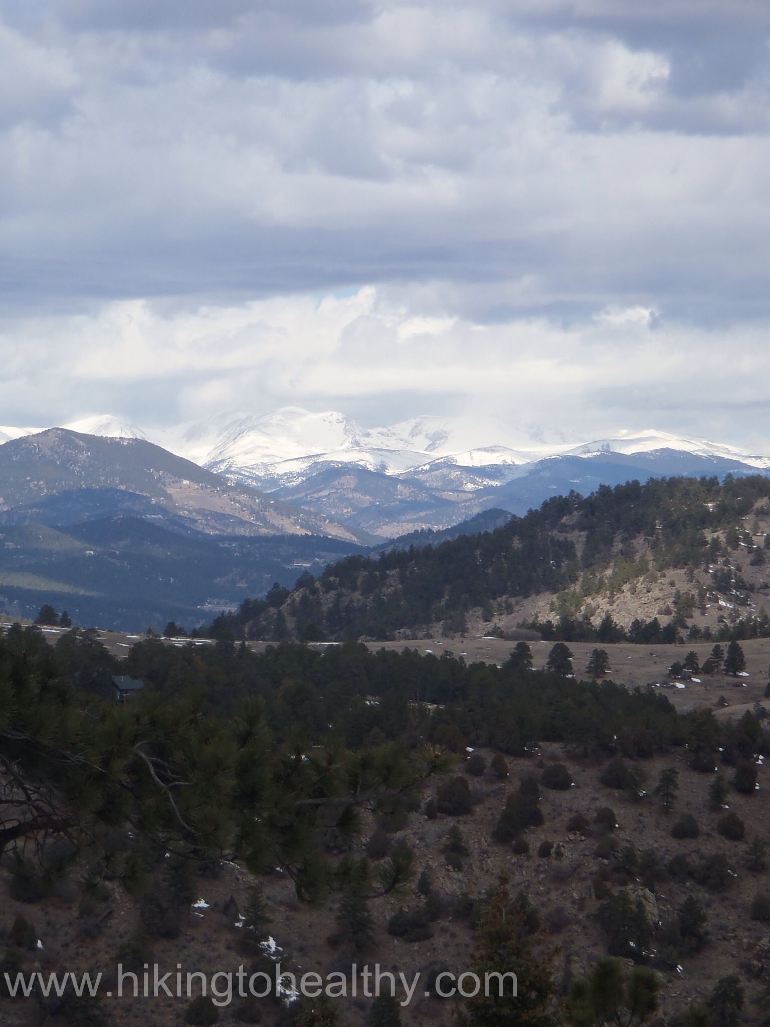
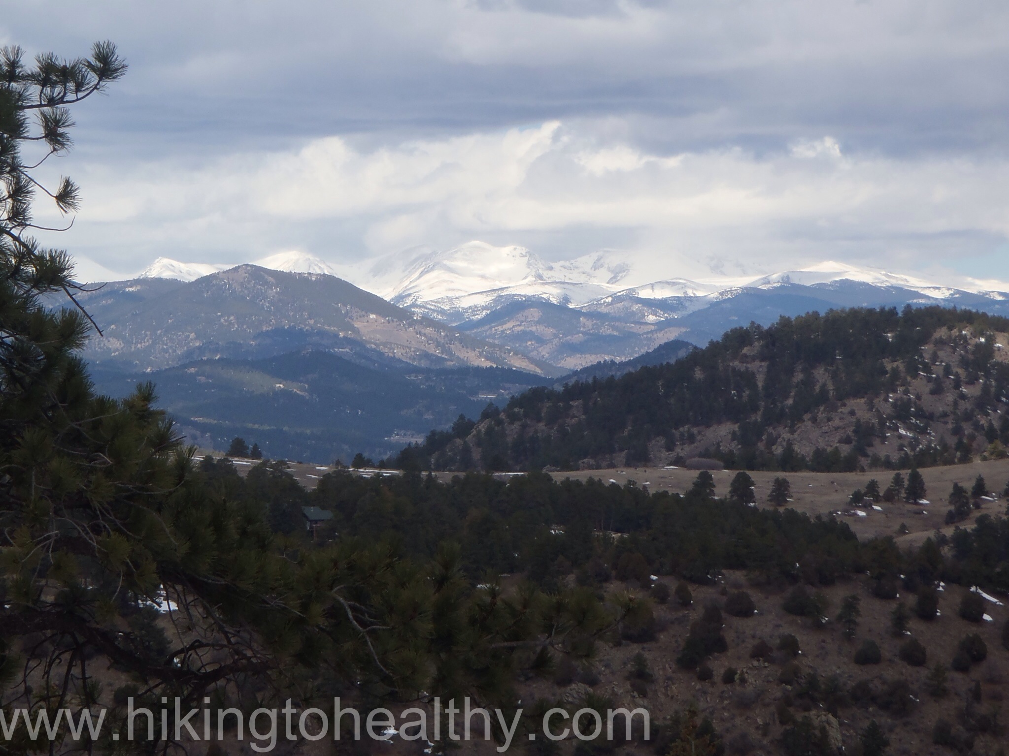
The Parmalee trail was really beautiful, mostly covered by trees and then it broke out of the trees with great views  of the surrounding mountains.

Trail conditions
Trail conditions

OLYMPUS DIGITAL CAMERAOLYMPUS DIGITAL CAMERAOLYMPUS DIGITAL CAMERA

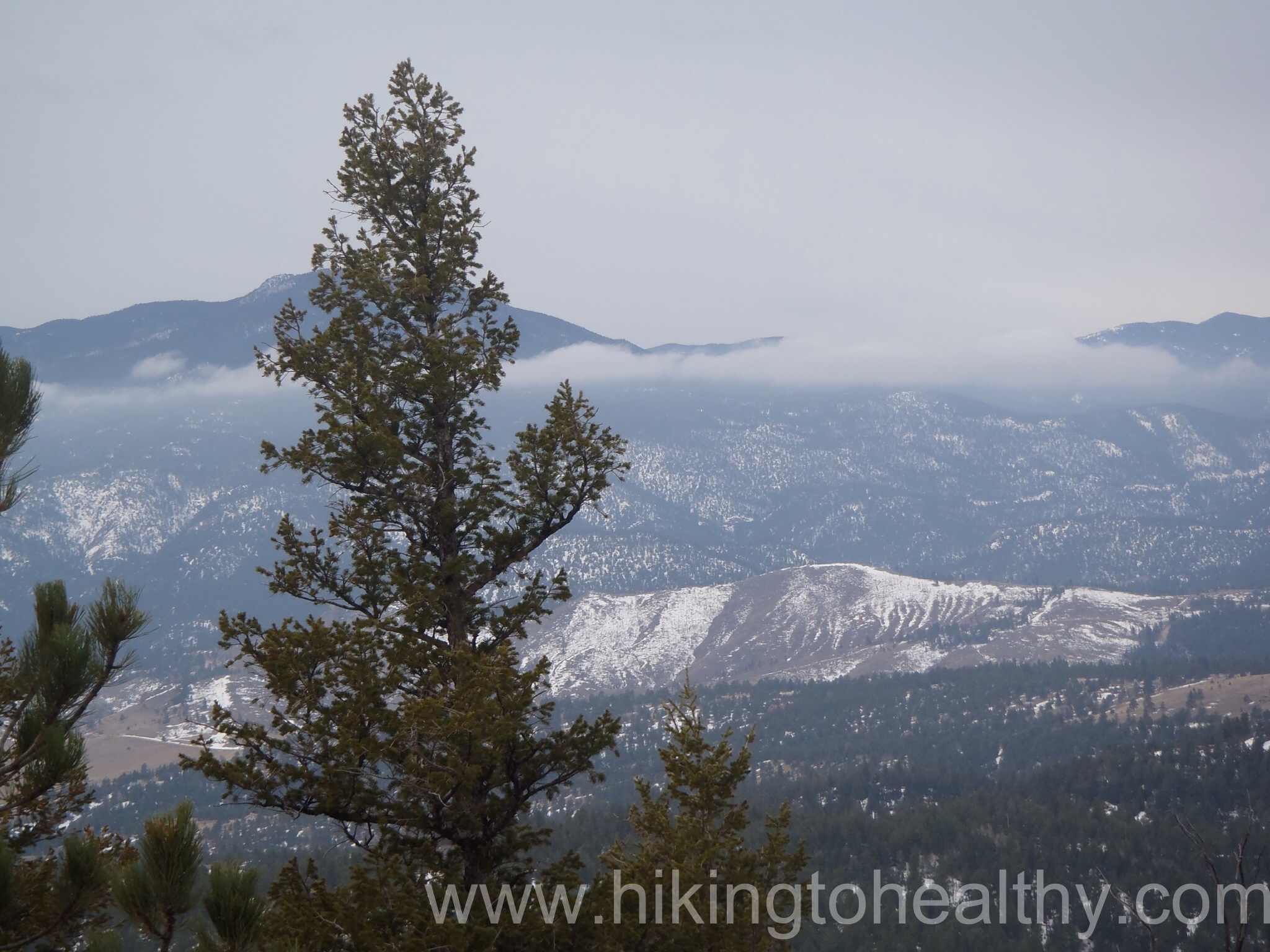
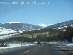
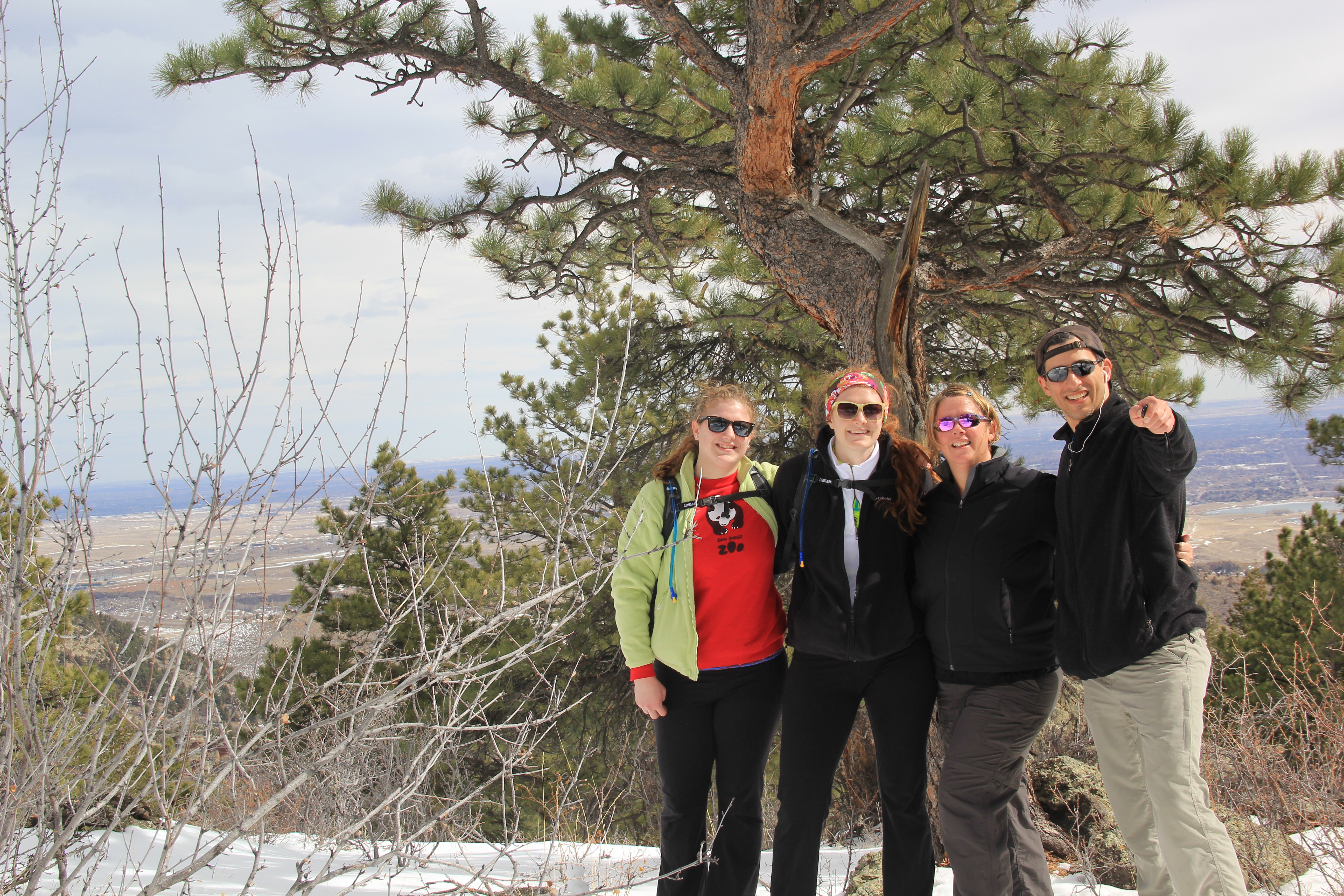
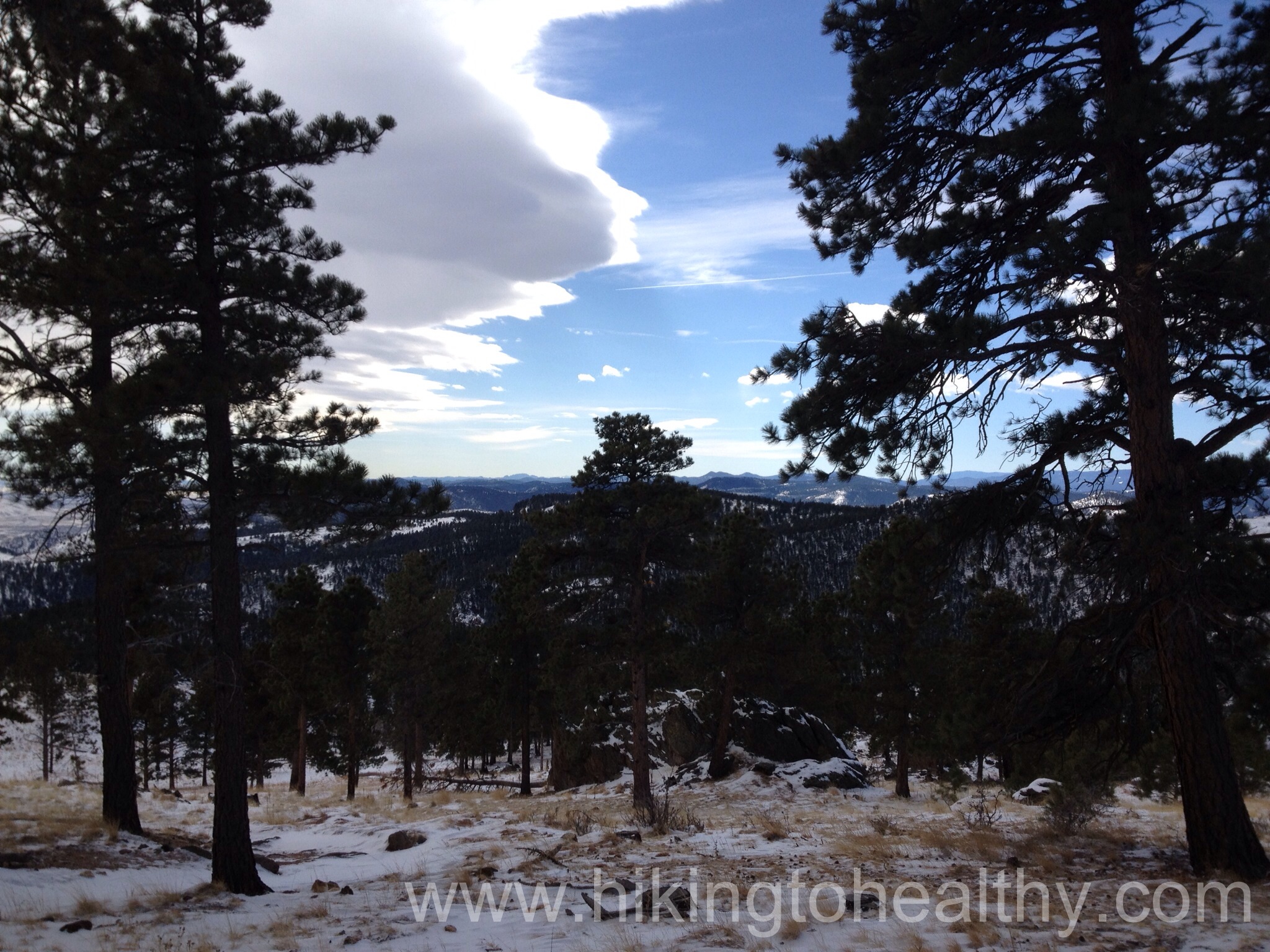
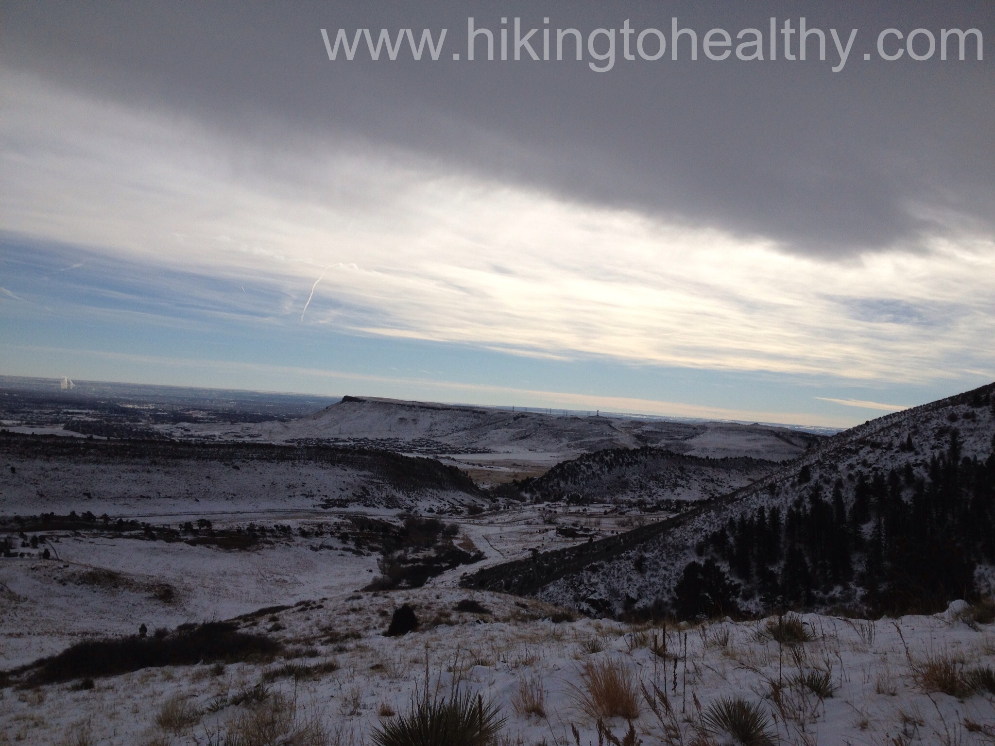
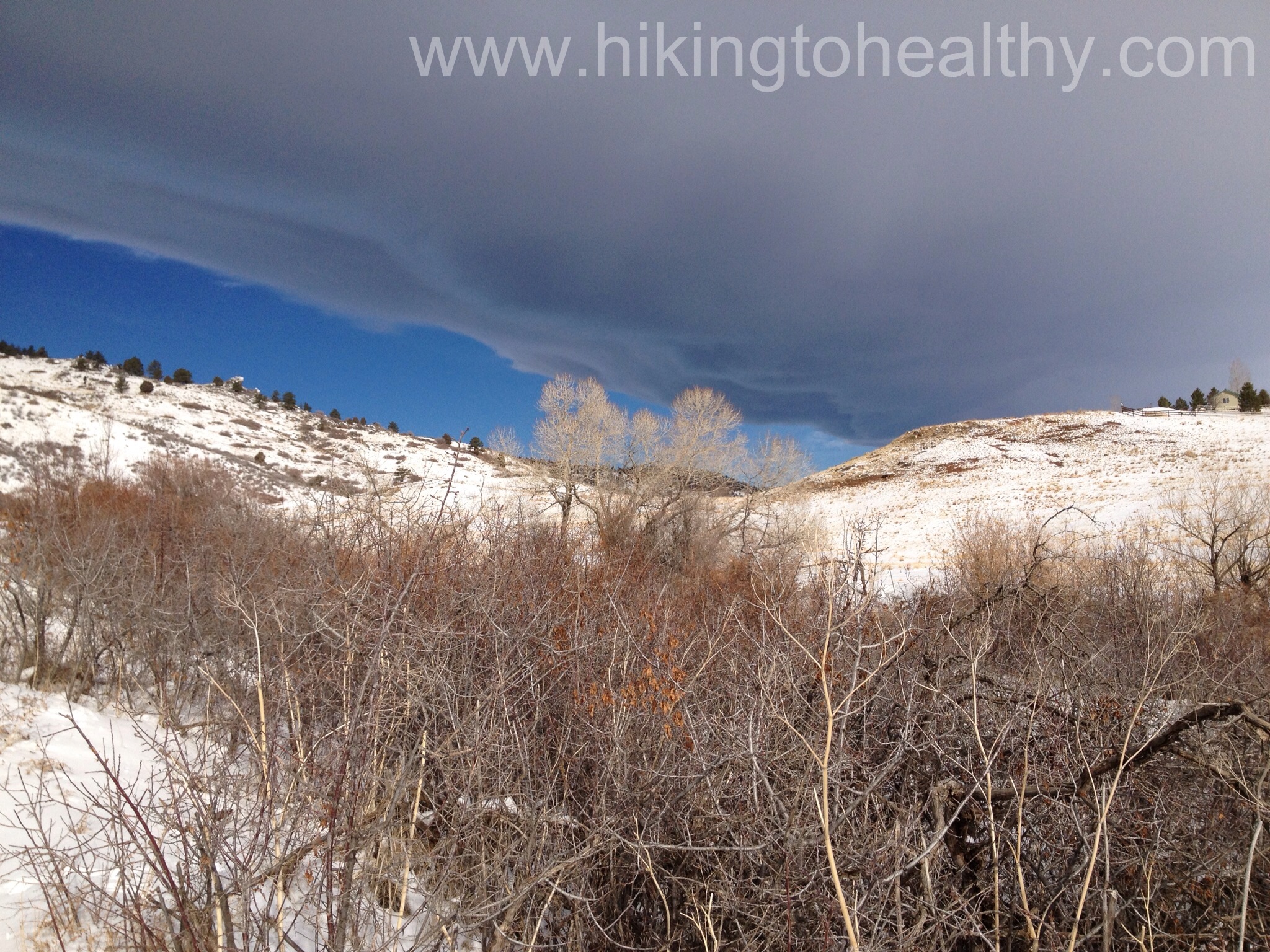
When we got back to the Castle Trail, a lot more clouds had started to roll in but man did it make the mountains look even better.

OLYMPUS DIGITAL CAMERAOLYMPUS DIGITAL CAMERA

As we headed back down the views of the ruins there also looked spectacular!!!  I don’t know what it was but everything just looked so good today.

OLYMPUS DIGITAL CAMERA

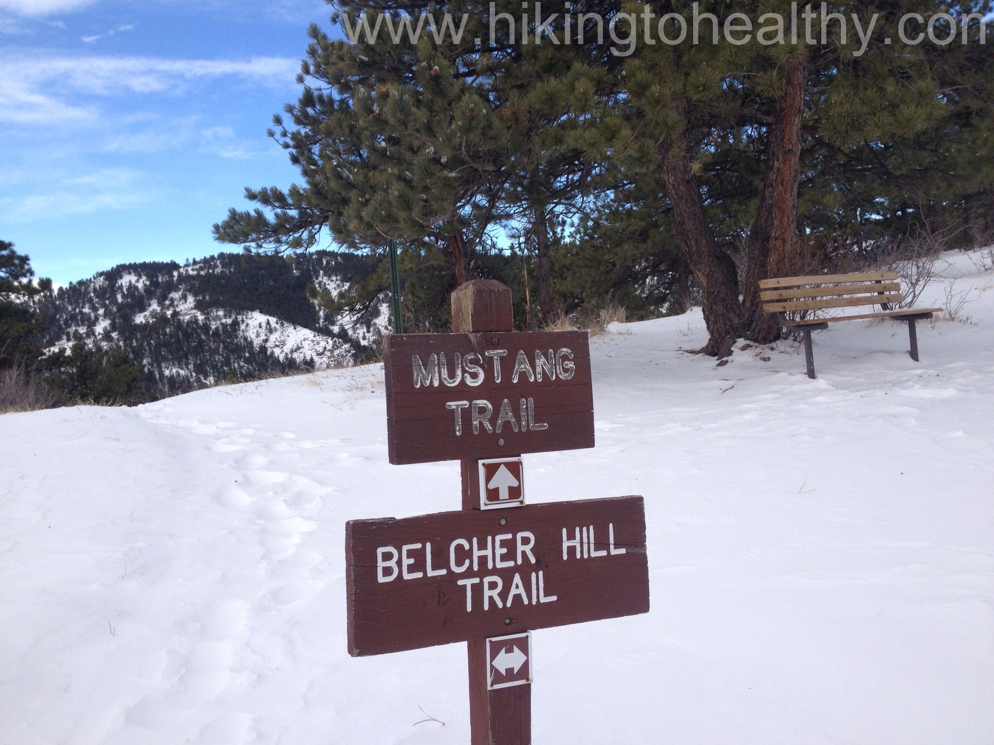
Oh and there was a new sign that I hadn’t seen before….I hope they start posting these everywhere because really going up is hard and those going down should give way even if they are jogging….

OLYMPUS DIGITAL CAMERA

Here are a couple of the amazing views we had:

OLYMPUS DIGITAL CAMERAOLYMPUS DIGITAL CAMERAOLYMPUS DIGITAL CAMERA

OLYMPUS DIGITAL CAMERA

This hike was wonderful, even more so then the first time we did it!  If you find  your way over to this park try any of these trails or all of them, they were all great on their own each with new and amazing views!

When we got home, one of our cats was very vocal about us coming home smelling terrible but still demanded he get picked up….

Serenity

Weigh in Day 3/29/13 -1lb, 49.6 lbs down 40.4 lbs to go

FINALLY!!!!! I am covering new ground this week and seeing a new number for the first time in like 7-8-ish years.  I cannot tell you how happy I was when I looked at the scale this morning and saw this new number it made my hard work this week extra worth it.

It was also a relief as all week I had been kinda down on myself for not making any real progress for the past 3+  months.  Not hiking this weekend really threw off my whole psyche in that suddenly it seemed really easy to give up if I didn’t see some progress.  But instead of just laying down and giving up, I fought my habit of throwing in the towel by getting in lots of extra exercise.  I got in my Elliptical every morning, my walks at lunch and then in the evening Aaron and I stuck with weights and a walk before dinner 3 of the 4 nights.  There was one day where I actually ended up moving 14 miles in a single day according to my fitbit, I was pretty impressed with myself on that day.  My legs are thanking me for the rest I am giving them today.

This week’s real battle was in my head though, the feeling of loss of drive and determination was almost more than I could handle.  We have been so good about getting out every weekend and hiking, then suddenly I could see us skipping more and more weekends and then what is the reason for any of it?  Let’s just give into the frito-lay demon on my shoulder begging me to buy more cheetos…..

In the end I didn’t give up or give in, I pushed through it all, threw myself one pity party and then moved on.

We are hiking tomorrow no matter what even if I have to drive to a trail head tonight and sleep in the car to make sure it happens, I cannot afford another week of “Why?”.  We aren’t supposed to have bad weather tomorrow maybe just some rain, but I think it is looking less and less likely.  We are doing a repeater hike even though I have 3 new hikes I am anxious to get out on, with all the snow last weekend and the slow warm up this week I don’t want to risk injury right now because a trail in transition.

Hope you all get out on a trail near you soon, it really helps change your perspective!

To hike or not to hike….. Snow Storm wins

20130323-114750.jpg


We had big plans last night for our hike today not that it was new one but that we were going to hammer out a lot of miles regardless of the “storm ” they were predicting….  For the past 4 weekends the “storms” that have hit on the weekend have been underwhelming or non-existent so we were pretty confident this weekend’s storm would be the same.  Not only was it not the same, it started sooner than they predicted and the scant 1 inch we might get by 6AM turned out to be a robust 4 inches at 5AM.  Oh and the Barometric pressure change was killer on Aaron’s blood sugar so we had little to no sleep all night dealing with the lows it brought along with it.  When the alarm went off at 5AM and I looked outside I crawled right into bed and sweet talked Aaron into not hiking, not that it took much.  When I got up at 8, I was surprised to hear that we had already received almost 8 inches of snow and are expecting still more before the storm is done, not to mention the wind.  Oh and it may start back up again tomorrow, if we weren’t so desperate for the moisture I would be more annoyed.

20130323-114201.jpg


After getting in an hour of elliptical I am now contemplating the huge drink I am about to make myself….. well maybe I will do a few flights of stairs before I start drinking….maybe

20130323-114225.jpg


I think Nugget is starting to judge my motivation.

While I figure out how to weather this storm ( sober or not) I am also looking at our hike for next weekend which is going to have to be a double butt killer since this weekend’s hike had to canceled.  Hope your weekend plans came through!

Weigh in Day 3/22/13 No change 48.6lbs down, 41.4lbs left to go

I just realized that I have not posted a weigh in lately….  well maybe I didn’t just realize it but I didn’t feel like lamenting about my yo-yoing again before now.

With my nieces here, we ate like crazy and then we cooked and baked like crazy, which meant more eating and not enough exercising.  We had an insane amount of fun though so I don’t regret anything we did or how we did it.  The next time they come we will do more hikes like they suggested so that it balances out better.   Either way, it took me 2 weeks to get back to where I was before they arrived.

The next couple of months  have no trips or visits in them(yet) just lots of hiking and exercising.  I am really optimistic that I will be breaking through my plateau soon.

I think we will be able to get our first 14er( mountain over 14000ft above sea level) done in July unless of course this crazy weather continues.  Which I am absolutely not complaining about because we need the moisture so desperately but this weekend again (like the 4th weekend in a row) they are saying a huge snow storm starting tonight and rolling into tomorrow which is our hiking day.  Since we will never be able to predict the weather on high hikes as accurately as we would like, we have decided we are still going to hike tomorrow.  It will just be close to home and on a sure long trail that will hopefully be less impacted by the weather then if we tried the hike I had originally planned.

Green Mountain Boulder- Repeat hike 3/16/13

view at the top on 3/16/13

We had so much fun with Lauren and Anne last week and with the benefit of a surprise blizzard, their stay was unexpectedly extended which meant another day of fun for us.  That also meant no hike for us last weekend…. It hit me this week that the summer is fast approaching and our hikes need to get tougher if we want to do our first 14er so I decided that we needed a really good workout.  What I really wanted was a good butt killer and figured this weekend was a good one to revisit Green Mountain in Boulder, I had some problems in posting this one so there are 2 links to the original hike, first the specs and then the details of our assessment.  The other reason I wanted to hit this one was that the weather was calling for rain on Saturday but it had been moved to the early afternoon from first thing in the morning and a tough workout as quickly as we could manage  was in order .

We woke up extra early to make sure the hike would be mostly done before the rain which meant we were the first car in the parking lot.  I have to be honest, I was little worried that the trail would be too much for us not to mention that we  are starting to really get into spring, my Chicago brain was thinking so will this be the hike we see a bear?

Oh and the other big thing about this hike, it is exactly 1 year after we started on this journey.  Which means I needed to show my inner eater/fat girl I knew how to keep it moving for a whole year and beat the hell out of it!

We got out on the trail and started climbing right away…on ice and after like 100 yards we thought “ok time for crampons” and I kid you not, we put them on and walked just around the corner to no ice… no ice at all for like ever.  Off came the crampons, we moved onto heavy breathing and the butt workout we needed.

OLYMPUS DIGITAL CAMERA

The view from the non icy part in the beginning

There was no ice until we reached the Ranger trail break, got passed by a jogger at the start of more ice  and while we slid on ice we  saw only ice in the distance.  For the second time we put on crampons, walked a 100 yards and no more ice….. although this time there was actually more ice visible not far  up ahead.  I am so glad we didn’t take them off this time because the ice really never ended the rest of way up.

All ice all the time

The interesting piece of climbing this part of the trail with all this ice and snow was that the it felt so much smaller than the first time we hiked it.  I was actually looking at the edge thinking hmmm I don’t remember it being so steep and I am comfortable with heights.  I didn’t even want to think about how Aaron was feeling who is actually uncomfortable with that part of hiking.

At the end of the day the hike was awesome again, because of the forecasted weather we had this hike almost to ourselves which was perfect mostly because I could breath heavy without fear of judgement by those insanely healthy people we saw the last time.

Here are our favorite pictures from the hike:

OLYMPUS DIGITAL CAMERAOLYMPUS DIGITAL CAMERA

OLYMPUS DIGITAL CAMERA

Us at the top....it was really cold at the summit
Us at the top….it was really cold at the summit
The front range looked especially beautiful from the summit

Gem Lake -Rocky Mountain National Park, Estes CO 3/6/13 ( Spring Break Hike #2)

Gem Lake
Gem Lake

Gem Lake Trail

Starting Elevation:  7882 Ft

Highest Elevation:  8830 Ft ( Total elevation gain 948 ft)

Trail Length:  According to the map it is 1.8 miles one way to the lake for a total of 3.6.  We did a lot of walking around taking pictures so in the end we had a little over 4 miles on my fitbit.   It took about 2 and half hours for our whole trip.

Trail uses:  Hiker only

Degree of Difficulty:  This one is hard for me to categorize, I would say overall Moderate but the elevation gain is a lot in a short distance and so some parts could be considered strenuous….

Bathrooms:  Yes, at the parking lot/trailhead and then there is a privy not too far below the lake itself.

Pets:  No dogs allowed.

Fees: None

Here we are at the parking lot ready to start the hike to Gem Lake

When I was looking at different hikes for when Lauren and Anne were here, I wanted something with great views.  Normally I would have taken them to a hike I had done before but at this particular time of year all those great view hikes were probably under quite a bit of snow.  I liked what I read about Gem Lake for different reasons, it was not too long with spectacular views of Long’s peak, Mt. Meeker, the Twin Sisters and the whole town of Estes Park down below along with a nice elevation gain.  The other bonus was that  we had tickets for the ghost hunt tour at the Stanley Hotel later that night so it gave us lots to do in Estes Park.  I have also been wanting to do this hike for a long time but since we have been focused in getting more stamina a hike under 4 miles kept getting knocked off for longer, harder hikes.  My final reason, evil genius plan to make my nieces fall in love with Colorado….

Informational signNo

Lets talk trail, this is a short trail that climbs quickly but has some very well placed straights to catch your breath on with stunning views to admire.  From the parking lot you want to go to the vault toilet and take the path to the right of it, this is the Gem Lake trail it is very easy to follow and is straight in and straight out.   At points there were some stairs to help with the climbing but the path itself is pretty easy.  It actually runs through and along Lumpy Ridge and the rock formations were really neat.

Gem Lake trailheadTrail 1

The best part is that the trail is done in such away that you are always moving towards the next great view and the trail is so easy to follow.  We were lucky to have a pretty nice day, we started out a little chilly but quickly stripped off layers as we went up.

Trail 2A L K at view

One of the things I super love about Colorado is about how beautifully blue the skies get and the day we did this hike they were extra pretty.   After the above picture we climbed at a little steeper pace for just a little longer before it leveled out to where we started entering an aspen grove and some beautiful pine.  But before that grove we came around to the Paul Bunyans Boot, seriously check this out:

The trail as it leveled out and before the boot
Paul Bunyans Boot
Paul Bunyans Boot and Lauren

After this is a great Aspen Grove that my nieces thought looked like it should be in a museum as a perfect depiction of an alpine aspen grove and I had to agree.

OLYMPUS DIGITAL CAMERA

From here it is not far to the lake and the last climb.  The steps could get challenging as there was some with long distances from one step to the next so I think this is where other hikers have decided to classify this as a harder hike but if you take your time getting through it is no problem.  Also there is a privy up here.  Privy’s are so interesting and I encountered one when we hiked Chasm Lake I just want to giggle every time I have to use one because there is barely enough coverage to get your business done.  At least this one was kinda down and behind a huge boulder so you could sort of get off the trail and out of view.  The last stretch of trail was a little in the shade and so snowy but not hard to get up or down at all.

Trail conditions to the lake

From here it is an easy scramble to the lake, which was frozen when we got there but still beautiful and the views around were amazing.

Gem Lake
Gem Lake

OLYMPUS DIGITAL CAMERA

We took a bunch of pictures, pretended to be yeti’s waiting to be spotted laughed a ridiculous amount and then headed back down.  I have to admit hiking with my nieces was so much fun, today’s hike ( post coming) was a little subdued  because we didn’t have their company!  We are already counting down the days until their next visit so we can show them more of beautiful Colorado.  After the directions on how to get to the trail I will put some of our favorite pictures.

Directions: 

This trailhead was relocated to the northwest of the old trailhead, and the parking lot expanded.  The turn-off to the new trailhead is approximately 1/4 mile west of the old Gem Lake Trailhead, on Lumpy Ridge Rd.

From Estes Park, take the US Hwy 34 bypass (the road that goes by the Stanley Hotel). Just west of the Stanley, turn right (north) onto MacGregor Avenue (CR 43). The road makes a hard right at the entrance to MacGregor Ranch, after which it is known as the Devils Gulch Rd. Veer right, and proceed about 3/4 miles to Lumpy Ridge Rd. Turn left onto Lumpy Ridge Rd. The Lumpy Ridge Trailhead and parking area at the end of the road.

OLYMPUS DIGITAL CAMERAOLYMPUS DIGITAL CAMERAFav 1

fav 3

Fun with perspective and Lauren

Spring Break: Breckenridge Adventures 3/3/13 – 3/5/13

The view Monday morning at Breakfast

We went right from our hike at White Ranch Park to Breckenridge for 2 nights. The weather we had been planning on completely changed between Saturday night and Sunday morning. Instead of no snow with sunny bluebird skies, a huge snow storm was moving in for Sunday afternoon and supposed to go until Monday morning. I don’t know if you have ever experienced driving west on I70 past the Eisenhower Tunnel during a snow storm but I consider it a white knuckler as you head down a 6-8%grade decline on a typically icy road, and no I don’t have 4 wheel drive which is so stupid living here hiking like we do. I started working up my nerves at the back end of the hike as I was watching those clouds churn off to the west of us. Fortunately mother nature was on our side, the first snow flake didn’t hit until we were almost down that steep grade decline and the car was safely parked in the garage before any real snow hit. We didn’t move it again until we left Tuesday morning which was beautifully sunny so there was no ice on the return trip either, yay me!

This is how we spent Monday morning hoping we would be able to get to keystone for tubing

Anyway, we had planned on doing tubing at Keystone on Monday with the snow coaster in Breckenridge as a follow-up. After 9 inches of snow falling they actually closed the interstate and the one road between Breckenridge and Keystone, so we had to regroup. I was able to delay our tubing reservation by 2 hours but then that meant no snow coaster for us, we took advantage of all the free transportation in Summit County. There was a free gondola ride from our condo to the bus station just off of Main street in Breckenridge and then we hopped a free bus to Keystone. The tubing was actually at the top of the mountain and so we had to ride up that Gondola too, but the snow had picked up again and we didn’t have much of a view.

The Tubing tracks at Keystone
A little closer
A little closer

As we walked up to the Yurt for tubing we were pretty excited, the tracks they had set up for tubing were awesome, then they had a people mover to get you back up from the bottom. We could go alone, in groups of 2, 3 or all 4 of us which we did a lot of. I think we got in 10-14 runs and we laughed and screamed the whole time. It was so fast the snow looked like moving to warp speed in Star Trek ( as observed by Anne). There were Keystone workers at the top making sure the track was clear and then they asked if you wanted to go straight or spin and spinning was freaky but AWESOME!!!! The hour went too fast and at first I thought oh man I have to get us another hour, but at the end we were all ready to be done and so we began the journey back to Breckenridge.

Anne and Lauren spinning together
Action shot of Lauren and the 4 of us tubing together
Action shot of Anne and the 4 of us tubing together
Lauren with the white snow fog as we sped up

We ate and hot tubbed the night away as everyone should do when in Breckenridge, then headed back home on Tuesday for our next adventures….

20130315-110340.jpg

Spring Break Hike #1- White Ranch Park – Rawhide Trail 3/3/13

20130313-135934.jpg

My nieces arrived early on Saturday for our spring break extravaganza, they are both in college and decided it sounded fun to hang out with me and Aaron for a whole week. I have to admit I had been planning our week for the past 4 months and was so excited to finally get started.

Our first hike was an easy pick and a must do as my niece Anne was going to be here, so we had to do the White Ranch Park Rawhide trail so that we could get pictures at the Princess Anne View bench with her.  The details of the hike are here as I did it with their mother when she visited in October.

Princess Anne View Bench

When Aaron and I were out here the week before doing Belcher Hill there was a lot of snow on our trail but the West parking lot didn’t look too bad. Unfortunately we got hit with a snow storm that week between the and their arrival,  even though the weather was nice most of the week the snow was still pretty deep and then wet, followed by heavy and wet. Typically this trail is a cake walk and my nieces were more than up to the challenge of a snow covered walk, as it turns out I was not! We all strapped on yaktrax/crampons shortly into the hike and were moving pretty good, about halfway through I started working on an epic blister on my right heel and by the last mile every step was incredibly painful. I even tried taking my crampons off to see if it would help with the discomfort but no luck. I was so bummed, I kept telling them to go on ahead and I would catch up there was just nothing I could do at that point. I am not sure how it happened, I haven’t taken a break from hiking or exercising, my shoes were not new or old and I was wearing my usual socks so I am chalking it up to heavy,wet, deep snow.

Start of the trailAfter Princess Anne View bench

In the end it took us a solid 3 hours to finish the hike, mostly because of how slow I was going but also because we took a ton of pictures. As I shuffled up to the car I made Aaron find my flip-flops meant for our hot-tubbing in Breckenridge so I could actually drive to and walk around post hike.

It was so much fun hiking with Lauren and Anne, I was so glad they liked the hike and didn’t mind the snow factor at all. Not even when Anne had to switch out soaked socks for dry ones halfway through only to have those new ones get soaked pretty quickly. My evil genius plan of wooing them to want to live here too is slowly starting to work I think….

across from benchAnne and lauren at viewGood View


Weigh in Day 3/1/13 -1.6 lbs, 48.6 lbs down – 41.4 lbs to go

It was a good week, our hike was really awesome last weekend and then we got a good blizzard on Sunday, which forced us to focus on getting the house clean for our guests this next week.   I got in a ton of exercise including 2 weight lifting sessions while cleaning each night post work out.  It was actually a great way to avoid boredom eating, which is a huge problem for me!

This next week is going to be tricky for me, my nieces are coming to visit for their spring break and we have a ton of activities planned.  They land tomorrow afternoon so Aaron and I are going to make the most of morning and get in a quick but tough hike close to home.  We are taking them on hikes for sure on Sunday and Wednesday, maybe even one on Tuesday or Friday if we can squeeze it in.

What is kinda cool about this visit is two- fold; first I am super honored that my nieces want to spend their spring break from college with me!  Second, it was Anne’s visit exactly a year ago that got my butt in motion to start this journey and helped Aaron and I set the goals we have today.  It was what drove me to get to know my state better and start doing the things I moved here to do!  It will be nice to show Anne and Lauren  all our favorite parts of Colorado so far and my, how it has expanded in the past year!

With the fact we will have guest hikers in town for a whole week, my hiking posts for their visit probably won’t make an appearance until next weekend or a little later.  Mine and Aaron hikes are going to be repeaters just to keep us moving the next 2 weekends as their only purpose.

Have a great week everyone!!!!

Belcher Hill Trail – White Ranch Park, Golden CO 2/23/13

Belcher Hill Trail - White ranch park
Belcher Hill Trail – White ranch park

Belcher Hill Trail

Lowest Elevation:  Approximately 6100 feet

Highest Elevation: 7800 + ( total Elevation gain of almost 2000 feet with a few declines and then having to climb back up)

Trail Length:  According to the Park Map it is 8.8 miles roundtrip but my fitbit said we got 10.5 miles and every account of hiking the trail said it was 9 miles round trip.

Trail Uses: Hiker, Biker, Horses

Degree of Difficulty:  Moderate to difficult ( today we got an extra hard workout because of the snow) mostly due to length and incline

Bathrooms:  Yes, at the trailhead and then I assume there is one at the sawmill campsite and then at the west parking lot if you want to walk over there

Dogs:  Yes,  I think they are supposed to be on leash but none were so maybe not….

A good View
A good View

When I was thinking about today’s hike, I wanted to be realistic about how much snow we might encounter.  We actually got a little snow this week, not as much as we need but it is at least something and since we are so desperate for precipitation I will not complain at all about it.  Almost exactly a year ago I found this particular trail when my good friend Karin was telling me about how much she loved White Ranch Park and I looked up the open space to see what I could try there.  I was terrified by what I read about the Belcher Hill trail, the descriptions were all about how tough the incline was and how busy it was.  Lately I have been wondering how hard it really is and how much hype I have given it based on my physicality a year ago.  Since we got the snow I thought today was a good day to face my fears.

We LOVED it!  Yes, it is challenging in that it is pretty much a straight climb up over the length of 3-ish miles with a 1700 foot elevation gain.  But oh the views, they are just amazing!  I have been to this park a dozen times on the easier Rawhide trail and while there are some really spectacular views of Denver and the front range on that trail, it is nothing like what we saw today.  We could see Mt. Evans at one point and the sun perfectly highlighted all the beauty for us while we had some cloud cover overhead.

Parking lot
Parking lot
Open Space Signage
Open Space Signage

Ok let’s talk trail, we started from the East Parking lot for White Ranch Park  and it is surrounded by private land in fact we went through a few gates and crossed over someone’s driveway.  They had horses and the horses were given free reign, it was pretty cool.

Horses
Horses

The trail actually drops down and goes past some pretty amazing estates and so is surrounded by private property signs and barbed wire just to make sure you don’t go off trail.  It is pretty cool that these people let us go through or around their properties and enjoy the beauty they paid for… and paid a lot!

Trail conditions at the beginnig

It was pretty snowy when we started, but fortunately there had been enough people before us that we had a solid path to follow and with no ice.  We really came at the right time as only a few people had stamped down the snow.  We continued down until we crossed over a short bridge and then the climbing began and never seemed to stop.  At first the snow was a non-issue:

Steep incline
Steep incline

We climbed for almost 2 miles before we started to hit the other trail junctions.  I have read that a lot of people opt to take the Sawmill or Mustang loops instead of doing the straight in, straight out of Belcher Hill, on today’s adventure we kinda understood why as the snow was way deeper on Belcher Hill.  At the same time there is an attraction in getting a full loop that we miss in doing straight in straight out.  We wanted the toughest workout we could get so it was all Belcher Hill all the way and the trail was so easy to follow.  Here are the trails we passed on our journey:

Mustange 1Roundup trailbreakSawmill Trail Break

At the Sawhill Trailhead, the Belcher Hill Trail was almost lost in the snow and went down to a single track.  It was hard to see the trail in the picture but Aaron was nice enough to show us the way.  We weren’t sure how deep it got because no one had gone this way since at least the last snow.  We probably went in for a longer then we should have before we put on our gators to deal with all the snow but we were the one making all the tracks for those who followed, it was pretty awesome.

Trail COnditions at the top

It doesn’t look too bad here, but we were mostly walking through snow that was half way to our knees a lot of the time.  It was a great workout and even better, I still felt strong through the toughest parts.  It was a really great hiking day for me. From here we climbed a lot more, higher than we have ever been in White Ranch Park and the views were breathtaking.  When we got the second crossing with the Mustang trail we started to descend to the West parking lot and the final stretch of the trail.

Mustange 2 trail breaklast section of trail Trail marker from west entrance

Initially our intention was to do this final stretch( just .4 miles according to the map) but all the snow traversing above had made us  a little nervous about our stamina and how we would fare on our way back, so we turned around at the West parking lot and headed back to the east parking lot.  On the return trip we encountered the most traffic of the day, I guess everyone was thinking later is better, lucky for us!

This is a great trail and while not at all popular when there is snow on the ground, I personally think it was the best possible time to be out on it.  From what I read getting ready to hike this trail, it sounds pretty busy in the summer/fall and mostly with bikers.  But today was almost perfect and very low traffic.  I know we will do this one again and again there was just something about getting to the highest point and the views we had of the surrounding mountains, I could live up there!  It also occurred to me while we were climbing away, we have managed to hike at least 44 out of the past 52 weeks.  It felt so good!  The weekend doesn’t feel right anymore unless I am out on a trail getting my Colorado mountain views fill.

This trail may be for the more hardy but all in all, it is so worth doing!  After the directions I will post our favorite pictures.

Directions:

East Access: 5611 Glencoe Valley Road, Golden
Take State Highway 93 north from Golden 1.7 miles to West 56th Avenue. Turn left (west) on Pine Ridge Road and travel about 1 mile east to the parking lot.

 fav 2Fav 4 OLYMPUS DIGITAL CAMERA

North Table MountainOLYMPUS DIGITAL CAMERAFav 7

Fav 8 Fav 9

OLYMPUS DIGITAL CAMERA