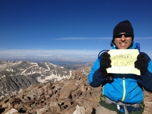
Highest Elevation: 13,294 Ft (2900 total elevation gain)
Trail Length: 8 miles ( It varies as you cross the Flats and start the summit) It took us 4 hours total.
Trail Uses: Hiker
Degree of Difficulty: Moderate to Difficult due to elevation
Bathroom: Port-o-potty at the parking lots
Fees: $5 to park per day ( 2 lots near the trailhead – No parking allowed on the roads around it)
St. Marys Lake from the Glacier
To start out our vacation week in the mountains, I wanted to do a trail on the way to our condo and this one was supposed to be beautiful. It would take us over 13,000 ft, had decent mileage and was supposed to get us around 2900 feet in total elevation gain. Plus we would get to climb on the Glacier, which was something I have always wanted to do.
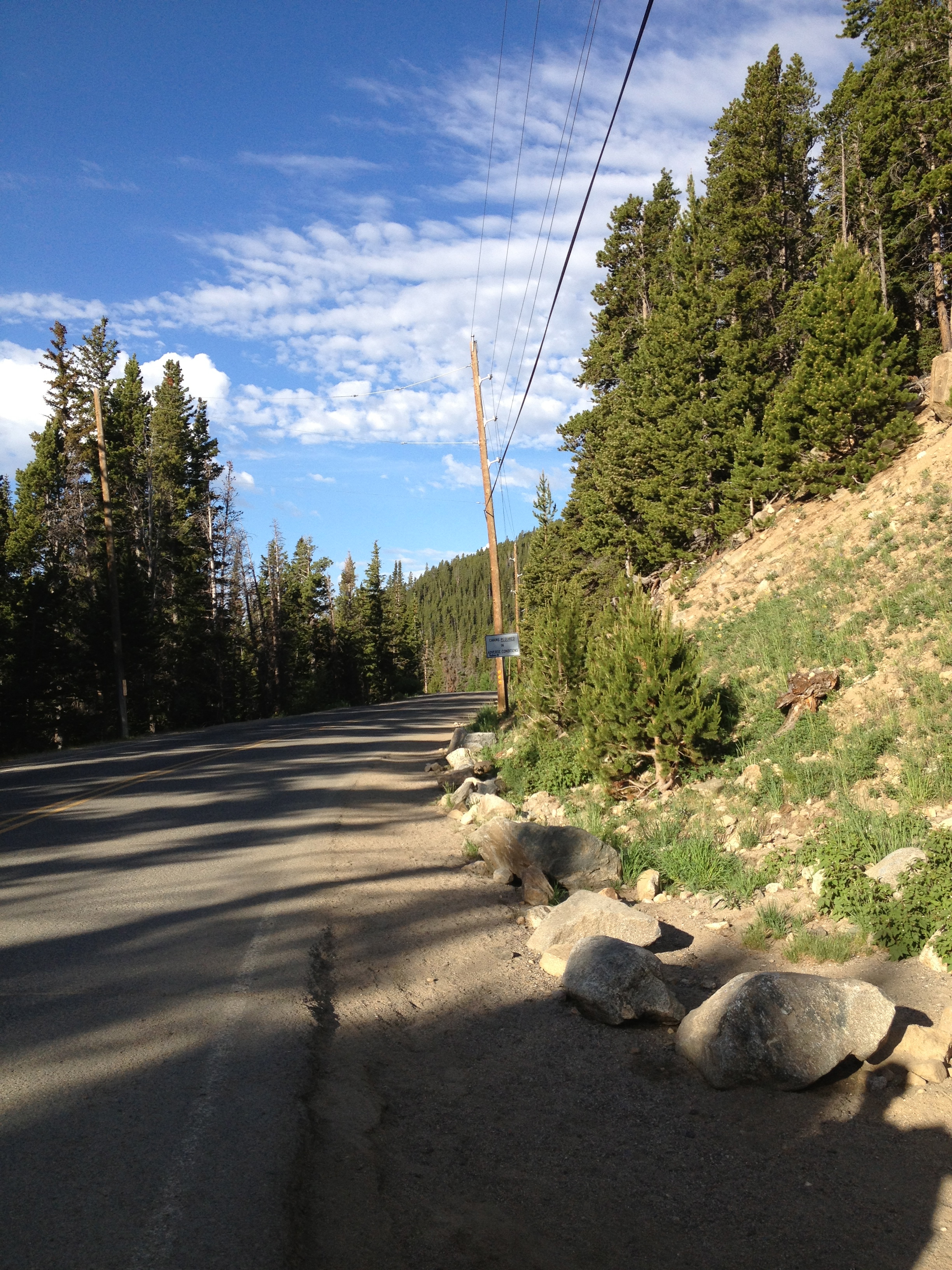
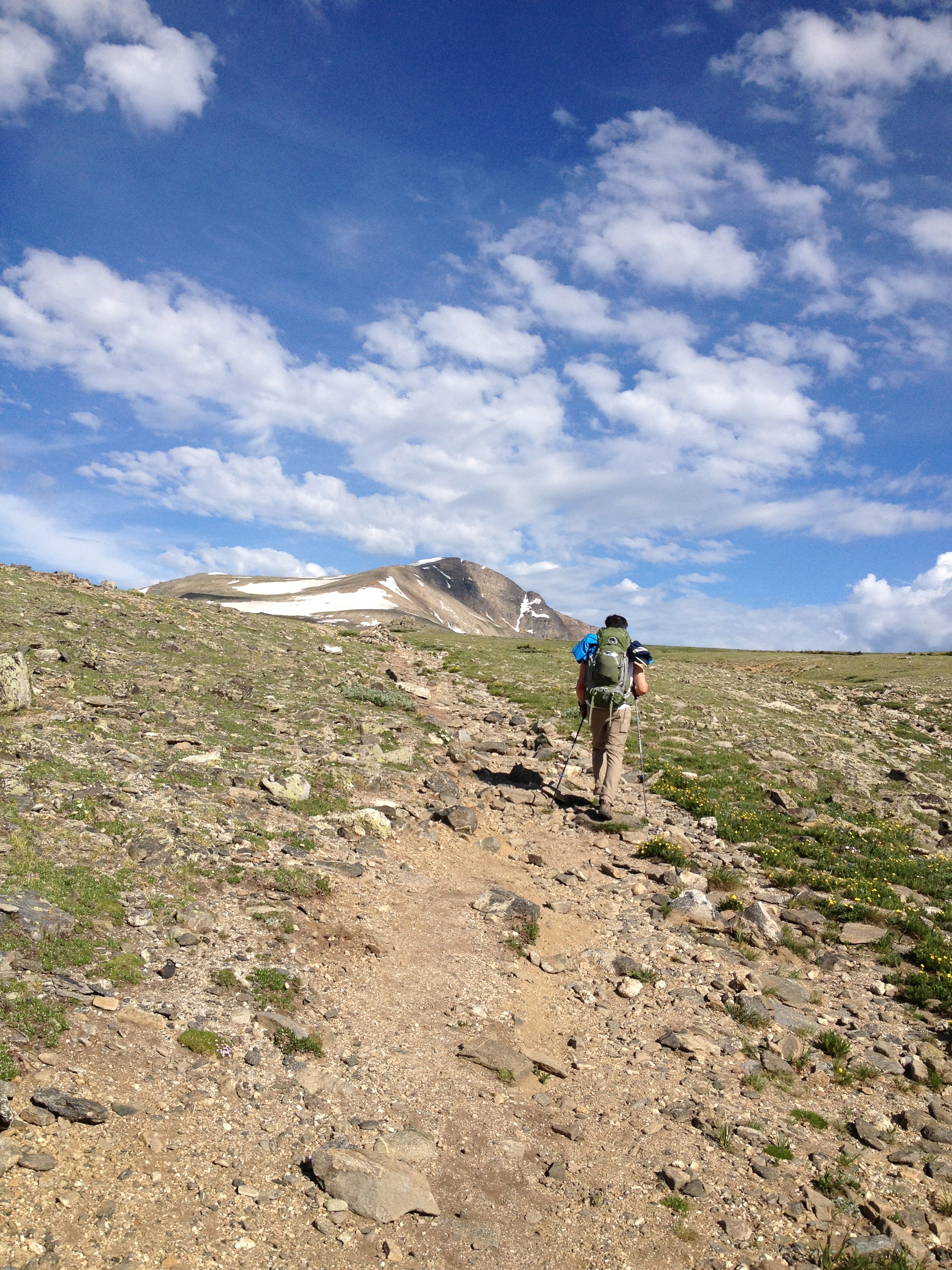
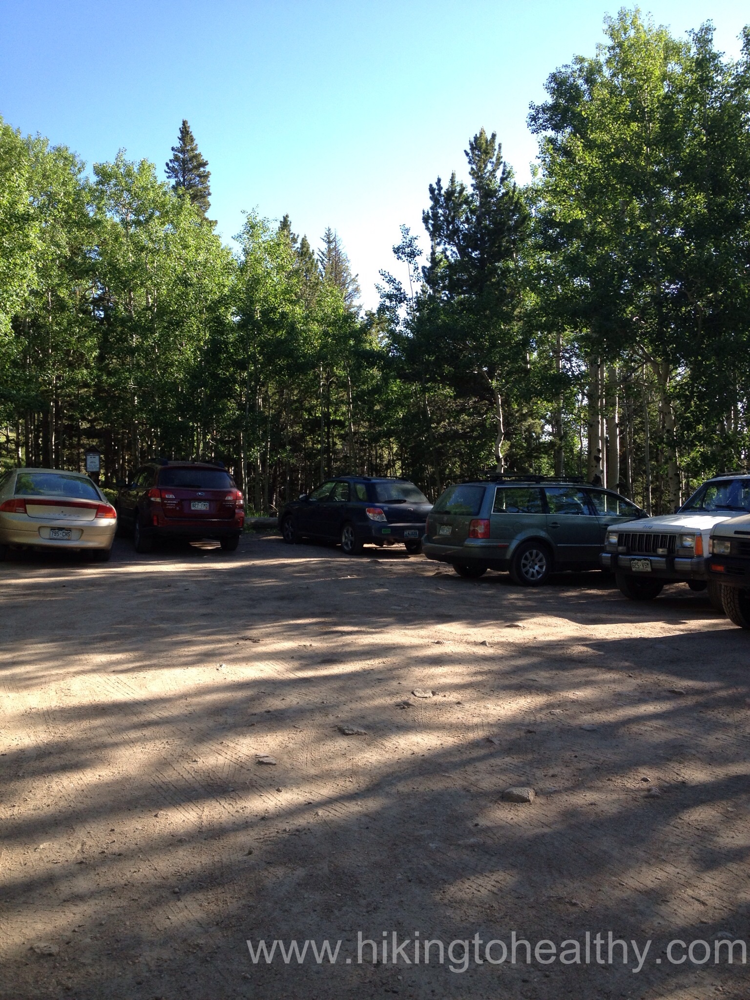
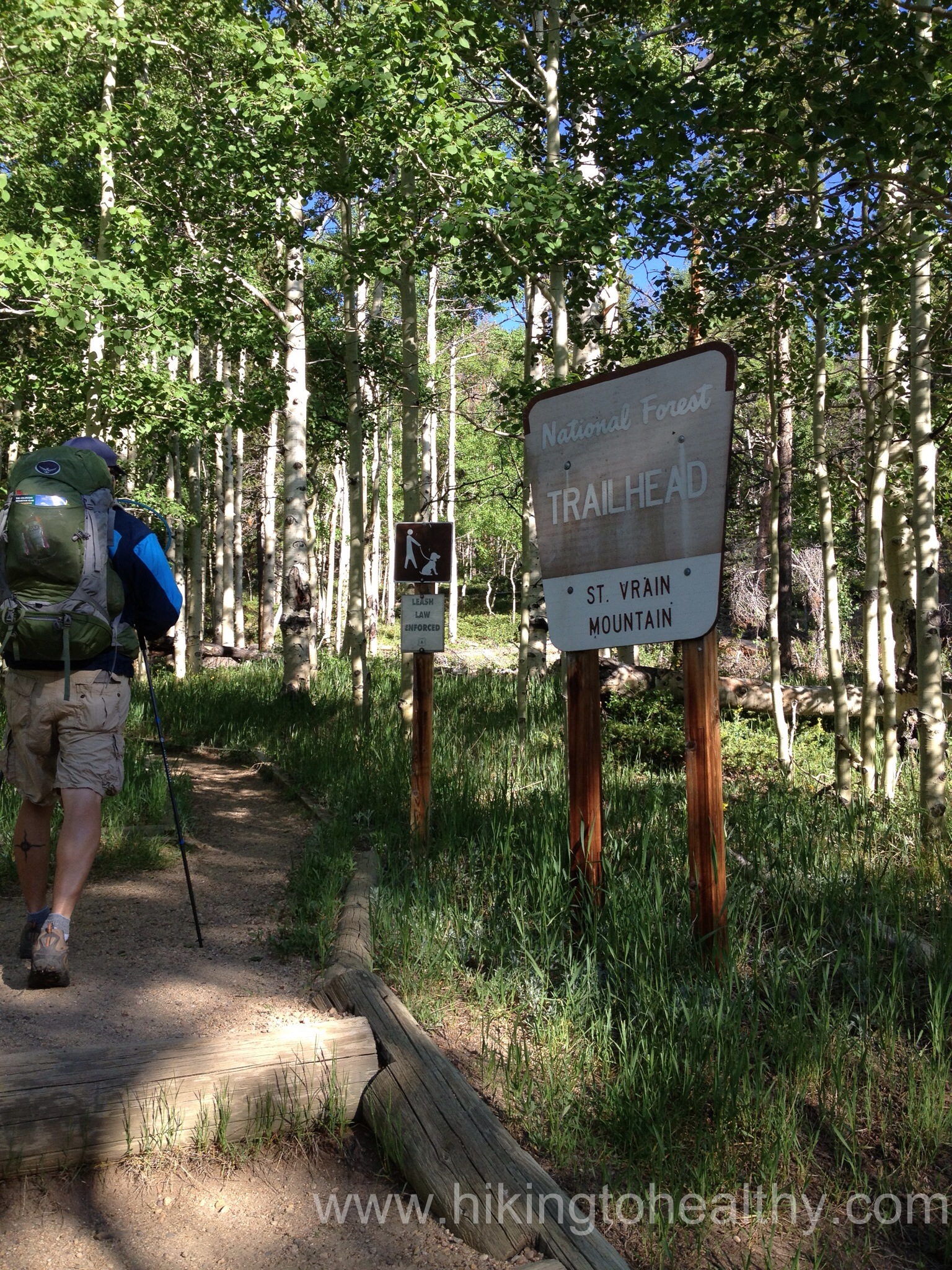
We actually started from the parking lot down the road back to the trailhead, although if you have to park in the other lot you will have to walk up the road to the trail.
walking to the trailhead
We tried for an early start but with the extra packing for our week in Breckenridge we didn’t get to the parking lot until almost 7:30am. Normally that wouldn’t be all that big of a deal but there was supposed to be a storm rolling in sometime between 11-2 so it cut down on how long we could take to get to the summit.
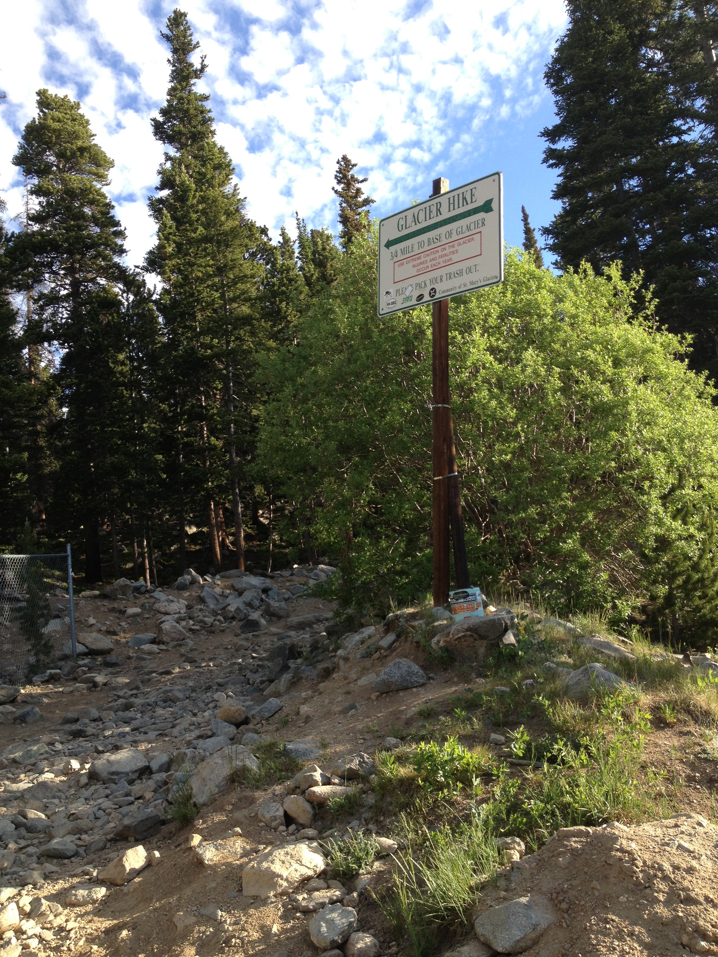
Trailhead
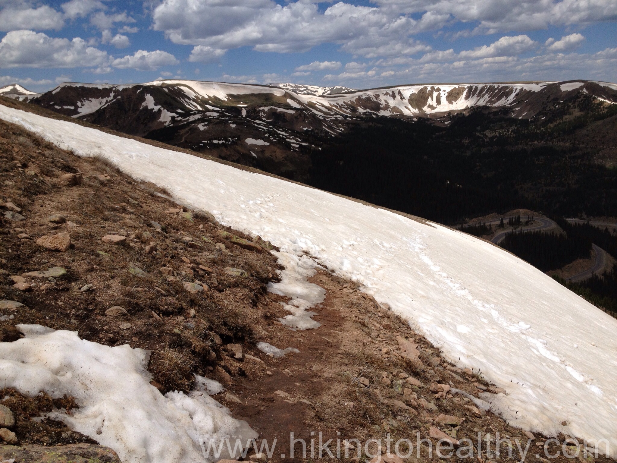
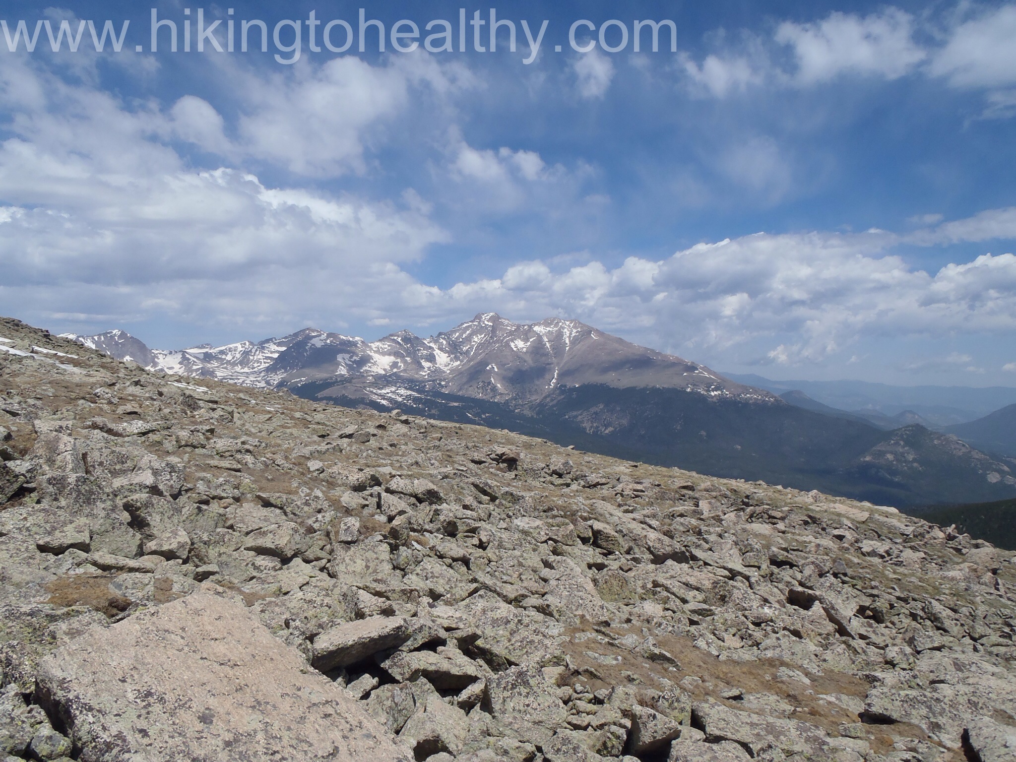
The trail itself starts out as an old 4×4 Jeep Road with a ton of rocks and a nice incline up to St. Mary’s Lake and the glacier. In just 3/4 of a mile we got to the lake and the Glacier, it took just 30 minutes.
To the left is the lake and the trail to the right goes up the glacier to James peak.
We did stop for a few minutes and took pictures of how beautiful everything looked. At this point we were hoping that the rain would hit more around 2 then 11 and the sky was supporting our hopes.
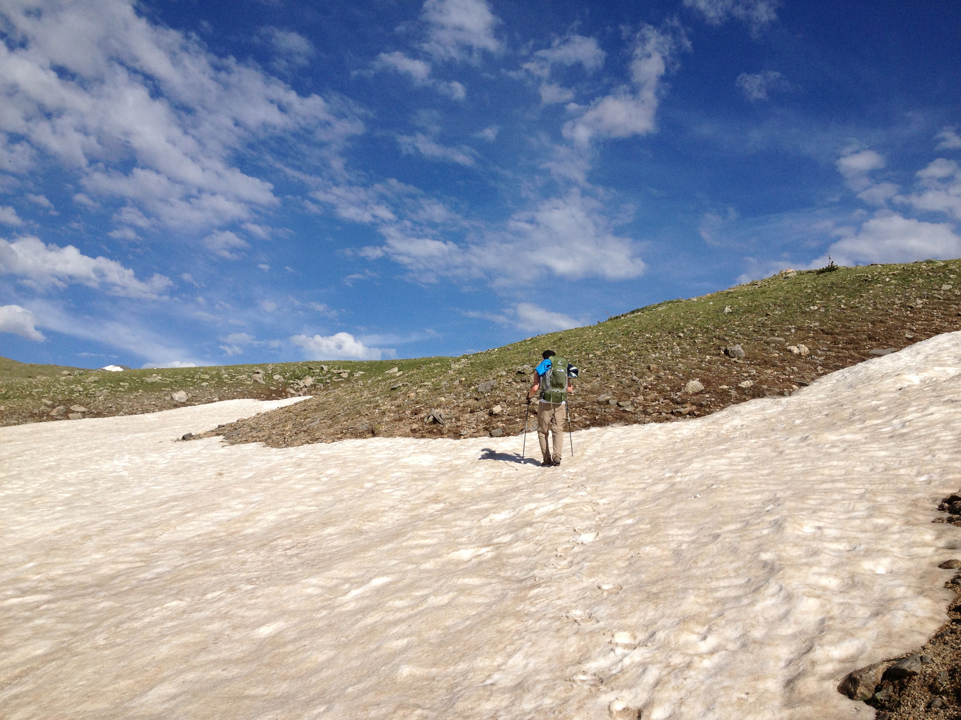
From here we went back to the trail split, crossed over the stream and headed up the north side of the Glacier.
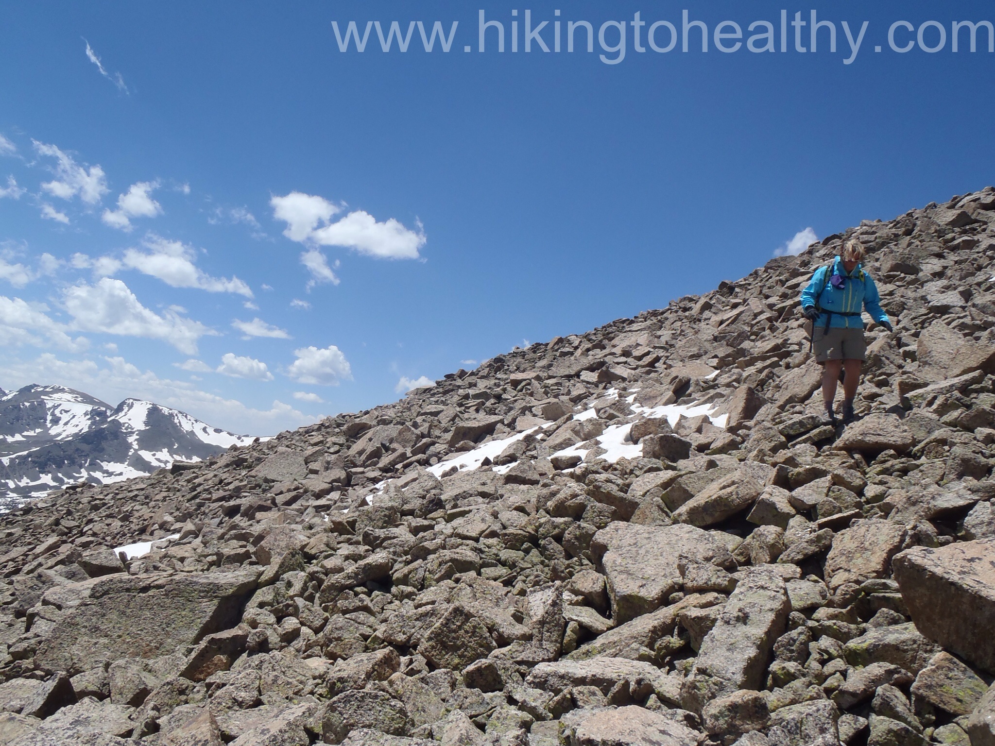
We kept moving up and made it to the glacier part of the climb pretty quickly, then we slowed down. Hiking up the glacier took longer then I thought it would, we were on it as long as it took us to get to the lake itself I had no idea it was so big.
As we reached the top of the Glacier
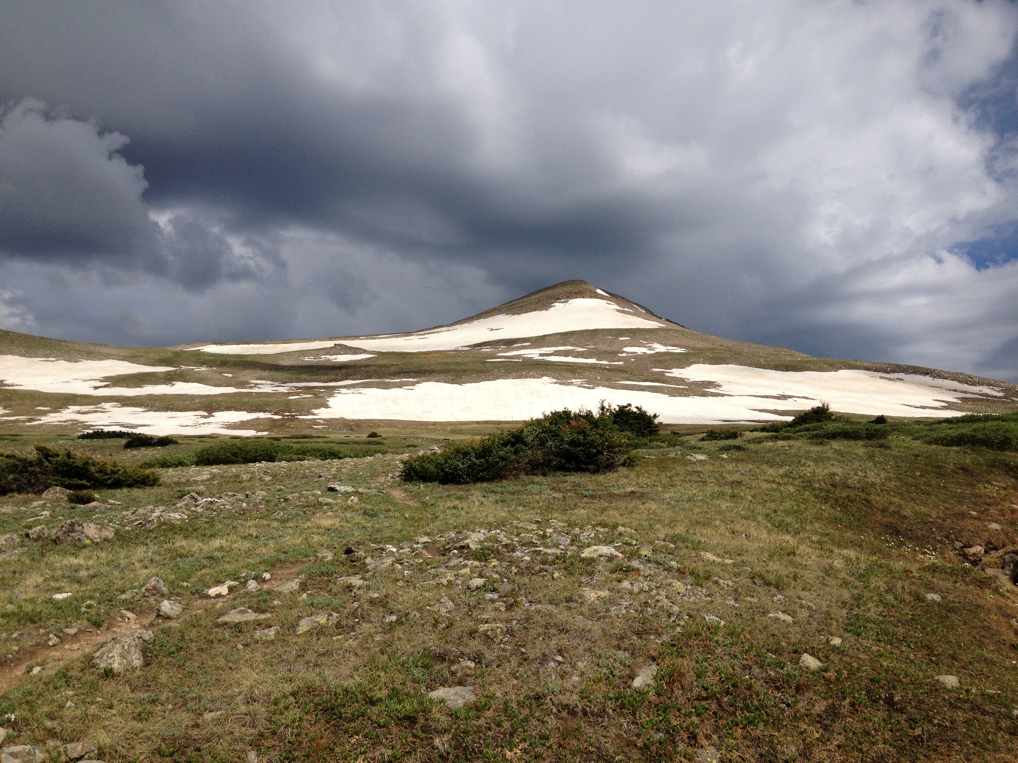
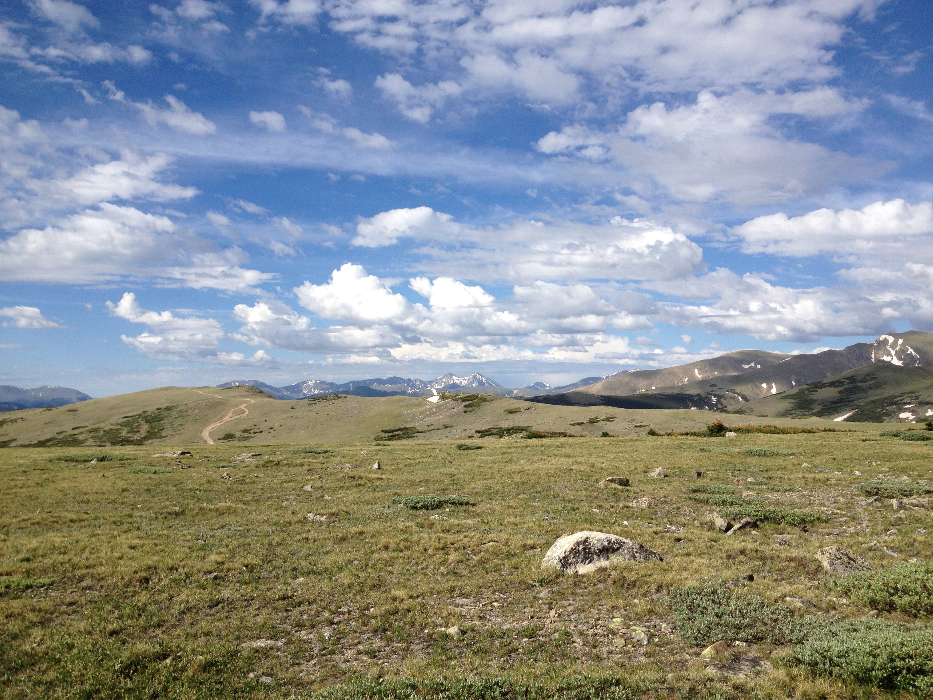
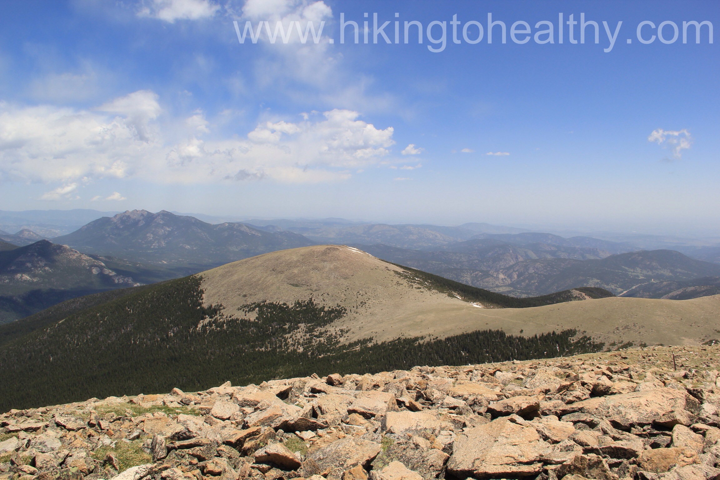
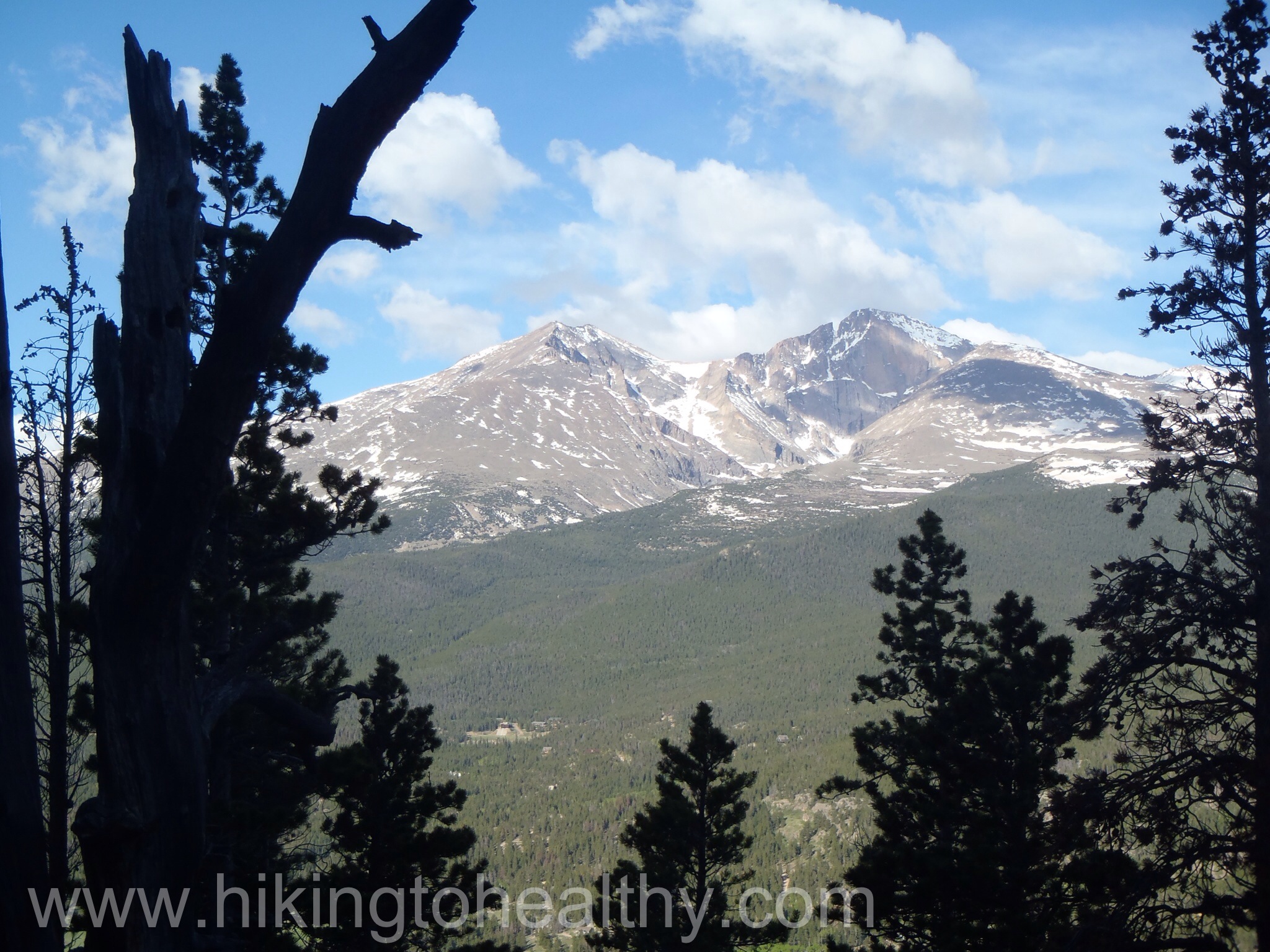
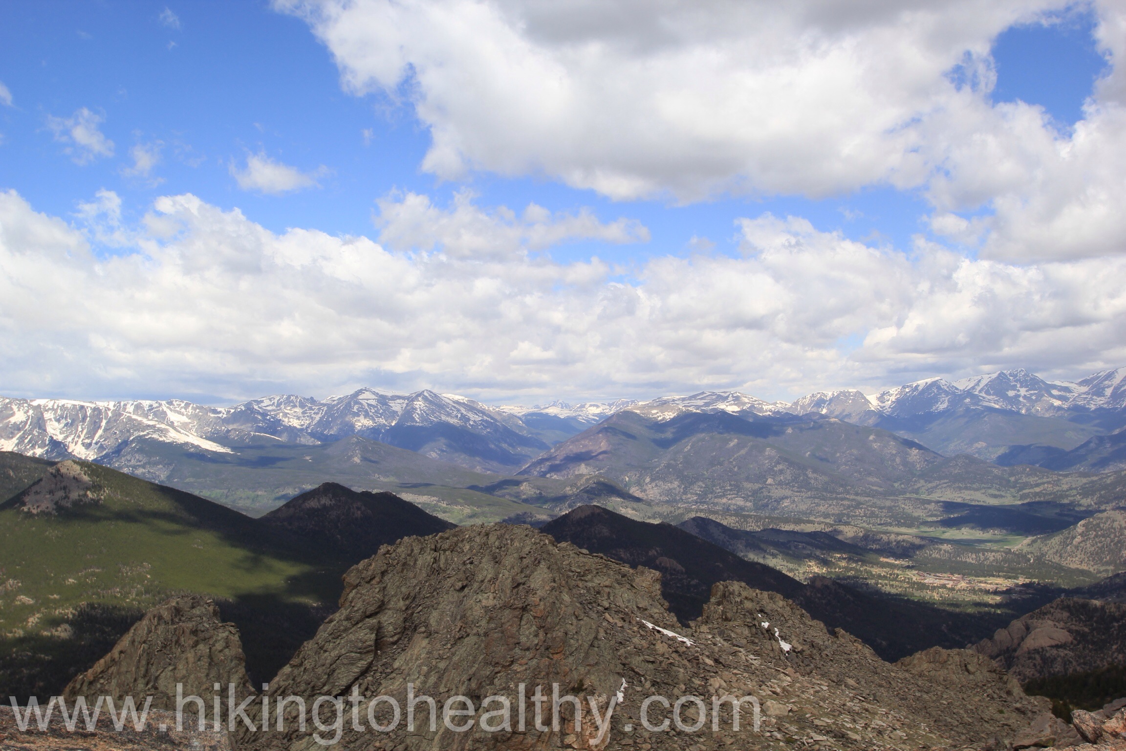
After the climb up the glacier we reached the Jamaica Flats with James Peak directly in front of us.
James Peak
The trail takes the flats on the left over an old jeep road.
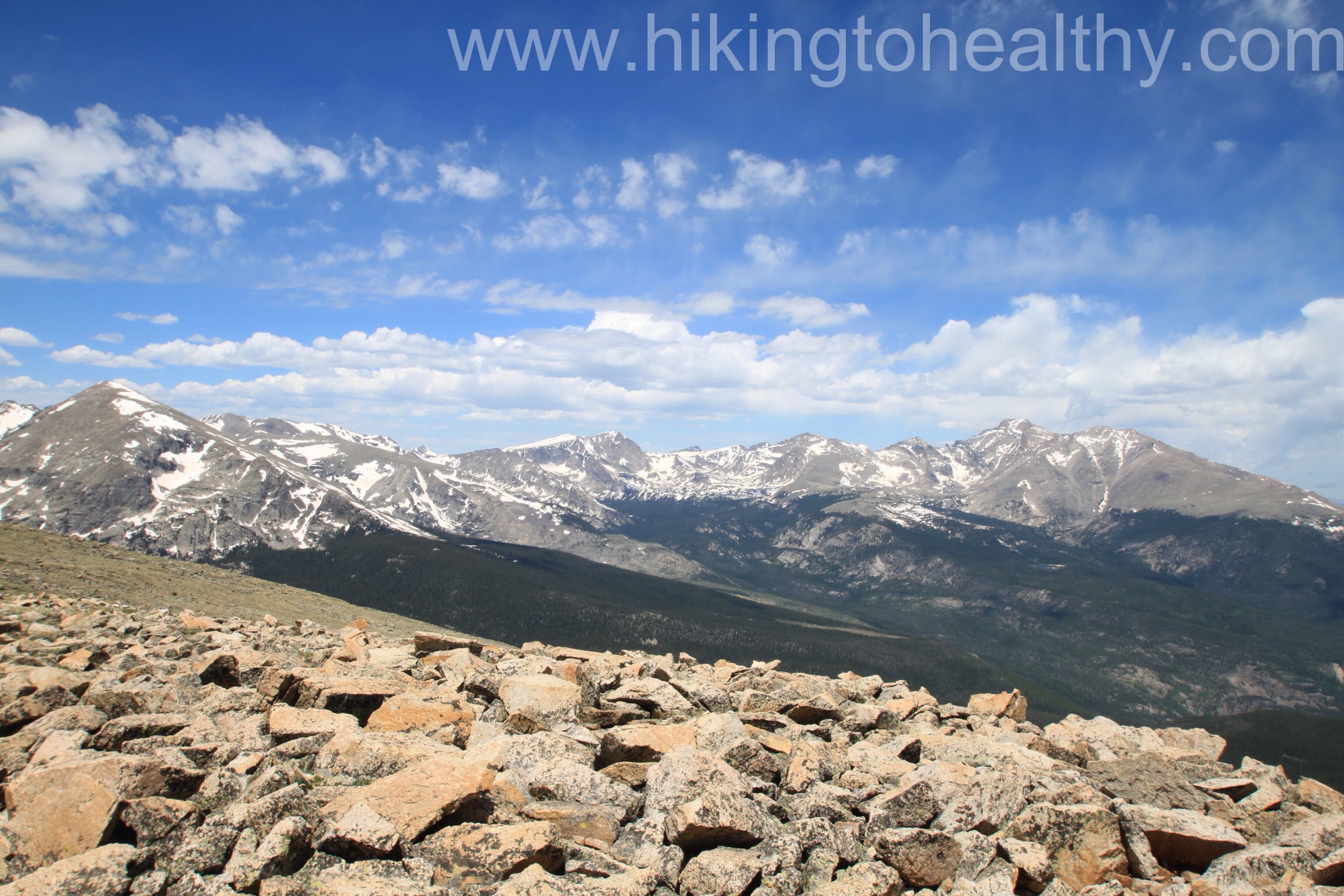
The view while we were on Flats
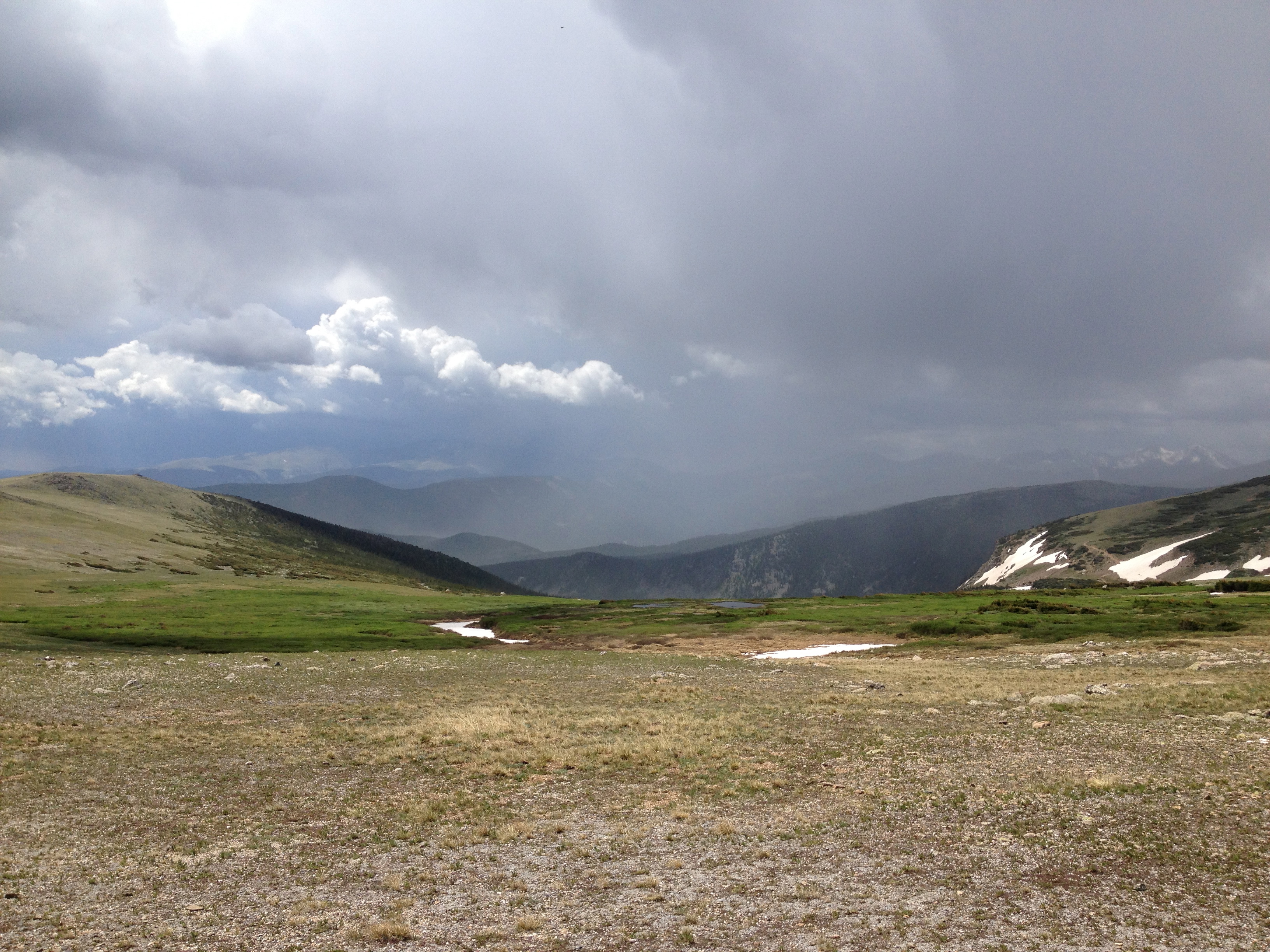
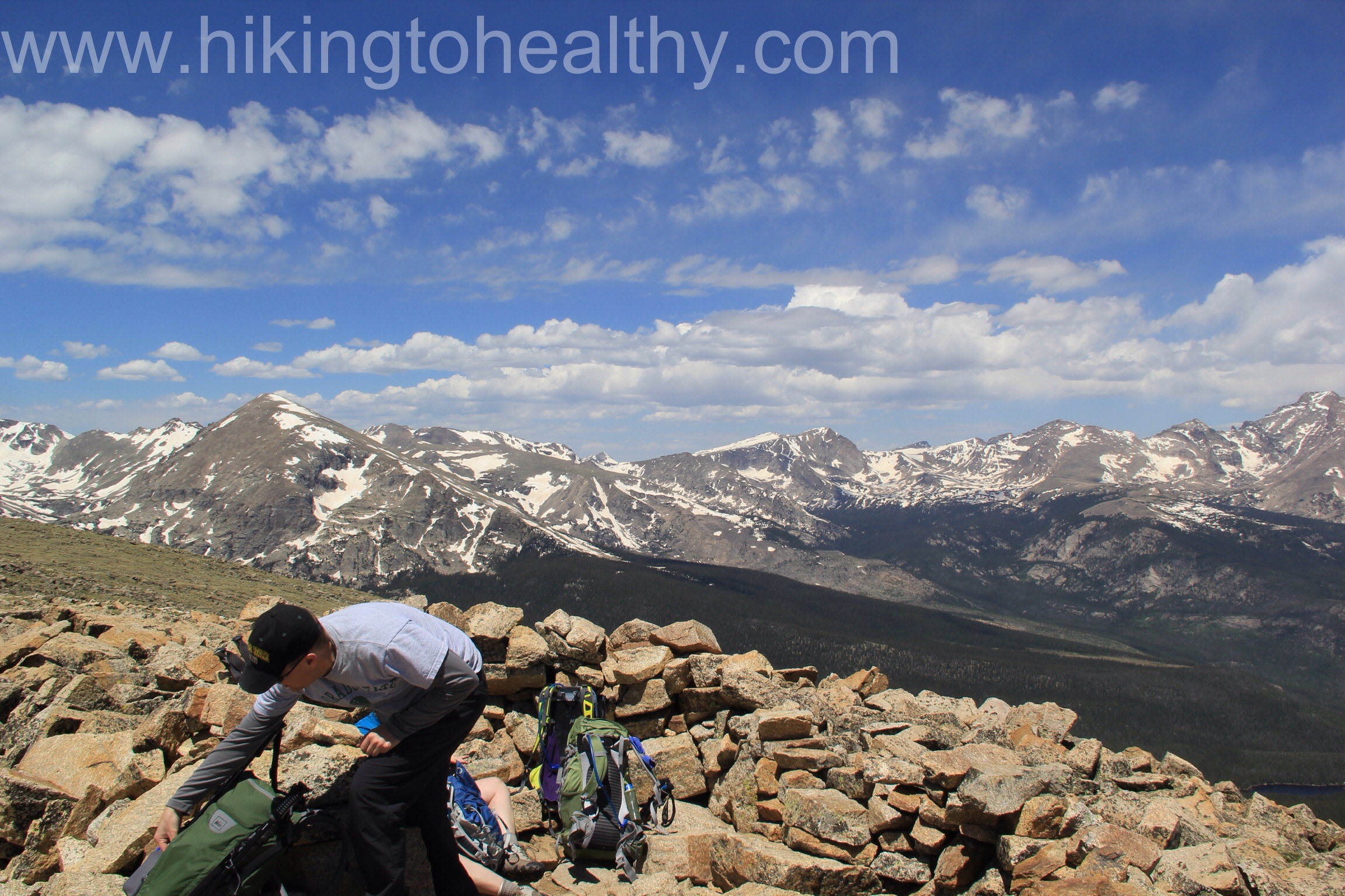
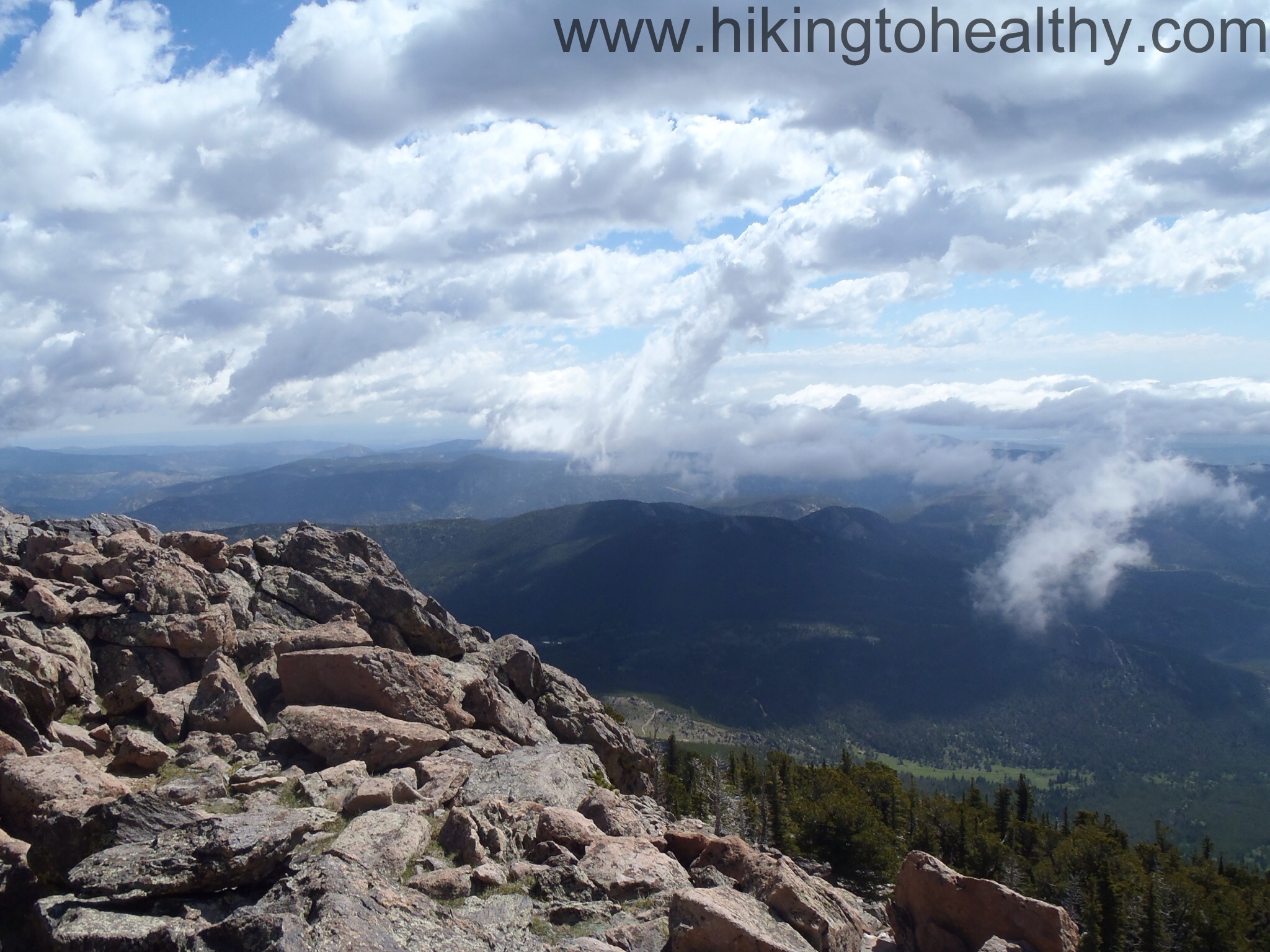
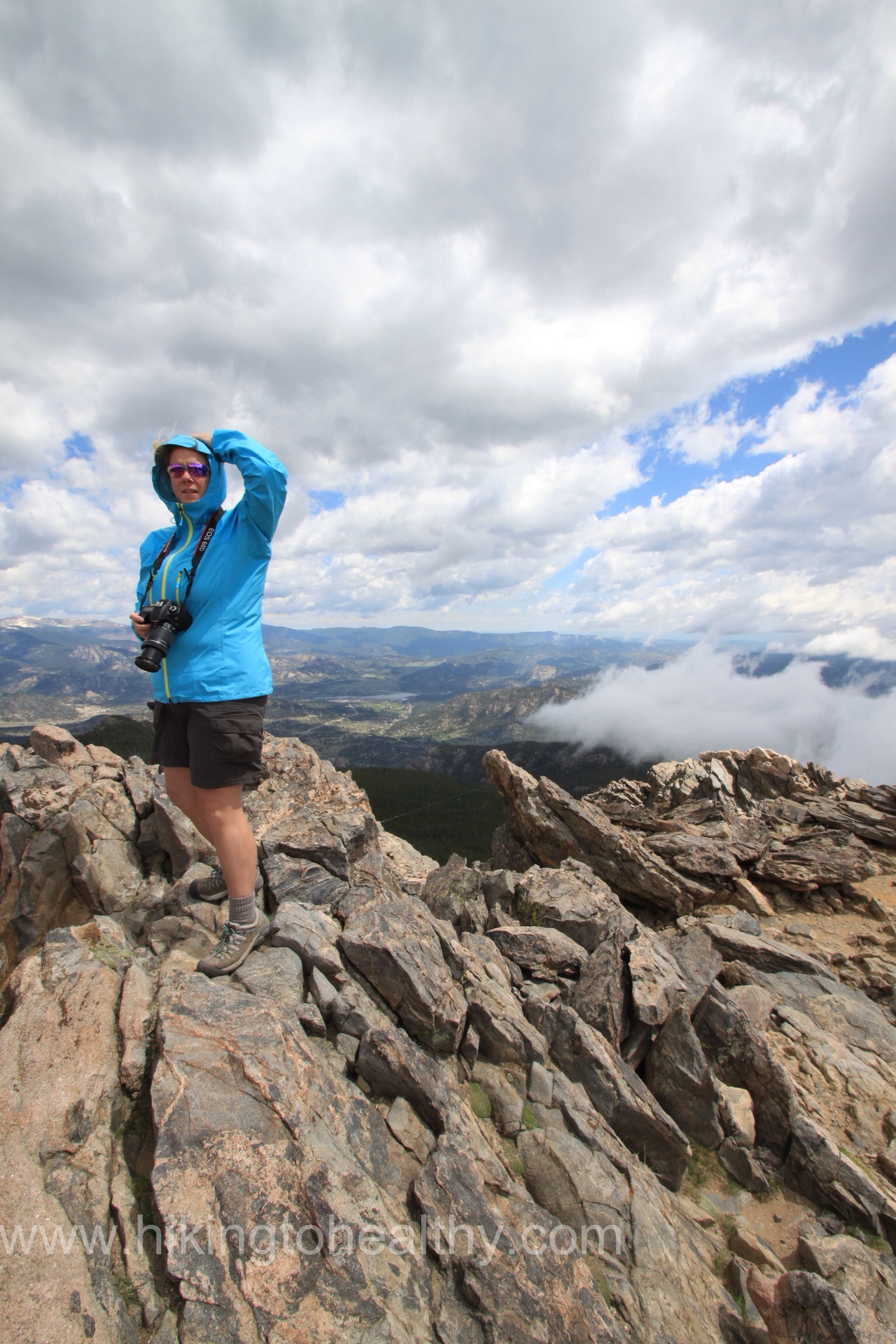
We started our summit climb looking at all the clouds starting to show up around the peak and all the peaks around us. We moved as fast as we could while approaching 13,000Ft in altitude and so you know fast wasn’t really all that fast. When we passed a few hikers coming down they said the clouds were all around on the other side as well and looking ominous not to make too many stops if we wanted to reach the summit before the storm hit. It started raining on and off, then as we were maybe a quarter of a mile away from the summit we saw lightning just over the edge of the top. That was a hike killer for us. We turned right around and headed down, here is the picture I took just before we turned around:
James Peak will always be there so no reason to risk getting hit by lightning when we can hit it again later. Of course as we started to head down the storm got worse and then surprisingly better. When we got back on to the flats, it was beautifully blue over James Peak which made us regret turning around.
James Peak as we were heading down.
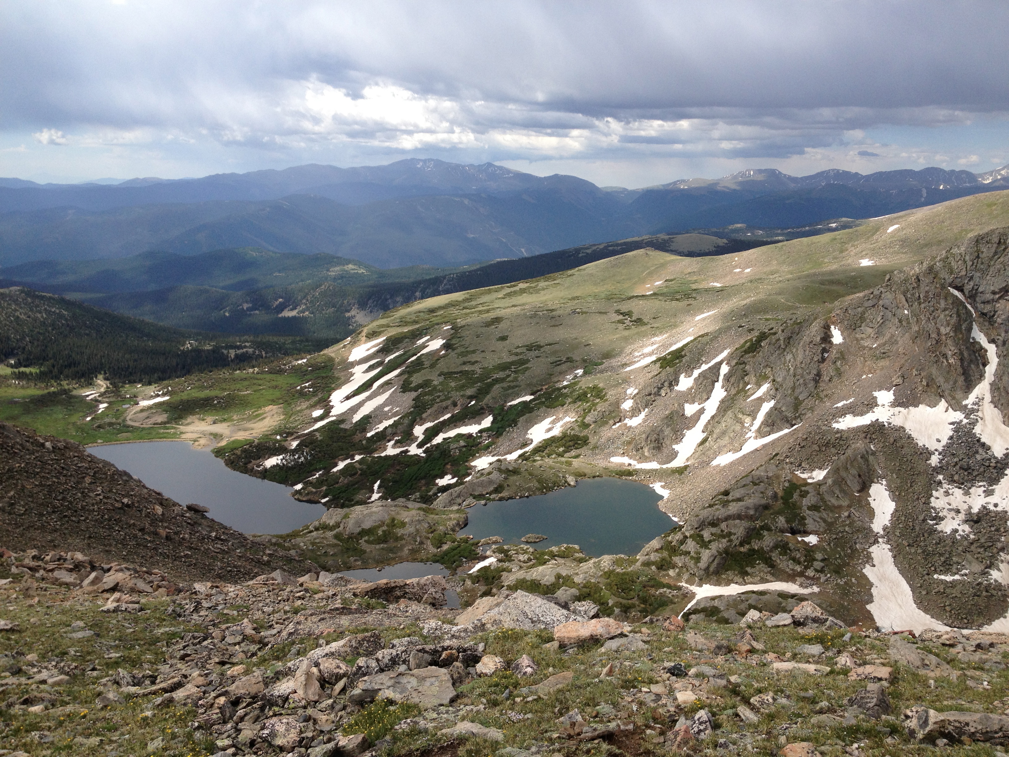
The best part of this hike was the actually the beauty of the storms hitting all around us.
Storm over Grays & TorreysStorm over Mt.Evans
Overall it wasn’t too super tough just high up, on the way up we were pretty much alone and then on the way down the trail was super busy. At the Glacier, it was insanely packed with lots of people partying at the lake before the 4th of July holiday week. We did love the hike, it was beautiful and challenging! We can’t wait to get back there and actually make it to the summit, we will leave much earlier next time though! A few of our favorite pictures after the directions.
Directions: Take I70 west and exit at Fall River Road ( Exit #238), turn right on to Fall River Road take it up 10 miles past the town of Alice. Look for the Glacier Hike sign on your left; 100 yards past the sign is a public parking lot. $5 to park.
I am THRILLED. I was just hoping for a maintain but to get this type of loss, well I can say it was so much more than I could have imagined.
As it is probably obvious, I am late in posting my weigh in and that’s because we are on vacation. This is our favorite week of every year, because it was this week 15 years ago Aaron and I met so we celebrate it in fun ways every year. But as a junk food addict, I look forward to trips in general as a break from the healthy lifestyle I am trying to achieve, you know a VACATION from everything. In the past this break has bled into the week before the vacation and the week after. Which is why losing 1.8 pounds the week before our vacation is such a huge win for me!
Another big win, this is our first aggressively active vacation. We started it out with a beautiful hike yesterday en route to our condo for the next week, have our 1st 14er ( mountain over 14,000 feet high) planned in the next few days as well as 3-4 other hikes planned. Where we are staying has a beautiful gym overlooking the most inspiring set of mountains and we intend to use it.
Aaron has always been really healthy and fit, at every other vacation when he suggested healthy options I would fight it and typically win out. Last week was no different while we were working out he said we should lift weights in addition to hiking to help stay on track. My angry vacation monster was like WTF hiking is not enough??? But he is totally right and instead of snapping at him I bit my tongue and thought hard about what he was suggesting. How difficult would it be to dedicate an hour each day to lifting weights? It would allow me a certain freedom in terms of enjoying other aspects of vacation like eating and drinking, with out the typical weight gain. But most importantly it would help cement my healthier life style transition. Healthy people never take vacations from exercising, they work it into what ever they are doing on their vacation( at least that is what I have read). I want to be a healthy person so that is what we are doing!
We got one new hike under our belts yesterday and it was another with intense mind-blowing views, man I so love Colorado. I can’t wait to tell you about it and the other 3-4 we have planned, but it will take me a little bit so please bear with me.
Have a wonderful 4th of July week!
These perfect Columbines are part of the landscaping at where we are staying.
Continental Divide Trail to> Mines Peak Road> Mt. Flora Trail > Traverse to Mt. Eva
Starting Elevation: 11,315 Ft
Highest Elevation: 13,132 Ft ( We had a total elevation gain of approximately 2800Ft)
Trail Length: Officially, if we had finished 10 miles. We Turned around about a mile short of Mt. Eva so officially we got 8 miles but my fitbit said we got about 10 miles anyway. We spent 5 hours hiking total.
Trail Uses: Hiker only after the road
Degree of difficulty: Strenuous – Mostly due to Altitude & Length
Bathrooms: There is one at the Berthoud Pass parking lot, but keep extra supplies handy, it is popular.
Pets: Dogs are allowed on the trail but they must be leashed.
Fees: None
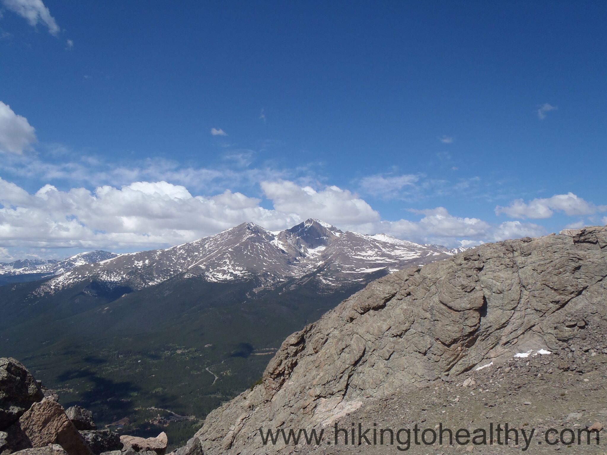
We did Mt. Flora ( Details here) last September, it was our first and only 13er and a huge achievement for us. Unfortunately it was also our last because snow moved in, then moved in again and again. We are really close to our planned 14er and so this seemed like a good way to visit Mt. Flora again and do additional peaks, elevation gain, mileage while getting progressively higher in time to do our 14er next week. I read about this trifecta of peaks in my Colorado Mountain Club book, we had already done Mt. Flora so seeing the other 2 peaks felt right.
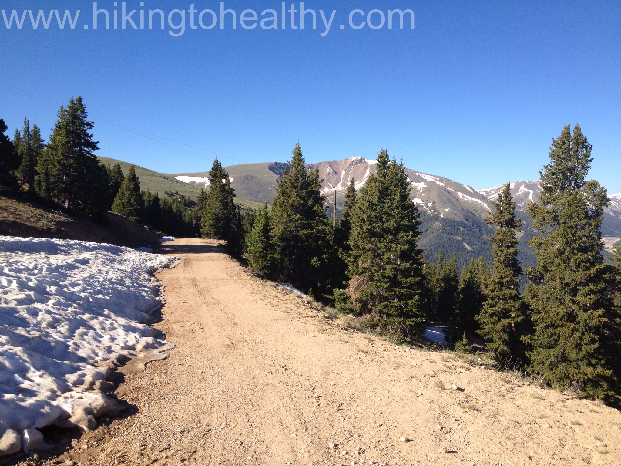
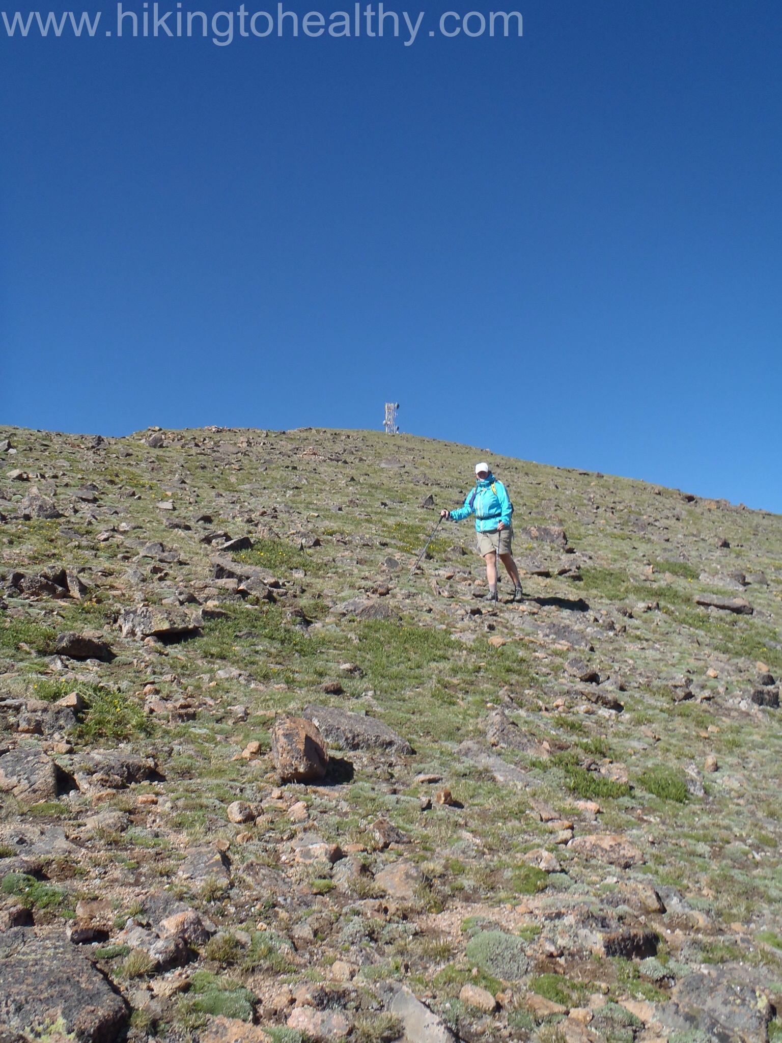
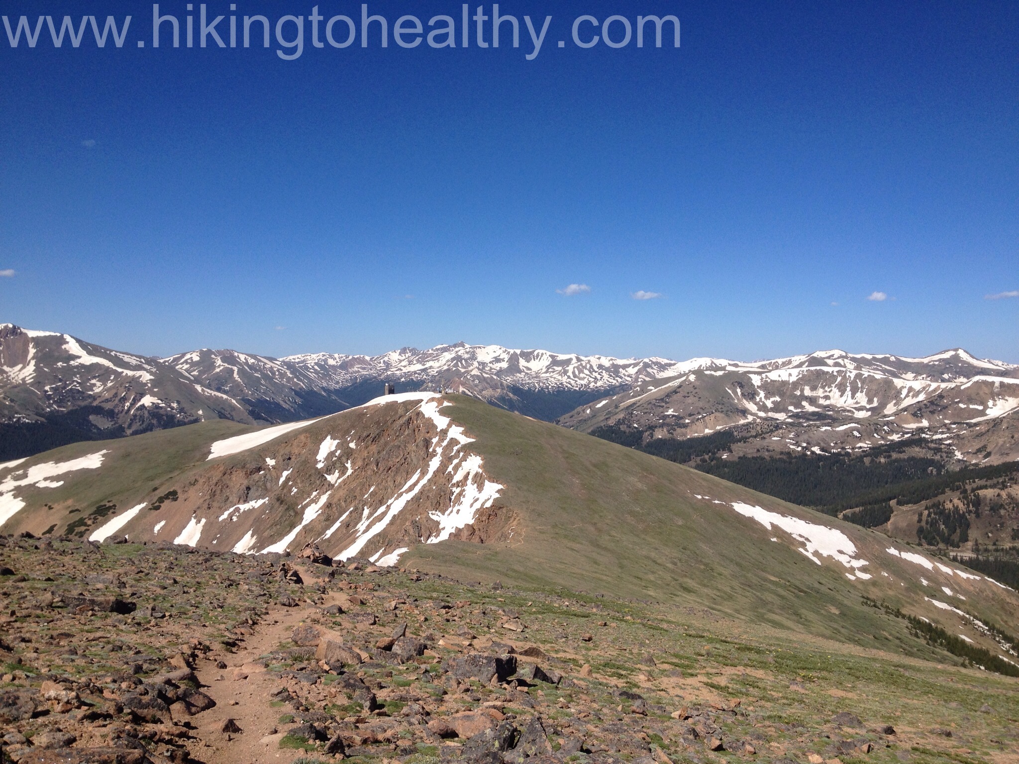
We started a little later than we wanted to at about 8AM but jumped right in, we cranked it up Colorado Mines Peak road in just 50 minutes. That is 1178 ft of elevation gain in just 1.3 miles.
Colorado Mines Peak Road past the Mt. Flora trailhead.Almost at the top of Colorado Mines PeakThe view West as we climbed to Colorado Mines Peak
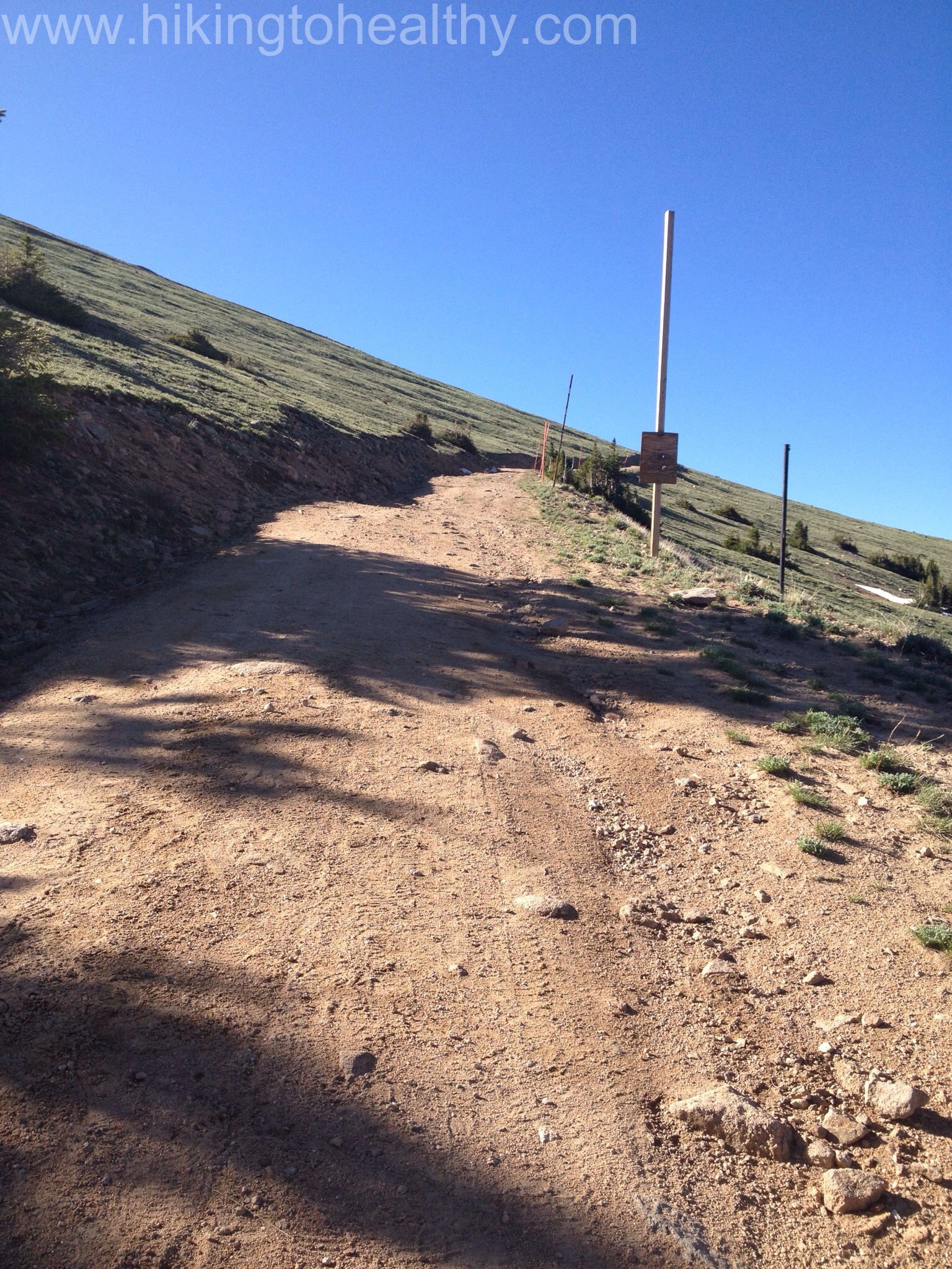
The top of this peak is not very exciting as it is full of buildings and antennas, but the views are beautiful. We didn’t spend too much time here but still managed to not find the official path down to the Mt. Flora trail so we just went down close to the ridge line since we could easily see the trail below. On the way back from Flora we clearly saw the correct path coming off of Mines, if I had to guess it is straight North from the main road once you get to the top.
We started down by this Pole, which would be the wrong way…
It was is almost a 40o ft decent, and the wall of snow hanging off of the ridge line was impressive.
Wall of snow along the ridge line of Minesme coming down the side of Colorado Mines
We pretty much had Colorado Mines peak completely to ourselves up and then again down, but as we were going down to Flora we could see 3 groups of hikers on that trail already. As we started on the Mt. Flora trail we keep our aggressive pace and in no time we made it to the top. At the point we hit the top of Mt. Flora we had been hiking for 2 hours 20 minutes, 25 minutes less than it took us last time and we had already added elevation and mileage to our hike.
on the path to Mt. Flora
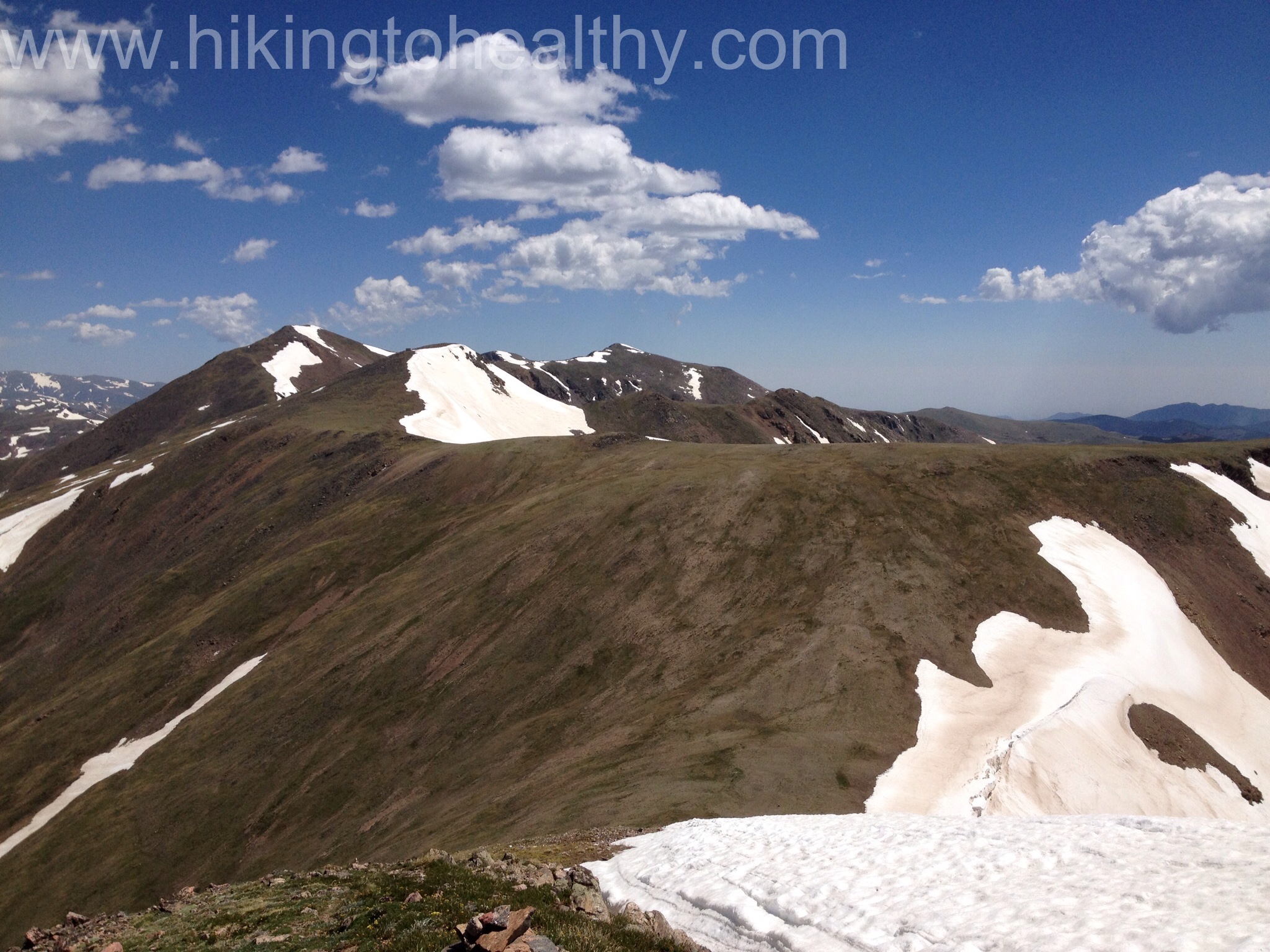
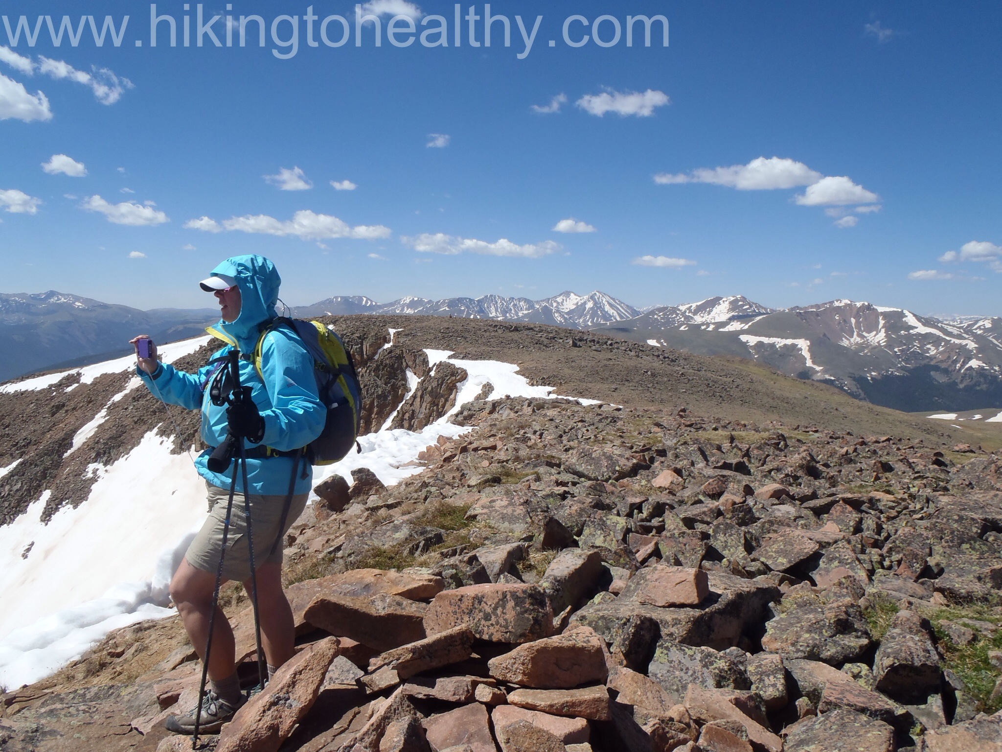
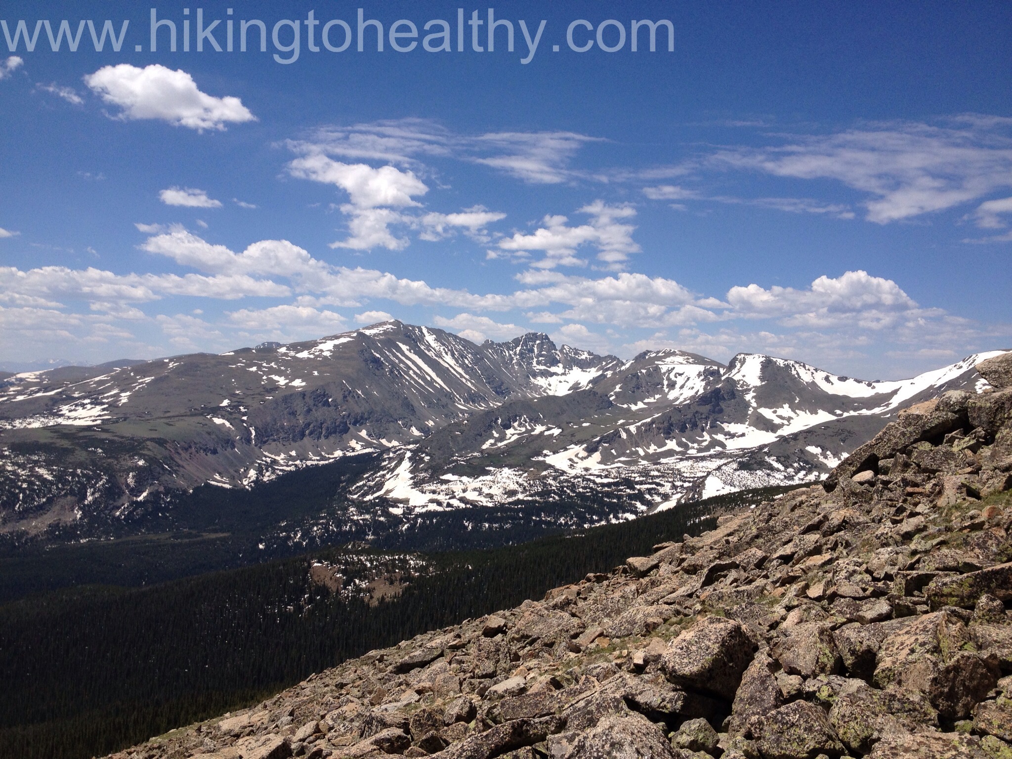
Again we didn’t spend too much time on Mt. Flora as we were anxious to get over to Mt. Eva and to us it looked way further away then 2 miles.
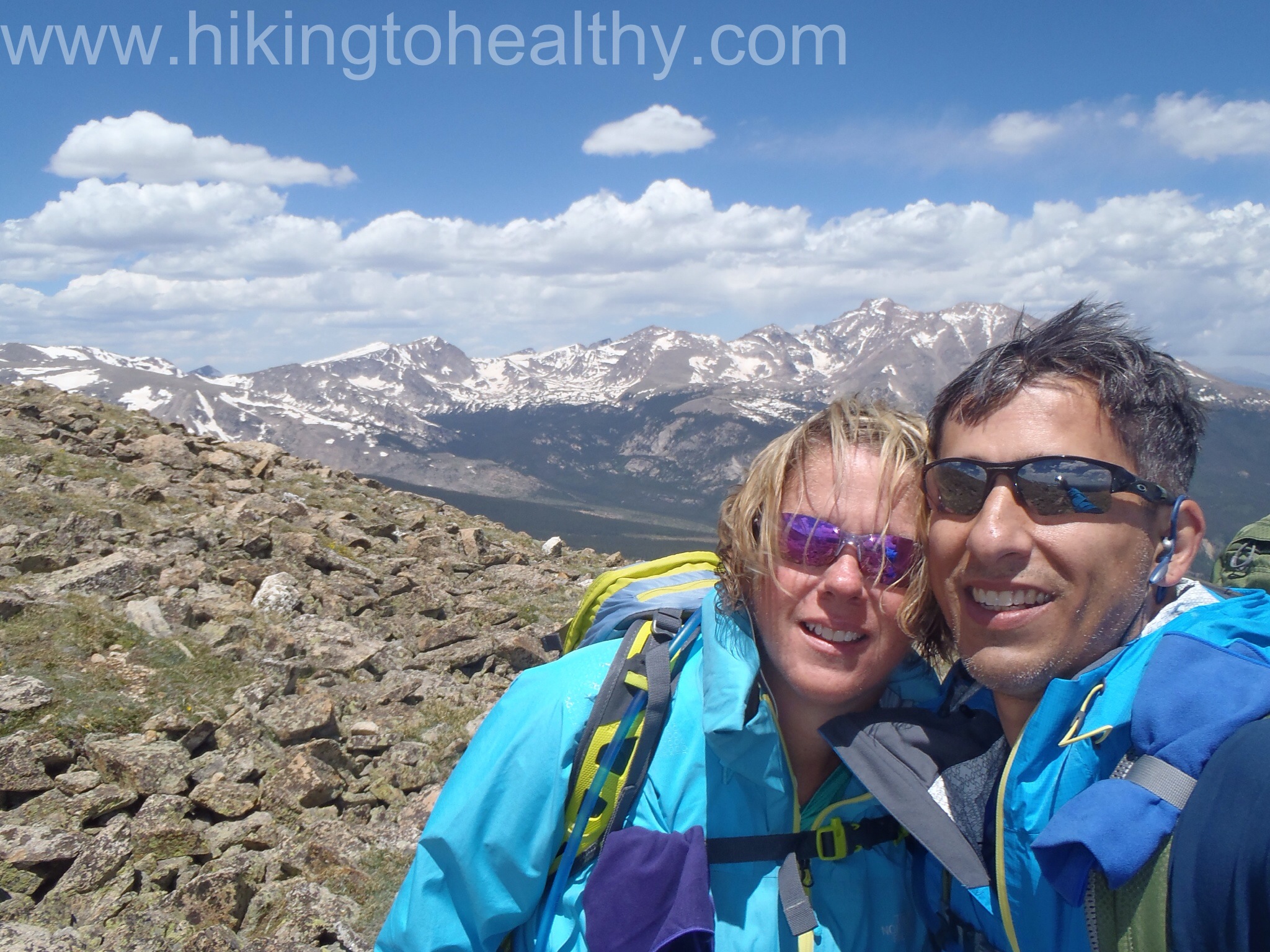
Mt. Eva is almost perfectly in the middle, past the peak on the left but under the higher peak in the middleA Quick capture of us on Flora
There is no defined path to Eva you just follow your eyes over to it, we kinda went up 2 un-named peaks and then followed a couple cairns down the ridge line, again. Each one looked like an inverted path below but when we got there we were oh that makes sense and moved onto the next one. It took us an hour to work our way almost a mile over and when we looked over to Eva it still looked more than 2 miles away.
Eva is the peak a little left of center with the remains of a building on it
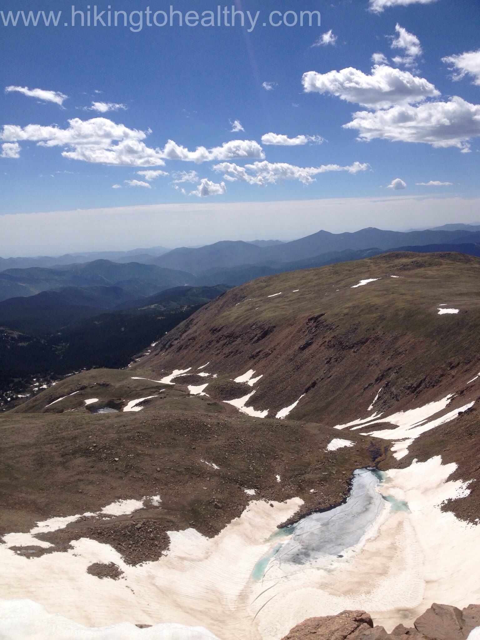
It was a tough call at this point, the way down looked REALLY challenging then having to come back up 6 hours into a hike seemed not the smartest for us. The wind had picked up and the smoke from all the wild fires was building up more, we decided that we would turn around and try it another day. We climbed back up to Flora even though we could have easily cut it off to get back to the parking lot, we just wanted a little extra mileage and elevation.
On the first un-named peak north of Flora, In fact Flora is over my shoulderThe view East getting smokey
We felt great on this hike, the altitude was a factor but only in the beginning and then as we came to the top of Flora. We really moved faster than I felt we have for some time. On the way back down we encountered one snow field on the Mt. Flora trail and we were able to walk around with a little work.
Snow FIeld on the way back down Flora
This is a great hike and one I know we will do again and again. We felt awesome in the way we climbed and how quickly we moved, so much better than the first time we did this hike. One thing I want to note is that this trail is a busy one and mostly above tree line, opportunities to relieve yourself are VERY tricky and use lots of sunscreen ( just sayin). After the directions will be our favorite pictures from the hike. The ones with the shadows are from Colorado Mines peak.
Directions: Take I-70 west to exit 232, US 40 west. Follow US 40 for approximately 14.4 miles up through Empire to the top of Berthoud Pass. You will see Berthoud Pass Trailhead Parking lot there on your right and you are at the trailhead.
I was pretty thrilled with my loss this week especially since I was so sore from Saturday’s hike that I was essentially a slug on Sunday.
This has been a transformative week for me as our hike this past weekend really made me break through a wall I have let creep up over time. The “I can’t do that” wall. I can’t really pinpoint how the foundation started, but then again I never notice it until it is a couple of stories higher either, suddenly anything that looks too hard is automatically an I can’t response. This weekend we did a summit climb that was a million I cants the entire way up and down but I did it all, feeling a million times better for it!
It has changed my whole attitude this week and while I would love to lose this weight faster, I am perfectly content that I am in fact still losing weight. It took me years to do this to myself, it’s going to take some time to fix it.
We have a good hike planned for tomorrow, part of it is a repeater while adding on additional peaks, mileage and altitude gain to our original attempt. I am both nervous and crazy excited, as I often am on the eve of our hike!
I am leaving you with a cute picture of 2 of our cats I caught snuggling earlier this week.
When we finally got to the top of St. Vrain mountain, the views were really breath-taking and if the wind hadn’t been so bad we would have spent a lot more time up there. We knew there was a chance of a storm rolling in so we kept a close eye on the clouds moving our way as the wind actually picked up in intensity. At one point I seriously thought I was going to get blown over.
Just before I was almost blown over.
We took just 20 minutes of resting at the top and immediately started down. If I was worried when I was climbing up the summit, going down I was incredibly nervous with how steep it was especially after falling the weekend before on the hike down off of Twin sisters. Aaron told me to just take my time and follow him as much as I could. We were also kind of following the couple who was in the wind shelter with us, they mentioned that following the border posts was supposed to be the easiest way down. We were all of the mind that going down a slightly different way then how we went up might be a better idea and at first it was.
Me going down slowly.At least the views on the way down were beautiful
But we wanted to get around the snow field at the base of the summit climb and from up top it looked possible so we started heading right while they went left. It took me longer to get down from the summit then it did to go up, for like the first time ever. When we finally got to the bottom I was thrilled when we saw the trail that goes all the way past the mountain onto other trails and eventually the Continental Divide Trail, it was way south of the where we had turned up the mountain. As we tried to get around the snow, trees and bushes we were moving downward and further down then we expected. We weren’t getting any closer to our route down and the snow field was worse in this direction, ie the snow was deeper then we were tall. We decided that the smart thing to was to get to a trail entrance of the snow field and try to get across it safely to get back on trail. Neither one of us said anything to the other, but we knew that if one us went through the snow here there wasn’t much we would be able to do to get out or help the other because it was so deep at this part of the crossing. Needless to say we didn’t take out a camera to capture it all. We moved quickly and as lightly as we could, in short order we were back on trail.
Now things were changing very quickly, the dark clouds were rolling in fast over Long’s Peak, Mount Meeker, Lady Washington and building in over us while the sun was baking us. Suddenly Aaron started to slow down and I couldn’t figure out why when he tested his blood, he was pretty low with insulin on board. This was not a good time to stop and deal with it but we really had no choice, so in between he sugar feeding frenzy I got these pictures of the storm coming in.
Storm starting over Long’s PeakThe sky closer to us still showing some sun.
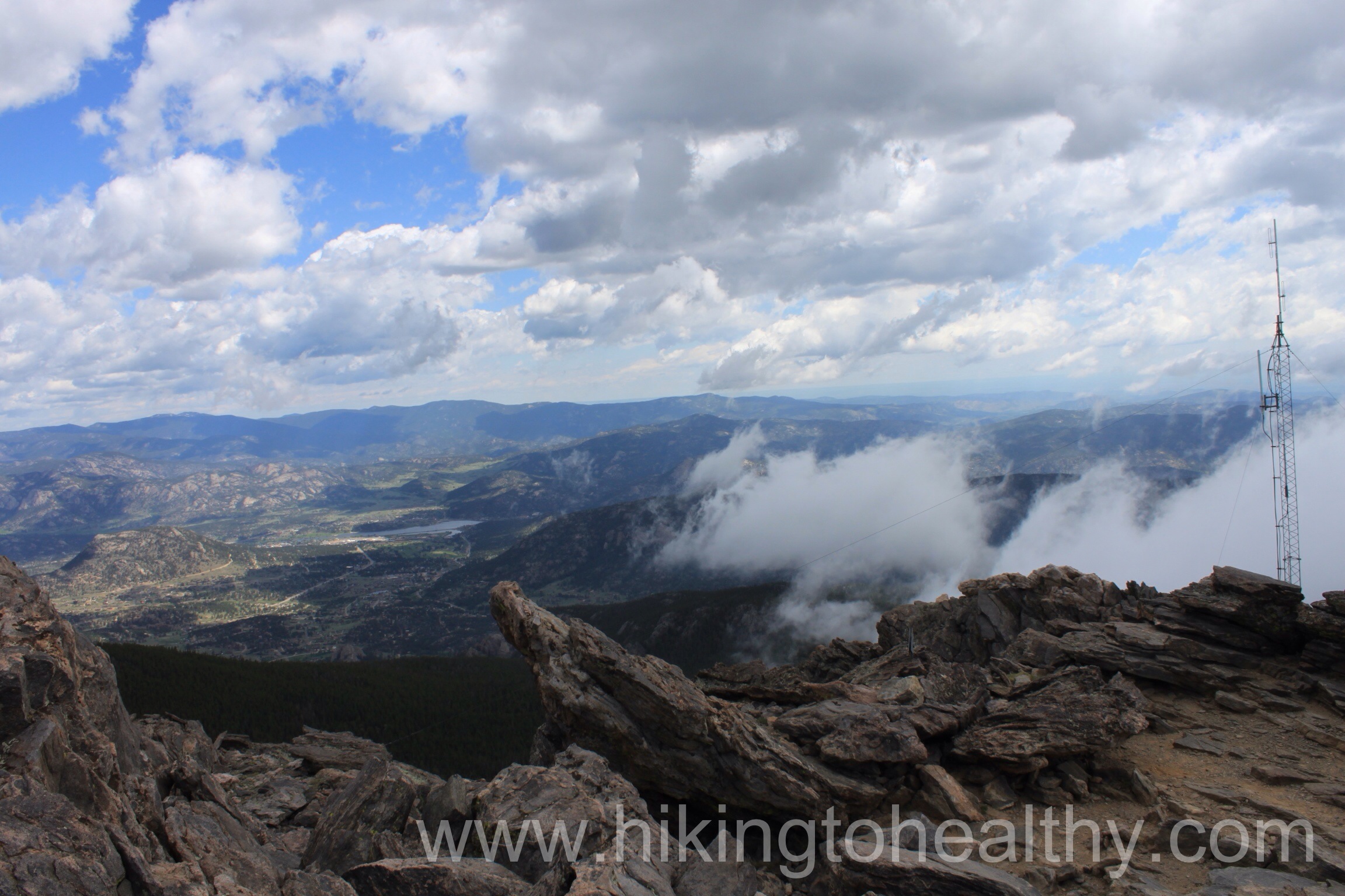
He was such a trooper and started moving as soon as he could so we could try to get off the pass before the storm started while I looked for places we could take shelter or at least not be the highest point on the pass. I was pretty sure we were going to get soaked. Surprisingly the storm completely passed us by.
We were both spent now 6.5 hours into the hike with more than halfway down still to get through. We moved slowly but did keep moving, we passed about 6 or 7 groups of hikers just starting up and I bet they were treated to a beautiful sunset. The snow fields we crossed earlier were melting and much harder to get through the runoff deeper. Despite all that we were insanely proud of what we had accomplished because it proved to us both that we had come so far from last summer and told us we could do so much more!
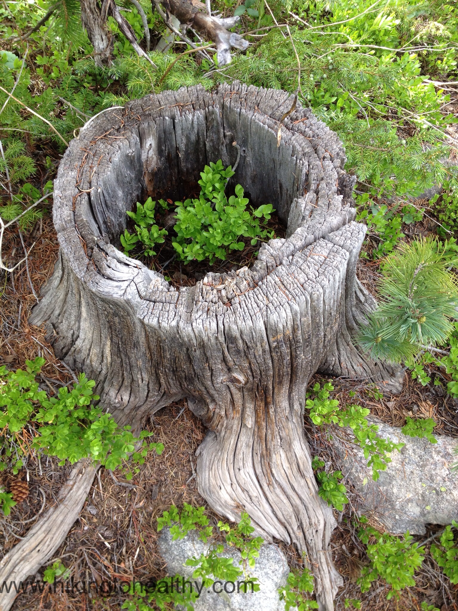
There are those moments on the way down where you see stuff you don’t know how you could have missed on the way up, like this:
Nature’s flower pot
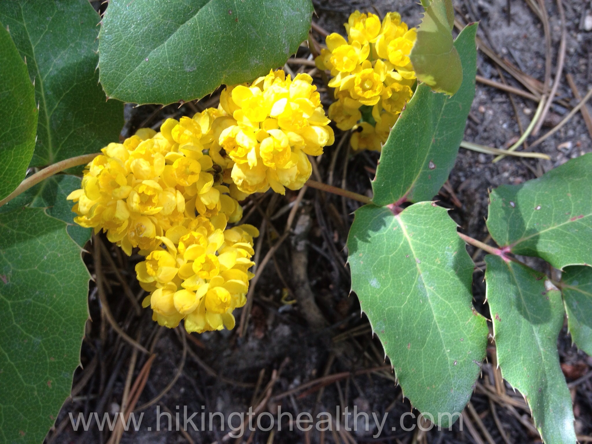
And the bottom part of the trail was a bloom with these flowers:
We were probably about half a mile from the end when came across the final group of hikers we would see. They casually asked if we had made it to the top we were excited to say yes and then she said so how long did it take you like 2.5 hours, because I have done this before, that’s how long it took me…. I was a little crestfallen when I answered, oh um we started at 8AM ( it was 4PM ) I started making all these excuses as to why we took so long but stopped, who cares how long it took us, we finished and that is all that matters. We walked up to the parking lot and saw our wind shelter buddies just getting into their car, it lifted our spirits because they needed 8 hours too and were like 15 years younger than us.
Things you should keep in mind when you do this trail:
1. It takes a long time to complete and if you start the same time we did you will be in the direct sun as you climb from the East to the West. Then when you come back down from the West to the East, the sun is still beating on you be liberal with the sun block and wear a hat. My sunburned scalp is mad at me.
2. Bring lots of water as we ran out of our 100 ounces just as we walked up to our car. We also always have a water filtration system with us just in case, this is exactly the kind of hike we carry it for. Plus we always have more water in our car.
3. Brings lots of fuel to keep you going over the course of the whole hike, we were moving for almost 8 hours straight that is a crazy amount of energy to expend and you need to be able to keep going.
4. know the weather and watch the sky, you do not want to be on the mountain or the pass when weather changes.
Even if the Mountain itself looks too daunting do this hike to the pass, that alone is worth it. You don’t get the amazing 360 views you can from the top but pass views are spectacular on their own. Here are the rest of my favorite pictures, I hope one day you find yourself able to try this hike it will be worth it.
South facing view at the summitSouthwest view from the summitWest viewMore West view
Northwest View from the wind shelterMeadow mountain and Twin Sisters from the SummitThe view to the East
Highest elevation: 12, 162 Ft ( With all the snow fields we ended up going for a total elevation gain of 3400Ft)
Trail Length: Officially it is 8.6 miles but going around some of the snow fields and our route up my fitbit said 13 miles. It took us 8 solid hours to complete.
Trail Uses: hikers/ joggers
Degree of Difficulty: Difficult/Strenuous.
Bathrooms: None
Pets: Dogs are allowed on leash only but note that this does cross over to Rocky Mountain National Park at some places and dogs are NOT allowed there.
View to the south at the top
We tried this hike about a month ago and the snow won out. Saturday it was much easier and while snow was still a factor, it didn’t stop us from making it to the summit of St. Vrain Mountain. I read about this hike in the Colorado mountain Club Guidebook for the Best Front Range Hikes and when it said 7 hours to do a max of 9.6 miles for both St. Vrain Mt AND Meadow Mountain I figured we should have no problem completing it in less time. Now that I have actually done it, I want to know how someone does this and Meadow mountain in just 7 hours.
It was a pretty amazing hike and I picked a crazy amount of pictures so I have decided to do this one in 2 parts, one on the way up and one for the way down as surprisingly they were 2 very different hikes.
Let’s talk the start and our way up, we got to the parking lot a little later than we planned around 7:45 and started hiking around 8AM. The road from Allens Park to the trailhead does require 4 wheel drive and while there is a parking lot, it is small no more than 8 or 10 vehicles, but you can park on the side of the road leading up to the trailhead. It was almost full when we got there and 2 cars pulled in while we got ready.
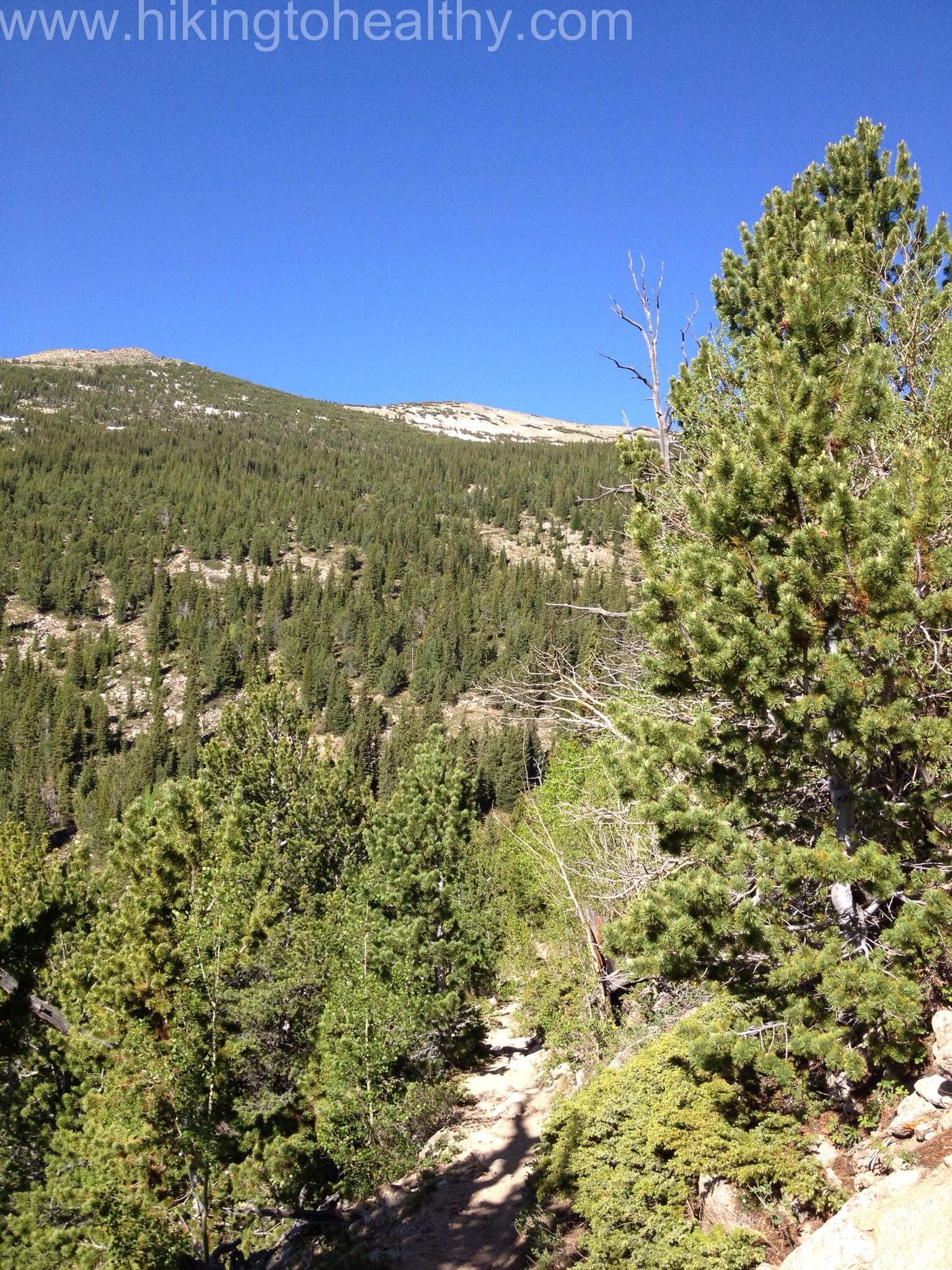
The trail itself starts off with a nice steady incline nothing too hard to warm you up. There are some rocks through out the path but initially it doesn’t start out too bad and the weather was perfect high 40’s and not a cloud in the sky. We started peeling off layers pretty quickly, I love that about Colorado 47 feels like 70 and then again so can 90.
We made it to the Indian Peaks Wilderness sign in a third of the time it took us on our first attempt, which is just under a mile in to the trail.
The trail started to get rockier here,while the creek started moving up along the south side of the trail. The nice thing was, no snow in sight and what we learned was that we totally went the wrong way last time. The trail stays pretty close to the creek as it starts to switchback up the mountain and the creek is RUSHING nice and loud from all the snow melt right now.
Outside of the actual summit climb, I would say this is the most steep section of the trail.
At about 2 miles in the views started to really open up all around and while we had some tree cover we were in the sun about half the time. It was really strong and so we slathered on the sunblock early. The snow melt was also interesting in that there were little paths of water working their ways towards the larger creek and often are part of the trail itself.
About 2 miles into the trail on a switchback as we caught a glimpse close to our goal.The view at the end of a switchback and the view southeast.Trail is snowmelt runoff.
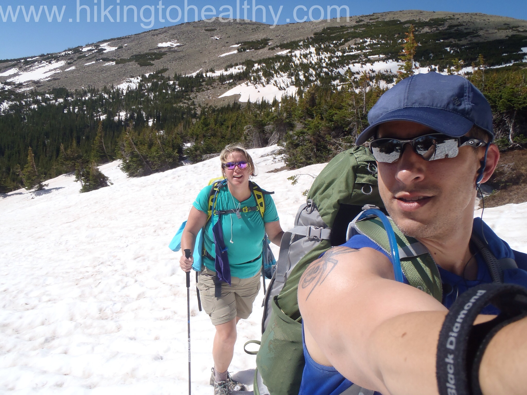
We did actually have to cross over the main creek but it was at a good spot and then the switchbacks got very long as we crossed over to other side of the valley here the trees started to spread out. We got to our first snow field at close to 3 miles in and it was interesting as we had to start in a runoff path and then climb up on to the field. From there we followed those who went before us to get back on the trail. It was surprisingly easy but a little nerve-racking as we knew it was deepish snow.
We were making decent time all this way, in fact we did this in less time then it took us to go a mile the first time. The snow fields would slow us down a bit and certainly take more energy but overall they weren’t as bad as what we had been dealing with.
As we started to get closer to the tree line, there were still lots of runoff and I have learned to look behind us often because it is always so beautiful, this time was no disappointment.
The back the way we came, East – Southeast
As we came up to the saddle between mountains, the most spectacular view starting coming into play
Coming to the pass
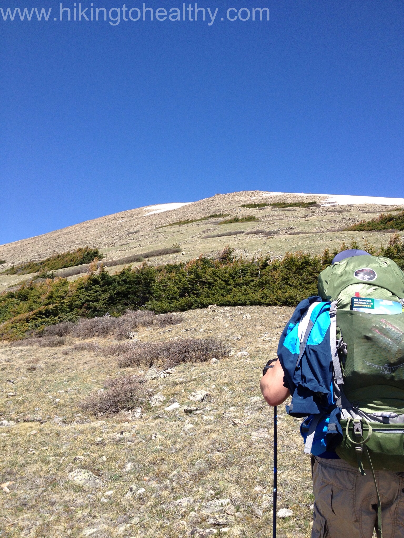
We also now figured out it was Meadow Mountain on our right. In the trail descriptions I could find it is often suggested to hit Meadow Mountain for an extra .6 miles round trip and an extra 400 foot elevation gain and then go onto to St. Vrain Mountain. I had decided that if we had time and stamina we would try this addition on the way back but our main goal was St. Vrain Mountain, mostly because I had read there is no defined path up Meadow Mountain that it would require a lot of bouldering. Somehow I missed that St. Vrain mountain was exactly the same only more than twice the height and distance to cover.
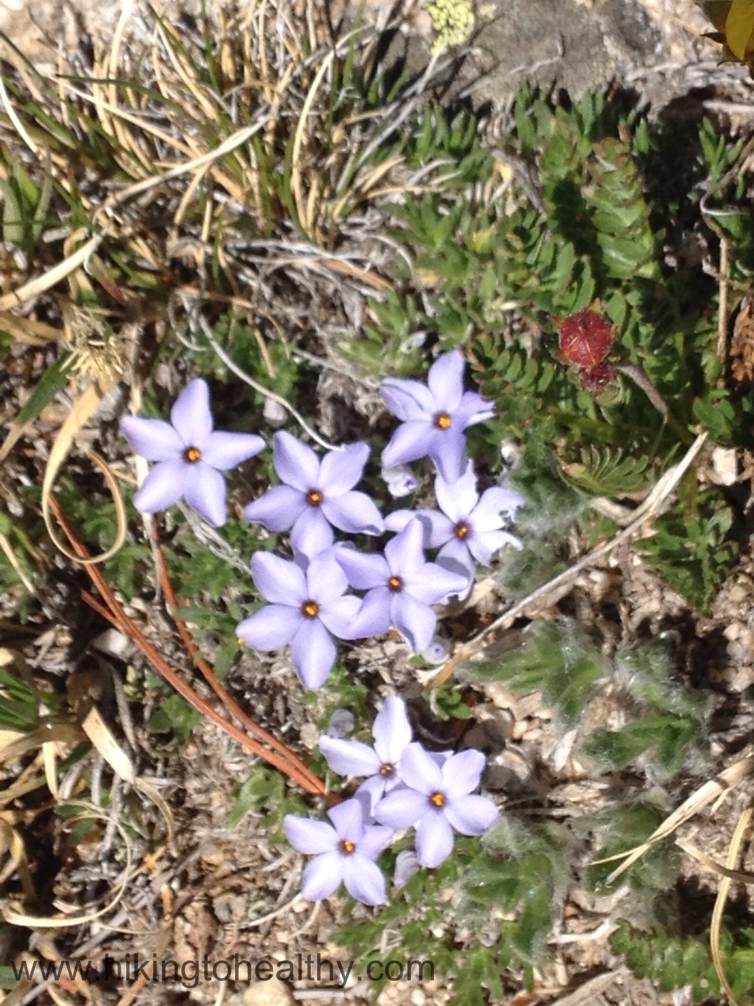
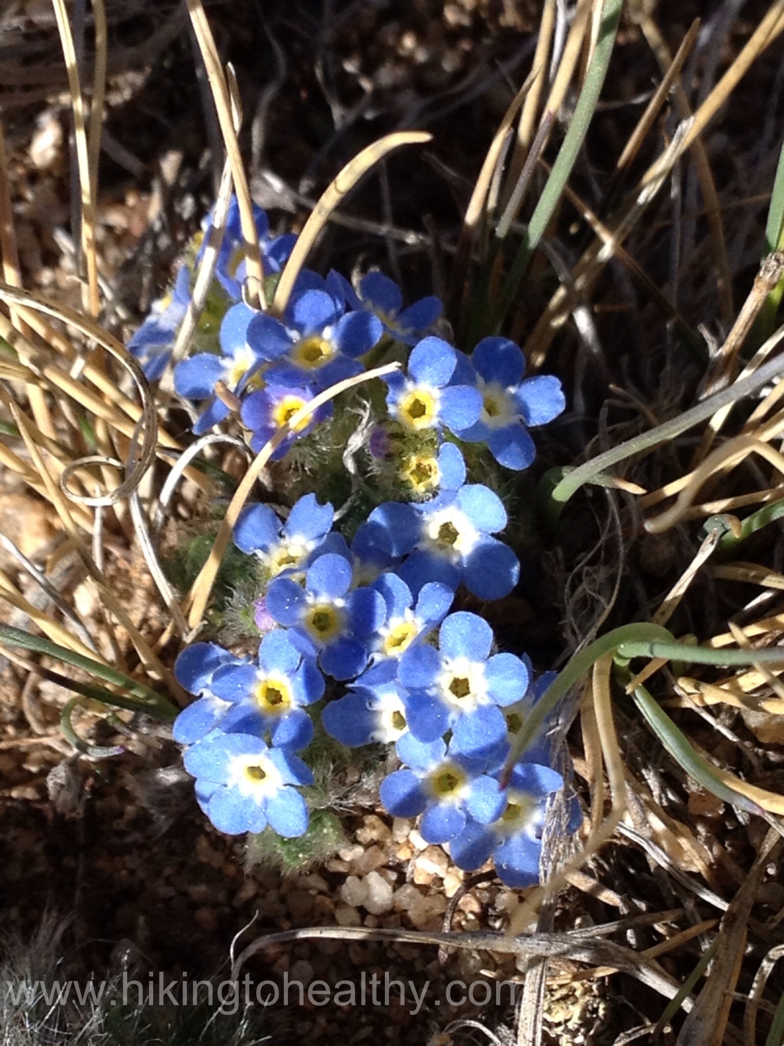
As we passed Meadow Mountain and got to the border of the Rocky Mountain National Park, it was hard not to constantly stare at the amazing beauty of the massive mountains to our right; Longs Peak, Mt. Meeker and Lady Washington as well as the beautiful flowers all along the path, small but plentiful!
Meadow Mountain Behind us.Rocky Mountain National Park BorderUs at the border sign very excited about the hike so far.View from higher up on the pass trail.
The trail goes from Meadow Mountain over to St. Vrain and at a nice easy incline, when we got to the last the snow field before the final climb the amount of snow and water was amazing. It was not unlike a marsh, Aaron randomly put his pole in a little pool of water only to watch it go down a couple of feet. It was a bit of a shock and really struck home how much we have left to learn about hiking in Colorado.
We followed one pair of hikers through the last snowfield to the base of the summit climb. We saw one lone hiker making his own path down and a couple of snowboarders getting in a run down the large snowfield on the East face of St. Vrain Mountain, all going via different routes. As we approached the end of the snow field, no path was discernible and so Aaron kept the couple a bit head in view and tried to follow where it looked like they might have gone.
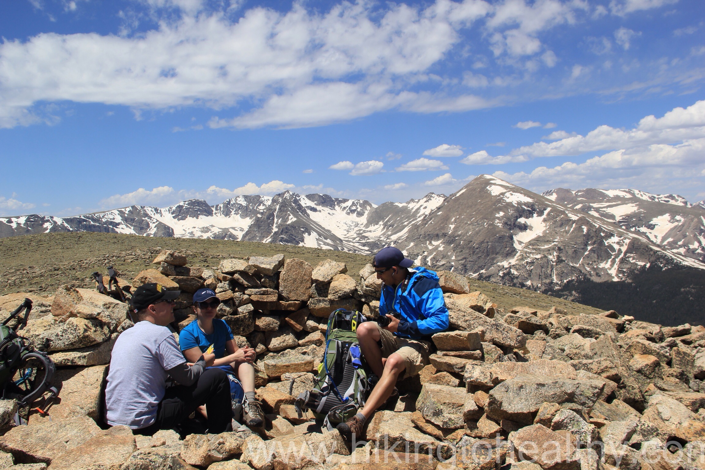
Approaching the Boulder field. It is already pretty steep.Climbing over the steepest edge of the boulder field and false summitThe view north as the boulder field ended and we were steps away from the summit.Wind Shelter
I can tell you I was pretty stressed the entire climb up and repeatedly thought about asking Aaron to turn around, not because the height bothered me but I was using so much strength to crawl over the boulders and for so long with it getting more steep. At some point I realized that I was trying to give up and convince myself I couldn’t do things like this because of my size, but the truth is I was doing just fine. Yes it was hard and yes I was pushing my limits but I was still ok. Interestingly Aaron was doing the same thing for different reasons but because I kept on following him without complaint he kept on going. When we reached the summit I was so crazy proud of us that I didn’t even care how windy it was getting. We shared the wind shelter at the top with another couple that was so incredibly nice. It took us 4 and half hours to get to the top and probably at least an hour of it for the summit climb alone. We ate some food, took a bunch of pictures and then headed back down. More to come on the way down, but first the directions and a few favorite pictures from the way up.
Directions:
From Boulder, take Highway 36 north until it dead ends. Turn left at the light towards Lyons and continue through the town of Lyons until you reach another dead-end. Turn left onto Highway 7 which will take you through St. Vrain Canyon from Lyons to Allenspark. Upon entering Allenspark, take County Road 107 (ski road) south for about 1.5 miles. At this point, National Forest System Road #116 heads up the hill to your right for about .5 miles to the St. Vrain Mountain Trailhead there is a sign noting the trailhead that way. Parking is limited at the trailhead.
I am OK with this no change. It was a tough week in terms of staying on track so in and of itself, not gaining is a win.
Colorado has again been racked by wildfires and the devastation is staggering. There is so much beauty here and seeing it lost in a matter of days is hard, it was hard for me to focus on our next hike or my diet thin king about all those who lost everything and all that was lost to us as a result. I decided that my only goal this week was a no change.
Our hike today was AMAZING!!!! It was also way harder than we thought it would be, well then I thought it would be since I do all the hike research and choosing. I can’t wait to tell you all about it, but it was so taxing that we have decided that it will not be a 2 hike weekend after all. Well the hike today and the fact that I barely slept all week due to the fall injuries from last weekend.
Last week when I was hiking with my girlfriends, we were admiring Twin Sisters (Hike details here) at all of our different amazing view spots. I think it took me 3 looks to realize that there was not all that much snow showing at the summit and by the end of that hike I knew this was where we were going to hike next. It was a good elevation gain, has amazing views and got us above 11,000 feet.
When we arrived at the trail head at 7:30 AM, other hikers were pulling up at a steady pace and we could tell it was going to be a crowded day on the hike. The summit isn’t all that huge either on the West sister and the East sister we never even attempted it last time, so we had no idea what that might look like. We decided to go with a slow and steady pace on the way up mostly to adjust to altitude.
The weather was perfect, it was sunny but with clouds constantly moving across the sky making each glimpse of Longs peak different and more magnificent. As we got closer to the tree line the wind started to really pick up, this is one of those peaks that is always windy and some of the hikers we passed as they were descending said it was hit or miss at the top on if the wind would be bad or not. Most of the snow was gone but we hit a few patches mostly above the tree line.
As we got to the saddle between the 2 sisters, the wind really picked up…like A LOT. Last time we came here we didn’t even try the East sister, which is the true summit, this time Aaron really wanted to try it and so we went towards it. Our timing was almost perfect as 6 people were coming down while we started going up this meant that we had it all to ourselves. This East Summit requires some bouldering and the use of your hands as you find the best path up for you. There is no defined path but most people end up going the same way up just by finding the easiest rocks to crawl over.
When we got to the top of the East Sister, the wind was really pushing us around strong and Aaron is uncomfortable with heights when there is no wind. So while I could have walked around up there, I didn’t because I knew he would probably have a heart attack. I took a couple of pictures and then followed him down, as we were climbing the clouds started to come around the mountainside and we were literally in the clouds.
The view of the West Sister from the East Sister.The view east from the summit of the East SisterView of Longs Peak from the East SisterAaron climbing down the East Sister.
We got down from the East sister and almost ran over to the West Sister so that we could catch the clouds coming in from the East and around the mountain, it was so cool looking.
The Summit was CROWDED and more people were coming up all the time. Fortunately the wind was also driving a lot of people right back down, we got some great pictures as the clouds were zooming across the sky and mountains.
We made great time down the mountain and just as we were about a mile from being done, I fell….hard. I squeaked and got all twisted in my poles trying to protect my head, I even managed to break one of my trekking poles. It turned out not to be a big deal since I couldn’t close my left hand around it anyway and I could only use one pole the rest of the way regardless.
I was doing an assessment of my injuries and figured the hand was the worst one, as soon as we got to the car I grabbed an ice pack and started icing it took some Advil and figured we could still do a second hike on Sunday. The one I had picked was easy so why not…..turns out my hand wasn’t the problem but my whole right side of my body( on which I landed) ignited with pain at about 2AM. Not one for suffering in silence, I woke up Aaron to tell him the hike was off, I am such a good wife…..
Sunday all I did was lay around feeling sorry for myself as the weather was perfect so views of our second hike would have been spectacular. Outside of a few bruises ( including my pride), I am feeling pretty good today but Sunday and Monday were good days of healing. I should be back to hiking this weekend and we are planning on trying 2 hikes again.
I am thrilled with the loss this week! I have been working out extra hard, not because I was focused on weight loss( even though I was sort of) but because I wanted to get extra conditioning for our weekend. We have decided that we are going to really push our hiking these next 4 weekends leading up to our first 14er, which we hope to do the first week of July.
Here is a random moment of shock from this week. I was looking at the pictures we took on our Gem lake hike and noticed what I thought was swelling just above my knee….. thinking great all I need right now is a knee injury. I kinda stewed on it for a few days because I didn’t want to admit there may be a problem. I finally had Aaron check it out and he is like,” um yeah you are developing that muscle it is not swollen, look it’s over your right knee too”. I have had muscular legs before, in fact I had powerhouse legs in high school when I played sports, but I have never developed muscles like I have been getting with hiking. It makes me want to wear short skirts! I guess I kinda knew it would build me some strong legs, but it never really hit me until these past few weeks when I throw on shorts and am like, whoa whose legs are those!
It is finally getting good and warm here but the snow is still holding out at those higher elevations, so this weekend we are going to do 2 hikes. One is a repeater but a little higher than we have been able to get so far, I saw it on my girlfriend hike and there was no snow at the summit. The second one I have been changing my mind on every 5 minutes so it is still a mystery to even me! I know that I am looking for a shorter hike with high elevation.