
Starting Elevation: 8940ft
Highest elevation: 12, 162 Ft ( With all the snow fields we ended up going for a total elevation gain of 3400Ft)
Trail Length: Officially it is 8.6 miles but going around some of the snow fields and our route up my fitbit said 13 miles. It took us 8 solid hours to complete.
Trail Uses: hikers/ joggers
Degree of Difficulty: Difficult/Strenuous.
Bathrooms: None
Pets: Dogs are allowed on leash only but note that this does cross over to Rocky Mountain National Park at some places and dogs are NOT allowed there.

We tried this hike about a month ago and the snow won out. Saturday it was much easier and while snow was still a factor, it didn’t stop us from making it to the summit of St. Vrain Mountain. I read about this hike in the Colorado mountain Club Guidebook for the Best Front Range Hikes and when it said 7 hours to do a max of 9.6 miles for both St. Vrain Mt AND Meadow Mountain I figured we should have no problem completing it in less time. Now that I have actually done it, I want to know how someone does this and Meadow mountain in just 7 hours.
It was a pretty amazing hike and I picked a crazy amount of pictures so I have decided to do this one in 2 parts, one on the way up and one for the way down as surprisingly they were 2 very different hikes.
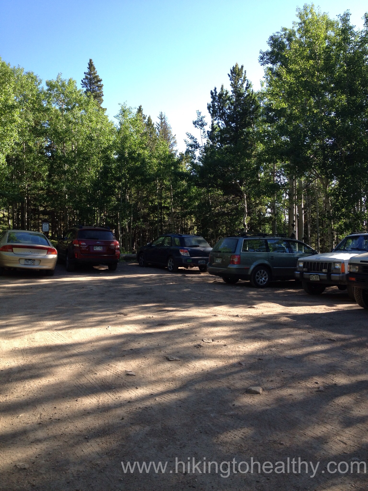
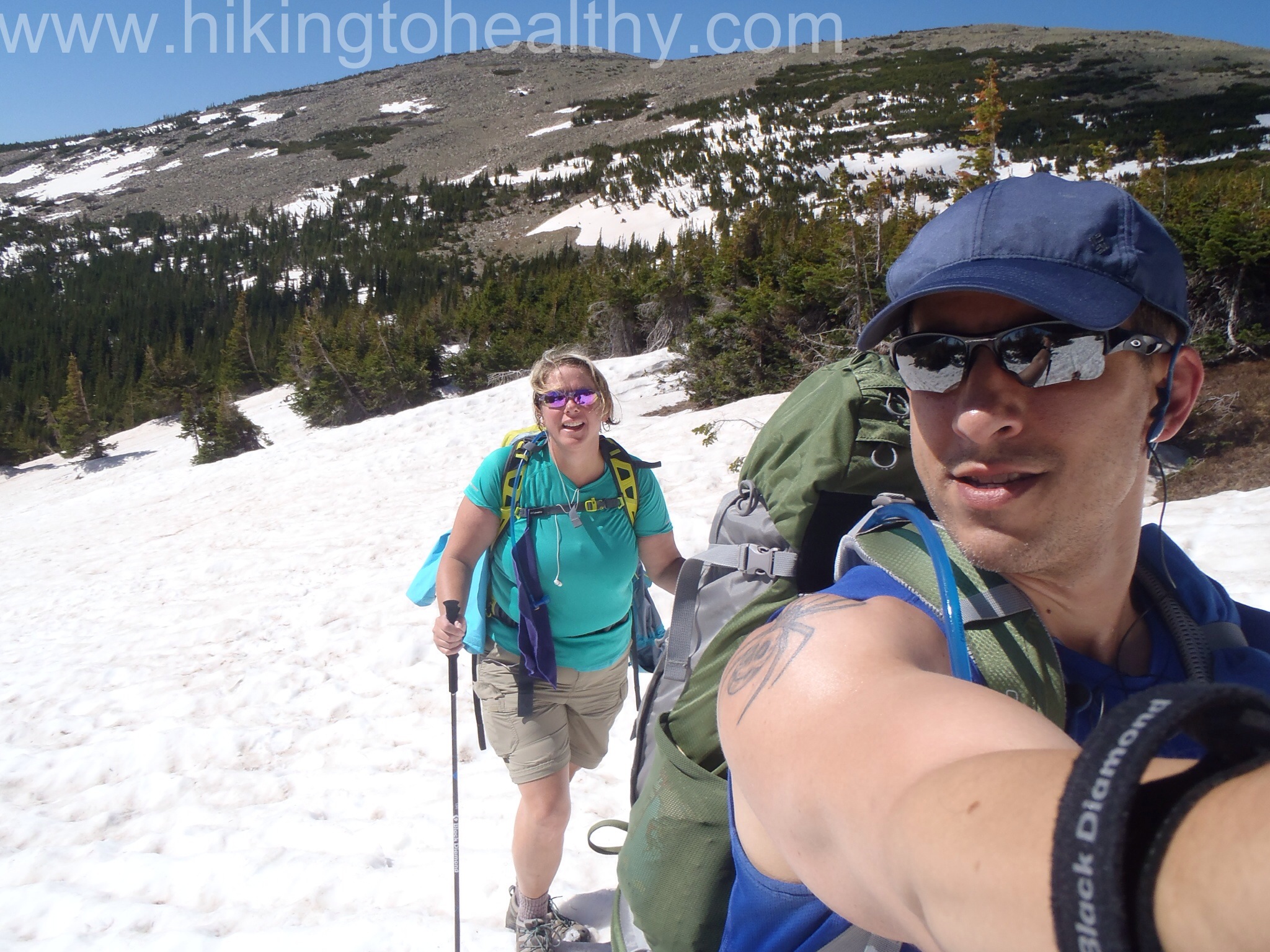
Let’s talk the start and our way up, we got to the parking lot a little later than we planned around 7:45 and started hiking around 8AM. The road from Allens Park to the trailhead does require 4 wheel drive and while there is a parking lot, it is small no more than 8 or 10 vehicles, but you can park on the side of the road leading up to the trailhead. It was almost full when we got there and 2 cars pulled in while we got ready.
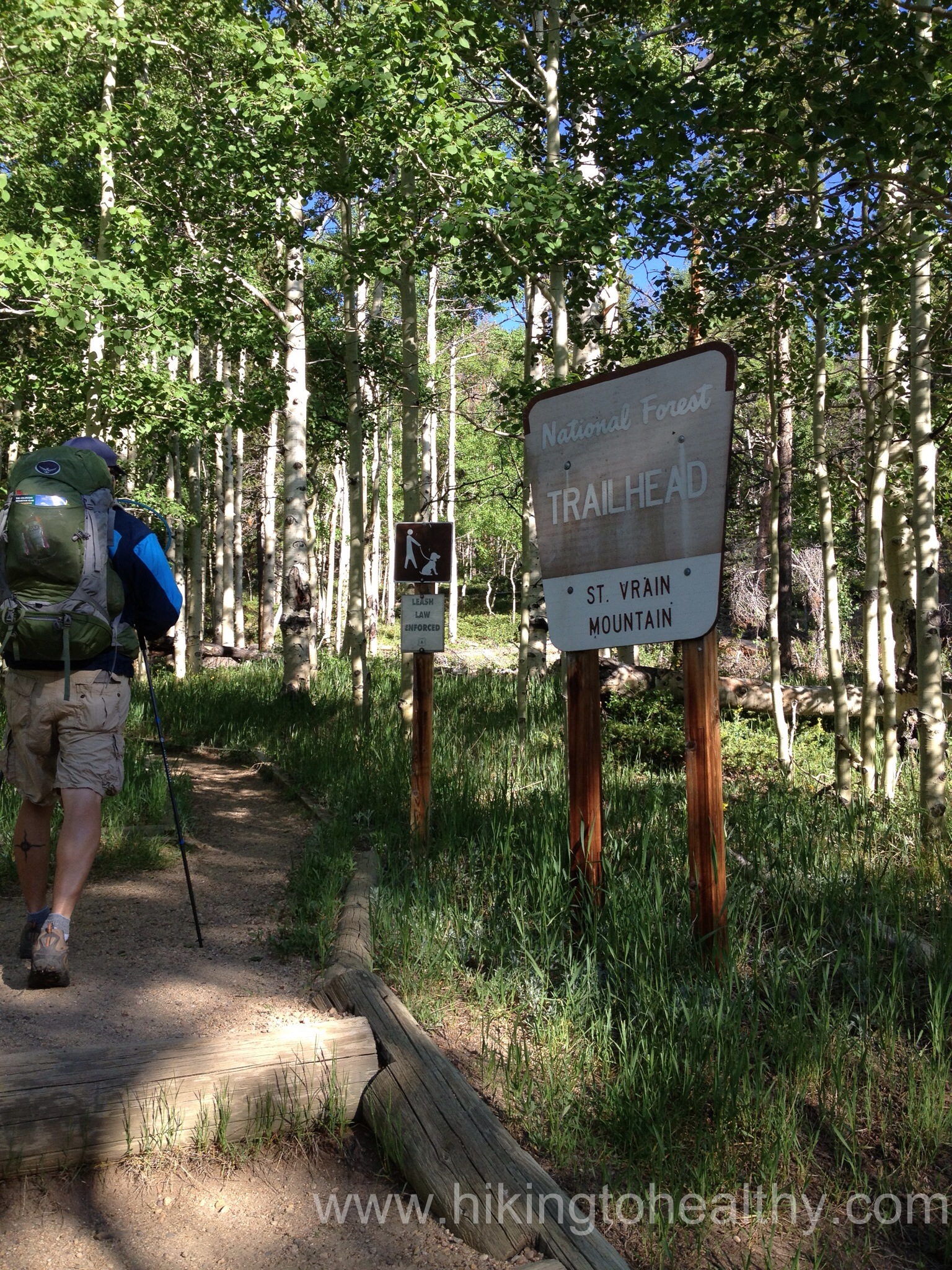
The trail itself starts off with a nice steady incline nothing too hard to warm you up. There are some rocks through out the path but initially it doesn’t start out too bad and the weather was perfect high 40’s and not a cloud in the sky. We started peeling off layers pretty quickly, I love that about Colorado 47 feels like 70 and then again so can 90.

We made it to the Indian Peaks Wilderness sign in a third of the time it took us on our first attempt, which is just under a mile in to the trail.

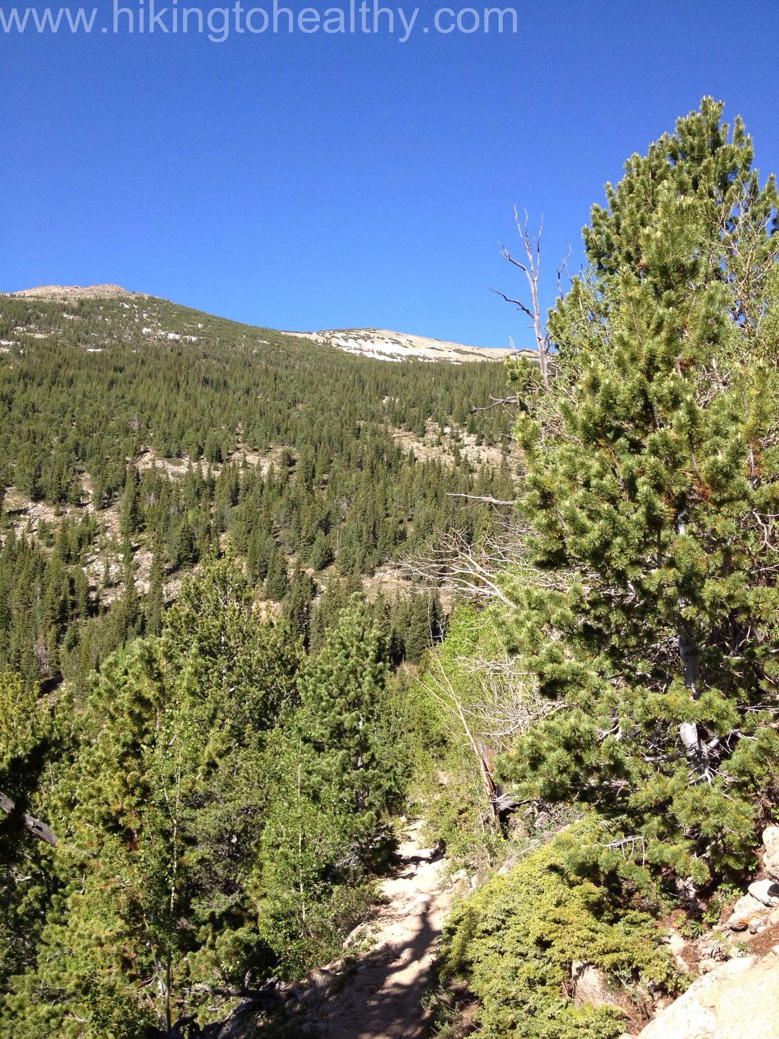
The trail started to get rockier here,while the creek started moving up along the south side of the trail. The nice thing was, no snow in sight and what we learned was that we totally went the wrong way last time. The trail stays pretty close to the creek as it starts to switchback up the mountain and the creek is RUSHING nice and loud from all the snow melt right now.

Outside of the actual summit climb, I would say this is the most steep section of the trail.
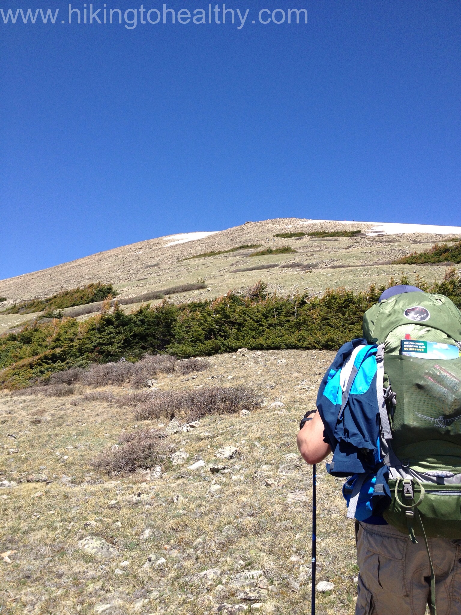
At about 2 miles in the views started to really open up all around and while we had some tree cover we were in the sun about half the time. It was really strong and so we slathered on the sunblock early. The snow melt was also interesting in that there were little paths of water working their ways towards the larger creek and often are part of the trail itself.


We did actually have to cross over the main creek but it was at a good spot and then the switchbacks got very long as we crossed over to other side of the valley here the trees started to spread out. We got to our first snow field at close to 3 miles in and it was interesting as we had to start in a runoff path and then climb up on to the field. From there we followed those who went before us to get back on the trail. It was surprisingly easy but a little nerve-racking as we knew it was deepish snow.

We were making decent time all this way, in fact we did this in less time then it took us to go a mile the first time. The snow fields would slow us down a bit and certainly take more energy but overall they weren’t as bad as what we had been dealing with.
As we started to get closer to the tree line, there were still lots of runoff and I have learned to look behind us often because it is always so beautiful, this time was no disappointment.


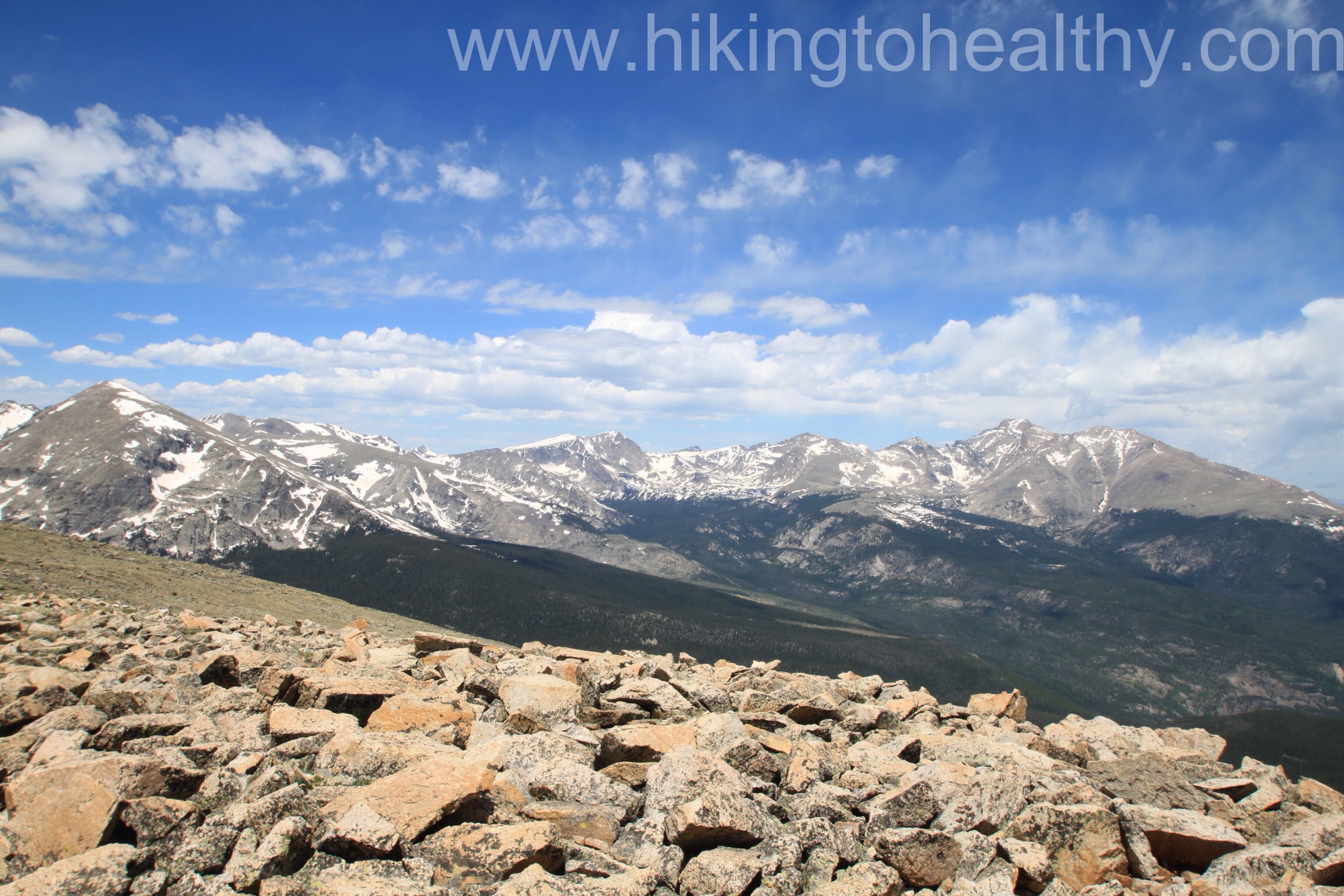
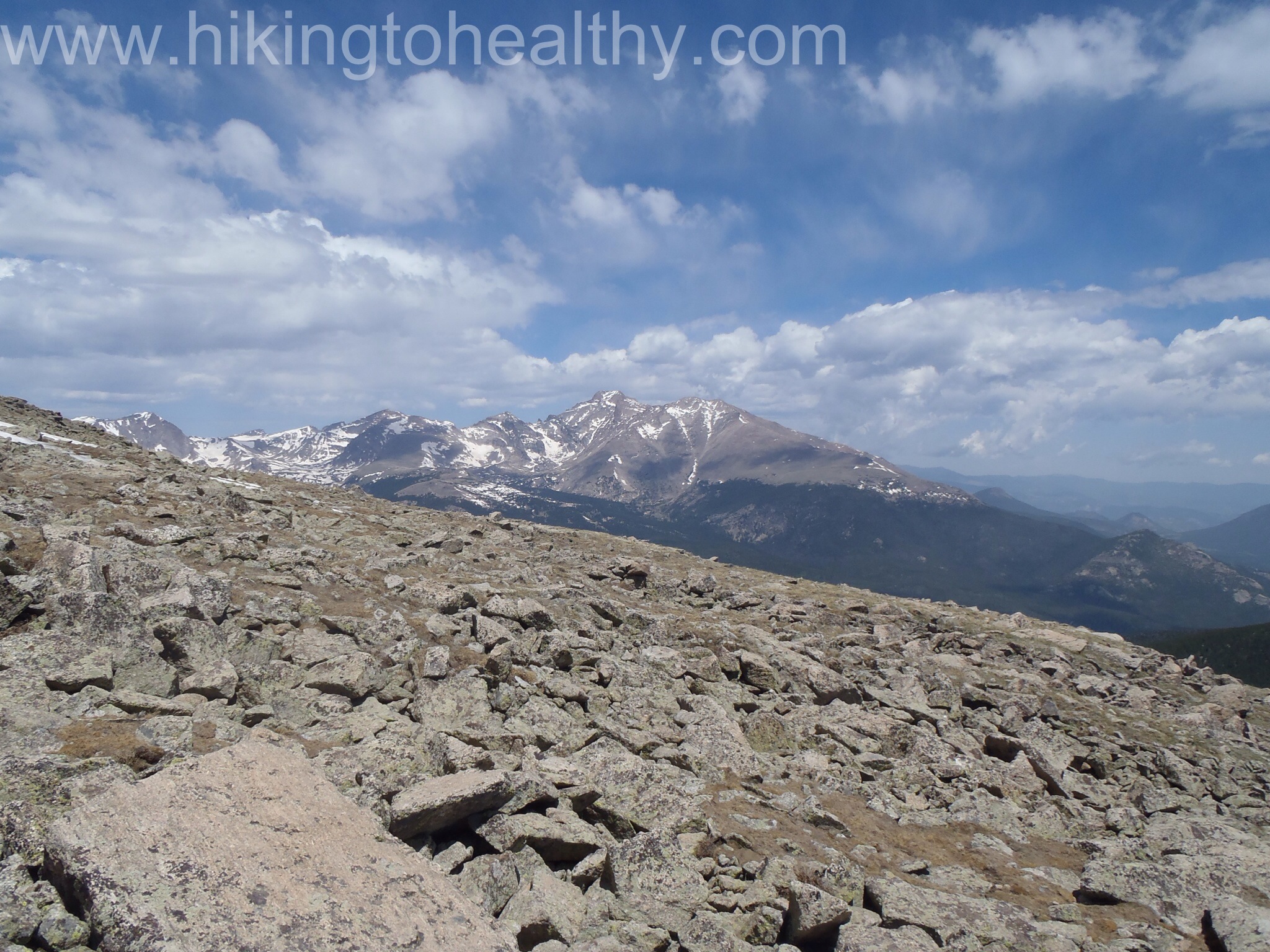
As we came up to the saddle between mountains, the most spectacular view starting coming into play

We also now figured out it was Meadow Mountain on our right. In the trail descriptions I could find it is often suggested to hit Meadow Mountain for an extra .6 miles round trip and an extra 400 foot elevation gain and then go onto to St. Vrain Mountain. I had decided that if we had time and stamina we would try this addition on the way back but our main goal was St. Vrain Mountain, mostly because I had read there is no defined path up Meadow Mountain that it would require a lot of bouldering. Somehow I missed that St. Vrain mountain was exactly the same only more than twice the height and distance to cover.
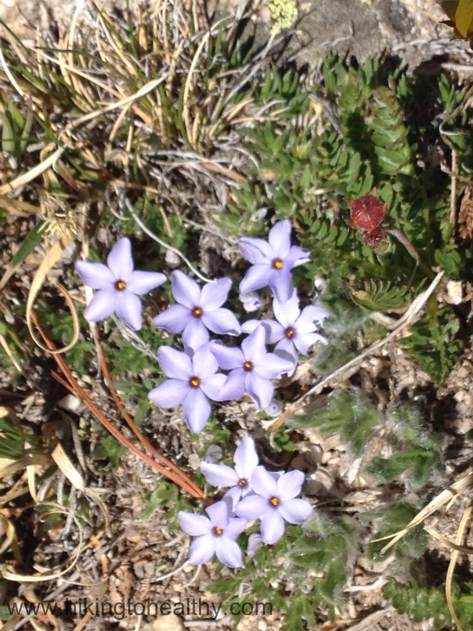
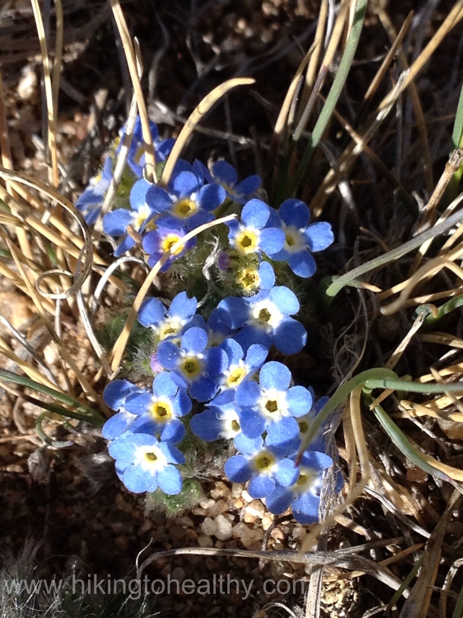
As we passed Meadow Mountain and got to the border of the Rocky Mountain National Park, it was hard not to constantly stare at the amazing beauty of the massive mountains to our right; Longs Peak, Mt. Meeker and Lady Washington as well as the beautiful flowers all along the path, small but plentiful!


The trail goes from Meadow Mountain over to St. Vrain and at a nice easy incline, when we got to the last the snow field before the final climb the amount of snow and water was amazing. It was not unlike a marsh, Aaron randomly put his pole in a little pool of water only to watch it go down a couple of feet. It was a bit of a shock and really struck home how much we have left to learn about hiking in Colorado.
We followed one pair of hikers through the last snowfield to the base of the summit climb. We saw one lone hiker making his own path down and a couple of snowboarders getting in a run down the large snowfield on the East face of St. Vrain Mountain, all going via different routes. As we approached the end of the snow field, no path was discernible and so Aaron kept the couple a bit head in view and tried to follow where it looked like they might have gone.

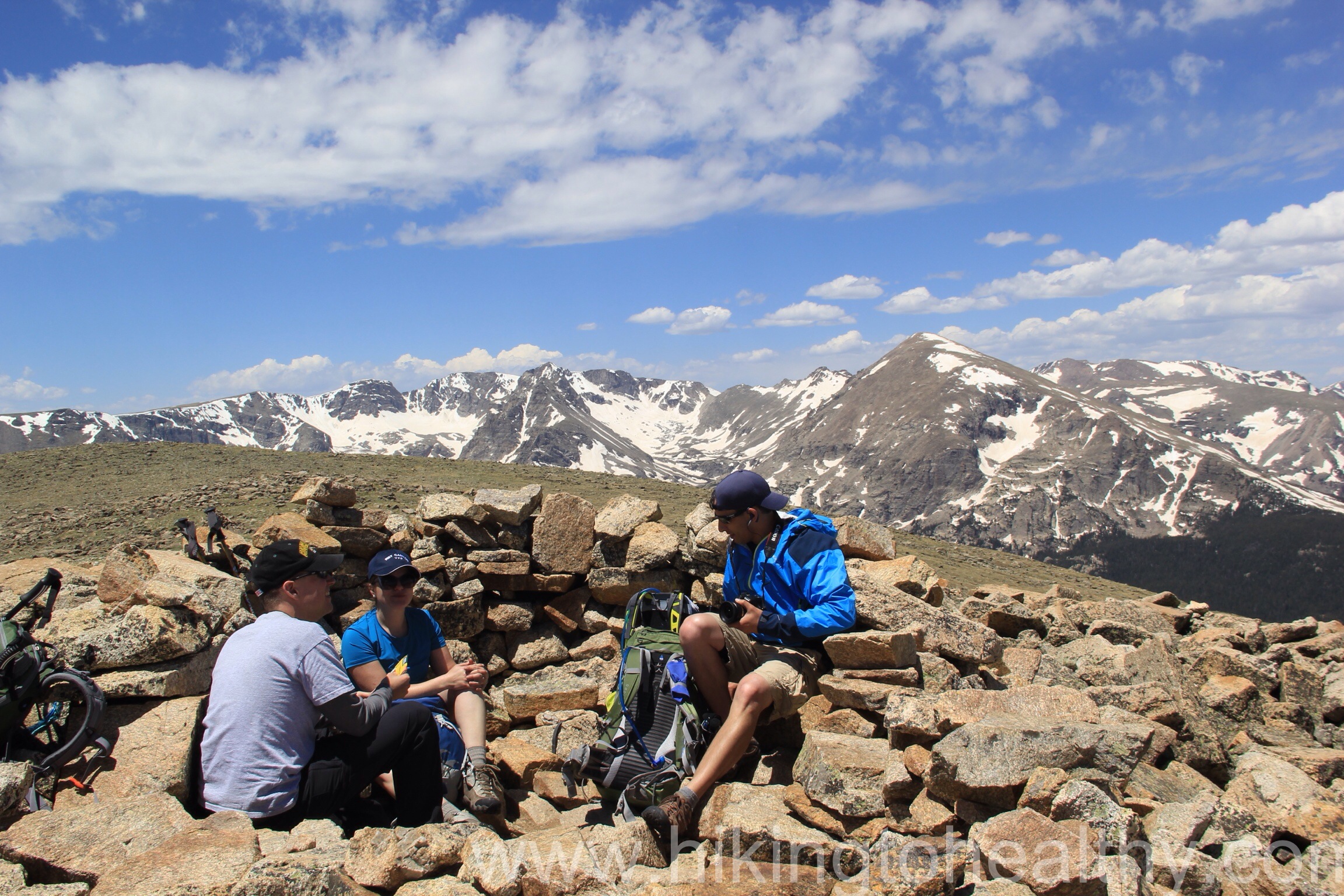
I can tell you I was pretty stressed the entire climb up and repeatedly thought about asking Aaron to turn around, not because the height bothered me but I was using so much strength to crawl over the boulders and for so long with it getting more steep. At some point I realized that I was trying to give up and convince myself I couldn’t do things like this because of my size, but the truth is I was doing just fine. Yes it was hard and yes I was pushing my limits but I was still ok. Interestingly Aaron was doing the same thing for different reasons but because I kept on following him without complaint he kept on going. When we reached the summit I was so crazy proud of us that I didn’t even care how windy it was getting. We shared the wind shelter at the top with another couple that was so incredibly nice. It took us 4 and half hours to get to the top and probably at least an hour of it for the summit climb alone. We ate some food, took a bunch of pictures and then headed back down. More to come on the way down, but first the directions and a few favorite pictures from the way up.
Directions:
From Boulder, take Highway 36 north until it dead ends. Turn left at the light towards Lyons and continue through the town of Lyons until you reach another dead-end. Turn left onto Highway 7 which will take you through St. Vrain Canyon from Lyons to Allenspark. Upon entering Allenspark, take County Road 107 (ski road) south for about 1.5 miles. At this point, National Forest System Road #116 heads up the hill to your right for about .5 miles to the St. Vrain Mountain Trailhead there is a sign noting the trailhead that way. Parking is limited at the trailhead.


What a marvelous post! Great hike and awesome pictures.
Thank you Cindy! It has taken the top of our list for favorite hikes so far!
Looks like an incredible trail to hike. The views you’ve shared are beautiful. Thanks.
Thanks John. We could barely contain our awe while we were doing it!
Great job! Looks like an awesome hike. Congratulations on making it happen!
Thank you!
Whoa! What a great hike for you and Aaron – congratulations!!! Just love the pics – it’s almost as good as being there. You continue to be my inspiration!
Thank you Karin!
A great dialogue of your mountain ascent. The scenery there just looks stunning – it’s the kind of place to top up your backpack and get lost in for weeks at a time 🙂
It really is! In fact we saw a backpacker just pop out among the trees and continue on their journey over the pass. It looked like the best place to be backpacking!
That looks like such a gorgeous place. Way to hang in there and get to the top! Sometimes we only have enough determination and strength to continue to take single steps forward…but with enough of those, any summit can be reached.
You are so right, I never thought of myself as a quitter… but this hike made me realize I am doubter. I am working on it. Doubt and question moves in so quickly!!!! You are giving great advice….now to keep working on reprogramming! THank you!
Thanks for including the pics of the flowers, the views are spectacular, but so are the smaller things along the way. Congratulations on the summit. Yeah, I hear ya about boulder scrambling – that is what Acadia’s mountains are all made of. 🙂