
Bluebell Road > Mesa Trail
Starting Elevation: 5700Ft
Highest Elevation: 6482 Ft ( but the trail goes up and down the whole way like we covered 8 ascents and 9 descents, giving an overall elevation gain of 2600- ish for what we completed) It is a great leg workout!
Trail Length: Officially the Mesa trail is 6.7 miles from Chautauqua Park all the way south to the Southern trailhead just outside Eldorado Canyon State Park for 13.4 round trip and our goal was to do the whole trail round trip. What we managed to hit was 5.7 one way, 11.4 miles round trip according to the map, but my fit bit said 6.5 miles. So I am taking the middle of the road and saying we finished 12 miles today. It took us 5.50 hours 8AM-1:30PM to finish.
Trail Uses: Hiker, Running and I think horses….NO BIKES
Degree of Difficulty: For the first time, Aaron and I cannot agree – my assessment moderate to difficult, Aaron’s = Moderate the book says easy
Bathrooms: At each end North and South. Otherwise this thing is insanely busy all year round so use good judgement…..unlike me
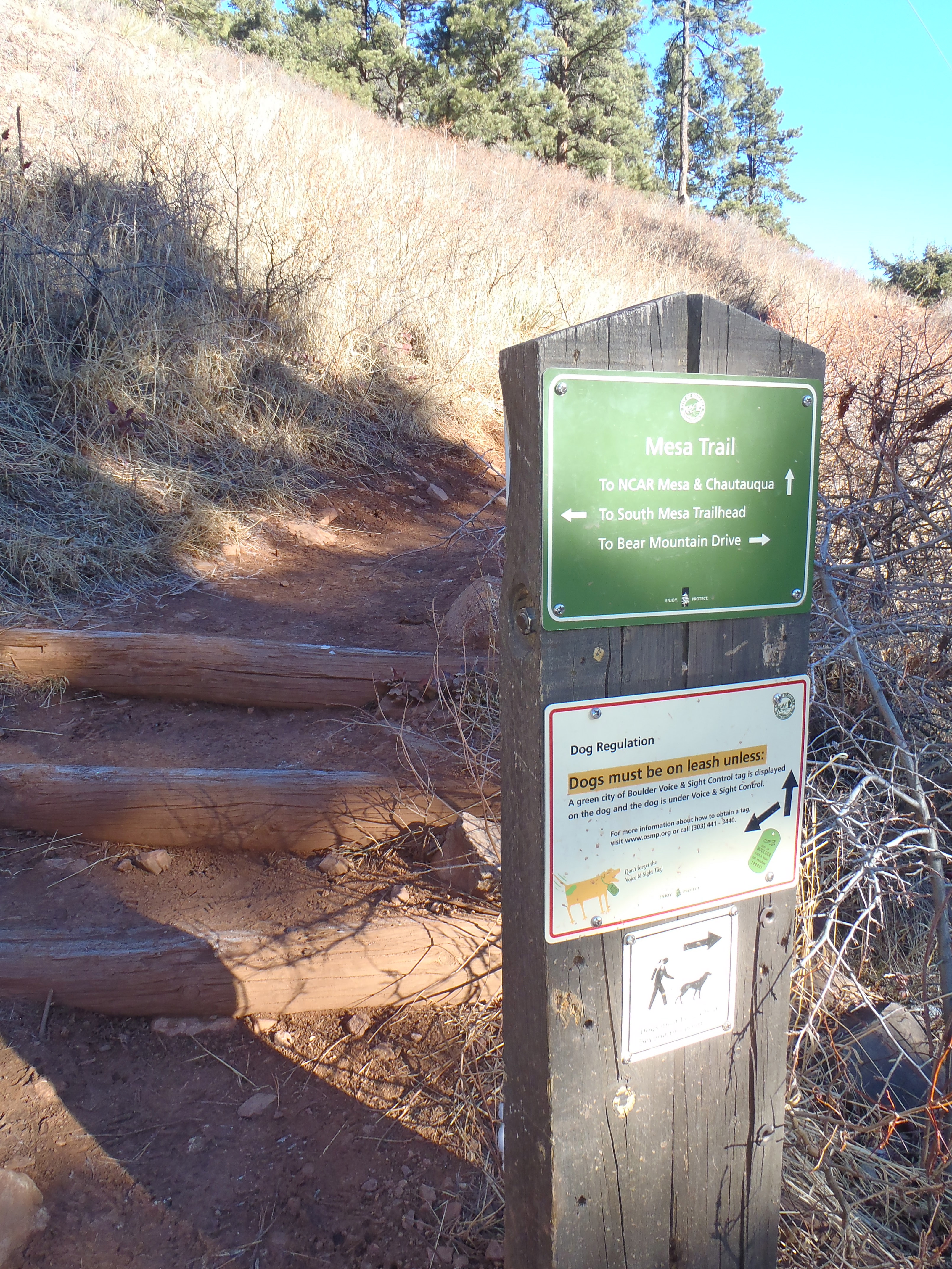
Pets: Yes, but dogs must be either on leash or have the green tag indicating they passed the voice control test for Boulder.
Fees: None!
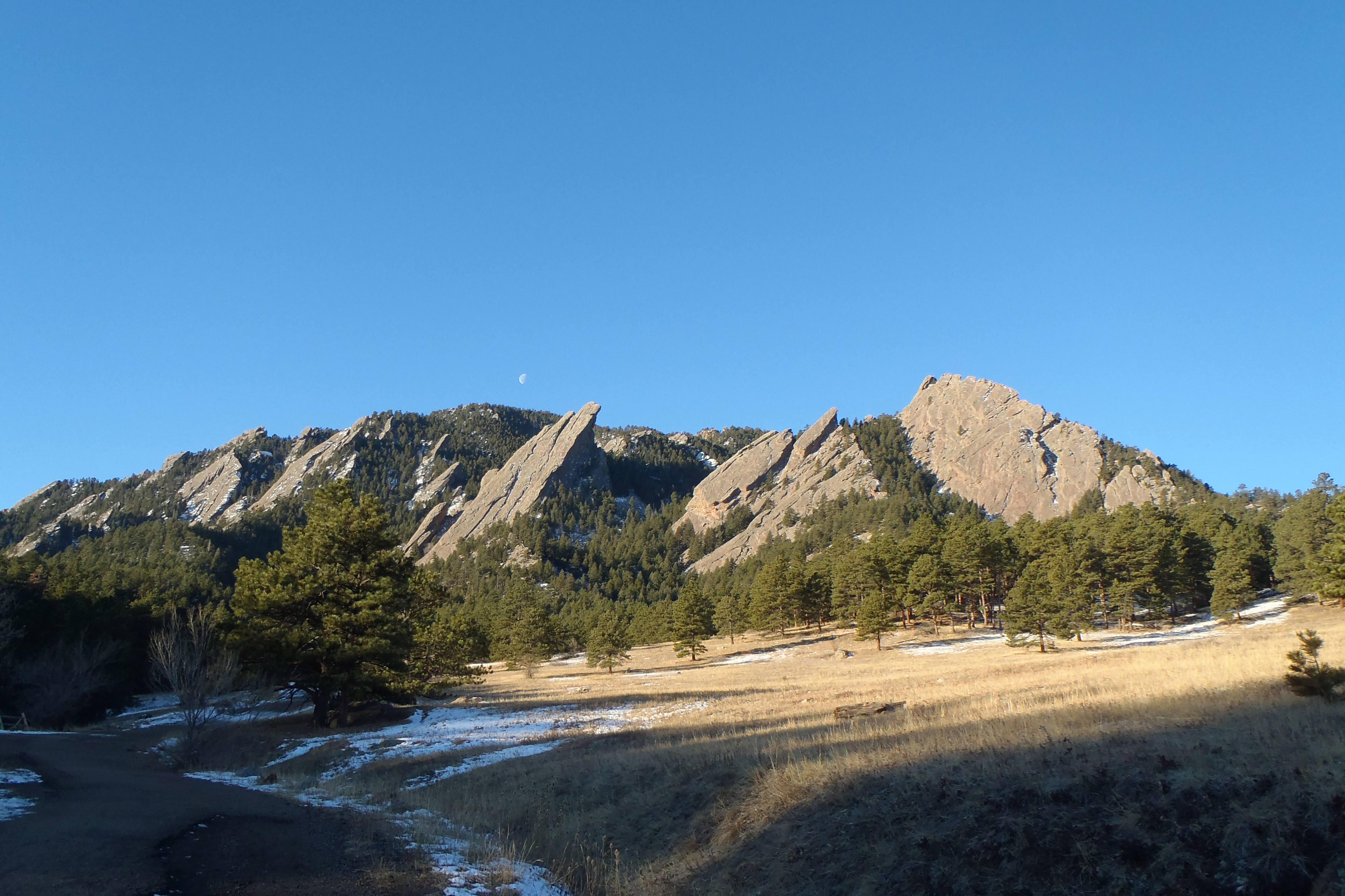
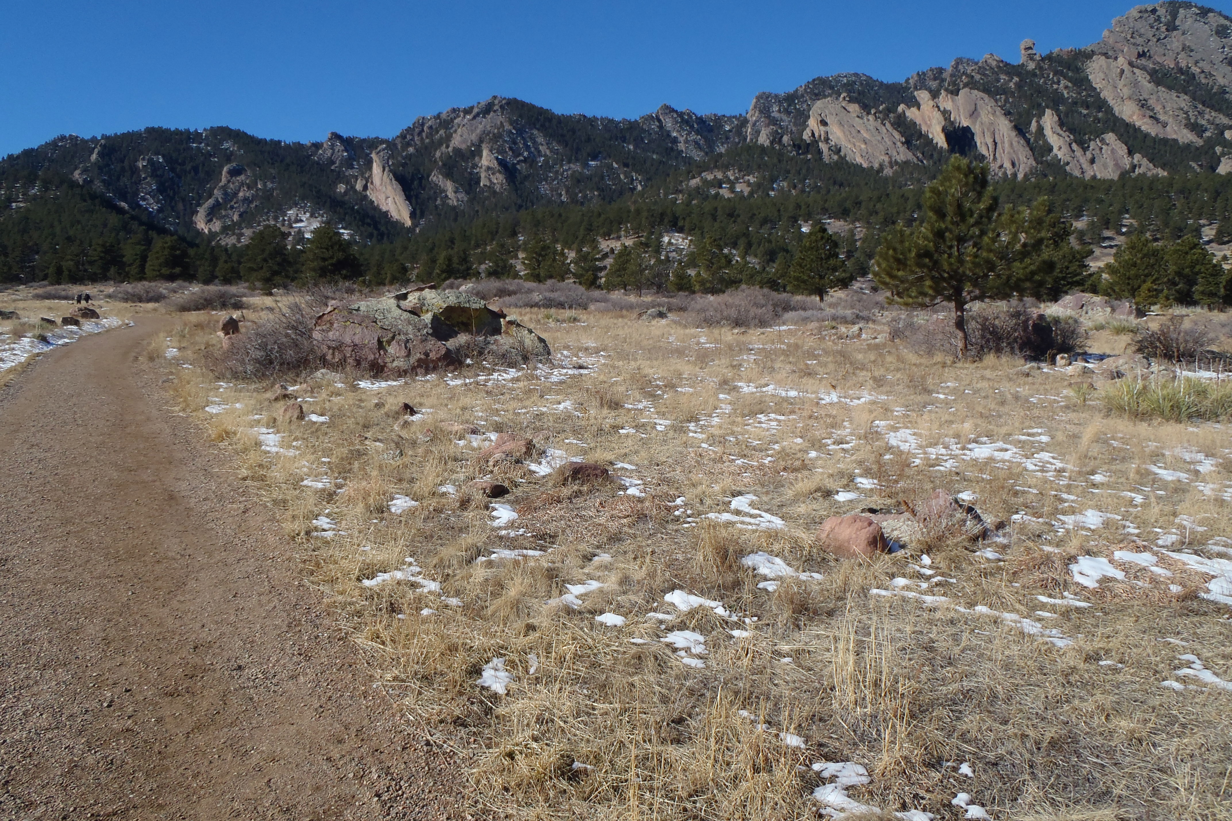
We were feeling pretty awesome after last weeks hike and decided ambitious was the best way to jump into this weekend’s hike. I picked this hike because it was long and while it is considered an easy trail, I think that rating is only given because if you do any one section it is easy compared to where you are going. The Mesa Trail is the main artery along the Flat Irons of Boulder, it leads to the some of the best and hardest hikes on the front range. It goes to Shadow Canyon, Fern Canyon, Bear Peak ( Closed due to fire damage until 7/31/13), Bear Canyon among others. The total up and down elevation gain is around 3200 feet, which is a pretty tough butt burner, calf builder or cardio challenge. At the end I think I counted roughly 8 ascents with 9 descents, I am wiped out!
You can pick up any portion of this trail at 3 parking lots, today we chose to go from North to South so the only choice was to start at Chautauqua Park in Boulder or the beginning ( You can also start at NCAR and the South trailhead by Eldorado Canyon). Take Bluebell Road, directly west of the Rangers station up( South) to the Mesa Trailhead.
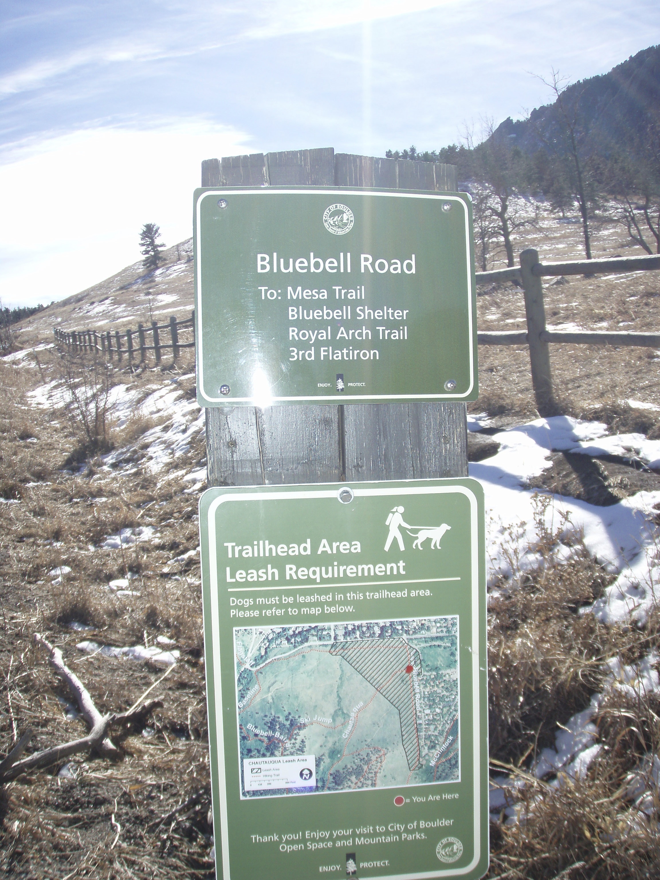
- Mesa Trailhead
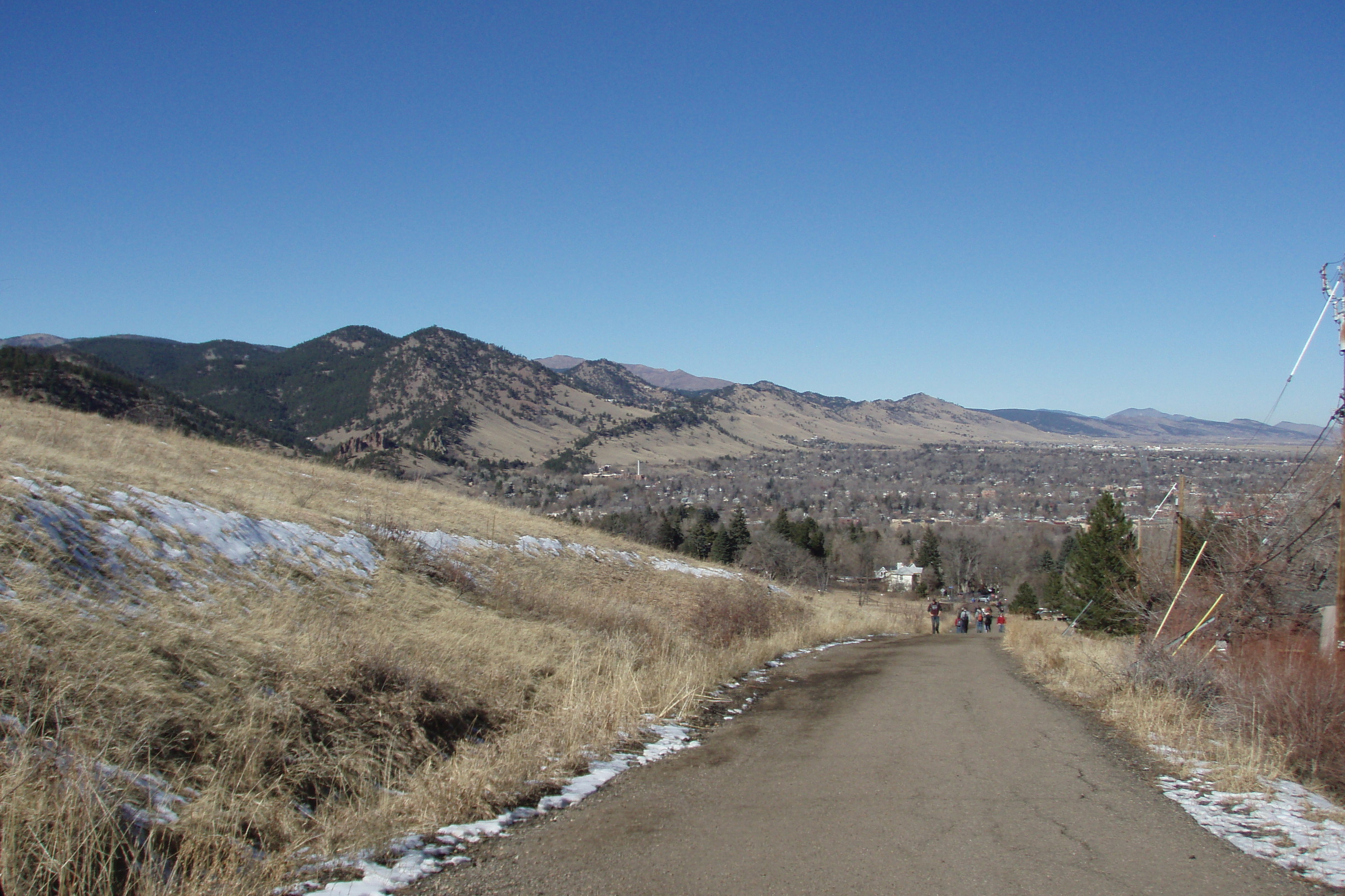
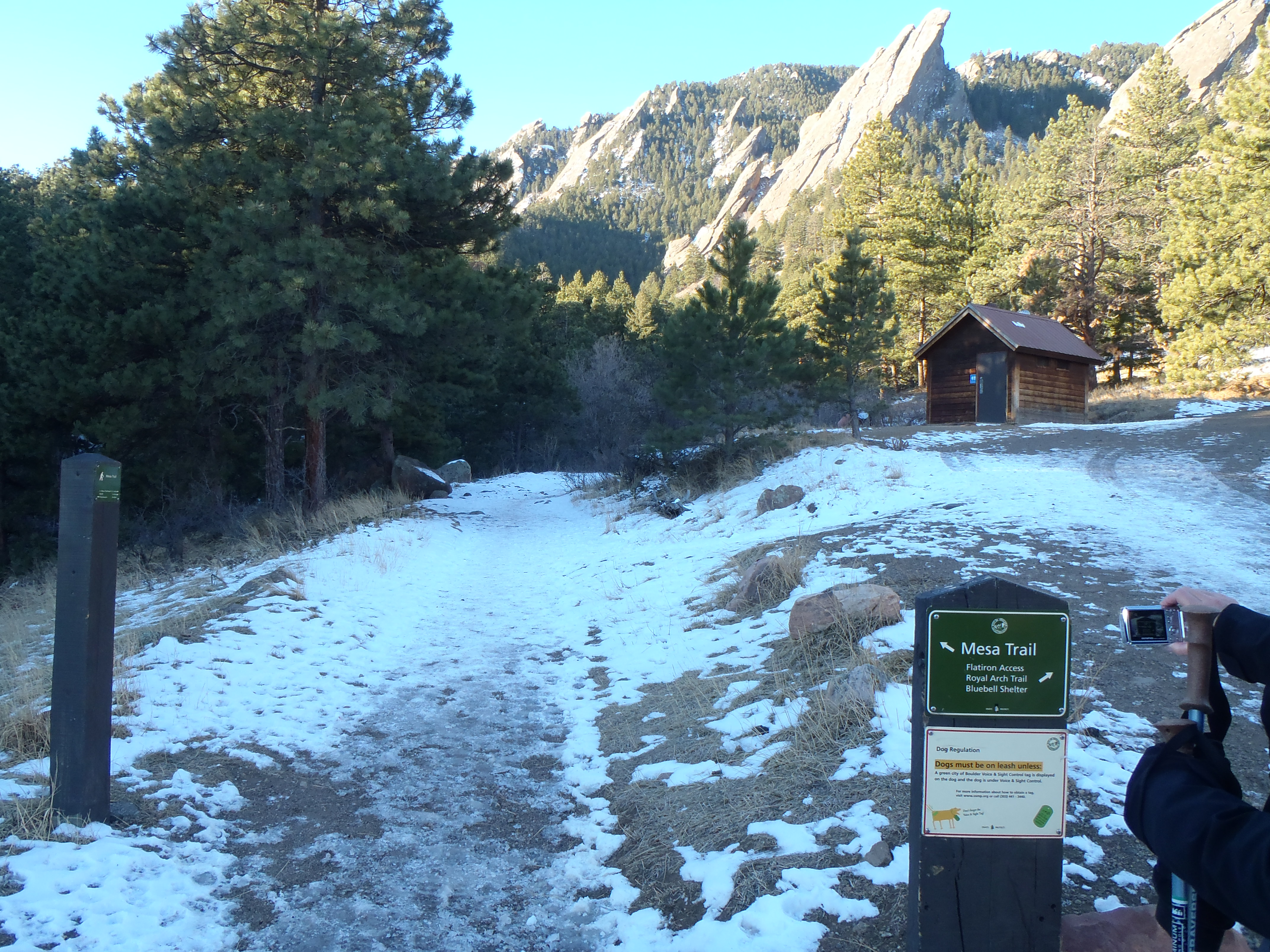
It isn’t a killer climb until you realize it goes on for roughly 2 miles and 700 feet in elevation. It did warm us up super quick! In the distance of the picture above, there is another outhouse which I thought was poorly placed since it was just over half a mile from the parking lot…. but at the end of the hike I actually ran to it. The trail was so busy and after mooning 6 fellow hikers I was a little outdoor solution shy….. Anyway we took the left smaller trail, the right is supposed to be a butt buster up to Royal Arch but we haven’t tried it yet. From the left, this is really the most narrow the trail will ever be. It was often wide enough for 2 groups to pass each other easily. As we got to the ice/mud stairs, I was feeling great thinking how awesome I was, hehe if only had a crystal ball.
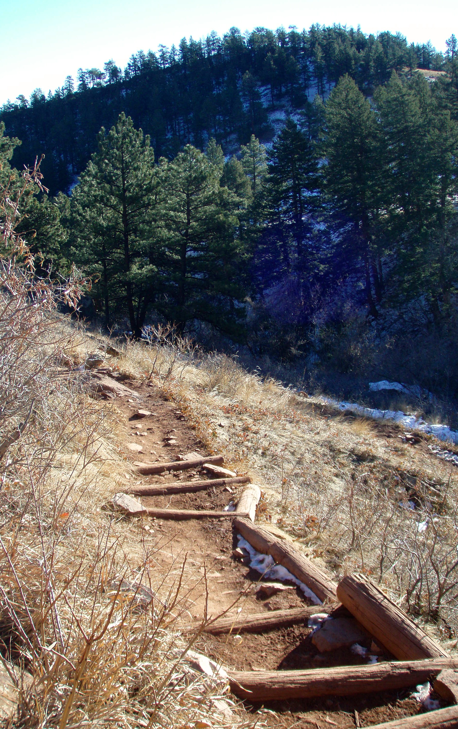

- The Bottom of the mud stairs….not so cute now
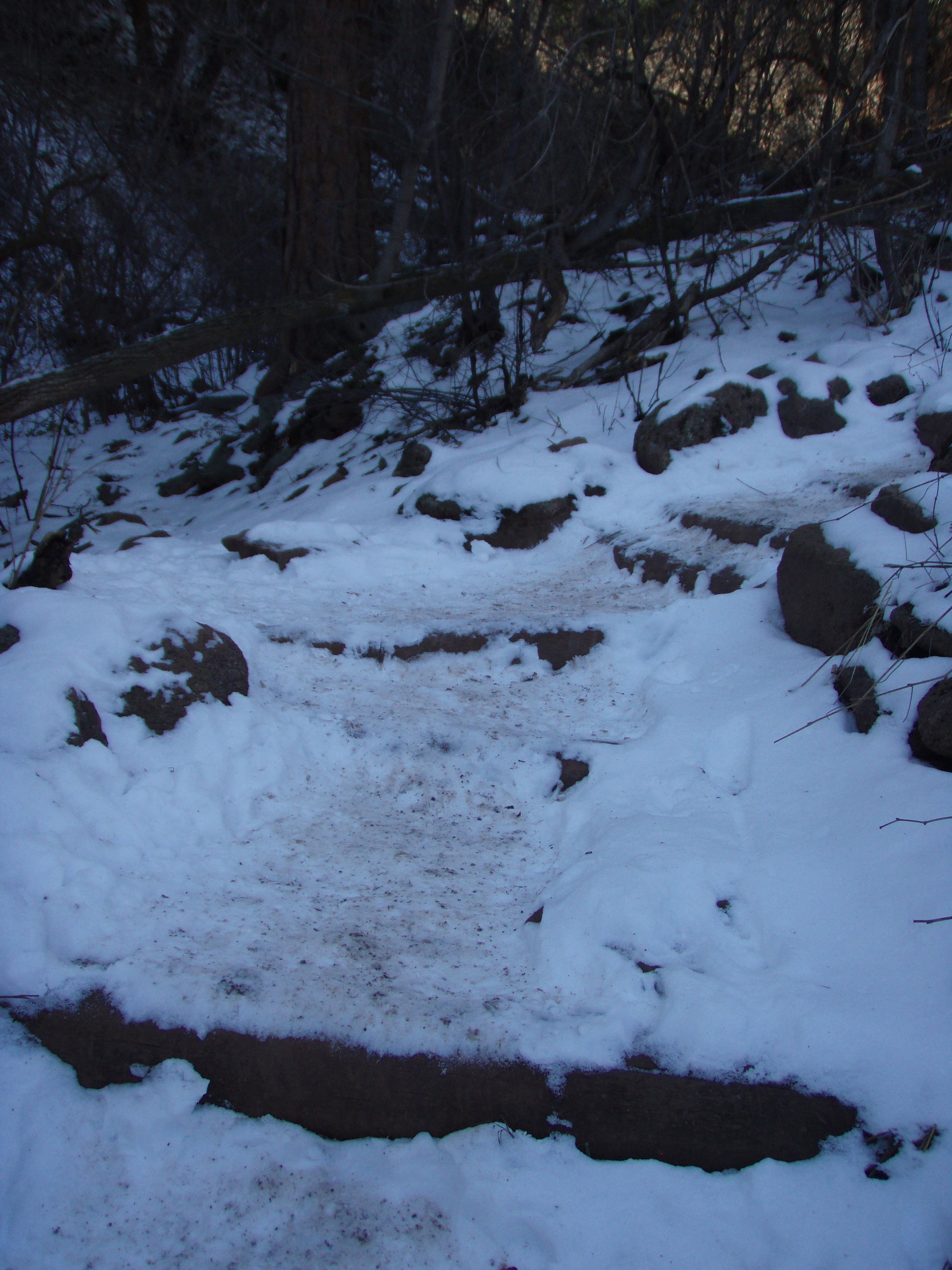
The whole time I was thinking, man those stairs are going to suck on the way back if all that mess melts…it did! The trail is so well-marked, each trail head is very well identified, as is the Mesa trail and what way is the way you want to go. I was super impressed. We stuck to following the signs for 5.7 miles until we turned around.
This trail is interesting for so many reasons. It is really a beautiful hike, in and out of pines, around canyons, the views East and along the front range are stunning. It makes you want to be out there every weekend to see how it is different each day. What makes you kinda not want to ever go there again is your fellow trail users. At first, early in the morning everyone was sort of nice but then the later it gets the nastier your trail companions become, no courtesy or consideration for other people on the trail. Runners are huge here, and no joke, on the way back as we were on a tough climb up, 2 runners tried to “run” us off the trail as they came down making sure that we knew their workout was more important than ours. I was shocked and really disappointed at how many mean or indifferent people there were after 10AM, honestly it made me not want to ever come back.
There was one more thing that made me not want to come back. On a slow trail, finding a secluded place to “take care of business” is challenging as it is. On a busy trail like the Mesa Trail it is almost miraculous, which is how I found myself mooning several hikers after my best efforts to find a secluded spot, shortly before we turned around. I am newly comfortable to peeing outside so this new hiccup was unexpected and REALLY embarrassing. Aaron was trying to so hard to misdirect the passing hikers stares by talking to the decoy me on the opposite side of the trail but I just chose unwisely. It did lead to a ton of laughter and trying not to make eye contact with those hikers that passed Aaron as they realized it was my butt they saw in the trees not so long ago……
This is a year round place to hike, the ice can get tough in the shade just as the mud is super tough on the sunny parts. It is worth doing at least once and honestly we will probably do it one more time to try to get to the end.
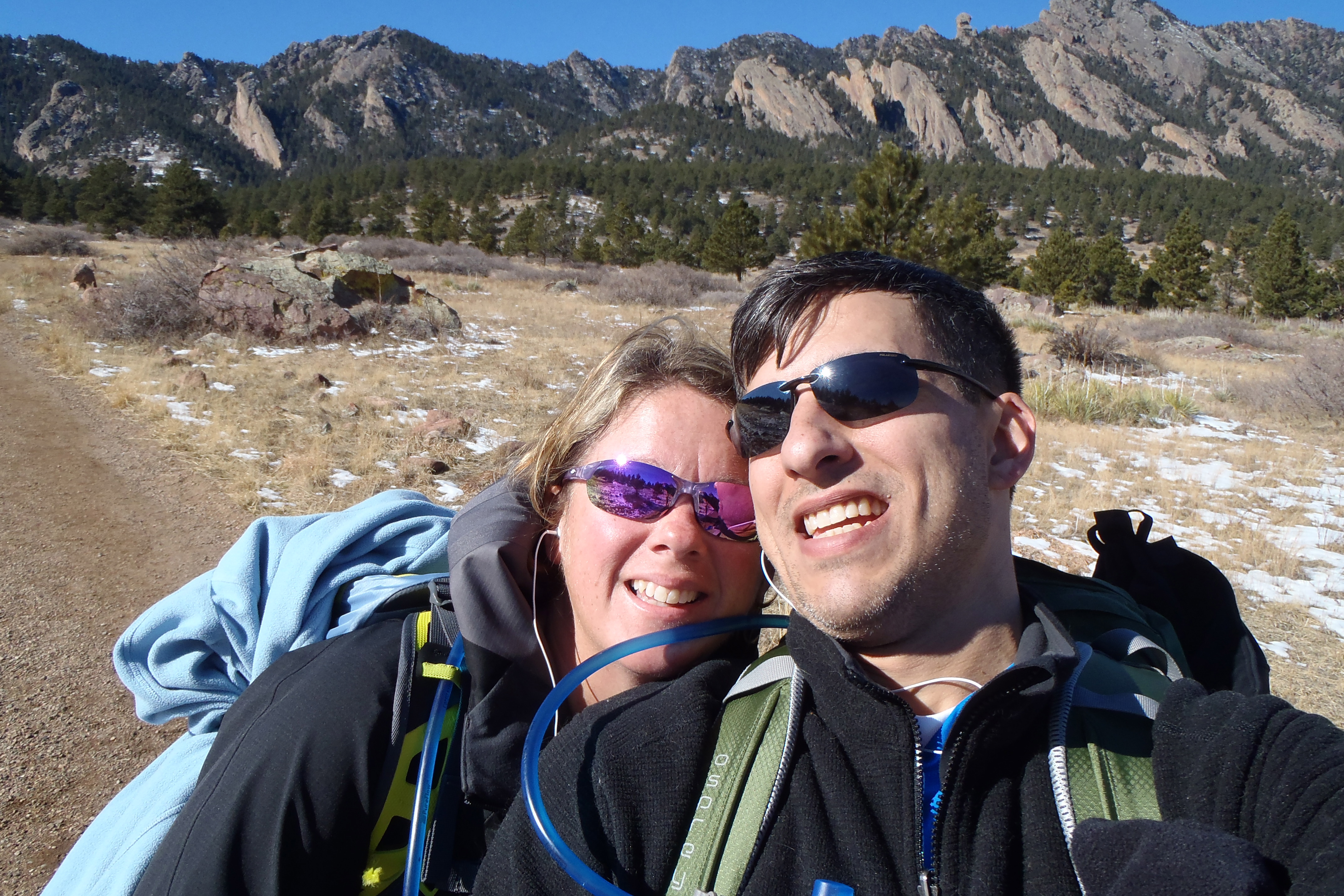
After the directions to the hike will be our favorite pictures.
Directions:
From Boulder, take Baseline Road west of Broadway 1 mile to the Chautauqua Park entrance on the left hand side of the road.
From Denver, take I-25 North to HWY 36 towards Boulder. As you enter Boulder, turn left onto Baseline Road and turn left. Take Baseline Road for about 1-2 miles and Chautauqua Park will be on your left.

Your descriptions are so vivid I can do the hikes with you. Thanks again for the effort to share your experiences with us. I really LMAO reading your mooning story. It is a tricky situation to accomplish the deed discreetly. Sometimes we win and sometimes we lose. Keep up the good work.. Love you, dear one.
Thank you Vikki! Love you too!
The rudeness on the part of other trail users is just so silly, if THEY don’t want other people “in their way”, then THEY should go elsewhere. What a shame how a few people ruin a good thing for everyone else. And if the worst thing that happens is a few people see your butt, well that’s not too bad. Guys certainly have the advantage in this regard!
I know Carol, it was very disappointing for us and really turned our attitude towards those we had to continue to pass. The trick for this trail is to go early and get out before the mean people come in.
Way to go! Thanks for the “Like” on my blog. trekker2013.wordpress.com My quest is somewhat different than yours. My trek this year is the Camino de Santiago that runs from St Jean Pied de porte France to Santiago Spain. The Way of St james. It is my “Bucket” list. Just one item. I will pray for you on your “Pilgrimage” to health. It looks like you are well on the way. With luck and faith, I will be in pretty good health after a 500 mile trek.
Bob Schultz trekker2013@hotmail.com
Thank you Bob! Your Journey sounds amazing, I cannot wait to hear more about it and I am sure you will be in great health after it!!! Thank you for checking out my blog!
This post is great! I’ve been wondering about this trail and appreciate your write-up. I think we have a lot in common regarding our reasons for hiking:) And I also am turned off my runners or bikers who act like their workout is more important than any mere walker. We’re new to Colorado, and find that most people are kind and polite (especially compared to the east coast), but perhaps the elite athlete attitude is worse in Boulder than other areas.
Thanks Miriam! Everyone here is very nice I am sure you will love it here!!!