
The Glacier Hike> Jamaica Flats> James Peak:
Starting Elevation: 10,423 Ft
Highest Elevation: 13,294 Ft (2900 total elevation gain)
Trail Length: 8 miles ( It varies as you cross the Flats and start the summit) It took us 4 hours total.
Trail Uses: Hiker
Degree of Difficulty: Moderate to Difficult due to elevation
Bathroom: Port-o-potty at the parking lots
Fees: $5 to park per day ( 2 lots near the trailhead – No parking allowed on the roads around it)

To start out our vacation week in the mountains, I wanted to do a trail on the way to our condo and this one was supposed to be beautiful. It would take us over 13,000 ft, had decent mileage and was supposed to get us around 2900 feet in total elevation gain. Plus we would get to climb on the Glacier, which was something I have always wanted to do.

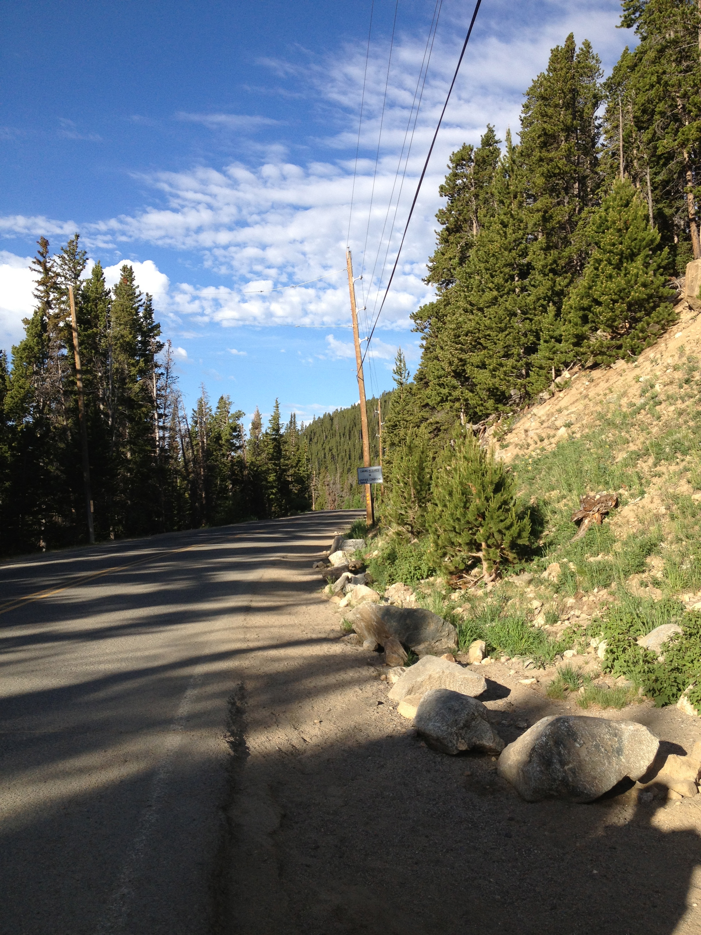
We actually started from the parking lot down the road back to the trailhead, although if you have to park in the other lot you will have to walk up the road to the trail.
We tried for an early start but with the extra packing for our week in Breckenridge we didn’t get to the parking lot until almost 7:30am. Normally that wouldn’t be all that big of a deal but there was supposed to be a storm rolling in sometime between 11-2 so it cut down on how long we could take to get to the summit.
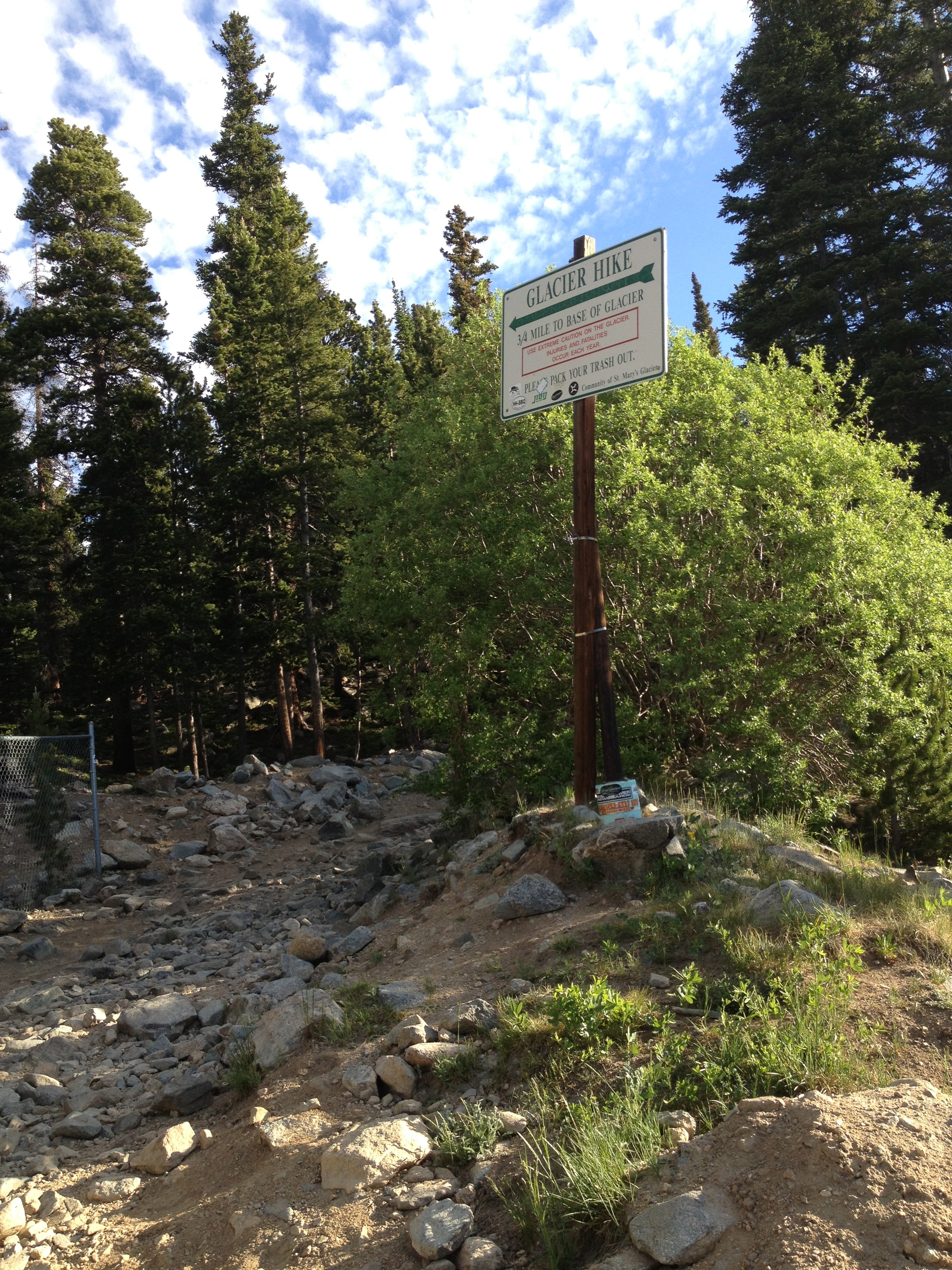
The trail itself starts out as an old 4×4 Jeep Road with a ton of rocks and a nice incline up to St. Mary’s Lake and the glacier. In just 3/4 of a mile we got to the lake and the Glacier, it took just 30 minutes.

We did stop for a few minutes and took pictures of how beautiful everything looked. At this point we were hoping that the rain would hit more around 2 then 11 and the sky was supporting our hopes.


From here we went back to the trail split, crossed over the stream and headed up the north side of the Glacier.


We kept moving up and made it to the glacier part of the climb pretty quickly, then we slowed down. Hiking up the glacier took longer then I thought it would, we were on it as long as it took us to get to the lake itself I had no idea it was so big.
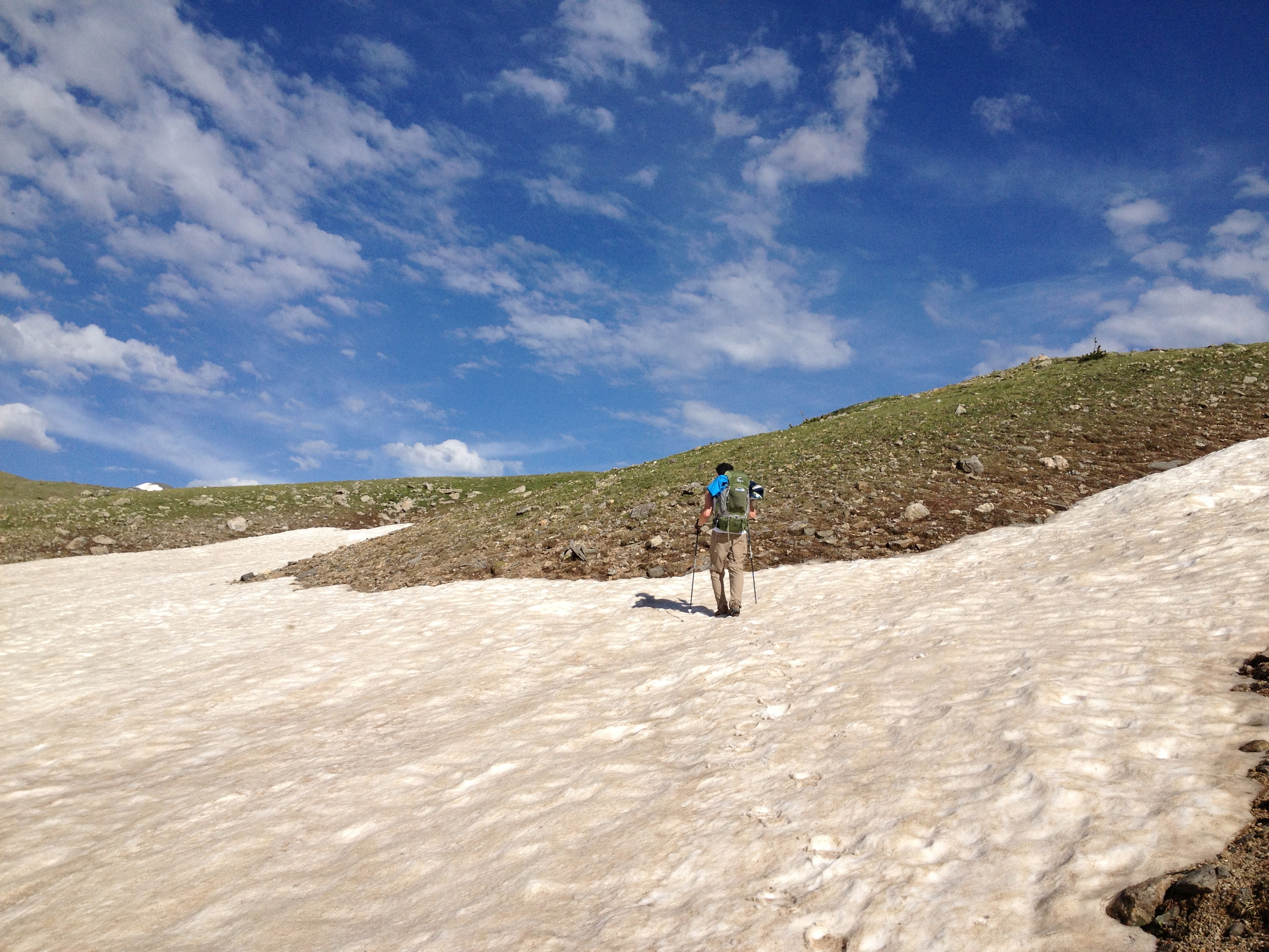
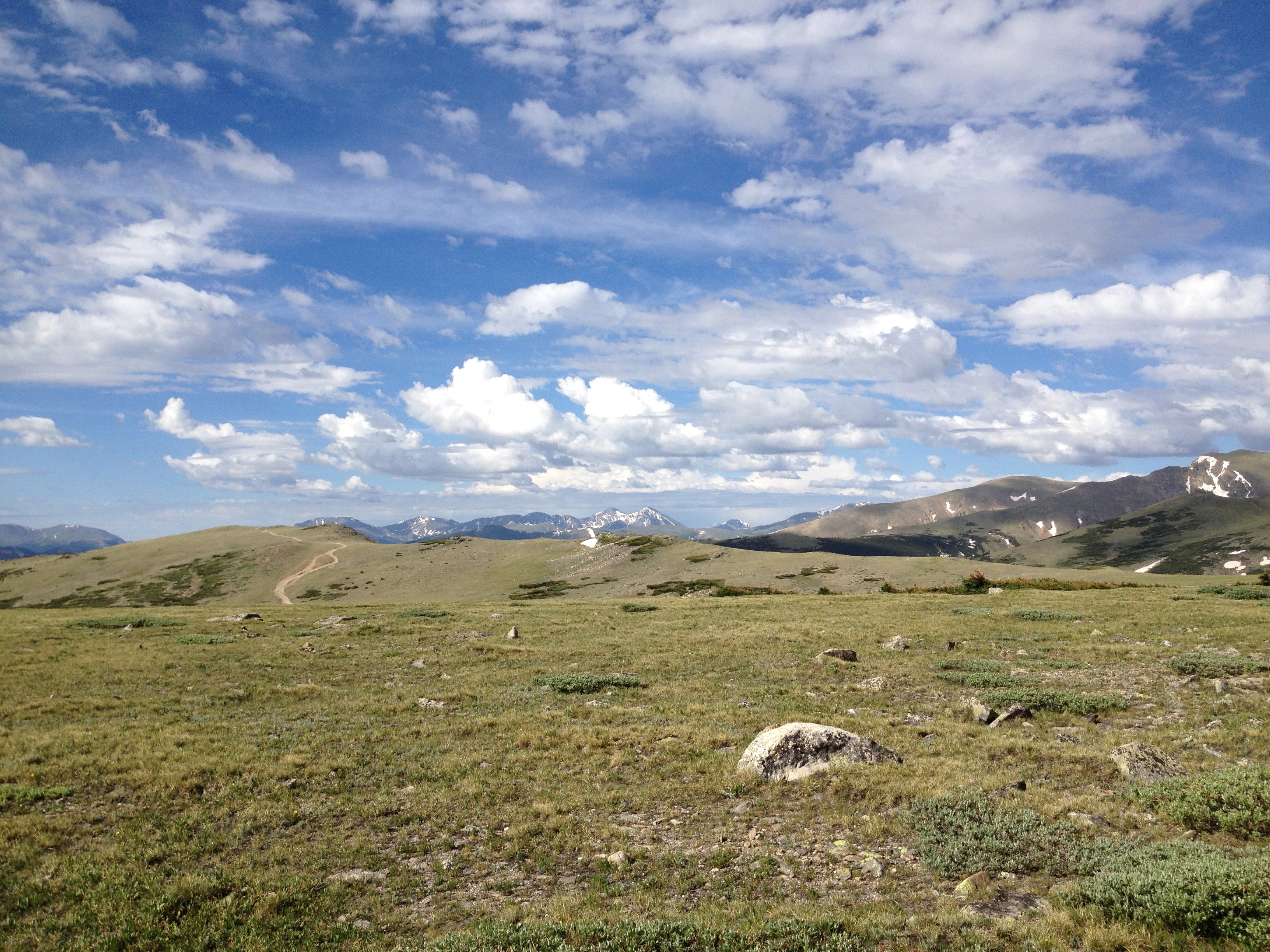
After the climb up the glacier we reached the Jamaica Flats with James Peak directly in front of us.
The trail takes the flats on the left over an old jeep road.
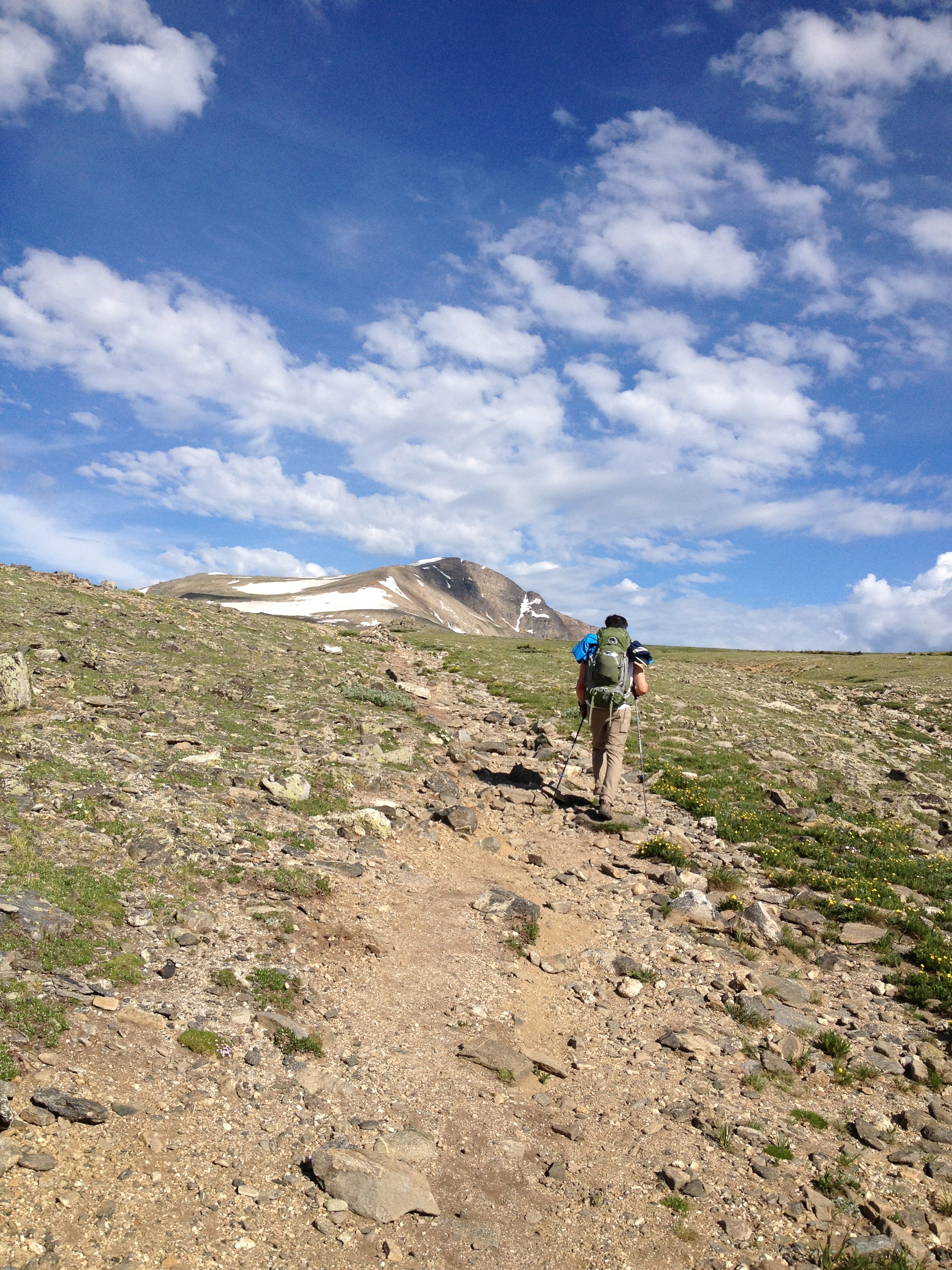

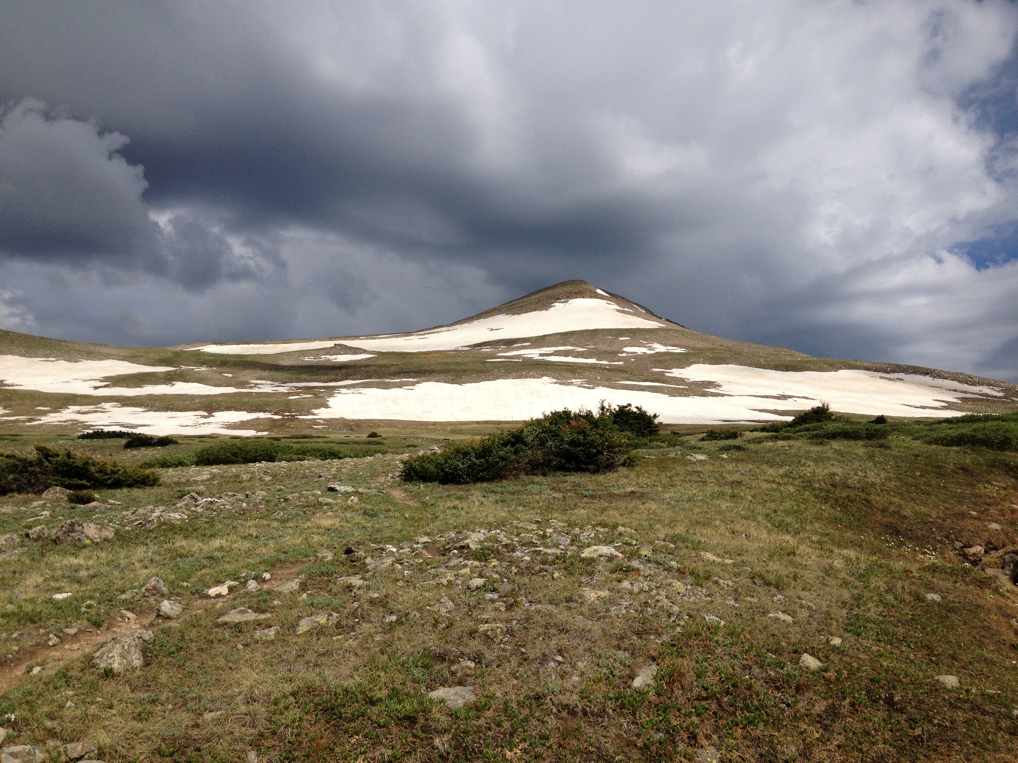
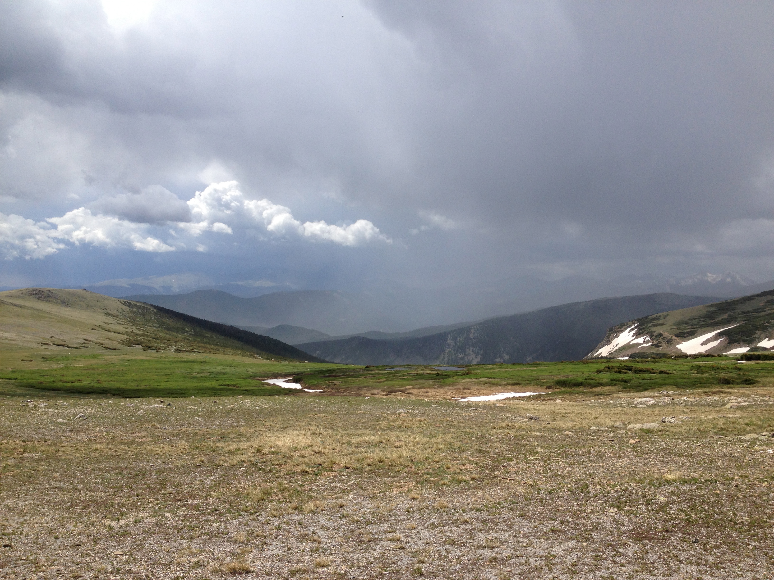
We started our summit climb looking at all the clouds starting to show up around the peak and all the peaks around us. We moved as fast as we could while approaching 13,000Ft in altitude and so you know fast wasn’t really all that fast. When we passed a few hikers coming down they said the clouds were all around on the other side as well and looking ominous not to make too many stops if we wanted to reach the summit before the storm hit. It started raining on and off, then as we were maybe a quarter of a mile away from the summit we saw lightning just over the edge of the top. That was a hike killer for us. We turned right around and headed down, here is the picture I took just before we turned around:

James Peak will always be there so no reason to risk getting hit by lightning when we can hit it again later. Of course as we started to head down the storm got worse and then surprisingly better. When we got back on to the flats, it was beautifully blue over James Peak which made us regret turning around.

The best part of this hike was the actually the beauty of the storms hitting all around us.

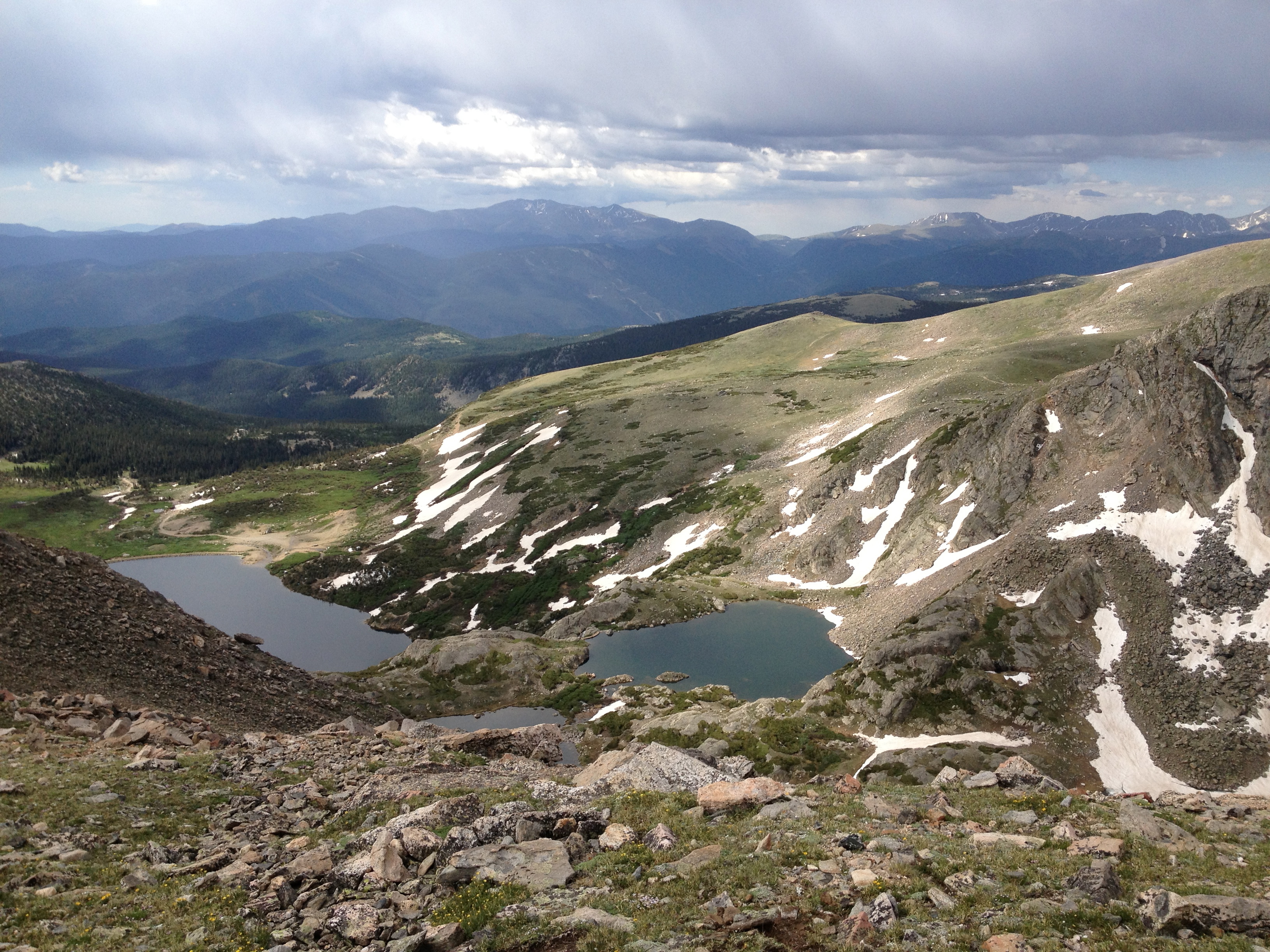
Overall it wasn’t too super tough just high up, on the way up we were pretty much alone and then on the way down the trail was super busy. At the Glacier, it was insanely packed with lots of people partying at the lake before the 4th of July holiday week. We did love the hike, it was beautiful and challenging! We can’t wait to get back there and actually make it to the summit, we will leave much earlier next time though! A few of our favorite pictures after the directions.
Directions: Take I70 west and exit at Fall River Road ( Exit #238), turn right on to Fall River Road take it up 10 miles past the town of Alice. Look for the Glacier Hike sign on your left; 100 yards past the sign is a public parking lot. $5 to park.


Sorry for the bad luck with weather. We attempted this hike in April of this year but didn’t make it all the way to James Peak. Hiking up the glacier seemed to take forever and then the weather turned bad on us as well. Was the trail well marked towards the peak? I read somewhere that it becomes a little bit difficult to navigate up there past the glacier?
It is really well marked in most places, as soon as you climb over the end of the Glacier there is a defined path on the left, with James peak obviously in front of you. Once you cross over the old Jeep road, you see it jog a little to your left but then it disappears as you approach the summit climb. Once we got to the most obvious wind shelter, we saw a cairn way to left and this is the easier ridge ascent to the summit. You can really go any way you want on the summit climb but I preferred the trail once we found it again. We are so doing this again soon, we felt cheated not getting to see the summit views. Good Luck on your next try!
Great pictures! Sorry you didn’t make the summit. James Peak is on my list to do. You have me motivated to go now!
It was so beautiful! I can’t wait to try it again but we will make sure to go crazy early to avoid those chance of storms at the summit!
I hiked the glacier my first summer here (5 years ago) and have always thought about climbing James Peak. Thanks for the reminder to make it happen (and to get out early to beat the storms)!
I cannot wait to get back there, honestly I am trying to fit it in as quickly as I can because I must see the top!