

Starting Elevation: Approx. 7200 ft
Highest Elevation: Approx. 8000 ft. You can get as much descent and gain you want just go further. Our last hike we climbed a total of 2300 ft, most of that heading back to the trailhead.
Trail Length: 9.3 miles one way – Each time we did different lengths but went as far as 6.5 miles one way the last time, for a total of 13 miles hiked.
Trail Uses: Hiker, biker, Equestrian and if the snow ever stayed maybe on a snowy day – snowshoe
Degree of Difficulty: Moderate
Bathroom: Yes in the parking lot
Pets: Supposed to be on leash but I have noticed that many dog owners ignore this rule
Fees: None

Humming Bird > North Fork Trail
It is an exciting moment in Colorado when new open space opens or expands…. North fork trail is one such revelation that opened/expanded on 10/14/14. I am not sure, but I think the ultimate goal is have it connect to the Colorado trail. It goes over 10 miles one way through lots of privately owned land and through a burn scar. I had read about it and thought it would be cool to check out as much as I could. To be honest, I was also sick of repeaters which I had been hitting A LOT lately.

The hike we did actually starts across the street from the parking lot. I think you can pick it up North Fork Trail other ways through the park but this is the way we went each time. Hummingbird Trail is a steep climb and really the hardest part we experienced for the whole hike, other than that just the overall distance. Plus this initial part is totally exposed and so HOT in the spring, summer & fall so go early.
After this initial climb, you come back behind the mountain and get some shade, which depending on the time of year could also mean snow/ice.mud. But on the hikes in March it was a welcome relief from the sun. Hummingbird Trail is 1.3 miles and then you pick up North Fork Trail.
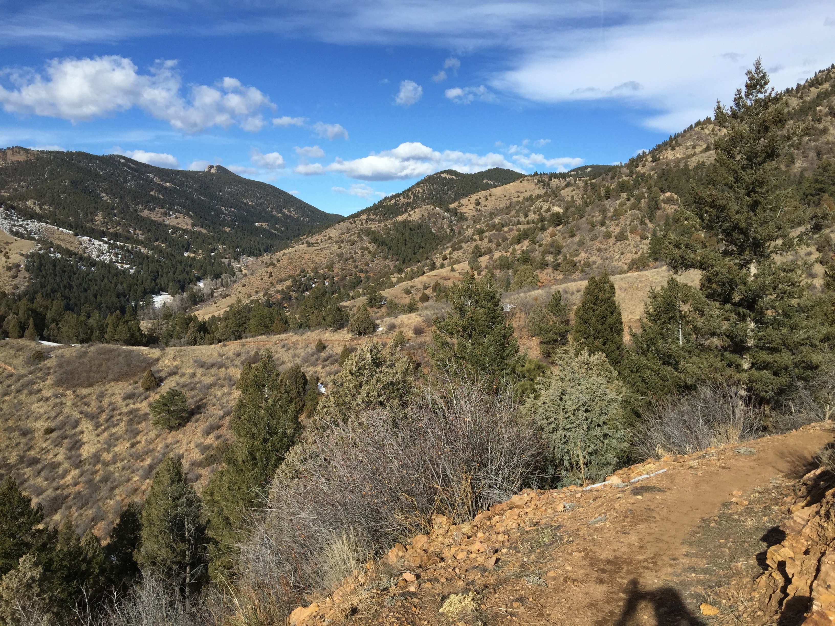
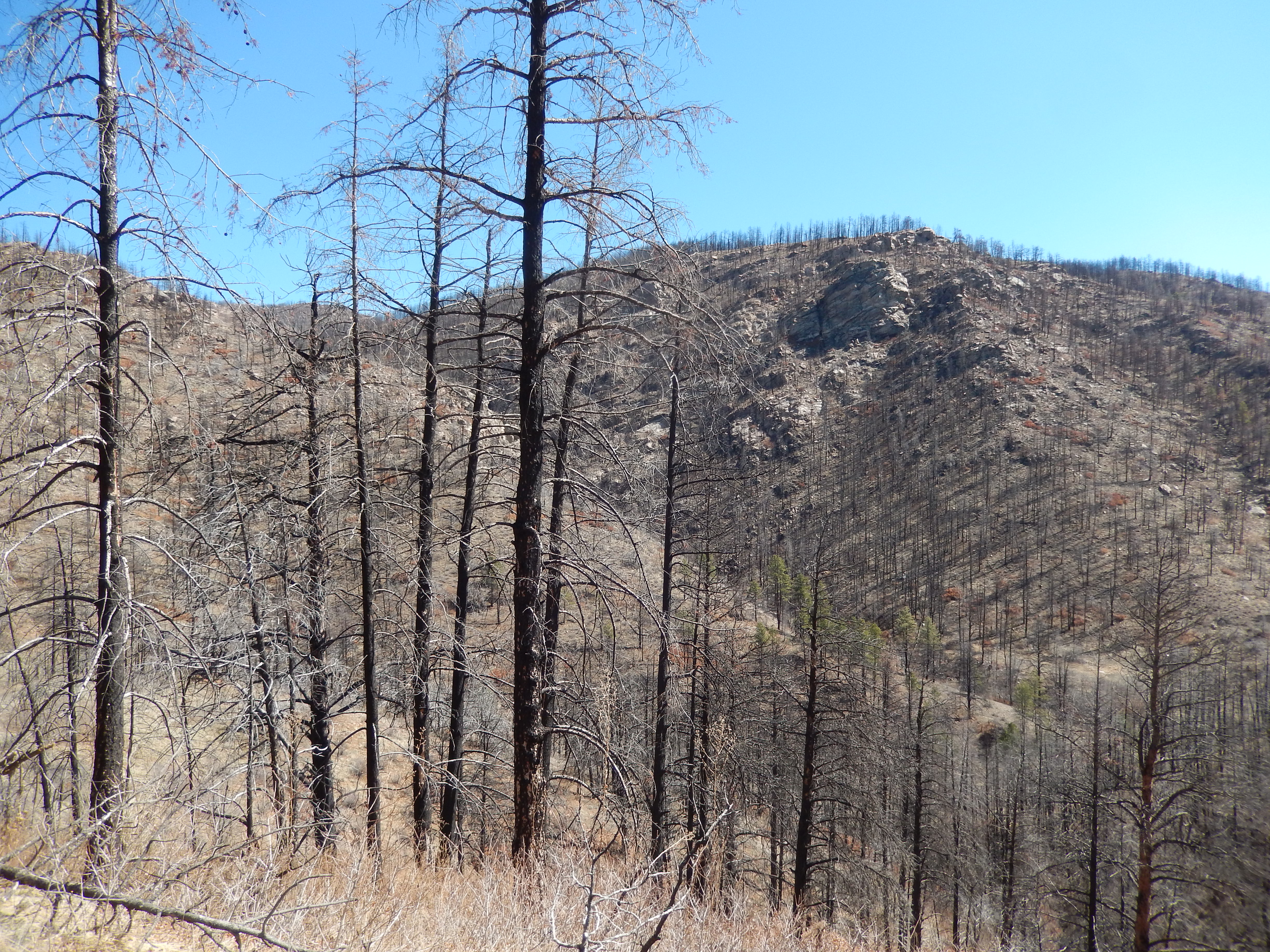
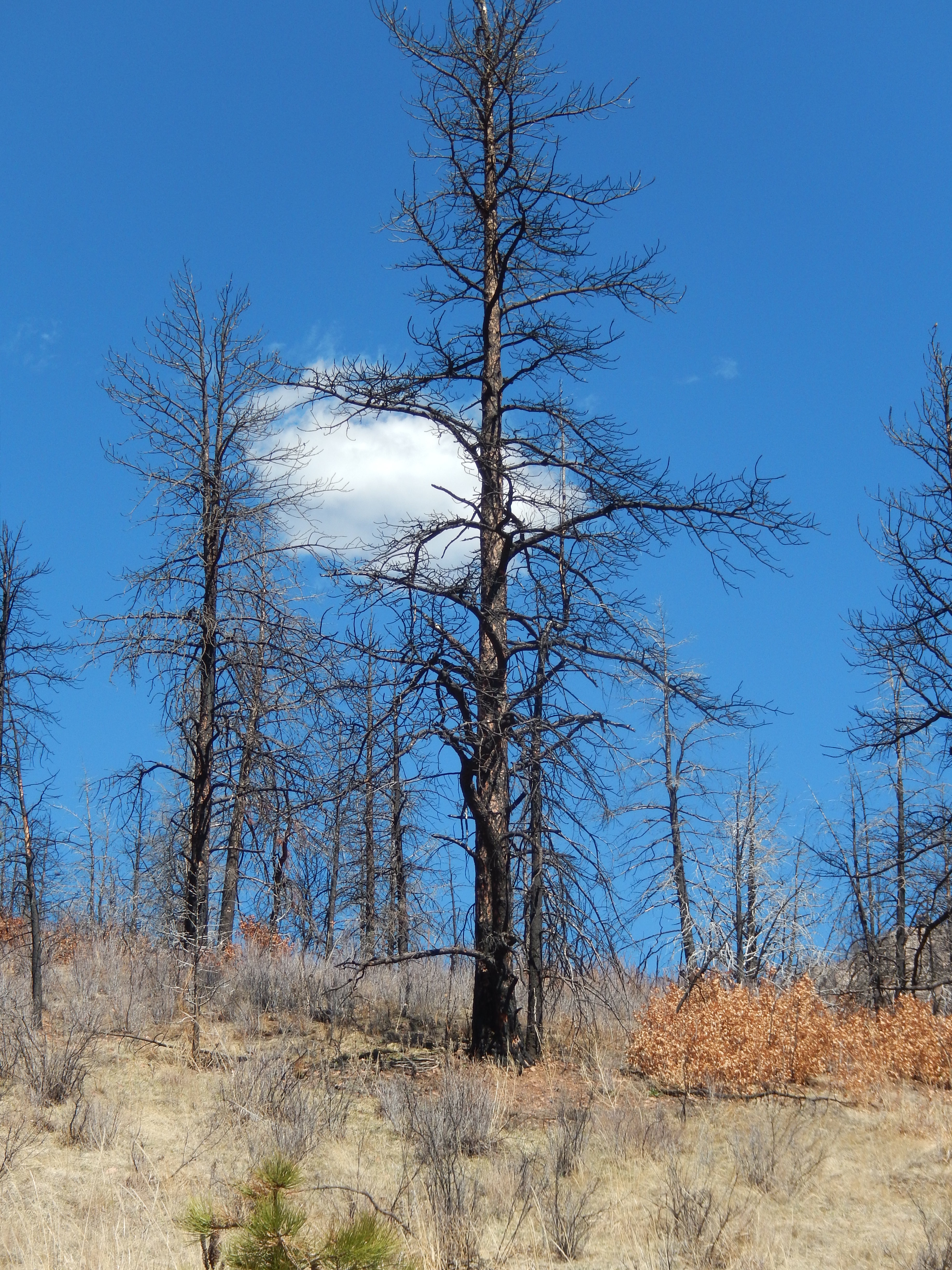
From this point there are lots of ups and downs, we went through a burn scar and just kept moving south and east.
It was hard to turn around at 6.5 miles the last time because around each curve was more beauty I wanted to see but I could tell the harder part is the return trip, as we went down a lot more then we went up. If you find yourself on this trail remember that, you climb more returning than you do on the way out.
Our First visit in January we essentially had it all to ourselves, the second and third visits in March were MUCH busier. Mostly with bikers after the first 3 miles in. Which I can totally understand why given the excellent distance and beauty it offers. I am categorizing this one as a mostly cool season hike, because of crowds and how exposed some of it is.

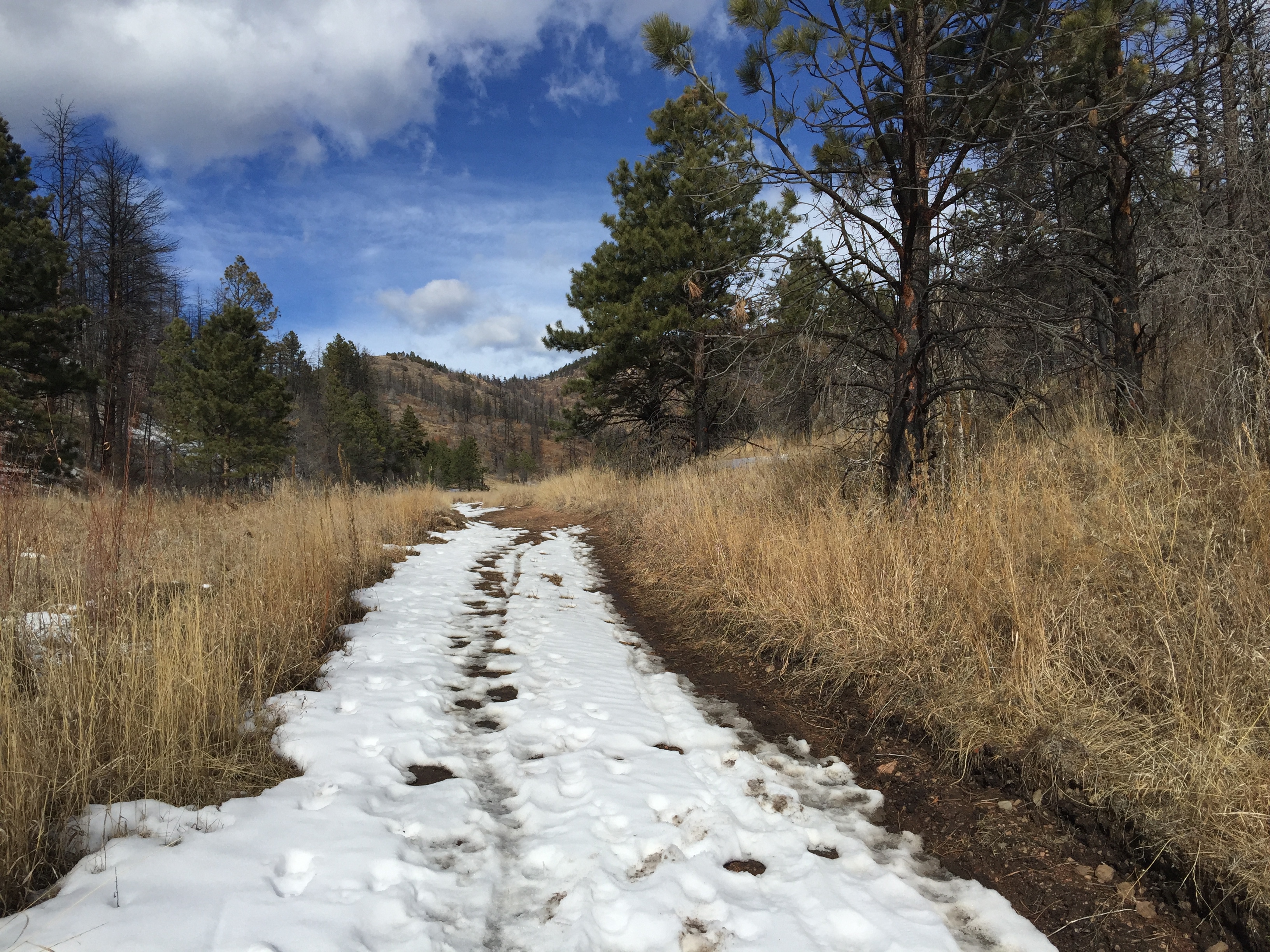

At the times We hiked this, I wasn’t sure I would keep blogging so I didn’t take that many trail identifying pictures. I can tell you it was beautifully planned and the path itself is very nice to walk, AKA not a ton of obstacles like roots and rocks. After the initial climb all the ups and downs are very manageable so don’t scared off from the Humming bird trail.
The parking lot for the open space is huge, which makes me think the park was pretty popular before this addition and only expect it to get more popular. Also what is exposed… is really exposed so go early or late but remember that along with hours that the park is open which is an hour before sunrise to an hour after sunset.
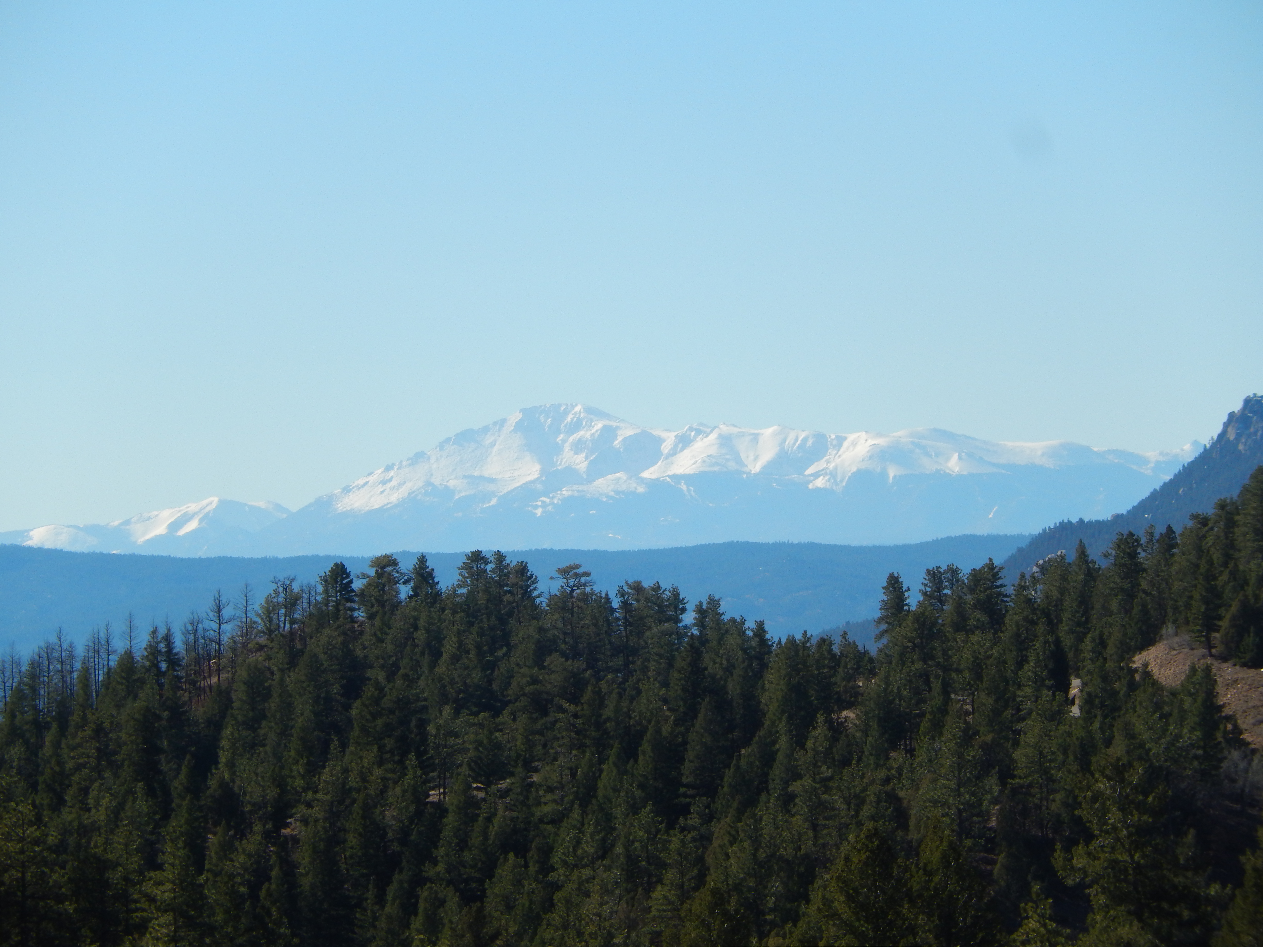
The “new” trail is really super beautiful, I loved all the challenges it provided and the terrain was different enough to be extra memorable as it changes all through out. Going from the beginning, through a burn scar and then all these beautiful rock formations it is worth you time.
After the directions are the few pictures that I thought were really great between the 3 hikes.
Directions:
13581 South Foxton Road, Aspen Park External Link Icon
From U.S. Highway 285, drive south 5 miles to the parking area on the south side of Foxton Road.


There’s so many great hiking trails in CO that the biggest decision is to choose which one 🙂
I know Ingrid and I have barely covered them compared to all there is! This new one is really pretty!
Nice! I love Jefferson County Open Space Parks. My son and I hiked all of these trails and I saw for the first time the Cathedral Spires from the top on Labor Day of 2012. We did Beaver Brook Trail today, and it was gorgeous.
I do too! They take such good care of all their facilities and do great trail planning! Beaverbrook is an awesome one and love that it has stuff for the vision impaired!
Yes! Between Denver Mt Parks and Jeff Open Spaces, you have beauty and adventure all within a short drive. Cheers!
Nice to see you hiking and blogging again! Hope all is great!
Thanks Nancy! I never stopped hiking so I have much to catch up on!